
Delahaye, Guillaume-Nicholas (sold)

Guillaume-Nicolas Delahaye (1725 - February 24, 1802) was the most prolific member of the Delahaye (De-La-Haye) family of engravers active in Paris throughout the 18th century. Given that the name, Delahaye literally translates to 'of the Hague' it can be assume they were French Huguenots who were forced to flee the Netherlands under threat of religious persecution. Born in Paris, he was the son of patriarch Jean-Baptiste Delahaye and brother to Jean-Baptistie-Henri Delahaye. It is said that his godfather, who held him at the baptismal font, was none other than the famous french cartographer Guillaume de L'Isle. The Delahaye family engraved for many of the great cartographers of 18th century Paris, including Jean-Baptiste Bourguignon d'Anville, Didier Robert de Vaugondy, Jean-Baptiste de Mannevillette, and Jean-Nicolas Buache, among others. He was awarded the public office Premier Graveur du Roi and worked on a series of maps illustrating the king's hunts around Versailles. Guillaume also worked with foreign cartographers such as Tomas Lopez of Madrid. Possibly Delahaye's most significant map is A Map of the Country between Albemarle Sound and Lake Erie prepared for the memories of Thomas Jefferson. He married in 1758. In total he engraved some 1200 maps. Delahaye died in Charenton. In 1792, his daughter, Antoinette Marie Delahaye (1773-1857), married the geographer Jean-Denis Barbie du Bocage.
Scarce highly detailed map of East Africa detailing the explorations of Jeronimo Lobo.
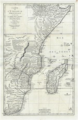
Carte de L'Ethiopie Orientale situee sur La Mer Des Indes Entre le Cap Guardasouin, le Cap de Bonne Esperance.
sold
- Digital Map Information
- Suitable for large format printing
- DPI: 300
- File Size: 19.81 MB
- File Type: ZIP / TIFF
- ICC color profile embedded
- Delivered instantly via download link
A scarce 1727 map of eastern and southern Africa by J. B. B. D'Anville. The map covers the Africa coastline from Bab al-Mandab and the Horn of Africa couth to the Cape of Good Hope, South Africa, and extends inland roughly to the, at this time in history, largely ... (more details)
Incredible hand colored map depicting the Republic of Venice at its height.
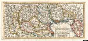
Etat de la Seigneurie et Republique de Venise avec l'Evêché de Trente. Par le Sr. Robert de Vaugondy, fils de M. Robert Geog. ord. du Roi.
sold
- Digital Map Information
- Suitable for large format printing
- DPI: 300
- File Size: 3.32 MB
- File Type: ZIP / TIFF
- ICC color profile embedded
- Delivered instantly via download link
This is a hand colored 1749 Didier Robert de Vaugondy map of the Republic of Venice in Italy. The map depicts the Republic of Venice following the War of Austrian Succession and stretches from the border with the Duchy of Milan to Istria on the Adriatic and from ... (more details)
Identifies the Sea of Korea.
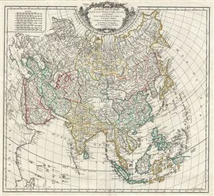
Carte de l'Asie dressee sur les Relations les plus nouvelles, principalement fur les Cartes de Russie, de la Chine, et de la Tatarie Chinoise; et divisee en ses Empires et Royaumes.
sold
- Digital Map Information
- Suitable for large format printing
- DPI: 300
- File Size: 14.57 MB
- File Type: ZIP / TIFF
- ICC color profile embedded
- Delivered instantly via download link
A rare and attractive 1750 map of Asia by Robert de Vaugondy. Vaugondy's map covers the entire continent from Africa and the Mediterranean east to the Bering Sea and south as far as Java and New Guinea. This map is most interesting in its rendering of the ... (more details)
Attractive 18th century map of the Iberian Peninsula.
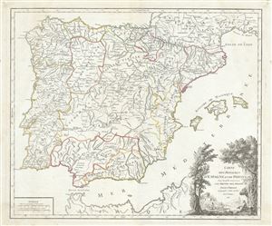
Royaumes d'Espagne et de Portugal.
sold
- Digital Map Information
- Suitable for large format printing
- Full resolution TIFF file
- ICC color profile embedded
- Delivered instantly via download link
This is a fine 1750 map of Spain and Portugal by Robert de Vaugondy. It covers the Iberian Peninsula including the islands of Majorca, Minorca and Ibiza and depicts the provinces as they appeared when the map was drawn. The most prominent provinces are ... (more details)
Early map of the East Indies identifying Singapore Strait.
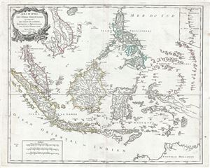
Archipel des Indes Orientales, qui comprend les Isles de la Sonde, Moluques et Philippines, tirees des Cartes du Neptune Oriental.
sold
- Digital Map Information
- Suitable for large format printing
- DPI: 300
- File Size: 15.93 MB
- File Type: ZIP / TIFF
- ICC color profile embedded
- Delivered instantly via download link
This is a beautiful 1750 map of the East Indies and Southeast Asia by Robert de Vaugondy. It covers from Vietnam and the Gulf of Siam eastward to include Malaysia, Sumatra, Indonesia, Philippines and part of New Guinea and south south as far as the ... (more details)
Centered on the important French colony of Hispaniloa.
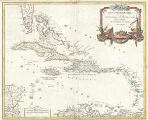
Partie de la mer du Nord, où se trouvent les grandes et petites isles Antilles, et les Isles Lucayes.
sold
- Digital Map Information
- Suitable for large format printing
- Full resolution TIFF file
- ICC color profile embedded
- Delivered instantly via download link
A fine c. 1750 map of the West Indies and southern Florida by Robert de Vaugondy. Centered on the important French colony of Hispaniola, this map covers from the northern part of the Florida Peninsula to the Northern coast of South America (the ... (more details)
Map of the West Indies from the era of Caribbean privateering.
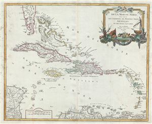
Partie de la Mer du Nord, ou se trouvent les Grandes et Petites Isles Antilles, et les Isles Lucayes.
sold
- Digital Map Information
- Suitable for large format printing
- DPI: 300
- File Size: 15.92 MB
- File Type: ZIP / TIFF
- ICC color profile embedded
- Delivered instantly via download link
This is a beautiful first edition first state 1750 map of the West by Robert de Vaugondy. It covers the Caribbean from southern Florida south to Trinidad and Tobago. Includes Cuba, the Bahamas, Puerto Rico, Jamaica, Santo Domingo, and the ... (more details)
18th century map of the Piedmont wine region of Italy.
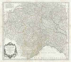
Partie Occidentale de la Lombardie et pays circonvoisins, ou sont les Etats de Savoye, Piemont, Milan, Genes, Plaisance etc.
sold
- Digital Map Information
- Suitable for large format printing
- DPI: 300
- File Size: 20.69 MB
- File Type: ZIP / TIFF
- ICC color profile embedded
- Delivered instantly via download link
This is a scarce 1750 map of the western part of Lombardy in northern Italy by Robert de Vaugondy. It covers from Lake Geneva south as far as Nice and east as far as Pisa and depicts the regions of Savoy, Piedmont, Milan, Genoa and ... (more details)
Rare and historically important map of Ecuador and the Spanish-French Geodesic Mission.
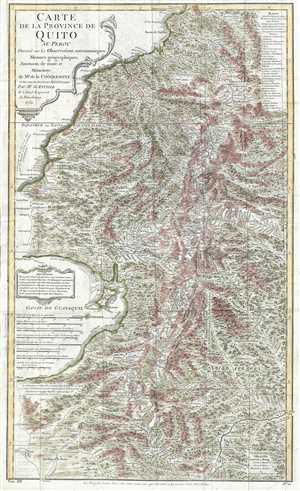
Carte de la Province de Quito au Perou. Dressée sur les observations astronomiques, mesure géographiques, journaux de route et mémoires de Mr. de Condamine et sur ceux de Don Pedro Maldonado.
sold
- Digital Map Information
- Suitable for large format printing
- DPI: 300
- File Size: 12.49 MB
- File Type: ZIP / TIFF
- ICC color profile embedded
- Delivered instantly via download link
This is a 1751 Charles Marie de la Condamine and Jean-Baptiste Bourguinon d'Anville map of Ecuador and Peru. This map details, with incredible precision, the area which the Spanish called the Province of Quito, which covers parts of ... (more details)
A foundational map of Persia, Arabia, and India.
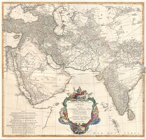
Premiere Partie de la Carte d'Asie contenant La Turquie, L'Arabie, La Perse, L'Inde en deca du Gange et de la Tartarie ce qui est limitrophe de la Perse et de l'Inde.
sold
- Digital Map Information
- Suitable for large format printing
- DPI: 300
- File Size: 25.92 MB
- File Type: ZIP / TIFF
- ICC color profile embedded
- Delivered instantly via download link
A monumental and highly detailed 1751 map of India, Persia, and Arabia by the French cartographer Jean Baptiste Bourguignon d'Anville. Centered on Persia, this map covers from Istanbul to eastern India and Tibet, and from the Black ... (more details)
A foundational map of Persia, Arabia, and India.
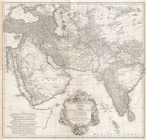
Premiere Partie de la Carte d'Asie contenant La Turquie, L'Arabie, La Perse, L'Inde en deca du Gange et de la Tartarie ce qui est limitrophe de la Perse et de l'Inde.
sold
- Digital Map Information
- Suitable for large format printing
- DPI: 300
- File Size: 34.98 MB
- File Type: ZIP / TIFF
- ICC color profile embedded
- Delivered instantly via download link
A monumental and highly detailed 1751 map of India, Persia, and Arabia by the French cartographer Jean Baptiste Bourguignon d'Anville. Centered on Persia, this map covers from Istanbul to eastern India and Tibet, and from the Black ... (more details)
A foundational map of Persia, Arabia, and India.
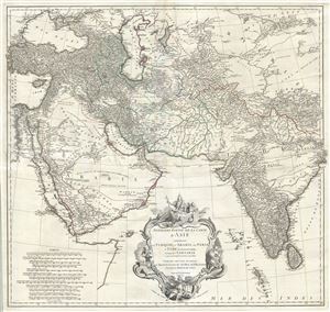
Premiere Partie de la Carte d'Asie contenant La Turquie, L'Arabie, La Perse, L'Inde en deca du Gange et de la Tartarie ce qui est limitrophe de la Perse et de l'Inde.
sold
- Digital Map Information
- Suitable for large format printing
- DPI: 300
- File Size: 36.34 MB
- File Type: ZIP / TIFF
- ICC color profile embedded
- Delivered instantly via download link
A monumental and highly detailed 1751 map of India, Persia, and Arabia by the French cartographer Jean Baptiste Bourguignon d'Anville. Centered on Persia, this map covers from Istanbul to eastern India and Tibet, and from the Black ... (more details)
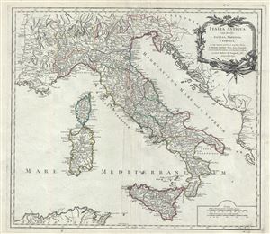
Italia Antiqua, cum Insulis Sicilia, Sardinia, et Corsica, in suas majores partes et populos divisa.
sold
- Digital Map Information
- Suitable for large format printing
- Full resolution TIFF file
- ICC color profile embedded
- Delivered instantly via download link
This is a beautiful 1751 map of Ancient Italy by Robert de Vaugondy. It covers from Gaul to Sicily, including the islands of Corsica and Sardinia. It identifies several important cities and towns and uses ancient names throughout. ... (more details)
The finest obtainable Colonial Era map of the Gulf Coast around the Mississippi Delta and Louisiana.
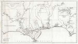
Carte de la Louisiane.
sold
- Digital Map Information
- Suitable for large format printing
- Full resolution TIFF file
- ICC color profile embedded
- Delivered instantly via download link
A lovely example of an important 1732/52 map of the Gulf coast and lower Mississippi River Valley by Jean Baptiste Bourguignon d'Anville. D'Anville's map covers from Sabine Pass (Cabo del Norte), Texas, past the Mississippi River ... (more details)
The finest obtainable Colonial Era map of the Gulf Coast around the Mississippi Delta and Louisiana.
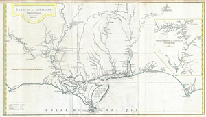
Carte de la Louisiane.
sold
- Digital Map Information
- Suitable for large format printing
- Full resolution TIFF file
- ICC color profile embedded
- Delivered instantly via download link
A fine example of an extraordinary and important 1732/52 map of the Gulf coast and lower Mississippi River Valley by Jean Baptiste Bourguignon d'Anville. D'Anville's map covers from Sabine Pass (Cabo del Norte), Texas, past the ... (more details)
The finest obtainable Colonial Era map of the Gulf Coast around the Mississippi Delta and Louisiana.
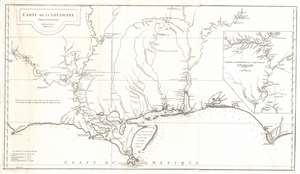
Carte de la Louisiane.
sold
- Digital Map Information
- Suitable for large format printing
- Full resolution TIFF file
- ICC color profile embedded
- Delivered instantly via download link
A lovely example of an important 1732/52 map of the Gulf coast and lower Mississippi River Valley by Jean Baptiste Bourguignon d'Anville. D'Anville's map covers from Sabine Pass (Cabo del Norte), Texas, past the Mississippi River Delta, Mobile Bay, and Pensacola Bay, to Saint Joseph Bay (Baye de St. Joseph) and Cabo Escondido (Cape San Blas), Florida. The map extends northwards along the Mississippi River as far as, roughly, Lake Providence, and northwards along the Alabama River (Riviere des Alibamons) as far as Fort Toulouse (modern day Wetumpka, Alabama). An inset in the upper right quadrant focuses on the upper Mississippi River Valley and includes much of the lower Missouri River as far as the Kansas River (Kansaz). Minimal topography is present as little was known, but the region's river courses, including the lower Mississippi, the Red, the Osage, and the lower Missouri, appear in some detail. presents Numerous depth soundings are indicated along the Gulf Coast and in the adjacent Bays. (more details)
New perspective on East Asia.
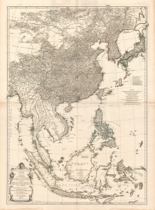
Seconde partie de la Carte d'Asie contenant La Chine et Partie de la Tartarie, L'Inde au de la du Gange, les Isles Sumatra, Java, Borneo, Moluques, Philippines, et du Japon.
sold
- Digital Map Information
- Suitable for large format printing
- DPI: 600
- File Size: 160.89 MB
- File Type: ZIP / TIFF
- ICC color profile embedded
- Delivered instantly via download link
A beautiful example of French cartographer J. B. B. d'Anville's 1752 map of the East Indies, China, Korea, and Japan. This influential map redefined European perceptions of East Asia and remained the dominant cartographic assessment of the region until the early 19th century. (more details)
A scarce large format map of East Asia.
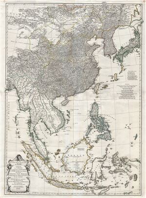
Seconde partie de la Carte d'Asie contenant La Chine et Partie de la Tartarie, L'Inde au de la du Gange, les Isles Sumatra, Java, Borneo, Moluques, Philippines, et du Japon.
sold
- Digital Map Information
- Suitable for large format printing
- Full resolution TIFF file
- ICC color profile embedded
- Delivered instantly via download link
A remarkable and near pristine example of French cartographer Jean Baptiste Bourguignon d'Anville's 1752 map of the East Indies, China Korea and Japan. This impressive map covers from the latitudes of Mongolia and Hokkaido ... (more details)
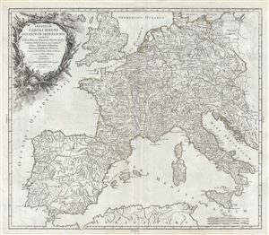
Imperium Caroli Magni occidentis Imperatoris complectens Galliam, Marcam Hispanicam, Baleares insulas, Corsicam, Italiam Vulturnum usque et Ausidum fluv?, Istriam, Liburniam, Dalmatiam, Rhaetiam, Vindeliciam, Noricum, et quidquid Germaniae a Rheno ad Oderam usque et Mare Balticum, protenditur.
sold
- Digital Map Information
- Suitable for large format printing
- Full resolution TIFF file
- ICC color profile embedded
- Delivered instantly via download link
This is a beautiful 1752 map of Europe and the Empire of Charlemagne by Robert de Vaugondy. It covers Europe and the European Empire of Charles the Great from England south as far as northern Africa and from Portugal to ... (more details)
Auchagah Map, a unique synthesis of American Indian and European cartography.
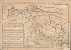
Réduction de la Carte tracée par le Sauvage Ochagach et autres. / Carte Physique des Terreins les plus eleves de la Partie Occidentale du Canada.
sold
- Digital Map Information
- Suitable for large format printing
- Full resolution TIFF file
- ICC color profile embedded
- Delivered instantly via download link
This is Philipe Buache's c. 1754 dual map of inland water routes west of Lake Superior extending, ostensibly, to the Pacific. It is an important and intellectually complex juxtaposition of two radically divergent cartographic conceptions of the North American interior: American Indian (Cree) geographic knowledge (known as the Auchagah Map) and Philippe Buache's speculative synthesis of French exploration, hydrographic theory, and the elusive dream of a navigable route to the Pacific. Within a decade of this map's issue, the route revealed here between Lake Superior and Winnipeg became the primary artery of the Canadian fur trade. (more details)
Essential French-and-Indian War Map.
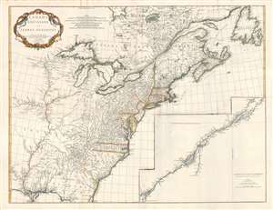
Canada Louisiane et Terres Angloises.
sold
- Digital Map Information
- Suitable for large format printing
- DPI: 300
- File Size: 56.89 MB
- File Type: ZIP / TIFF
- ICC color profile embedded
- Delivered instantly via download link
This is Jean-Baptiste Bourguignon d'Anville's 1755 map of North America from the Mississippi watershed eastwards. It spans from Newfoundland and James' Bay to St. Augustine, Florida. The map reaches westward as far as modern day Texas, and extends eastward to embrace Newfoundland. It details the English colonies along the Atlantic seaboard, as well as French claims in Louisiana (the Mississippi Valley) and modern day Canada. Elevation is rendered in profile with fortifications, towns, and American Indian villages identified. A large inset centered on Montreal details the course of the St. Lawrence River from the Isle Aux Coudres to Lake Ontario. (more details)
The first state of Vaugondy's important map of Virginia showing the lands of Lord Fairfax.
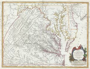
Carte de la Virginie et du Maryland.
sold
- Digital Map Information
- Suitable for large format printing
- Full resolution TIFF file
- ICC color profile embedded
- Delivered instantly via download link
This is a fine example of Robert de Vaugondy's 1755 map of the Virginian, Delaware, and Maryland, including the Chesapeake Bay. The map extends from the Allegany Mountains eastward to the Chesapeake Bay, Delaware Bay, ... (more details)
French map issued in the second year of the French and Indian War.
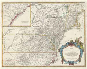
Partie de l'Amerique Septentrionale, qui comprend le Cours de l'Ohio, la Nlle. Angleterre, la Nlle. York, le New Jersey, la Pensylvanie, le Maryland, la Virginie, la Caroline.
sold
- Digital Map Information
- Suitable for large format printing
- DPI: 300
- File Size: 17.72 MB
- File Type: ZIP / TIFF
- ICC color profile embedded
- Delivered instantly via download link
An uncommon first edition first state example of Robert de Vaugondy's 1755 map of the Ohio River Valley and eastern seaboard from Maine to Carolina. The map coves from Lake Huron to Brunswick North Carolina and from ... (more details)
The first state of Vaugondy's important map of Virginia showing the lands of Lord Fairfax.
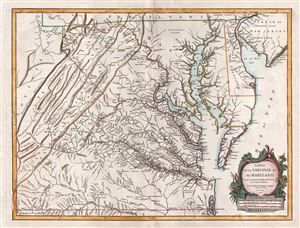
Carte de la Virginie et du Maryland.
sold
- Digital Map Information
- Suitable for large format printing
- DPI: 300
- File Size: 17.31 MB
- File Type: ZIP / TIFF
- ICC color profile embedded
- Delivered instantly via download link
A fine first edition example of Robert de Vaugondy's 1755 map of the Virginian, Delaware, and Maryland, including the Chesapeake Bay. The map extends from the Allegany Mountains eastward to the Chesapeake Bay, ... (more details)
One of the earliest nautical charts to show the coasts near Kuala Lumpur, Malaysia.
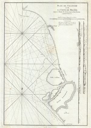
Plan de Salangor et de La Cote de Malaye depuis al Pointe de Caran jusqu au Mont Parcelar.
sold
- Digital Map Information
- Suitable for large format printing
- Full resolution TIFF file
- ICC color profile embedded
- Delivered instantly via download link
A scarce 1775 map of the coasts of Malay (modern day Malaysia) in the vicinity of Kuala Lumpur. This is a fine example Jean-Baptiste d'Apres de Mannevillette 1775 nautical chart or maritime map of Selangor and ... (more details)
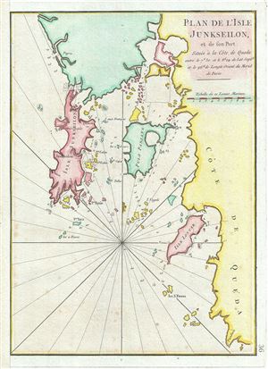
Plan de l'Isle Junseilon, et de son Port.
sold
- Digital Map Information
- Suitable for large format printing
- Full resolution TIFF file
- ICC color profile embedded
- Delivered instantly via download link
This is a scarce 1775 nautical chart or maritime map of the port and harbor of the Island of Phuket, Thailand by Jean-Baptiste d'Apres de Mannevillette. It details the Island of Phuket or Junk Ceylon along ... (more details)
One of the few early maps to detail the original seven islands of Bombay.
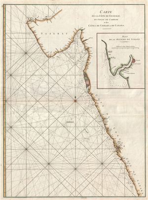
Carte de la Cote de Guzerat, du Golfe de Cambaye et des Cots de Concan et de Canara.
sold
- Digital Map Information
- Suitable for large format printing
- Full resolution TIFF file
- ICC color profile embedded
- Delivered instantly via download link
A scarce 1775 nautical chart or maritime map of the coasts of western Indian in the vicinity of Bombay (Mumbai) and Goa. Composed by Jean-Baptiste d'Apres de Mannevillette, this map covers from Gujarat ... (more details)
Remarkable Vaugondy map of North America showing speculative Chinese colony of Fusang and De Fonte's mythical voyages.
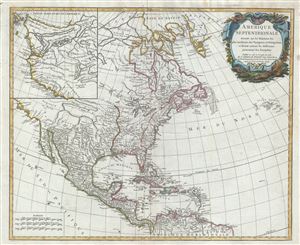
Amerique Septentrionale dressee sur les Relations les puls modernes des Voyageurs et Naviageurs, et divisee suivant les differentes possessions des Europeens.
sold
- Digital Map Information
- Suitable for large format printing
- Full resolution TIFF file
- ICC color profile embedded
- Delivered instantly via download link
An attractive example of Robert De Vaugondy's 1775 map of North America. The map covers from the high arctic and Baffin Bay south to the northern coast of South America. In includes all of modern day ... (more details)