
Harper and Brothers (sold)
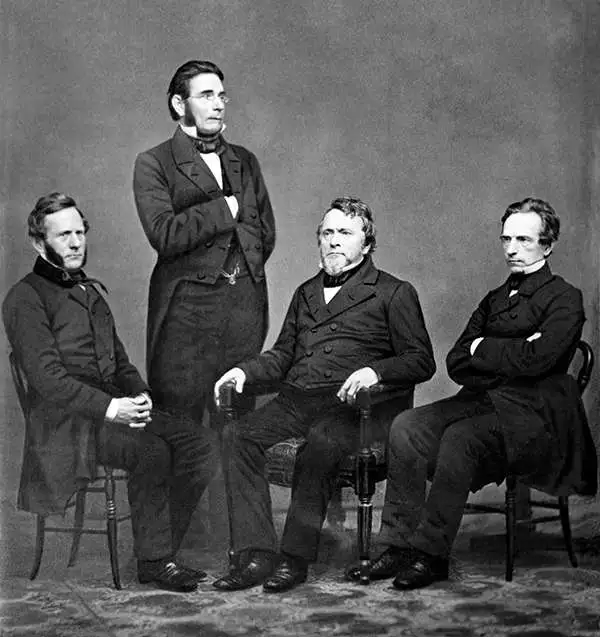
Harper and Brothers (1817 – Present) is New York based American printing publishing firm founded in 1817 by James Harper and his brother John Harper as J. and J. Harper (1817-1833). Their younger brothers Joseph Wesley Harper and Fletcher Harper joined the company around 1926 prompting the 1833 imprint change to Harper and Brothers (1833 – 1962). The firm published countless books, magazines, prints, maps, and more. They began publishing a monthly magazine, Harper's Monthly in 1850. The success of Harper's Monthly led to the introduction of a popular weekly illustrated journal, Harper's Weekly published from 1857 - 1916. They later introduced Harper's Bazar (1867) and Harper's Young People (1879). From about 1899 the business went through a series of permutations selling off some assets and developing others. The company merged with Row, Peters and Company inn 1962, rebranding itself as Harper and Row (1962 – 1990), which was acquired by Marshall Pickering in 1988. It was acquired by Rupert Mordoch (News Corp) and merged with William Collins and Sons in 1990 to form HaprerCollins (1990 – Present), the imprint under which it still publishes. Their original offices were at 331 Franklin Street, roughly below today's Manhattan Bridge. Today they have many offices and are one of the world's largest publishing companies and one of the 'Big Five' English-language publishers.
Illustrates English, French, and Spanish possessions in the modern-day United States.
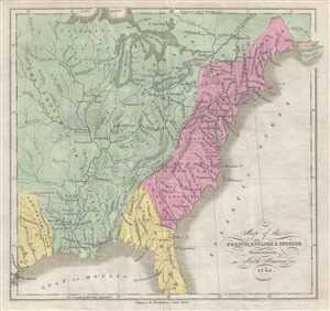
Map of the French, English, and Spanish Possessions in North America in 1745.
sold
- Digital Map Information
- Suitable for large format printing
- DPI: 300
- File Size: 1.64 MB
- File Type: ZIP / TIFF
- ICC color profile embedded
- Delivered instantly via download link
This is an 1846 William Kemble map of the colonial United States. The map depicts the United States from the Missouri River to the Atlantic Ocean and Acadia and from Lake Superior to the Gulf of Mexico. The colonial possessions of the English, French, and Spanish ... (more details)
The mission after which Sault Ste. Marie, Michigan is labeled!
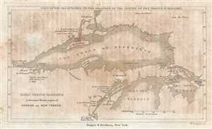
Early French Missions in the remote Western regions of Canada or New France. Copy of the Map Attached to the Relations of the Jesuits in New France in 1670 and 1671.
sold
- Digital Map Information
- Suitable for large format printing
- DPI: 300
- File Size: 0.76 MB
- File Type: ZIP / TIFF
- ICC color profile embedded
- Delivered instantly via download link
This is an 1846 William Kemble map of the region surrounding Lake Superior and the northern portion of Lake Michigan. The map depicts the region from modern-day Minnesota and Wisconsin to Michigan, Lake Huron, and Canada and from Canada and Minnesota to Wisconsin ... (more details)
A remarkable view drawn at the open of the American Civil War.
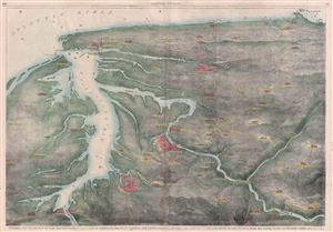
Pictorial Map of the Seat of War, Showing Parts of the States of Maryland, Delaware, Virginia, and North Carolina, and also the Coast Line From Cape Henry to Fort Pickens, With the United States Blockading Fleet.
sold
- Digital Map Information
- Suitable for large format printing
- File Size: 15.91 MB
- File Type: ZIP / TIFF
- ICC color profile embedded
- Delivered instantly via download link
An uncommon and interesting view and map of the Chesapeake Bay and vicinity drawn just after the 1861 outbreak of the American Civil War. Oriented to the south, this view covers from the entrance to the Susquehanna River at Perryville and Havre de Grace to Cape ... (more details)
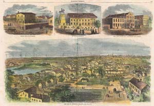
The City of Richmond, Virginia.
sold
- Digital Map Information
- Suitable for large format printing
- File Size: 10.41 MB
- File Type: ZIP / TIFF
- ICC color profile embedded
- Delivered instantly via download link
This is a rare and attractive view of Richmond Virginia printed in the May 1862 edition of Harper's Weekly . Shows Richmond shortly after it was seized by the Union Army near end of the Peninsular Campaign during the American Civil War. Union Troops are shown ... (more details)
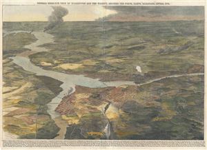
General Birds-Eye View of Washington and the Vicinity, Showing the Forts, Camps, Railroads, Rivers, etc.
sold
- Digital Map Information
- Suitable for large format printing
- Full resolution TIFF file
- ICC color profile embedded
- Delivered instantly via download link
This is a stunning 1862 birds-eye view map or view of Washington D. C. and vicinity issued in the January 4, 1862 edition of Harper's Weekly. This view offers a fascinating snapshot of the nation's capitol shortly after the outbreak of the American Civil War. ... (more details)
Protecting Washington, D.C. against a potential Confederate attack.
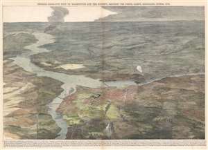
General Birds-Eye View of Washington and the Vicinity, Showing the Forts, Camps, Railroads, Rivers, etc.
sold
- Digital Map Information
- Suitable for large format printing
- File Size: 31.87 MB
- File Type: ZIP / TIFF
- ICC color profile embedded
- Delivered instantly via download link
This is a stunning 1862 birds-eye view or map of Washington D. C. and vicinity, published nine months after the outbreak of the American Civil War, in the January 4, 1862 issue of Harper's Weekly. The view overlooks Washington from the north, placing the U.S. capital firmly in the foreground. Occupied Virginia (and several Union forts protecting Washington, D.C.) lies just across the Potomac. Fredericksburg, Virginia, the site of the Battle of Fredericksburg on December 13, 1862, appears in the background, labeled with the number twenty-six. (more details)
Graphic and informative map of the Southern States at the end of the American Civil War.
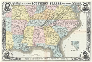
Map of the Southern States, including Rail Roads, County Towns, State Capitals, Country Roads, the Southern Coast from Delaware to Texas, showing the Harbors, Inlets, Forts and Positions of Blockading Ships.
sold
- Digital Map Information
- Suitable for large format printing
- File Size: 18.48 MB
- File Type: ZIP / TIFF
- ICC color profile embedded
- Delivered instantly via download link
An impressive and informative 1863 map of the Southern States of the United States at the end of the American Civil War. The map covers from the Chesapeake Bay to, roughly, Cape Canaveral, Florida, and westward along the Gulf Coast as far as Galveston, Texas. ... (more details)
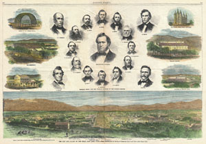
The City and Valley of the Great Salt Lake, Utah
sold
- Digital Map Information
- Suitable for large format printing
- File Size: 15.95 MB
- File Type: ZIP / TIFF
- ICC color profile embedded
- Delivered instantly via download link
A handsome view of Salt Lake City, Utah from the August 1866 issue of Harper's Weekly. Offers a panoramic view of the city as well as six smaller views of important Salt Lake City buildings, including the Tithing Office, The Tabernacle, the Arches of the Mormon ... (more details)

New York, From a Balloon. Pictorial Map of New York and Vicinity, Showing the Suburban Town, and Railroad and Water Communications.
sold
- Digital Map Information
- Suitable for large format printing
- File Size: 15.99 MB
- File Type: ZIP / TIFF
- ICC color profile embedded
- Delivered instantly via download link
A spectacular 1871 view of Manhattan issued in the May 6th supplement edition of Harper's Weekly Magazine. To quote from the document itself: In studying this pictorial map the spectator is supposed to be stationed somewhere in mid air above Fort Hamilton, at ... (more details)
Uncommon Bird's-Eye View of Chicago just before the Great Fire.
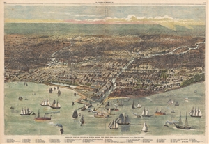
Birds's-Eye View of Chicago as it was Before the Great Fire - Drawn by Theodore R. Davis.
sold
- Digital Map Information
- Suitable for large format printing
- File Size: 12.16 MB
- File Type: ZIP / TIFF
- ICC color profile embedded
- Delivered instantly via download link
An attractive example of Theodore R. Davis' 1871 view of Chicago as it appeared before the Great Chicago fire of October 10, 1871. This view was drawn about 10 days after the fire for publication in October 21, 1871 issue of Harper's Weekly . The view ... (more details)
Celebrating Ulysses S. Grant's second nomination for the Presidency.
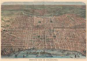
Bird's-Eye View of Philadelphia.
sold
- Digital Map Information
- Suitable for large format printing
- File Size: 177.8 MB
- File Type: ZIP / TIFF
- ICC color profile embedded
- Delivered instantly via download link
This is an 1872 Harper's Weekly bird's-eye view of Philadelphia, Pennsylvania, published nine days after Philadelphia hosted the 1872 Republican National Convention. This view looks west on Philadelphia from a high point across the Delaware River. It was issued to supplement reporting on the nomination of President Ulysses S. Grant for a second term. The Convention was held at the Academy of Music, here situated slightly above and to the left of center, apparent from the conventioneers milling outside. (more details)
One of the first illustrations of the Great Boston Fire of 1872. - See more at: http://www.geographicus.com/P/AntiqueMap/BostonFireRuins-harpersweekly-1872#sthash.VhY812R2.dpuf
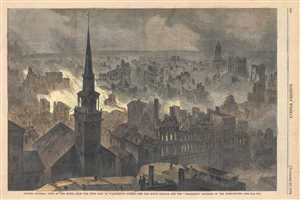
Boston-General view of the Ruins, from the West side of Washington Street - The Old South Church and the 'Transcript' Building in the foreground.
sold
- Digital Map Information
- Suitable for large format printing
- Full resolution TIFF file
- ICC color profile embedded
- Delivered instantly via download link
This is a dramatic journalistic view of Boston, Massachusetts prepared to illustrate the ruin after the Great Boston Fire of 1872. Issued just three weeks after the tragic fire (November 7-8, 1872), this is one of the first publications to illustrate ... (more details)
The first view to illustrate the devastation following the Great Boston Fire of 1872.
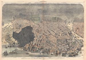
Bird's-Eye View of Boston, Showing the Burned District.
sold
- Digital Map Information
- Suitable for large format printing
- File Size: 16.27 MB
- File Type: ZIP / TIFF
- ICC color profile embedded
- Delivered instantly via download link
A dramatic journalistic view of Boston, Massachusetts prepared to illustrate the devastation following the Great Boston Fire of 1872. Issued just three weeks after the tragic fire (November 7-8, 1872), this is one of the first publications to ... (more details)
The first view to illustrate the devastation following the Great Boston Fire of 1872.
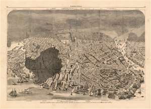
Bird's-Eye View of Boston, Showing the Burned District.
sold
- Digital Map Information
- Suitable for large format printing
- File Size: 33.83 MB
- File Type: ZIP / TIFF
- ICC color profile embedded
- Delivered instantly via download link
A dramatic 1872 view of Boston, illustrating the extent of the devastation caused by the Great Boston Fire of November 7-8, 1872. Issued just three weeks later, this is one of the first depictions of the fire. In order to satisfy the immediate demand for information about the disaster, Harper's Weekly turned to Currier and Ives, who had already contracted illustrator Charles R. Parsons to collect material to produce a grand view of the city. Parsons - already employed as head of Harper's art department - was in a unique position, consolidate the resources of both firms to swiftly produce this timely view. It therefore predates the famous grand format Currier and Ives The City Of Boston by a year. (more details)
Cartographically delivering the news of the Great Fire of Boston.
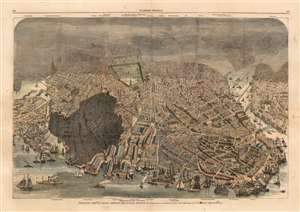
Bird's-Eye View of Boston, Showing the Burned District.
sold
- Digital Map Information
- Suitable for large format printing
- File Size: 30.81 MB
- File Type: ZIP / TIFF
- ICC color profile embedded
- Delivered instantly via download link
A dramatic 1872 view of Boston illustrating the extent of the devastation caused by the Great Boston Fire of November 7-8, 1872. Issued just three weeks later, this is one of the first depictions of the fire. In order to satisfy the immediate demand for information about the disaster, Harper's Weekly turned to Currier and Ives, who had already contracted illustrator Charles R. Parsons to collect material to produce a grand view of the city. Parsons - already employed as head of Harper's art department - was in a unique position and consolidated the resources of both firms to swiftly produce this timely view. It therefore predates the famous grand format Currier and Ives The City Of Boston by a year. (more details)
One of the first illustrations of the Great Boston Fire of 1872.
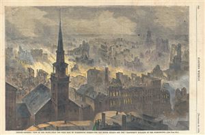
Boston - General View of th Ruins, From the West Side of Washington Street - The Old South Chuyrch and the 'Transcript' Building in th Foreground.
sold
- Digital Map Information
- Suitable for large format printing
- File Size: 6.75 MB
- File Type: ZIP / TIFF
- ICC color profile embedded
- Delivered instantly via download link
A dramatic journalistic view of Boston, Massachusetts prepared to illustrate the Great Boston Fire of 1872. Issued just three weeks after the tragic fire (November 7-8, 1872), this is one of the first publications to illustrate the fire's ... (more details)
The first view to illustrate the devastation following the Chicago Fire of 1874.
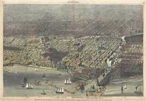
The City of Chicago, Showing the Burnt District.
sold
- Digital Map Information
- Suitable for large format printing
- Full resolution TIFF file
- ICC color profile embedded
- Delivered instantly via download link
A dramatic journalistic view of Chicago, Illinois prepared to illustrate the devastation following the Chicago Fire of 1874. Issued just two weeks after the tragic fire (July 14, 1874), this is one of the first publications to illustrate ... (more details)
Philadelphia's grand exposition.
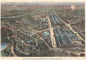
The Centennial-balloon view of the grounds...
sold
- Digital Map Information
- Suitable for large format printing
- File Size: 148.3 MB
- File Type: ZIP / TIFF
- ICC color profile embedded
- Delivered instantly via download link
This spectacular bird's-eye view of the 1876 Philadelphia Centennial Exposition appeared as a special supplement to Harper's Weekly on September 30, 1876. Taking in the entire grounds, it displays the grand scale and vast ambitions of the exposition. (more details)
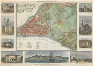
A Plan of the City of New York and Its Environs...
sold
- Digital Map Information
- Suitable for large format printing
- File Size: 12.37 MB
- File Type: ZIP / TIFF
- ICC color profile embedded
- Delivered instantly via download link
An uncommon 1876 map of New York City issued for Harper's Weekly . Presented surrounded by engraved illustrations of New York City buildings and monuments, this map, based on the map of John Montresor, was drawn to commemorate 100 years ... (more details)
Traces the first half of Stanley's first expedition across Africa from 1874 - 1877.
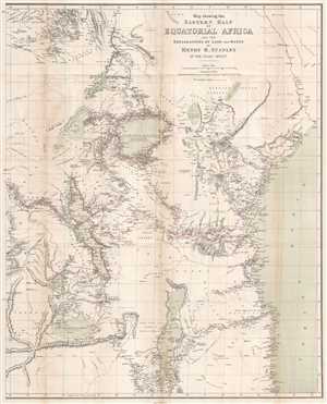
Map showing the Eastern Half of Equatorial Africa and the Explorations by Land and Water of Henry M. Stanley in the years 1874 - 1877.
sold
- Digital Map Information
- Suitable for large format printing
- File Size: 16.13 MB
- File Type: ZIP / TIFF
- ICC color profile embedded
- Delivered instantly via download link
This is a rare 1879 Henry Morton Stanley map of East Africa. The map depicts the region from South Sudan to Zambia and Mozambique and from the Democratic Republic of the Congo to the Indian Ocean. A study in stark contrast, Stanley's route from Zanzibar across the continent to Uzimba in the modern-day Democratic Republic of the Congo, is highly detailed. Points all along the route are labeled, including during his circumnavigation of Lake Victoria and Lake Tanganyika. Notes concerning the region's larger lakes are also included, such as their elevation above sea level and the name of the first European to 'discover' each lake. However, outside of the immediate vicinity of Stanley's expedition, the map is blank, underlining the complete lack of knowledge then available concerning African geography and its people. Tribes are named, and river courses are included, but the majority of the territory depicted is left blank. (more details)
Traces the first half of Stanley's first expedition across Africa from 1874 - 1877.
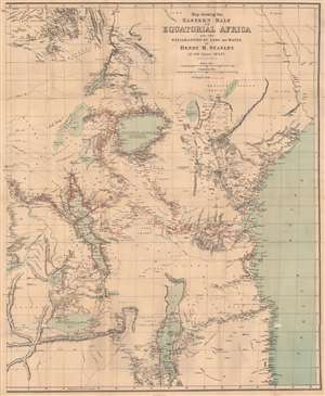
Map showing the Eastern Half of Equatorial Africa and the Explorations by Land and Water of Henry M. Stanley in the years 1874 - 1877.
sold
- Digital Map Information
- Suitable for large format printing
- File Size: 31.76 MB
- File Type: ZIP / TIFF
- ICC color profile embedded
- Delivered instantly via download link
This is a rare 1879 Henry Morton Stanley map of East Africa - one of the first maps to accurately illustrated the Rift Valley. Coverage extends from South Sudan to Zambia and Mozambique and from the Democratic Republic of the Congo to the Indian Ocean. A study in stark contrast, Stanley's route from Zanzibar across the continent to Uzimba in the modern-day Democratic Republic of the Congo, is highly detailed. Points all along the route are labeled, including during his circumnavigation of Lake Victoria and Lake Tanganyika. Notes concerning the region's larger lakes are also included, such as their elevation above sea level and the name of the first European to 'discover' each lake. However, outside of the immediate vicinity of Stanley's expedition, the map is blank, underscoring a general lack of knowledge. Tribes are named, and river courses are included, but the majority of the territory is blank. (more details)
Depicts Jackson Square and the French Quarter!
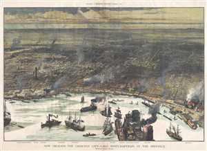
New Orleans - The Crescent City - Lake Pontchartrain in the Distance.
sold
- Digital Map Information
- Suitable for large format printing
- File Size: 22.54 MB
- File Type: ZIP / TIFF
- ICC color profile embedded
- Delivered instantly via download link
This is an 1884 Charles Graham and Harper's Weekly map or view of New Orleans, Louisiana. The map depicts New Orleans from the Mississippi River to Lake Pontchartrain. The Mississippi River occupies the immediate foreground. The river is ... (more details)
1898 Harry Fenn Original Manuscript View of the Forbidden City, Beijing (Peking) for Harper's Weekly
One of a kind original pen and ink cover art for Harper's Weekly illustrating the Forbidden City.
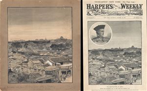
Coal Hill [Beijing Forbidden City View]
sold
- Digital Map Information
- Suitable for large format printing
- File Size: 11.71 MB
- File Type: ZIP / TIFF
- ICC color profile embedded
- Delivered instantly via download link
A remarkable discovery. This 1898 view of Beijing or Peking's Forbidden City is the original pen and ink cover art for the October 22, 1898 edition of Harper's Weekly , which is itself included with this piece. The view was drawn by ... (more details)
A fun New York City cartographic curiosity.
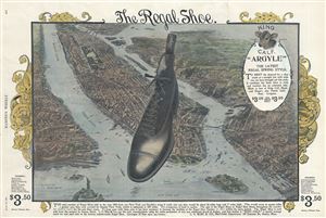
The Regal Shoe.
sold
- Digital Map Information
- Suitable for large format printing
- File Size: 4.11 MB
- File Type: ZIP / TIFF
- ICC color profile embedded
- Delivered instantly via download link
A fun cartographic curiosity, this is an 1898 shoe advertisement set against and backdrop of New York City. The view, prepared in 1897 by Moses King, has here been coopted to demonstrate the prosperity of the Regal Shoe Company. The ... (more details)