
NEW ACQUISITIONS
Wool towns on the Piscataquis.
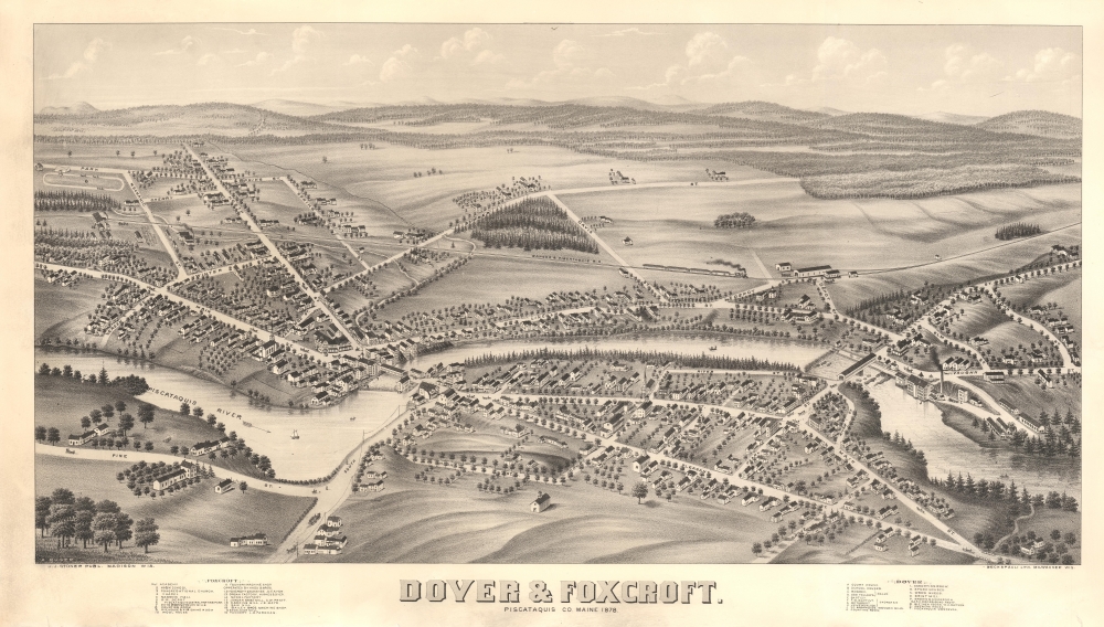
Dover and Foxcroft. Piscataquis Co. Maine 1878.
$1,500.00
Acquire
- Digital Map Information
- Suitable for large format printing
- Full resolution TIFF file
- ICC color profile embedded
- Delivered instantly via download link
This is a scarce 1878 bird's-eye view map of Dover and Foxcroft, Maine, by J. J. Stoner. It captures the river towns at the height of their prosperity as industrial and mill centers of the Maine wool industry. (more details)
Unique German edition of the Bulla Chart.
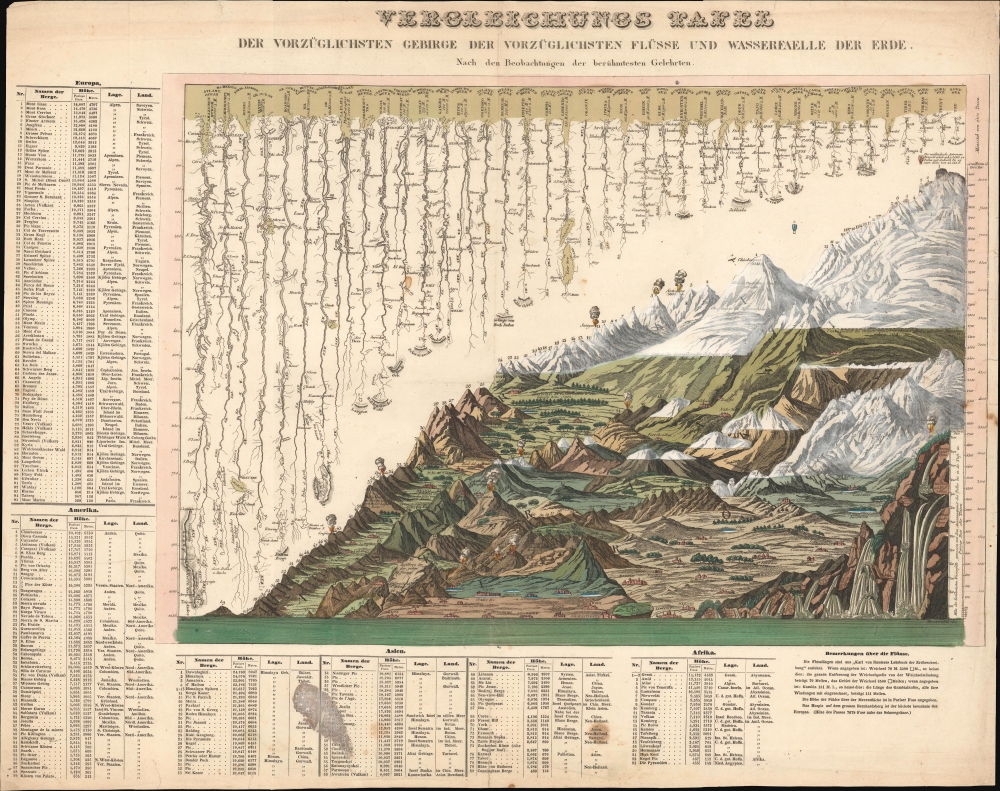
VERGLEICHUNGS TAFEL DER VORZÜGLICHSTEN GEBIRGE DER VORZÜGLICHSTEN FLÜSSE UND WASSERFALLE DER ERDE. Nach den Beobachtungen der berühmtesten Gelehrten.
$1,500.00
Acquire
- Digital Map Information
- Suitable for large format printing
- Full resolution TIFF file
- ICC color profile embedded
- Delivered instantly via download link
This is a rare c. 1826 separate German issue of François Bulla's seminal comparative mountains-and-rivers chart, one of the first to integrate mountains and rivers on a single chart and the first to add waterfalls. (more details)
Victim of the French and Indian War.
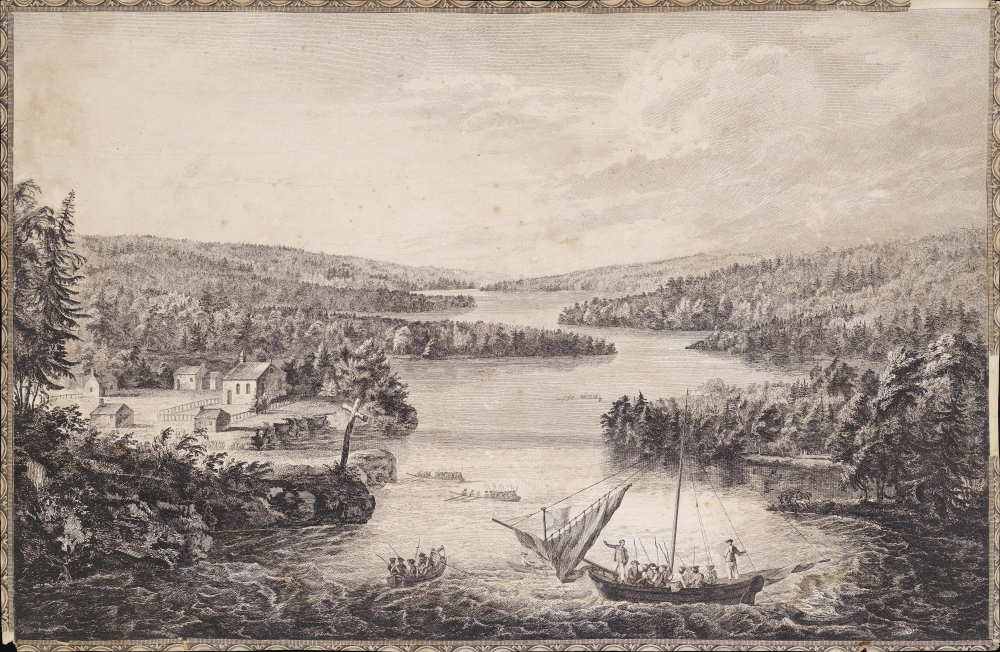
[A View of Miramichi, a French Settlement in the Gulf of St Laurence, destroyed by Brigadier Murray detached by General Wolfe for that purpose, from the Bay of Gaspe / Vue de Miramichi Établissement François dans le Golfe de St Laurent, détruit par le Brigadier Murray, détaché à cet e effet de la Baye de Gaspé, par le Général Wolfe].
$1,500.00
Acquire
- Digital Map Information
- Suitable for large format printing
- Full resolution TIFF file
- ICC color profile embedded
- Delivered instantly via download link
This is Hervey Smyth and Paul Sandby's portrayal of the settlement of Miramichi on the Miramichi River in New Brunswick that appeared in the 1760 Six Views of the Most Remarkable Places of the Gulf and River St. Laurence (later Scenographia Americana), published in London. The strategically located settlement was targeted by the British during the French and Indian War (Seven Years' War) and completely sacked. (more details)
One of the Great Natural Wonders of the American Colonies.
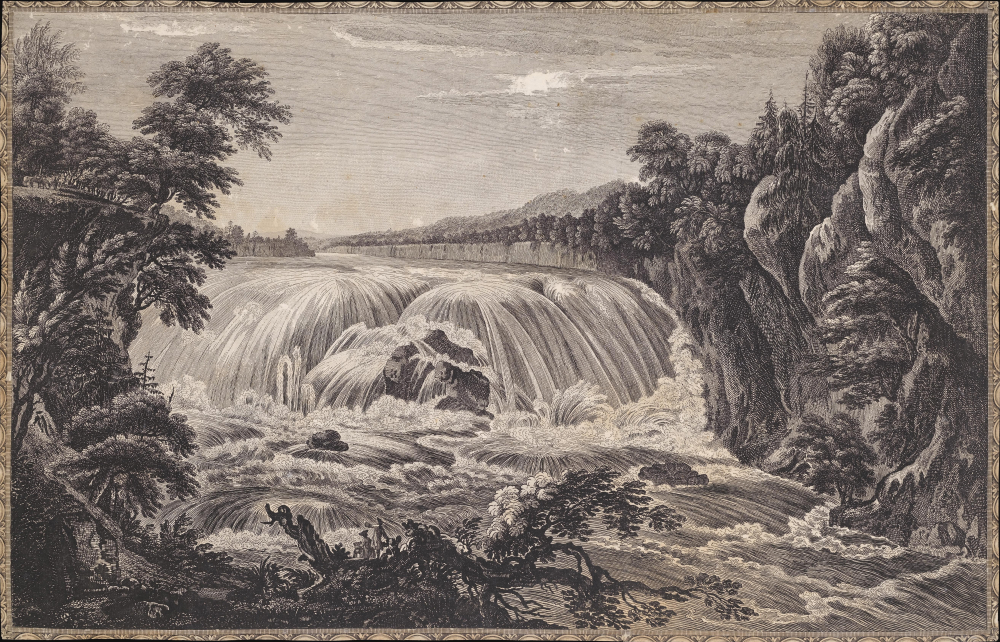
[A view of the great Cohoes Falls, on the Mohawk River, the fall about seventy feet, the river near a quarter mile broad / Vue de la grande cataracte de Cohoes, sur la riviere des Mohawks, la hateur est l'environ 70 pieds, 1 sa riviere a pres l'un quart de mile de large].
$1,500.00
Acquire
- Digital Map Information
- Suitable for large format printing
- Full resolution TIFF file
- ICC color profile embedded
- Delivered instantly via download link
This is Thomas Pownall and Paul Sandby's portrayal of the Cohoes Falls on the Mohawk River in New York that appeared in the 1761 Six Remarkable Views in the Provinces of New York, New Jersey and Pennsylvania (later Scenographia Americana), published in London. The falls were one of the great natural wonders of Britain's American colonies and, in the following decades, played an important role in the development of the Erie Canal and early industry in Upstate New York. (more details)
Natural Wonder, Engine of Industry.
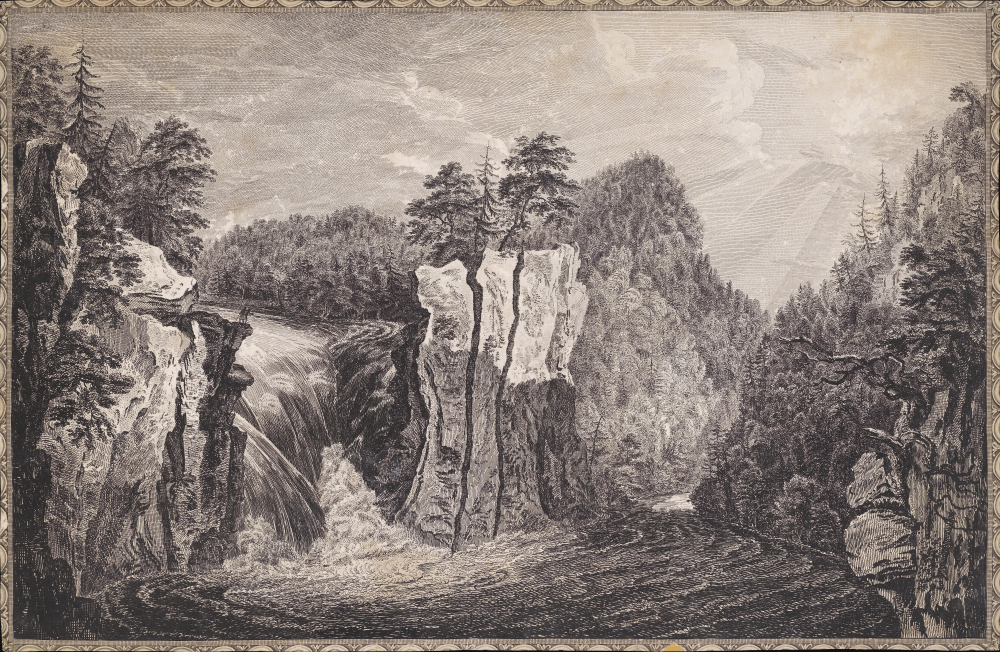
[A View of the Falls on the Passaick, or Second River in the Province of New Jersey / Vue de l'cataracte du Passaick, ou seconde riviere, dans la province du Nouveau Jersey].
$1,500.00
Acquire
- Digital Map Information
- Suitable for large format printing
- Full resolution TIFF file
- ICC color profile embedded
- Delivered instantly via download link
This is Thomas Pownall and Paul Sandby's illustration of the Great Falls of the Passaic River in New Jersey that appeared in the 1761 Six Remarkable Views in the Provinces of New York, New Jersey and Pennsylvania (and later Scenographia Americana), published in London. The falls would soon afterward become the site of America's earliest planned industrial city, Paterson. (more details)
Only Known Manuscript Example of Classic Pictorial Map.
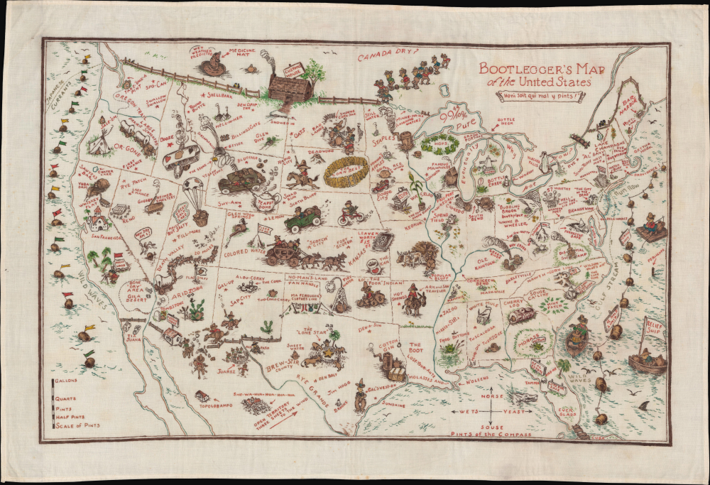
Bootlegger's Map of the United States.
$1,500.00
Acquire
- Digital Map Information
- Suitable for large format printing
- Full resolution TIFF file
- ICC color profile embedded
- Delivered instantly via download link
This is a unique example of Edward McCandlish's famous 1926 Bootlegger's Map of the United States, here presented in manuscript, drawn on linen rather than printed. Produced at the height of Prohibition, the Bootlegger's Map is one of the great pictorial maps of its era. (more details)
Curious Bilingual Map of Yokohama.
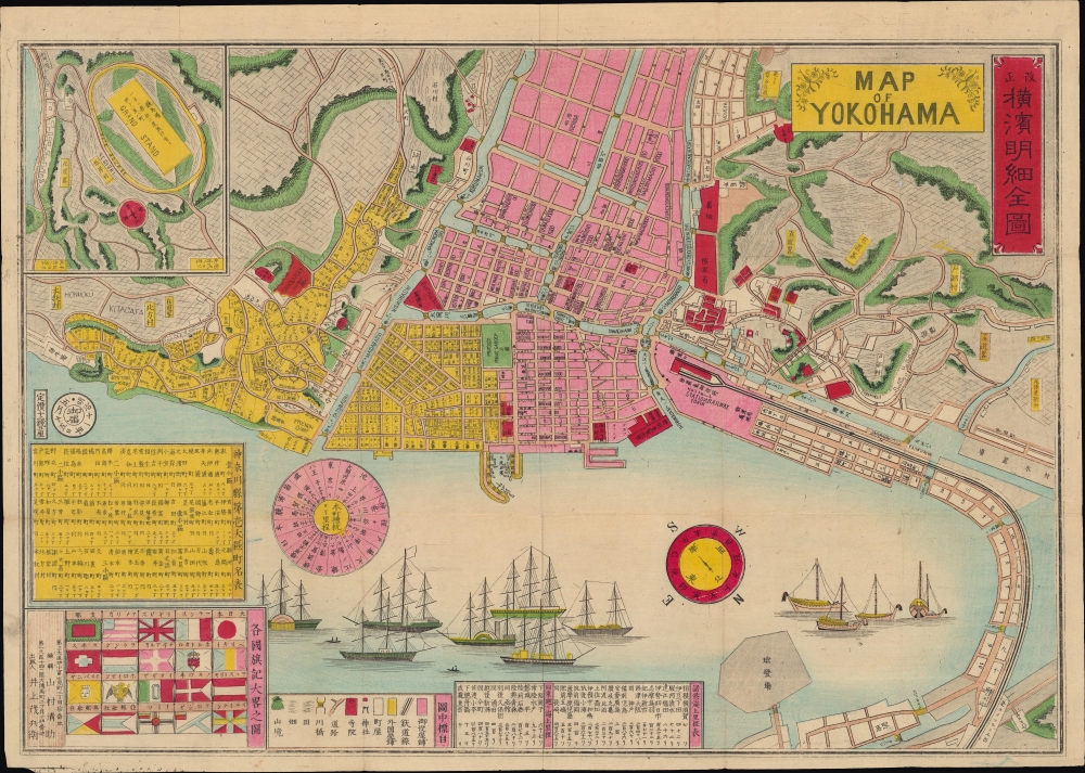
改正橫濱明細全圖 / Map of Yokohama.
$1,300.00
Acquire
- Digital Map Information
- Suitable for large format printing
- Full resolution TIFF file
- ICC color profile embedded
- Delivered instantly via download link
A scarce, colorful bilingual 1878 map of Yokohama, Japan, edited by Yamamura Seisuke and published by Inoue Mohei. It depicts the city nearly twenty years after its opening as Japan's main outlet for trade and interaction with the outside world, and demonstrates how internationalized it had become in that short period. (more details)
Direct Steam Service from France to America!
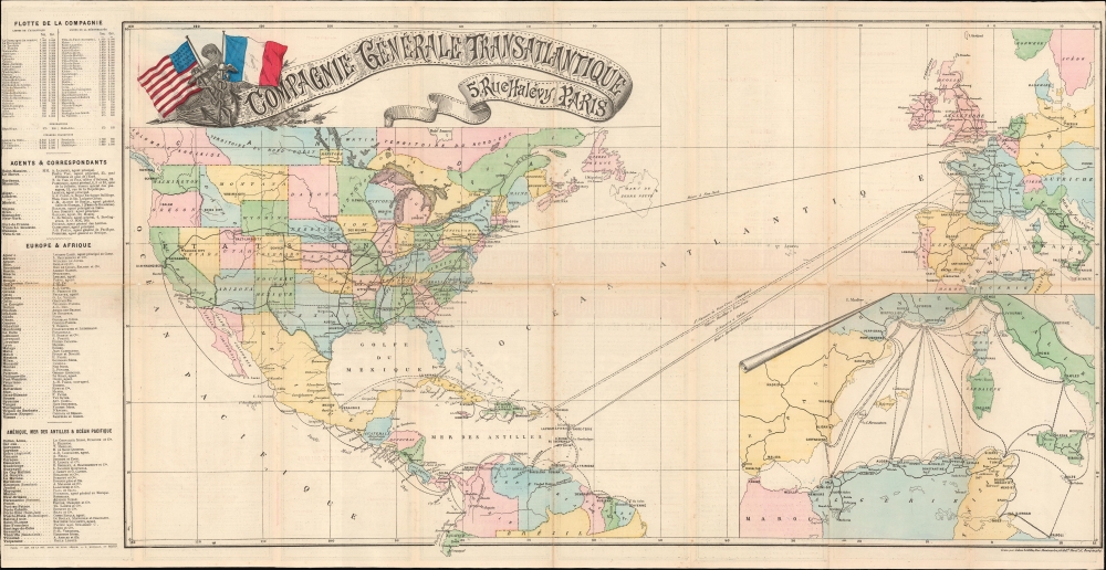
Compagnie Générale Transatlantique.
$950.00
Acquire
- Digital Map Information
- Suitable for large format printing
- Full resolution TIFF file
- ICC color profile embedded
- Delivered instantly via download link
This is an 1882 Jules Sédille map of the Atlantic Ocean highlighting the transatlantic routes between France and the Americas, primarily issued to promote the Compagnie Générale Transatlantique's service between Le Havre and New York, as well as the routes to the Caribbean and Mexico. (more details)
A 'most unblushing fraud upon the government'.
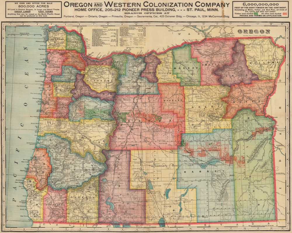
Oregon. Oregon and Western Colonization Company.
$950.00
Acquire
- Digital Map Information
- Suitable for large format printing
- Full resolution TIFF file
- ICC color profile embedded
- Delivered instantly via download link
This is a 1911 George Cram map of Oregon published for the Oregon and Western Colonization Company (OWC). The grant lands offered for sale here were the fruit of a 'most unblushing fraud upon the government' perpetrated in the late 19th century by the Willamette Valley and Cascade Mountain Wagon Road Company. (more details)
Tracking the Pacific War from Pearl Harbor to V-J Day.
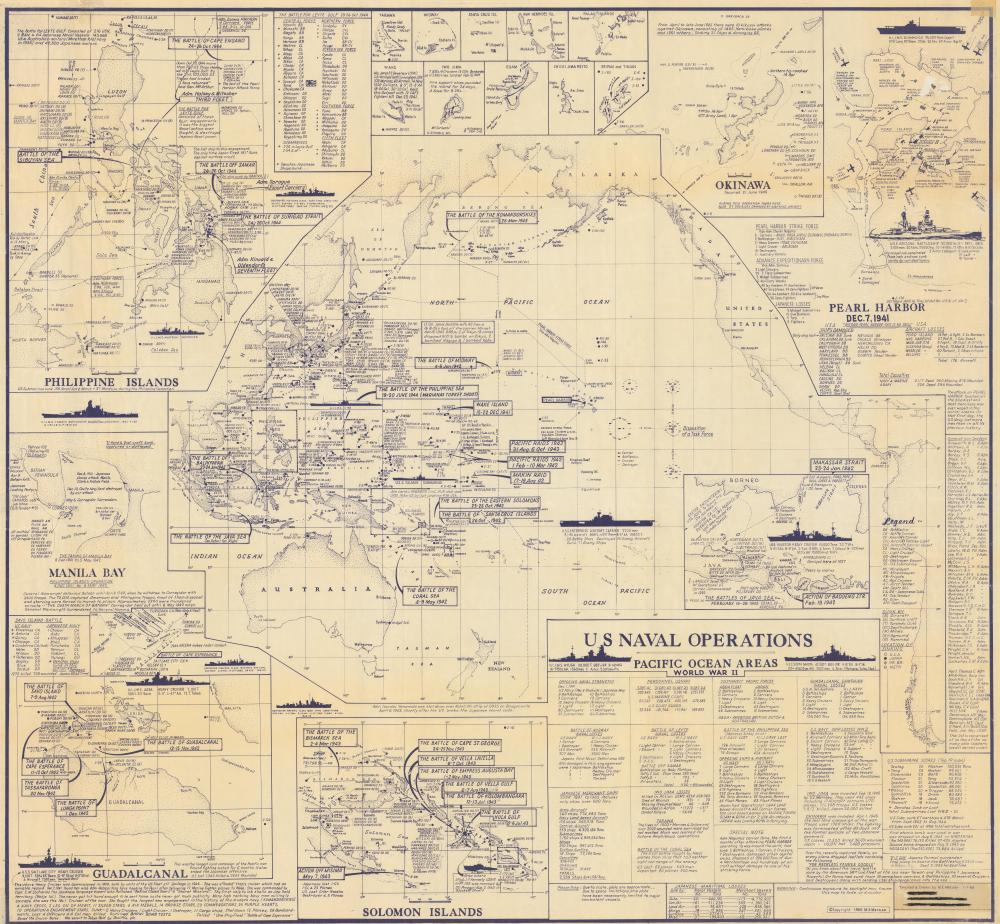
U.S. Naval Operations Pacific Ocean Areas World War II.
$900.00
Acquire
This is a rare first-edition 1966 Marvin E. Metzler infographic map of the Pacific War battles of World War II (1939 - 1945). It is a unique tribute to the Pacific War prepared by a veteran who experienced it firsthand. (more details)
The 188th from England to victory in Germany.
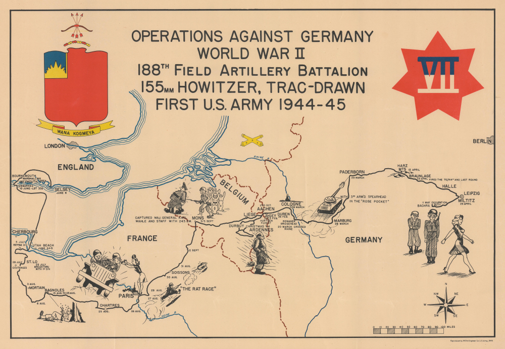
Operations Against Germany World War II 188th Field Artillery Battalion 155mm Howitzer, Trac-Drawn First U.S. Army 1944 - 45.
$750.00
Acquire
- Digital Map Information
- Suitable for large format printing
- Full resolution TIFF file
- ICC color profile embedded
- Delivered instantly via download link
This is a 1945 188th Field Artillery Battalion World War II Route Map of Europe. The map traces the battalion's movements during the war, marking important events and providing comedic commentary on the experience. (more details)
Edinburgh's Pioneering Blend of Conservation and Slum Clearance.
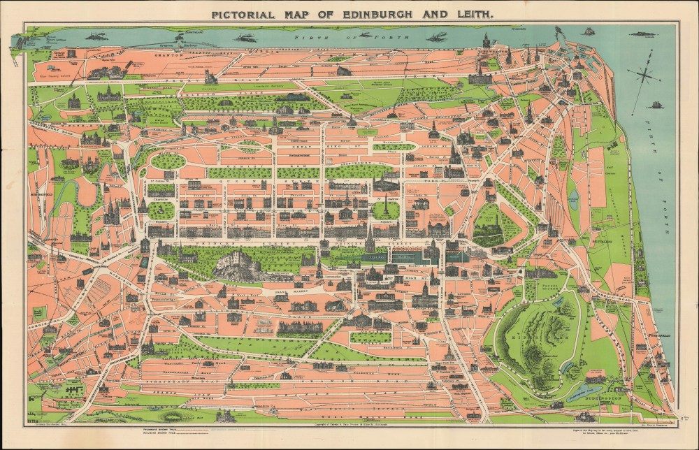
Pictorial Map of Edinburgh and Leith.
$300.00
Acquire
- Digital Map Information
- Suitable for large format printing
- Full resolution TIFF file
- ICC color profile embedded
- Delivered instantly via download link
This is a 1935 Art Deco-style pictorial map of Edinburgh, Scotland, published by George A. Reid. It was issued at a time when Edinburgh, led by urban planner Patrick Geddes, implemented innovative urban renewal projects while preserving the city's distinctive historic architecture. (more details)
Most comprehensive and detailed mid-19th century map of Arabia.
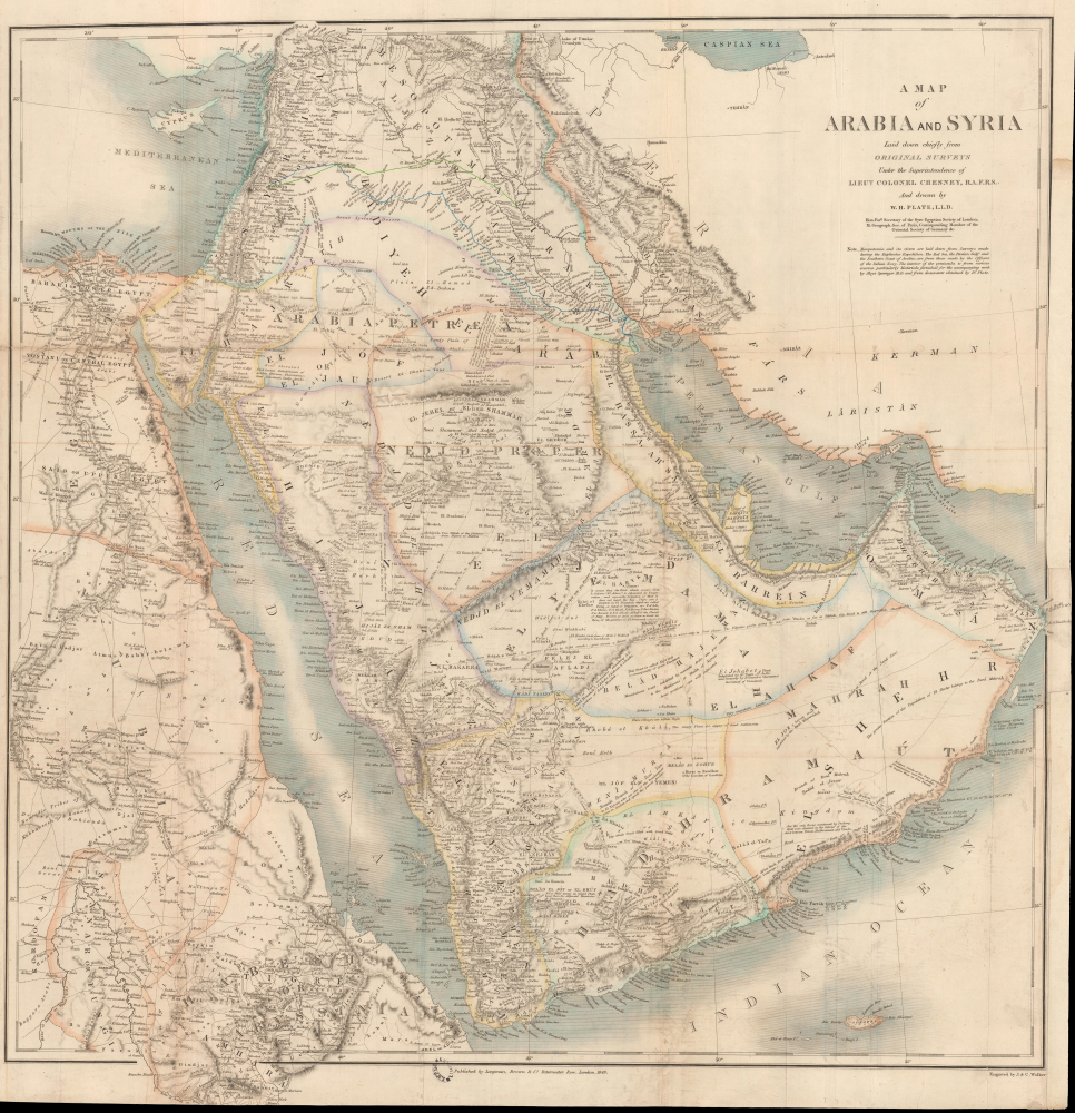
A Map of Arabia and Syria Laid down chiefly from original Surveys Under the Supervision of Leiut. Colonel Chesney, R.A. F.R.S. and drawn by W. H. Plate, L.L.D.
$22,000.00
Acquire
- Digital Map Information
- Suitable for large format printing
- Full resolution TIFF file
- ICC color profile embedded
- Delivered instantly via download link
This is William Henry F. Plate's important 1849 map of Arabia, the Persian Gulf, Syria, and Mesopotamia. The product of a wave of new exploration and surveys in the first half of the 19th century, this map is the most significant and detailed map of Arabia and the Persian Gulf to appear in the mid-19th century. (more details)
Foreigners so strange.
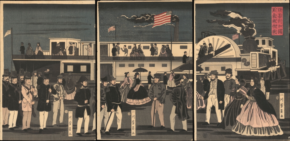
亜墨利加國蒸気車往來 / [The Comings and Goings of an American Steamship].
$5,500.00
Acquire
- Digital Map Information
- Suitable for large format printing
- Full resolution TIFF file
- ICC color profile embedded
- Delivered instantly via download link
This is Utagawa Yoshikazu's 1861 ukiyo-e woodblock triptych of an American steamship and passengers at Yokohama, an intriguing depiction of foreigners in Japan from the early days after Yokohama's opening as a treaty port. It is notable for reflecting both the curiosity of Japanese artists about the new arrivals and their imperfect understanding of these visitors. (more details)
Earliest Official Map of the Suez Canal.
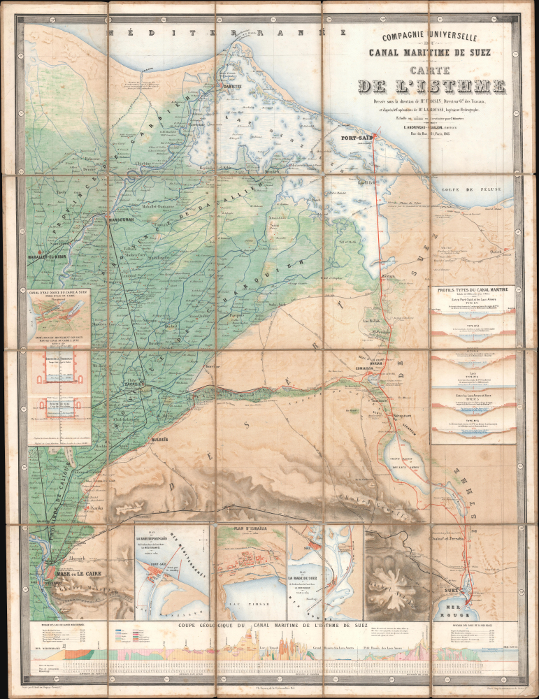
Compagnie Universelle du Canal Maritime de Suez Carte de l'Isthme.
$5,000.00
Acquire
- Digital Map Information
- Suitable for large format printing
- Full resolution TIFF file
- ICC color profile embedded
- Delivered instantly via download link
This is a 1866 large-format chromolithographic folding map issued by the Compagnie universelle du canal maritime de Suez, under the direction of its chief engineer, François-Philippe Voisin. Published in 1866, three years before the canal's completion, this rare first edition of the official canal map is among the most visually compelling and technically detailed maps ever made of the project. During World War I (1914 - 1918), the Imperial German Army deemed it so accurate and useful that it issued a faithful pirated edition for commanders planning an assault on the canal. (more details)
The Rapid Expansion of Yokohama.
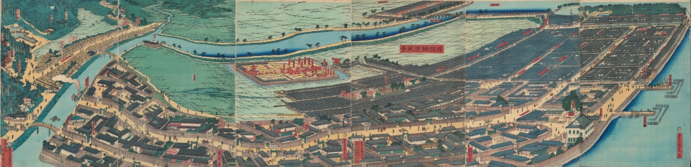
再改橫濱風景 / [Up-to-date View of Yokohama].
$4,000.00
Acquire
- Digital Map Information
- Suitable for large format printing
- Full resolution TIFF file
- ICC color profile embedded
- Delivered instantly via download link
This is a stunning 1861 panoramic set of six ukiyo-e (nishiki-e) Utagawa Sadahide woodblock prints depicting the port of Yokohama. The port opened to foreign trade in 1859, just two years earlier, becoming Japan's primary point of contact with the West. Sadahide was the most prolific among a school of woodblock artists chronicling these momentous changes. (more details)
Used by Henry David Thoreau when writing 'Cape Cod.'
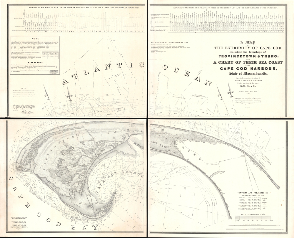
A Map of the Extremity of Cape Cod Including the Townships of Provincetown and Truro: A Chart of Their Sea Coast and of Cape Cod Harbour, State of Massachusetts.
$4,000.00
Acquire
- Digital Map Information
- Suitable for large format printing
- Full resolution TIFF file
- ICC color profile embedded
- Delivered instantly via download link
An exceptional discovery, this is James Duncan Graham's wall map of Provincetown at the tip of Cape Cod. At the time of issue, and for a long time afterward, this was the definitive map of the Provincetown area and the surrounding waters, said to have been used by, among many others, Henry David Thoreau when writing Cape Cod. The map was produced to
aid in the projection of the works for the military defenses of the important harbor formed by the peculiar spiral termination of [Cape Cod], and also to aid our ships of war and other vessels in entering it with safety after making this prominent headland. (Congressional Report, 25th Congress, Second Session, p. 3).(more details)
Revolutonary War Florida Rarity.
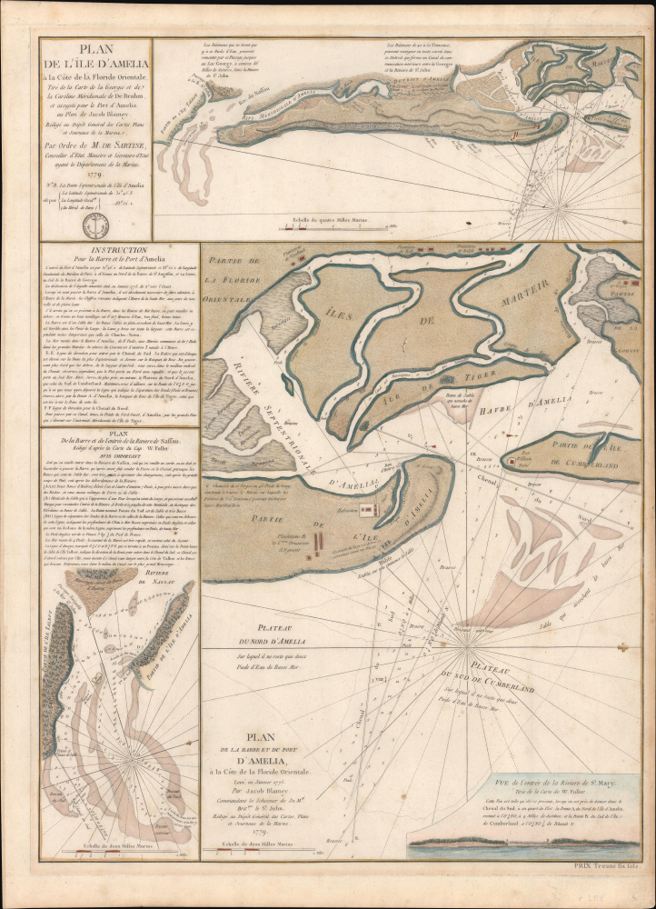
Plan de l'île d'Amelia à la Côte de la Floride Orientale. / Plan de la Barre et et de l'entrée de la Riviere de Nassau. / Plan de la Barre et du port d'Amelia, à la Côte de la Floride Orientale.
$3,850.00
Acquire
- Digital Map Information
- Suitable for large format printing
- Full resolution TIFF file
- ICC color profile embedded
- Delivered instantly via download link
This is a rare 1779 American Revolutionary War map of Amelia Island, Florida, issued by Antoine de Sartine (1729 - 1801) and Jean-Nicholas Buache de Neuville (1741 - 1825). The chart was issued following the 1778 Treaty of Alliance, in which France formally recognized the United States and offered to aid the fledgling country against the British. Early in the war, French aid was primarily maritime. The Dépôt de Marine recognized the need for better nautical charts and began compiling and improving British charts of the North American coastline. (more details)
Yokohama's Yoshiwara.
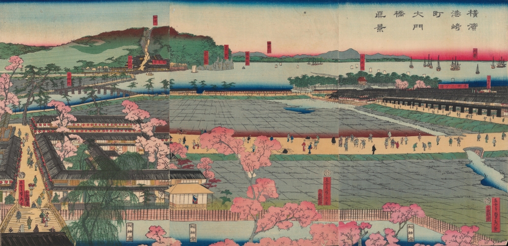
横浜港崎町大門橋真景 / [An Accurate View of the Miyozaki Great Gate and Bridge in Yokohama].
$3,500.00
Acquire
- Digital Map Information
- Suitable for large format printing
- Full resolution TIFF file
- ICC color profile embedded
- Delivered instantly via download link
This is a ukiyo-e triptych of Yokohama, prepared in 1860 by Sadahide, the master of the Yokohama-e subgenre of ukiyo-e woodblock prints. It depicts a view from the Miyozaki pleasure quarter, one of the main sites of cultural contact and mutual curiosity between foreigners and Japanese in Yokohama. (more details)
Pimlico's social geography at the outset of WWII.
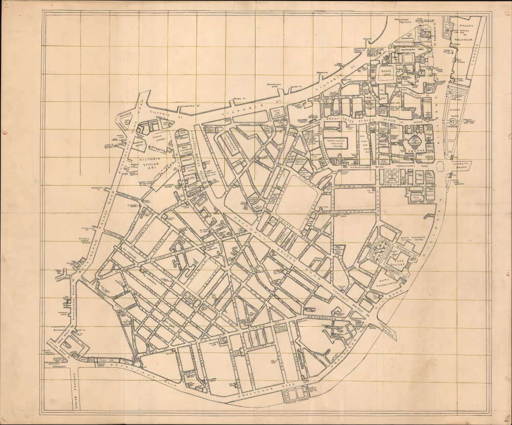
[Pimlico, London.]
$3,500.00
Acquire
- Digital Map Information
- Suitable for large format printing
- Full resolution TIFF file
- ICC color profile embedded
- Delivered instantly via download link
This is an exceptional c. 1939 manuscript map of Pimlico, London, capturing the social geography of wartime London just before the Blitz, German aerial bombing campaign against London and the rest of the United Kingdom. Uniquely, rather than emphasizing civil defense, it meticulously identifies the pubs, clubs, theaters, and nightlife that sustained morale in the shadow of grim war. The map's remarkable precision, suggestive of a military hand, leads us to believe it was prepared as a recreation guide for soldiers on leave, preserving a vibrant urban landscape that would soon be devastated during the Blitz of 1940-1941. (more details)