
Highly desirable early plan of Tokyo or Edo.
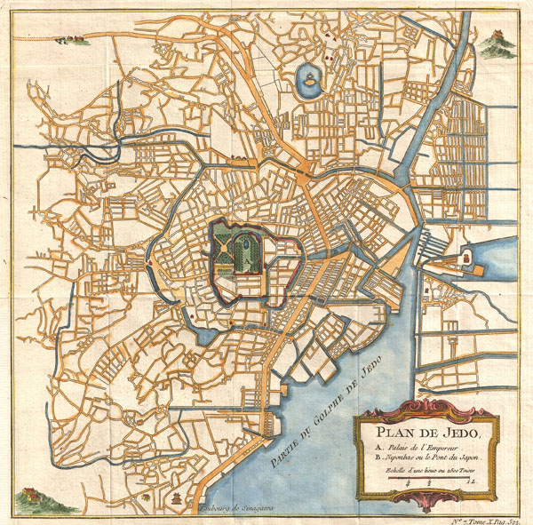
Plan de Jedo.
sold
- Digital Map Information
- Suitable for large format printing
- DPI: 300
- File Size: 4.44 MB
- File Type: ZIP / TIFF
- ICC color profile embedded
- Delivered instantly via download link
This is an attractive and highly desirable c. 1752 map of Edo or Tokyo, Japan. Issued by Bellin and Schley for Prevost's Histoire Generale des Voyages , this map is cartographically based on a 1702 map of the same issued by Scheuchzer and Kaempfer, which itself is ... (more details)

Islas Filipinas, Posesiones de Oceania
sold
- Digital Map Information
- Suitable for large format printing
- Full resolution TIFF file
- ICC color profile embedded
- Delivered instantly via download link
This magnificent 1852 hand colored case map of the Philippines was issued by Dr. Morata and Francisco Coello of Madrid. In 32 folding sections mounted onto linen. Covers the Philippine Islands and the entirety of the Spanish possessions in Oceania.. Perhaps the ... (more details)

(Sketch A No. 3) Minots Ledge Off Boston Harbor.
sold
- Digital Map Information
- Suitable for large format printing
- DPI: 300
- File Size: 9.63 MB
- File Type: ZIP / TIFF
- ICC color profile embedded
- Delivered instantly via download link
A rare hand colored 1853 coastal chart of the Minots Ledge, just off Boston Harbor, Massachusetts. Features The Cohasset Salt Works, Old Harbor, Brig Harbor, The Glades, Cohasset Harbor, and various islands. Published under the supervision of A. D. Bache for the ... (more details)

Colton’s Railroad & Township Map of the State of New York with Parts of the Adjoining States & Canada.
sold
- Digital Map Information
- Suitable for large format printing
- File Size: 27.63 MB
- File Type: ZIP / TIFF
- ICC color profile embedded
- Delivered instantly via download link
Remarkable 1876 Pocket Map of New York State. Depicts the whole of the state and surrounding areas in splendid detail with particular attention to roads and railroads. In the upper left hand corner there is a population chart breaking down the State into ... (more details)
Four rare panoramas of Kyoto by famed illustrator Hiroshi Yoshida.
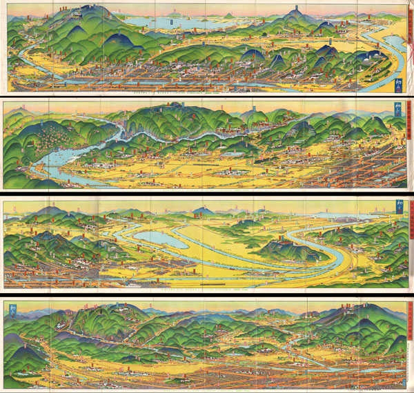
Kyoto Rail Guide.
sold
A rare set of four maps of Kyoto dating to Showa 3 or 1928. Drawn by the famous Japanese illustrator and print maker Hiroshi Yoshida these maps are representative of a style of map that developed in Japan in the early 19th century. Essential transport ... (more details)
Highly unusual Chinese Map of Tientsin that DOES NOT show the Foreign Concessions.
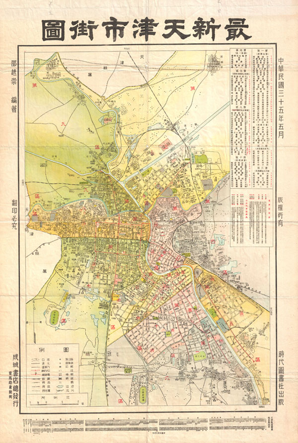
Tientsin.
sold
- Digital Map Information
- Suitable for large format printing
- File Size: 22.93 MB
- File Type: ZIP / TIFF
- ICC color profile embedded
- Delivered instantly via download link
A highly uncommon map of Tianjin (Chinese: ??; pinyin: Tianjin; Wade-Giles: T'ien-chin; [t?i??n?? t??in??]; Postal map spelling: Tientsin), China dating to 1932. Tientsin was a major trading center in Northern China and, like Shanghai, had ... (more details)
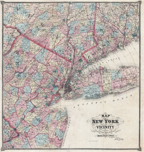
Map of New York and Vicinity.
sold
- Digital Map Information
- Suitable for large format printing
- File Size: 27.89 MB
- File Type: ZIP / TIFF
- ICC color profile embedded
- Delivered instantly via download link
An uncommon large format 1867 F. W. Beers map of New York and Vicinity. Centered on New York City, the map covers from Poughkeepsie to Barnegat Bay and from the Pennsylvania border east to Suffolk County, Long Island, and New Haven ... (more details)
Extraordinary rare panoramic atlas Japan.

Japan Railway Guide.
sold
This is a rare Japanese Railway Guide and Atlas dating to 1925 or Taisho 14. Contains over 370 pages with 100s of lithograph color maps and panoramic views covering the whole of Japan. Panoramic views include the Meiji Shrine, ... (more details)
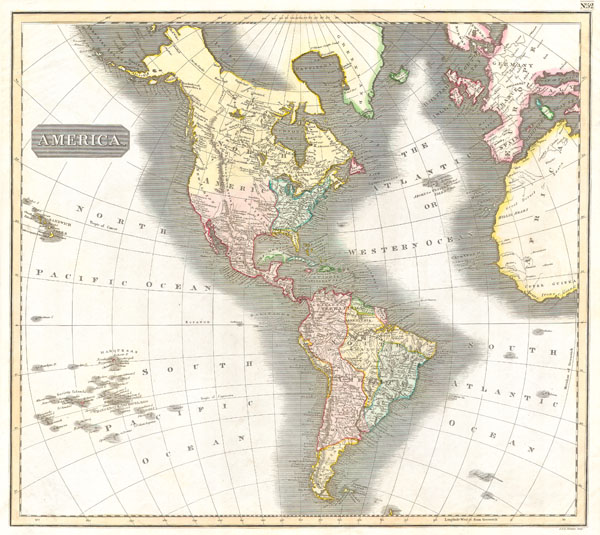
America.
sold
- Digital Map Information
- Suitable for large format printing
- DPI: 300
- File Size: 3.57 MB
- File Type: ZIP / TIFF
- ICC color profile embedded
- Delivered instantly via download link
This fascinating hand colored 1815 map by Edinburgh cartographer John Thomson depicts North and South America, parts of the South Pacific, and the western parts of Europe and Africa. Shows the political borders as they existed ... (more details)
A preliminary chart of the U.S. Coast Survey's work around Cape Fear.
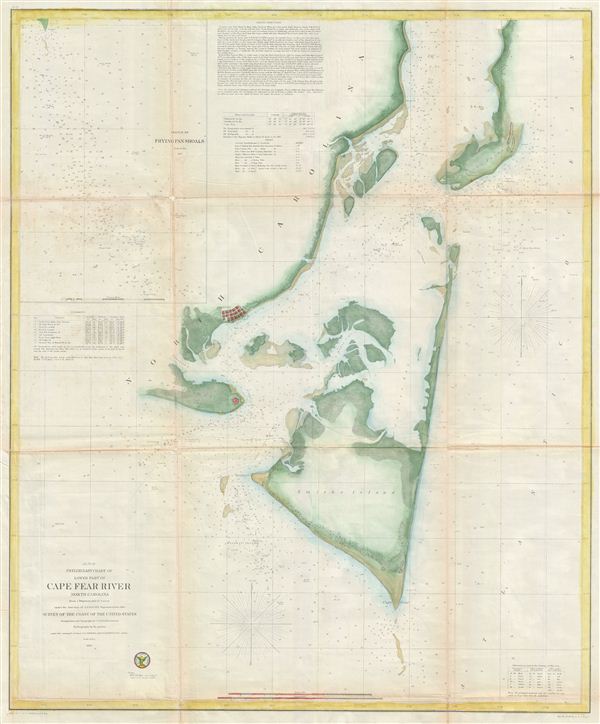
Preliminary Chart of lower part of Cape Fear River North Carolina from a Trigonometrical Survey.
sold
- Digital Map Information
- Suitable for large format printing
- File Size: 15.92 MB
- File Type: ZIP / TIFF
- ICC color profile embedded
- Delivered instantly via download link
One of the largest and most striking U.S.C.S. Map of North Carolina's Cape Fear. extends from Federal Point south to the tip of Cape Fear and then west past Smithville and Fort Caswell to Oak Island (roughly 78.04 Longitude). ... (more details)
Attractive world map showing the routes of the great explorers.
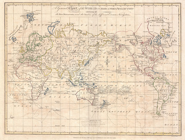
A General Chart of the World on Mercators Projection exhibiting all the New Discoveries and the Tracks of the Different Circum Navigators.
sold
- Digital Map Information
- Suitable for large format printing
- DPI: 300
- File Size: 8.86 MB
- File Type: ZIP / TIFF
- ICC color profile embedded
- Delivered instantly via download link
A fine example of Clement Cruttwell's 1799 map of the world on Mercator's Projection. This is an elegant world map designed to illustrate the activities of important explorers of the 17th and18th centuries. The tracks of ... (more details)
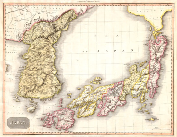
Japan.
sold
- Digital Map Information
- Suitable for large format printing
- Full resolution TIFF file
- ICC color profile embedded
- Delivered instantly via download link
A masterpiece. This fascinating hand colored 1809 map by Edinburgh cartographer John Pinkerton depicts Korea (Corea) and Japan. A spectacular, highly detailed map of this fascinating region with spectacular engraving, ... (more details)
Attractive double hemisphere map showing the routes of the great explorers.
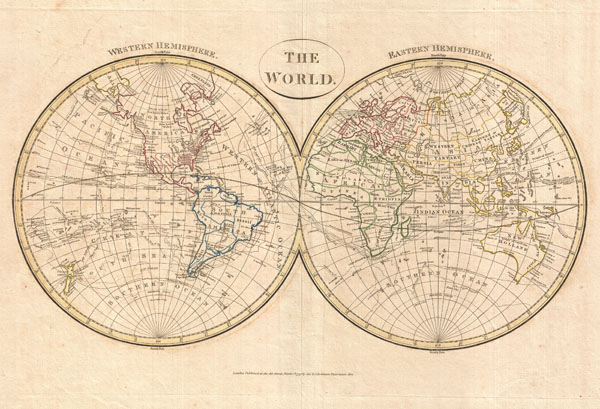
The World. Western Hemisphere. Eastern Hemisphere.
sold
- Digital Map Information
- Suitable for large format printing
- DPI: 300
- File Size: 8.46 MB
- File Type: ZIP / TIFF
- ICC color profile embedded
- Delivered instantly via download link
A fine example of Clement Cruttwell's 1799 map of the world in two hemispheres. This is an elegant world map designed to illustrate the activities of important explorers of the 17th and18th centuries. The tracks of ... (more details)
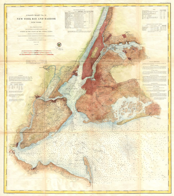
Coast Chart No. 21, New York Bay and Harbor, New York
sold
- Digital Map Information
- Suitable for large format printing
- File Size: 27.97 MB
- File Type: ZIP / TIFF
- ICC color profile embedded
- Delivered instantly via download link
A rare 1861 U.S Coast Survey chart of New York City, it's harbor, and environs. One of the first 19th century carts to depicts New York City as we know it today, including Manhattan, Queens, Brooklyn, the Bronx and ... (more details)
Scarce map of the post-Revolutionary United States with the 14th colony of Sagahaddok.
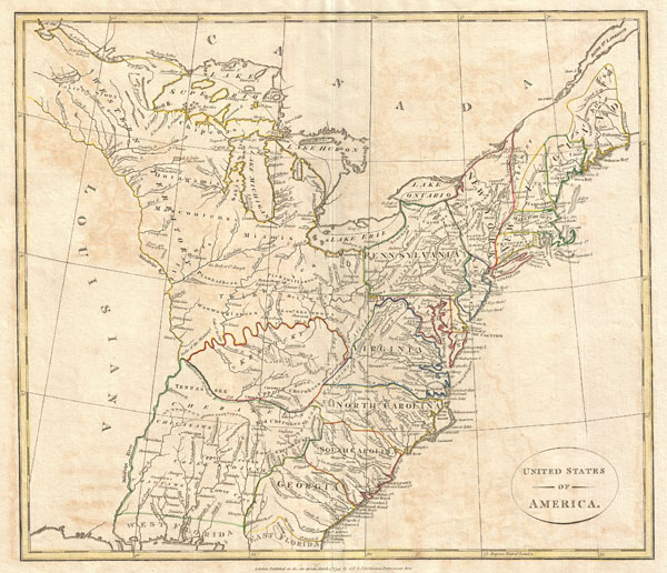
United States of America.
sold
- Digital Map Information
- Suitable for large format printing
- DPI: 300
- File Size: 7.39 MB
- File Type: ZIP / TIFF
- ICC color profile embedded
- Delivered instantly via download link
This is a highly unusual and extremely scarce 1799 map of the United States by the English map publisher Clement Cruttwell. Depicts a post-colonial pre-Louisiana United States extending from the Mississippi River ... (more details)
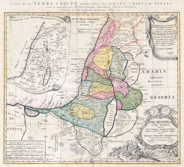
Palaestina in XII Tribus divisa cum Terris Adiacentibus…
sold
- Digital Map Information
- Suitable for large format printing
- DPI: 300
- File Size: 7.88 MB
- File Type: ZIP / TIFF
- ICC color profile embedded
- Delivered instantly via download link
This is one of the Homann Heirs finest and most appealing maps of Palestine / Israel / The Holy Land. Depicts the region divided into the 12 Tribes of Israel. In the right hand corners there are two title ... (more details)
Ephemeral map showing an incomplete understanding of the American Arctic.
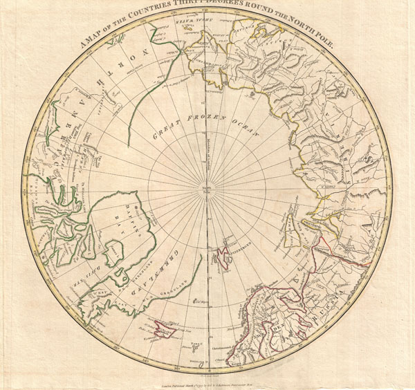
A Map of the Countries Thirty Degress Round the North Pole.
sold
- Digital Map Information
- Suitable for large format printing
- DPI: 300
- File Size: 6.29 MB
- File Type: ZIP / TIFF
- ICC color profile embedded
- Delivered instantly via download link
A fine 1799 map of the northern polar regions by the English map publisher Clement Cruttwell. Covers the polar regions from roughly 60 degrees north latitude to the North Pole. Reveals a primitive yet ... (more details)

West Indies.
sold
- Digital Map Information
- Suitable for large format printing
- DPI: 300
- File Size: 12.37 MB
- File Type: ZIP / TIFF
- ICC color profile embedded
- Delivered instantly via download link
A masterpiece. This fascinating hand colored 1814 map by Edinburgh cartographer John Thomson depicts the West Indies and Central America. Covers from the Carolinas south through Texas, Mexico and ... (more details)

Spain and Portugal.
sold
- Digital Map Information
- Suitable for large format printing
- DPI: 300
- File Size: 7.54 MB
- File Type: ZIP / TIFF
- ICC color profile embedded
- Delivered instantly via download link
A fine 1799 map of Spain and Portugal by the English map publisher Clement Cruttwell. Map shows the provinces as they appeared at this time, including the islands of Majorca, Minorca, and Ibiza ... (more details)
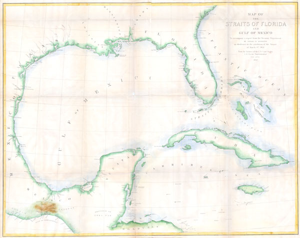
Map of the Straits of Florida and Gulf of Mexico. To accompany a report from the Treasury Department of Israel D. Andrews in obedience to the resolution of the Senate of March 8th, 1851.
sold
- Digital Map Information
- Suitable for large format printing
- DPI: 300
- File Size: 7.17 MB
- File Type: ZIP / TIFF
- ICC color profile embedded
- Delivered instantly via download link
This is a rare large format coastal chart depicting the full coast of the Gulf of Mexico, Florida, the Bahamas, The Isthmus of Tehuantepec, Yucatan, Cuba and Jamaica. It was issued in 1852 to ... (more details)