

Alexandri Magni Imperium et Expeditiones.
sold
- Digital Map Information
- Suitable for large format printing
- DPI: 300
- File Size: 7.49 MB
- File Type: ZIP / TIFF
- ICC color profile embedded
- Delivered instantly via download link
An excellent example of Delamarche's map of the conquests of Alexander the Great. Depicts Alexander's empire at its height, extending from Macedonia eastward all the way to India and south To Egypt. Notes archaic place names, roadways, and destinations. Prepared ... (more details)

Geographie des Hebreux.
sold
- Digital Map Information
- Suitable for large format printing
- DPI: 300
- File Size: 4.42 MB
- File Type: ZIP / TIFF
- ICC color profile embedded
- Delivered instantly via download link
This is Conrad Malte Brun's very appealing map of the Biblical geography of the Torah and Old Testament. Covers what is modern day Egypt, Arabia, Persia and Turkey. Notes many Old Testament lands and Kingdoms including the lands of Magog, Canaan, Saleph, Lubim, ... (more details)
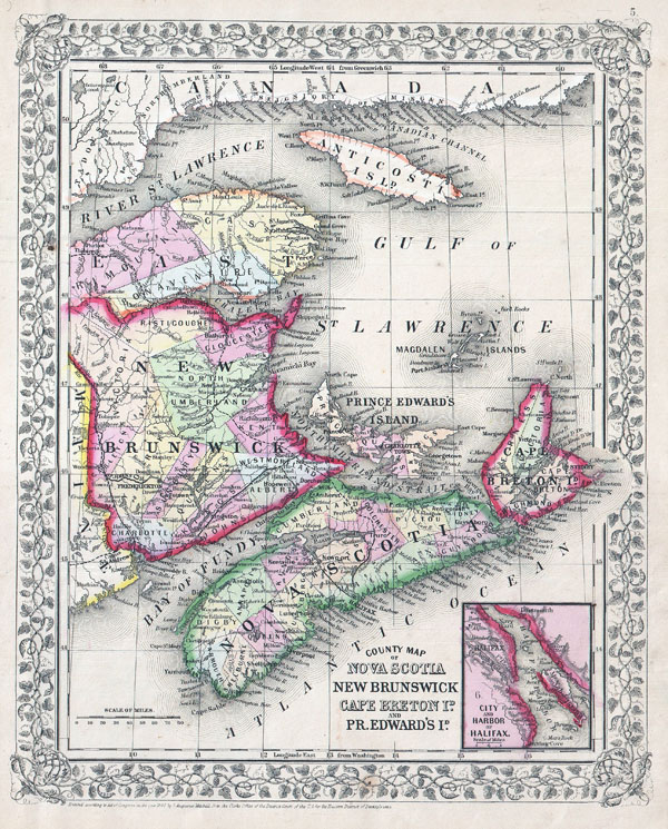
County Map of Nova Scotia, New Brunswick, Cape Breton Is. And Pr. Edward's Id.
sold
- Digital Map Information
- Suitable for large format printing
- File Size: 7.29 MB
- File Type: ZIP / TIFF
- ICC color profile embedded
- Delivered instantly via download link
A beautiful example of S. A. Mitchell Jr.'s 1864 map of the Canadian Maritime Provinces of Nova Scotia, New Brunswick, Prince Edward's Island, and Cape Breton Island. Detailed to the county level with special attention both political and geographic elements. ... (more details)

Mediterranean Sea From the Latest Surveys.
sold
- Digital Map Information
- Suitable for large format printing
- File Size: 41.49 MB
- File Type: ZIP / TIFF
- ICC color profile embedded
- Delivered instantly via download link
A rare and extremely attractive nautical map of the central Mediterranean Sea issued in 1868 by the British Admiralty. Covers from Corsica, Sardinia and Tunisia eastward past Italy and Sicily to detail Greece and the Adriatic Coast. Extends southward as ... (more details)

Carte Des Isles Decouvertes Aux Environs D'Otahiti, dans Plusieurs Voyages Faits Autour Du Monde Par Les Capitaines Byron, Wallis, Carteret & Cook. En 1765, 1767,1769.
sold
- Digital Map Information
- Suitable for large format printing
- DPI: 300
- File Size: 18.4 MB
- File Type: ZIP / TIFF
- ICC color profile embedded
- Delivered instantly via download link
This is a fine map shows the explorations of Captain Cook, Captain Byron, Captain Wallis and Captain Carteret in the vicinity of Tahiti and the Society Islands from 1765 to 1769. Extends from Is. Scilly [i.e. the Scilly Islands] in the west and to I. ... (more details)

Circle Map of Greater New York showing Distances from City Hall and Comparative Values or Real Estate also Transportation Lines, Municipal Ferries and Proposed Bridges, Tunnels, Etc., to The Borough of Richmond.
sold
- Digital Map Information
- Suitable for large format printing
- File Size: 34.39 MB
- File Type: ZIP / TIFF
- ICC color profile embedded
- Delivered instantly via download link
This is a real estate map of New York City issued by the Wood Harmon company in 1806. Depicts the greater New York area, including parts of New Jersey and all five boroughs, with a focus on advancing the real estate interests of the Wood Harmon firm. ... (more details)

Carte des Isles de la Societe decouvertes parle Lieut. J. Cook. 1769.
sold
- Digital Map Information
- Suitable for large format printing
- DPI: 300
- File Size: 5.37 MB
- File Type: ZIP / TIFF
- ICC color profile embedded
- Delivered instantly via download link
This is a fine example of the first published map of the Society Islands, composed by James Cook on his first voyage. Consists of the islands of Maurua, Tubai, Bolabola, Otaha, Ulietéa and Huaheine. This group was identified by Cook in 1769, when he ... (more details)

Klein-Asien & Syrien nebst Den Westlichen Theilen von Armenien, Kurdistan & Mesopotamien.
sold
- Digital Map Information
- Suitable for large format printing
- File Size: 6.81 MB
- File Type: ZIP / TIFF
- ICC color profile embedded
- Delivered instantly via download link
This is a beautiful example of Stieler's 1873 map of the modern day Turkey, Syria, Israel / Palestine and Cyprus. Highly detailed with both political and physical data. Shows cities, mountains, roads, rivers and local divisions. An inset in the ... (more details)
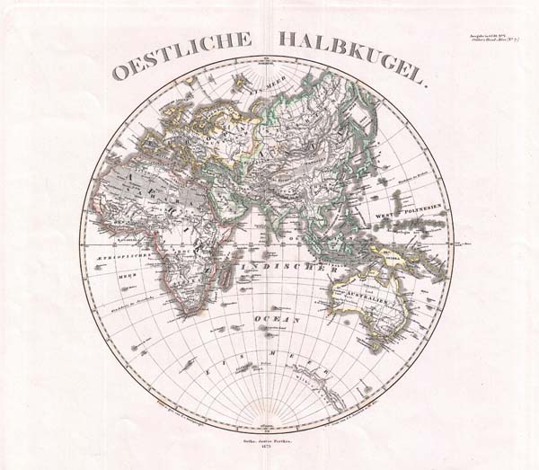
Oestliche Halbkugel
sold
- Digital Map Information
- Suitable for large format printing
- File Size: 3.87 MB
- File Type: ZIP / TIFF
- ICC color profile embedded
- Delivered instantly via download link
This is a beautiful example of Stieler's 1873 map of the Eastern Hemisphere. Includes the entirety of Asia, Europe and Africa as well as Australia and much of the Pacific. Also includes those parts of Antarctica, including 'Wilkes' Land?,' ... (more details)

Illinois, Missouri, Iowa, Nebraska and Kansas.
sold
- Digital Map Information
- Suitable for large format printing
- File Size: 22.9 MB
- File Type: ZIP / TIFF
- ICC color profile embedded
- Delivered instantly via download link
A beautiful example of the first edition of S. A. Mitchell Jr.'s 1860 map of Iowa, Nebraska, Illinois, Missouri Kansas and Nebrasa. Detailed to the county level with attention to towns, geographical features, proposed railroads, and cities. ... (more details)
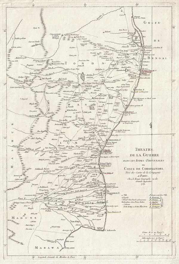
Theatre de la Guerre Dans Les Indes Orientales ou Coste de Coromandel Tiree des Cartes de la Compagnie a Paris…
sold
- Digital Map Information
- Suitable for large format printing
- DPI: 300
- File Size: 26.91 MB
- File Type: ZIP / TIFF
- ICC color profile embedded
- Delivered instantly via download link
This is an attractive 1759 map of Eastern India or Coromandel by George-Louis le Rouge. Covers the Indian coast from Marawa, in the south, northward past Pondicherry and Madras as far as Pallikata on the Bay of Bengal. Extends inland as far ... (more details)
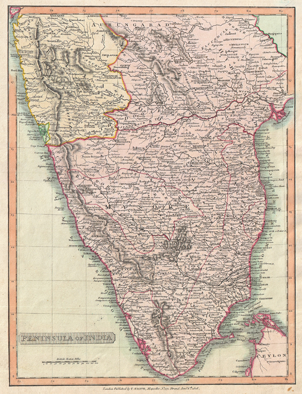
Peninsula of India.
sold
- Digital Map Information
- Suitable for large format printing
- DPI: 300
- File Size: 22.79 MB
- File Type: ZIP / TIFF
- ICC color profile embedded
- Delivered instantly via download link
This is an attractive 1808 map of India by English map publisher Charles Smith. Covers the subcontinent from Bombay (Mumbai) south to include parts of Ceylon (Sri Lanka). Highly detailed. Based on the Faden map of 1793. Divided according ... (more details)

County Map of the State of New York.
sold
- Digital Map Information
- Suitable for large format printing
- File Size: 47.55 MB
- File Type: ZIP / TIFF
- ICC color profile embedded
- Delivered instantly via download link
A beautiful example of S. A. Mitchell Jr.'s 1867 map of New York. Detailed to the county level with attention to towns, geographical features, proposed railroads, and cities. Five inset city plans detail Buffalo, Rochester, New York City ... (more details)
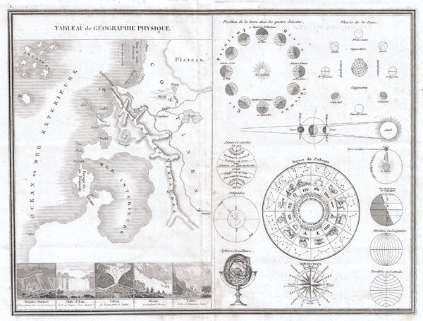
Tableau de Geographie Physique.
sold
- Digital Map Information
- Suitable for large format printing
- DPI: 300
- File Size: 15.06 MB
- File Type: ZIP / TIFF
- ICC color profile embedded
- Delivered instantly via download link
This is a very unusual 1838 map and astronomical chart by M. Monin. Divided into two sections. The left section is a Geographical Tableau, essentially a map of nothing, showing various geographical features and how they can be displayed. ... (more details)
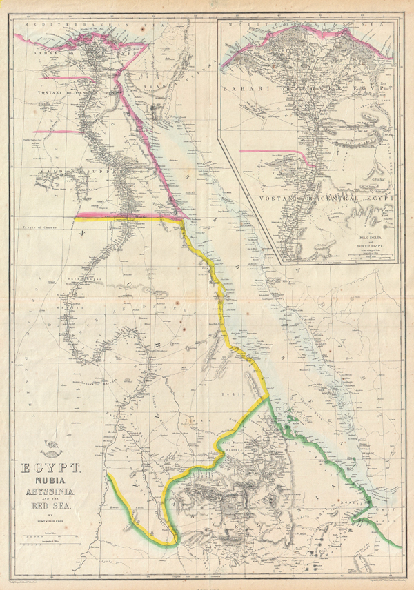
Egypt, Nubia, Abyssinia, and the Red Sea.
sold
- Digital Map Information
- Suitable for large format printing
- DPI: 300
- File Size: 57.26 MB
- File Type: ZIP / TIFF
- ICC color profile embedded
- Delivered instantly via download link
This is a hand colored map of Egypt, Nubia and Abyssinia, dating to 1858, by London cartographer Edward Weller. Depicts northeastern Africa from what is today central Ethiopia, northward along the Nile to Egypt and the Delta. Shows the Red ... (more details)
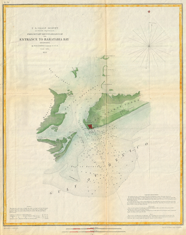
Preliminary Reconnaissance of the Entrance to Barataria Bay, Louisiana.
sold
- Digital Map Information
- Suitable for large format printing
- DPI: 300
- File Size: 25.17 MB
- File Type: ZIP / TIFF
- ICC color profile embedded
- Delivered instantly via download link
This is an attractive 1853 U.S. Coast Survey chart or nautical map or Barataria Bay, Louisiana. Covers from Grand Isle and Bayou Rigaud eastward Past Fort Livingston and Forstall's Plantation. Extends northward past Mendicant Island to ... (more details)

Johnson's Asia.
sold
- Digital Map Information
- Suitable for large format printing
- File Size: 31.57 MB
- File Type: ZIP / TIFF
- ICC color profile embedded
- Delivered instantly via download link
This is Johnson and Browning's 1861 map of Asia, first edition. Covers the entire continent offering good inland detail even in Central Asia and northern China. Includes parts of Europe, the Arabian Peninsula and Africa. Features the ... (more details)

Johnson's China.
sold
- Digital Map Information
- Suitable for large format printing
- File Size: 31.08 MB
- File Type: ZIP / TIFF
- ICC color profile embedded
- Delivered instantly via download link
A fine example of A. J. Johnson and Ross C. Browning's 1861 map of China and Korea. Covers China from Tibet and Yunnan east to Korea (Corea) and north as far as Mongolia. extends south to include the island of Hainan. Formosa or ... (more details)

Johnson's Missouri and Kansas.
sold
- Digital Map Information
- Suitable for large format printing
- File Size: 67.19 MB
- File Type: ZIP / TIFF
- ICC color profile embedded
- Delivered instantly via download link
This is Johnson and Ward's 1864 map of Missouri and Kansas. Covers the state divided into counties with special attention to transportation, especially roads, railroads, and canals. Features three inset woodcuts: 'Fire on the ... (more details)

Johnson's Massachusetts, Connecticut, and Rhode Island.
sold
- Digital Map Information
- Suitable for large format printing
- File Size: 23.56 MB
- File Type: ZIP / TIFF
- ICC color profile embedded
- Delivered instantly via download link
This is Johnson and Ward's 1862 map of Massachusetts, Connecticut and Rhode Island. This rare map offers a fascinating snapshot of these two New England states shortly following the outbreak of the American Civil War. Map shows ... (more details)