
Land of Lakes.
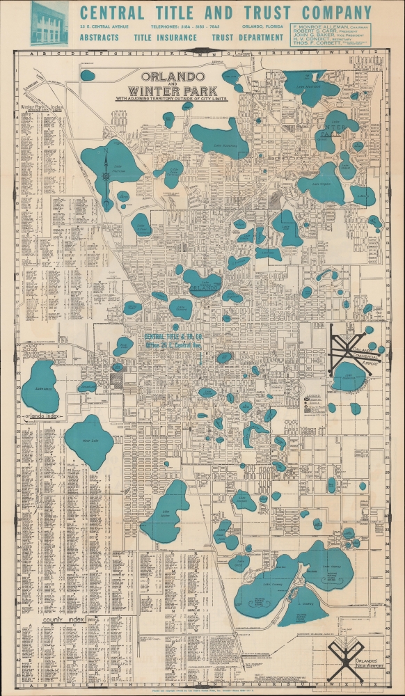
Street and Index Map of Orlando and Winter Park and adjacent territory outside of these city limits. / Large Aerial view of the Orlando Business District. / County Map Showing All oft Paved Roads.
sold
- Digital Map Information
- Suitable for large format printing
- Full resolution TIFF file
- ICC color profile embedded
- Delivered instantly via download link
An impressive 1947 Tyn Cobb folding city plan or map of Orlando and Winter Park, Florida. It presents the area early in its post-World War II (1939 - 1945) population boom. (more details)
Tacoma as a railroad town.

Whitney's Map of the City of Tacoma and environs, Washington.
sold
- Digital Map Information
- Suitable for large format printing
- File Size: 1186.34 MB
- File Type: ZIP / TIFF
- ICC color profile embedded
- Delivered instantly via download link
This is the rare 1889 W. H. Whitney and Frederick G. Plummer map of Tacoma, Washington. The map illustrates the early days of Tacoma as a stop on the Union Pacific's Northern Pacific Railroad. It combines the functions of a real estate map and a railroad map. An inset in the upper left offers an overview of the general area. (more details)
Florida Citrus Boom.
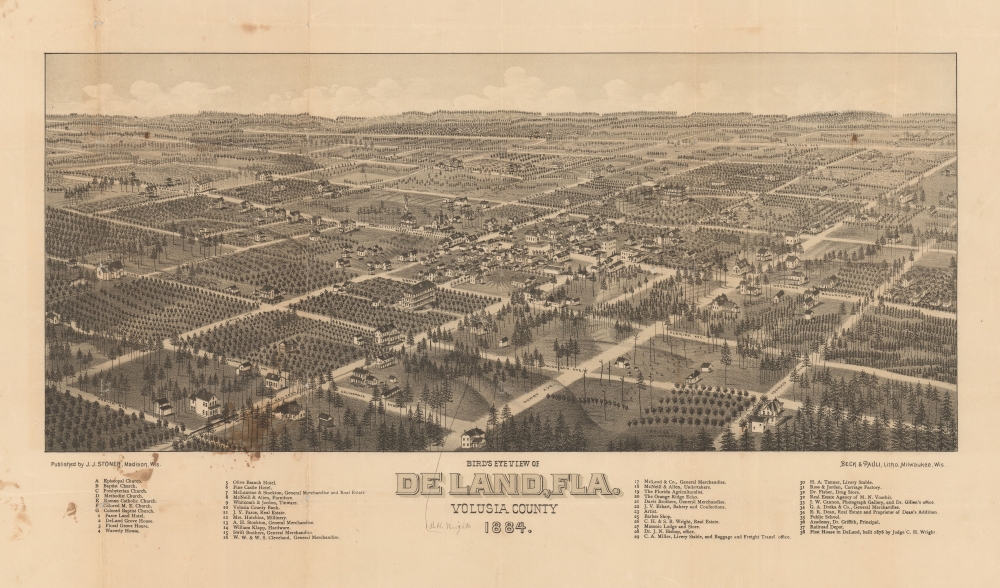
Bird's Eye View of De Land, Fla. Volusia County 1884.
sold
- Digital Map Information
- Suitable for large format printing
- File Size: 44.57 MB
- File Type: ZIP / TIFF
- ICC color profile embedded
- Delivered instantly via download link
A very rare 1884 Stoner / Wellge bird's-eye view of DeLand Florida at the height of the first Florida Citrus Boom and the Second Florida Land Boom - which centered around DeLand.The view looks northeast on Deland. Thirty-eight business, offices, hotels, and civic buildings rea named, as well as seven churches. Orange grows are evident throughout, underscoring DeLand's significance as a center of the Citrus Boom. (more details)
White Mountains tourism boom.

Bird's Eye View of the White Mountains.
sold
- Digital Map Information
- Suitable for large format printing
- File Size: 734.06 MB
- File Type: ZIP / TIFF
- ICC color profile embedded
- Delivered instantly via download link
A striking 1890 George. W. Morris bird's-eye view of the White Mountains of New Hampshire. The view captures 'The Whites' at the height of their 19th century tourism boom. Railroads began to penetrate the White Mountains in the mid-19th century, making them an instant hit with tourists and the 'rusticator' crowd. By the 1890s, when this view was issued, the region was well serviced and easily accessible by travelers from Boston, Portland, and New York. Such views were manufactured for sale from vendors on the trains as well as at station newsstands. (more details)
Between the great powers.
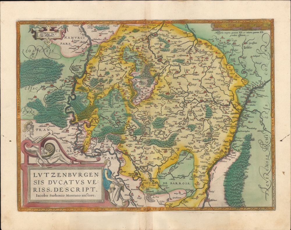
Lutzenburgensis Ducatus Veriss Descript.
sold
- Digital Map Information
- Suitable for large format printing
- Full resolution TIFF file
- ICC color profile embedded
- Delivered instantly via download link
A beautiful example, in superb original color, of Abraham Ortelius' map of Luxembourg. It is considered the first map of those areas presented in an atlas. While the book's first edition was released in 1570, Ortelius continually improved the work - both by adding new maps, and by refining the production of the book. Maps appearing in editions of the Theatrum in the 1580s and 1590s generally display, as here, a finer quality of color than those in the earlier issues of the work. (more details)
First atlas map of Switzerland, in superb original color.
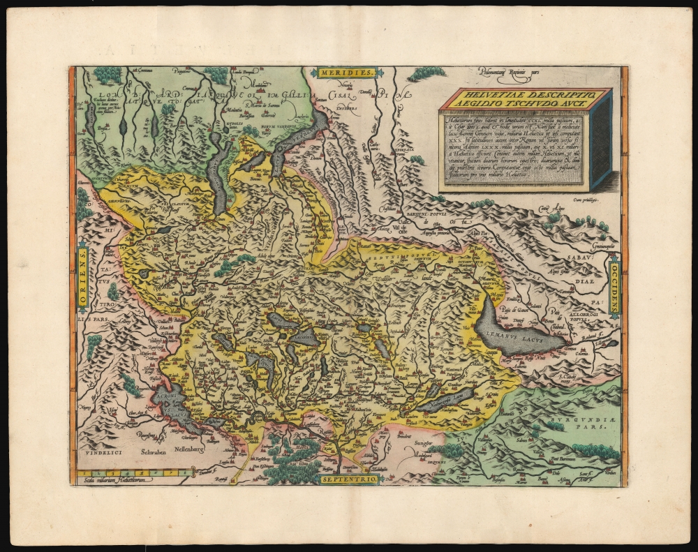
Helvetiae Descriptio Aegidio Tschudo Auct.
sold
- Digital Map Information
- Suitable for large format printing
- Full resolution TIFF file
- ICC color profile embedded
- Delivered instantly via download link
This is Abraham Ortelius' 1570 map of Switzerland, the first to appear in a modern atlas, in superb original color. This richly detailed, southern-oriented map provided the best delineation of the Swiss Confederation to date. (more details)
Foundational map of the southernmost extent of the Americas.
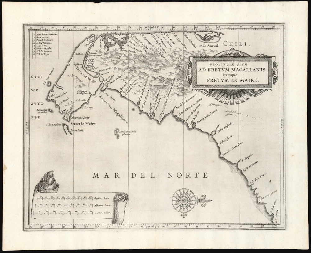
Provinciae Sitae Ad Fretum Magallanis itemque Fretum Le Maire.
sold
- Digital Map Information
- Suitable for large format printing
- DPI: 600
- File Size: 24.84 MB
- File Type: ZIP / TIFF
- ICC color profile embedded
- Delivered instantly via download link
This is Johannes de Laet's 1630 map of southern South America, from the southern bank of the Rio de la Plata in the north to Tierra del Fuego in the south. It was the work of the official chartmaker of the Dutch West India Company, Hessel Gerritsz; his was the best charting of the region available. It first appeared in De Laet's 1626 Beschrijvinghe van West-Indien with a Dutch title, Provincien van de Straet van Magallanes, ende vande Straet Le Maire. (The title and the labels for the three scales were altered on the copperplate for the 1633 Latin-text edition.) (more details)
Focusing on Lewis and Clark's Crossing of the Rockies.
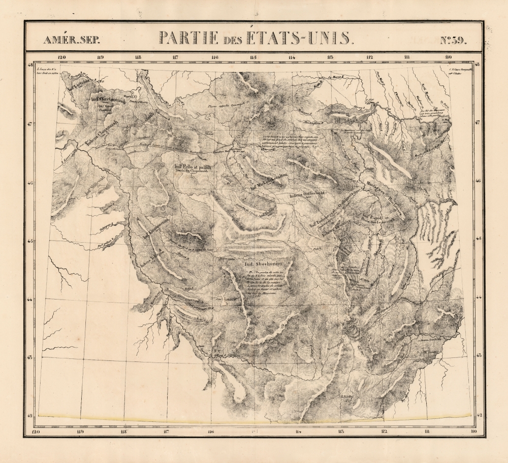
Amer. Sep. Partie des Etats-Unis No. 39.
sold
- Digital Map Information
- Suitable for large format printing
- DPI: 600
- File Size: 70.54 MB
- File Type: ZIP / TIFF
- ICC color profile embedded
- Delivered instantly via download link
This is Philipe Vandermaelen's revised 1827 map of the eastern Oregon Territory, capturing the mountainous region between the upper Missouri River and the headwaters of the Columbia River, which is now Idaho and the western parts of Montana and Wyoming. It was the largest-scale map of this region produced to date - 'no mapmaker had previously attempted to use such a large scale for any western American area.' (Wheat). Like all of the maps from Vandermaelen's Atlas, it is the also the first map of the region executed in lithograph. (more details)
Includes musk oxen, a polar bear, and caribou.

30 0569 Nordpolargebiet: Natur, Forschung, Wirtschaft.
sold
This is a 1957 Westermann pictorial map of the Arctic. Centered on the North Pole, the map incorporates parts of the northern hemisphere, including Siberia, Canada, Greenland, and most of Europe encircle the northern icecap. Illustrations of Arctic wildlife, such as musk oxen, elephant seals, polar bears, caribou, walruses, and moose add charm and educational value. Trappers, fishermen, Inuit, loggers, and explorers appear as well. Colored diamonds featuring chemical symbols mark mineral deposits. Icebergs dot most of the Arctic Ocean and some of the Atlantic, creating hazards for the steamships plying these waters. Airliners traverse the Atlantic as well, highlighting the newfound interconnectedness of the mid-20th century. (more details)
Como: Making other lakes jealous.

Larii Lacus Vulgo Comensis Descriptio... / Terretorii Romani Descrip. / Fori Iulii Vulgo Frivli Typus.
sold
- Digital Map Information
- Suitable for large format printing
- Full resolution TIFF file
- ICC color profile embedded
- Delivered instantly via download link
A beautiful example, in superb original color, of Abraham Ortelius' map of Lake Como, the vicinity of Rome, and the Upper Adriatic. It is considered the first map of those areas presented in an atlas. The map includes three maps on a single sheet, the largest representing Lake Como. While the book's first edition was released in 1570, Ortelius continually improved the work - both by adding new maps, and by refining the production of the book. Maps appearing in editions of the Theatrum in the 1580s and 1590s generally display, as here, a finer quality of color than those in the earlier issues of the work. (more details)
Convincing the colonies to stand by Occupied and Vichy France.
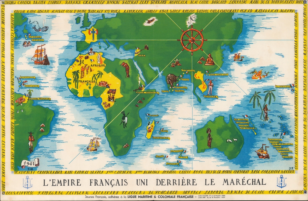
L'Empire français uni derrière le Maréchal.
sold
- Digital Map Information
- Suitable for large format printing
- File Size: 15.55 MB
- File Type: ZIP / TIFF
- ICC color profile embedded
- Delivered instantly via download link
This is a 1941 Vichy French pictorial propaganda map of the French Empire during the Nazi occupation. It was created to promote unity between the occupied France and its colonial empire - although in fact many French Colonial territories became havens for the resistance. (more details)
Mussolini Celebrating Pearl Harbor.
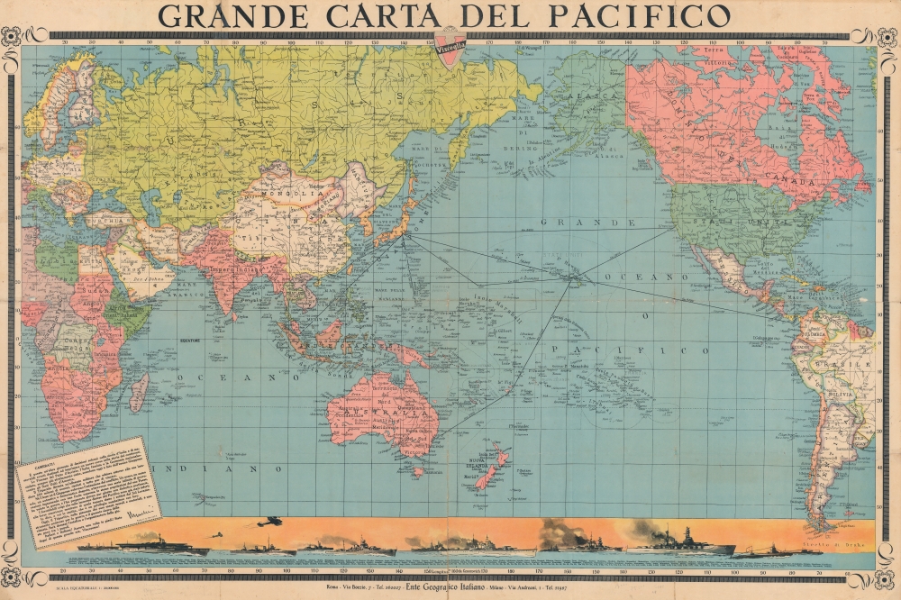
Grande Carta del Pacifico.
sold
- Digital Map Information
- Suitable for large format printing
- File Size: 232.91 MB
- File Type: ZIP / TIFF
- ICC color profile embedded
- Delivered instantly via download link
Celebrating the Japanese attack on Pearl Harbor and centered over the vast expanse of the Pacific, this is a 1942 Visceglia World War II Fascist Italian map of the Pacific. Originating only days after the Japanese attack, the map is an exhortation from Mussolini to celebrate the achievements of their 'friends in the east'. (more details)
Cataloging Kibbutzim.
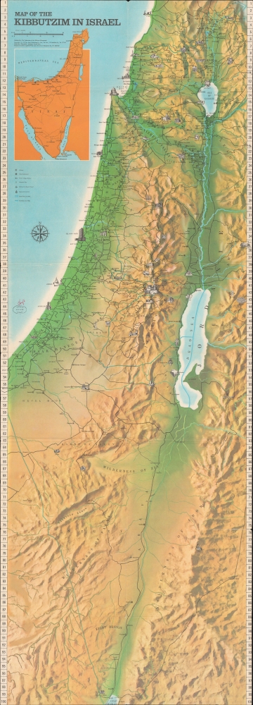
Map of the Kibbutzim in Israel / הקיבוצים בישראל.
sold
A large and highly detailed 1972 / 1975 map of Israel noting kibbutzim, published by Amir Publishing for the Federation of the Kibbutz Movements. Among other features, the map and information on the verso are keen to point out the variety of endeavors undertaken by kibbutzim. (more details)
The Swiss, Their Soldiery, Their Cattle, Their Cheese.
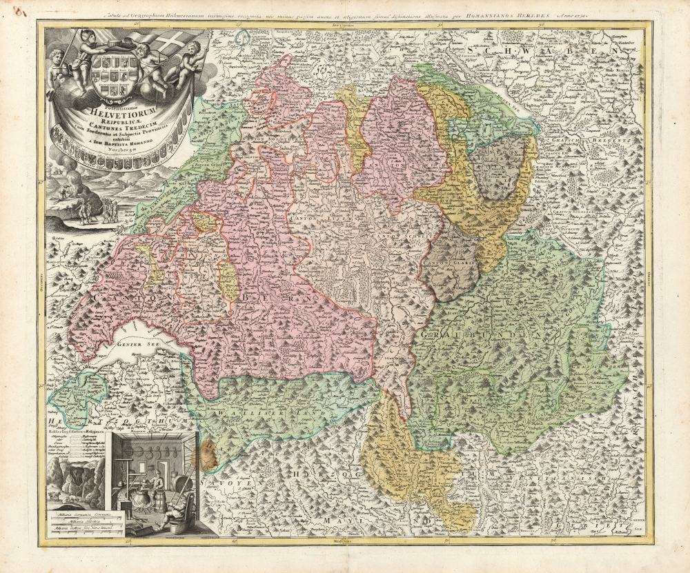
Potentissime Helvetiorum Reipublicae Cantones Tredecium cum Foederatis edt Subjectis Provinciis exhibiti a Joh. Baptista Homanno Noribergae.
sold
- Digital Map Information
- Suitable for large format printing
- DPI: 600
- File Size: 75.88 MB
- File Type: ZIP / TIFF
- ICC color profile embedded
- Delivered instantly via download link
This is Johann Baptist Homann's map of Switzerland divided into its thirteen cantons, in an example printed by Homann Heirs for inclusion in Hübner's popular school atlas starting in 1732. It is an evocative map, with the alpine landscape indicated pictorially in profile. (more details)
Pony Express Broadside.

Pony Express.
sold
- Digital Map Information
- Suitable for large format printing
- File Size: 1593.38 MB
- File Type: ZIP / TIFF
- ICC color profile embedded
- Delivered instantly via download link
This is a large and dramatic c. 1860-61 xylographic broadside promoting the Pony Express - one of just two known surviving examples. Its striking size and visual grandeur are unmatched by any other Pony Express piece with which we are aware. Moreover, with a lifespan of just 18 months, and the general mystique driving interest the Pony Express, all such promotional material is of the utmost rarity and desirability. (more details)
One of the most decorative maps of the 18th century - here in a pristine uncolored examples.

Carte très curieuse de la Mer du Sud, contenant des Remarques Nouvelles et très utiles non seulement sur des Ports et Îles de cette Mer, mais aussy sur les principaux Pays de l'Amerique tant Septentrionale que Méridionale en a été faite.
sold
- Digital Map Information
- Suitable for large format printing
- DPI: 600
- File Size: 2448.4 MB
- File Type: ZIP / TIFF
- ICC color profile embedded
- Delivered instantly via download link
One of the most spectacularly decorative maps of the 18th century, this is Henri Chatelain's magnificent 1719 map of the Americas and the Pacific. The map emerged on the cusp of a new age of global exploration wherein world-spanning trade routes offered Europeans unprecedented exposure to new cultures, peoples, and trade opportunities. It is no mistake that his map of America - as seen here, presents the continent as the center of a staggering array of trade networks reaching from Europe to America itself, the South Pacific, and Africa. (more details)
Riding in Style.

Fall River Line Old Colony Steamboat Company New York Boston.
sold
- Digital Map Information
- Suitable for large format printing
- File Size: 105.63 MB
- File Type: ZIP / TIFF
- ICC color profile embedded
- Delivered instantly via download link
A scarce and vibrant c. 1896 chromolithographic view of the Priscilla, flagship of the Old Colony Line, docked at Pier 18 on the west side of Lower Manhattan. It was drawn by artist Fred Pansing and printed by the Gray Lithograph Co. Aside from the wonderful variety of ships evident in the foreground, the view is also significant for portraying several of the earliest skyscrapers in Manhattan. (more details)
From Skylab.

X-Ray Photo of the Sun. Jan. 21, 1974. 1550 GMT.
sold
This is an x-ray photo of the Sun taken by the Skylab Apollo Telescope Mount on January 29, 1974. It illustrates the intensity of x-rays emitted from a specific portion of the Sun. Colors coded by the MSFC/S-056 Image Data Processing System (IDAPS) represent maximum intensity x-rays (white/purple), medium intensity x-rays (green/orange) and minimum intensity x-rays (red). (more details)
The world's oldest ship still afloat.

U.S.S. Constitution 1817. Compliments of the Union Iron Works.
sold
- Digital Map Information
- Suitable for large format printing
- File Size: 171.32 MB
- File Type: ZIP / TIFF
- ICC color profile embedded
- Delivered instantly via download link
A rare and eye-catching piece, this is a c. 1917 reverse cyanotype broadside of the U.S.S. Constitution. Known as Old Ironsides after British sailors watched cannon balls bounce off her hull during the War of 1812, the Constitution is the world's oldest ship still afloat. This beautiful piece highlights her masts, sails, and rigging, as well as the gun ports on her starboard (right) side. (more details)
A Native American map by Wounded Sparrow.
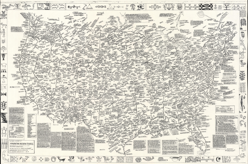
A Map-History of American Indian Tribes. This Second Edition is Dedicated to His Memory by His Friend Wounded Swallow.
sold
This is a 1986 Wounded Swallow map of American Indian tribes throughout the United States. It comprises a visual history of American Indians to about 1900. (more details)