
The world's most beautiful skyline.
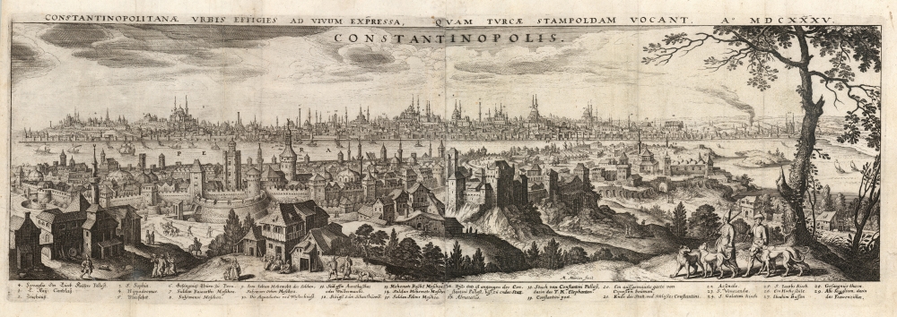
Constantinopolitanae urbis effigies ad vivum expressa, quam turcae Stampoldam vocant, Ao. MDCXXXV.
sold
- Digital Map Information
- Suitable for large format printing
- Full resolution TIFF file
- ICC color profile embedded
- Delivered instantly via download link
This is a 1638 (dated 1635) Matthäus Merian view of Constantinople, or Istanbul, Turkey. The view is oriented to the south. The Beyoğlu district - then known as 'Pera' - is in the foreground, while a panorama of Istanbul proper can be seen as a distant skyline beyond the Golden Horn. A legend at the bottom names twenty nine structures, with a key indicating the named buildings on the view - predominantly mosques. It is a beautiful example of Merian's superb engraving. The panorama is artfully framed with lifelike trees and other flora, and is filled with depictions of the city's denizens going about everyday life: walking and talking with one another, sitting and conversing, and bringing the dogs back home from the hunt. (more details)
'The Real Thing'.

101 Reasons to Shoot and Post in the Big Apple, New York.
sold
An imaginative depiction of New York City focusing on its film and television industry, this c. 1993 promotional pictorial view was drawn by Rob Zell-Breir and produced by Bayside Promotions. (more details)
A British mapping of Charleston Harbor.
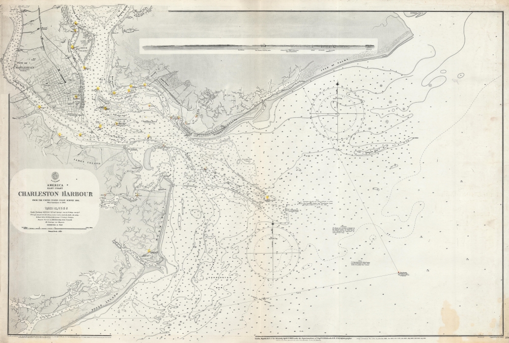
America. East Coast. Charleston Harbour.
sold
- Digital Map Information
- Suitable for large format printing
- File Size: 111.81 MB
- File Type: ZIP / TIFF
- ICC color profile embedded
- Delivered instantly via download link
This is a 1912 British Admiralty nautical chart or map of Charleston Harbor, South Carolina. Detailing the harbor using depth soundings and identifying channels, this chart also includes a small coastal view of the harbor that includes Fort Sumter. (more details)
The Greatest Phantom Island of the Old World.
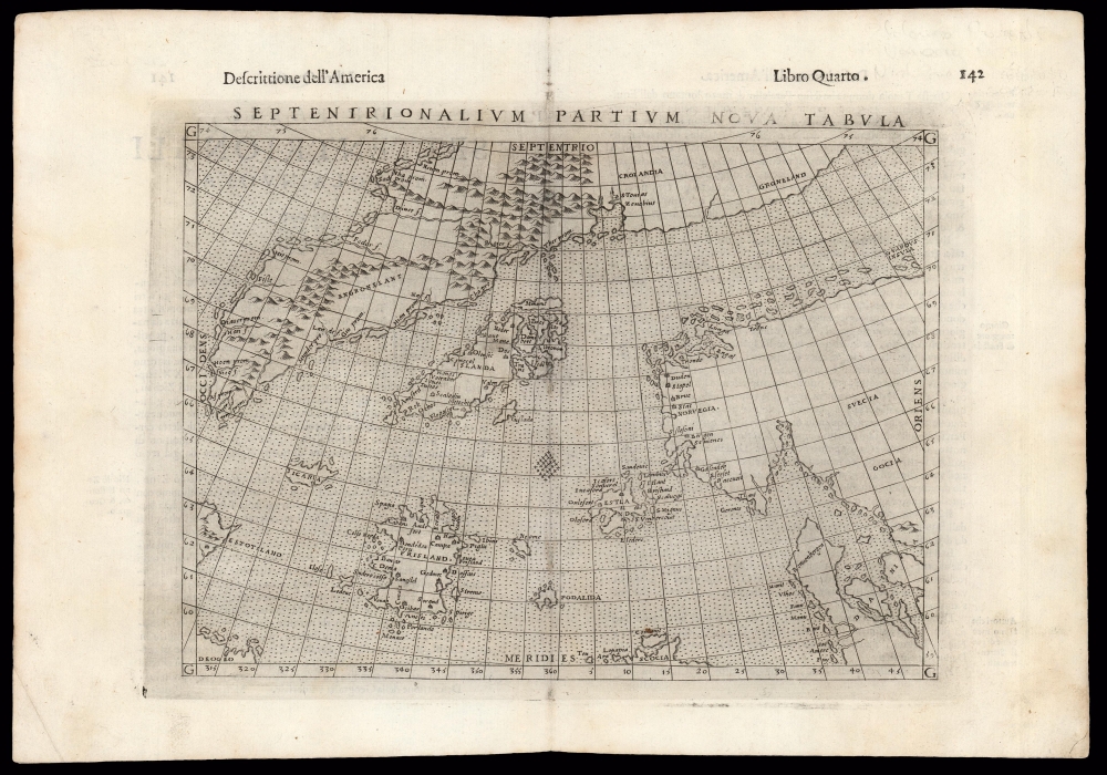
Septenirionalium Partium Nova Tabula.
sold
- Digital Map Information
- Suitable for large format printing
- DPI: 600
- File Size: 15.77 MB
- File Type: ZIP / TIFF
- ICC color profile embedded
- Delivered instantly via download link
This is Girolamo Ruscelli's 1599 edition of the 1558 Carta Da Navegar De Nicolo et Antonio Zeni Furono In Tramontana Lano MCCCLXXX by Nicoló Zeno the Younger, revealing the alleged 14th century voyages of his ancestors, Nicoló and Antonio Zeno. The fraud, largely an attempt to co-opt Columbus' 1492 discovery of America, is responsible for the tenacity with which sixteenth and early seventeenth century geographers mapped the phantom islands Frisland, Icaria, Deogeo, and the coastline of Estotiland, which was taken to be the coast of Labrador. (more details)
The Beautiful Buildings of South Beach.
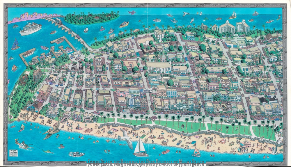
South Beach, the Historic Art Deco District of Miami Beach.
sold
A large and impressive pictorial view of the southern portion of South Beach, Miami Beach, Florida, produced in 1993 by Cityscape Graphics. In addition to highlighting local businesses and attractions, it also focuses on the area's distinctive art deco style architecture. (more details)
A Most Unique Early Map of Jerusalem.

Jerusalem die heilige viereckete Stadt, in grund gelegt und eigentlich abgemalet.
sold
- Digital Map Information
- Suitable for large format printing
- DPI: 600
- File Size: 28.34 MB
- File Type: ZIP / TIFF
- ICC color profile embedded
- Delivered instantly via download link
This is Heinrich Bünting's 1581 bird's eye view of the Holy City of Jerusalem. Despite its schematic appearance, the plan was presented to Bünting's readers as depicting the city as being drawn as it was actually laid out - 'in Grundt gelegt und eigentlich abgemalet'. This fascinating view appeared in Bünting's Itinerarium Sacrae, the first and for many years the only complete work of biblical geography. As such, this map's representation of Jerusalem would be for many years the armchair pilgrim's best view of the Holy City. (more details)
Where the Mississippi meets the Gulf.
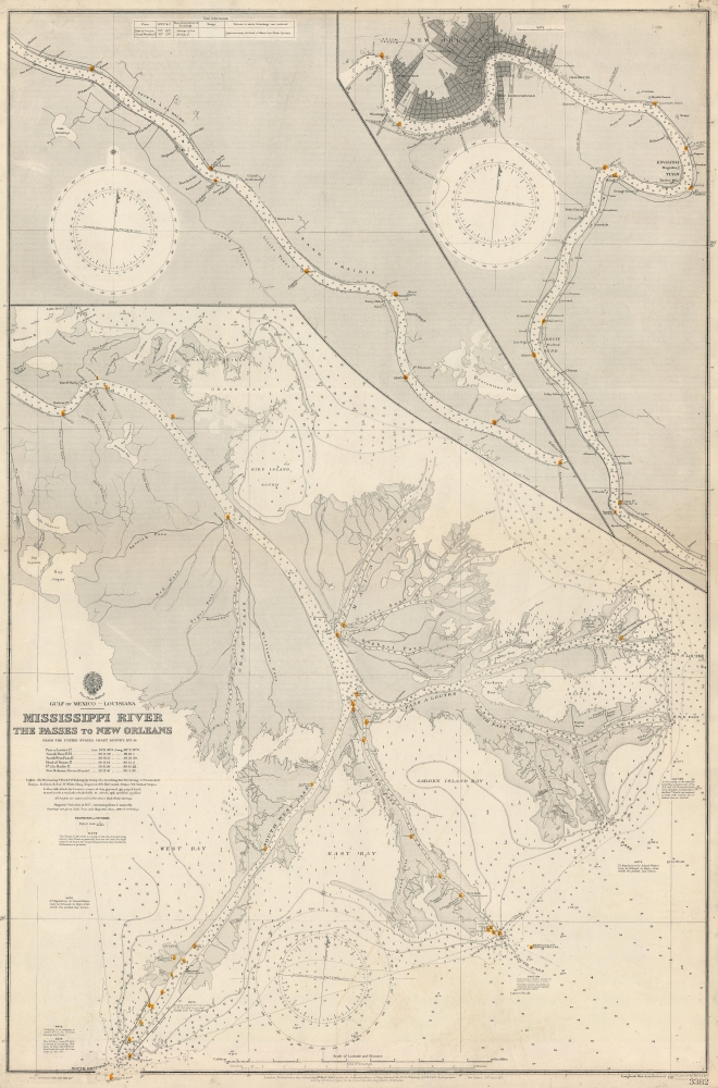
Gulf of Mexico. Louisiana. Mississippi River The Passes to New Orleans.
sold
- Digital Map Information
- Suitable for large format printing
- File Size: 136.18 MB
- File Type: ZIP / TIFF
- ICC color profile embedded
- Delivered instantly via download link
This is a 1919 British Admiralty nautical chart or map of the Mississippi River from New Orleans to The Passes - thus detailing one of the most important water routes in the United States. Providing a plethora of information necessary to navigate the river, this chart offers a detailed look at the Great River. (more details)
'Brooklyn's first Public Park' - AIA Guide
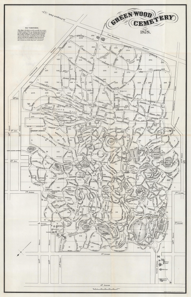
Green-Wood Cemetery.
sold
- Digital Map Information
- Suitable for large format printing
- Full resolution TIFF file
- ICC color profile embedded
- Delivered instantly via download link
This is an 1878 Snyder and Black map of Green-Wood Cemetery, Brooklyn. The AIA considers Greenwood Cemetery 'Brooklyn's first public park'. Celebrated for its design, and known for its notable monuments and mausoleums, today Green-Wood remains an active cemetery but also has become a cultural institution and an outdoor museum. (more details)
Vietnam War Pictorial Propaganda likely bought by a soldier in Vietnam.
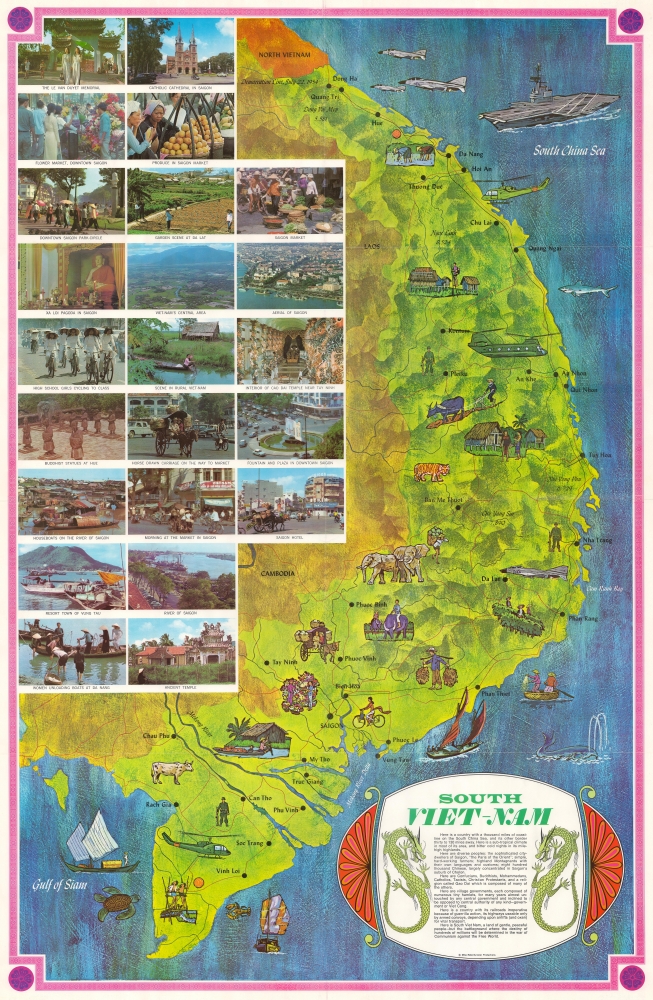
South Viet-Nam.
sold
This is a c. 1970 Mike Roberts pictorial map of South Vietnam published during the Vietnam War. The map emphasizes the region's bucolic terrain and peaceful history - a striking contrast to the war then ravaging these lands. (more details)
A View of Kobe from the Clouds.

Kobe Bird's Eye View.
sold
- Digital Map Information
- Suitable for large format printing
- Full resolution TIFF file
- ICC color profile embedded
- Delivered instantly via download link
A beautiful large-scale bird's-eye view of Kobe, Japan, and environs produced c. 1937 by the Toppan Printing Company. It is reminiscent both of traditional landscape paintings and Yoshida-style bird's-eye views which were very popular in Japan at the time, and is notable for being published in English rather than Japanese. (more details)
Queen Elizabeth II's coronation.

Route Map of the Coronation of Her Majesty Queen Elizabeth II Head of the Commonwealth.
sold
- Digital Map Information
- Suitable for large format printing
- Full resolution TIFF file
- ICC color profile embedded
- Delivered instantly via download link
This is a 1953 Master Maps pictorial map of London highlighting the route of the Royal Procession following Queen Elizabeth II's coronation. (more details)
One of the Earliest Printed Maps of Arabia.
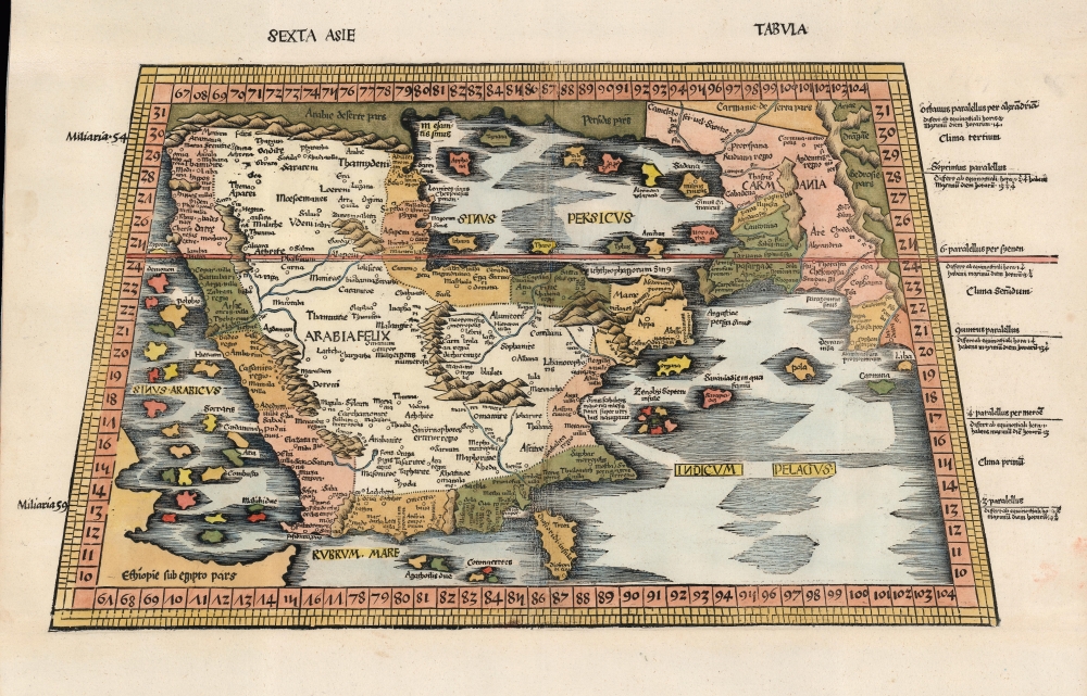
Sexta Asie Tabula.
sold
- Digital Map Information
- Suitable for large format printing
- Full resolution TIFF file
- ICC color profile embedded
- Delivered instantly via download link
This is the Waldseemüller / Ringmann 1513 map of Arabia, considered one of the earliest acquirable maps of the Arabian Peninsula and essential to any serious Arabia collection. It was issued for Waldseemüller and Ringmann's 1513 Geographie Opus Novissima, then the most thoroughly edited and amended edition of Ptolemy. Moreover, this map was the most detailed map of the Arabian Peninsula to have been produced to date, illustrating and naming many of the islands of the Red Sea and the Persian Gulf, and including comprehensive interior detail. Despite presenting ancient geography, the detail of Ptolemaic maps of the region had yet to be improved upon significantly, and so this map remained one of the most detailed maps of the Arabian Peninsula available, illustrating and naming many of the islands of the Red Sea and the Persian Gulf, and including comprehensive interior detail. (more details)
First English Atlas Map of the World.
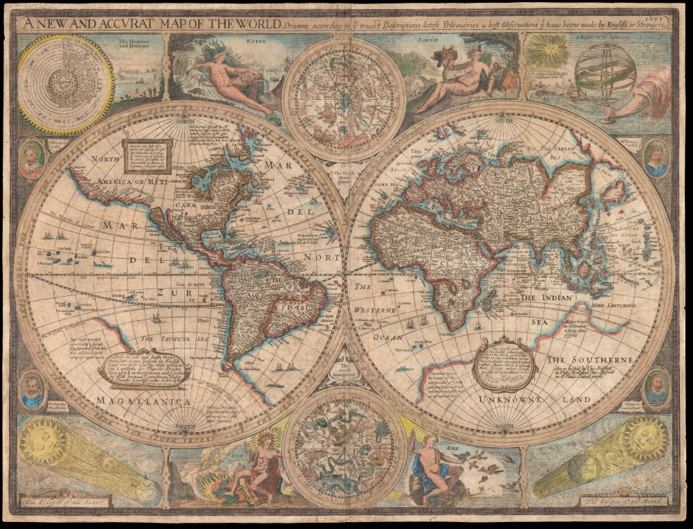
A New and Accurat Map of the World Drawne according to ye truest Descriptions latest Discoveries and best Observations yt have beene made by English or Strangers.
sold
- Digital Map Information
- Suitable for large format printing
- Full resolution TIFF file
- ICC color profile embedded
- Delivered instantly via download link
This is John Speed's 1626 map of the world, in its 1676 Bassett and Chiswell edition. It is the earliest acquirable English world map, and the first world map to appear in an English atlas. It is the earliest acquirable world map to illustrate the California-as-an-island myth. It was also singular in its emphasis on the English colonies in America and is the first world map to mark the settlement of New Plymouth. The map presents the globe in a double-hemisphere format, and is embellished with astronomical diagrams and allegorical representations of the seasons, as well as portraits of famous circumnavigators. (more details)
Advancing worldwide communication!

Western Union Trans-Atlantic Cables and Connections.
sold
- Digital Map Information
- Suitable for large format printing
- File Size: 107.57 MB
- File Type: ZIP / TIFF
- ICC color profile embedded
- Delivered instantly via download link
This is a c. 1927 map of trans-Atlantic cables operated by Western Union, a striking piece promoting the advance of communication technology. The colorful map highlights cables between Europe, North America, and South America, reinforcing the wonders of modem communication. (more details)
American Indian land grants, fraud, and Half-Breed Tracts.
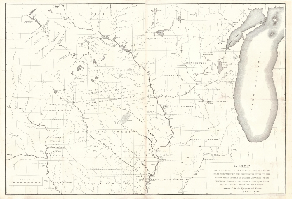
A Map of a Portion of the Indian Country Lying East and West of the Mississippi River to the Forty Sixth Degree of North Latitude from Personal Observation Made in the Autumn of 1835 and Recent Authentic Documents.
sold
- Digital Map Information
- Suitable for large format printing
- Full resolution TIFF file
- ICC color profile embedded
- Delivered instantly via download link
This is an 1836 George William Featherstonhaugh map of the American Upper Midwest. It is significant for detailing land grants given by American Indian Nations to both colonials and métis peoples - the so-called 'Half-Breed Tracts'. It also details the Carver Grant, a fraudulent land speculation scheme of the early 19th century. (more details)
One of the first general maps of Brooklyn to include a completed Prospect Park.
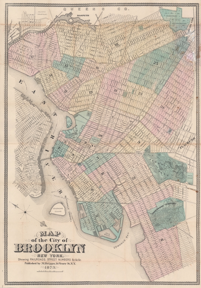
Map of the City of Brooklyn New York.
sold
- Digital Map Information
- Suitable for large format printing
- File Size: 68 MB
- File Type: ZIP / TIFF
- ICC color profile embedded
- Delivered instantly via download link
A rare 1873 map of Brooklyn, New York by Matthew Dripps. A rare 1873 map of Brooklyn, New York by Matthew Dripps. This is one of the first general maps of Brooklyn to include Prospect Park, which was completed in 1873, after 4 years of continuous construction. Moreover, unlike most earlier maps of Brooklyn, which were oriented to the west per the 1852 Brooklyn Commissioner's Plan (see Geographicus BrooklynWilliamsburg-colton-1852), Dripps adopts a more modern convention by orienting his map to the north - and in doing so established a revolutionary new convention followed by most subsequent Brooklyn mapmakers. (more details)
Cold War secrecy, espionage, and the Olympics.

Схема режима разъездов иностранцев по Московской области / [Plan of the Travel Regime for Foreigners in Moscow Oblast].
sold
A remarkable 'classified' map illustrating the logistics surrounding the 1980 Moscow Summer Olympic Games, and showcasing fear of the espionage and general secrecy that marked Cold War foreign relations. This map indicates areas of Greater Moscow (including portions of Moscow Oblast) designated as restricted to foreigners. It was almost certainly produced by the Central Taxi Control Room, which oversaw state-owned taxi companies operating in and around Moscow. (more details)
Pacifying the Northwest?
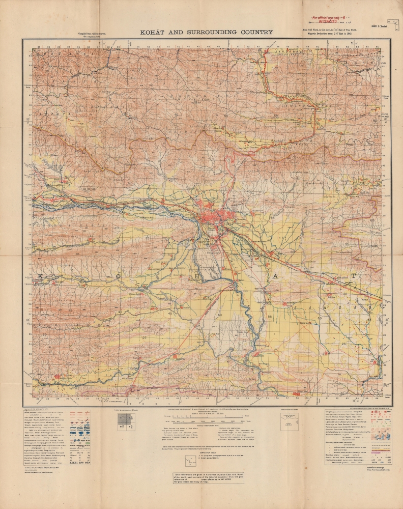
Kohat and surrounding country.
$1,200.00
Acquire
- Digital Map Information
- Suitable for large format printing
- File Size: 35.94 MB
- File Type: ZIP / TIFF
- ICC color profile embedded
- Delivered instantly via download link
A wartime production, this Survey of India map of Kohat and environs, now in northwestern Pakistan, was published in 1944. The noticeable presence of British military forces in and around Kohat is testament not only to fighting during World War II (1939 - 1945), but also to a long history of regional unrest. (more details)
Italia Viva.

Italia.
sold
- Digital Map Information
- Suitable for large format printing
- File Size: 43.27 MB
- File Type: ZIP / TIFF
- ICC color profile embedded
- Delivered instantly via download link
A vibrant pictorial map of Italy produced in the wake of World War II. This 1946 maps was drawn by Vsevolode Nicouline and published by Giovanni De Agostini. Its intricate drawings bring to life the local culture, economy, and history of Italy. (more details)
The Salubrious Sands of South Beach.

South Beach, the Historic Art Deco District of Miami Beach.
sold
A large and impressive pictorial view of South Beach, Miami Beach, Florida, produced in 1993 by Cityscape Graphics. In addition to highlighting local businesses and attractions, it also focuses on the area's distinctive art deco style architecture. (more details)