
Historical and social stratification.
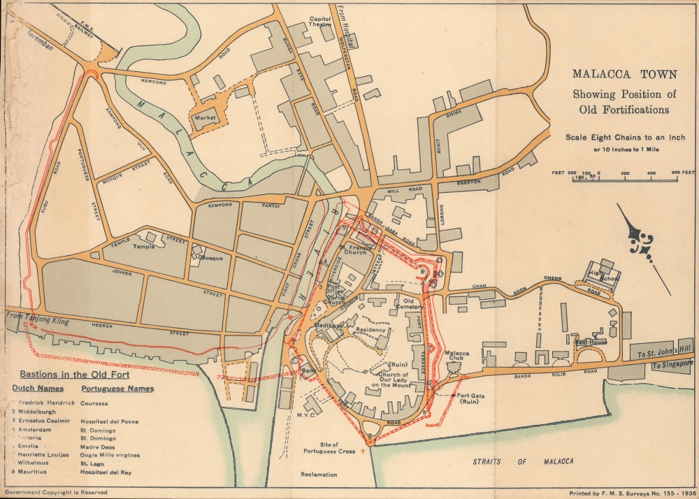
Malacca town, Showing position of old fortifications.
sold
- Digital Map Information
- Suitable for large format printing
- File Size: 2.98 MB
- File Type: ZIP / TIFF
- ICC color profile embedded
- Delivered instantly via download link
An intriguing 1936 map of Malacca (Melaka) highlighting the location of historic sites, especially fortifications, produced by the Survey Department of the Federated Malay States (FMS). Although Malacca had been under British control for more than a century by this point, the city's identity was closely tied to its complex colonial and pre-colonial past. (more details)
Bird's-eye view of Boston Harbor.
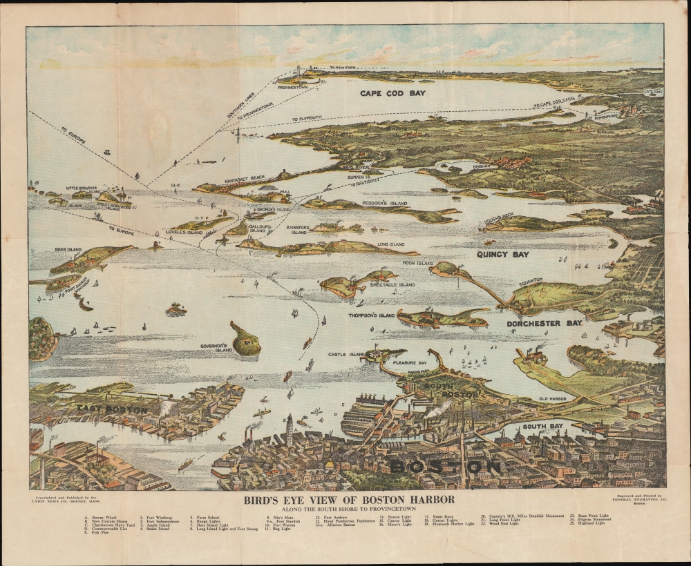
Bird's Eye View of Boston Harbor Along the South Shore to Provincetown.
sold
- Digital Map Information
- Suitable for large format printing
- File Size: 59.19 MB
- File Type: ZIP / TIFF
- ICC color profile embedded
- Delivered instantly via download link
This is a 1920 Union News map and view of the Boston Harbor from Boston to Provincetown. In the late 19th and early 20th century, such views were popular travel souvenirs sold at newsstands in train and ferry stations, as well as by newsboys onboard the trains and ferries themselves. (more details)
Signed. Natural and Manufactured wonders.

World Wonders. A Pictorial Map.
sold
- Digital Map Information
- Suitable for large format printing
- File Size: 76.71 MB
- File Type: ZIP / TIFF
- ICC color profile embedded
- Delivered instantly via download link
This is a 1939 Ernest Dudley Chase pictorial map of the world celebrating natural and manufactured wonders worldwide. Signed by Chase in pencil below the border in the lower left. Pictorial vignettes highlight structures on every continent, including bridges, skyscrapers, cathedrals, and monuments. Among these are the Empire State Building, the Colosseum, Angkor Wat, the Dome of the Rock, and Petra. Other vignettes capture Earth's natural wonders, including waterfalls, mountains, caves, and canyons. Smaller illustrations populate the continents, many of which illustrate Earth's diverse wildlife. Others emphasize human achievements, technological advances, or landmark moments in exploration. (more details)
Complete set: Covarrubias' Pageant of the Pacific.

Pageant of the Pacific.
sold
- Digital Map Information
- Suitable for large format printing
- Full resolution TIFF file
- ICC color profile embedded
- Delivered instantly via download link
This is a complete set of the 1943 second edition of Miguel Covarrubias' pictorial maps of the Pacific created as a set of murals for Pacific House at the Golden Gate International Exposition (1939 - 1940). (more details)
Earliest Printed Map to show the Hajj.
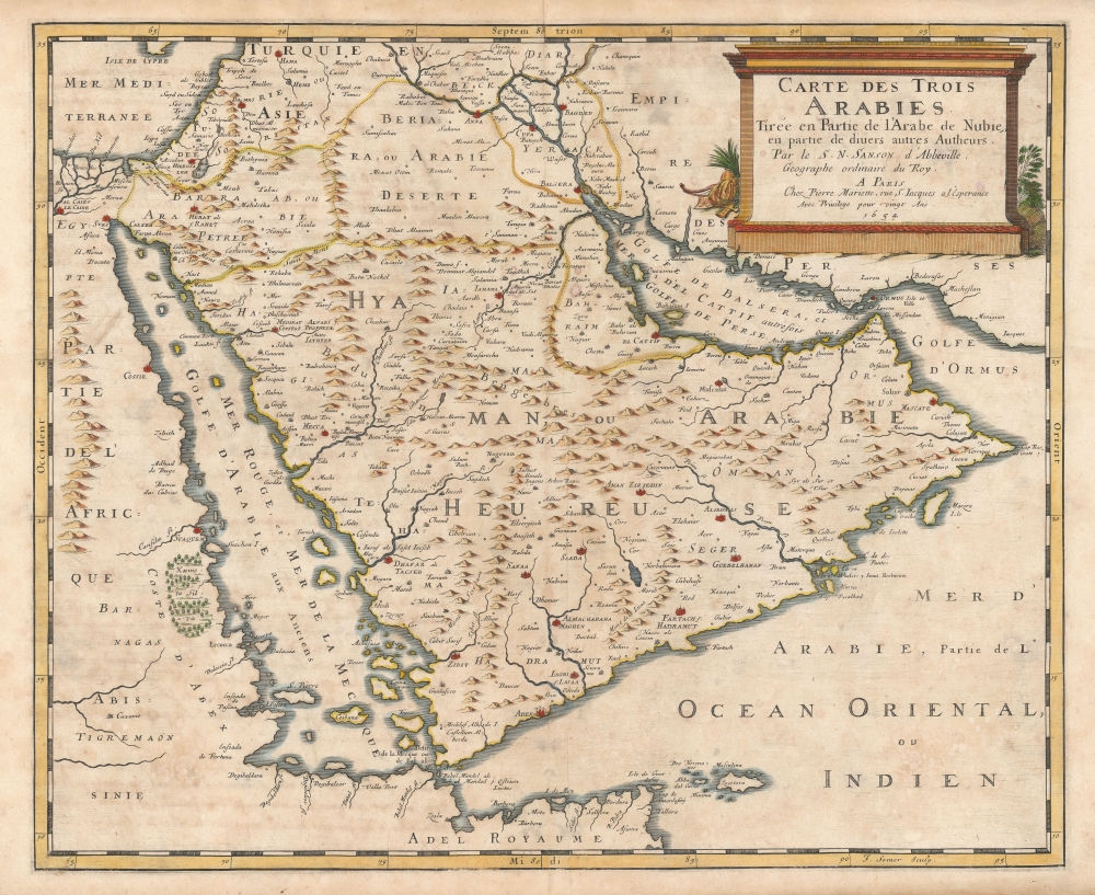
Carte des Trois Arabies Tirée en Parte de l'Arabe de Nubie, en partie de divers autres Autheurs, Par le S. N. Sanson d'Abbeville, Geographe ordinaire du Roy, A Paris.
sold
- Digital Map Information
- Suitable for large format printing
- Full resolution TIFF file
- ICC color profile embedded
- Delivered instantly via download link
This is an attractive example of Nicolas Sanson's scarce 1654 map of the Arabian Peninsula. As indicated in the title, it depicts the three Arabias: Arabie Petree, Arabie Deserte, and Arabia Heureuse; that is, Stony Arabia, Desert Arabia, and 'Happy' Arabia. The map depicts both shores of the Red Sea and the Persian Gulf, and the Indian Ocean island of Zocotora off the horn of Africa. The map includes Mecca and Medina, and the pattern of named settlements describes the Hajj routes: along the Red Sea coast, the overland routes across the peninsula from Basra, and the route to Mecca from Damascus. The Kingdom of Bahrain (Bahraim) appears as well. The largest portion of the Arabian Peninsula is here named Hyaman, ou Arabie Heureuse: 'Yemen, or Happy Arabia.' (more details)
Early Glimpses of Mexico, California and the Gulf Coast.
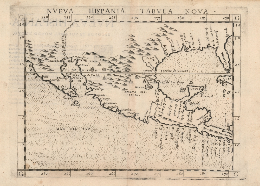
Nueva Hispania Tabula Nova.
sold
- Digital Map Information
- Suitable for large format printing
- DPI: 600
- File Size: 10.08 MB
- File Type: ZIP / TIFF
- ICC color profile embedded
- Delivered instantly via download link
This is Girolamo Ruscelli's 1574 map Tierra Nveva, an early and influential map of what would become Mexico, California, Texas, and Florida. Ruscelli's work is an enlarged and improved version of the 1548 map of the same region by fellow Venetian Giacomo Gastaldi. Apart from the Gastaldi, Ruscelli's map is the earliest to focus so closely on the southern parts of what would become the United States and is one of the earliest acquirable maps to reflect Spanish exploration and colonization in the Americas. Overall, along with the map covering the East Coast north of Florida, this is among the earliest maps to focus on North America. (more details)
A long-dreamt of connection.
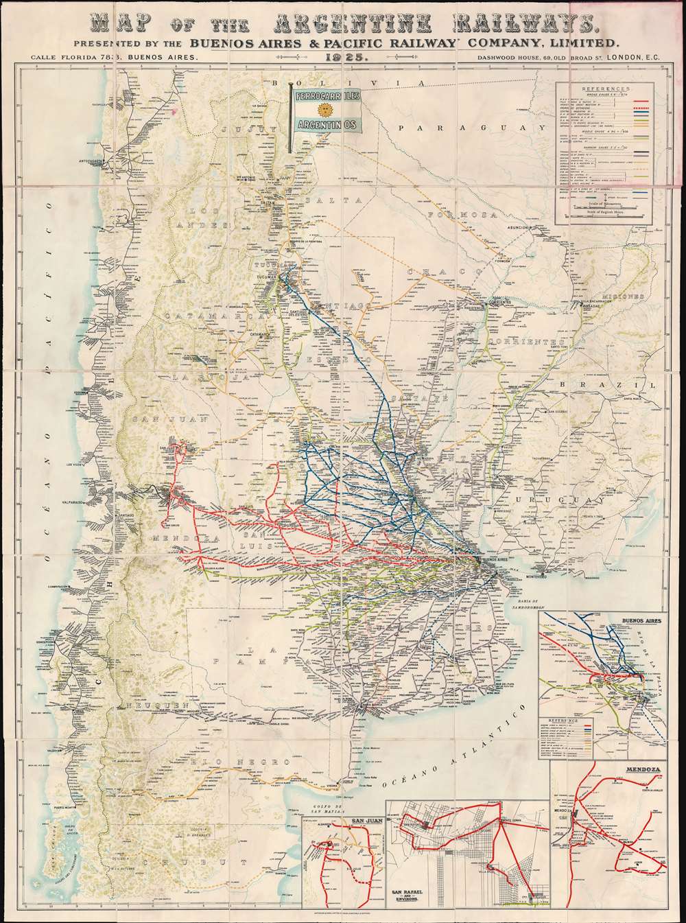
Map of the Argentine Railways. Presented by the Buenos Aires and Pacific Railway Company, Limited.
sold
- Digital Map Information
- Suitable for large format printing
- Full resolution TIFF file
- ICC color profile embedded
- Delivered instantly via download link
This is a striking 1925 chromolithograph railroad map of Argentina and Chile. The map covers from Atlantic to Pacific and from Tocopilla to Isla Chiloe and Rawson. Railroad lines are coded by color and design, with a focus, in red, on the routes operated by the Buenos Aires and Pacific Railway - who sponsored this map. This map was likely made to spur additional British investment in Argentine railroad infrastructure - much of which was already heavily leveraged to British consortiums. Insets in the lower right detail railroad connections in Buenos Aires, Mendoza, San Juan, and San Rafael. (more details)
Shanghai at the beginning of the Second Sino-Japanese War.
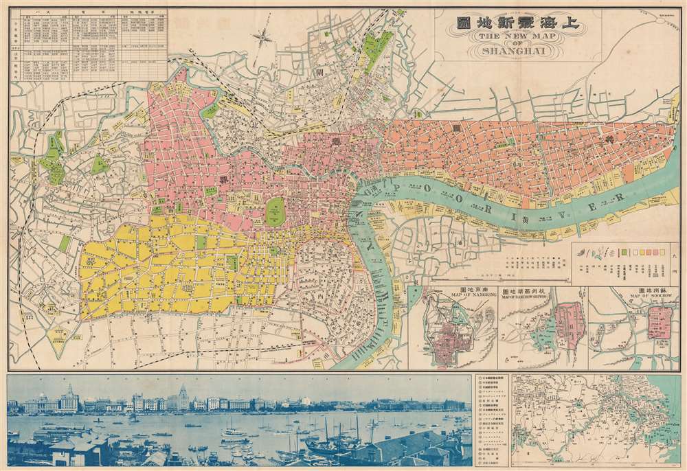
The New Map of Shanghai. /上海最新地圖 / Shànghǎi zuìxīn dìtú.
sold
- Digital Map Information
- Suitable for large format printing
- File Size: 99.71 MB
- File Type: ZIP / TIFF
- ICC color profile embedded
- Delivered instantly via download link
This is a rare and beautiful bilingual 1933 Fusazō Sugie city plan or map of Shanghai, China. Published only two years after the Second Sino-Japanese War began, the map depicts central Shanghai including the Chinese Quarter, the French Concession, the International Settlement, and the English Quarter (along the Bund), among many other sites. Shanghai's cosmopolitan International Settlement is highlighted in orange (USA), pink (Great Britain), and yellow (France). Nineteen important buildings along the Bund are carefully noted and can be referenced via a table to the right of the view. These include the first HSBC Bank, the British Club, the Peace Hotel, and the Customs House. A lovely vintage panoramic photograph of the Bund adorns the map's bottom border. Of note, a large inset in the lower right corner illustrates the greater Shanghai area and three smaller insets detail Nanking (Nanjing) Hanchow Shiwoo (Hangzhou), and Soochow (Suzhou). (more details)
Expansion of the United States from coast to coast.
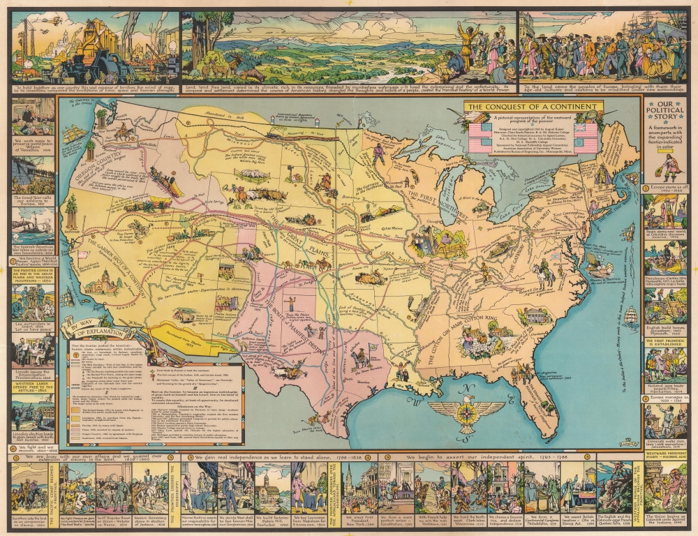
The Conquest of a Continent. A pictorial representation of the westward progress of the pioneer.
sold
- Digital Map Information
- Suitable for large format printing
- File Size: 86.1 MB
- File Type: ZIP / TIFF
- ICC color profile embedded
- Delivered instantly via download link
This is a 1933 August Kaiser persuasive pictorial map of the United States. While the map chronicles American expansion across the continent, it also proclaims American Exceptionalism and the rise of the United States to global power. Pictorial vignettes and tidbits of American history populate the map, many of which make broad historical proclamations. Historical firsts (first newspaper, first steamboat, etc.) are lauded alongside achievements such as the National Road and Transcontinental Railroad. Color highlights the territorial expansion of the U.S. from 1783 through the 1803 Louisiana Purchase, to the 1846 annexation of Texas, and the 1848 Mexican Cession. A pictorial border creates a decidedly exceptional version of the history of the United States and features illustrations from Columbus 'discovering' the New World to President Wilson at the 1919 Paris Peace Conference. (more details)
Visit this Caribbean paradise!
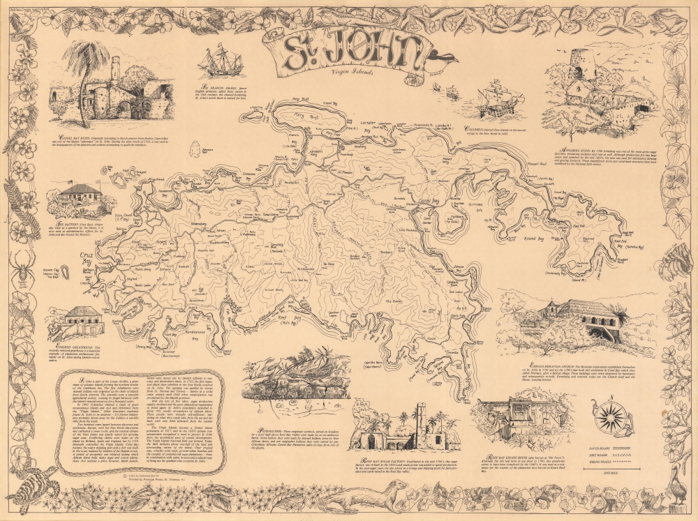
St. John Virgin Islands.
sold
This is a 1981 Deborah Jacobs pictorial map of St. John, U.S. Virgin Islands. Virgin Islands National Park (established in 1956) occupies over half the island, here its boundaries are delineated. Hiking trails, mountain peaks, ruins of former plantations, churches, and other buildings, and roads are illustrated. Contour lines detail topography. Coral Bay, St. John's biggest settlement, and Cruz Bay are labeled, along with coastal points, bays, and other important locations. Pictorial vignettes encircling the central map illustrate the Battery, Caneel Bay Ruins, Annaberg Ruins, Emmaus Moravian Church, Reef Bay Estate House, the Reef Bay Sugar Factory, and the petroglyphs found in Reef Bay Valley. A pictorial border brings the entire piece together and highlights the natural wonders of St. John, focusing on flora and fauna. (more details)
Salem Harbor and vicinity.

Salem Harbor Massachusetts.
sold
- Digital Map Information
- Suitable for large format printing
- File Size: 70.25 MB
- File Type: ZIP / TIFF
- ICC color profile embedded
- Delivered instantly via download link
This is an 1869 U.S. Coast Survey separate issue nautical chart or map of Salem Harbor, Massachusetts. Coverage embraces the Massachusetts coast from Kettle Cove past Marblehead Neck to Ram Island. Depth soundings populate Salem Harbor, Marblehead Harbor, and Beverly Harbor. Numerous islands, sandbars, grounds, and other navigational hazards are illustrated, along with dozens of navigational buoys. Coves, points, beaches, and other coastal features are identified. Salem, Beverly, and Marblehead are illustrated in detail, although no buildings are identified. The Eastern Railroad, with its Marblehead Branch Railroad, is depicted. Notes on currents, tides, and lighthouses occupy the lower left while detailed sailing directions appear along the top border. (more details)
Superman's home planet!

Map of Krypton.
sold
This is a 1973 National Periodical Publications double hemisphere map of Krypton, Superman's home world. Separated into the 'Old World' hemisphere and the 'New World' hemisphere, continents, islands, and other landmasses appear. Urrika appears in the 'Old World' hemisphere, along with Twenex, Mioz, and Tuvu. Ten locations are numerically identified across the hemisphere and correspond with vignettes situated around the central map, including Erkol, the Striped River, the Glass Forest, and Antarctic City. An inset of Vathlo Island states that it is the 'home of highly developed black race'. Lurvan dominates the 'New World' hemisphere. Fifteen locations are numerically identified with corresponding vignettes, including Kryptonopolis (Superman's birthplace), Atomic town, Rainbow Canyon, and Argo City (Supergirl's birthplace). (more details)
'The whole world awaits you by clipper...'
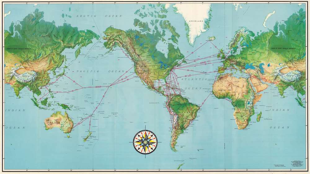
Destinations Unlimited.
sold
- Digital Map Information
- Suitable for large format printing
- Full resolution TIFF file
- ICC color profile embedded
- Delivered instantly via download link
A striking 1952 world map illustrating the routes of Pan American World Airways. A towering pioneer in the aviation industry, the company was among the first to offer reliable international passenger service and by the 1950s had the most developed global network of any American airline. (more details)
The making of a Midwestern metropolis.
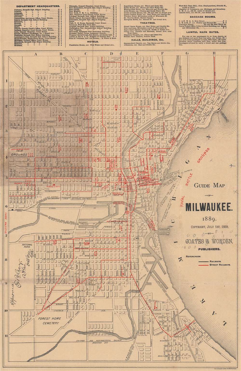
Guide Map of Milwaukee.
sold
- Digital Map Information
- Suitable for large format printing
- File Size: 27.82 MB
- File Type: ZIP / TIFF
- ICC color profile embedded
- Delivered instantly via download link
A rare 1889 map of Milwaukee published by Coates and Worden. It displays the city during a period of breakneck population growth, when it developed into one of the main industrial and economic centers of the Upper Midwest. (more details)
The Green Mountain State.

Complete map of Vermont showing highways and natural features…
sold
- Digital Map Information
- Suitable for large format printing
- File Size: 289.22 MB
- File Type: ZIP / TIFF
- ICC color profile embedded
- Delivered instantly via download link
An impressive, large-format 1902 indexed folding map of Vermont by the National Publishing Company highlighting the rail network at the start of the 20th century. (more details)
Once-popular / now-defunct Florida department stores.

Maas Brothers...the home of Tropical Fashions!
sold
This is a c. 1957 Maas Brothers placemat map of Florida. An outline map of the state dominates, and four Maas Brothers restaurants are noted: the Neptune Room in Tampa, the Sunshine Room in St. Petersburg, the Everglades Room in Sarasota, and the Imperial Room in Lakeland. Palm trees and other greenery completes the placemat's tropical aesthetic. (more details)
Postwar tourist map.
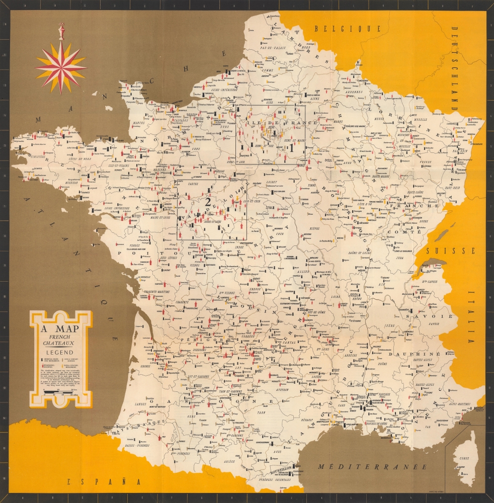
A map : French Châteaux.
sold
A memorable c. 1954 tourist map of France, published by the government's Direction Générale du Tourisme, highlighting the location of chateaux, castles, ruins, and other historic buildings. Intended for English-speaking tourists, it reflects the French efforts to boost tourism, today a major contributor to the economy. (more details)
Florida's cities and destinations, including Disney World.

Florida.
sold
This is a 2001 Unique Media, Inc. pictorial bird's-eye view map of Florida. Overlooking Florida from the southeast, exaggerated illustrations of the state's most iconic skylines draw attention. Among these are Miami, Tampa, St. Petersburg, Orlando, Tallahassee, and Jacksonville. Other landmarks, including Walt Disney World (Cinderella's Castle and Spaceship Earth at Epcot), Sea World (a gigantic orca), and Kennedy Space Center (the Space Shuttle), appear in much the same manner. Osceola National Forest, Apalachicola National Forest, and Everglades National Park are illustrated as open wild spaces home to the state's iconic wildlife. (more details)
Several famous nebulae.

Clusters, Nebulae, and Comets.
sold
- Digital Map Information
- Suitable for large format printing
- File Size: 24.25 MB
- File Type: ZIP / TIFF
- ICC color profile embedded
- Delivered instantly via download link
This is an 1856 E. H. Burritt chart of comets, star clusters, and nebulae. Several important comets recorded in the previous 300 years appear, including the Comet of 1689, the Comet of 1744, The Great Comet of 1680, the Great Comet of 1811, Halley's Comet, the Great Comet of 1819, and the Comet of 1843. Other celestial bodies include the Horse Shoe Nebula, the Spiral Nebula, and the Dumb Bell Nebula. (more details)
Includes the Pleiades!

Double Stars and Clusters.
sold
- Digital Map Information
- Suitable for large format printing
- File Size: 25.03 MB
- File Type: ZIP / TIFF
- ICC color profile embedded
- Delivered instantly via download link
This is an 1856 E. H. Burritt chart of star clusters and double stars. Fifty illustrations include important star clusters, nebulae, and double stars, including the Pleiades, the Perseus cluster, the Andromeda, and Polaris. (more details)