
Postwar Pictorial Map of Guam.
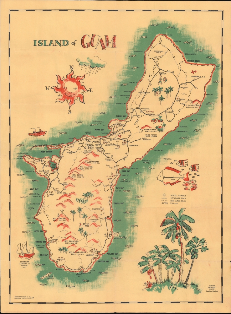
Island of Guam. / pictorial and road map of Guam.
$350.00
Acquire
This is a c. 1956 Louise Swigart Davis pictorial folding map of Guam (Guåhan), produced for Catalina Studios. (more details)
'One of the supreme examples of the map maker's art'. ~ Shirley

Nova Totius Terrarum Orbis Geographica ac Hydrographica Tabula. auct. Guiljelmo Blaeuw.
sold
- Digital Map Information
- Suitable for large format printing
- Full resolution TIFF file
- ICC color profile embedded
- Delivered instantly via download link
This is Willem Blaeu's magnificent map of the world, considered the epitome of thecarte à figures and the gold standard for decorative cartography of the Dutch Golden Age. Engraved in 1606, it nevertheless remained the centerpiece map for Blaeu's Atlas Novus for more than twenty years starting in 1630. It represented the dominant European image of the world for the first part of the 17th century and remains the sine qua non for collectors of world maps and of Dutch cartography. (more details)
First Atlas of The Argentine Confederation, and La Plata.

Description géographique et statistique de la Confédération Argentine... Atlas
sold
This is Victor Martin de Moussy's Atlas of the Argentine Confederation, in a beautiful example of the second edition. It is often hailed as the first work devoted entirely to Argentina, but is, in fact, a much broader work, incorporating modern-day Uruguay, Paraguay, Bolivia, and Chile. (more details)
'Unofficial' possibly pirated first publication of Hurd's Survey.
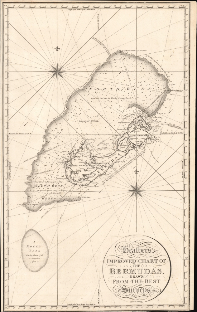
Heathers, Improved Chart of the Bermudas, Drawn from the Best Surveys.
sold
- Digital Map Information
- Suitable for large format printing
- File Size: 446.87 MB
- File Type: ZIP / TIFF
- ICC color profile embedded
- Delivered instantly via download link
This is the rare 1805 William Heather blueback nautical map of Bermuda. It is almost certainly the first publication of Thomas Hurds's groundbreaking 1789 - 97 hydrographic survey of Bermuda - though unofficial and possibly pirated. (more details)
First specific published map of Amelia Island.
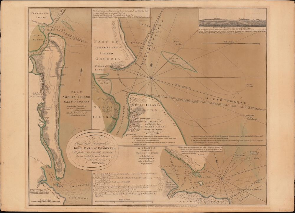
Plan of Amelia Island In East Florida. / A Chart of The Entrance Into St. Mary's River. / A Chart of The Mouth of Nassau Rivers. / To the Right Honourable John Earl of Egmont, and c. This Plate is most humbly Inscribed by his Lordships most Obedient Humble Servant Willm. Fuller.
$4,000.00
Acquire
- Digital Map Information
- Suitable for large format printing
- DPI: 600
- File Size: 733.91 MB
- File Type: ZIP / TIFF
- ICC color profile embedded
- Delivered instantly via download link
This is Thomas Jeffery's 1770 map of Amelia Island, considered the first specific published chart of that part of British East Florida. The map is based upon the William Gerard De Brahm and William Fuller surveys, which followed shortly after the 1763 British takeover of Florida. It illustrates the significance of Amelia's natural deep-water harbor, long a haunt of pirates, slavers, and smugglers, and details British attempts by John Perceval, 2nd Earl of Egmont, to establish a plantation colony. (more details)
First economic thematic map -Robinson

Neue Carte von Europa welche die merkwürdigsten Producte und vorn ehmsten Handelspläze nebst den Flächen-Inhalt aller Europäischen Länder in deutschen Quadrat-Meilen... [New map of Europe which contains the strangest and most prestigious products of trading places together with the surface content of all European countries in German square miles...]
$4,000.00
Acquire
- Digital Map Information
- Suitable for large format printing
- File Size: 37.02 MB
- File Type: ZIP / TIFF
- ICC color profile embedded
- Delivered instantly via download link
An important and influential piece, this is the first edition of A. F. W. Crome's 1782 separate-issue thematic map of Europe illustrating production and economics. It is considered the first thematic and comparative map printed in Europe and, as such, had a profound impact on subsequent cartography, particularly in Germany and France, where Crome's methodology inspired a wave of new thematic cartography. (more details)
Rallying the Union Cause at the Start of the Civil War.
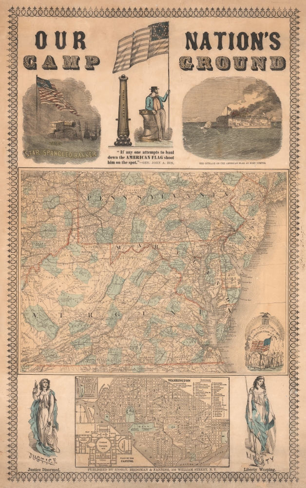
Our Nation's Camp Ground.
sold
- Digital Map Information
- Suitable for large format printing
- Full resolution TIFF file
- ICC color profile embedded
- Delivered instantly via download link
A remarkable piece of persuasive cartography from the early days of the U.S. Civil War, this Ensign, Bridgman, and Fanning broadside was produced in 1861 in the wake of the Confederate attack on Fort Sumter. Including two maps and six illustrations, the sheet is a comprehensive call to arms for the Union. (more details)
Cowboy Culture, by a cowboy.

I dedicate this Carte of Evolution to The California Rodeo of Salinas...
sold
Considered Jo Mora's most iconic image, this is the 1933/41 'Evolution of the Cowboy.' The image celebrates all things cowboy, from the rodeo to saddles, steers, and chuckwagons. It is worth noting that Mora became a cowboy himself, and his depictions of cowboy life and culture exhibit realism based on experience. (more details)
The FEC reaches Key West!

Map of the Peninsula of Florida and Adjacent Islands.
sold
- Digital Map Information
- Suitable for large format printing
- File Size: 46.38 MB
- File Type: ZIP / TIFF
- ICC color profile embedded
- Delivered instantly via download link
A highly decorative 1914 map of Peninsular Florida issued by the Mathews-Northrup Company for the Henry Morrison Flagler's (1830 - 1913) Florida East Coast Railway. The map is one of just 2 editions to illustrate the Key West Extension. (more details)
Philippines at the beginning of the Great Depression.
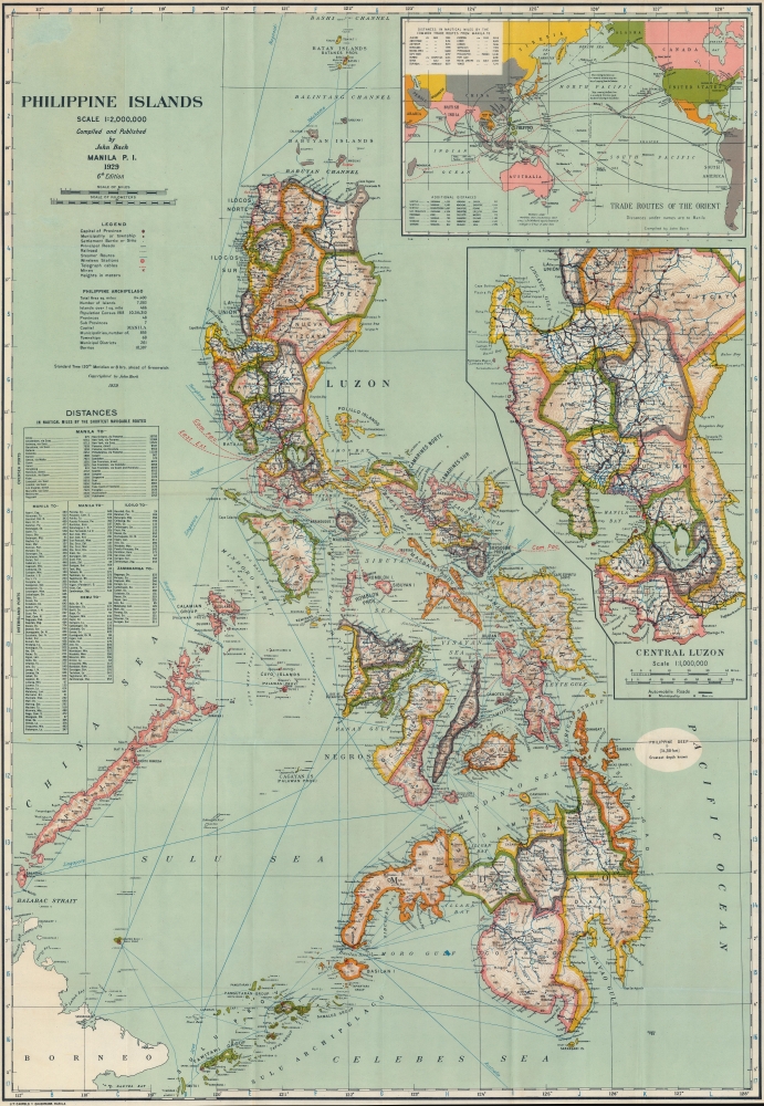
Philippine Islands.
sold
- Digital Map Information
- Suitable for large format printing
- File Size: 105.61 MB
- File Type: ZIP / TIFF
- ICC color profile embedded
- Delivered instantly via download link
This is a striking Manila-imprint 1929 John Bach map of the Philippines. The map provides a detailed overview of the archipelago as a nexus connecting the Far East with Southeast Asia and the Americas. It was, moreover, issued on the cusp of the Great Depression, which destabilized global economies while setting the stage for Philippine Independence. (more details)
Don't Go AWOL.
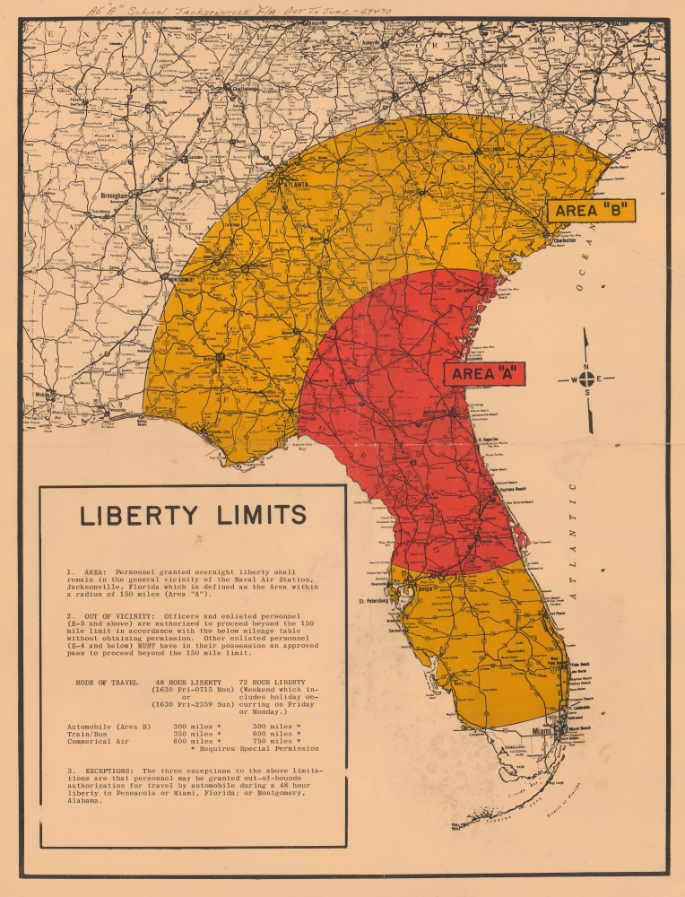
Liberty Limits.
sold
This is a c. 1969 U.S. Navy map illustrating the 'liberty limits' for navy-men on leave from the Jacksonville Naval Air Station. (more details)
Early Nautical Chart of Maine's Maritime Metropolis.
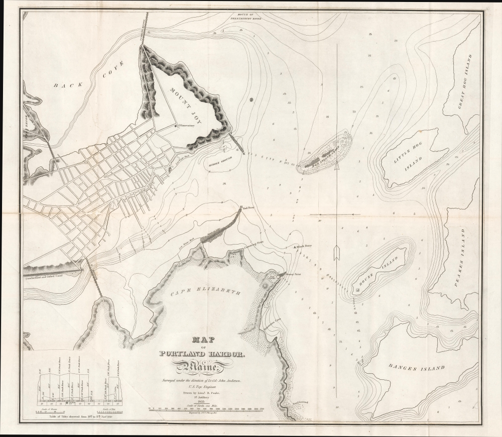
Map of Portland Harbor. Maine.
sold
- Digital Map Information
- Suitable for large format printing
- File Size: 14.99 MB
- File Type: ZIP / TIFF
- ICC color profile embedded
- Delivered instantly via download link
This is an 1833 nautical chart of the harbor of Portland, Maine, produced for a congressional report on the harbor. (more details)
'Dixie Flyer' from Chicago to Jacksonville.
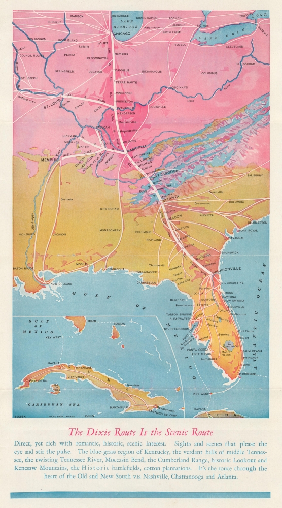
The Dixie Route is the Scenic Route. / Dixie Route to Florida.
sold
- Digital Map Information
- Suitable for large format printing
- Full resolution TIFF file
- ICC color profile embedded
- Delivered instantly via download link
This is a 1924 Poole Brothers map of the 'Dixie Route' from Chicago, Illinois, to Jacksonville, Florida, which was operated by the named passenger train, the Dixie Flyer. The Dixie Flyer brought passengers from Chicago and St. Louis to Jacksonville for over 60 years. (more details)
America's fastest growing city.

[Cape Coral Plat. Southeast.]
sold
This is a c. 1961 plat or real-estate city map of the development of the southeastern part of Cape Coral, Florida. (more details)
Proposal for a new Enlightenment religion for Revolutionary France.

Tableau central des opinions et de l'éducation publique, ou Développement du spectacle de la Nature, de l'unité et de la Trinité de son principe, et l'accord de la Philosophie avec la Religion. Tableau destiné à accompagner l'ouvrage intitulé De l'amour et de sa puissance supreme.
sold
- Digital Map Information
- Suitable for large format printing
- File Size: 21.12 MB
- File Type: ZIP / TIFF
- ICC color profile embedded
- Delivered instantly via download link
A unique artifact of French Revolutionary thought, this is Jean Chevret's 1791 diagrammatic presentation of a new religion for Revolutionary France, synthesizing Revolutionary values, Enlightenment idealism, and spiritual cosmology. It is accompanied by Chevret's 28-page essay on the subject in its original manila-paper wraps. Ideologically, it reflects a moment when thinkers sought to map all human knowledge, moral truth, and divine wisdom into a single, coherent framework. (more details)
Spy journey to Samarkand.
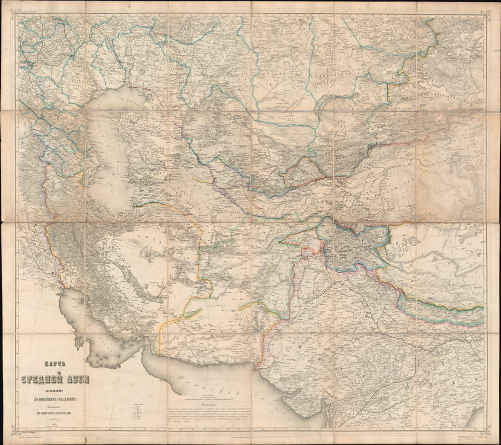
Карта Средней Азии. / Map of Central Asia.
sold
- Digital Map Information
- Suitable for large format printing
- File Size: 118.71 MB
- File Type: ZIP / TIFF
- ICC color profile embedded
- Delivered instantly via download link
This is an impressive, large-scale 1873 Russian-language map of central Asia during the Great Game, compiled by the Imperial Russian Topographic Depot for the 1873 Invasion of Khiva, with manuscript annotations detailing a British spy's travels. (more details)
Israeli and Jordanian positions in Jerusalem during the Six-Day War in manuscript.

[Six-Day War.]
sold
This is a 1967 map of Jerusalem and its environs featuring manuscript notations detailing military positions throughout the region during the Six-Day War. Based on what we know from the former owner, Israeli author, historian, archaeologist, and lecturer Magen Broshi's family, the annotations are likely contemporaneous with the events depicted. (more details)
Hollywood at the End of the Silent Film Era.
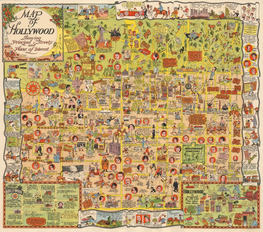
Map of Hollywood Showing Principal Streets and Places of Interest.
sold
- Digital Map Information
- Suitable for large format printing
- File Size: 45.85 MB
- File Type: ZIP / TIFF
- ICC color profile embedded
- Delivered instantly via download link
This is Harrison Godwin's 1928 pictorial map of Hollywood, California, the rarest of his creations and a masterpiece of pictorial cartography. It provides a colorful, raucous, and molecularly local snapshot of the film industry near the end of the Silent Film Era and the advent of the 'Golden Age of Hollywood.' (more details)
Best and largest pictorial map of San Francisco.

Map of San Francisco Showing Principal Streets and Places of Interest.
sold
- Digital Map Information
- Suitable for large format printing
- File Size: 61.26 MB
- File Type: ZIP / TIFF
- ICC color profile embedded
- Delivered instantly via download link
This is a 1927 Harrison Godwin pictorial map of San Francisco, California - considered the best genre illustration of that city. The map offers a wealth of unique detail that only a local would know - the balloon over the Presidio, a well-known homeless character in Richmond, criminal activity in Sutro Forest, and more. (more details)
Roman Road System - scarce long-format.
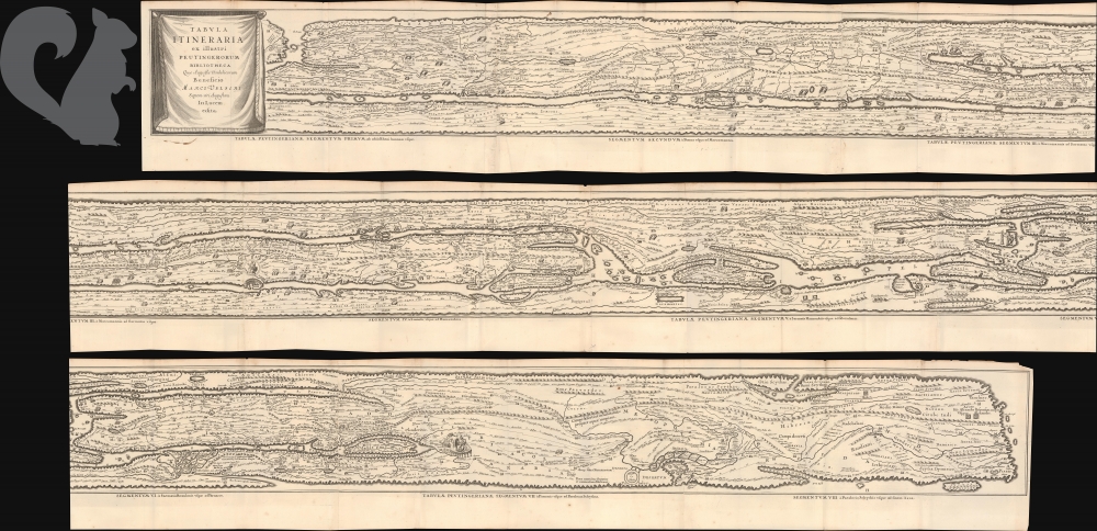
Tabula Itineraria ex illustri Peutingerorum Bibliotcheca Quae Augustae Vindelicorum Beneficio Marci Velseri Setpem-viri Augustani In lucem edita.
sold
- Digital Map Information
- Suitable for large format printing
- File Size: 98.16 MB
- File Type: ZIP / TIFF
- ICC color profile embedded
- Delivered instantly via download link
This is Jan Jansson's c. 1662 map of the Peutinger Table or Peutinger Map, an ancient Roman road map of the known world. It is here presented in an unusual long format. Also known as the Castorius Stage Map or Theodosian Table, this is the only surviving representation of the Roman Empire's vast road network, offering a unique glimpse into how space, travel, and imperial infrastructure were conceptualized in antiquity. (more details)