
One of the most influential nautical charts of the 19th century.
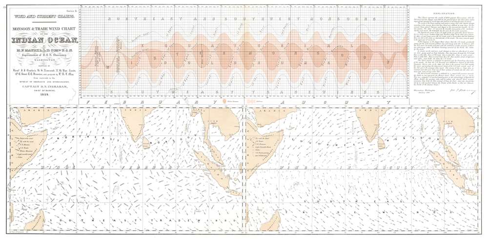
Monsoon and Trade Wind Chart of the Indian Ocean.
sold
- Digital Map Information
- Suitable for large format printing
- Full resolution TIFF file
- ICC color profile embedded
- Delivered instantly via download link
This is Matthew Fontaine Maury's seminal 1859 map of Indian Ocean monsoon winds, a practical tool meant help navigators plot the best routes throughout the year and significantly reduce their transit times. The map represents the culmination of Maury's remarkable efforts to map the Indian Ocean's complex seasonal currents. (more details)
First Latin edition of a classic map.

Insulae Americanae in Oceano Septentrionali cum Terris adiacentibus.
sold
- Digital Map Information
- Suitable for large format printing
- Full resolution TIFF file
- ICC color profile embedded
- Delivered instantly via download link
This is a beautiful 1635 example of Willem Blaeu's 1634 map of the Caribbean Islands and the adjacent coastlines of North and South America: this was the first Latin edition of the map to appear in the Blaeu atlas. Both geographically and aesthetically, this map set the standard for the mapping of this region: more than a dozen maps of the region produced later in the 17th century would copy this map, some to the extent of reproducing the title. Blaeu based this work both on his own West Indische Paskaert and Hessel Gerritsz' unacquirably rare and unassailably authoritative De Eylanden Ende Vastelanden Van Westindien op de Noordzee of 1631. The map thus reflects those geographers' commanding knowledge of the Caribbean and the Gulf Coast. (more details)
The oldest secondary school in the United States.

Andover Mass. from the North-West.
sold
- Digital Map Information
- Suitable for large format printing
- File Size: 31.83 MB
- File Type: ZIP / TIFF
- ICC color profile embedded
- Delivered instantly via download link
A striking bird's-eye view of Andover, Massachusetts, highlighting the town's commitment to secondary education with illustrations of Phillips Andover Academy, Abbott's Female School, Stone Academy, and the Andover Theological Seminary. The view overlooks Andover from the northwest. A low stone wall and fields in the foreground highlight Andover's idyllic small-town setting. In the mid-ground, a factory and train steaming out of town suggest prosperity. In the background, the buildings of the Theological Seminary and Phillips Andover are prominent. (more details)
Ortelius' corrected version of the first detailed map of Prussia.
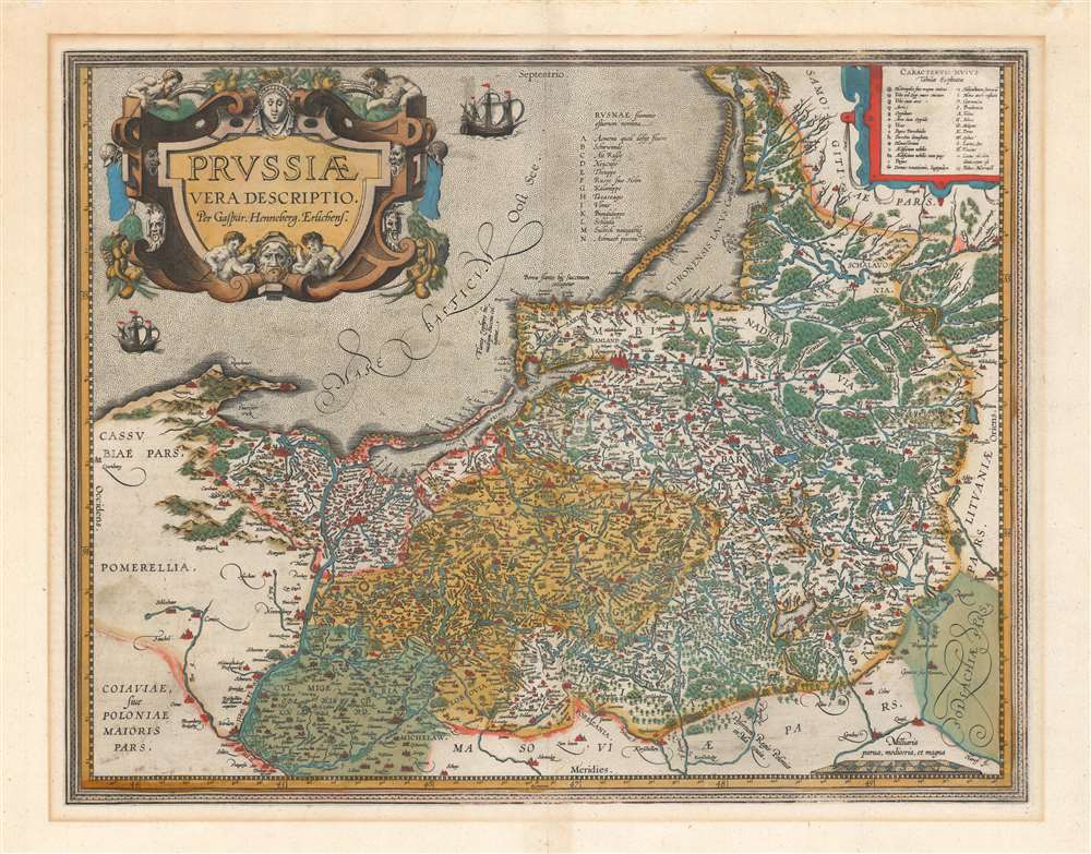
Prussiae Vera Descriptio Per Gaspar Henneberg Erlichens.
sold
- Digital Map Information
- Suitable for large format printing
- DPI: 600
- File Size: 53.76 MB
- File Type: ZIP / TIFF
- ICC color profile embedded
- Delivered instantly via download link
A beautiful, original-color first atlas edition of Ortelius' third map of Prussia, added to the Theatrum Orbis Terrarum in 1595. It depicts the region now comprised of northern Poland (as far south as Toruń on the Vistula River), the Russian province of Kaliningrad, and western Lithuania. Detail spans from just west of Gdansk to Augustów in the east. The northeast limits of the map are marked with the region of Samogitia, and the Lithuanian coastal town of Palanga. (more details)
Cartographic wonderlands.

Traveller's joy : a device
sold
A delightful work of geographical fantasy, this is Dion Clayton Calthrop and Gilbert Anthony Pownall's 1824 Traveler's Joy: A Device. The fantasy atlas takes readers on a tour of imagined places, succinctly described by Calthrop to leave room for interpretation and gorgeously illustrated by Pownall. (more details)
Toronto assumes its modern form.
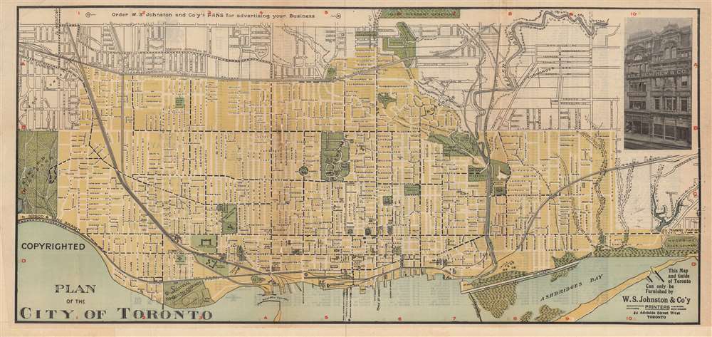
Plan of the City of Toronto.
sold
- Digital Map Information
- Suitable for large format printing
- File Size: 38.95 MB
- File Type: ZIP / TIFF
- ICC color profile embedded
- Delivered instantly via download link
This is a rare c. 1905 map or plan of Toronto, Canada, produced by W.S. Johnston and Company. It depicts the city following breakneck expansion in the late 19th century, as it incorporated and filled in surrounding communities. (more details)
A highly detailed city map of Melbourne.

Norman Bros. New Map of Melbourne and Suburbs.
sold
- Digital Map Information
- Suitable for large format printing
- Full resolution TIFF file
- ICC color profile embedded
- Delivered instantly via download link
This is a c. 1950 Norman Brothers city plan or map of Melbourne, Australia. Streets are labeled throughout, and red dashed lines and solid red lines along streets trace electric and cable tramways. Town halls are illustrated and shaded red. Melbourne University, the Royal Park, Princes Park, Studley Park, and the Metropolitan Lunatic Asylum are identified. Noticeable black dots appear sporadically throughout and, per the 'references' table in Port Philip Bay, they mark bowling clubs. The black lines trace railways and the black boxes are stations, all of which are named. Concentric circles mark distances in quarter-mile increments from downtown Melbourne. The inset maps along the lower border are continuation maps that illustrate Sunshine, Footscray, and Braybrook. (more details)
An important early map of the Gambia River.
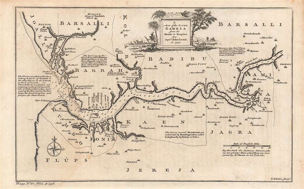
A map of the River Gambra from it's mouth to Eropina.
sold
- Digital Map Information
- Suitable for large format printing
- DPI: 600
- File Size: 16.8 MB
- File Type: ZIP / TIFF
- ICC color profile embedded
- Delivered instantly via download link
This is an excellent example of Thomas Kitchin's c. 1752 map and chart of the Gambia River, based on the descriptions of John Leach, an agent of the Royal African Company. It highlights knowledge gained from Leach's travels, which were recounted in several works in the years afterwards, eliciting considerable interest among the British public. (more details)
Turning the tide in the War of the Second Coalition.

Plan des environs de Zurich pour l'intelligence de la bataille gagnée par les Francais le 25 septembre 1799.
sold
- Digital Map Information
- Suitable for large format printing
- DPI: 600
- File Size: 48.49 MB
- File Type: ZIP / TIFF
- ICC color profile embedded
- Delivered instantly via download link
This is a fine illustrative map of the Second Battle of Zurich, published in Antoine-Henri Jomini and Jean Baptiste Bielaerts' Atlas pour servir à l'intelligence de l'histoire critique et militaire de la révolution in 1839, forty years after the battle took place. The French victory in the battle was an important turning point in the War of the Second Coalition, ensuring the security of Revolutionary France from foreign invasion. (more details)
Includes the Salem Witch Trials and the Boston Tea Party.
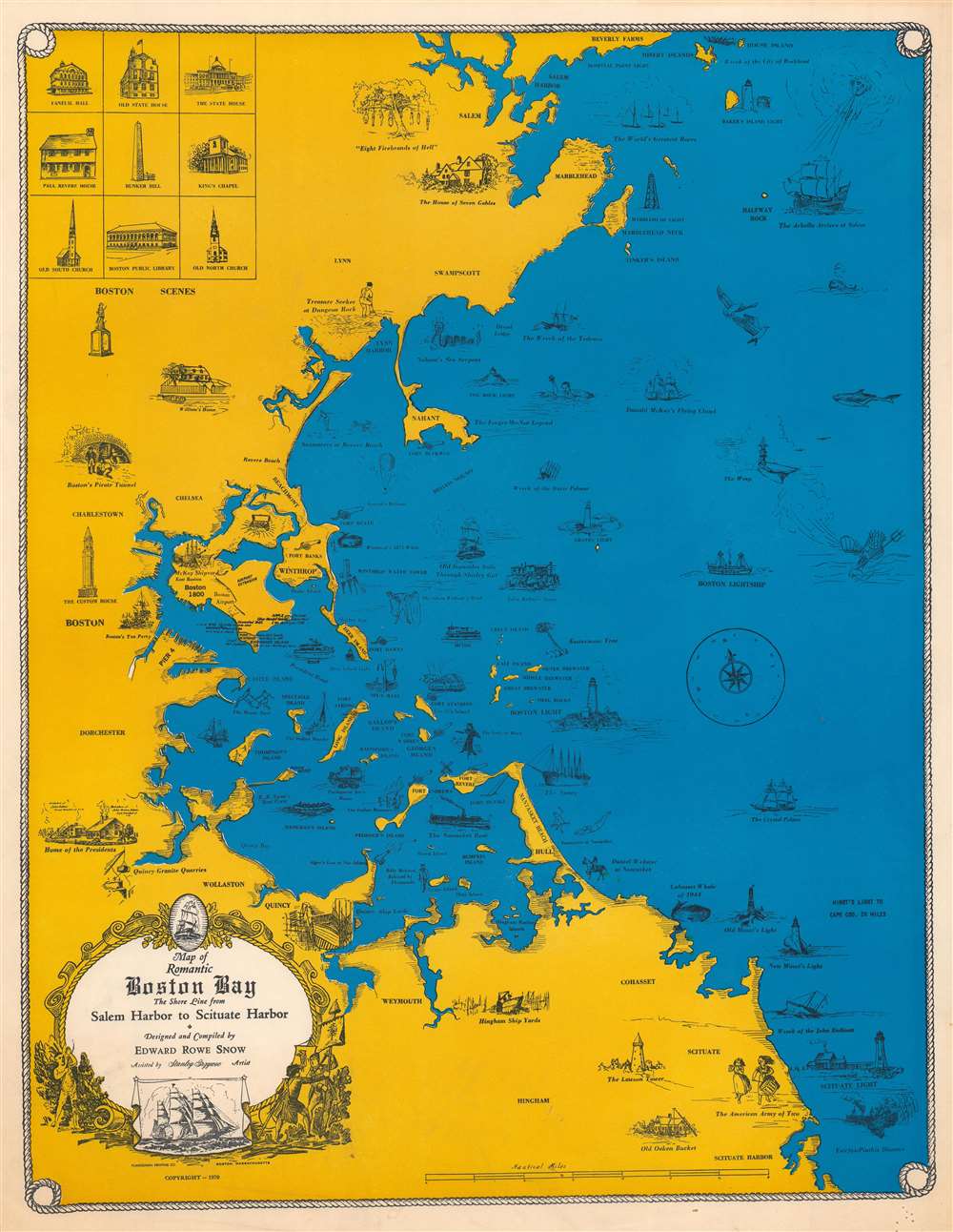
Map of Romantic Boston Bay. The Shore Line from Salem Harbor to Scituate Harbor.
sold
This is a 1970 Edward Rowe Snow pictorial map of Boston Bay. Depicting coastal Massachusetts from Salem Harbor to Scituate Harbor, Snow populates the map with illustrations of important buildings and historical events throughout Massachusetts's history. Among these are the Salem Witch Trials ('Eight Firebrands of Hell'), the Boston Tea Party, and numerous maritime events and disasters. Regional myths and legends appear as well, including the Forget-Me-Not legend and Nahant's Sea Serpent. Coastal forts appear alongside pleasure beaches, shipyards, and lighthouses. Illustrations of nine important buildings in Boston occupy the upper left and include the State House, the Bunker Hill Memorial, the Boston Public Library, and Old North Church. (more details)
Rare, Distinctive World Map with a Unique Projection.
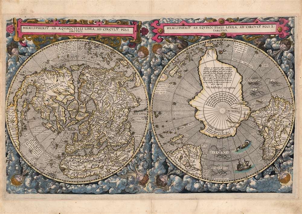
Hemispheriū Ab Aequinoctli Linea, Ad Circulū Poli Arctici / Hemispheriū Ad Circulū Poli Ātarctici.
sold
- Digital Map Information
- Suitable for large format printing
- Full resolution TIFF file
- ICC color profile embedded
- Delivered instantly via download link
This is a beautiful example of Cornelis De Jode's 1593 double-polar projection map of the world. It is among the most striking early world maps, and among the earliest to introduce the double hemispheric polar projection. Moreover, as a competitor to Ortelius' cartography, it is the sole obtainable map to preserve the innovative Guillaume Postel / Antwerp Unicum cartography. The map is moreover exceedingly rare, having been published in only a single edition. (more details)
The Source of Dutch Wealth Revealed.
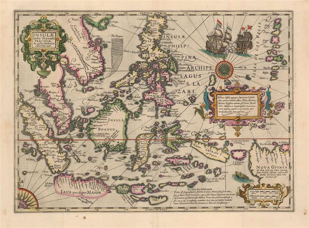
Insulae Indiae Orientalis Praecipuae, In quibus Moluccae celeberrime sunt.
sold
- Digital Map Information
- Suitable for large format printing
- DPI: 600
- File Size: 49.93 MB
- File Type: ZIP / TIFF
- ICC color profile embedded
- Delivered instantly via download link
This is a beautiful, original color example of Jodocus Hondius' 1606 map of the East Indies and Spice Islands, reflecting state of the art cartography for the early years of Dutch influence there. It also includes details of English exploration, specifically Francis Drake's passage and landfalls during his circumnavigation. (more details)
By 'The Ptolemy of His Age'.
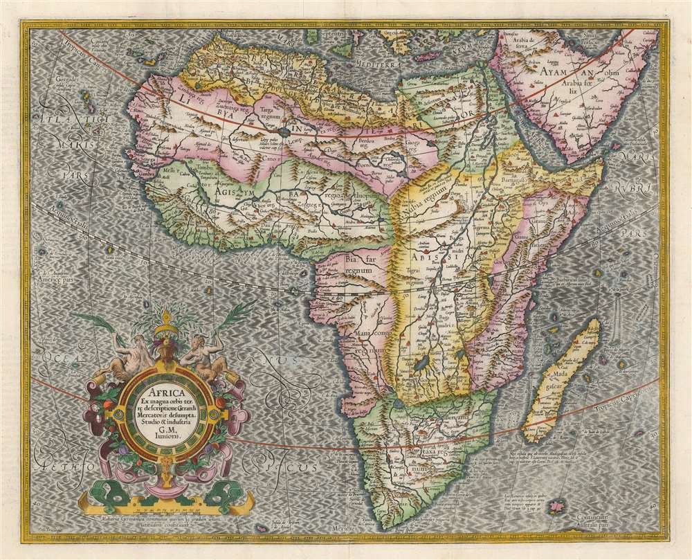
Africa Ex magnus orbis terre descriptione Gerardi Mercatoris desumpta. Studio and industria G.M. Iunioris.
sold
- Digital Map Information
- Suitable for large format printing
- DPI: 600
- File Size: 52.95 MB
- File Type: ZIP / TIFF
- ICC color profile embedded
- Delivered instantly via download link
This is an attractive Hondius edition of Gerard Mercator's 1595 map of Africa. The map is a classic, early Dutch depiction of the continent derived from the Gerard Mercator's 1569 wall map of the world. It was engraved by the illustrious Gerard's grandson, Gerard the Younger, whose command of the engravers' craft is brilliantly apparent. (more details)
First edition of the most accurate map of Scandinavia of its day.
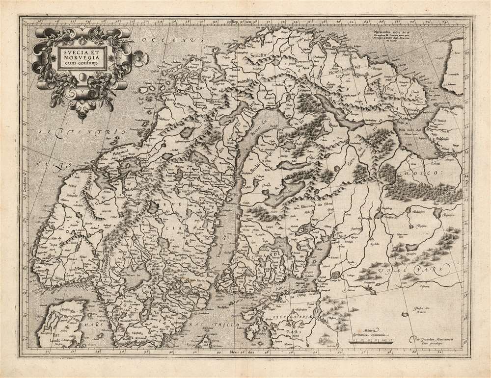
Suecia Et Norvegia cum confinijs.
sold
- Digital Map Information
- Suitable for large format printing
- Full resolution TIFF file
- ICC color profile embedded
- Delivered instantly via download link
This is a superb example of the 1595 first atlas edition of Gerard Mercator's map of Scandinavia. Among the maps of the north parts of Europe produced in the sixteenth century, this is the first to focus narrowly on Scandinavia. Ginsberg, typically laconic in praise, notes that the map 'gave the Scandinavian peninsula its correct form' and 'became the model for nearly all subsequent maps of Scandinavia.' This basic model would stand until supplanted in the mid-seventeenth century by the work of Anders Bure. (more details)
Shanghai Bund during the boisterous pre-war period.

Panoramic View of the Bund Shanghai. August 1929.
sold
- Digital Map Information
- Suitable for large format printing
- File Size: 83.75 MB
- File Type: ZIP / TIFF
- ICC color profile embedded
- Delivered instantly via download link
A stunning large-format 1929 panoramic photographic view of the Shanghai Bund. The view looks upon the Bund from Pudong, on the east side of the Huangpu River. The Bund, at the time, was the heart of the Shanghai International Settlement, a consolidated extraterritorial zone administered by a British dominated council. This image captures Shanghai at the height of its pre-war glory, when it was a haven in the midst of social and political strife, a hub of vice and crime, and a global trade center. (more details)
Sail the Eastern Philippines.
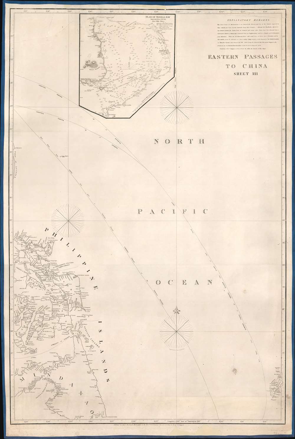
Eastern Passages to China Sheet III.
sold
- Digital Map Information
- Suitable for large format printing
- DPI: 600
- File Size: 24.52 MB
- File Type: ZIP / TIFF
- ICC color profile embedded
- Delivered instantly via download link
This is an 1828 James Horsburgh blueback nautical chart or maritime map of the eastern Philippines, including the islands of Samar, Leyte, and Cebu (Zebu), as well as parts of the islands of Luzon (Luconia), Panay, Negros, and Mindanao. Numerous coastal locations are labeled on many of the Philippine Islands, including Cebu City (Zebu), as well as points, straits, and bays. Myriad smaller islands are also identified, and Palau (Pellew Islands) is illustrated in the lower right corner. A detailed inset map of Manila Bay is situated along the top border and features numerous depth soundings, identifies coastal settlements, and the lighthouse at Manila. (more details)
The challenges of wartime cartography.

ארץ ישראל / [Land of Israel].
sold
- Digital Map Information
- Suitable for large format printing
- File Size: 64.15 MB
- File Type: ZIP / TIFF
- ICC color profile embedded
- Delivered instantly via download link
This is a rare c. 1949 Abraham Brawer map of Israel and surrounding territories, made soon after the nation's independence in 1948. Though produced in a fraught and rapidly changing political and military context, the map focuses primarily on topography and climate. (more details)
A snapshot of global power in the years before World War II.

最新世界政治經濟地圖 / [Latest World Political and Economic Map].
sold
- Digital Map Information
- Suitable for large format printing
- File Size: 170.75 MB
- File Type: ZIP / TIFF
- ICC color profile embedded
- Delivered instantly via download link
This is a 1933 Ishizuka Ittoku map of the world that appeared in the popular magazine Kaizō. It falls into a genre of world maps popular in Japan (and elsewhere) in the 1930s that compare the relative economic and military power of major countries. (more details)
Japanese WWII Prisoner of War Camps.

Reference Map Prisoner of War and Internee Camps in the Far East.
sold
- Digital Map Information
- Suitable for large format printing
- Full resolution TIFF file
- ICC color profile embedded
- Delivered instantly via download link
This is a c. 1945 Australian Red Cross Society map of East Asia marking Japanese prisoner of war (POW) and civilian internment camps housing Australians. It is the only known example outside of Australia and a critical visual record of POW presence in Asia. (more details)
Home Ports of the Spanish Treasure Fleet.
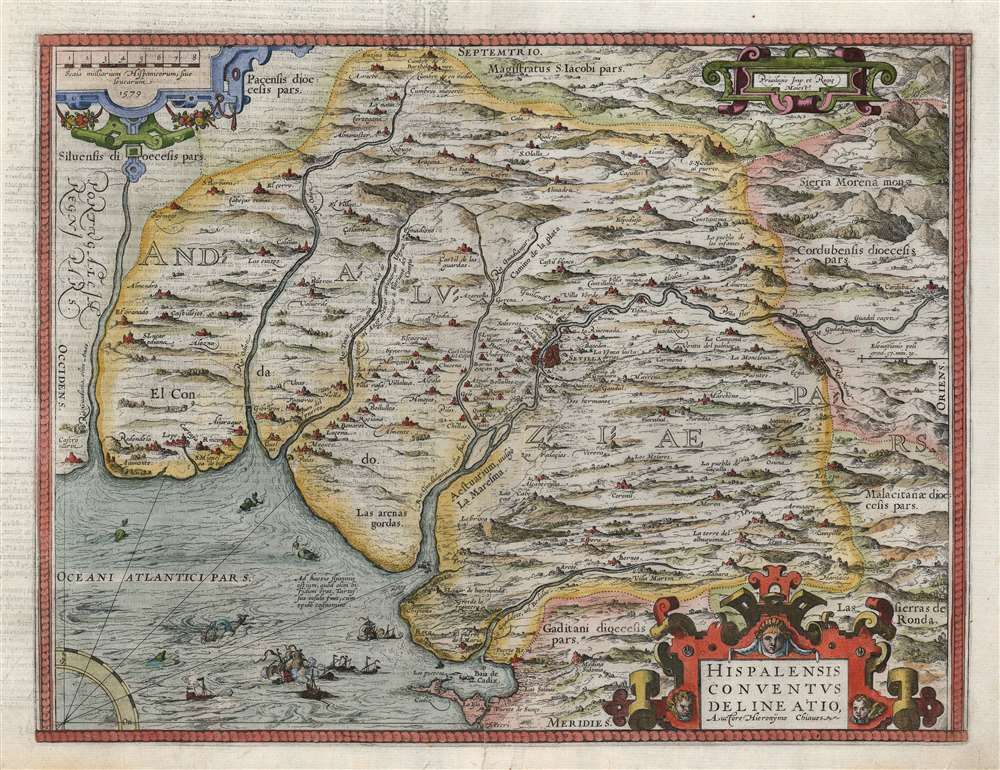
Hispalensis Conventus Delineatio Auctore Hieronÿmo Chiaves.
sold
- Digital Map Information
- Suitable for large format printing
- DPI: 600
- File Size: 45.23 MB
- File Type: ZIP / TIFF
- ICC color profile embedded
- Delivered instantly via download link
This is an attractive, first state example of Abraham Ortelius' 1581 map of Seville and its surroundings, Andalusia, Spain. This map details the most crucial home ports of the Spanish Empire, based on the report of Geronimo de Chavez, the chief geographer of Spain's Casa de Contratación at the peak of its power. It centers on a pictorial representation of the walled city of Seville and its cathedral on the Guadalquivir River. The vital port and city of Cadiz, home port of the Spanish treasure fleet, appears at bottom center. The region's mountainous terrain is dramatically and artfully depicted. Off the coast of Cadiz a sea battle rages, while hungry sea monsters prowl the waters. (more details)