
Factories, schools, and churches around town.

Peterborough, N.H. 1886.
sold
- Digital Map Information
- Suitable for large format printing
- File Size: 70.12 MB
- File Type: ZIP / TIFF
- ICC color profile embedded
- Delivered instantly via download link
This is an 1886 Lucian Rinaldo Burleigh bird's-eye view of Peterborough, New Hampshire. Churches, schools, banks, factories, and individual homes are illustrated in profile, with thirty locations numerically identified that correspond with an index below the bottom border. The numbers appear on the building's roofs and among these are five churches, two banks, numerous factories, and the Peterborough Creamery Company. Four insets appear below the main view, three on the left and one on the right. The views on the left depict North Peterborough, South Peterborough, and Joshua Briggs Piano Chairs and Stools. The inset on the right focuses west Peterborough and includes the Union Manufacturing Company. (more details)
Ryukyu's perilous prosperity.

琉球國圖 / [Map of the Ryukyu Kingdom].
sold
- Digital Map Information
- Suitable for large format printing
- DPI: 600
- File Size: 22.44 MB
- File Type: ZIP / TIFF
- ICC color profile embedded
- Delivered instantly via download link
This is a unique c. 1850 map of the Ryukyu Kingdom (琉球國) published in Korea during the late Joseon period (1392 - 1897). It provides geographic and administrative information on the kingdom, which in this era played a delicate balancing act between Qing China and the Tokugawa Shogunate in Japan. (more details)
Korea's northwest, including Pyongyang.

平安道 / [Pyongan Province].
sold
- Digital Map Information
- Suitable for large format printing
- DPI: 600
- File Size: 25.73 MB
- File Type: ZIP / TIFF
- ICC color profile embedded
- Delivered instantly via download link
This is a unique c. 1850 map of Pyongan Province (平安道) published in Korea during the late Joseon period (1392 – 1897). It provides substantial geographic and administrative information on Pyongan (also transliterated as Pyeongan), one of the eight traditional provinces of Joseon, now located in the Democratic People's Republic of Korea (North Korea). (more details)
Key Port in the Indian Ocean.
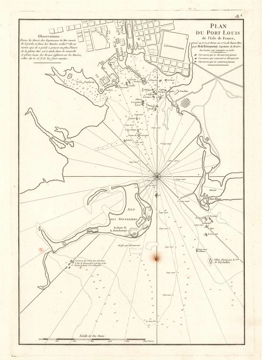
Plan du Port Louis de l'Isle de France, Levé en 1771 et Revu en 1775, de basse Mer, par M. de Boisquenay Capitaine de Brulot.
$950.00
Acquire
- Digital Map Information
- Suitable for large format printing
- DPI: 600
- File Size: 32.96 MB
- File Type: ZIP / TIFF
- ICC color profile embedded
- Delivered instantly via download link
This is a 1775 harbor chart of Port Louis, a critical port in northwest Mauritius for the Indian Ocean trade. At the time Mauritius was a French possession known as l'Isle de France. (more details)
The first settlement of free Blacks in what would become the United States.
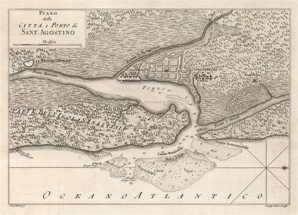
Piano della Città, e Porto di Sant.'Agostino.
sold
- Digital Map Information
- Suitable for large format printing
- DPI: 600
- File Size: 17.24 MB
- File Type: ZIP / TIFF
- ICC color profile embedded
- Delivered instantly via download link
This is a c. 1763 Violante Vanni map of St. Augustine, Florida. Oriented to the east, St. Augustine appears above center with its walls and fort depicted. Two Native American settlements appear to the to the north and south of St. Augustine. Fort Mose, the first free Black settlement in what became the United States, is illustrated to the right (north) of St. Augustine, here labeled as 'Forte Negro'. Depth soundings with measurements appear along the 'Canale Meridionale' with several banks are illustrated. (more details)
Celebrating Ulysses S. Grant's second nomination for the Presidency.
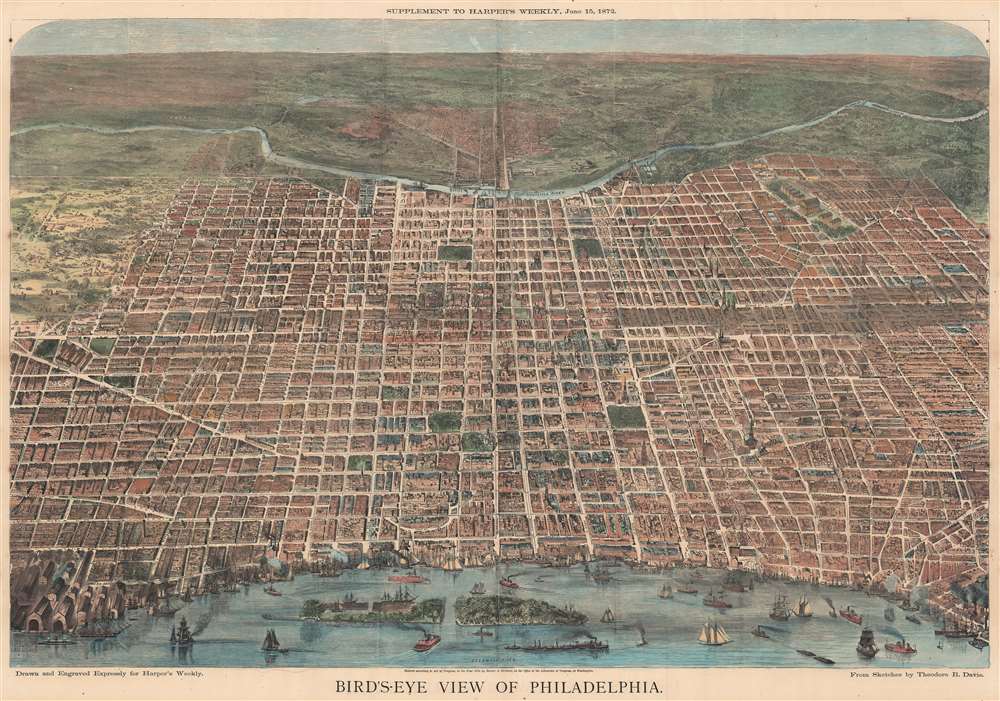
Bird's-Eye View of Philadelphia.
sold
- Digital Map Information
- Suitable for large format printing
- File Size: 177.8 MB
- File Type: ZIP / TIFF
- ICC color profile embedded
- Delivered instantly via download link
This is an 1872 Harper's Weekly bird's-eye view of Philadelphia, Pennsylvania, published nine days after Philadelphia hosted the 1872 Republican National Convention. This view looks west on Philadelphia from a high point across the Delaware River. It was issued to supplement reporting on the nomination of President Ulysses S. Grant for a second term. The Convention was held at the Academy of Music, here situated slightly above and to the left of center, apparent from the conventioneers milling outside. (more details)
First atlas map of the Franche-Comte.
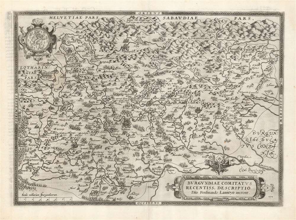
Burgundiae Comitatus Recentiss. Descriptio Dno. Ferdinando Lannoyo auctore.
sold
- Digital Map Information
- Suitable for large format printing
- DPI: 600
- File Size: 61.61 MB
- File Type: ZIP / TIFF
- ICC color profile embedded
- Delivered instantly via download link
This is Abraham Ortelius' 1579 map of the County of Burgundy in France - as distinct from the Duchy of Burgundy, which lay to the west. The map follows Ferdinand de Lannoy's unacquirable 1563 map, the first to depict Franche-Comté. Shortly after publication, De Lannoy's cartography was officially suppressed, so Ortelius' version is the earliest acquirable derivative. The map conforms to the eastern part of modern-day Bourgogne-Franche-Comté. (more details)
Montana's frontier history.

Montana. Frontier. Pioneer.
sold
- Digital Map Information
- Suitable for large format printing
- Full resolution TIFF file
- ICC color profile embedded
- Delivered instantly via download link
This is a 1937 Irvin Shope pictorial map of Montana. The map depicts the state from Idaho to the Dakotas and from Canada to Wyoming, including Yellowstone National Park. The map is highly detailed, with captions, vignettes, and other illustrations populating it, offering a rich visual representation of Montana's history. Most captions recount tales of the Wild West. Outlaws, vigilantes, and frontier violence and vigilante 'justice' abound. Others inform on more conventional milestones, such as the location of the first Territorial Legislature, or that Virginia City was the first capital of the Montana Territory. Numerous cities and towns appear, including Helena, Missoula, and Bozeman. Vignettes frame the map, illustrating 'the major frontier industries: trapping, mining, cattle and sheep raising, and lumbering'. (more details)
A beautiful map of the Eastern Hemisphere.
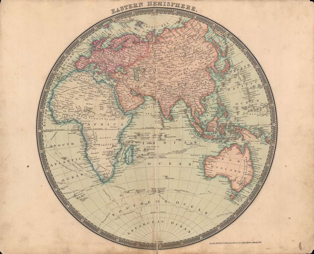
The Eastern Hemisphere.
sold
- Digital Map Information
- Suitable for large format printing
- DPI: 600
- File Size: 34.6 MB
- File Type: ZIP / TIFF
- ICC color profile embedded
- Delivered instantly via download link
This is a beautifully-colored 1831 Henry Teesdale / John Dower map of the Eastern Hemisphere published in their A New General Atlas of the World. It reflects the latest geographical knowledge available at that time and charts the voyages of Captain James Cook. (more details)
'Rusticators' become 'Tourists'.
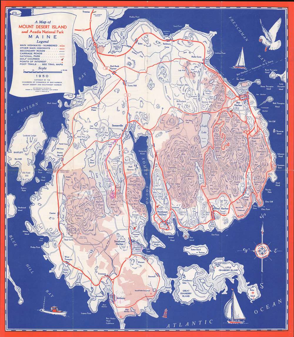
A Map of Mount Desert Island and Acadia National Park Maine.
sold
- Digital Map Information
- Suitable for large format printing
- File Size: 330 MB
- File Type: ZIP / TIFF
- ICC color profile embedded
- Delivered instantly via download link
This is a 1950 National Survey Company tourist map of Mount Desert Island, Maine, likely created 'rusticators' visiting Acadia National Park. Pink areas highlight the park's boundaries. Highways, secondary roads, and Mount Desert Island's celebrated carriage roads are illustrated. Charming pictorial elements occupy the three corners, including a personification of wind blowing a sailboat along the island's northern coast. (more details)
Possibly one-of-a-kind map of a Siege Campaign in the Franco-Spanish War.
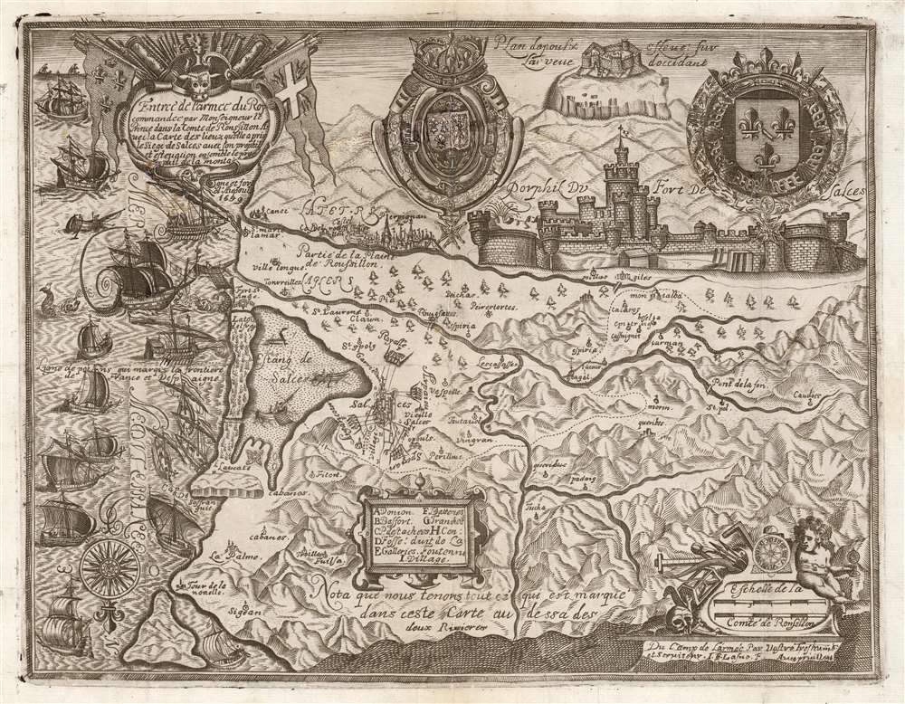
Entreé de l'Armee du Roy commandee par Monseigneur le Prince dans ala Comte de Roussllon...
sold
- Digital Map Information
- Suitable for large format printing
- DPI: 600
- File Size: 37.98 MB
- File Type: ZIP / TIFF
- ICC color profile embedded
- Delivered instantly via download link
This is a rare and highly evocative 1639 Jean-Etienne Lasne map of the region around Salses-le-Château, Roussillon, France, depicting its first siege during the Franco-Spanish War (1635 - 1659). The south-oriented map embraces the Province of Roussillon, including the Étang de Salces (Étang de Leucate), the cities of Salces, Leucate, and Perpignan, and other towns. (more details)
One of the earliest obtainable views of Singapore.
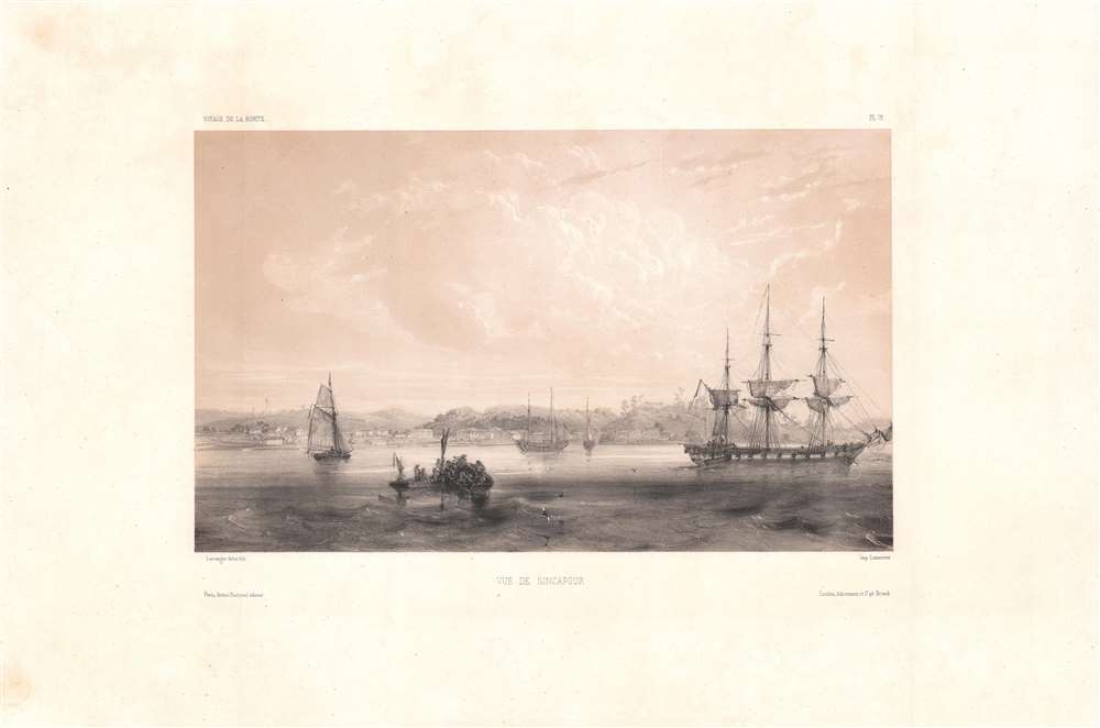
Vue de Sincapour.
sold
- Digital Map Information
- Suitable for large format printing
- DPI: 600
- File Size: 26.17 MB
- File Type: ZIP / TIFF
- ICC color profile embedded
- Delivered instantly via download link
One of the earliest obtainable views of Singapore, this is a rare c. 1845 chromolithograph by Barthélémy Lauvergne, one of the resident artists on the Bonite Expedition (1836 - 1837), a French scientific and diplomatic circumnavigation. It presents the British colony in its early days of development as a bustling port and meeting point of cultures. (more details)
Korea's rural heartland.

忠清道 / [Chungcheong Province].
sold
- Digital Map Information
- Suitable for large format printing
- DPI: 600
- File Size: 29.02 MB
- File Type: ZIP / TIFF
- ICC color profile embedded
- Delivered instantly via download link
This is a unique c. 1850 map of Chungcheong Province (忠清道) published in Korea during the late Joseon period (1392 – 1897). It provides substantial geographic and administrative information on Chungcheong, one of the eight traditional provinces of Joseon. (more details)
Korea's feisty southwest.

全羅道 / [Jeolla Province].
sold
- Digital Map Information
- Suitable for large format printing
- DPI: 600
- File Size: 25.37 MB
- File Type: ZIP / TIFF
- ICC color profile embedded
- Delivered instantly via download link
This is a unique c. 1850 map of Jeolla Province (全羅道) published in Korea during the late Joseon period (1392 – 1897). It provides substantial geographic and administrative information on Jeolla, one of the eight traditional provinces of Joseon. (more details)
50th anniversary of the Russian Revolution.
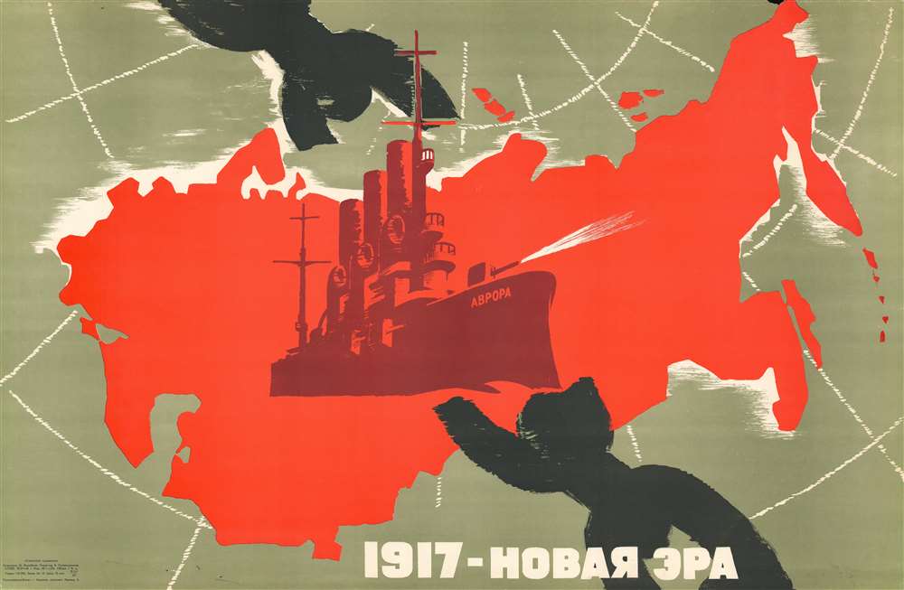
1917 - НОВАЯ ЭРА. / 1917 - NEW ERA.
sold
This is a c. 1967 Vorobyov Soviet propaganda broadside map of the Soviet Union created to celebrate the 50th anniversary of the Russian Revolution (1917 - 1923). Superimposed upon a red (Soviet) map of Russia, the Cruiser Aurora (АВРОРА) takes center stage as it blasts through through a massive black chain representing the repressive Tzarist Old Regime. Text along the bottom declares '1917 - New Era'. (more details)
One of the best maps of the Mississippi and Ohio River Valleys issued after the Revolutionary War.

[Mississippi Valley].
sold
- Digital Map Information
- Suitable for large format printing
- DPI: 600
- File Size: 39.05 MB
- File Type: ZIP / TIFF
- ICC color profile embedded
- Delivered instantly via download link
This is the northwestern sheet from Franz Anton Schraembl's 1788 edition of Generalkarte von Nord America samt den Westindischen inseln depicting the central part of North America. Although derived from a larger wall map, the present map is a stand-alone piece and one of the first detailed maps of this region to appear after the American Revolutionary War (1775 - 1783). Concentrating on the Mississippi Valley, the map extends from the Gulf of California to the Pacific near Savannah, Georgia, and from Lake Winnipeg (Ouinpigon) to Mobile Bay. (more details)
Iconic early map of Hawaii after Cook.
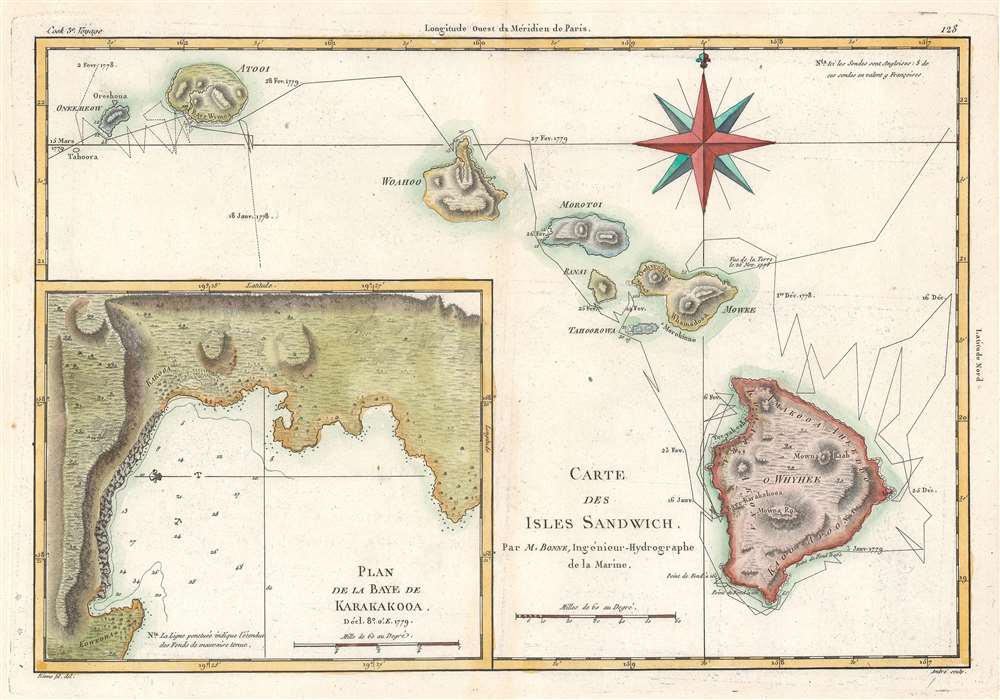
Carte des Isles Sandwich.
sold
- Digital Map Information
- Suitable for large format printing
- DPI: 600
- File Size: 17.9 MB
- File Type: ZIP / TIFF
- ICC color profile embedded
- Delivered instantly via download link
This is a 1788 Rigobert Bonne map of the Hawaiian Islands, a result of the third and final voyage of Captain James Cook. The map includes the entire archipelago: Hawaii, Maui, Lanai, Molokai, Oahu, Kauai, and Nihau. The route followed by Cook's expedition appears along with dates. An inset map of the Bay of Karakakooa is situated in the lower left. (more details)
The U.S. becomes a Pacific power.
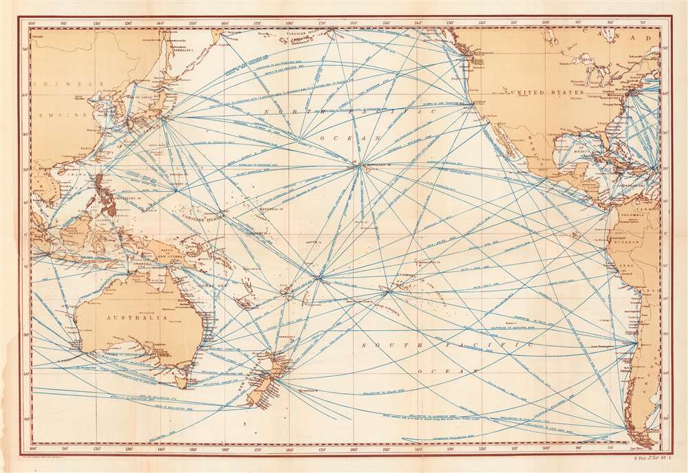
Distance Map of the Pacific Ocean... showing tracks of full-powered steam vessels, with the shortest routes between points, in nautical miles.
sold
- Digital Map Information
- Suitable for large format printing
- File Size: 48.67 MB
- File Type: ZIP / TIFF
- ICC color profile embedded
- Delivered instantly via download link
This is a scarce 1902 Norris Peters map detailing steamship routes across the Pacific. It was produced when the United States was consolidating its control of the Philippines, Hawaii, Guam, and other Pacific possessions in the wake of the Spanish-American War, a process which the map was designed to facilitate. (more details)
Features manuscript notations likely written by a Korean War veteran.
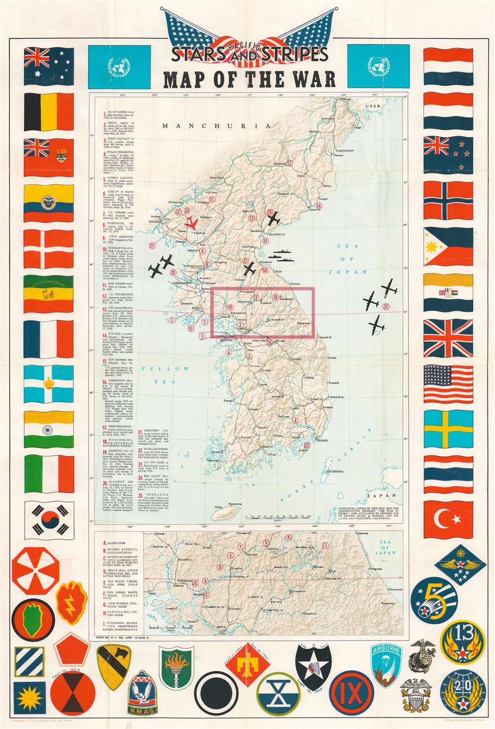
Pacific Stars and Stripes Map of the War.
sold
- Digital Map Information
- Suitable for large format printing
- Full resolution TIFF file
- ICC color profile embedded
- Delivered instantly via download link
This is a 1953 Pacific Stars and Stripes map of the Korean War. Twenty-five different events in the history of the Korean War are numerically identified, with explanations appearing along the left border. Several silhouettes of aircraft are depicted, including what appears to be a Grumman F9F Panther, a squadron of large four-engine bombers over the Sea of Japan, and a MiG-15 illustrated in red. An inset map, situated below the central map of the Korean peninsula, details the area in the box in the larger map, along the 38th parallel from Yonan and P'anmunjom to Kansong. Several different hills and ridges that played major roles in battles are labeled, including the area of the Punchbowl, Bloody Ridge, Heartbreak Ridge, and Christmas Hill, along with the Iron Triangle. The map is bordered on three sides by the flags of the United Nations and the insignia of numerous American combat units are included along the bottom border. (more details)
How to get to Canada's favorite department store.
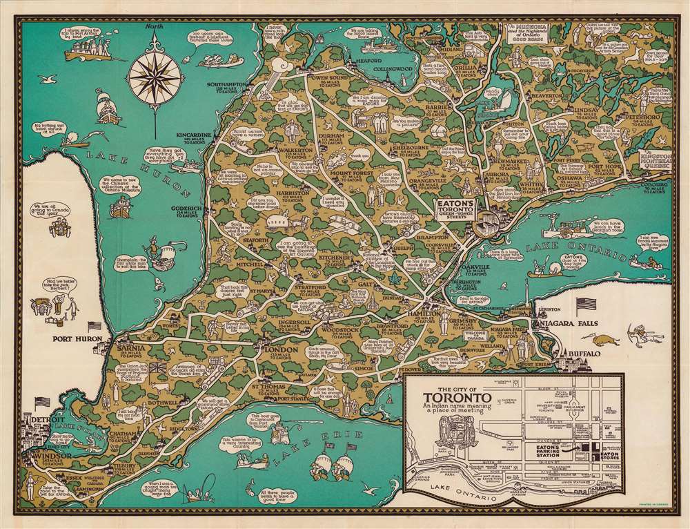
On the Road to Eaton's, Route Map to Toronto, Ont.
sold
- Digital Map Information
- Suitable for large format printing
- Full resolution TIFF file
- ICC color profile embedded
- Delivered instantly via download link
This is a c. 1926 pictorial folding map of the area around Toronto, Canada published by T. Eaton Co., a popular local department store. It shows the southern portion of Ontario, highlighting roads to Toronto and Eaton's main store. (more details)