
The NYC during the Roaring Twenties.
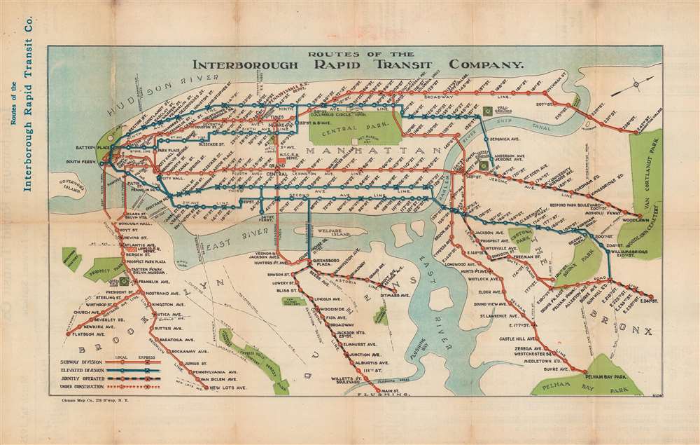
Routes of the Interborough Rapid Transit Company.
sold
- Digital Map Information
- Suitable for large format printing
- Full resolution TIFF file
- ICC color profile embedded
- Delivered instantly via download link
This is a March 1, 1925, Ohman Map Company and Interborough Rapid Transit Company subway map of the Interborough Rapid Transit Company's routes in New York City. Elevated (blue) and subway (red) lines are differentiated. Express and local stations are identified, and the jointly operated lines in Queens and The Bronx are illustrated as black and red dashed lines. Central Park, the Metropolitan Museum of Art, the Museum of Natural History, Yankee Stadium, Ebbets Field, and Prospect Park rank among the locations identified. (more details)
An elegant 18th century Ireland.
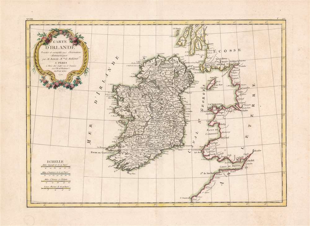
Carte D'Irlande Projettée de assujettie aux Observation Astronomiques par M. Bonne M.tre de Mathémat.
sold
- Digital Map Information
- Suitable for large format printing
- DPI: 600
- File Size: 31.32 MB
- File Type: ZIP / TIFF
- ICC color profile embedded
- Delivered instantly via download link
A beautiful example of Rigobert Bonne's 1771 decorative map of Ireland. Includes all of Ireland as well as parts of neighboring England and Scotland. An elaborate decorative title cartouche appears in the upper left quadrant. Drawn by R. Bonne 1771 for issue as ... (more details)
Attractive, southern-oriented map of Germany.

Teutschlandt/ mit seinem gantzen Begriff und eyngeschlosznen Landtschafften.
sold
- Digital Map Information
- Suitable for large format printing
- DPI: 600
- File Size: 32.95 MB
- File Type: ZIP / TIFF
- ICC color profile embedded
- Delivered instantly via download link
This is the modern map of Germany from Sebastian Petri's updated edition of Münster's Cosmographia. It was added by the publisher toCosmographia in 1588, to replace the map which had first appeared in Münster's work in 1540, which over the course of almost fifty years had become supplanted by the more modern and detailed map printed by Ortelius. Indeed, most of the maps which Petri caused to be made for Cosmographia were reduced-format, woodcut versions of Ortelius' copperplate maps, an acknowledgement of their superiority to the older Münster maps. In this respect, the present map stands out: while some of its features reflect Ortelius' work, the overall composition of the map - especially its southern orientation - are more reflective of the original Münster map: perhaps evoking the sentiment that a German could make a better map of Germany than the Flemish Ortelius. (more details)
Berlin Wall less than 18 months after it was built.
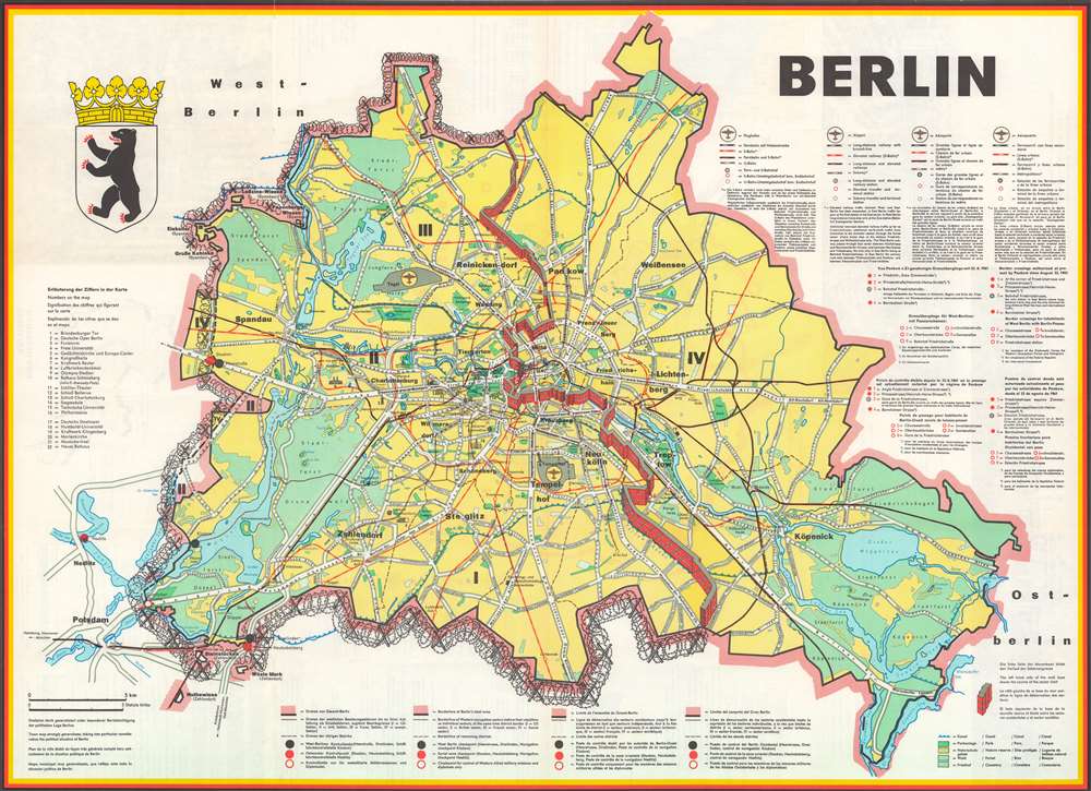
Berlin.
sold
This is a 1962 JRO-Sonderkarte pictorial city map of Berlin, Germany. The map depicts East and West Berlin, with the recently constructed Berlin Wall dividing the city. Created within 18 months of the construction of the Berlin Wall, a certain undeniable Cold War cache defines the map. Here, West Berlin is encircled by barbed wire on three sides with the Berlin Wall completing its imprisonment on the fourth. (more details)
One of the most beautiful, important, and enduring maps of Manhattan ever published.

Topographical Map of the City of New York Showing Original Water Courses and Made Land.
sold
- Digital Map Information
- Suitable for large format printing
- File Size: 86.7 MB
- File Type: ZIP / TIFF
- ICC color profile embedded
- Delivered instantly via download link
This is a very beautiful and fine example of Egbert L. Viele's 1865 topography and waterways map of Manhattan, one of the scarcest, most important, and most enduring maps of New York City ever published. Covering the entirety of Manhattan Island, Viele's map details the canals, swamps, rivers, ditches, ponds, meadows, and drainage basins of Manhattan as they existed prior to the city's urban development. A version of the Viele map remains in use today by architects and contractors who need to be certain they are not building over underground rivers and swamps that may destabilize a new construction's foundation. (more details)
Proposed Masonic African American community near David City, Florida.

The Town of David City.
sold
- Digital Map Information
- Suitable for large format printing
- File Size: 17.6 MB
- File Type: ZIP / TIFF
- ICC color profile embedded
- Delivered instantly via download link
A unique c. 1920 broadside map promoting the development of an all-African American town, 'David City', in Putnam County, Florida. The city was planned by the African American Masonic Lodge of Jacksonville, for settlement by its members, on the abandoned site of a female-operated African American Masonic convalescent home. The map provides unique insight into the role of African American philanthropy and values in northern Florida in the early 20th century. (more details)
Boston as 'bicycle-fever' epicenter.
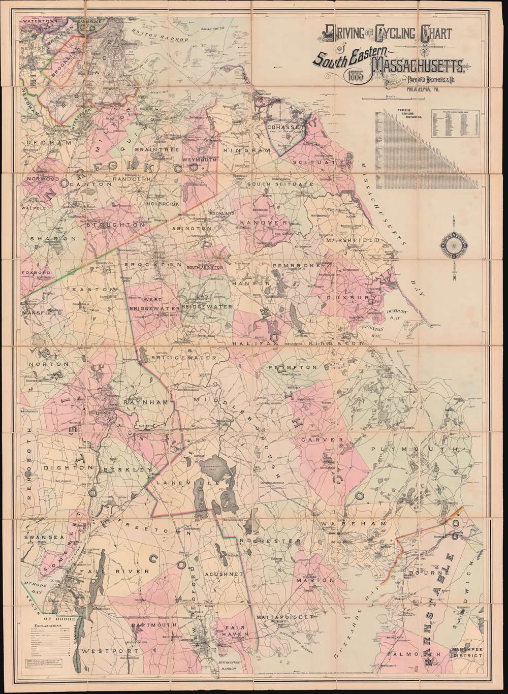
Driving and Cycling Chart of South Eastern Massachusetts.
sold
- Digital Map Information
- Suitable for large format printing
- File Size: 139.17 MB
- File Type: ZIP / TIFF
- ICC color profile embedded
- Delivered instantly via download link
A meticulous large scale folding wall map of southeastern Massachusetts issued by Herbert and Horace Packard in 1885. The map is an expression of the pre-automobile 'bicycle fever' that gripped New England, particularly the Boston area, in the late 19th century. It further underscores the importance of quality roads to cyclists. In the latter 19th and early 20th centuries, cyclists proved major lobbyists for the 'good roads everywhere' movement, setting the stage for the emergence of the American highway system in the mid-20th century. (more details)
Tajikistan, published in Tashkent, first official map of the Tajik S.S.R.

Карта Таджикской С.С.Р. / [Map of the Tajik Soviet Socialist Republic].
sold
- Digital Map Information
- Suitable for large format printing
- File Size: 31.99 MB
- File Type: ZIP / TIFF
- ICC color profile embedded
- Delivered instantly via download link
This is a unique 1932 map of Tajikistan made by Geokartprom and published by the Tajik State Publishing House - the first official map of the Tajik S.S.R. It shows the recently-formed Soviet Socialist Republic (SSR) and reflects the efforts of the Soviet Union to build political and economic infrastructure in Central Asia while also 'delimiting' the complex ethnic groups of the region. (more details)
Scarce pictorial Florida.
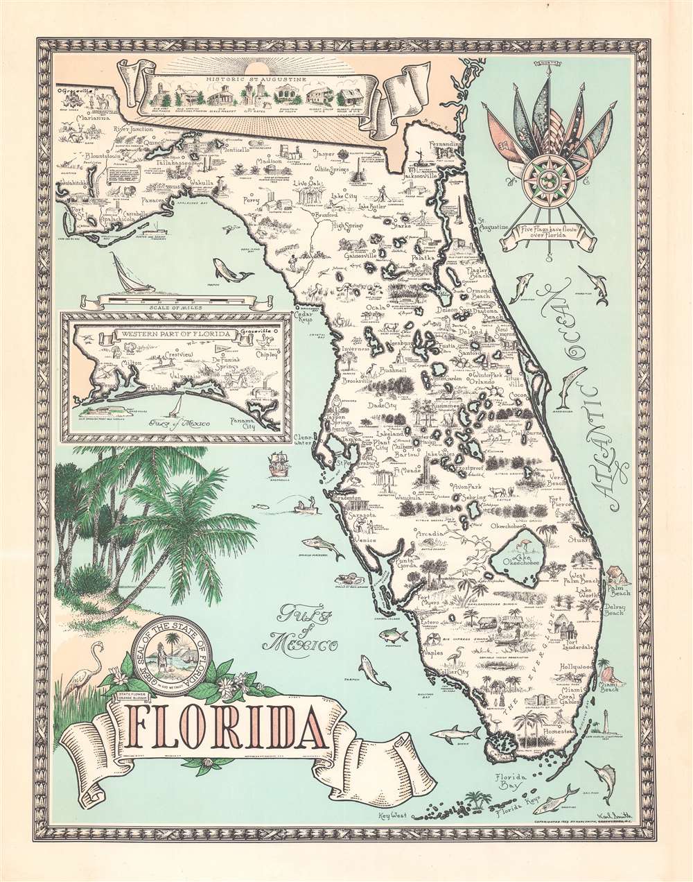
Florida.
sold
- Digital Map Information
- Suitable for large format printing
- File Size: 20.66 MB
- File Type: ZIP / TIFF
- ICC color profile embedded
- Delivered instantly via download link
A fine example of Karl Smith's striking 1953 pictorial map of Florida. The map focuses on peninsular Florida, with the western panhandle illustrated via inset. Throughout, vignette illustrations depict life in Florida, from citrus harvesting to fishing and ranching. Florida's rich flora and fauna are also incorporated. West of Tampa, 'Gasparilla', ship of the notorious but apocryphal Spanish pirate José Gaspar, lies in wait. Other features including the '5 Flags over Florida' compass rose, a banner illustrating the historic buildings of St. Augustine, and a palm tree themed title cartouche. (more details)
Comic look at 1980 Hong Kong.

Hong Kong.
sold
A 1980 charming pictorial map of Hong Kong by illustrator and historian Tom Briggs. The map looks east on Hong Kong, with Kowloon on the left and Hong Kong Island on the right. The Star Ferry appears just below and left of center, connecting Central to Kowloon Pier. The map is rife with advertising for Hong Kong businesses, but also historical notes, and humorous commentary. For example, a wizard advertised as a 'World Money Analyst' claims he can 'turn it into almost anything.' Fish in the harbor comment on Hong Kong social strata - 'They haven't spoken a word to anyone since they moved up to mid levels.' The pirate 'Eung Po Choi' claims that in 100 years he'll be a 'Hong Kong real estate developer.' Even the basement strip club, 'Bottoms Up' appears - duty free. (more details)
Eruption of a new island in the Santorini Caldera.
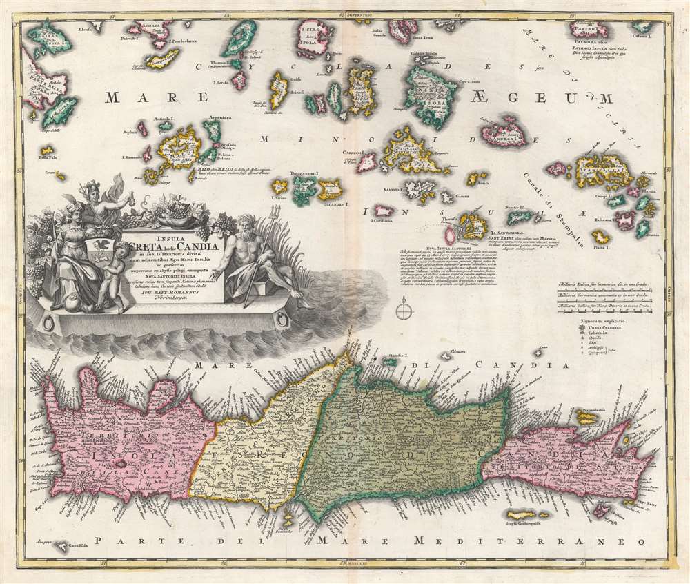
Insula Creta hodie Candia in sua IV Territoria divisa.
sold
- Digital Map Information
- Suitable for large format printing
- DPI: 600
- File Size: 25.53 MB
- File Type: ZIP / TIFF
- ICC color profile embedded
- Delivered instantly via download link
This dramatic c. 1710 map of Crete and the Greek Islands was engraved for inclusion in the atlases of J. B. Homann. In terms of the island's topography, it is largely based on the maps of Sanson from the prior century, but this older cartography frames fresh and astonishing information: the emergence of a new island, as part of the Santorini Archipelago. (more details)
Tribes of Israel.
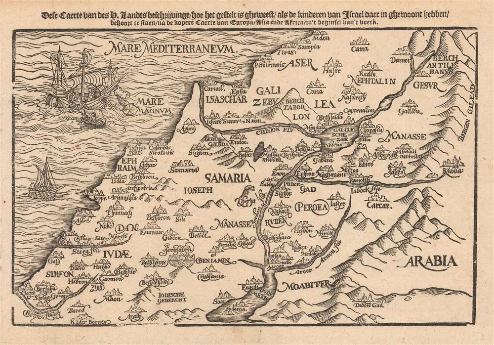
Dese Caerte van des H. Landts Beschrijvinge/ hoe het gestelt is gheweest/ als de kinderen van Israel daer in ghewoont hebben.
$750.00
Acquire
- Digital Map Information
- Suitable for large format printing
- DPI: 600
- File Size: 4.78 MB
- File Type: ZIP / TIFF
- ICC color profile embedded
- Delivered instantly via download link
This is a scarce 1635 Dutch woodcut map of the Holy Land, presenting (as per the title) a 'map of the Holy Lands, describing how it was when the Children of Israel lived there.' The map depicts the location of present-day Israel, Palestine, and parts of Lebanon, Syria, and Jordan. (more details)
Enforcers of the Dutch Spice Monopoly.

De Ambonsche Hongi of de Coracora Vloot.
sold
- Digital Map Information
- Suitable for large format printing
- DPI: 600
- File Size: 14.38 MB
- File Type: ZIP / TIFF
- ICC color profile embedded
- Delivered instantly via download link
This is a 1724 engraved illustration of the Hongi Fleet of 1702 under the command of Dutch official Balthazar Coyett (c. 1650 - 1725), Governor of the Dutch colony at Ambon. The Hung Fleet were a part Dutch, part indigenous Moluccan fleet of kora-kora shipped contracted to enforce the Hongitochten inspections of the VOC (Dutch East India Company) spice monopoly. (more details)
A monumental shrine befitting the first emperor of modern Japan.

明治神宫全景 / [Panorama of the Meiji Shrine].
sold
- Digital Map Information
- Suitable for large format printing
- File Size: 18.55 MB
- File Type: ZIP / TIFF
- ICC color profile embedded
- Delivered instantly via download link
This is a one-of-a-kind c. 1925 birds-eye panoramic view of the Meiji Shrine (Meiji Jingū) in Tokyo, published by the Meiji Jingū Shamusho, the office tasked with managing the shrine. The shine has played an important historical role in Japanese national identity, especially in the years between its completion and the end of World War II. (more details)
Rare Mapping of Islands of the North Atlantic.
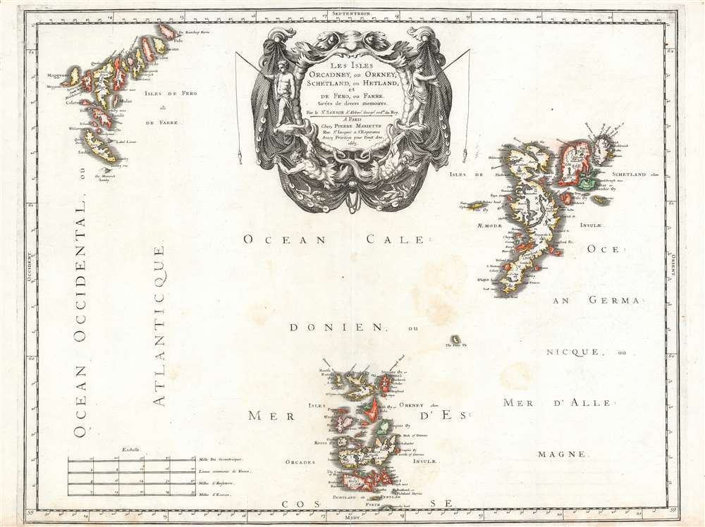
Les Isles Orcadney, ou Orkney; Schetland, ou Hetland; et de Fero, ou Farre, tirées de divers memoires.
sold
- Digital Map Information
- Suitable for large format printing
- DPI: 600
- File Size: 30.27 MB
- File Type: ZIP / TIFF
- ICC color profile embedded
- Delivered instantly via download link
This is a scarce, beautifully engraved 1655 map of the Orkney, Shetland and Faroe Islands, produced by Nicolas Sanson, the preeminent French mapmaker of the 17th century. While the detail of the Orkneys and the Shetlands derives from contemporaneous Dutch sources, Sanson's map is the first to focus on the Faroe Islands, and place them in reasonably accurate context with the other two archipelagos. (more details)
African Catholic Bishoprics of the Roman Empire.
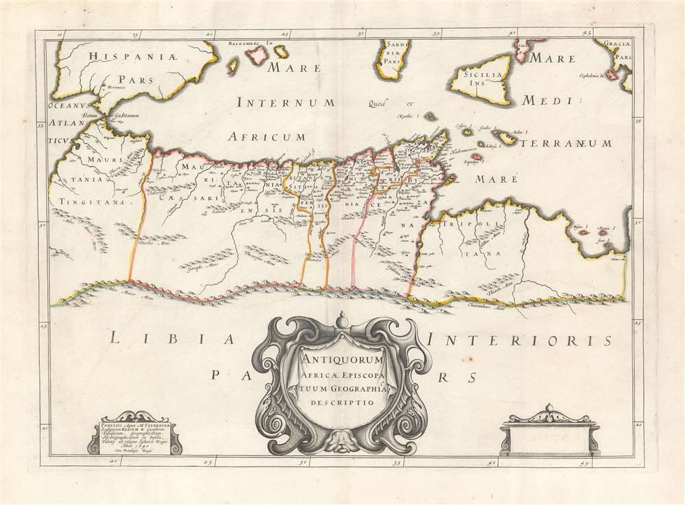
Antiquorum Africae Episcopatuum Geographica Descriptio.
sold
- Digital Map Information
- Suitable for large format printing
- DPI: 600
- File Size: 36.24 MB
- File Type: ZIP / TIFF
- ICC color profile embedded
- Delivered instantly via download link
This scarce 1641 Tavernier map of Northern Africa and the Mediterranean Sea was produced for the first edition of Charles Vialart's Geographica Sacra, to illustrate the African bishoprics of the early Christian church. (more details)
Visit the Land of 10,000 Lakes!
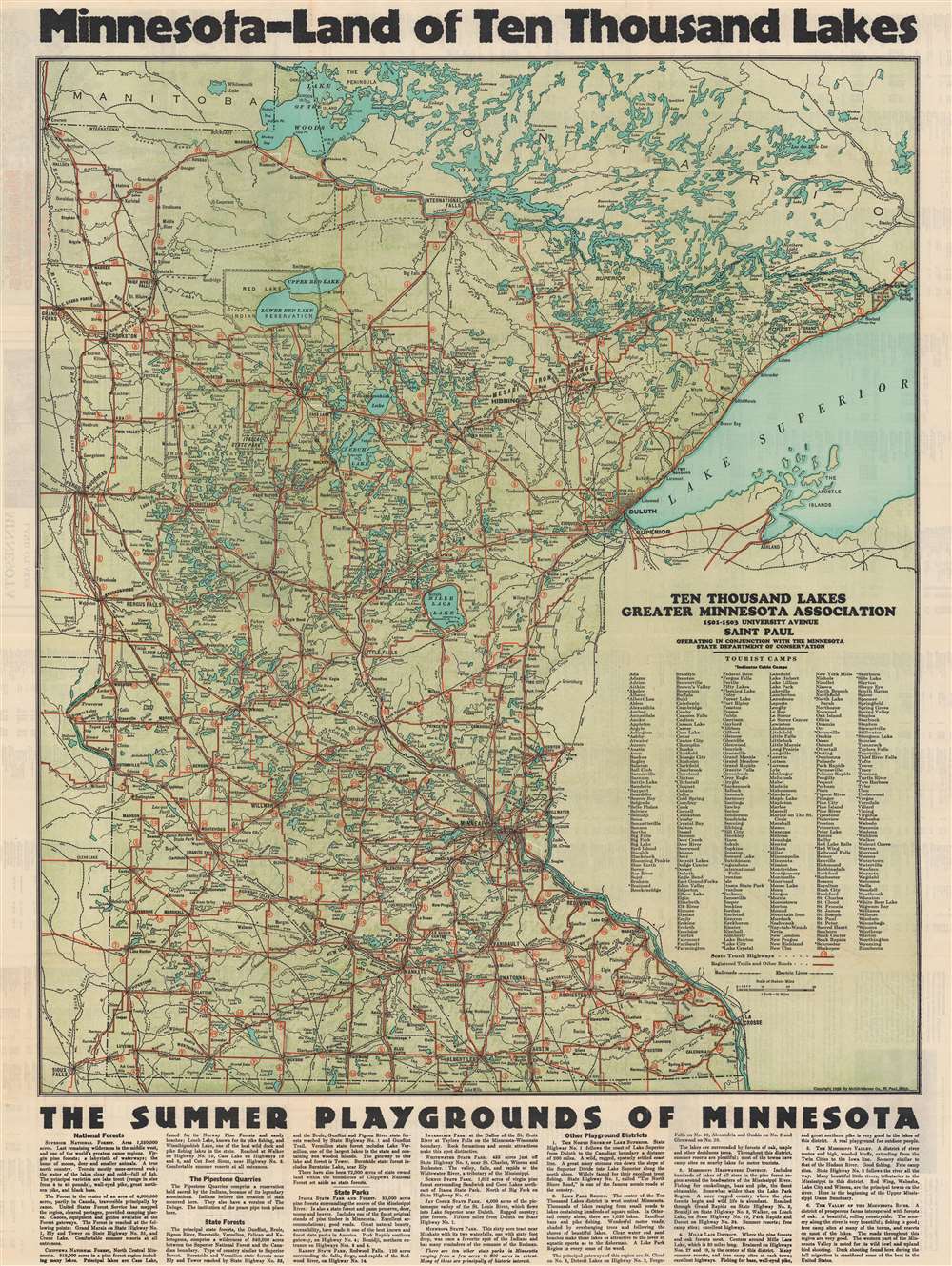
Minnesota - Land of Ten Thousand Lakes.
sold
- Digital Map Information
- Suitable for large format printing
- Full resolution TIFF file
- ICC color profile embedded
- Delivered instantly via download link
This is a c. 1930 McGill-Warner Company map of Minnesota. Minnesota's unofficial nickname - the Land of 10,000 Lakes - dominates the top margin. This nickname is appropriate, as 11,842 lakes can be found within Minnesota! Created as an aid to tourists, Minnesota's highway network is prominently illustrated and cities and towns across the state are labeled, along with state parks. The Minnesota Northwestern Electric Railway and a handful of other railways appear. An index of hotels and summer resorts fills the verso. (more details)
Byrd's second Antarctic expedition.

Authorized Map of the Second Byrd Antarctic Expedition.
sold
- Digital Map Information
- Suitable for large format printing
- File Size: 30.3 MB
- File Type: ZIP / TIFF
- ICC color profile embedded
- Delivered instantly via download link
This is a fascinating 1934 George Annand pictorial map of Antarctica celebrating the second Antarctic expedition of Rear Admiral Richard E. Byrd. It beautifully illustrates the South Polar Region, including the southern tip of South America and the eastern tip of New Zealand. Explored regions of Antarctica are identified along the coast, especially near the Ross Sea. Unexplored regions are also labeled. The title cartouche is adorned with a sled dog, a compass rose, penguins, and the portrait of the man himself Richard Evelyn Byrd. A note below the title reads
Past polar expeditions have been swallowed up by a silence which was never broken until they returned--if they did return. But on the Byrd Expedition there is being attempted the most notable feat in radio history--a two-way broadcast of the Expedition as it is being lived--from the very lips of the men themselves. Hailed by leading authorities as an important contribution to radio science, this series is made possible by General Foods, makers of Grape-Nuts'.Two insets, situated in the top left and bottom right quadrants respectively, detail the 'Route of Expedition and Path of the Broadcast', and 'The Bay of Whales'. A detail map of Little America (the expedition base camp on Ross Ice Shelf) is included within the inset of the Bay of Whales. Other illustrations of whales, penguins, ships, and airplanes, among other things, appear throughout. (more details)
New Mexico's frontier history.
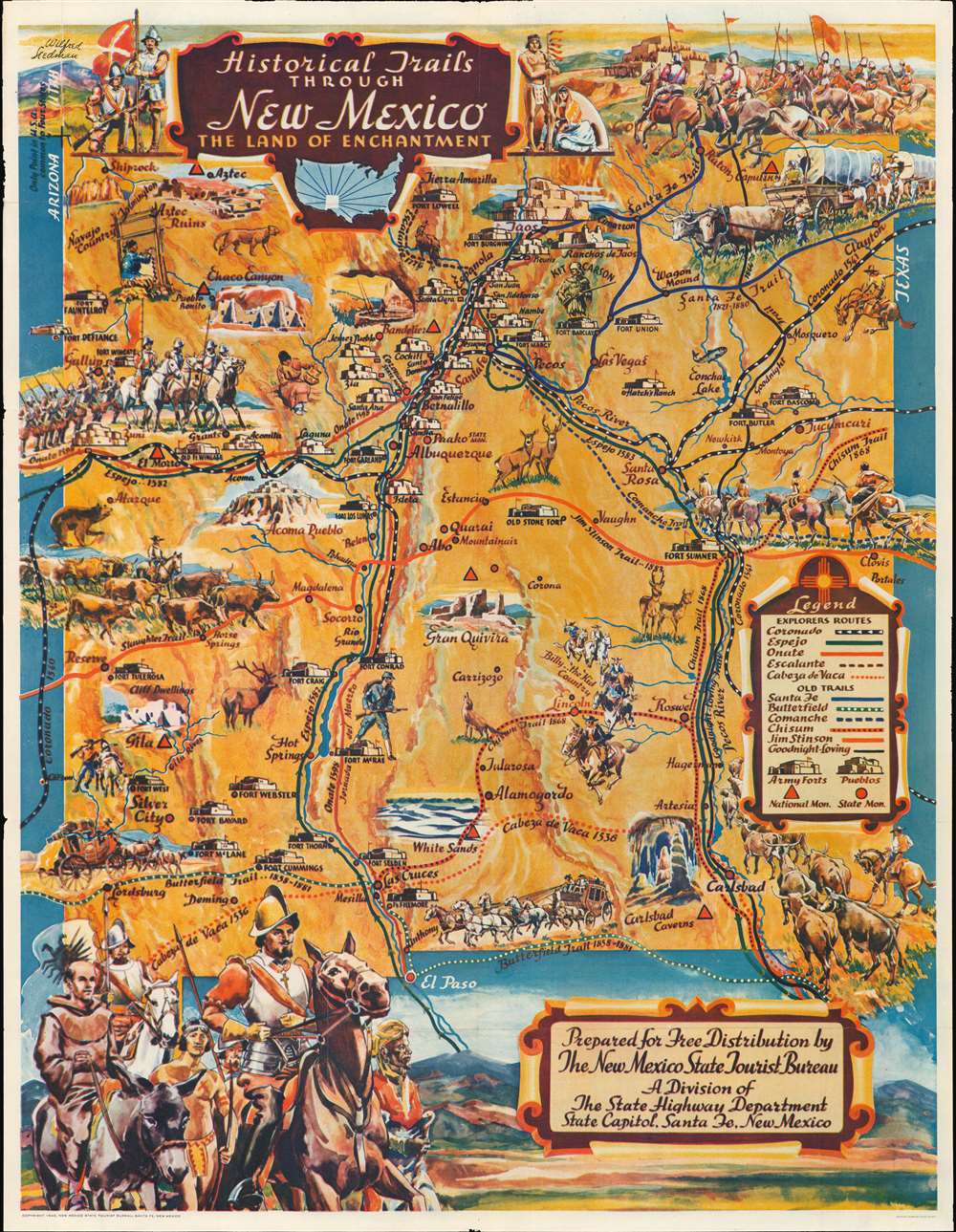
Historical Trails Through New Mexico the Land of Enchantment.
sold
- Digital Map Information
- Suitable for large format printing
- Full resolution TIFF file
- ICC color profile embedded
- Delivered instantly via download link
This is a fine example of Wilfred Stedman's beautifully illustrated 1940 map of the historical trails through New Mexico. Historic routes and trails are identified, including the Butterfield Trail, the Santa Fe Trail, and the Goodnight Loving Trail, among others, as well as the exploratory routes taken by Cabeza de Vaca, Coronado, Onate, Escalante, and Espejo. Steadman's map also identifies various army forts, pueblos, national and state monuments. Throughout, the map is fantastically illustrated with carriages, cowboys, soldiers, explorers, forts, wildlife, etc. It notes the only point in the United States common to four states, where the boundaries of Utah, New Mexico, Arizona and Colorado meet. The verso contains information about the various trails and the Coronado Cuarto Centennial Celebrations. (more details)
Extremely detailed American map of the Philippines.
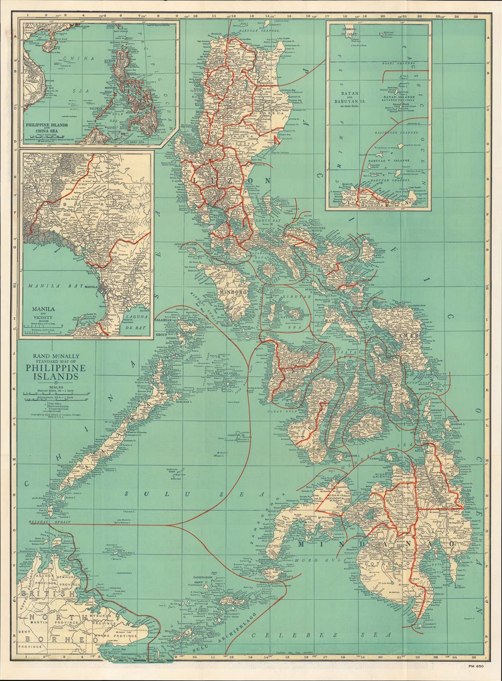
Philippine Islands Pocket Map.
sold
- Digital Map Information
- Suitable for large format printing
- Full resolution TIFF file
- ICC color profile embedded
- Delivered instantly via download link
This is a rare and highly detailed c. 1940 Rand McNally pocket map of the Philippines. It was produced in the period just before the Pacific War, as the Philippines was transitioning towards independence. (more details)