
The not-so-Chinese Chinese Empire.
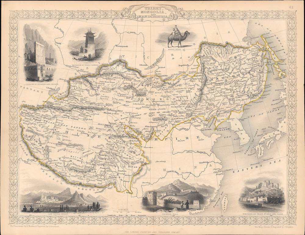
Thibet, Mongolia, and Mandchouria.
sold
- Digital Map Information
- Suitable for large format printing
- Full resolution TIFF file
- ICC color profile embedded
- Delivered instantly via download link
This is an 1851 map of Tibet, Mongolia, Manchuria, and neighboring regions belonging to the Qing Empire that appeared in the Tallis's Illustrated Atlas and Modern History of the World. It shows the immensity of territory under Qing rule, or at least Qing suzerainty, and how much of the 'Chinese Empire' was in fact outside of China. (more details)
Comprehensive guide to San Francisco for Japanese visitors.

日本人居住区桑港案内地圖 / [San Francisco Guide Map of Neighborhoods with Japanese Residents].
sold
- Digital Map Information
- Suitable for large format printing
- File Size: 31.57 MB
- File Type: ZIP / TIFF
- ICC color profile embedded
- Delivered instantly via download link
This is a unique c. 1930 Japanese-language map of San Francisco, California, published by San Francisco Koshinsha (桑港興信社), a Japanese-American printing house. It highlights the areas of the city with Japanese residents and businesses and was intended for Japanese travelers. (more details)
First Accurate Map of Galicia by Spain's 18th century greatest cartographer.
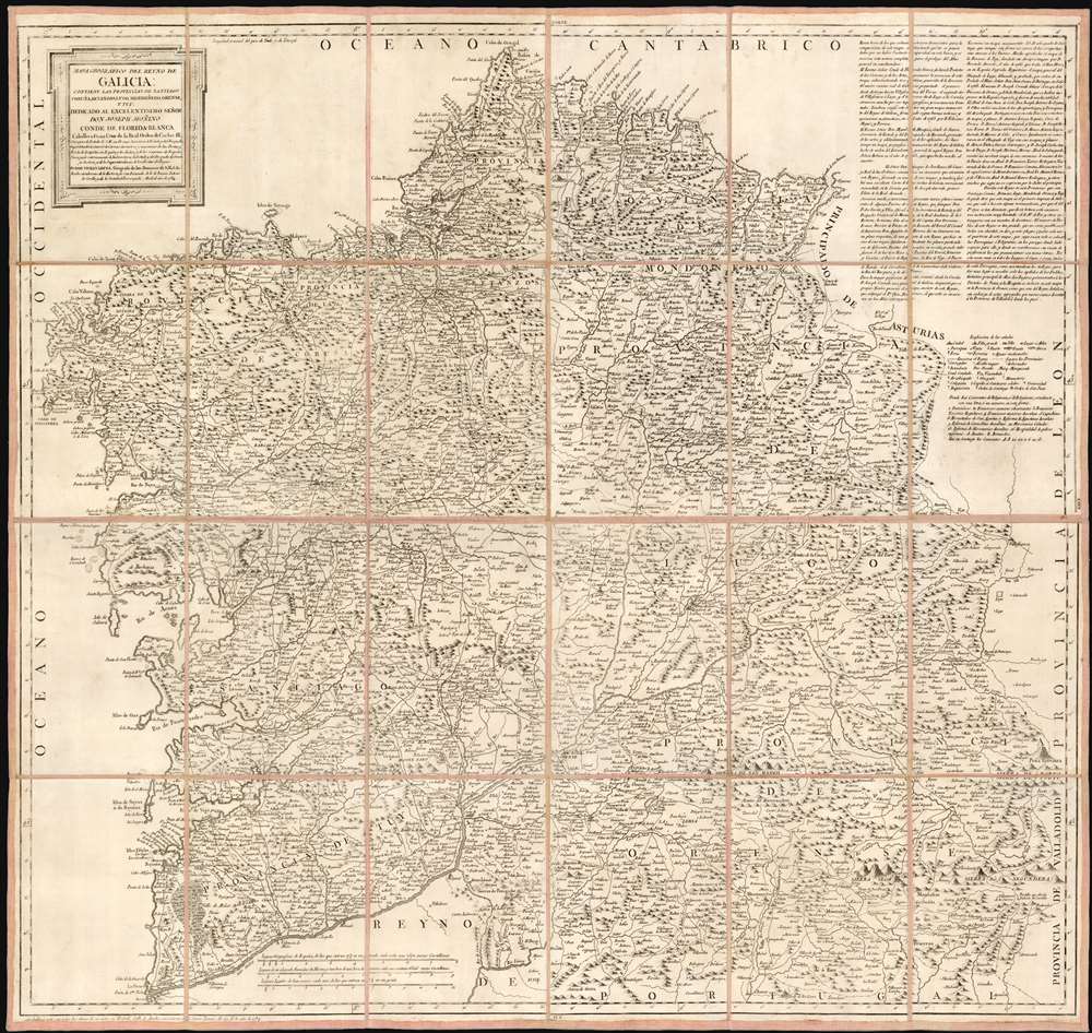
Mapa geográfico del Reyno de Galicia contiene las provincias de Santiago, Coruña, Betanzos, Lugo, Mondoñedo, Orense, y Tuy.
sold
- Digital Map Information
- Suitable for large format printing
- Full resolution TIFF file
- ICC color profile embedded
- Delivered instantly via download link
This is a 1784 map of the Kingdom of Galicia by Tomás López de Vargas Machuca, the preeminent Spanish cartographer of his generation. This is most authoritative map of Galicia ever committed to print, which López argued should be considered the first such map overall. In the text at the upper right, López wrote:
Se puede decir que este mapa es el primero impreso de Galicia... porque el del Pe. Ojea es tan diminuto, que de su lectura solo sacamos una instruccion muy limitada; el de Mr. De Fer y otros estrangeros son un monton de desalinos.López's boast is not baseless. The map of Hernando Ojea (1543 - 1615) to which he refers was first committed to print in the 1603 J.B. Vrients edition of the Ortelius atlas (he obtained a manuscript from Ojea.) This, in absolute terms, was the first printed map of Galicia, and was considered sufficiently correct that virtually every map printed of Galicia in that century was copied directly from it. Even so, in terms of detail López's criticism of the Ojea is valid: its scale limits detail. The maps of De Fer - which appear to be derived from, or from the same sources as the Cantelli and the Coronelli maps - did contain more data than their precursor, but even if they did not deserve the appellation un monton de desalinos, None approach this López map in either size or detail. Lopez credits an impressive array of sources - in sum, the map compiled a wealth of state-of-the-art data from a roster dominated by leading lights of the Spanish Enlightenment. They include the statesman Gaspar Melchor de Jovellanos (1744 - 1811); Pedro Varela y Ulloa (1737- 1797), then an official of the Secretary of State, who would eventually become Secretary of the Navy. Particular credit was given to José Andrés Cornide de Folgueira y Saavedra (D. Joseph Cornide; 1737 - 1803), a noted Galician geographer, naturalist and humanist (more details)
'It can be said that this map is the first printed of Galicia... because that of Father Ojea is so tiny, that from its reading we only get a very limited instruction; those of Mr. De Fer and other foreigners are a bunch of slops.'
A view and a fan!

[Panorama von Rigi Kulm].
sold
This is an c. 1860 fan-map panorama map of Switzerland as seen from the top of Rigi Kulm. Rigi Kulm is the summit of The Rigi (also known as Mount Rigi and Queen of the Mountains), part of the Swiss Plateau in central Switzerland. The map can sometimes be founds as a circular panorama, but was likely always intended to be a fan. The present example lacks sticks, which may have been removed at a later date so the fan could be more easily framed as a decorative piece - as became common in the late 19th century. (more details)
Cartoony cartography.

世界歷史地圖 明治十一年刊 新訂輿地全圖より / [World Historical Map, based on a map published in 1878, newly and fully revised].
sold
This is a playful cartoon world map published in the Asahi Shimbun in September 1979, based on a map published in the early Meiji period a century earlier. It shows portraits of important figures in the history of Japan's relations with the outside world, mostly from the Meiji period. (more details)
Reorganizing Japan's imperial capital.

市區改正東亰實測全圖 / [Complete Survey Map of Tokyo with Revised Wards].
sold
- Digital Map Information
- Suitable for large format printing
- Full resolution TIFF file
- ICC color profile embedded
- Delivered instantly via download link
This is an 1889 folding survey map of Tokyo, Japan by Ishijima Yae and Yamanaka Yoshisaburō. Its primary purpose is to highlight recent administrative changes in Tokyo, namely the creation of Tokyo Municipality (東京市), composed of 15 wards (區), within the larger Tokyo Prefecture (東京府). This map likely would have been used in a government office for reference purposes; the outside cover appears to include a list of names which might indicate its provenance, but the surname characters (at top) are unintelligible. (more details)
Proposed trans-Florida barge canal.

Map of the Country Embraced in the preliminary Survey and Examination of the Peninsula of Florida with a view to the construction of a Ship Canal from the St. Mary's River to the Gulf of Mexico.
sold
- Digital Map Information
- Suitable for large format printing
- File Size: 28.91 MB
- File Type: ZIP / TIFF
- ICC color profile embedded
- Delivered instantly via download link
This is an 1895 Robert Gamble map of northern Florida highlighting the route for a proposed cross-Florida barge canal. Illustrated by a red line, the prospective canal was intended connect the Apalachicola River in the west with Camp Pinckney on the Saint Mary's River in the east. Planned to be 100 feet wide and 8 feet deep, the proposed route utilizes some of the 1880 survey work done by Quincy Adams Gillmore (1825 - 1888). A short text in the lower left explains the proposed canal. Our research unearthed very little about the canal. The only mention of the project found was in a Senate report. (more details)
The Mexican Central Railway the year before it became part of the Ferrocarriles Nacionales.
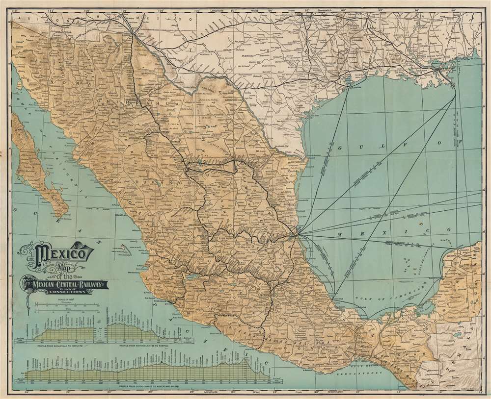
Mexico. Map of the Mexican Central Railway and Connections.
sold
- Digital Map Information
- Suitable for large format printing
- Full resolution TIFF file
- ICC color profile embedded
- Delivered instantly via download link
This is a c. 1908 Leonard L. Poates map of Mexico and the Mexican Central Railway - illustrating Mexico on the cusp of the Mexican Revolution (1910 - 1920). At the time, foreign investment was flooding into Mexico, much of which went to finance major infrastructure projects - like the Mexican Central. The operation of the Mexican Central Railroad provided a major artery of trade, both within Mexico and internationally with the United States - an artery that would soon be uprooted by revolution. (more details)
George Town in the early days of independence.

George Town Penang.
sold
This is a rare 1960 negative print map of George Town, the capital of Penang, likely produced soon after the Federation of Malaya gained independence from British rule. The map gives a sense of the vibrant mix of cultures and activities that have always defined the city. (more details)
Largo, Florida, and its many golf courses.

Largo, Florida.
sold
This is a 1974 J and R Map Company city plan or map of Largo, Florida and environs. Depicting from Old Tampa Bay south to the Tom Stuart Causeway and the Seminole Bridge, streets are illustrated and labeled throughout the area. Largo is highlighted by a bright white, while the rest of the region is shaded gray. A red dashed line marks Largo's city limits. Other than streets and lakes, the only sites labeled are golf clubs and a yacht club. Advertisements for local realtors, banks, churches, and a handful of local businesses appear above and below. A business index and a street index occupy the majority of the verso. (more details)
An optimistic view of the upcoming war.

Rand McNally standard map of Europe./ Sears Silvertone radio European War Map.
sold
- Digital Map Information
- Suitable for large format printing
- Full resolution TIFF file
- ICC color profile embedded
- Delivered instantly via download link
This is a 1940 Rand McNally Map of Europe, published for Sears and Roebuck as a promotion for their Silvertone line of electronics - 'Keep Posted with a Silvertone Radio!' The recto map displays what was, for the American audience, the expected theatre of what would 'undoubtedly' be a simple re-play of World War I (1914 - 1918): the continent of Europe. The brightly-colored map shows the 1939 national boundaries, with pre-World War borders marked in red for reference. (Thus, the borders of Austria-Hungary and the Balkans can be seen, as can the pre-Soviet Russia.) To provide a sense of scale for the American reader, an outline of the State of Missouri has been added - suggesting that any one of the players in the upcoming conflict was barely the size of just one small part of the United States. (more details)
Attractive Woodcut, Foundational map.
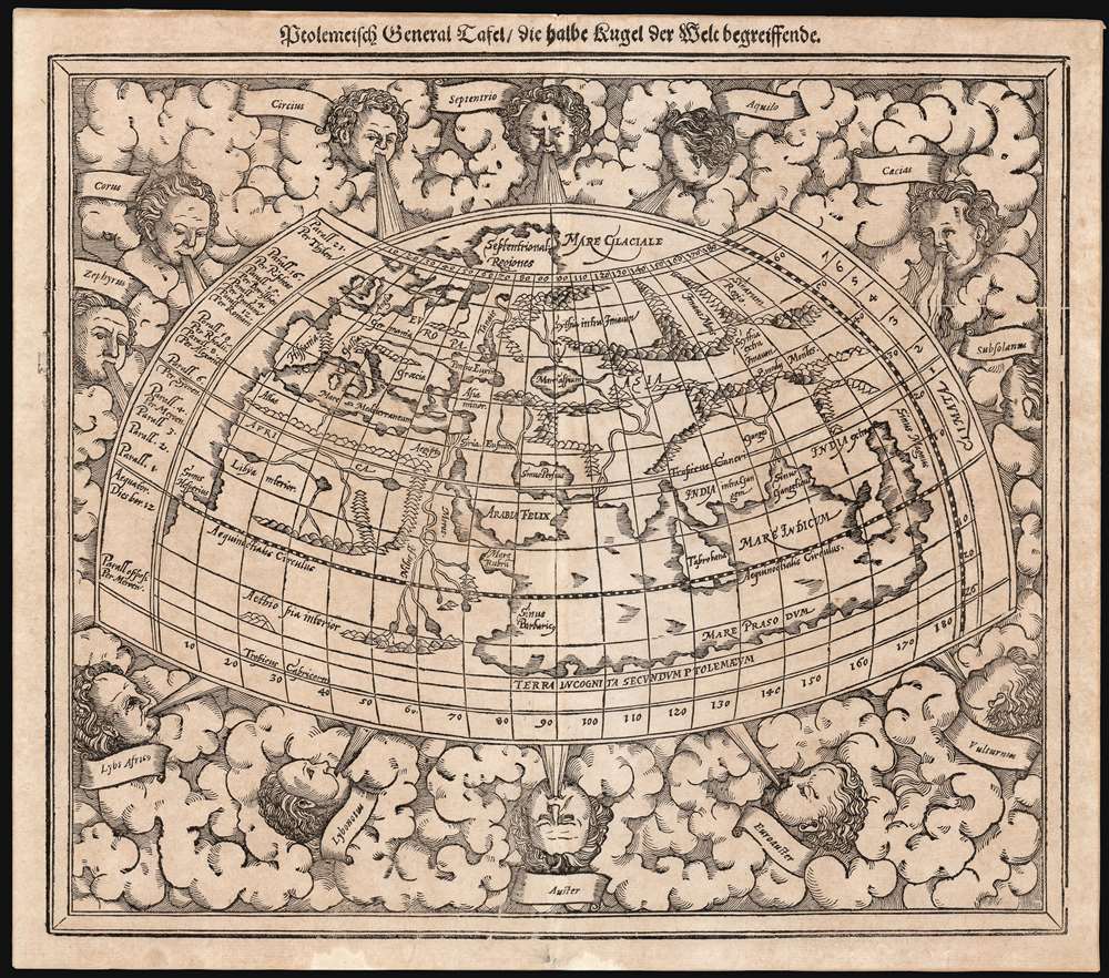
Ptolemeisch General Tafel die halbe Kugel der Welt begreissende.
sold
- Digital Map Information
- Suitable for large format printing
- Full resolution TIFF file
- ICC color profile embedded
- Delivered instantly via download link
An attractive 1614 example of Sebastian Münster's map of the world, according to Claudius Ptolemy. Added to Münster's Cosmographia in 1588, it replaced a similar, albeit smaller and simpler, woodcut which had been in use since 1540. As a Ptolemaic map, it details the Oikumene, the inhabited world as it was known to 2nd century Romans, well before the Age of Discovery. It covers only the 'Old World' from the Atlantic (Pillars of Hercules) to Indochina, and from the Arctic to the Tropic of Capricorn. The map is surrounded by aeoli and clouds. (more details)
The ancient city of Mosul - includes the Great Mosque of al-Nuri, which was destroyed by ISIL in 2017.
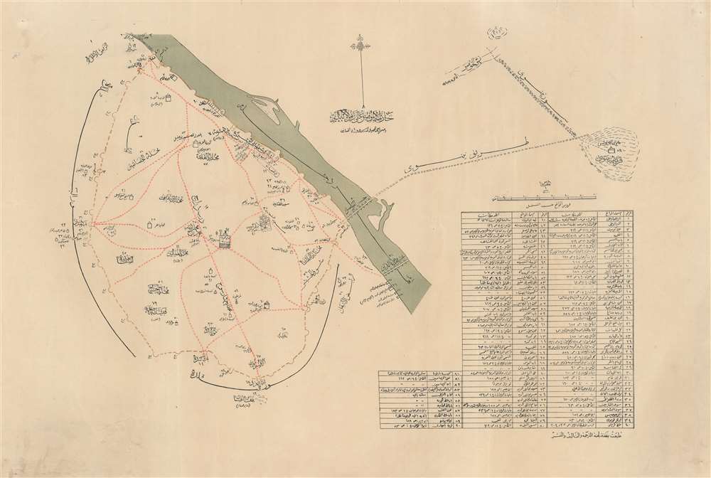
Mosul. / الموصل
sold
- Digital Map Information
- Suitable for large format printing
- File Size: 17.47 MB
- File Type: ZIP / TIFF
- ICC color profile embedded
- Delivered instantly via download link
This is a c. 1910 city plan or map of Mosul, Iraq composed entirely in Arabic by an unknown cartographer. Situated along the west bank of the Tigris River, Mosul is a major city in northern Iraq. Religious sites throughout the city are identified, including mosques and some Christian sites. Every location is numerically identified and corresponds with a table situated in the lower right. (more details)
The Southern Pacific Railroad's to the Panama-Pacific Exposition!
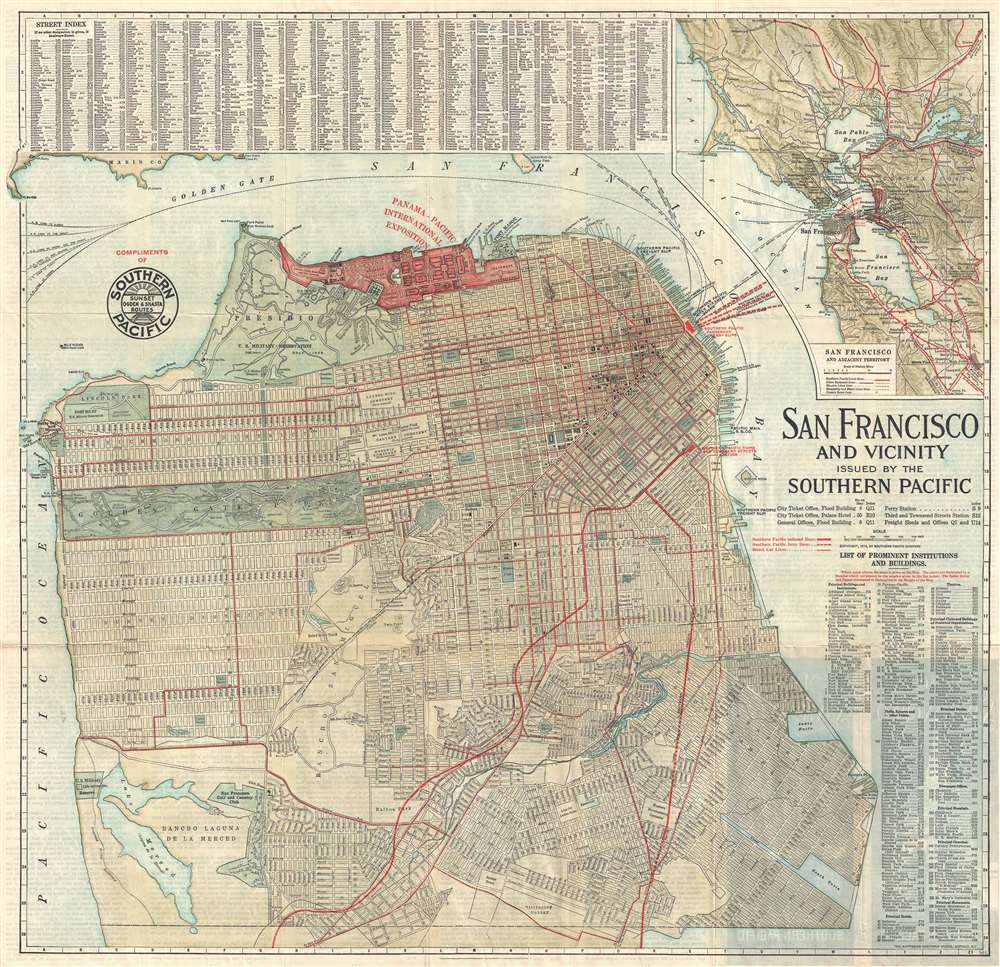
San Francisco and Vicinity Issued by the Southern Pacific.
sold
- Digital Map Information
- Suitable for large format printing
- File Size: 24 MB
- File Type: ZIP / TIFF
- ICC color profile embedded
- Delivered instantly via download link
An attractive first edition 1914 city map or plan of San Francisco, California, issued in by the Southern Pacific Railroad. The map covers the northern part of San Francisco Peninsula from Bellevue Street and Lake Merced to San Francisco Bay. The routes of the Southern Pacific Railroad are highlighted in red, emphasizing their utility in accessing the Panama-Pacific International Exposition. This, however, may not have been the case, as there is another depot near the exposition grounds for ferries, operated by a competitor, that offers direct access to the fair. It is also important to note that the Exposition did not begin until February 1915, and this map was printed in 1914. Thus, it was created while the Panama-Pacific International Exposition was still in the planning phases. Geographically, the map offers impressive detail, all streets and numerous parks and public buildings are identified, even the individual links in the San Francisco Gold and Country Club are noted. Golden Gate Park and the Presidio Military Reservation are particularly well rendered. At the top of the map, the lands reserved for the Panama-Pacific International Exposition are marked and highlighted in red. (more details)
Earliest map of Greece based on contemporaneous knowledge, in a very early issue.
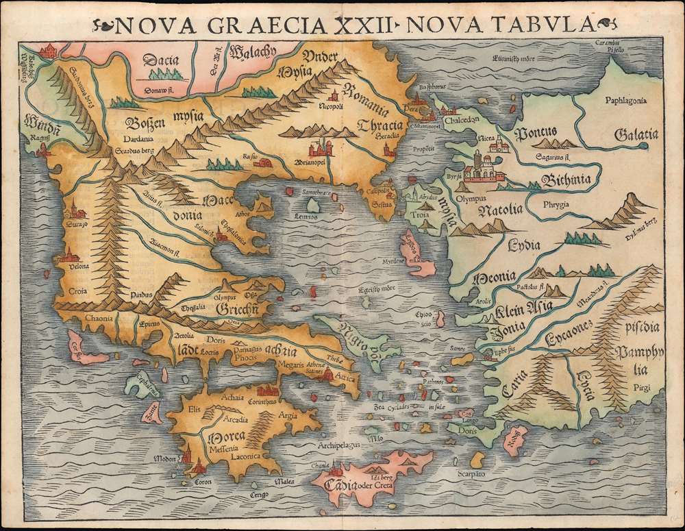
Nova Graecia XXII Nova Tabula.
sold
- Digital Map Information
- Suitable for large format printing
- File Size: 9.2 MB
- File Type: ZIP / TIFF
- ICC color profile embedded
- Delivered instantly via download link
This is a scarce 1545 example of Sebastian Münster's modern map of Greece: the second imprint of the first detailed map specifically of Greece and the Greek Islands based on contemporary geographical information. Münster's Geographia and Cosmographia provided for many years the literate European's only glimpses of the world, and these two works contained several maps with previously unseen contemporaneous knowledge of the areas they depicted. For Münster's readership, this map was the first depiction of Greece not based upon the 2nd century work of Claudius Ptolemy. This map appeared in Geographia as a somewhat late addition: the 1540 and 1542 editions of the work did not include this map. It would appear again in the 1552 Ptolemy (with the added coordinate bars characteristic of that edition.) It first appeared in the 1544 debut edition of Münster's Cosmographia and would appear in all editions of that work until 1578. In that 1544 German edition, the title of the map explicitly states Münster's intent: 'Neüw Griechen land mit andern anstoffenden in lendern/ wie es zu unsern zeiten beschreiben ist' - 'New Greece... as it is described in our era.' (more details)
Exceptional East India Trade nautical chart.
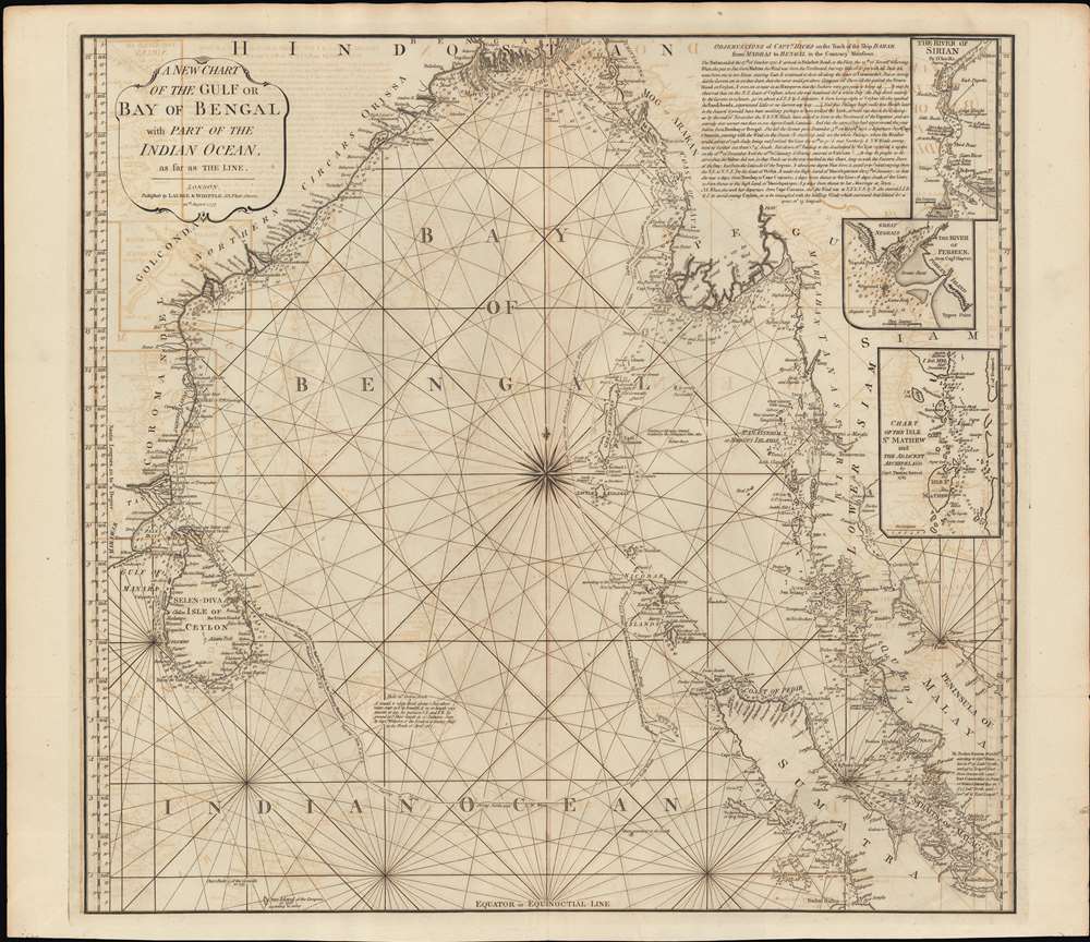
A New Chart of the Gulf or Bay of Bengal with Part of the Indian Ocean, as Far as the Line.
$750.00
Acquire
- Digital Map Information
- Suitable for large format printing
- Full resolution TIFF file
- ICC color profile embedded
- Delivered instantly via download link
This is a fine example of Laurie and Whittle's 1794 nautical chart or maritime map of the Bay of Bengal. The map covers from southeastern India and Ceylon (Sri Lanka) eastward to eastern Malaysia, north as far as the mouth of the Ganges River, and south to central Sumatra. There are three inset maps: The River of Sirian (based on D'Anville), but in fact the modern day Irrawaddy River, Burma / Myanmar; The River Perseen (based on Hayter), in fact the modern day Pathein River, Burma; and the Isle St. Mathew (after Thomas Forrest, 1783), which is probably the modern day Zadetky Island, Burma, but it is not clear. The Andaman and Nicobar Islands are in the center of the Bay, near the wind rose. In the upper right there is a lengthy observational note attributed to Captain Hicks and the ship Bahar on a 1770 voyage from Madras to Bengal in the Monsoon season. (more details)
Connecting the world.
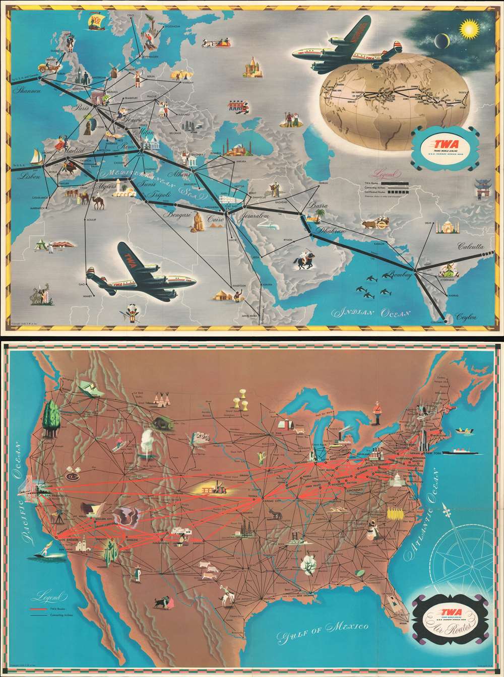
T.W.A. Air Routes.
sold
- Digital Map Information
- Suitable for large format printing
- Full resolution TIFF file
- ICC color profile embedded
- Delivered instantly via download link
This is a 1948 T.W.A. (Trans World Airline) pictorial airline route map of the world. Printed on both sides of one sheet, the recto (front) presents T.W.A.'s routes, along with connecting air routes, in Europe, northern Africa, the Middle East, and India. The verso (back) highlights T.W.A.'s routes across the United States. Pictorial vignettes emphasize cities with famous tourist sites, such as the Arc de Triomphe in Paris, Big Ben in London, New York's iconic skyline, the Golden Gate Bridge in San Francisco, the Grand Canyon in Arizona, the Hagia Sophia in Istanbul, and the Pyramids at Giza in Cairo. Others are marked by activities, like sunbathing in Nice, skiing in Zurich, and bagpipes in Glasgow. Vignettes also illustrate areas not directly served by T.W.A., predominantly in the U.S., with views of Old Faithful, skiers in the Rockys, the White Mountains of New Hampshire, and a Texan cowboy. A globe on the European map follows all T.W.A.'s major routes around the world, from Hong Kong to Bombay. Two Lockheed L-049 Constellations, then the world's most advanced passenger airplane, adorn the European map. The Constellation's iconic three vertical stabilizers make it one of history's most impressive aircraft. (more details)
Depicts the city during its 'silver age' - one of the most prosperous eras in its long history.
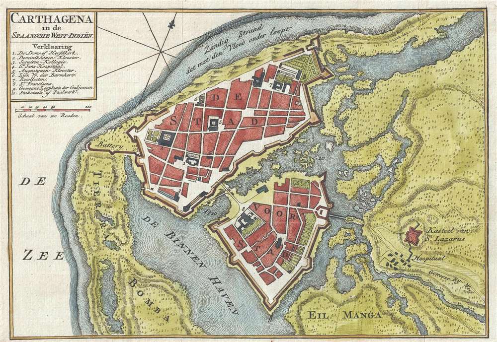
Carthagena in de Spaansche West-Indiën.
sold
- Digital Map Information
- Suitable for large format printing
- DPI: 300
- File Size: 2.35 MB
- File Type: ZIP / TIFF
- ICC color profile embedded
- Delivered instantly via download link
This is a c. 1766 Isaak Tirion map of Cartagena, Colombia, one of the most important port cities in the vast Spanish American Empire. Several locations within the city are numerically identified, with the corresponding index located in the upper-left corner, just below the title. Monasteries, churches, gardens, hospitals, forts, and defensive batteries are among the illustrated locations. The St. Lazarus Castle, located outside the city, and its nearby hospital, are the only buildings identified which are not included in the numerical index. (more details)
The spring training home of the Chicago Cubs beginning in the 1920s.

Avalon Town Santa Catalina Island California.
sold
- Digital Map Information
- Suitable for large format printing
- Full resolution TIFF file
- ICC color profile embedded
- Delivered instantly via download link
This is a 1948 James Wren Lister pictorial bird's-eye view map of Avalon, Santa Catalina Island, California. With Avalon Bay in the foreground, boats and piers in the bay immediately catch the eye. A casino occupies a point in the foreground on the right, while Avalon's streets stretch into the hills. Schools, the post office, City Happ, a golf course, and a ball park are labeled. (The 'ball park' as it is simply labeled, was the spring training home of the Chicago Cubs and was known as Wrigley Field.) Thirty-seven vignette views frame the central image and present numerous aspects of life in Avalon and around Sana Catalina Island, including people enjoying water sports, a baseball player, and a smaller version of the large central map. (more details)
Array of maritime flags.
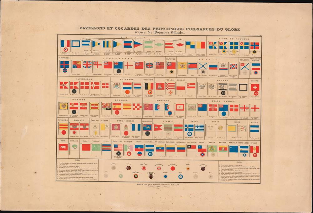
Pavillons et Cocardes des Principales Puissances du Globe.
sold
- Digital Map Information
- Suitable for large format printing
- Full resolution TIFF file
- ICC color profile embedded
- Delivered instantly via download link
This is an 1837 flag chart produced in Paris by Andriveau-Goujon. It shows the naval, merchant, and national or royal flags of European, American, and Asian kingdoms, republics, port cities, and trading assemblies. (more details)