
Early original color issue of one of the most influential maps of the 16th century.
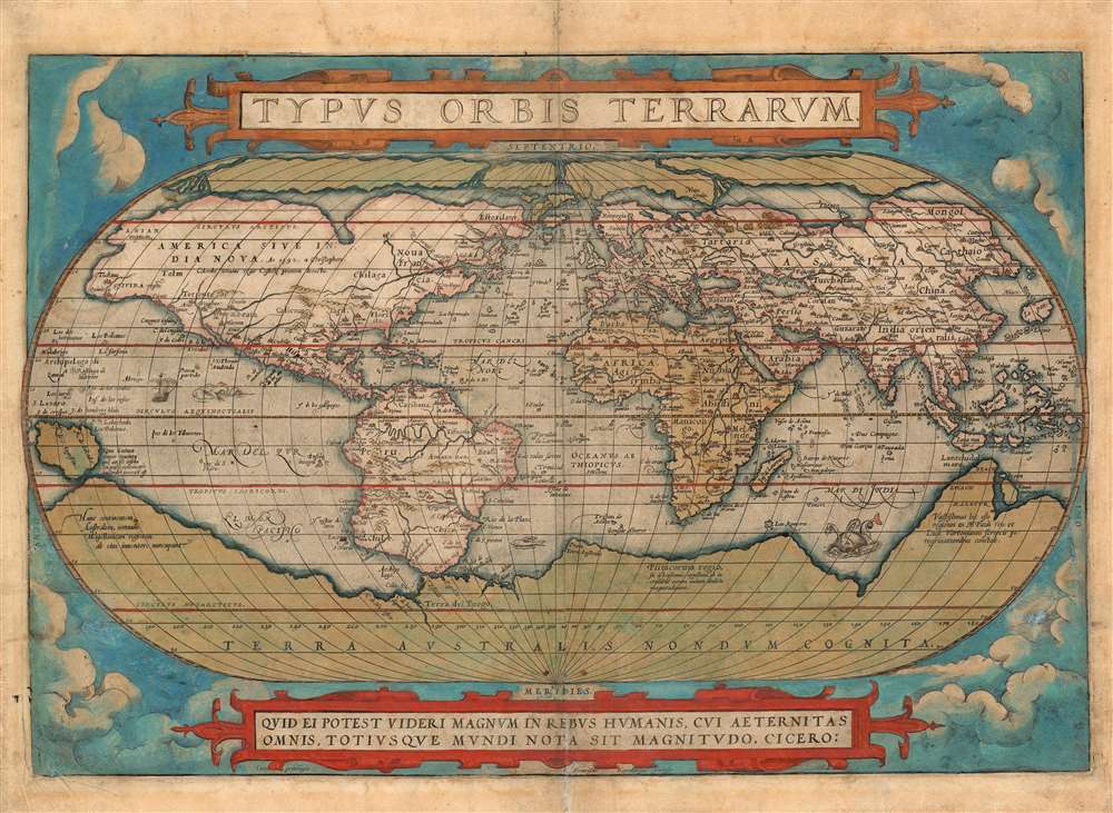
Typus Orbis Terrarum.
sold
- Digital Map Information
- Suitable for large format printing
- Full resolution TIFF file
- ICC color profile embedded
- Delivered instantly via download link
A superbly-colored example of Abraham Ortelius' iconic 1570 map of the world, here in a 1572 edition, still the first state of the first plate. This map is the first map of the world to appear in a standard atlas and is thus of fundamental importance to the history of cartography. It was one of the most widely-seen, and most influential printed maps of the world produced in the sixteenth century. (more details)
Beacon before it was Beacon.

Matteawan, N.Y. 1886.
sold
- Digital Map Information
- Suitable for large format printing
- File Size: 29.44 MB
- File Type: ZIP / TIFF
- ICC color profile embedded
- Delivered instantly via download link
An extremely rare 1886 Lucian Burleigh two-color chromolithograph bird's-view of Beacon, Dutchess County, New York, using its historical name, Matteawan. The view looks southeasterly on Beacon from an imaginary high point over the Hudson River. Coverage extends roughly from modern day Chestnut Street to Mountain Lane. Mount Beacon, for which the city was renamed, rises prominently in background, its vertical elevation exaggerated considerably. Local iconic buildings, many of which still stands such as the Warren S. Dibble Opera House. (more details)
Infographic map of the greatest natural disaster in Budapest history.
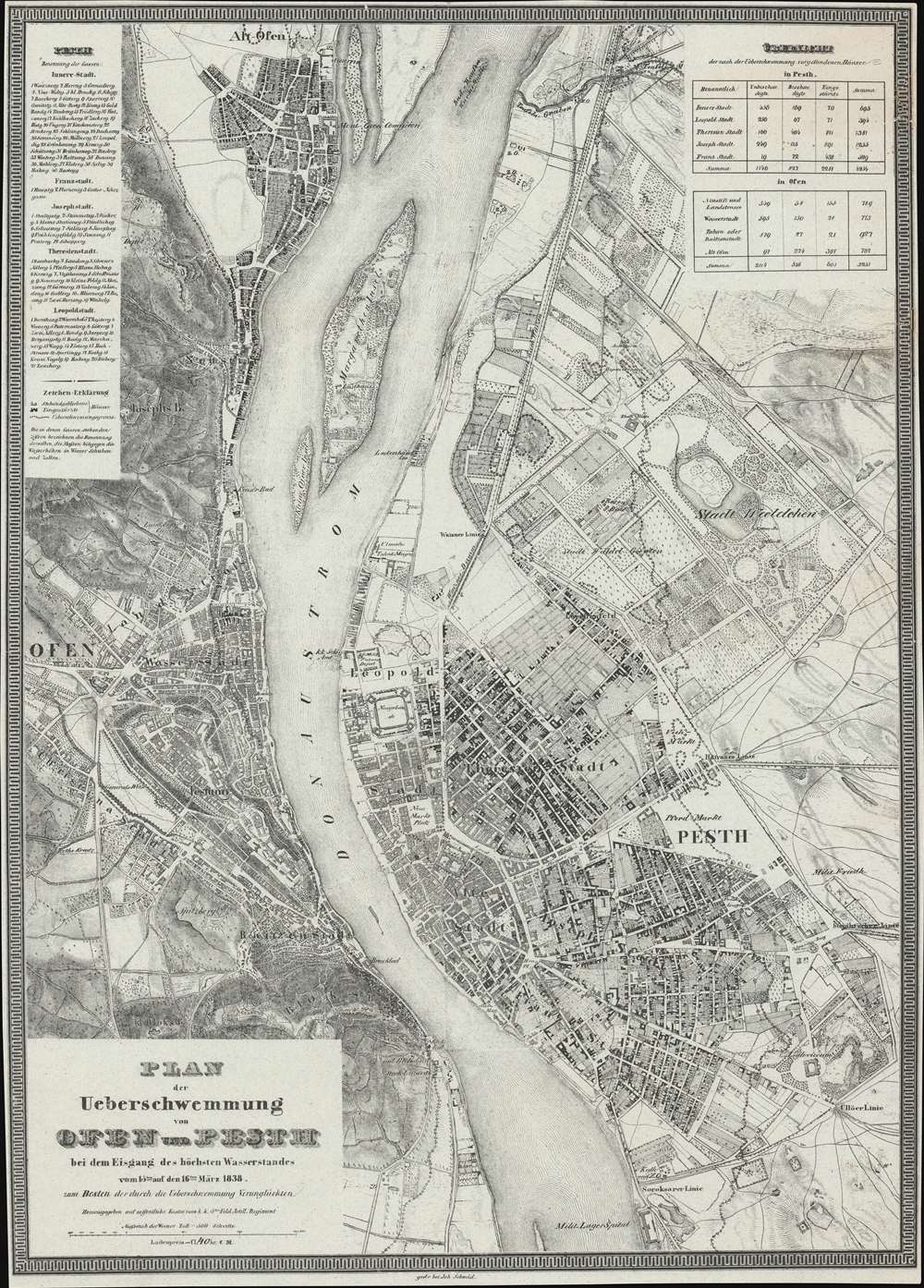
Plan der Ueberschwemmung von Ofen und Pesth bei dem Eisgang des höchsten Wasserstandes vom 15ten auf den 16ten März 1838.
sold
- Digital Map Information
- Suitable for large format printing
- DPI: 600
- File Size: 34.36 MB
- File Type: ZIP / TIFF
- ICC color profile embedded
- Delivered instantly via download link
An extremely rare 1838/1839 infographic map of Budapest, Hungary, issued directly following the disastrous Great Danube Flood of 1838 - likely the greatest natural disaster in Budapest history. Coverage embraces Pest, Buda, and Óbuda. The map shows the high-water marks on both the Buda and Pest sides of the Danube - although the Buda side, being of higher elevation, was mostly unharmed, while the Pest side, a flood plain, was completely destroyed. It also illustrates areas of higher elevation within Pest where residents took refuge. The detail throughout is strikingly granular, with hachured buildings representing surviving structures, and black buildings those that fully collapsed. (more details)
First Printed Modern Map of Asia.
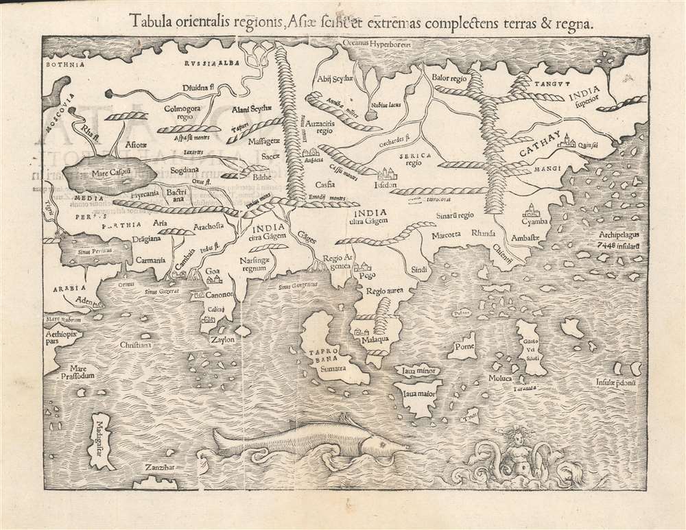
Tabula orientalis regionis, Asiae scilicet extremas complectens terras et regna.
sold
- Digital Map Information
- Suitable for large format printing
- Full resolution TIFF file
- ICC color profile embedded
- Delivered instantly via download link
This is a c. 1552 strike of Sebastian Münster's 1540 map of Asia, the first printed map of that continent based on contemporary data, and the earliest obtainable map of the continent overall. The map depicts the Asian continent from the Caspian Sea and the Persian Gulf to the Pacific Ocean, and from the Arctic Ocean to the Indian Ocean. Although the interior detail is based heavily on Ptolemy, Münster also blends in information gleaned from recent discoveries by Portuguese traders and adventurers, including Vasco da Gama (c. 1460 - 1624). Both the Portuguese outposts of Goa and Calicut, on the Indian subcontinent, are labeled, and the depiction of India is improved, moving closer to a truly accurate depiction, although still undersized. The inclusion of Sri Lanka (Zaylon) as an island is also an improvement; Münster applies Ptolemy's historical name for Sri Lanka - Taprobana - to Sumatra, which is placed correctly to the west of the Malay peninsula. (more details)
Rare Chinese issued pre-war map of Shanghai.

[Recent Detailed Survey Map of New Shanghai]. / 最近實測新上海市詳圖
sold
- Digital Map Information
- Suitable for large format printing
- File Size: 48.16 MB
- File Type: ZIP / TIFF
- ICC color profile embedded
- Delivered instantly via download link
This is a scarce c. 1927 map of Shanghai by the artist and book publisher Shen Shiqiu (沈士秋). It is one of the few Pre-war maps of Shanghai printed by a Chinese rather than Japanese publisher. The map details the central concession area shortly before the 1932 Japanese invasion. The various concession areas are highlighted, with orange indicating the International Settlement and purple the French Concession. An inset in the lower right details the main British Concession area and the Bund. Smaller insets detail the course of the Huang Pu River to is juncture with the Yangtze. (more details)
Tennessee just after the Creek War (1813 - 1814) and the War of 1812 (1812 - 1815).
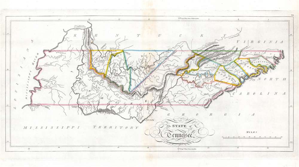
The State of Tennessee.
sold
- Digital Map Information
- Suitable for large format printing
- Full resolution TIFF file
- ICC color profile embedded
- Delivered instantly via download link
This is an 1814 Mathew Carey map of Tennessee issued at the height of the Creek Wars. This is one of the earliest maps of Tennessee to include an embryonic county structure - fine original outline color defines a handful of emerging counties. Nashville and Knoxville are both labeled. A handful of smaller towns are identified on the skeleton road network. Cherokee territory occupies all of western Tennessee and extends east along the southern border to Tennessee's border with North Carolina. (more details)
The Belle Epoch of Phnom Penh.
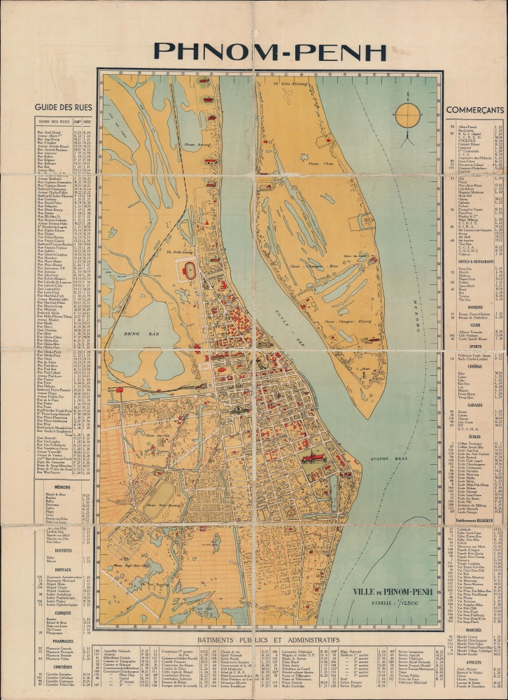
Phnom-Penh.
sold
- Digital Map Information
- Suitable for large format printing
- File Size: 38.37 MB
- File Type: ZIP / TIFF
- ICC color profile embedded
- Delivered instantly via download link
A rare and striking c. 1935 map of Phnom Penh, capital of Cambodia. Covering the city from the Mekong to Beng Kâk and the Phnom Penh - Poipet Railway, the map represents a golden era of development for Phnom Penh, as major urban development projects, canals, and dredging efforts drained the swampy flood plain. A street and building index surrounds the piece and important structures are illustrated pictorially. (more details)
Outings for all summer long...

Panoramic View of the Route of the Aurora, Elgin and Chicago Railway, The Great Thrid-rail Double-track Electrice Railroad between Chicago and the Fox River Valley Connecting at Aurora, Elgin, and Batavia with the lines of the Elgin Aurora and Southern Traction Co.
sold
- Digital Map Information
- Suitable for large format printing
- Full resolution TIFF file
- ICC color profile embedded
- Delivered instantly via download link
A striking c. 1910 Rand McNally chromolithograph view of Chicago and lands west as far as the Fox River. The view illustrates the routes and coverage of the Chicago, Aurora, and Elgin Railroad, Chicagoland's largest Pre-WWI interurban electric railroad. The verso features timetables, a map of the Loop, and promotional material regarding the Fox River Valley's 'unspoiled country' and the 'peaceful valley'. (more details)
The routes of two short-lived railroads.
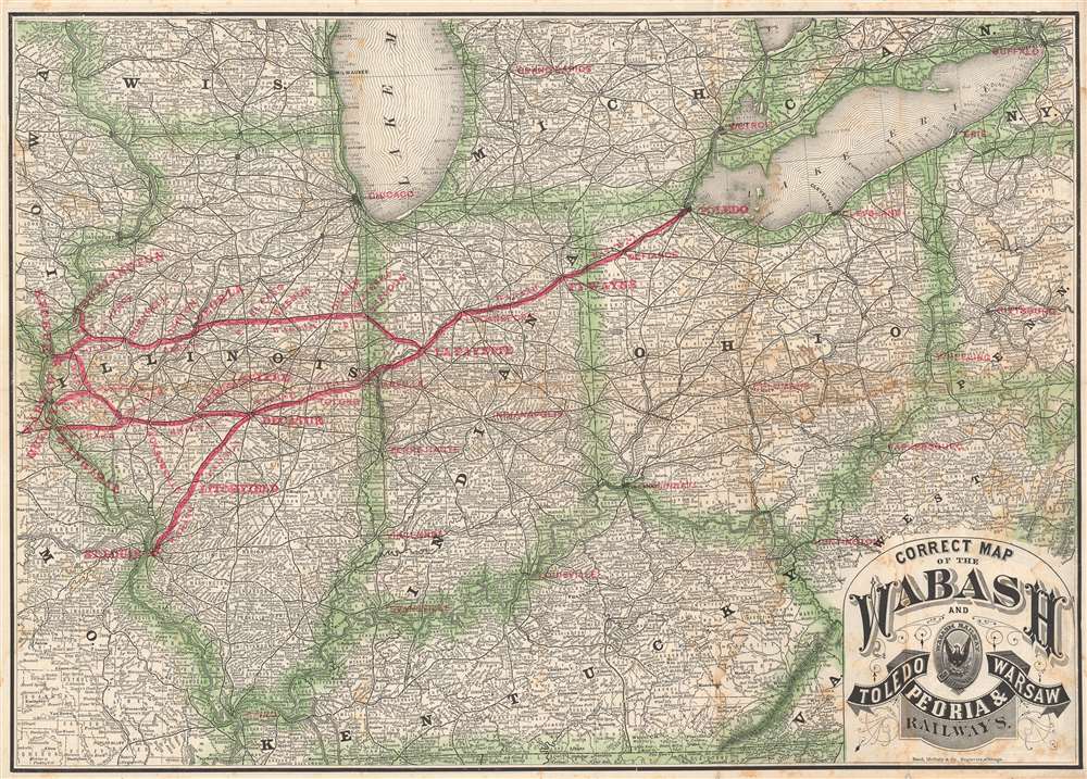
Correct Map of the Wabash and Toledo, Peoria, and Warsaw Railways.
sold
- Digital Map Information
- Suitable for large format printing
- Full resolution TIFF file
- ICC color profile embedded
- Delivered instantly via download link
This is an 1878 Rand McNally map of Illinois, Indiana, and Ohio illustrating the Wabash Railway and the Toledo, Peoria, and Warsaw Railway. Red overprinting highlights the routes and block lettering marks major stops, including St. Louis, Hannibal, Quincy, Springfield, Lafayette, Fort Wayne, and Toledo. Other major cities, such as Cleveland, Detroit, Cincinnati, Chicago, Louisville, and Cairo, are marked. Competing and connecting railroads are traced as well. (more details)
Earliest map of Czech, earliest map with a key!

Bohemiae Nova Descriptio Tabula.
sold
- Digital Map Information
- Suitable for large format printing
- Full resolution TIFF file
- ICC color profile embedded
- Delivered instantly via download link
This is Munster's 1545 map of Bohemia, the earliest acquirable printed map of what is now the Czech Republic. This map appeared in the 1572 Latin edition Munster’s Cosmographia Universalis, a work notable for presenting to a broad lay audience many of the first printed maps based on contemporaneous surveys and toponymy, rather than data from classical sources. Munster’s source for this map was Nicolaus Claudianus’ 1518 map of Bohemia, which now exists in only one known surviving example. Munster's map is the only version of Claudianus' map available to the collector. (more details)
The orbits of the planets and comets.
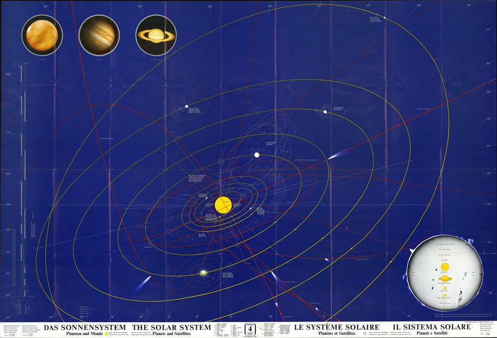
Das Sonnensystem : Planeten und Monde - The Solar System : Planets and Satellites - Le Système Solaire : Planètes et Satellites - Il Sistema Solare : Pianeti e Satelliti.
sold
This is a 1970/1976/1977 Hallwag map of the Solar System. THe Sun appears just below center, and yellow lines trace the orbit of the planets, including Pluto. Pluto and Neptune's orbits are so large that both extend off the bottom of the sheet. All planets are labeled in German, English, French, and Italian. Thin gray lines surrounding each indicate moons. Red lines highlight the orbits of numerous comets, all of which are identified. A diagram in the lower right provides a visual representation of the size of the Sun relative to the size of each planet. Color renderings of Mars, Jupiter, and Saturn are situated in the upper left. Information concerning the map's scale, notations used, and the statement that the planets' positions were taken on January 1, 1976, appear along the bottom border. (more details)
Names Daniel Boone's ephemeral settlement of Boonsborough.

A Map of the United States of America, with Part of the Adjoining Provinces from the latest Authorities.
sold
- Digital Map Information
- Suitable for large format printing
- Full resolution TIFF file
- ICC color profile embedded
- Delivered instantly via download link
This is a scarce 1817 map of the United States. The map covers the United States east of the Mississippi, with an ephemeral early state configuration limited to the original 13 colonies, as well as Kentucky and Tennessee. Further west, the map is dominated by an expansive Western Territory extending from the Florida boundary to Lake Superior. It is most significant for its early illustration of Kentucky and Tennessee, including its unique inclusion of Daniel Boone's (1734 - 1820) ephemeral settlement Boonesborough. The map was engraved for inclusion in the 1817 edition of William Robertson uncompleted History of America. (more details)
Railroads in the central United States at the beginning of the 20th century.
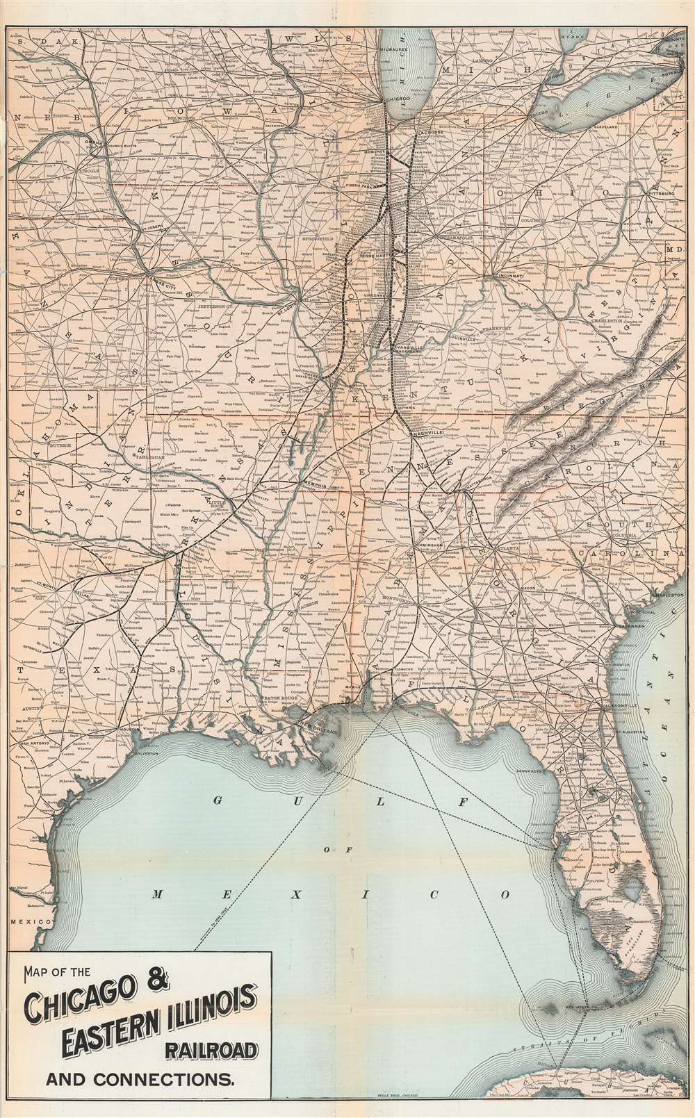
Map of the Chicago and Eastern Illinois Railroad and Connections.
sold
- Digital Map Information
- Suitable for large format printing
- File Size: 39.78 MB
- File Type: ZIP / TIFF
- ICC color profile embedded
- Delivered instantly via download link
This is a 1901 Poole Brothers / Chicago and Eastern Illinois Railroad map of the central United States. Coverage extends from San Antonio, Texas east to Charleston, South Carolina and Buffalo, New York and from Madison, Wisconsin south to Havana, Cuba. The map highlights the routes of the Chicago and Western Railroad in Illinois and Indiana, along its connections to the Louisville and Nashville Railroad. Stops throughout are identified, with La Crosse, Terre Haute, Evansville, Thebes, and Chicago emphasized. (more details)
Robber Barons carving up the country.

Überlässt ihnen den ganzen Rummel - und damit basta!
sold
- Digital Map Information
- Suitable for large format printing
- Full resolution TIFF file
- ICC color profile embedded
- Delivered instantly via download link
This is an 1882 Frederick Opper Puck political cartoon map of the United States being carved up by Gilded Age millionaires. Published in a German language edition of Puck magazine, the cartoon features robber barons Jay Gould, William Henry Vanderbilt, Russell Sage, and Cyrus West Field dividing the country for personal gain. Vanderbilt physically cuts his slice of the country with a large knife, while Sage taunts European monarchs with proposals for buying Europe. Field and Gould play dice in the Northeast, likely rolling to see who would control what. Railroads, which played a critical role in building these four men's (and others like them) incredible fortunes, appear across the country. (more details)
Uncommon map of Florida and Carolina on the cusp of the French and Indian War.

La Floride divisee en Floride et Caroline. Par le Sr. Robert de Vaugondy, Fils de Mr. Robert Geogr. ordin. du Roi.
sold
- Digital Map Information
- Suitable for large format printing
- Full resolution TIFF file
- ICC color profile embedded
- Delivered instantly via download link
This is a hand colored 1749 Didier Robert de Vaugondy map of Florida, Georgia, and Carolina published just a few years prior to the French and Indian War (1754 – 1763). The map depicts from French Louisiana on the left to the Atlantic Ocean on the right and from mouth of the Chesapeake Bay to the Florida Keys. Spanish Florida extends west no farther than Pensacola. Florida is peninsular and conical, breaking up south of Tampa (which is noted) in an attempt to illustrate the Everglades. Numerous American Indian Villages, as well as the cities Pensacola and St. Augustine in Florida, Savannah (Savana) in Georgia, and Charleston (Charlestown) in South Carolina, are identified.
The coastline is depicted in detail, particularly along the Carolinas. Numerous rivers are included in both Florida and the Carolinas. Georgia (Georgie) is labeled, although there is no defined boundary between Georgia and the Carolinas. The Bahamas are depicted to the right of Florida and identified as the Lucayes. (more details)
The coastline is depicted in detail, particularly along the Carolinas. Numerous rivers are included in both Florida and the Carolinas. Georgia (Georgie) is labeled, although there is no defined boundary between Georgia and the Carolinas. The Bahamas are depicted to the right of Florida and identified as the Lucayes. (more details)
Dramatic, Pictorial Long Island with Nautical and Historical Vignettes.
A Map of Long Island.
sold
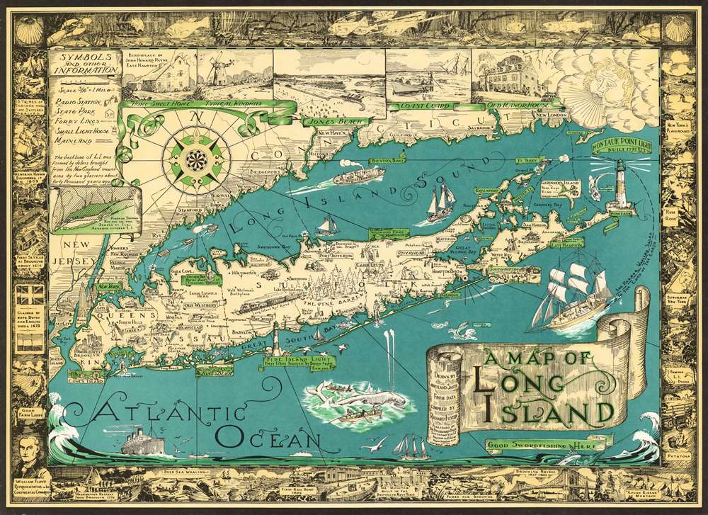
This is a charming 1961 pictorial map of Long Island by Courtland Smith. This historical map covers from New London in Connecticut and Fishers Island south as far as the Lower New York Bay and Staten Island. Long Island is depicted in its entirety from Brooklyn and Queens east to Montauk. Throughout, the map notes cities, towns, beaches, radio stations, parks, ferry lines, lighthouses and several other important landmarks,scenes and activities. Several landmarks have been attractively illustrated, including the Montauk Point Light, Fire Island Light, Southampton, Coney Island, etc. Facts about Gardiner's Island - 'here Capt. Kidd buried loot' and Oyster Park 'Burial Place of Theodore Roosevelt' are noted.
The top left quadrant of the map includes the note, 'The backbone of L.I. was formed by debris brought from the New England Mountains by two glaciers about forty thousand years ago' as well as an inset featuring a 'Diagram showing how far the two Stages of Ice Advance covered L.I.' Five beautiful illustrated views along the top border include the Birthplace of John Howard Payne East Hampton, a Typical Windmill, Jones Beach, Coast Guard and Old Manor House. A decorative compass rose and an art deco style wind figure are also featured. In Long Island Sound and the Atlantic Ocean, pictorial illustrations of Boston Boat, ships, striped bass, a swordfish, whale fishing, and the Sag Harbor Whalers that 'sailed to the ends of the Earth' can be seen. The map is surrounded by an elaborate border, with underwater scenes at the top and historic events and places along the remaining three sides, including the '13 Tribes of Indians when First Settlers Arrived,' 'First Settled at Brooklyn in 1614,' 'First Rail Road 1836,' 'Brooklyn Bridge 1867-1883,' etc. (more details)
The top left quadrant of the map includes the note, 'The backbone of L.I. was formed by debris brought from the New England Mountains by two glaciers about forty thousand years ago' as well as an inset featuring a 'Diagram showing how far the two Stages of Ice Advance covered L.I.' Five beautiful illustrated views along the top border include the Birthplace of John Howard Payne East Hampton, a Typical Windmill, Jones Beach, Coast Guard and Old Manor House. A decorative compass rose and an art deco style wind figure are also featured. In Long Island Sound and the Atlantic Ocean, pictorial illustrations of Boston Boat, ships, striped bass, a swordfish, whale fishing, and the Sag Harbor Whalers that 'sailed to the ends of the Earth' can be seen. The map is surrounded by an elaborate border, with underwater scenes at the top and historic events and places along the remaining three sides, including the '13 Tribes of Indians when First Settlers Arrived,' 'First Settled at Brooklyn in 1614,' 'First Rail Road 1836,' 'Brooklyn Bridge 1867-1883,' etc. (more details)
Scarce city plan of Tampa.

Welcome to Tampa Hillsborough County, Florida. Compliments of Tampa Federal Savings and Loan Association.
sold
This is a 1969 Namco Publishing Company city plan or map of Tampa, Florida. Depicting from Lake Charles south to MacDill Air Force Base and from Sheldon Road to Clair Mel. Highways and major city streets are highlighted in red, allowing for easy identification of the major thoroughfares. A light pink hue marks Tampa proper, with all areas outside the city limits illustrated in white. An alphabetical index of Florida's counties appears in the upper left with population and the county seat. (more details)
Highpoint of Russian Harbin.
ПЛАНЬ г. ХАРБИНА и ФУДАДЯНА. / Plan of Harbin and Fudadyan.
sold
- Digital Map Information
- Suitable for large format printing
- File Size: 61.88 MB
- File Type: ZIP / TIFF
- ICC color profile embedded
- Delivered instantly via download link
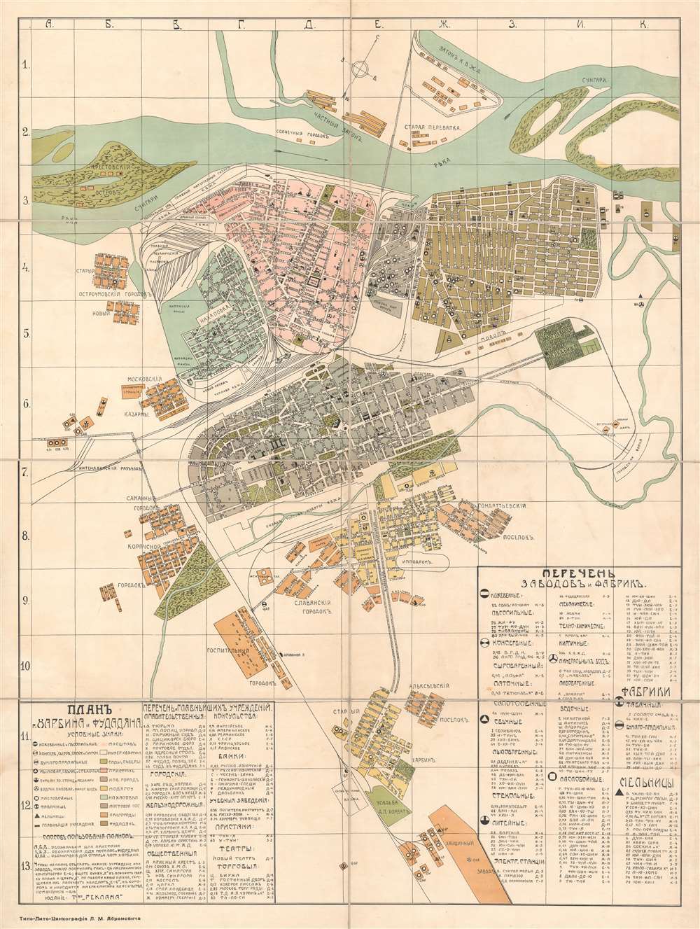
This is a c. 1916 Lev Markovich Abramovich large-scale administrative city plan or map of Harbin (哈尔滨 / Харби́н), China. Composed in art nouveau styled Cyrillic, the map depicts China's most 'Russian' city during the ephemeral period of Russian control between the Russo-Japanese War (1904 - 1905) and Bolshevik Revolution (1917 - 1923). As evidenced by the map's authorship, this was also the highpoint of Judaism in Harbin, then known as the 'Jerusalem of the East'. Harbin Jews, like the mapmaker here, Abramovich, were exiled from Russia, but became influential in Harbin. Orientation is to the northeast, with the Songhua River at top, employing color coding to highlight neighborhoods and an icon system for significant sites, including breweries, banks, consulates, theaters, wells, and government buildings. The all-important railroad lines are illustrated throughout. Although undated, the map can only have been made between 1915 and 1919, reflecting the development of city at that time, as well as the need for a large-scale administrative plan in Russian - as by 1920, Chinese officials had taken over most positions of power and influence and any administrative map would have been in Chinese. (more details)
Manifest Destiny.
Map of the United States Compiled from the most Authentic Sources.
sold
- Digital Map Information
- Suitable for large format printing
- Full resolution TIFF file
- ICC color profile embedded
- Delivered instantly via download link
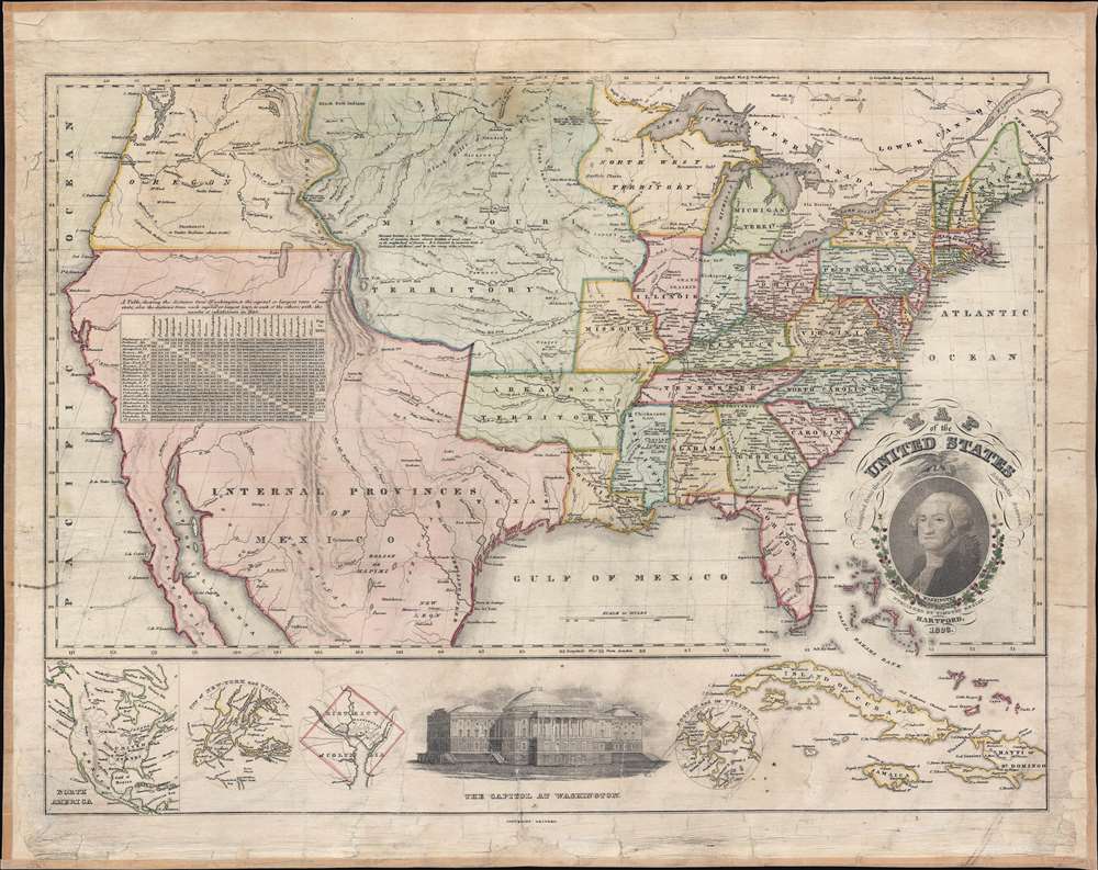
This is Timothy Ensign's 1829 map of the United States - one of the earliest to illustrate the United States stretching to the Pacific. Generally known as the 'Washington Map' for the portrait of George Washington in the lower right, Ensign's map covers the United States from Oregon to the Atlantic and from Canada to Mexico. As this map predates the Texas Revolution, the Mexican American War, and the 1846 Treaty of Guadeloupe-Hidalgo, all of the southwest, including California, Arizona, New Mexico, Nevada, Utah, and Texas are part of Mexico. (more details)
Early Amherst College.
Amherst, Mass. 1886.
sold
- Digital Map Information
- Suitable for large format printing
- File Size: 40.69 MB
- File Type: ZIP / TIFF
- ICC color profile embedded
- Delivered instantly via download link
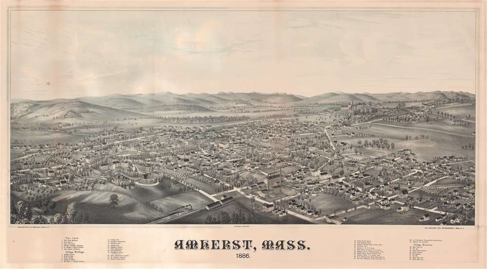
A rare 1886 two-color chromolithograph bird's-eye view map of Amherst, Massachusetts by the prominent viewmaker Lucien Rinaldo Burleigh. The view looks on Amherst from a fictional highpoint to the southwest, roughly over the modern-day campus of Amherst College. The Massachusetts Agricultural College (UMass Amherst) is also noted. In the town itself all streets are labeled, and some 43 buildings are numerically keyed to a table in the lower margins. In the foreground, the New London and Northern Railroad steams past two large basketry mills towards Amherst Station. The hills of the Holyoke Range roll off into the distance, in all conveying the image of a prosperous college town with a growing industrial base. (more details)