
Do You Speak Princetonian?

Princeton University.
sold
- Digital Map Information
- Suitable for large format printing
- File Size: 26 MB
- File Type: ZIP / TIFF
- ICC color profile embedded
- Delivered instantly via download link
This is a scarce 1906 photogravure Richard Rummell view of Princeton University. Overlooking campus from a point high above today's Rockefeller College and Nassau Street, Alexander Hall and Maclean House appear immediately on the left. On the right, the first recognizable buildings are Blair and Buyers Halls and the Blair Arch. The old Halstead Observatory appears in front of Blair Hall, which is where Joline Hall stands today. Witherspoon Hall appears immediately behind the Blair Arch. Edwards Hall is partially blocked by Witherspoon Hall and Edwards does the same thing to Dod Hall. Both Little Hall and the Dillon Gym appear to the right of Edwards and Dod, and Princeton's railroad station adorns the right border with several horse-drawn carriages waiting. Returning to Alexander Hall at the center, Stanhope Hall is blocked by trees and Nassau Hall with its iconic belfry. East Payne Hall and Chancellor Green, then Princeton's library, are to the left of Nassau Hall. Dodge Hall appears to the right of East Payne Hall and McCosh Hall is illustrated to the left and behind both Didge Hall and East Payne Hall. 1879 Hall is recognizable in the background on the left. (more details)
Celebrates the Statue of Liberty's Centennial.
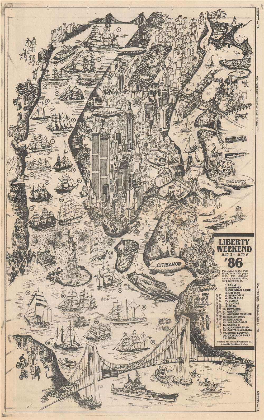
Liberty Weekend July 3 - July 6 '86.
sold
This is a 1986 Dan Cioca pictorial map of New York City celebrating Liberty Weekend. Liberty Weekend took place between July 3, 1986 and July 6, 1986 and celebrated the 1984 renovation and centenary of the Statue of Liberty. The Statue of Liberty is prominently illustrated surrounded by bursting fireworks. The World Trade Center, the Empire State Building, the Chrysler Building, Rockefeller Center, Lincoln Center, and the Metropolitan Museum of Art are all identifiable. New York's iconic bridges also hold prominent places, with the Brooklyn Bridge, Manhattan Bridge, and Queensboro crossing the East River between Manhattan and Brooklyn. The Verrazzano-Narrows Bridge appears prominently in the foreground. (more details)
Detailed ribbon map of the Hudson River Valley.
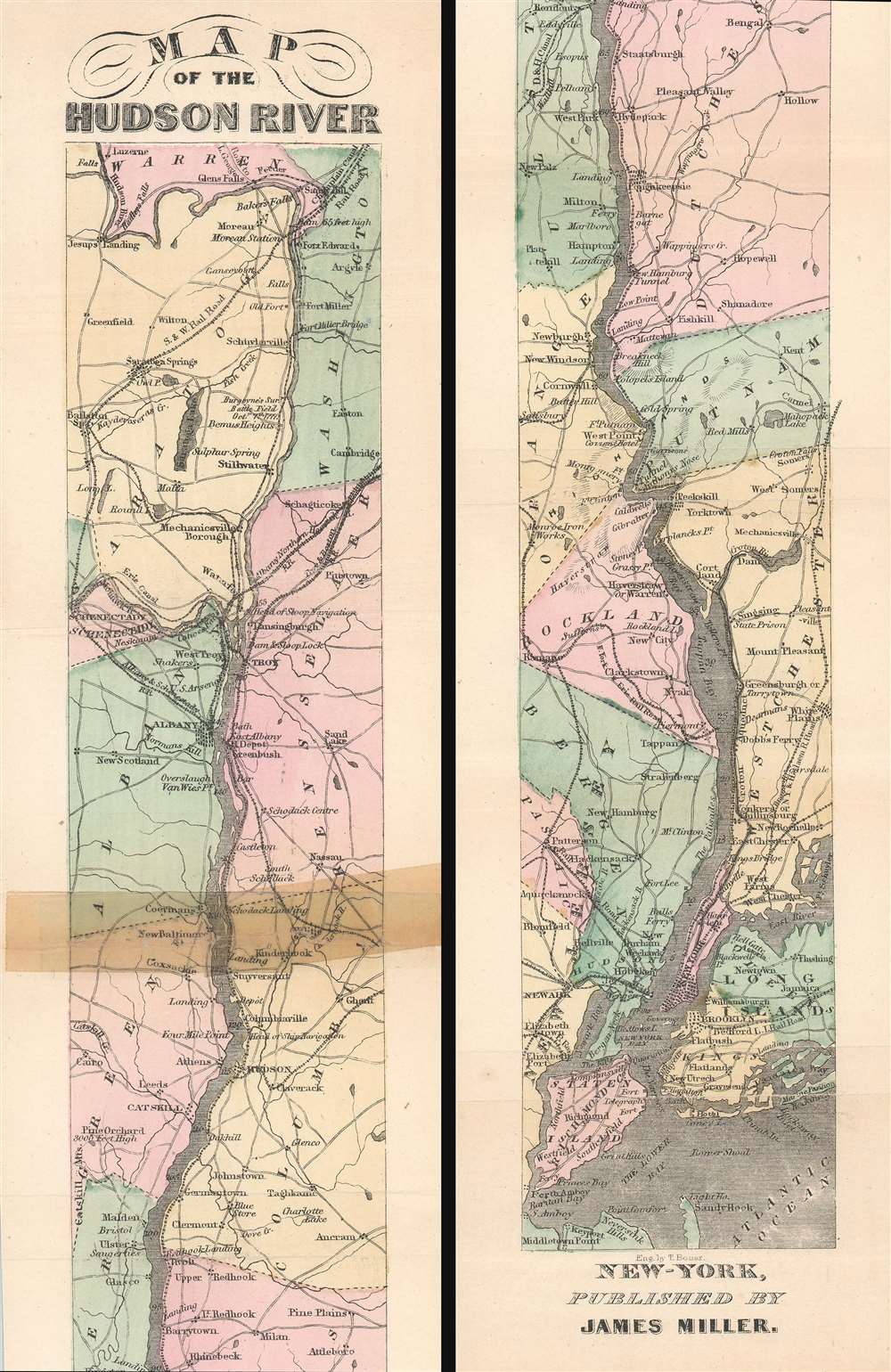
Map of the Hudson River.
sold
- Digital Map Information
- Suitable for large format printing
- File Size: 5.8 MB
- File Type: ZIP / TIFF
- ICC color profile embedded
- Delivered instantly via download link
This is a scarce 1866 ribbon map of the Hudson River, New York by James Miller. The map depicts the course of the Hudson River from Lake Luzerne south as it empties into Upper New York Bay. It also illustrates the numerous towns, cities, and counties along its banks, including the New York state capital of Albany, Troy, Hudson, Kingston, Poughkeepsie, Peekskill, White Plains, Yonkers, and New York City. Manhattan, Brooklyn, Staten Island and Long Island are also illustrated. (more details)
Likely published within days of the D-Day landings in Normandy, France.

Dated Events Invasion Map of Fortress Europe. Seventh Edition.
sold
- Digital Map Information
- Suitable for large format printing
- Full resolution TIFF file
- ICC color profile embedded
- Delivered instantly via download link
This is a 1944 Stanley Francis Turner pictorial map of Europe just after the D-Day invasion of France. This is the first edition of Turner's 'Dated Events War Map' series to depict the D-Day invasions, published only days after the landings in France. (more details)
A lovely pictorial map of the Hawaiian Islands.
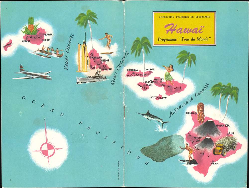
Hawaï. Programme 'Tour du Monde'.
sold
This is a 1962 Association Française de Géographie pictorial map of Hawaii. Part of the Association's Programme 'Tour du Monde', this beautiful piece would have been the cover for a short booklet about Hawaii. Pictorial vignettes highlight aspect of life in the Hawaiian Islands, including surfing, fishing, and hula dancing. Palm trees and pineapples evoke Hawaii's tropical climate and the King Kamehameha statue on Oahu reflects the archipelago's history. A battleship references the U.S. Navy's presence at Pearl Harbor and the modern airliner suggests the ease with which tourists could now visit this island paradise. (more details)
Comical vignettes highlights Tampa's many attractions.

Points of Interest In and Around Tampa Hillsborough County Florida.
sold
- Digital Map Information
- Suitable for large format printing
- File Size: 20.78 MB
- File Type: ZIP / TIFF
- ICC color profile embedded
- Delivered instantly via download link
This is a c. 1947 Tampa Chamber of Commerce city map or plan of Tampa, Florida. The map depicts the region from Tampa Bay to the Temple Terrace Golf Club and the Florida Christian College and from Fowler Street and the Tampa Golf and Country Club to MacDill Air Force Base. Meant to be a tourist map, pictorial vignettes populate the map and highlight area attractions and activities. Numerous golf courses are marked, as are farmer's markets, baseball stadiums, tennis courts, and beaches. Florida's celebrated orange groves also make an appearance. Other sites, that most likely are not on the average tourist's itinerary, are also illustrated, including cigar factories, a cement plant, the police pistol range, and dairy cattle. Only major streets and avenues are depicted, making this map less about getting around Tampa and more about what there is to see and do. An inset map of downtown Tampa is situated in the lower left corner details this part of the city and features vignettes of Union Station, the bus terminal, city hall, the Greater Tampa Chamber of Commerce, the University of Tampa and the American Hellenic League. (more details)
Santa adventures through the State of Good Cheer to 'Your House.'

A Road Map for Santa. State of Good Cheer.
sold
- Digital Map Information
- Suitable for large format printing
- Full resolution TIFF file
- ICC color profile embedded
- Delivered instantly via download link
This is a c. 1940 Forget-Me-Not Greeting Cards pictorial fantasy map of the State of Good Cheer. Published as a Christmas card, the map illustrates the route from the North Pole (complete with a Pole Cat) to 'Your House'. Along the way, a traveler (in this case Santa himself) crosses the Pleasant Bridge over the Oceans of Happiness where a 'Christmas Seal' and a 'Whale of a Good Time' live. Then Santa follows J'oy Shore Drive' to 'Good Luck Avenue' (bordered by a field of four-leaf clovers) and makes his way to the 'Lane of Good Wishes'. 'Dreams Come True Park' sits off to one side of the 'Lane of Good Wishes' not far from 'Gladness Square' where 'Christmas Belles' swoon over 'A Dandy Wish'. The 'Street of Good Friends' passes by the 'Ladder of Success' leaning against a 'Christmas Tree' and 'Ye Old Wishing Well' before finally arriving at 'Your House'. 'Holy Smoke' rises out of the chimney and everyone inside is having a 'Merry Christmas and Happy New Year'. (more details)
Tourist itineraries in Tampa.

Tampa One-day, year-round Treasure Tours.
sold
This is a c. 1960 Greater Tampa Chamber of Commerce pictorial tourist map of Tampa, Florida. Promoting 'treasure tours' around Tampa and the surrounding area, pictorial vignettes highlight attractions, activities, and other local highlights. Forty-eight locations are numerically identified and correspond with an index situated along the right border. Among the labeled attractions include Ybor City, the Tampa Public Library, the University of South Florida, and Tampa Stadium. Detailed itineraries for the first- and second-day tours are situated between the map and the location index. Colored lines mark the routes for each day's 'adventure'. A different vignette occupies each corner and illustrates an important historical figure with ties to Tampa. Proceeding counterclockwise from the top left, these include the 'extinct Calusa Indians', Ponce de Leon, Teddy Roosevelt and his Roughriders, and Jose Marti, the Father of Cuban Independence. A map of the greater Tampa area occupies the right third of the sheet on verso and proposed routes for Day Four through Day Seven are highlighted in different colors. Vignettes of some of the proposed activities, including a family frolicking on the beach, add appeal to each day's journey. Detailed itineraries occupy the remaining two thirds of the sheet. (more details)
A Great Rarity of 16th Century Venetian Engraving
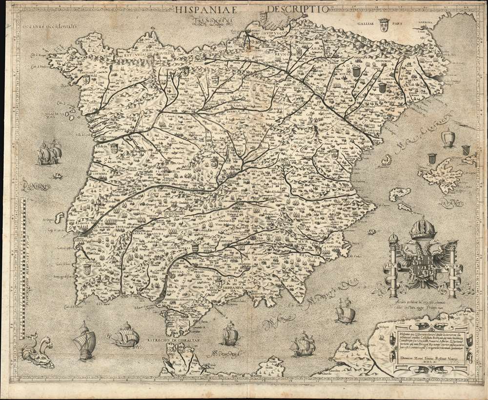
Hispania Descriptio / Hispania, quae et Iberia in ulteriore dividit ac citeriorem...
sold
- Digital Map Information
- Suitable for large format printing
- Full resolution TIFF file
- ICC color profile embedded
- Delivered instantly via download link
This is a beautiful, rare map of Spain engraved in 1560 by Domenico Zenoni (Zenoi.) It is among the earliest acquirable detailed maps of Spain based on contemporaneous knowledge. It is, moreover, a superb example of the heights the engraver's art reached in 16th century Venice. The oceans are lightly stippled, allowing for its calligraphy to be clearly legible throughout. Cities and mountain regions are shown pictorially. Each of the subordinate realms of Spain are given their respective armorial crests, and the seas are sailed by eight beautifully realized ships, and menaced by three monsters - one of which resembles nothing so much as a dog. (more details)
The earliest map to attempt the illustration of ocean currents - and the subterranean connections between the world's oceans!
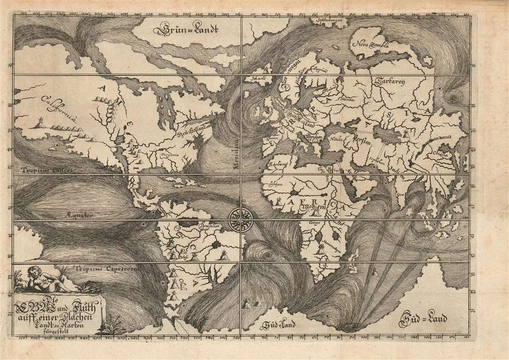
Die Ebbe und Fluth auff einer flachen Landt-Karten fürgestelt.
sold
- Digital Map Information
- Suitable for large format printing
- Full resolution TIFF file
- ICC color profile embedded
- Delivered instantly via download link
This is the rare, 1675 first plate of Eberhard Werner Happel's map of the world. This striking, unique engraving was 'identified as the earliest attempt to trace 'the more important ocean currents of the world' (The World Encompassed). Happel intended this map to illustrate not only the existence of ocean currents, but their causes: underground oceans, rivers, and volcanic activity, surely, were the cause of the baffling movements of the world's waters. To this end the map also illustrates no fewer than eighteen dramatically engraved volcanoes, at least twenty-four whirlpools, and four speculative subterranean connections between major bodies of water via eight titanic maelstroms. (more details)
Best 1820s map of the region.
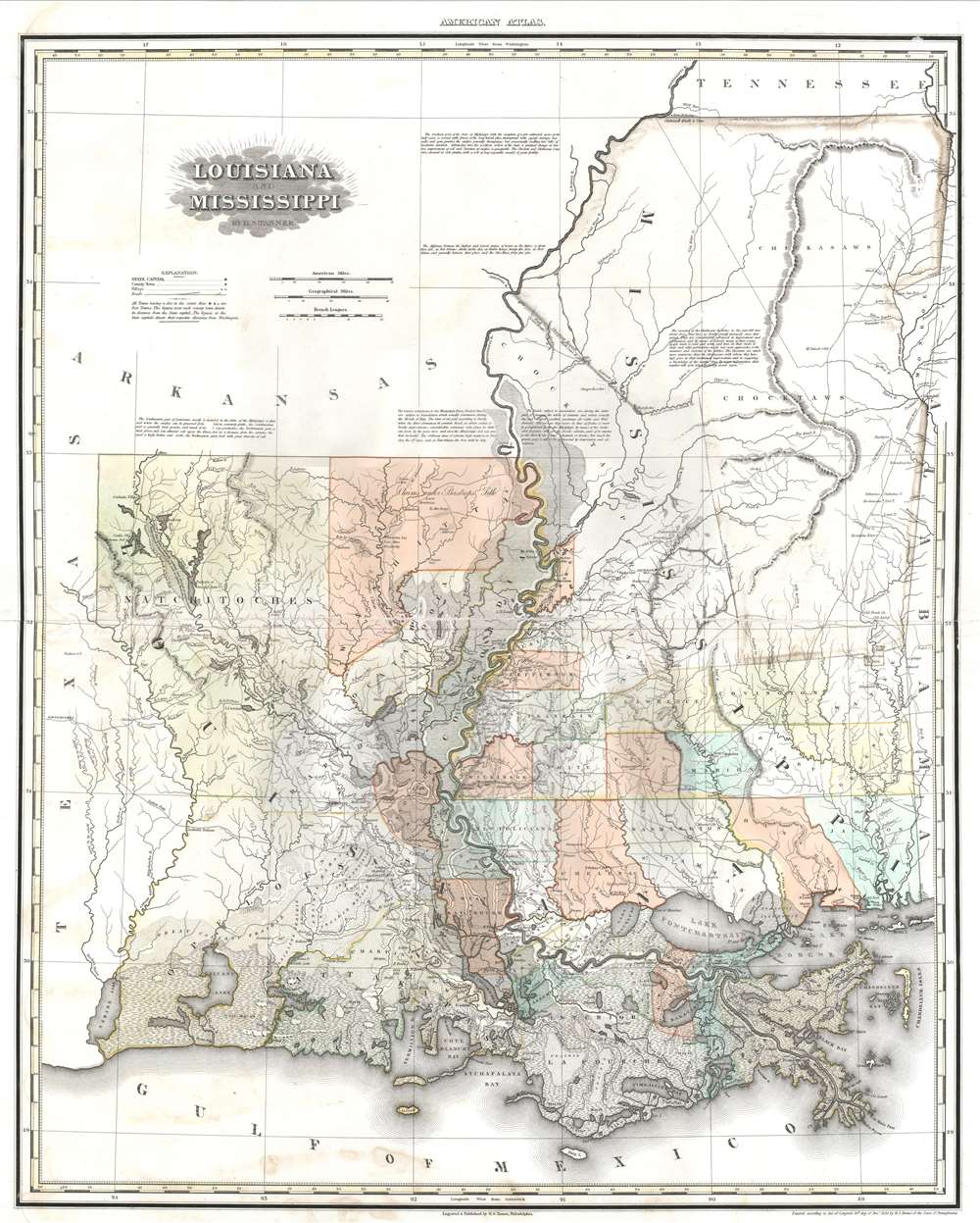
Louisiana and Mississippi.
sold
- Digital Map Information
- Suitable for large format printing
- Full resolution TIFF file
- ICC color profile embedded
- Delivered instantly via download link
This is a rare first edition example of Henry S. Tanner's scarce and significant map of Louisiana and Mississippi. This elephant folio map covers all of Louisiana and Mississippi as well as, in less detail, adjacent parts of Texas. The map shows rivers, topography by hachure, cities, towns and roadways. Parishes in Louisiana and counties in southern Mississippi are identified and shaded. (more details)
A Study of India as the Maratha Empire shattered.
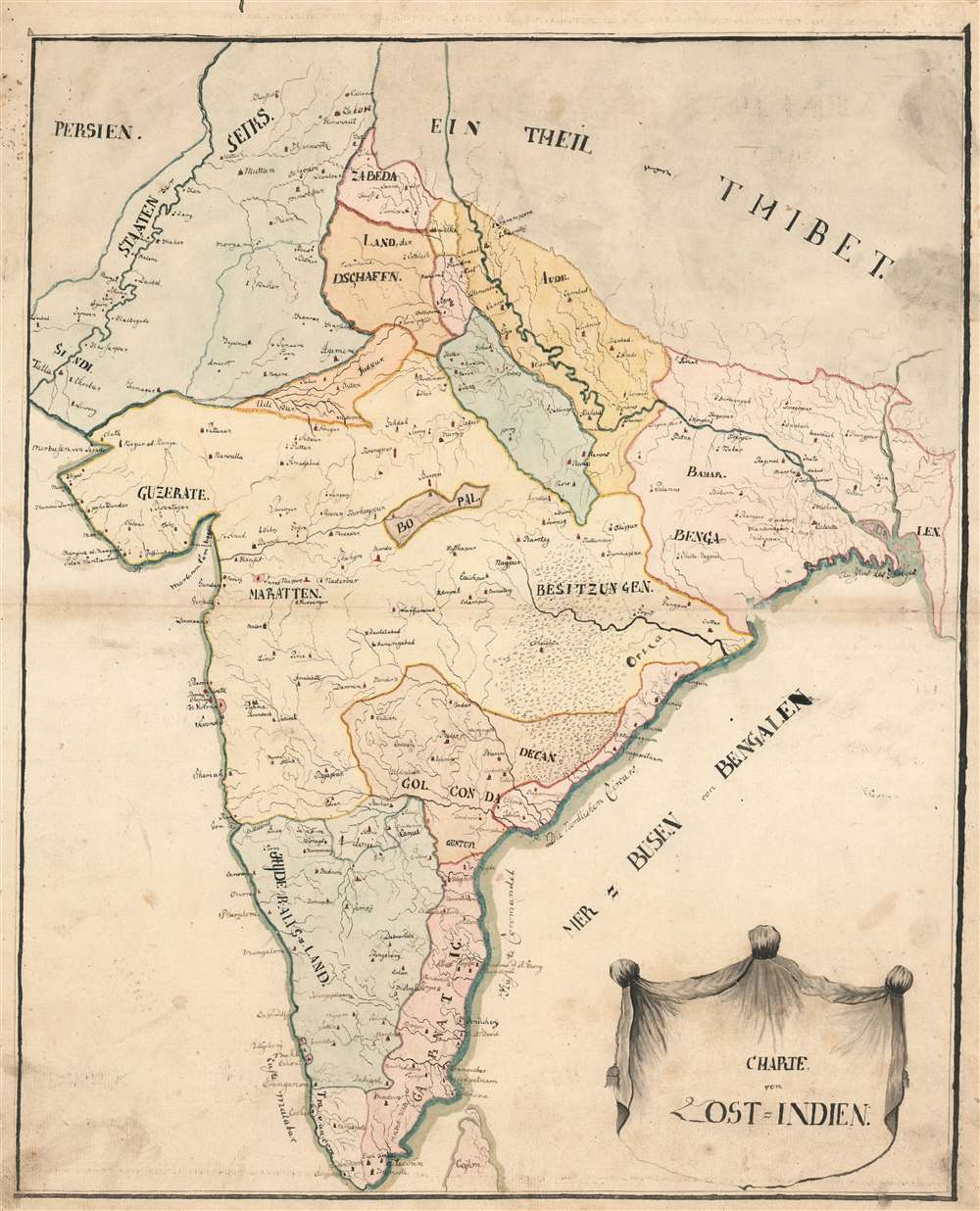
Charte von Ost=Indien.
sold
- Digital Map Information
- Suitable for large format printing
- Full resolution TIFF file
- ICC color profile embedded
- Delivered instantly via download link
This remarkable, early 19th century manuscript map of the Indian Peninsula captures the region during the fracture and turmoil of the turn of that century. In particular, it focuses most strongly on two theatres of conflict: those of the Anglo-Maratha Wars (1775 - 1782) in the north, and the Anglo-Mysore Wars (1767 - 1799) in the south, fought between those empires and the British East India Company. (more details)
Two weeks before the Siege of Paris.

No. 8. Stannard and Son's, Perspective View of Paris and its Environs, Shewing All the Fortifications and Redoubts, Together with the Lines of Defense Recently Thrown Up, and the Roads, Rivers, and Railways Communication with the Interior.
sold
- Digital Map Information
- Suitable for large format printing
- File Size: 53.72 MB
- File Type: ZIP / TIFF
- ICC color profile embedded
- Delivered instantly via download link
Published eighteen days before the beginning of the Siege of Paris on September 17, 1870, this 1870 Alfred Concanen view of Paris and its environs details the newly constructed defensive works around the French capital. Paris itself occupies the center of the view, and the Louvre and Notre Dame are easily identifiable, along with the Arc de Triomphe, the Panthéon, and the Invalides. The city's walls encircle the entire city, spanning 20.5 miles. A series of sixteen disconnected forts, constructed to protect the city gates, surround the city. Redoubts and other fortifications were built as well to supplement the forts. (more details)
Chinese railroad and telegraph networks on the eve of World War I.
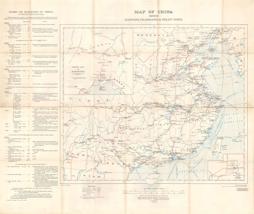
Map of China Shewing Railways, Telegraphs, and Treaty Ports.
sold
- Digital Map Information
- Suitable for large format printing
- File Size: 30.46 MB
- File Type: ZIP / TIFF
- ICC color profile embedded
- Delivered instantly via download link
This is a 1913 British War Office map of China and its railroads, telegraphs, and treaty ports. A system of red lines traces the Chinese railroad network. Solid red lines mark rail lines open to traffic, dashed red and white lines highlight lines currently under construction, and dashed red lines illustrate projected lines. Solid black lines follow telegraph lines. Blue lines in the Yellow Sea, Eastern Sea, and Southern Sea mark undersea cables connecting Chinese ports to other coastal Chinese cities and foreign nations. China's river system is also illustrated and labeled, and many cities along these rivers had been opened to foreign trade, a detail indicated by whether or not the city is underlined. An inset in the lower right details Peking, including the divisions of the Chinese City, Tartar City, and Imperial City. A second inset in the upper left corner illustrates railway connections in Manchuria that connect with Vladivostok and the Trans-Siberian Railway in Russia. (more details)
Aviation chart of the Philippines shortly before the Japanese conquest.
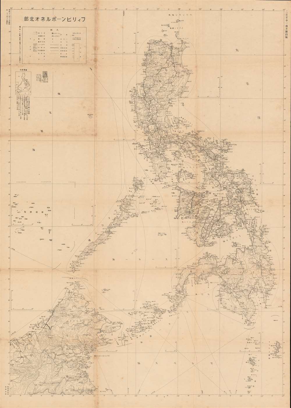
The Philippines - Northern Borneo. / フィリピンーボルネオ北部
sold
- Digital Map Information
- Suitable for large format printing
- File Size: 50.23 MB
- File Type: ZIP / TIFF
- ICC color profile embedded
- Delivered instantly via download link
A rare large-format World War II era 1941 Japanese map of the Philippines and Northern Borneo issued just months before the Japanese invasion (December 7, 1941). The map was issued by the General Staff Headquarters (参謀本部) of the Japanese Imperial Land Survey Office (陸地測量部). Cartographically, the map's focus is on topography and transportation networks, noting roads, railroad routes, and shipping lanes while at the same time emphasizing the archipelago's rugged topography. The focus of the map is on aviation - which is why, other than transportation networks, the map is minimalist. (more details)
By Shelter Island local Edith Hawkins Shepherd.
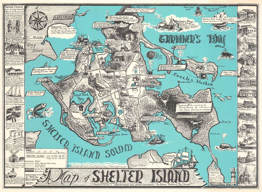
A Map of Shelter Island.
sold
This is Edith Hawkins Shepherd's rare 1966 pictorial map of Shelter Island, Long Island. Shelter Island is 'sheltered' between the north and south forks of Long Island and retains much of its traditional charm amidst the glam and glitz of the Hamptons. Shepherd identifies the basic geography of the island as well as local folklore (the place where Sachem Pogatticut watched the sunset), historical sites (such as the Westmoreland Clock Tower and the site of Lords' Shipyards), and more. The region's agricultural and maritime heritage are emphasized. Even Captain Kidd, the notorious pirate, is noted in the upper right. Historical buildings form sidebars to the left and right of the main map. (more details)
Views of the Kaaba, the Mosque at Medina, and the Dome of the Rock.

[Hajj Certificate].
sold
- Digital Map Information
- Suitable for large format printing
- File Size: 29.04 MB
- File Type: ZIP / TIFF
- ICC color profile embedded
- Delivered instantly via download link
This is a c. 1920 Library and Printing Press El-Mashhad El-Husseini hajj certificate with views of the Kaaba in Mecca, the Mosque in Medina, and the Dome of the Rock in Jerusalem. Printed entirely in Arabic, the three views occupy the center of the sheet and smaller views of Muslim holy sites appear in roundels or cartouches. (more details)
A Semi-Legendary Sanctuary and Paradise on Earth (near Antioch).
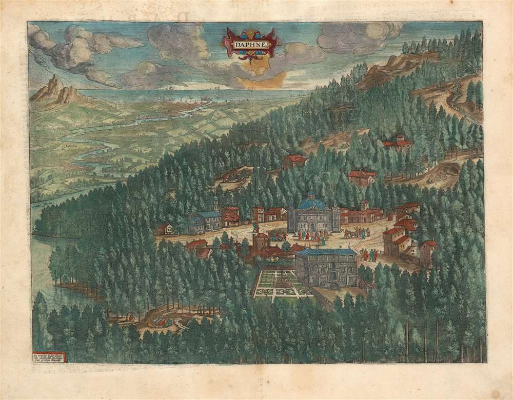
Daphne.
sold
- Digital Map Information
- Suitable for large format printing
- Full resolution TIFF file
- ICC color profile embedded
- Delivered instantly via download link
This is a lush example of Ortelius' 1595 engraving of the wooded parks and stately temples of Daphne, a classical paradise. At center is the temple to the Pythian Apollo: not visible here is Diocletian's companion sanctuary to Hecate, constructed (appropriately) underground. Four freshwater springs can be seen in clearings in the woods, with revellers taking the waters, dancing, playing music, drinking, and embracing, a hint given by the straitlaced Flemish engraver of the loose morals for which Daphne had unjustly become (in)famous. (more details)
Celebrates the 1933 opening of Rockefeller Center.
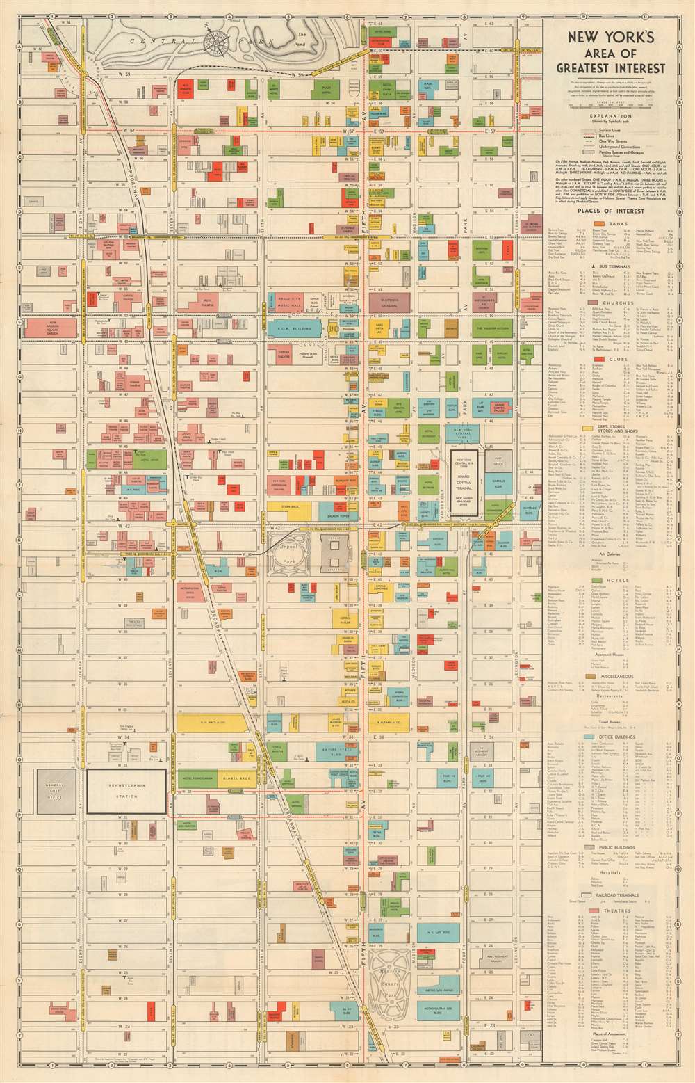
New York's Area of Greatest Interest.
sold
- Digital Map Information
- Suitable for large format printing
- Full resolution TIFF file
- ICC color profile embedded
- Delivered instantly via download link
This is a scarce 1933 first edition Robert Wentworth Floyd map of midtown Manhattan compiled for the Fifth Avenue Association and Rockefeller Center. Centered on Bryant Park, the map covers from 61st Street to 22nd Street and from 8th Avenue to Lexington Ave. Locations of note are color coded according to their function, with banks, churches, clubs, stores, hotels, office buildings, public buildings, railway terminals, and theaters differentiated. The verso contains text content promoting Rockefeller Center - which opened in the same year this map was published and most certainly contributed to its compilation. Also on the verso, there is a smaller map of New York City by Hagstrom illustrating transit routes. (more details)
The Kibbutz Movement in Israel. 'A Wonderful Community...'
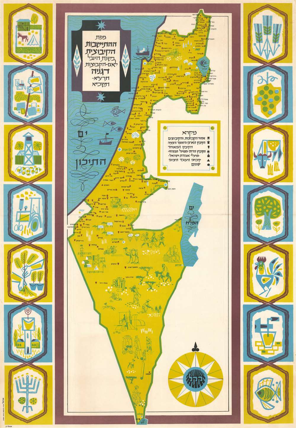
מפת ההתישבות הקיבוצית בשנת היובל לאם הקבוצות, דגניה, תzא-תשכא. / Map of the kibbutz settlement in the jubilee year for the mother of the groups, Degania, 191-1751.
sold
This is a 1961 Shmuel Katz pictorial map of Israel celebrating the 50th anniversary, or 'Jubilee' of Degania Alef, the first kibbutz founded in modern-day Israel. Icons mark six different types of kibbutzim throughout Israel, and each labeled in Hebrew. Pictorial vignettes depicting farmers at work occupy most of southern Israel. Wonderful artistic drawings create a colorful pictorial border focused on agricultural and Jewish themes. (more details)