
Rare map of Shanghai by revolutionary Nationalist Chinese geographer.
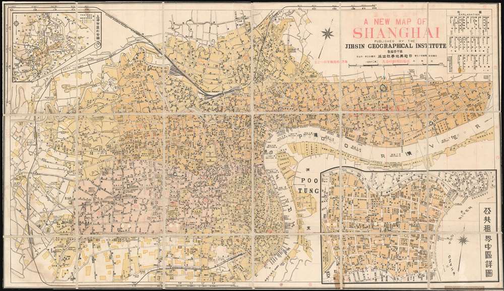
A New Map of Shanghai. / 新上海地圖
sold
- Digital Map Information
- Suitable for large format printing
- File Size: 32.01 MB
- File Type: ZIP / TIFF
- ICC color profile embedded
- Delivered instantly via download link
This is a rare Minguo 23 or 1934 bi-lingual map of pre-war Shanghai issued by the Chinese KMT Nationalist geographer Su Jiarong of the Jih-Sin Geographical Institute. Centered on the Bund, the map covers the International Settlement, the French Concession, the old Chinese City, and parts of NanTao and Pudong. Su Jiarong, the map's author, was a prominent Chinese book and map publisher in Shanghai whose anti-Japanese publications were aggressively collected and destroyed during the Japanese occupation of Shanghai (1937 - 1945), making his works exceptionally rare today. (more details)
Published by the Polish government for distribution at the 1939 New York World's Fair.
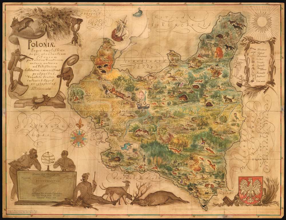
Poloniae regni amplissimi in quo abundantiam silvarum paradisum Venatorum...
sold
- Digital Map Information
- Suitable for large format printing
- File Size: 22.98 MB
- File Type: ZIP / TIFF
- ICC color profile embedded
- Delivered instantly via download link
An extremely rare find, this 1938 Eliasz Kanarek and Tadeusz Lipski pictorial nature map of Poland was created for the 1939 New York World's Fair. Meant to be a handout for attendees, Kanarek and Lipski composed this beautiful work to celebrate Poland State Forests, and their flora and fauna. The not-so-kind illustrations of Germans and Soviets along the national borders, underscore Poland's precarious situation between aggressive powers. German and Soviet delegations who felt they were insultingly depicted, complained and the map was censured. Nonetheless, within four months of the World Fair's launch, the mapmaker's fears proved valid and Nazi Germany invaded Poland launching World War II. Not all is serious, however. Some fantastical elements are included, among them a pink deer near Bialystok, a mermaid near Warsaw, and Krakow's fierce blue dragon. Both Kanarek and Lipski appear as well, discussing their work by a cartouche situated in the lower left corner. (more details)
The Spanish Malaspina Expedition!
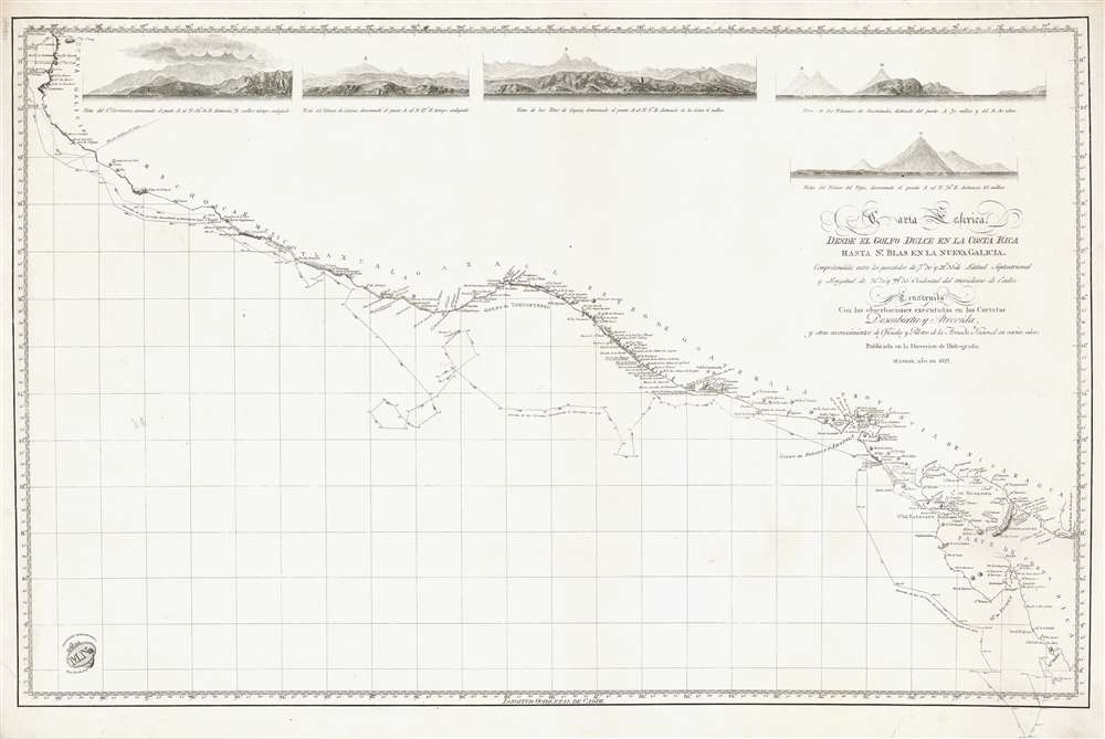
Carta Esferica desde el Golfo Dulce en la Costa Rica hasa Sn. Blas en la Nueva Galicia.
sold
- Digital Map Information
- Suitable for large format printing
- DPI: 600
- File Size: 34.8 MB
- File Type: ZIP / TIFF
- ICC color profile embedded
- Delivered instantly via download link
Representing the most advanced data available to the Spanish Admiralty at the time, this 1822 Direccion Hidrografía nautical chart or maritime map details the Pacific coast of Central America from southern Mexico and Guatemala to Costa Rica. The chart traces the movements of the 1789 - 1794 Spanish government sponsored Malaspina Expedition, a scientific expedition akin to those of Captain Cook, and labels the expedition's two ships the Descubierta and the Altrevida. Guatemalan volcanoes, Lake Nicaragua, and Acapulco are among the many coastal features. Five coastal views are included along the top border and illustrate the Volcán de Colima in Mexico, the Volcán de Vieja in Costa Rica, and the volcanoes of Guatemala. (more details)
Residential area for post-WWII U.S. Army advisors to the Chinese Nationalist Army.
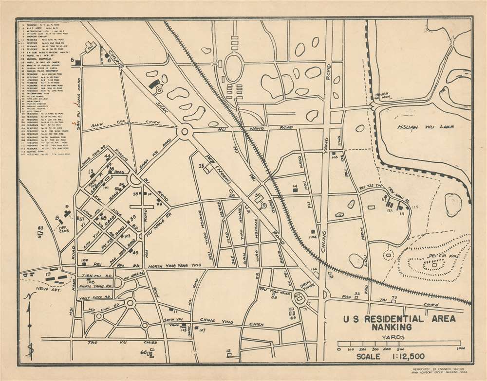
U.S. Residential Area Nanking.
sold
- Digital Map Information
- Suitable for large format printing
- File Size: 6.6 MB
- File Type: ZIP / TIFF
- ICC color profile embedded
- Delivered instantly via download link
An extremely rare find, this 1947 Engineer Section Army Advisory Group plan or map of the U.S. residential section in Nanking (Nanjing), China references American efforts to bolster the wavering Chinese National Army after World War II. The map details the American residential area in Nanjing. Forty-six locations important to American soldiers, civilian personnel, and their families are listed along the left border and correspond to residences identified on the map. Other locations, such as the International Club, Nanking University, the Russian Embassy, and the Ku Lin Temple are also noted. (more details)
A nature lover's paradise!
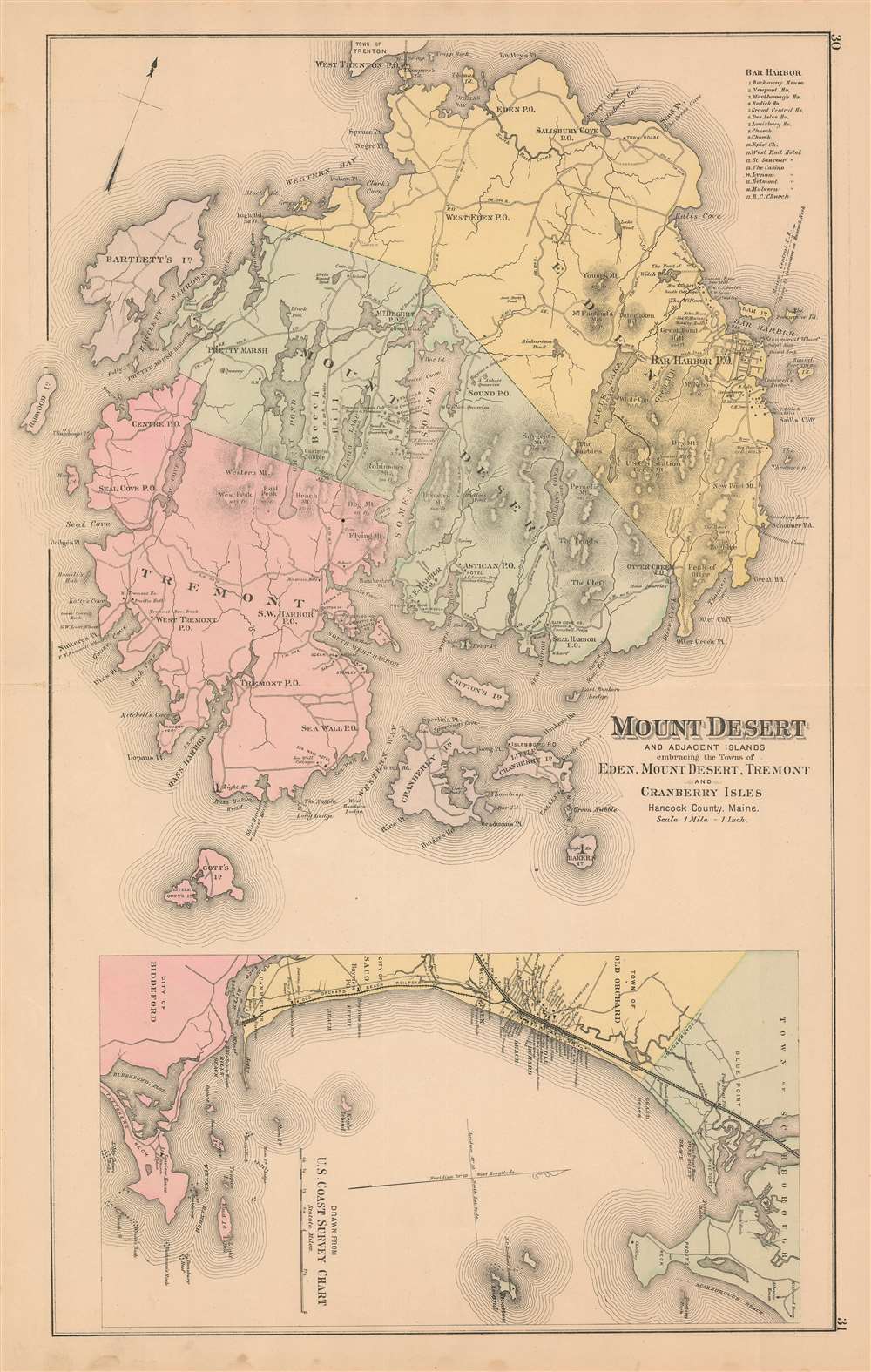
Mount Desert and Adjacent Islands embracing the Towns of Eden, Mount Desert, Tremont, and Cranberry Isles Hancock County, Maine.
sold
- Digital Map Information
- Suitable for large format printing
- File Size: 35.81 MB
- File Type: ZIP / TIFF
- ICC color profile embedded
- Delivered instantly via download link
Popularized as a vacation destination during the 19th century, Mount Desert Island is renowned for its exceptional natural beauty. First brought to public attention by painters of the Hudson River School, tourists and nature lovers began flocking to the island in the 1860s. By 1880, ten years before the present map was published, the island hosted thirty hotels all vying for tourist dollars. By the 'Gay Nineties', American social elites and business magnates, including the Rockefellers, Fords, Vanderbilts, and Carnegies, built summer homes on the islands' most desirable land. Eventually the Rockefellers acquired most of the island, donating it to the Federal government as a public recreation area, Acadia National Park. (more details)
Plotting the Urban Renewal of Barcelona's Ciutat Vella.

Ordenanzas Municipales Apendice No. 1 (c) Plano de la Reforma Interior de la Ciudad de Barcelona Aprobado por Reales Decretos de 12 de Abril de 1887 y 14 de Julio de 1889. 1891.
sold
- Digital Map Information
- Suitable for large format printing
- File Size: 41.16 MB
- File Type: ZIP / TIFF
- ICC color profile embedded
- Delivered instantly via download link
This rare 1891 map of Barcelona's Old City, or Ciutat Vella, captures a moment during the rapid urban renewal that took place in Barcelona in the latter half of the 19th century. The plan narrowly focuses on the Ciutat Vella, and superimposes (in color) the proposed layout over the convoluted warren of streets characterizing the old city. The edge of the plan hints at Barcelona's newly instituted grid of octagonal blocks, with which the planned new arrangement of streets in the old city were intended to be consonant. That grid had been implemented in the surrounding Eixample district after 1860 on the plan of Ildefons Cerdà i Sunyer; Cerdà's plan, however, had not been applied to this, the oldest part of the city. Despite the removal of the medieval city walls, the claustrophobic layout of the Ciutat Vella remained untouched by the redevelopment apparent on the rest of the plan: hence the purpose of this plan's publication. In 1891, in response to royal decrees of April 12, 1887 and July 14, 1889, A municipal ordinance was issued to plan the radical reconstruction of the old city. The ordinance was accompanied by an appendix of three plans: one of the entire Eixample district surrounding Barcelona, one of the Municipality of Barcelona itself, and this present work, focused specifically on the Ciutat Vella, to illustrate the planned radical reconstruction of the city center. All three are credited to one D. J. M. Serra, and were executed in chromolithograph by the Barcelona photolithographer Thomas and Co. All three plans appear to exist in a single edition. (more details)
Florida's many steamship and railroad lines.
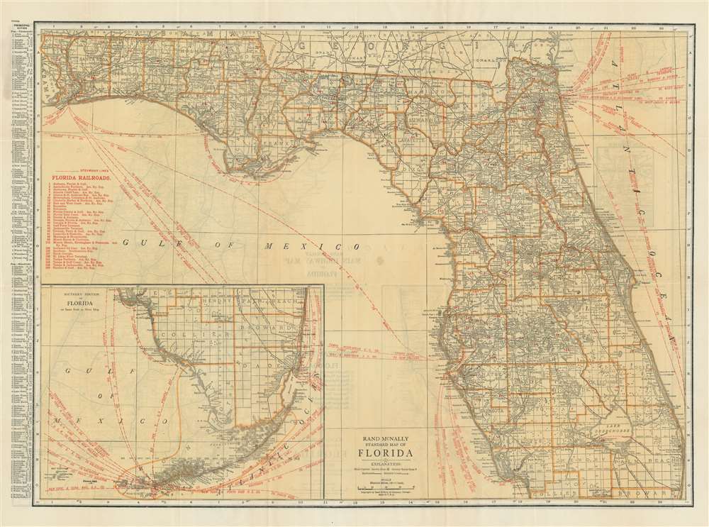
Rand McNally Standard Map of Florida.
sold
- Digital Map Information
- Suitable for large format printing
- File Size: 48.79 MB
- File Type: ZIP / TIFF
- ICC color profile embedded
- Delivered instantly via download link
A transportation map at its finest, this c. 1923 Rand McNally map of Florida traces the state's railroad lines and steamship lines. Thirty numerically identified railroad lines crisscross the state and correspond with an index situated along the left border. Steamship lines are illustrated by dashed lines that leapfrog from one port to the other. Nearly every line is identified by the company operating the route, but all promote the intended destinations, which include New York City, Europe, South America, Africa, and the Far East. An inset map, situated in the lower left corner, details southern Florida and the Florida Keys. Key West is a hub for steamship travel: ten lines head west for locations along the Gulf of Mexico, and another five point east, heading for ports along the East Coast of the United States and in the Caribbean. (more details)
Promotes the newly-opened highway linking Laredo, Texas and Mexico City.

Mapa de Mexico y Trazo de la Carretera Mexico-Laredo. Map of Mexico Describing the Pan-American Highway.
sold
- Digital Map Information
- Suitable for large format printing
- File Size: 45.77 MB
- File Type: ZIP / TIFF
- ICC color profile embedded
- Delivered instantly via download link
This is a c. 1936 El Modelo pictorial map of Mexico celebrating the opening of the National Road from Mexico City to Nuevo Laredo. This new highway - the first direct route between Mexico City and the United States, inaugurated on July 1, 1936 - is highlighted here in black. Seen as a means of promoting connection and tourism between Mexico and the U.S., the highway begins at the International Bridge connecting Laredo, Texas and Nuevo Laredo, Tamaulipas and stretches over 1,200 miles to Mexico City. Green lines trace other major highways in Mexico, while blue lines follow highways in Texas south of San Antonio. Pictorial vignettes throughout Mexico lend the piece a high level of charm. A printed photograph of the Gran Hotel Ancira in Monterey emphasizes the idea of tourism in Mexico. A terrain profile view from Nuevo Laredo to Mexico City is situated along the bottom of the sheet, showing the elevations experienced over the route as well as the distance between cities and towns encountered along the way. (more details)
Marks the houses of Paul Revere, John Adams, and Longfellow.
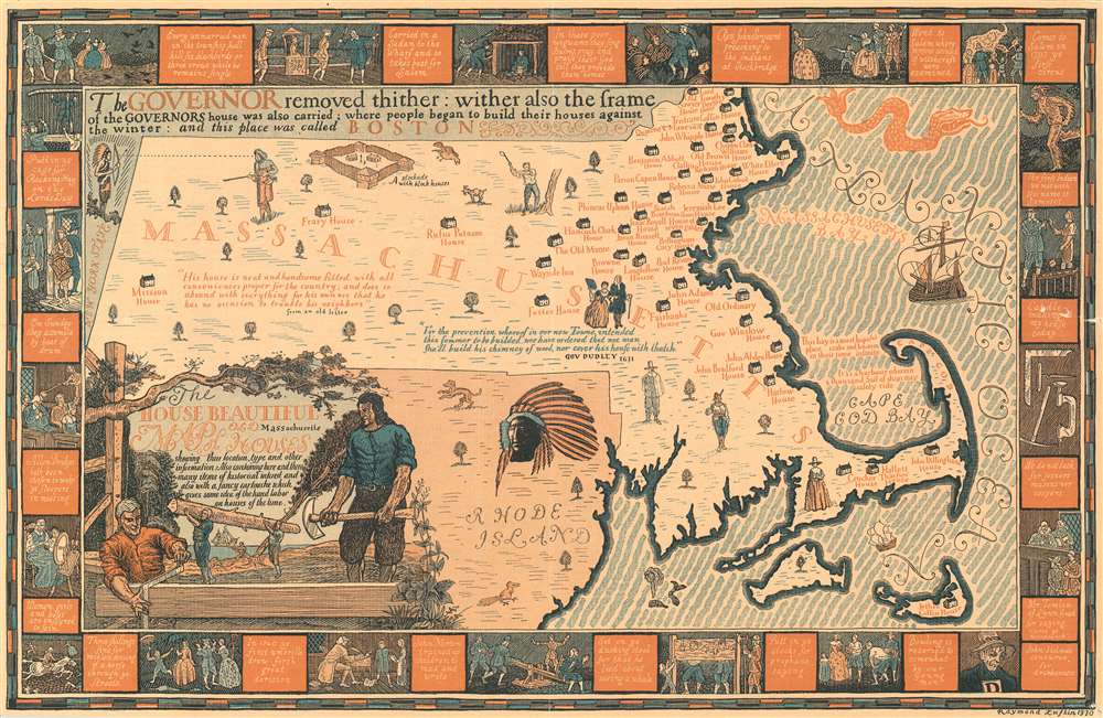
The House Beautiful Map of Old Massachusetts Houses showing their location, type, and other information.
sold
- Digital Map Information
- Suitable for large format printing
- File Size: 31.18 MB
- File Type: ZIP / TIFF
- ICC color profile embedded
- Delivered instantly via download link
Created to celebrate the tercentenary of the Massachusetts Bay Colony in 1930, this Raymond Lufkin pictorial map of Massachusetts highlights historic homes then still standing in Massachusetts. Dozens of houses are marked by icons and identified by the famous occupant's name, among them Paul Revere, John Adams, and Henry Wadsworth Longfellow. Today, many of these houses are national historic sites and museums. A decorative title cartouche adorns the lower left corner and features elements of construction. A pictorial border surrounds the central map and includes vignettes of historic events in the history of Massachusetts. (more details)
Promotes tourism in the White Mountains in the 1880s.

Bird's Eye View of the White Mountains New Hampshire.
sold
- Digital Map Information
- Suitable for large format printing
- File Size: 11.37 MB
- File Type: ZIP / TIFF
- ICC color profile embedded
- Delivered instantly via download link
A promotional view of the White Mountains, complete with hotels and the region's railroads, meant to entice the viewer into a vacation. Boston preacher William H. H. Murray launched the era of 'wilderness vacations' in 1869 with his book Adventures in the Wilderness; or, Camp Life about camping in the Adirondacks. The idea caught on quickly. By 1900, tens of thousands of Americans were flocking to 'rugged' mountainous regions as a sort of tonic against the evils of city life. All the elements of a good vacation brochure are present here. Railroads are illustrated and labeled, demonstrating the ease with which vacationers could access the beauty of the White Mountains. Numerous lodgings are also presented, suggesting that all comers will be well accommodated. The whole experience is completed by the Portland and Worcester Railroad printed on the verso. (more details)
One of the last maps of the Old Colony Railroad.
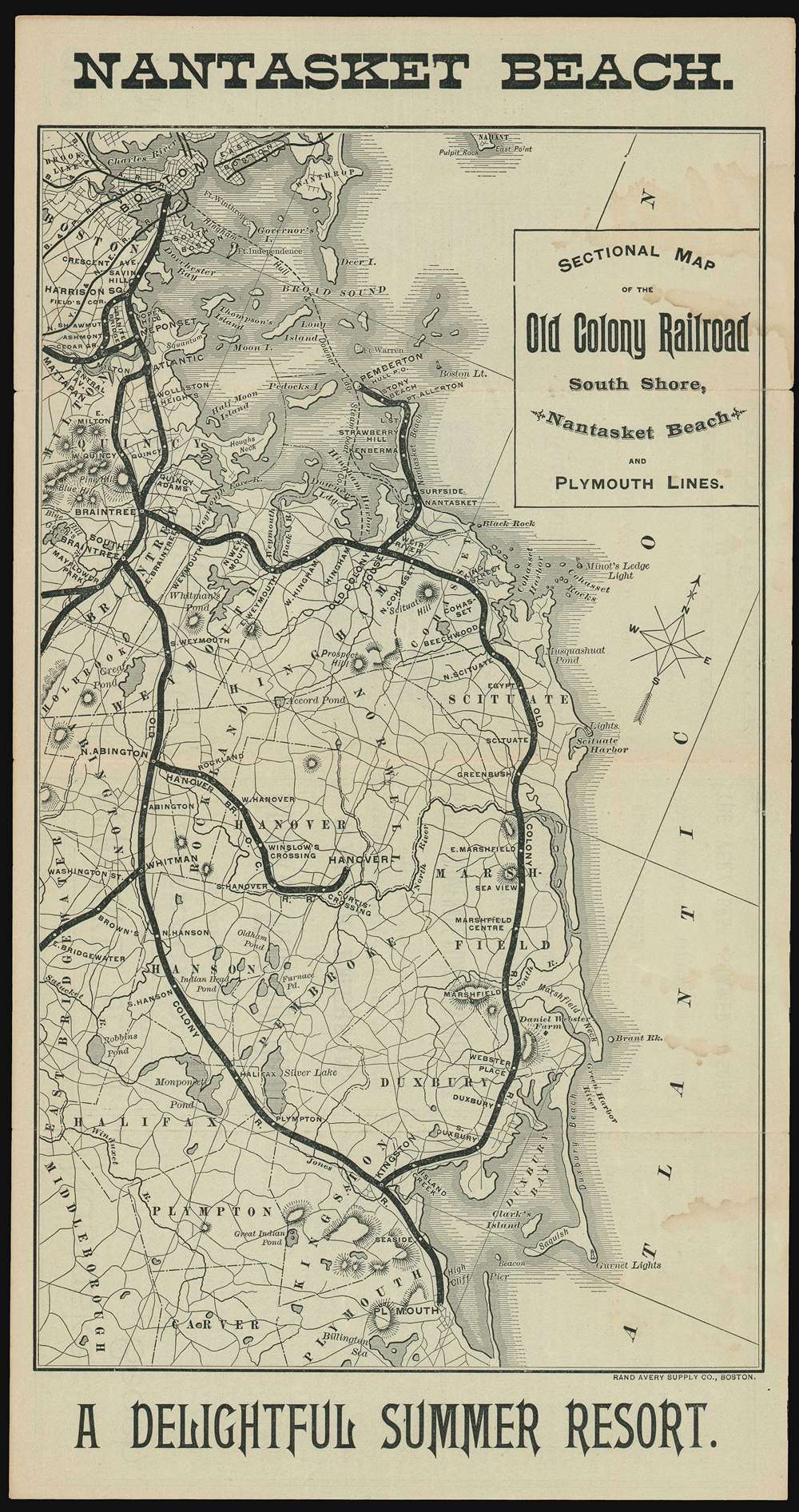
Sectional Map of the Old Colony Railroad South Shore, Nantasket Beach and Plymouth Lines. Nantasket Beach A Delightful Summer Resort.
sold
- Digital Map Information
- Suitable for large format printing
- File Size: 10.15 MB
- File Type: ZIP / TIFF
- ICC color profile embedded
- Delivered instantly via download link
An 1890 Old Colony Railroad tourist map of southeastern Massachusetts published only a few years before its acquisition by the New York, New Haven, and Hartford Railroad. Old Colony promotes its South Shore, Nantasket Beach, and Plymouth Lines, all of which were popular with Bostonians trying to escape the summer heat. The rail lines are emphasized in black and many stops are noted, including Nantasket, Braintree, Kingston, and Plymouth. (more details)
Resplendent primary-source manuscript illustrating the Kandahar theater fo the First Anglo-Afghan War.

Districts of Kundahar 1840.
sold
- Digital Map Information
- Suitable for large format printing
- DPI: 600
- File Size: 26.75 MB
- File Type: ZIP / TIFF
- ICC color profile embedded
- Delivered instantly via download link
An exquisitely drafted manuscript map of the Kandahar Region, Afghanistan, during the First Anglo-Afghan War (1839 - 1942). Resplendently drafted and colored by the Indian Quartermaster General's Office (QMG), the map incorporates traditional Bengali handmade inks. During this conflict, Kandahar was the most important British base in Afghanistan, and the surrounding region was a theater of fierce and constantly evolving guerrilla war. The present map is the result of direct field mapping, completed under onerous war-footing, yet nonetheless represents one of the earliest broadly accurate maps of the Kandahar region. The map is roughly centered on the city of Kandahar and presents a stellar overview of the surrounding region, extending from Girishk and the Helmand Valley, in the west, to Qalati Giliji, in the east, covering parts of the modern Afghan provinces of Helmand, Kandahar, Uruzgan and Zabol. It is, moreover, one of very few surviving original manuscript maps from First Anglo-Afghan War, the first (not the last) major western foray into Afghanistan. (more details)
The ICBM and the US nuclear response concept!

Concept of Deterrence.
sold
Published less than four months after the disastrous Bay of Pigs invasion, this 1961 Andrew Shallo graphic map of Asia illustrates U.S. nuclear response capabilities and strategies. Based in the doctrine of 'Mutually Assured Destruction', Shallo's map illustrates a world on the the edge of destruction. Before the proliferation of Intercontinental Ballistic Missiles (ICBMs), which emerged in the late 1950s, the U.S. relied on airplane-based response systems. A fleet of B-52s (still flown by the U.S. Air Force) and B-47s, both illustrated to the right of the globe, acted as launch platforms for missiles armed with nuclear warheads. The B-52s flew out of bases in the United States and would be refueled midair, while the B-47s were based in Guam and western Europe. In the 1960s, 1/3 of Strategic Air Command's bomber force was permanently on 24-hour alert, with those crews not already airborne ready to take off within fifteen minutes. (more details)
A uniquely Japanese combination of 'Kawaii' and military expansionism.

世界パノラマ大地圖 / World Panorama Daichi Sakai.
sold
- Digital Map Information
- Suitable for large format printing
- File Size: 56.87 MB
- File Type: ZIP / TIFF
- ICC color profile embedded
- Delivered instantly via download link
A remarkable 1933 Japanese issue pictorial map of the world drawn by Keizo Shimada (島田啓三). Centered on the Japanese Empire, which is highlighted in Red and includes both Taiwan and Korea, this map extends to cover the world with the exception of the Atlantic, which is only minimally addressed. The map presents a delightful array of vignettes intended to illustrate regional culture, flora, and fauna. Some of the images, despite being unbearably 'kawaii' are decidedly not politically correct, such as the rather intimidating looking Indian Chief in the Rocky Mountains. Despite the map's playful nature, Japan had already begun its grab for power in East Asia and the military aspect of the map is clear. Japanese destroyers patrol the western Pacific just as American destroyers stand watch on the Pacific Coast and in Hawaii. War was coming. (more details)
A charming pictorial map promoting the Southern Pacific Railroad!
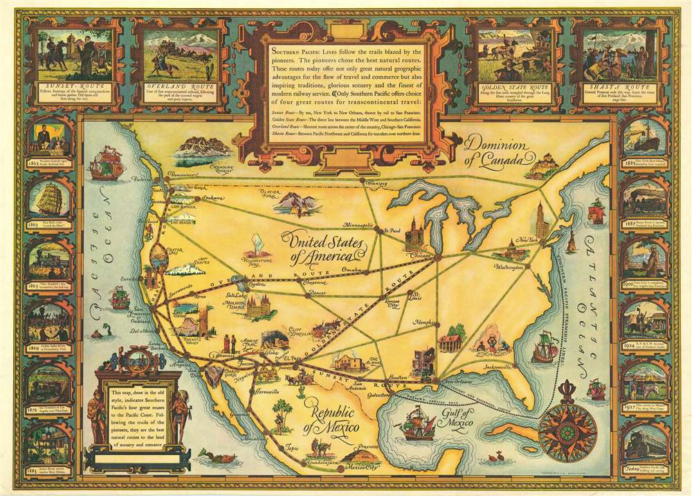
Southern Pacific Lines follow the trails blazed by the pioneers.
sold
- Digital Map Information
- Suitable for large format printing
- File Size: 75.42 MB
- File Type: ZIP / TIFF
- ICC color profile embedded
- Delivered instantly via download link
This 1928 Southern Pacific Railroad pictorial map of the United States celebrates the Southern Pacific's four routes to the Pacific Coast and emphasizes the ease with which travelers can experience the grandeur of the United States. Southern Pacific also promotes the historical character of these four routes and employs vignettes along the top border to inform the viewer on each route's pioneer history. The railroad utilizes this history as a sales pitch, alongside pictorial vignettes of historic and natural wonders, such as the Cliff Dwellings at Mesa Verde, Yosemite Valley, Crater Lake, and Mt. Rainier. A dozen vignettes adorn the left and right borders, and continue the historic theme by illustrating the history of the first transcontinental railroad line (promoted here as Southern Pacific's 'Overland Route') and the expansion of Southern Pacific's rail network through the American Southwest and California. (more details)
Depicts the entire area of conflict during The Great Game.

Russisch-Turkisch-Persisch-Englische Grenzländer von Bosnien vis Kaschgar und Indien.
sold
- Digital Map Information
- Suitable for large format printing
- File Size: 34.97 MB
- File Type: ZIP / TIFF
- ICC color profile embedded
- Delivered instantly via download link
This is a scarce and unusual 1877 Augustus Petermann map of the Middle East and Central Asia at the height of The Great Game, a decades-long diplomatic duel between the British and Russian Empires. Detailing the entire theater of war, the map's polyconic projection covers from the Balkans to British India; Crimea to the Persian Gulf and Indian Ocean. The Russian Empire stretches across the top of the map, an ever-expanding threat to countries to the south with deep water ports on the Mediterranean Sea and Indian Ocean. Throughout the 19th century, the Russian drive southward led to several wars with Persia and Turkey, which also embroiled British and French interests, staging Russia as 'the great enemy'. (more details)
A wonderful bird's eye view of the Yosemite Valley and its vicinity.

Yosemite National Park California
sold
This is a 1955 Della Taylor Hoss pictorial bird's eye view map of Yosemite National Park, California. Oriented to the northeast, Yosemite Valley is situated in the foreground, with El Capitan, Yosemite Falls, and Bridalveil Falls prominently illustrated, and Half Dome rising above the valley. Sites in the valley, including park headquarters, Yosemite Lodge, and The Ahwahnee are identified, as are numerous lakes and peaks in the vicinity. (more details)
Highlights the seven Latin American dictators that had been overthrown in the late 1950s and the Soviet rocket that was orbiting the Sun.
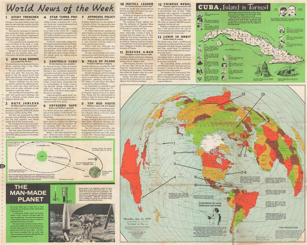
World News of the Week. Monday, Jan. 12, 1959 Covering Period Jan. 2 to Jan. 8 Volume 21 No. 21.
sold
This is a 1959 Hubert A. Bauer and News Map of the Week, Inc. map of the world chronicling the toppling of Latin American dictators from 1954 through 1959. A portrait of Fulgencio Batista, the ousted dictator of Cuba, occupies the southern Pacific Ocean and introduces the map's purpose - to detail the rise and fall of seven Latin American dictators from Cuba to Argentina. The other arrows, each numbered one through thirteen, indicate where the thirteen news stories summarized occurred. These include a landmark study of deep ocean trenches, the appointment of a cabinet in Cuba, a new U.S. national flag with a 49th star, a visit by the No. 2 Russian official Anastas Mikoyan to the United States, and a rebellion in Tibet. An inset, entitled 'Cuba, Island in Turmoil' provides a history of Cuba in thirteen vignettes. Profile views of the Cuban capital and Morro Castle are included as well. Bauer employs the azimuthal projection, developed by American Airlines. The projection allows the rendering great circle routes as straight lines. (more details)
Lampoons America's 'hunger' to annex Cuba even before the Spanish-American War.
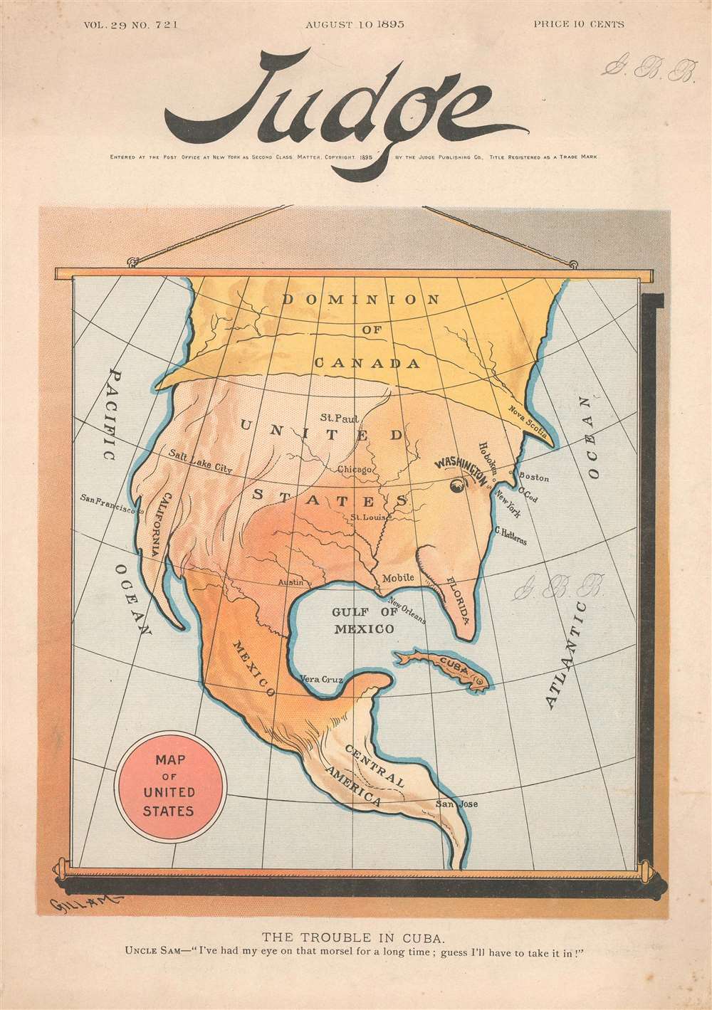
Map of the United States. / The Trouble in Cuba. Uncle Sam - 'I've had my eye on that morsel for a long time ; guess I'll have to take it in!'
sold
- Digital Map Information
- Suitable for large format printing
- File Size: 5.4 MB
- File Type: ZIP / TIFF
- ICC color profile embedded
- Delivered instantly via download link
This is an 1895 Victor Gillam political cartoon map of North America. Anthropomorphized as Uncle Sam, North America is preparing to eat Cuba, depicted here as a small fish. The United States acts as most of Sam's head, with Washington, D.C. as his eye and Florida as his nose. The western half of the U.S is colored white, to provide the illusion of hair. Canada functions as Sam's hat, while Mexico serves as his mouth and chin, and Central America, again colored white, is his beard. The Gulf of Mexico highlights Sam's gaping mouth and his voracious hunger to consume Cuba. This cover predates the Spanish-American War by two-and-a-half years, when the U.S. would wrest control of the Caribbean island from Spain. (more details)
Fun in the sun! Miami and Miami Beach.

Scen-O-Tour Miami and Miami Beach.
sold
This is a 1955 Don Mahn and Scenotour pictorial bird's-eye view of Miami and Miami Beach, Florida. Looking northwest over the cities from above the Atlantic Ocean, icons, drawn with the correct perspective, dot the landscape and mark schools, churches, hospitals, and libraries. Forty-five other locations are numerically identified and correspond with a key situated along the bottom border. A legend, surrounded by a pictorial border, explains all the icons present and lists nearly a dozen local radio stations. In a charming addition, it also includes a diagram of how to 'properly' fold the map. (more details)