
An iconic map of New York and New Engalnd!

Nova Anglia Septentrionali Americae Implantata Anglorumque Coloniis Florentissima Geographice Exhibita a Joh. Baptista Homann.
sold
- Digital Map Information
- Suitable for large format printing
- DPI: 300
- File Size: 17.27 MB
- File Type: ZIP / TIFF
- ICC color profile embedded
- Delivered instantly via download link
Full Sale Price Donated to COVID-19 Relief.
A significant though often overlooked piece, this is J. B. Homann's c. 1716 map of New England, New York, and New Jersey. Though titled 'Nova Anglia,' (New England) Homann's map actually covers a much broader area from New France (Canada) to the Delaware Bay, and from Philadelphia to Nova Scotia, inclusive of all of New England, New York, and New Jersey, as well as parts of adjacent Canada and Pennsylvania. The map identifies both European and American Indian settlements, differentiating between the two by rendering indigenous settlements as pictorial villages, huts and all, and European towns as small circles, major cities like Philadelphia and Boston being the exception. (more details)
A significant though often overlooked piece, this is J. B. Homann's c. 1716 map of New England, New York, and New Jersey. Though titled 'Nova Anglia,' (New England) Homann's map actually covers a much broader area from New France (Canada) to the Delaware Bay, and from Philadelphia to Nova Scotia, inclusive of all of New England, New York, and New Jersey, as well as parts of adjacent Canada and Pennsylvania. The map identifies both European and American Indian settlements, differentiating between the two by rendering indigenous settlements as pictorial villages, huts and all, and European towns as small circles, major cities like Philadelphia and Boston being the exception. (more details)
Paris During Urban Renewal Under Haussmann
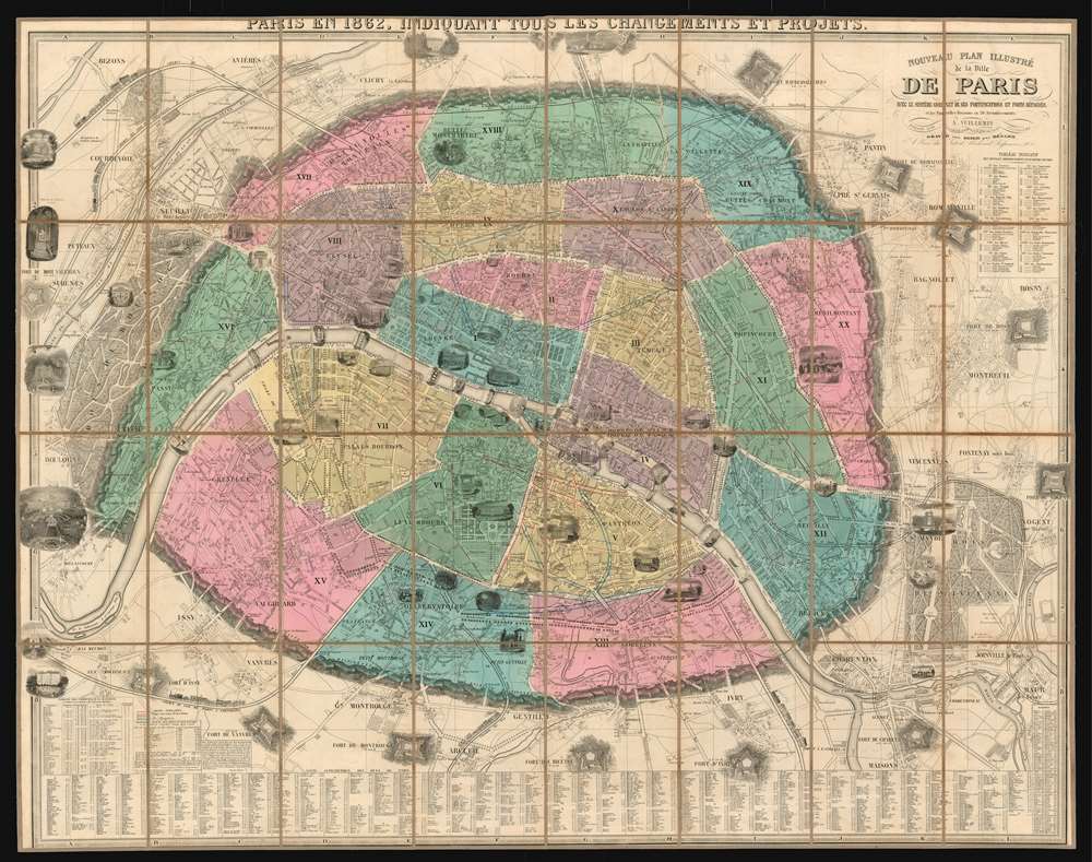
Nouveau plan illustré de la ville de Paris avec le système complet de ses fortifications et forts détachés et les nouvelles divisions en 20 arrondissements.
sold
- Digital Map Information
- Suitable for large format printing
- File Size: 115.46 MB
- File Type: ZIP / TIFF
- ICC color profile embedded
- Delivered instantly via download link
This is a spectacular 1862 folding wall map of Paris, France by the French cartographer Alexandre Vuillemin. This richly-detailed plan shows a city rapidly leaving its medieval past behind. It embraces Paris' 20 arrondisments, along with twelve surrounding forts and strongpoints. Dozens of architectural views depict important and historic buildings and parks. This frequently-updated plan highlights the current changes to Paris' plan under Haussmann: Superimposed over the original layout are the Rue de Turbigo, the Boulevard St. Germain, the Avenue de l'Opera, and many others. Five railroads, with trains charmingly illustrated, are shown leading in and out of the city. (more details)
This view creates ideas of luxury and relaxation in the viewer's mind.

Miami Beach, Florida.
sold
- Digital Map Information
- Suitable for large format printing
- File Size: 18.78 MB
- File Type: ZIP / TIFF
- ICC color profile embedded
- Delivered instantly via download link
This is a c. 1947 Tichnor Brothers view of Miami Beach, Florida. The view looks north over a crowded South Beach, with the historic Park Central, Majestic, and Beacon hotels conspicuously occupying the top left corner. Depicting the hey-day of Miami Beach, when stars like Humphrey Bogart, Rita Hayworth, and Clark Gable used the Park Central Hotel as a hangout, the interplay between Miami's art deco district and its renowned palm-lined beaches is highlighted. The beach and the skyline both stretch to the horizon, leaving the viewer to imagine just how special Miami Beach could be. (more details)
A wartime bird's eye view of Miami promoting tourism in the city.

[Miami. Miami Beach.]
sold
- Digital Map Information
- Suitable for large format printing
- File Size: 41.84 MB
- File Type: ZIP / TIFF
- ICC color profile embedded
- Delivered instantly via download link
This is a 1945 R.C. Traster, Sr. and Carmel Wilson bird's eye view of Miami and Miami Beach, Florida. From high over the Atlantic Ocean, the view overlooks the region from the east, with Biscayne Bay stretching to the left off the sheet. Myriad buildings are illustrated throughout, many of which are labeled as housing private companies, bars, restaurants, and schools, among others. Streets are illustrated and labeled, with major streets colored white such that they are easily located, while neighborhood streets are darker and fade into the landscape. The three causeways connecting the two cities are labeled, as are the islands in Biscayne Bay, including Belle Isle, Palm Island, and Star Island. The whole is framed by advertisements promoting local businesses, shopping centers, realtors, restaurants, hotels, and public transit. Columns on the left and right sides list hotels that are 'open to civilians' and include a grid location to help viewers locate them on the present map. (more details)
A groundbreaking map of central Africa published from David Livingstone's personal notes after his death.
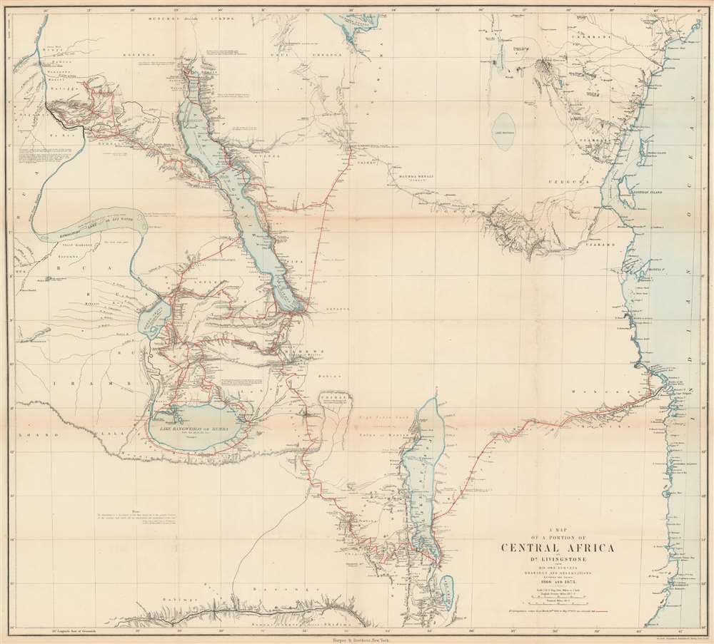
A Map of a Portion of Central Africa by Dr. Livingstone from His Own Surveys Drawings and Observations Between the Years 1866 and 1873.
sold
- Digital Map Information
- Suitable for large format printing
- File Size: 40.48 MB
- File Type: ZIP / TIFF
- ICC color profile embedded
- Delivered instantly via download link
This is an 1875 David Livingstone map of central Africa. The map depicts the region of central Africa from the Lualaba River to the Indian Ocean and from Lake Victoria to Lake Shirwa and part of the Zambezi (Zambesi) River, where Livingstone spent the years of 1866 until his death in 1873 along the southern shore of Lake Bangweolo. Dr. Livingstone's route during these years is traced in red, with Livingstone's comments on the landscape interspersed throughout, along with dates when he visited certain locations. Routes of other famous explorers, including Speke and Grant in 1860 and 1861, Burton and Speke in 1857 and 1858, Henry Morton Stanley in 1871 and 1872 on his famous expedition to find Livingstone, and even Livingstone himself in 1859 and 1861, are traced by black dashed lines. Curiously, only part of the journey made by Livingstone's aids Chuma and Susi, following his death in 1873 to bring his journals, maps, and physical remains to the coastal city of Bagamoyo, is illustrated. (more details)
A bird's eye view of Boston likely created for the recently opened Prudential Center.

[View of Boston].
sold
This is a c. 1964 bird's eye view of Boston. Illustrated as seen from the top of the Prudential Building, Boston extends outward in all directions, with buildings, parks, factories, and roads illustrated on both sides of the Charles River, which itself is busy with yachtsmen. The campus of the Massachusetts Institute of Technology (MIT) sits almost directly across the Charles River from the Prudential, and Fenway Park is illustrated to the left. Thirty-six locations (including both MIT and Fenway Park) appear in a points-of-interest index situated below the bottom border. Among the other listed sites are Harvard University, Boston University, Northeastern University, and the Bunker Hill Monument. (more details)
A previously uncatalogued state of Kenyon's Map of the Western Battle Front depicting the 1918 German Spring Offensive.

Kenyon's Map of the Western Battle Front.
sold
- Digital Map Information
- Suitable for large format printing
- File Size: 49.21 MB
- File Type: ZIP / TIFF
- ICC color profile embedded
- Delivered instantly via download link
This is a previously uncatalogued state of the 1918 Kenyon Company map of northern France, the main sector of the Western Front during World War I, and features overprinting illustrating the front line and several events between March and May 1918. The map depicts the region from Dieppe and Rouen in France to Strasbourg (Strassburg) and Mulhouse (Mulhausen) in Alsace and Basel in Switzerland. (more details)
A wonderful pictorial map of Marathon that beckons tourists to visit.

Marathon. The Heart of the Florida Keys.
sold
- Digital Map Information
- Suitable for large format printing
- File Size: 17.66 MB
- File Type: ZIP / TIFF
- ICC color profile embedded
- Delivered instantly via download link
This is a c. 1952 pictorial map of Marathon Key, Florida. Created as an eye-catching piece to promote tourism, Marathon is presented as an idyllic getaway where people spend their days on the beach, in the sun, or painting. Local bird life, including roseate spoonbill and great blue heron, add more color alongside various species of fish present in the waters around the key. Large signs proclaim Marathon as being forty-eight miles from Key West and 108 miles from Miami. Three photographs from this earthly paradise are situated along the bottom border, next to a caption that states that Marathon has an ideal climate and is accessible 'by car or bus, by boat or plane'. (more details)
The Malabar Coast and the Maldives
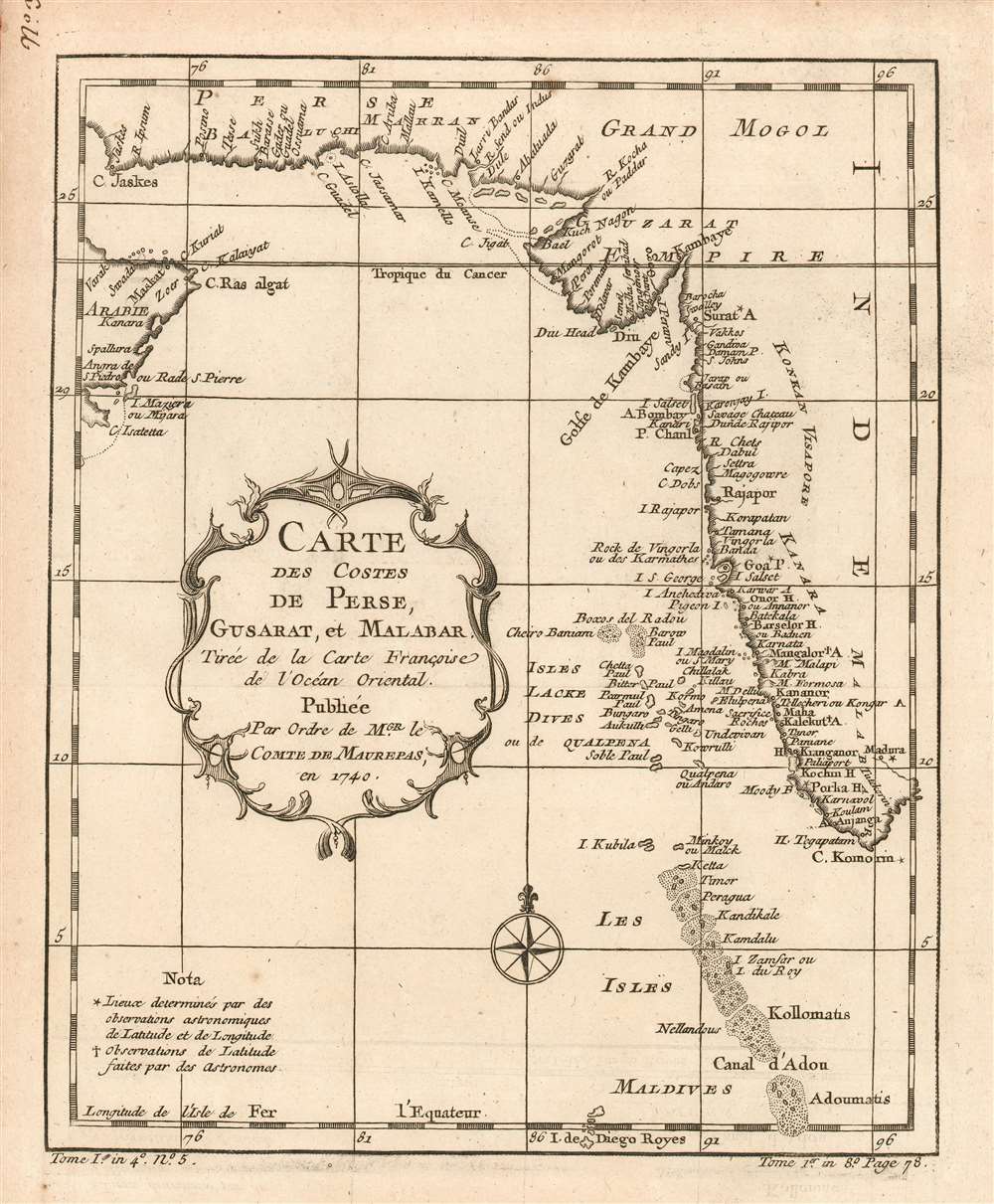
Carte des Costes de Perse, Gusarat et Malabar: Tirée de la Carte Françoise de l'Océan Oriental; Publiée Par Ordre de MGR. le Comte De Maurepas, en 1740.
sold
- Digital Map Information
- Suitable for large format printing
- DPI: 600
- File Size: 4.6 MB
- File Type: ZIP / TIFF
- ICC color profile embedded
- Delivered instantly via download link
This is a 1780 Bellin map of the western coast of India, the coast of Iran, and part of the Arabian Peninsula, showing many islands west of India, including the Maldives. Bellin drew the information for this chart from his own superb 1740 chart of the Indian Ocean, Carte Reduite de l'Ocean Oriental ou Mer des Indes Contenant Les Costes d'Afrique. It was this grand chart, and not the present lovely if narrowly-focused engraving, that was produced 'Par Ordre'of the Count de Maurepas. It seems slightly misleading that Bellin should here invoke this famous French statesman, naval strategist and spymaster, given that the present map was to appear in Harpe's 1780 Abrégé de l'histoire générale des voyages, which epitomized Prévost's Histoire générale des voyages - a work perhaps better known for its imaginative flourish than for its factuality. Nevertheless, despite the venue, Bellin drew on state-of-the-art knowledge for the maps he contributed. (more details)
Strikingly detailed ROC administrative map of Beijing!
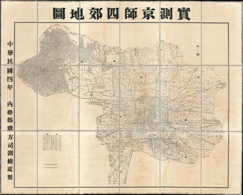
Surveyed Map of Beijing and the Four Suburbs. / 實測京師四郊地圖
sold
- Digital Map Information
- Suitable for large format printing
- DPI: 600
- File Size: 160.6 MB
- File Type: ZIP / TIFF
- ICC color profile embedded
- Delivered instantly via download link
An extraordinarily detailed large format 1915 (Mingou 4) map of Beijing and its 4 suburbs (East, West, North, South) issued by the Republic of China Ministry of Internal Affairs. At the time these regions were being incorporated under the administrative sovereignty of Beijing, but at the same time, operated somewhat independently, with separate regional governance and policing forces. Coverage extends from the old walled city to the surrounding areas, reaching as far northwest as today's Yangtaishan Scenic Area, east to (roughly) Xinggu, and south to Xihongmenzhen, encompassing the 'suburban' surroundings of the Republic's capital. This map was intended for administrative use and offers impressive detail throughout, naming different types of terrain and topographical detail, as well as illustrating transportation networks, administrative infrastructures (schools, electrical lines, etc.), mercantile infrastructure (shops, factories), and policing districts. (more details)
A unique Boxer Rebellion field map of Beijing representing the most detailed map of this region at time.

[Peking and Environs]
sold
- Digital Map Information
- Suitable for large format printing
- File Size: 21.53 MB
- File Type: ZIP / TIFF
- ICC color profile embedded
- Delivered instantly via download link
An exceptional c. 1900 Boxer Rebellion period map of Beijing and vicinity, China. Presented as a diazo or whiteprint (reverse cyanotype), with some manuscript, this map while complete onto itself, represents a small part of a now-lost French Service Géographique manuscript map of the environs of Beijing prepared for field use during the Boxer Rebellion (1899 - 1901). Offering greater detail than any known contemporaneous map of the region, the exceptional cartography here was not eclipsed until the 1930s and 40s. (more details)
The earliest acquirable map of Europe based on contemporaneous geographical knowledge.
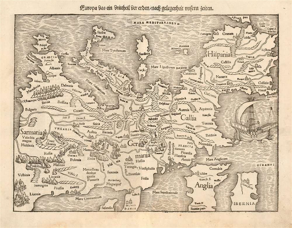
Europa das ein drittheil der erden / nach gelegenheit unsern zeiten.
sold
- Digital Map Information
- Suitable for large format printing
- DPI: 600
- File Size: 11.97 MB
- File Type: ZIP / TIFF
- ICC color profile embedded
- Delivered instantly via download link
This is a 1553 printing of Sebastian Münster's southern-oriented map of Europe, a German edition of the first acquirable map of Europe based on modern geographical information, and the only acquirable derivative of Martin Waldseemüller's unobtainable 1511 map of Europe. Münster's Geographia and Cosmographia provided for many years the literate European's only glimpses of the world beyond their homes, and these two works contained a disproportionate number of maps showing contemporaneous knowledge the areas they depicted for the first time. For Münster's readership, this map was almost certainly the first depiction of their home continent that was not based upon the 2nd century work of Claudius Ptolemy. (more details)
Rare view of one of Vermont's most beautiful and historic cities.

Birds Eye View of Burlington and Winooski VT.
sold
- Digital Map Information
- Suitable for large format printing
- File Size: 59.96 MB
- File Type: ZIP / TIFF
- ICC color profile embedded
- Delivered instantly via download link
A beautiful 1877 bird's-eye view and map of Burlington and Winooski, Vermont by Joseph J. Stoner and E. Meilbek. The view looks on Burlington from a point to the southwest high above Lake Champlain, with Main Street at the center of the map eastward proceeding from the lake.. In the distance, to the northeast, the neighboring town of Winooski is well drawn across the Winooski River. Even farther, the forested Green Mountains are prominent. The view is based on artwork by E. Meilbek, of whom almost nothing is known. (more details)
A 'Free Missouri' promotional piece.

Free Missouri. The Missouri Land Company. Capital Stock $500,000.
sold
- Digital Map Information
- Suitable for large format printing
- Full resolution TIFF file
- ICC color profile embedded
- Delivered instantly via download link
This is an 1865 Leopold Gast and Brother Lithograph Co. promotional map of Missouri issued for the Missouri Land Company. Several railroads are labeled, including the Union Pacific Railroad and the Hannibal and St. Joseph Railroad. The majority of the Southwest Branch of the Pacific Railroad is illustrated by a dashed line, indicating that it had not yet been built when this piece was published. Most of the Cairo and Fulton Railroad is illustrated in the same manner. The officers of the Missouri Land Company are listed in the lower left corner, along with the Board of Directors. (more details)
One of the Earliest Separate Maps of Iceland.
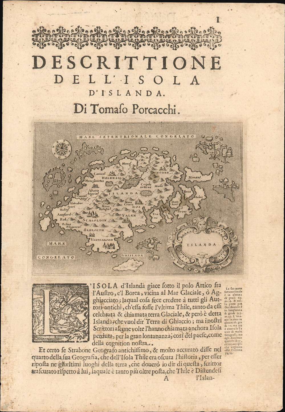
Islanda.
sold
- Digital Map Information
- Suitable for large format printing
- DPI: 600
- File Size: 4.98 MB
- File Type: ZIP / TIFF
- ICC color profile embedded
- Delivered instantly via download link
Tommaso Porcacchi's 1572 map of Iceland, in a beautiful early issue with a bold, sharp strike. It is the first separate map of Iceland to improve upon the cartography handed down from the venerable 1539 Olaus Magnus Carta Marina, whose Iceland data was reproduced by several mapmakers of the La Freri school without improvement. This map - elegantly engraved by Girolamo Porro for Porcacchi's isolario - starts with the Iceland of Magnus' Carta Marina but corrects the locations of many features. For example, the see of Hólar (Holensis) has been moved to its right place in the north, and Skálholt (Scalholdin) is correctly located in the south. Both of these locations were important in recent Icelandic history: Hólar had been the see of Jón Arason, the last Catholic bishop of Iceland. During the Reformation, it was to Skálholt that Arason and his two sons were taken and beheaded. Not all of Porcacchi's additions were well-advised; a few items have been taken from the wildly inventive Zeno map, including the seven islands appearing off the east coast. (more details)
Illustrates Guatemala's watershed.
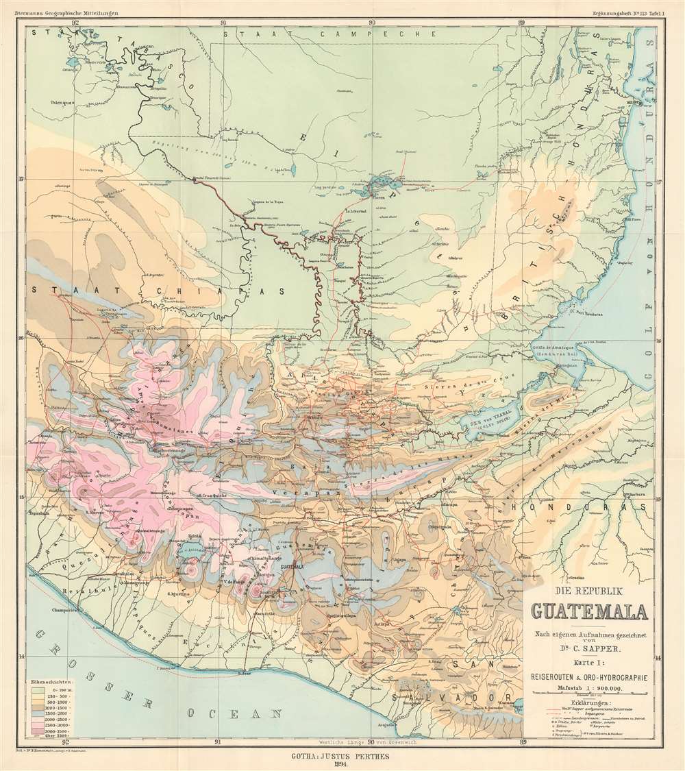
Die Republik Guatemala Nach eigenen Aufnahmen gezeichnet von Dr. C. Sapper. Karte I: Reiserouten und Oro-Hydrographie
sold
- Digital Map Information
- Suitable for large format printing
- File Size: 19.45 MB
- File Type: ZIP / TIFF
- ICC color profile embedded
- Delivered instantly via download link
This is an 1894 Hassenstein orohydrographic map of Guatemala. Orohydrography is the study of the relationship between mountains and water drainage patterns, thus an orohydrographic map illustrates a region's topography and how that topography effects its watersheds. Here, Hassenstein has employed nine different colors to highlight different areas separated by altitude, which allows the viewer to more easily understand how water would run downhill. Orohydrographic maps also illustrate flowing-water (rivers) and standing-water (lakes), in order to provide a complete understanding of the region's hydrography. Dr. Sapper's routes through the region are also traced, with the solid red line tracing overland sections and dashed lines marking parts of his journey made over water. (more details)
A detailed map of the Rio Polochic which empties into Lake Izabel.
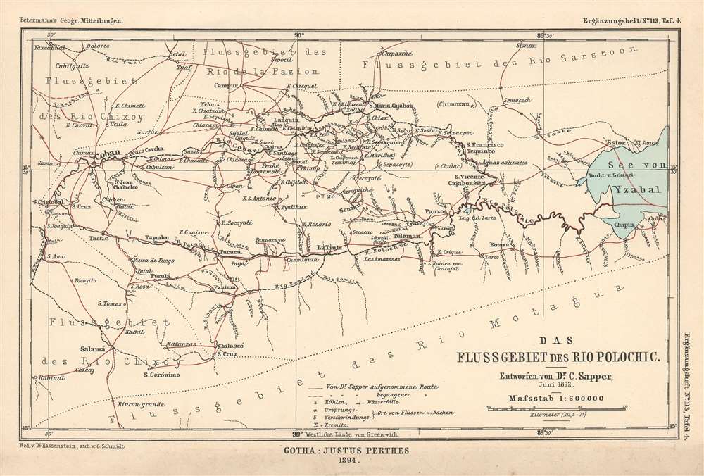
Das Flussgebiet des Rio Polochic.
sold
- Digital Map Information
- Suitable for large format printing
- File Size: 2.91 MB
- File Type: ZIP / TIFF
- ICC color profile embedded
- Delivered instantly via download link
This is an 1894 Hassenstein map of the Rio Polochic (Polochic River) in Guatemala. The map depicts the region west of Lake Izabel and details not only the Rio Polochic but most of the river system, which consists of the Rio Cajabon and numerous smaller rivers and tributaries, many of which are illustrated and labeled. Towns and villages throughout the region are also identified, and Dr. Sapper's travels through the region are traced by solid red lines. (more details)
Highlights many of Guatemala's volcanoes, three of which are currently active.
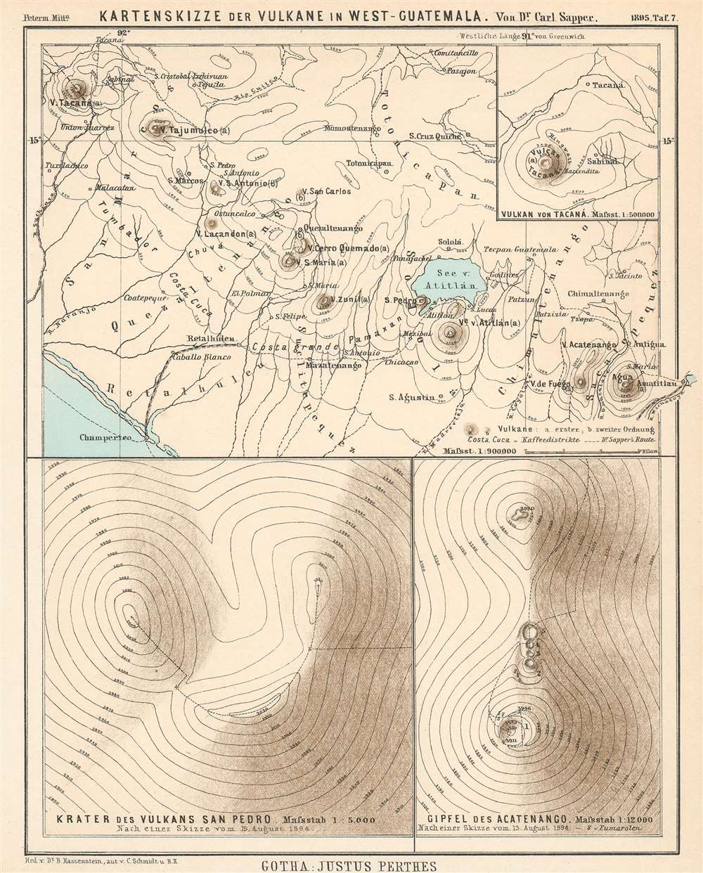
Kartenskizze der Vulkane in West-Guatemala.
$150.00
Acquire
- Digital Map Information
- Suitable for large format printing
- File Size: 4.53 MB
- File Type: ZIP / TIFF
- ICC color profile embedded
- Delivered instantly via download link
This is an 1895 Bruno Hassenstein map of volcanoes in western Guatemala. It depicts western Guatemala from the Tacaná Volcano on the Guatemala-Mexico border to Amatitlán and Lake Amatitlán, numerous volcanoes are illustrated and labeled, including the Volcán de Agua, the Volcán de Fuego, and the Volcán de Santa Maria. Cities and towns throughout the region are also labeled, along with rivers and the Lago de Atitlán. A dashed line marks the route followed by Dr. Sapper through the region. Topography lines are also illustrated, allowing the viewer some idea of the very mountainous nature of the terrain. An inset map situated in the upper right corner details the region around the Volcán de Tacaná, and labels both the town of Tacaná and Sabinal. Two other insets along the bottom focus on the Volcán San Pedro and the peak of the Volcán Acatenango. (more details)
A large map of North Africa meant for U.S. servicemen to use for tracking the North African campaign.
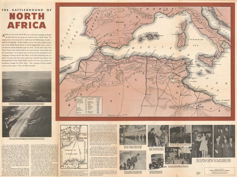
The Battleground of North Africa.
sold
- Digital Map Information
- Suitable for large format printing
- File Size: 118.38 MB
- File Type: ZIP / TIFF
- ICC color profile embedded
- Delivered instantly via download link
Published a month after the Operation Torch landings in Morocco and Algeria, this 1942 Army Orientation Branch Newsmap of North Africa was distributed so Allied troops could follow the progress of the new campaign. Depicting the region from Madeira Island to Libya, the focus is placed on the area where American soldiers were fighting the Wehrmacht for the first time, likely because American soldiers were the main audience for which Newsmaps were produced. Cities and towns are identified, including the key strategic locations of Casablanca, Algiers, Oran, Bizerte, Tunis, Sfax, and Sousse. Roads and railroads are also illustrated. A table in the lower left corner of the map informs the viewer of the distances involved in getting to North Africa, with the 3,486 miles between New York and Gibraltar at the top. (more details)
One of the Best Early Depictions of the Long Expedition.
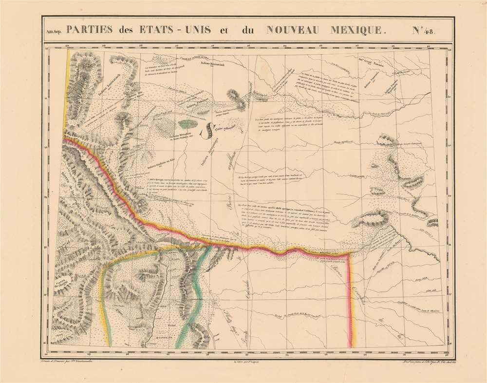
Parties des Etats-Unis et du Nouveau Mexique. Amer. Sep. no. 48.
sold
- Digital Map Information
- Suitable for large format printing
- DPI: 600
- File Size: 21.34 MB
- File Type: ZIP / TIFF
- ICC color profile embedded
- Delivered instantly via download link
This is 1827 Vandermaelen map of the American-Mexican frontier of the Missouri Territory, shown during a period of active exploration. It was the largest-scale map of this region produced to date - 'no mapmaker had previously attempted to use such a large scale for any western American area.' (Wheat). Like all of the maps from Vandermaelen's Atlas, it is the also the first map of the region executed in lithograph. (more details)