
Depicts both the Wabash and Erie Canal and the Miami and Erie Canal.
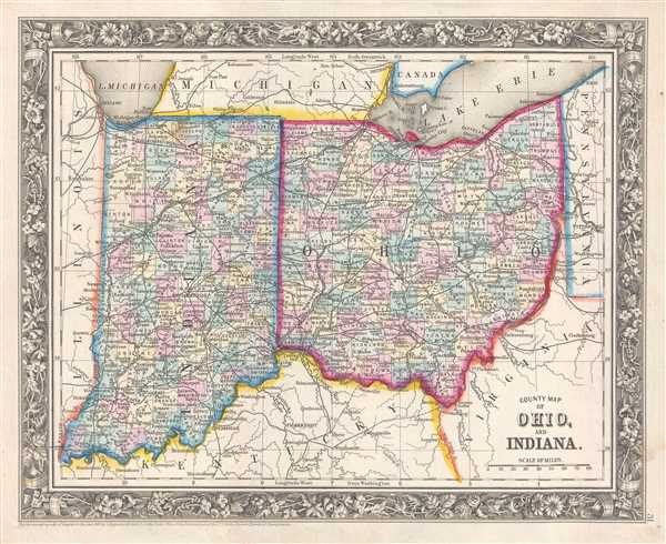
County Map of Ohio, and Indiana.
sold
- Digital Map Information
- Suitable for large format printing
- File Size: 4.22 MB
- File Type: ZIP / TIFF
- ICC color profile embedded
- Delivered instantly via download link
This is an 1861 Samuel Augustus Mitchell, Jr. map of Ohio and Indiana. The map depicts the region from Illinois to Pennsylvania and Virginia and from Lake Michigan, the State of Michigan, and Lake Erie to Kentucky and Virginia. The Wabash and Erie Canal and the ... (more details)
Illustrates the ever-expanding rail network in the region.

County Map of Michigan, and Wisconsin.
sold
- Digital Map Information
- Suitable for large format printing
- File Size: 5.22 MB
- File Type: ZIP / TIFF
- ICC color profile embedded
- Delivered instantly via download link
This is an 1861 Samuel Augustus Mitchell, Jr. map of Michigan and Wisconsin. The map depicts the region from Minnesota and Iowa to Canada, Lake Huron, and Lake Erie and from Lake Superior to Illinois, Indiana, and Ohio. The railroad network in the region is ... (more details)
Illustrates the New Orleans, Jackson, and Great Northern Railroad, which completed the direct rail link between New Orleans and Chicago.
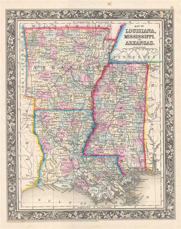
Map of Louisiana, Mississippi, and Arkansas.
sold
- Digital Map Information
- Suitable for large format printing
- File Size: 5.11 MB
- File Type: ZIP / TIFF
- ICC color profile embedded
- Delivered instantly via download link
This is an 1861 Samuel Augustus Mitchell, Jr. map of Arkansas, Louisiana, and Mississippi. The map depicts the region from Indian Territory and Texas to Tennessee and Alabama and from Missouri and Tennessee to the Gulf of Mexico. Though unlabeled, the New ... (more details)
Includes an inset map of Charleston, South Carolina that labels Fort Sumter, where the first shots of the American Civil War were fired on April 12, 1861.
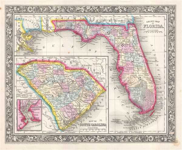
County Map of Florida. / Map of South Carolina.
sold
- Digital Map Information
- Suitable for large format printing
- File Size: 5.57 MB
- File Type: ZIP / TIFF
- ICC color profile embedded
- Delivered instantly via download link
This is an 1861 Samuel Augustus Mitchell, Jr. map of Florida and South Carolina on one sheet. The map depicts the region surrounding the state of Florida from eastern Louisiana to the Atlantic Ocean and from Georgia and Alabama to the Strait of Florida. ... (more details)
Traces the route of the Second Grinnell Expedition led by Dr. Elisha Kent Kane with the goal of locating the lost Franklin Expedition.
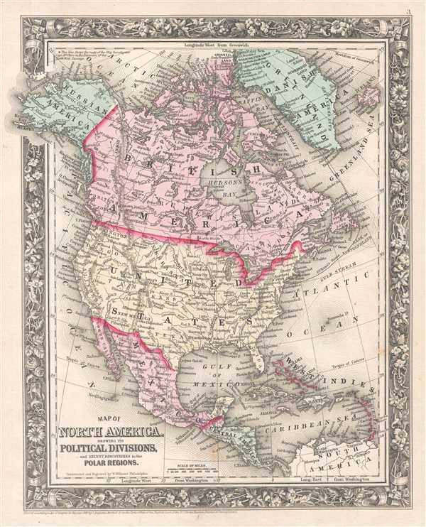
Map of North America. Showing its Political Division, and Recent Discoveries in the Polar Regions.
sold
- Digital Map Information
- Suitable for large format printing
- File Size: 5.35 MB
- File Type: ZIP / TIFF
- ICC color profile embedded
- Delivered instantly via download link
This is an 1861 Samuel Augustus Mitchell, Jr. map of North America. The map depicts the continent from the Pacific Ocean to the Atlantic Ocean and from the Arctic Ocean to Colombia and Venezuela in South America. Franklin's Lost Expedition and American ... (more details)
An overarching visual presentation of the state of world exploration at the beginning of the 1860s by tracing the routes of major exploration expeditions, while also illustrating the lack of knowledge with regard to the interior of Africa and the coast of Antarctica.
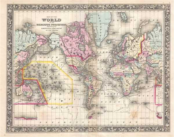
Map of the World on the Mercato Projection, Exhibiting the American Continent as its Centre.
sold
- Digital Map Information
- Suitable for large format printing
- File Size: 8.79 MB
- File Type: ZIP / TIFF
- ICC color profile embedded
- Delivered instantly via download link
This is an 1861 Samuel Augustus Mitchell, Jr. map of the World on Mercator's projection which depicts the entire world with the American continent at its center. The routes of important explorers including Cook, the U.S. Exploring Expedition (Wilkes), ... (more details)
Two states that fought on opposite sides of the American Civil War on the eve of the outbreak of the conflagration.
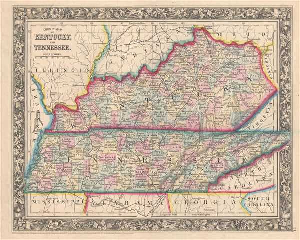
County Map of Kentucky, and Tennessee.
sold
- Digital Map Information
- Suitable for large format printing
- File Size: 4.1 MB
- File Type: ZIP / TIFF
- ICC color profile embedded
- Delivered instantly via download link
This is an 1861 Samuel Augustus Mitchell, Jr. map of Kentucky and Tennessee, two states that would soon fight each other on opposite sides of the onrushing American Civil War. The map depicts the region from Missouri to Virginia, North Carolina, and ... (more details)
The Orange and Alexandria Railroad is labeled - a railroad between Washington, D.C. and Richmond that would play a crucial role during the oncoming American Civil War.
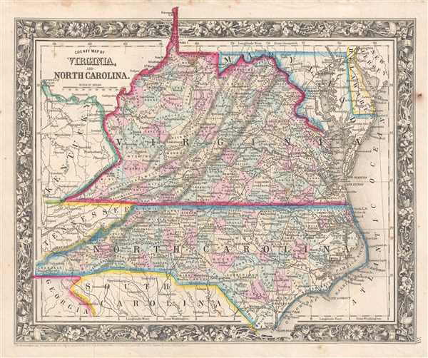
County Map of Virginia, and North Carolina.
sold
- Digital Map Information
- Suitable for large format printing
- File Size: 4.9 MB
- File Type: ZIP / TIFF
- ICC color profile embedded
- Delivered instantly via download link
This is an 1861 Samuel Augustus Mitchell, Jr. map of a unified Virginia with North Carolina, the seat of the Confederacy on the eve of the American Civil War. The map depicts the region from Kentucky, Tennessee, and Georgia to the Atlantic Ocean and ... (more details)
Labels the short-lived York and Cumberland Railroad, the Portland, Saco, and Portsmouth Railroad, and the European and North American Railway.
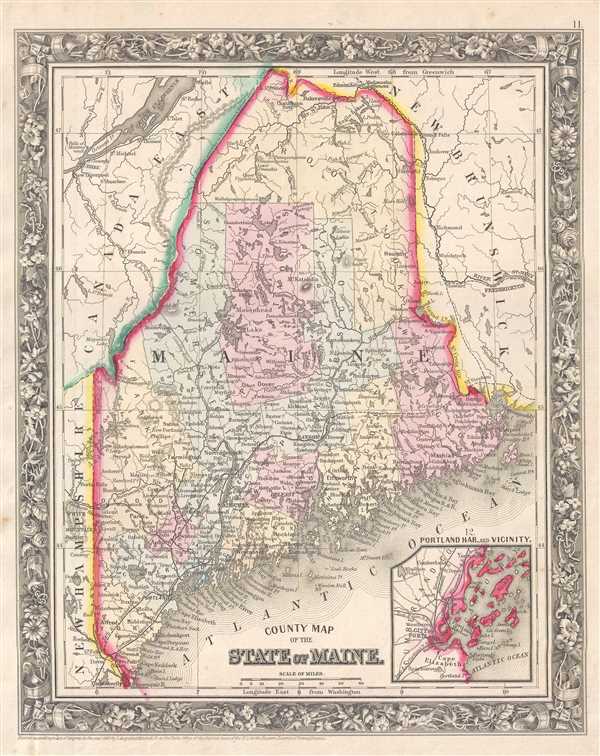
County Map of the State of Maine.
sold
- Digital Map Information
- Suitable for large format printing
- File Size: 5.15 MB
- File Type: ZIP / TIFF
- ICC color profile embedded
- Delivered instantly via download link
This is an 1861 Samuel Augustus Mitchell, Jr. map of Maine. The map depicts the region from New Hampshire to New Brunswick and from Quebec, Maine, and New Brunswick to the Atlantic Ocean. A handful of railroads are also illustrated and labeled. One ... (more details)
First official Bi-Lingual Map of Singapore issued after Malaysian Independence.

Map of Singapore City. / 新嘉坡市區地圖
sold
- Digital Map Information
- Suitable for large format printing
- File Size: 39.44 MB
- File Type: ZIP / TIFF
- ICC color profile embedded
- Delivered instantly via download link
This is an extremely rare large format 1958 first edition map of Singapore in Chinese and English. Being published just one year after the 1957 Treaty of London recognized the independence of the Federation of Malaysia – which then included Singapore - and in the year that Singapore formally attained internal self-governance. The political transition led to a wave of new bi-lingual publications as English was no longer the only official language. Maps in multiple languages became a necessity both for functional and administrative use. (more details)
The most complete illustration of Kircher's revolutionary hydro-geographic theories.
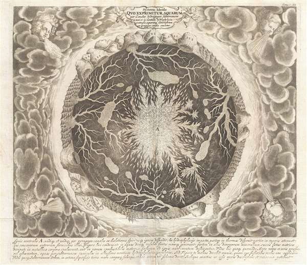
Systema Ideale Qvo Exprimitur, Aquarum per Canales hydragogos subterraneos ex mari et in montium hydrophylacia protrusio, aquarumq. subterrestrium per pyragogos canales concoctus.
sold
- Digital Map Information
- Suitable for large format printing
- DPI: 300
- File Size: 35.14 MB
- File Type: ZIP / TIFF
- ICC color profile embedded
- Delivered instantly via download link
This is one of the 17th century polymath Athanasius Kircher's most iconic and graphically intense maps. This map illustrates the subterranean world and is one of the maps included in Kircher's 1665 cosmography Mundus Subterranous . Inspired by ... (more details)
The Italian polymath Kircher's iconic map of the Earth's Volcanic Systems.

Systema Ideale Pyrophylaciorum Suberraneorum, quorum montes Vulcanii, veluti spiracula quaedam existant.
sold
- Digital Map Information
- Suitable for large format printing
- DPI: 300
- File Size: 12.66 MB
- File Type: ZIP / TIFF
- ICC color profile embedded
- Delivered instantly via download link
This is one of the 17th century polymath Athanasius Kircher's most iconic and graphically intense maps. This map illustrates Earth's volcanic system and is one of the maps included in Kircher's 1665 cosmography Mundus Subterranous . Inspired ... (more details)
Illustrates California as an Island and makes an explicit textual reference to the same theory.

Les Tables de Geographie, reduites en un Jeu de Cartes.
sold
- Digital Map Information
- Suitable for large format printing
- DPI: 300
- File Size: 8.56 MB
- File Type: ZIP / TIFF
- ICC color profile embedded
- Delivered instantly via download link
This is a 1669 Pierre du Val broadside of an uncut complete deck of fifty-two playing cards. Akin to a conventional deck of cards, each of the four traditional suits corresponds with a continent: clubs for the Americas (both North and South), ... (more details)
Stunning map of Rome designed for the Grand Tour set.
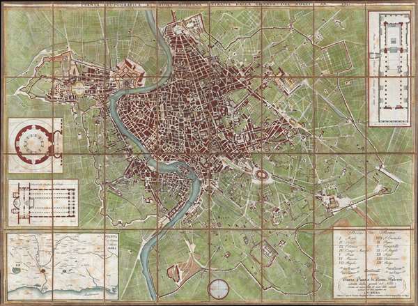
Nuova Pianta de Roma Moderna estratta dalla grand del Nolli corretta ed acccresciuta de nomi delle contrade indicati al loro rispettivo sito in Roma.
sold
- Digital Map Information
- Suitable for large format printing
- DPI: 300
- File Size: 32.32 MB
- File Type: ZIP / TIFF
- ICC color profile embedded
- Delivered instantly via download link
A beautiful 1847 case format map of Rome, Italy issued by Venanzio Monaldini. This extraordinary map of Rome heavily references, with various updates and revisions, the enormous 1734 map of Rome by Giovanni Battista Nolli. Nolli's map was ... (more details)
Extemely rare nautical chart illustrating routes to St. Petersburg, Russia.
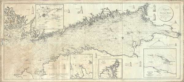
Kaart over den Finske Bugt, samlet og reduceret efter de nyeste udkomne svenske og rusiske Söe-Kaarter. / Map of the Gulf of Finland, based on the most recent charts, both Swedish and Russian.
sold
- Digital Map Information
- Suitable for large format printing
- DPI: 300
- File Size: 32.82 MB
- File Type: ZIP / TIFF
- ICC color profile embedded
- Delivered instantly via download link
A stunning 1815 Danish nautical chart or maritime map of the Gulf of Finland from, roughly Helsinki, Finland to St. Petersburg, Russia. This chart was published in Denmark by Johan Georg Blankensteiner. It covers the entire Gulf of Finland with as well as some of the surrounding seas. There are four inset charts and illustrations of 14 lighthouses as well as rhumb lines and depth soundings throughout. (more details)
Exquisitely detailed map and view of Recife, Brazil.

Das Norder Theil des Lands Brasilien.
sold
- Digital Map Information
- Suitable for large format printing
- DPI: 300
- File Size: 8.15 MB
- File Type: ZIP / TIFF
- ICC color profile embedded
- Delivered instantly via download link
This is a stunningly engraved 1655 Matthaeus Merian map of the coast of Brazil and a view of Olinda and Recife in Pernambuco, Brazil. The inset map, shown as if being unrolled on a piece of parchment, shows the coast of Brazil, and more ... (more details)
An important map that helped ignite European interest in China during the 17th century.
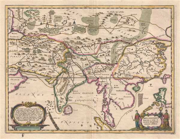
Tabula Geodoborica Itinerum a Varijs in Cataium susceptorum rationem exhibens.
sold
- Digital Map Information
- Suitable for large format printing
- DPI: 300
- File Size: 5.4 MB
- File Type: ZIP / TIFF
- ICC color profile embedded
- Delivered instantly via download link
This is a 1667 Athanasius Kircher map of Asia illustrating several routes from the Middle East to China. The map depicts the continent from the Caspian Sea, Persia, the Persian Gulf, and the Arabian Peninsula to the Pacific Ocean and ... (more details)
Employs a mountain range to separate the Amazon and Paraguay Rivers - unlike most other maps of South America from this era.

Brasilia.
sold
- Digital Map Information
- Suitable for large format printing
- DPI: 300
- File Size: 4.6 MB
- File Type: ZIP / TIFF
- ICC color profile embedded
- Delivered instantly via download link
This is a 1671 Arnoldus Montanus map of Brazil. Oriented toward the west, the map depicts the region from the Rio de la Plata to Guiana and the Atlantic Ocean and from two mythical lakes (Lake Parima and Lake Xarayes) to the Atlantic ... (more details)
Illustrates the Young Territory and Bexar Territory, two early counties in West Texas.
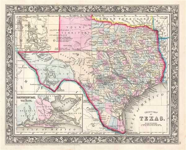
County Map of Texas.
sold
- Digital Map Information
- Suitable for large format printing
- File Size: 4.88 MB
- File Type: ZIP / TIFF
- ICC color profile embedded
- Delivered instantly via download link
This is an 1861 Samuel Augustus Mitchell Jr. map of Texas and part of New Mexico. The map depicts the region from western New Mexico to Arkansas and Louisiana and from the Indian Territory and northern Texas to the Rio Grande River ... (more details)
Incredible pictorial map recounting Montana's frontier history.

Montana. Frontier. Pioneer.
sold
- Digital Map Information
- Suitable for large format printing
- File Size: 9.39 MB
- File Type: ZIP / TIFF
- ICC color profile embedded
- Delivered instantly via download link
This is a 1937 Irvin Shope pictorial map of Montana. The map depicts the state from Idaho to the Dakotas and from Canada to Wyoming, including Yellowstone National Park. Highly detailed, myriad captions, vignettes, and other ... (more details)