
Extremely rare 1776 American Revolutionary War periodical map depicting the route of Benedict Arnold's disastrous expedition to Quebec.
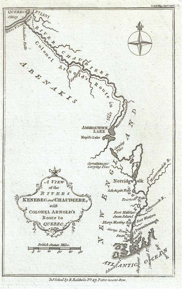
A View of the Rivers Kenebec and Chaudiere, with Colonel Arnold's Route to Quebec.
sold
- Digital Map Information
- Suitable for large format printing
- DPI: 300
- File Size: 1.01 MB
- File Type: ZIP / TIFF
- ICC color profile embedded
- Delivered instantly via download link
This is a 1776 Richard Baldwin map of Colonel Benedict Arnold's expedition to Quebec. The map depicts from Quebec City to the Atlantic Ocean. The Kennebec (Kenebec) River, in what is today the state of Maine, and the Chaudière River, in modern-day Quebec, Canada ... (more details)
Detailed and gorgeous map of the Korean War - with unit insignia, manuscript notations, and a signature!
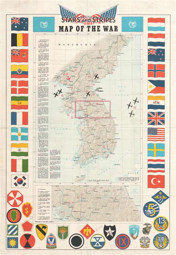
Pacific Stars and Stripes Map of the War.
sold
- Digital Map Information
- Suitable for large format printing
- File Size: 10.78 MB
- File Type: ZIP / TIFF
- ICC color profile embedded
- Delivered instantly via download link
This is a 1953 Pacific Stars and Stripes map of the Korean War. The map depicts the Korean peninsula from the Yalu River and the Tumen River to the Korea Strait and from the Yellow Sea to the Sea of Japan. Twenty-five different events in the history of the Korean ... (more details)
Innovative city map of San Francisco which employs a spinning indicator to aid in locating sites around the city.
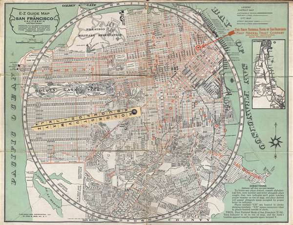
E-Z Guide Map of San Francisco California (with Patent Indicator) Showing at a Glance the Exact Location of Banks, Apartment Houses, Depots, Railway Offices, Theatres, Stores and Street Locations.
sold
- Digital Map Information
- Suitable for large format printing
- File Size: 6.71 MB
- File Type: ZIP / TIFF
- ICC color profile embedded
- Delivered instantly via download link
This is a 1921 Fred B. Bain city map or plan of San Francisco, California. The map depicts the city of San Francisco from the Pacific Ocean and Laguna de la Merced to San Francisco Bay and from the Presidio Military Reservation and the Presidio Golf Club to San ... (more details)
Allows for a glimpse into the racist tendencies of the United States in the 1920s and 1930s.
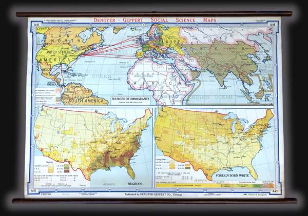
Sources of Immigrants. Negroes. Foreign Born White.
sold
This is a c. 1940s Albert Bushnell Hart and Denoyer-Geppert Company wall map of the world. The map depicts from North America to the Pacific Ocean, Japan, and Indonesia (labeled the Netherlands, Indies) and from the Arctic Circle to just past the Equator. ... (more details)
A striking visual presentation of how the United States expanded from the Atlantic to the Pacific - including the Republic of Texas!

Territorial Acquisitions 1776-1866.
sold
A visually striking piece, this is a c. 1940s Albert Bushnell Hart and Denoyer-Geppert Company wall map of the United States. The map depicts the continental United States from the Pacific Ocean to the Atlantic Ocean and from Canada (labeled British ... (more details)
Visually depicts the Western Expansion of the United States and the creation of the rail network.
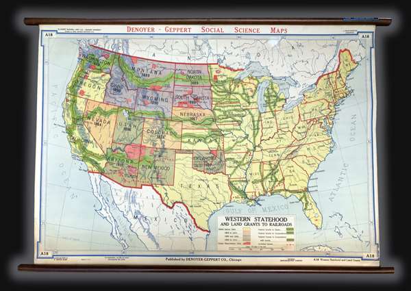
Western Statehood and Land Grants for Railroads.
sold
This is a c. 1940s Albert Bushnell Hart and Denoyer-Geppert Company wall map of the United States. The map depicts the continental United States from the Pacific Ocean to the Atlantic Ocean and from Canada to Mexico. As a means of illustrating the ... (more details)
The only known example in this edition.
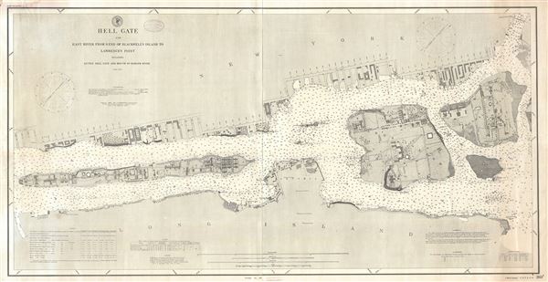
Hell Gate and East River from S. End of Blackwell's Island to Lawrence's Point including Little Hell Gate and Mouth of Harlem River.
sold
- Digital Map Information
- Suitable for large format printing
- File Size: 16.06 MB
- File Type: ZIP / TIFF
- ICC color profile embedded
- Delivered instantly via download link
An extremely scarce and important 1891 nautical chart or maritime map depicting New York City's Hell Gate, the East River, the Harlem River, Roosevelt Island (Blackwell's Island), Ward's Island, and Randall's Island, as well as portions of ... (more details)
One of the more attractive 19th century commercial atlas maps of New York City.

City of New York.
sold
- Digital Map Information
- Suitable for large format printing
- DPI: 300
- File Size: 7.28 MB
- File Type: ZIP / TIFF
- ICC color profile embedded
- Delivered instantly via download link
One of the more attractive atlas maps of New York City to appear in the mid-19th century, this is a beautiful example of Samuel Augustus Mitchell's 1854 map of southern Manhattan. The map depicts southern Manhattan from 37th street (Kips ... (more details)
Rare World War I Era Satirical Map of Europe drawn from the 'Russian' perspective.

Carte Symbolique de L'Europe. / Europe en 1914.
sold
- Digital Map Information
- Suitable for large format printing
- File Size: 9.74 MB
- File Type: ZIP / TIFF
- ICC color profile embedded
- Delivered instantly via download link
A scarce World War I era satirical map illustrating the political situation in Europe in c. 1914. This map was first issued in Poland where it was drawn by the Warsaw artist Vladislav Levinsky. Warsaw at the time being one of the ... (more details)
An incredibly detailed depiction of Eastern Europe, Russia, and Siberia - includes a hint of the coast of Alaska!

Partie Occidentale de l'Empire de Russie, Extrait de l'Atlas Russien et d'autres Cartes. Partie Orientale de l'Empire de Russie, Extrait de l'Atlas Russien et d'autres Cartes.
sold
- Digital Map Information
- Suitable for large format printing
- DPI: 300
- File Size: 11.7 MB
- File Type: ZIP / TIFF
- ICC color profile embedded
- Delivered instantly via download link
This is a 1771 Rigobert Bonne map of Russia. On two sheets, the map depicts from the Baltic Sea to Siberia and the Bering Strait, and from the Arctic Ocean to the Caspian Sea, Sakhalin and Kamchatka. Drawn in extraordinary detail, ... (more details)
A beautiful map depicting Italy before Unification.
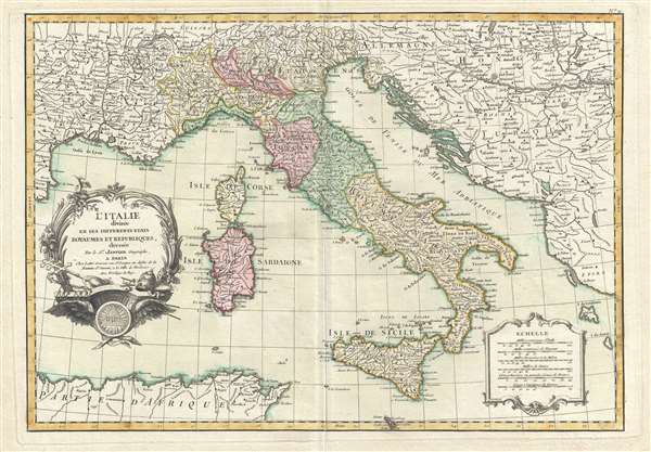
l'Italie divisée en ses Differents Etats Royaumes et Republiques.
sold
- Digital Map Information
- Suitable for large format printing
- DPI: 300
- File Size: 6.84 MB
- File Type: ZIP / TIFF
- ICC color profile embedded
- Delivered instantly via download link
This is a 1762 Jean Janvier map of Italy. The map depicts from the Gulf of Lyon to parts of Hungary and Turkey in Europe and from Lake Geneva in Switzerland to Sicily and North Africa. Depicting the Italian peninsula prior to its ... (more details)
Janvier's beautiful map of 'Greater Europe'.

L'Europe divisée en ses Principaux Etats.
sold
- Digital Map Information
- Suitable for large format printing
- DPI: 300
- File Size: 6.36 MB
- File Type: ZIP / TIFF
- ICC color profile embedded
- Delivered instantly via download link
This is a 1762 Jean Janvier map of the Europe. The map depicts from Iceland to the Aral Sea and from North Africa and the Middle East to the Arctic. Divided into countries and kingdoms, insight into mid-18th century Europe is ... (more details)
Beautiful hand colored map of the South Carolina and Georgia coastline - includes Charleston!
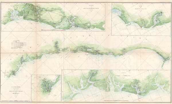
Sketch E Showing the Progress of the Survey in Section No. V from 1847 to 1857.
sold
- Digital Map Information
- Suitable for large format printing
- File Size: 11.64 MB
- File Type: ZIP / TIFF
- ICC color profile embedded
- Delivered instantly via download link
This is an appealing 1860 U.S. Coast Survey chart or map of the Georgia and South Carolina coastline with four sub sketches. The large central map depicts from Cumberland Island in Florida to Cape Fear in North Carolina. ... (more details)
Rare first edition of Mora's second pictorial map.

The Seventeen Mile Drive.
sold
- Digital Map Information
- Suitable for large format printing
- File Size: 18.6 MB
- File Type: ZIP / TIFF
- ICC color profile embedded
- Delivered instantly via download link
The rare first edition of Jo Mora's 1927 pictorial map of Monterey Peninsula's Seventeen Mile Drive. This is the second of Mora's iconic pictorial maps, which he called his 'cartes.' The map covers Monterey peninsula ... (more details)
Scarce map of Lincoln Park, Chicago - depicts the Lincoln Park Zoo and baseball diamonds!
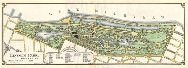
Lincoln Park, Chicago, Ill, 1899.
sold
- Digital Map Information
- Suitable for large format printing
- File Size: 4.08 MB
- File Type: ZIP / TIFF
- ICC color profile embedded
- Delivered instantly via download link
This is an 1899 J. H. Lindrooth map of Lincoln Park, Chicago. The map depicts Lincoln Park from Lake Michigan to N. Clark Street and from Surf Street and Diversity Boulevard to Burton Place. Forty-nine sites are listed ... (more details)
One of the earliest obtainable large format maps of Florida Territory. Shows early Proto-Zionist settlement of Moses Elias Levy.
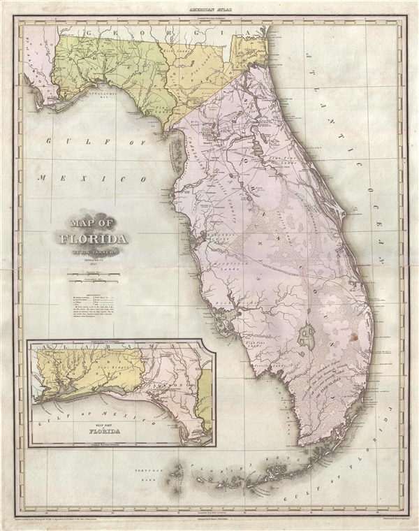
Map of Florida by H. S. Tanner. Improved to 1825.
sold
- Digital Map Information
- Suitable for large format printing
- DPI: 300
- File Size: 14.81 MB
- File Type: ZIP / TIFF
- ICC color profile embedded
- Delivered instantly via download link
A fine example of H. S. Tanner's monumental 1825 map of Florida. This is one of the earliest obtainable maps of Florida Territory. The map covers peninsular Florida to the St. Mary River which forms the Georgia ... (more details)
A French Edition of a map originally drawn by the crew of Captain Cook's third voyage.
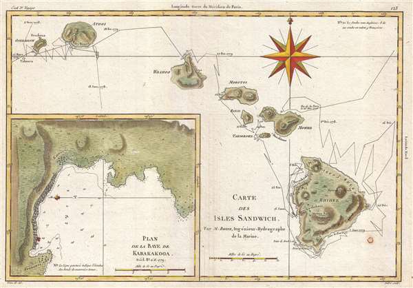
Carte des Isles Sandwich.
sold
- Digital Map Information
- Suitable for large format printing
- DPI: 300
- File Size: 3 MB
- File Type: ZIP / TIFF
- ICC color profile embedded
- Delivered instantly via download link
This is a 1788 Rigobert Bonne map of the Hawaiian Islands and part of the third and final voyage of Captain James Cook. The map depicts Hawaii, Maui, Lanai, Molokai, Oahu, Kauai, and Nihau. The route followed by ... (more details)
Rare example of Coulton Waugh's second pictorial map!

A Map of Cape Cod Wherin is showing ye discovery and ye settlement of the same; with the tracks of ye pilgrims carefully prepared according to Mourts Relation.
sold
- Digital Map Information
- Suitable for large format printing
- File Size: 8.53 MB
- File Type: ZIP / TIFF
- ICC color profile embedded
- Delivered instantly via download link
A beautiful example of Coulton Waugh's 1926 map of Cape Cod. This is the second pictorial map issued by Waugh, predated only by his map of Provincetown (1924). The map is centered on Cape Cod Bay and covers ... (more details)
One of the few true antique wine maps we have seen.
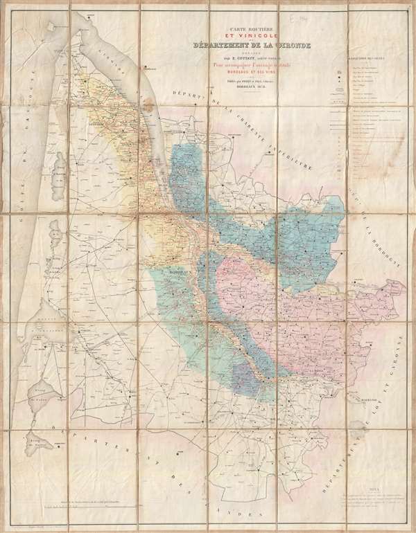
Carte routière et vinicole du Département de la Gironde.
sold
- Digital Map Information
- Suitable for large format printing
- File Size: 29 MB
- File Type: ZIP / TIFF
- ICC color profile embedded
- Delivered instantly via download link
This wonderful 1872 map of the Department of the Gironde, France, is one of the few true antique wine maps. It depicts the Gironde on a grand scale with color coding according to wine region and type. ... (more details)
Associated with The Island of Formosa Past and Present recognized as one of the foremost works on the history of Taiwan.
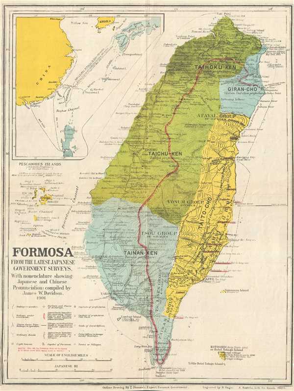
Formosa from the Latest Japanese Government Surveys. With nomenclature showing Japanese and Chinese Pronunciation.
sold
- Digital Map Information
- Suitable for large format printing
- Full resolution TIFF file
- ICC color profile embedded
- Delivered instantly via download link
This is a 1901 James Wheeler Davidson map of Formosa / Taiwan. The map depicts island of Taiwan from Fuki Point and Kelung (Keelung City) to Garambi, which is Kenting National Park today, and from the ... (more details)