
Wonderfully decorative vacationer's map of New England.

Summer Resorts of the Coast, Lake and Mountain Regions along the Boston & Maine Railroad and Connections.
sold
- Digital Map Information
- Suitable for large format printing
- File Size: 21.17 MB
- File Type: ZIP / TIFF
- ICC color profile embedded
- Delivered instantly via download link
A wonderfully decorative 1915 map of New England issued by the Matthews-Northrup Company. The map covers from New York City northwards along the Atlantic coast as far as New Brunswick and the Gulf of Saint Lawrence; and from the Hudson River Valley to the Atlantic ... (more details)
Striking old color Vaugondy map of the German Empire.
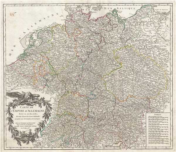
Carte de l'Empire d'Allemagne divisé en ses dix cercles, dessinée d'après les Cartes Nationales assujeties aux observations astronomiques.
sold
- Digital Map Information
- Suitable for large format printing
- DPI: 300
- File Size: 14.79 MB
- File Type: ZIP / TIFF
- ICC color profile embedded
- Delivered instantly via download link
This is a 1756 Gilles Robert de Vaugondy map of the German Empire. The map depicts the German Empire divided into various imperial circles, duchies, and states. The Circles of Westphalia, High and Low Saxony, and Bavaria are depicted, as well as Bohemia and Silesia ... (more details)
Belcher's influential chart is considered the first British Map of Hong Kong.
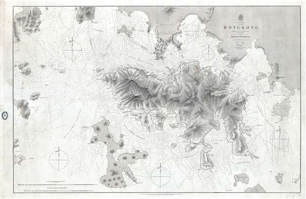
China Hong Kong Surveyed by Captn. Sir Edward Belcher in H.M.S. Sulphur 1841.
sold
- Digital Map Information
- Suitable for large format printing
- File Size: 25.14 MB
- File Type: ZIP / TIFF
- ICC color profile embedded
- Delivered instantly via download link
An iconic map of the utmost importance and rarity, this is the 1864 issue of Edward Belcher's 1843 nautical map of Hong Kong (香港) and vicinity. Belcher's 1841 study is the first detailed British survey of Hong Kong and played a significant role in the British ... (more details)
Controversial Japanese manuscript map identifying Dodko / Takeshima / Liancourt Islands as Korean territory
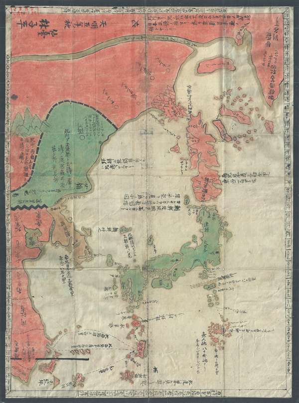
三国通覧輿地路程全図 / Sangoku tsūran yochi rotei zenzu. / Illustrated General Route Map of the Three Countries.
sold
- Digital Map Information
- Suitable for large format printing
- Full resolution TIFF file
- ICC color profile embedded
- Delivered instantly via download link
A banned and controversial map, this is the is the rarest and most important of the five c. 1785 maps issued by Hayashi Shihei. The map's title roughly translates to 'Illustrated General Route Map of the Three Countries.' The three countries, in this case, ... (more details)
Unusual and highly graphic pictorial map of North American composed of 50 trading cards.
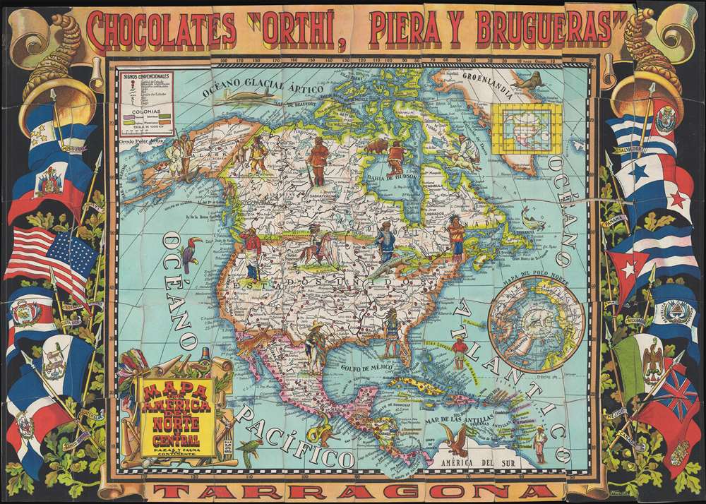
Mapa de America del Norte y Central, Razas y Fauna del Continente.
sold
- Digital Map Information
- Suitable for large format printing
- File Size: 13.3 MB
- File Type: ZIP / TIFF
- ICC color profile embedded
- Delivered instantly via download link
A highly unusual c. 1940 pictorial map of North America issued by Chocolates Orthi, Piera Y Brugueras of Tarragona, Spain. This beautiful pictorial map is composed of 50 unusually shaped trading cards that were issued inside boxes of Spanish chocolates. ... (more details)
Important 17th century map illustrating the conflict between French and English claims to the Carolina, Georgia, Florida seaboard.
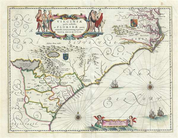
Virginiae Partis australis, et Floridae partis orientalis, interjacentiumque regionum Nova Descriptio.
sold
- Digital Map Information
- Suitable for large format printing
- DPI: 300
- File Size: 10.73 MB
- File Type: ZIP / TIFF
- ICC color profile embedded
- Delivered instantly via download link
A fine example of Jan Janssonius's 1640 map of the southeastern part of North America. The map covers the Atlantic seaboard form the Chesapeake Bay to Norther Florida, inducing the modern-day states of Virginia, North Carolina, South Carolina, Georgia, ... (more details)
Spectacularly detailed British Army map of Singapore and Malaysia.
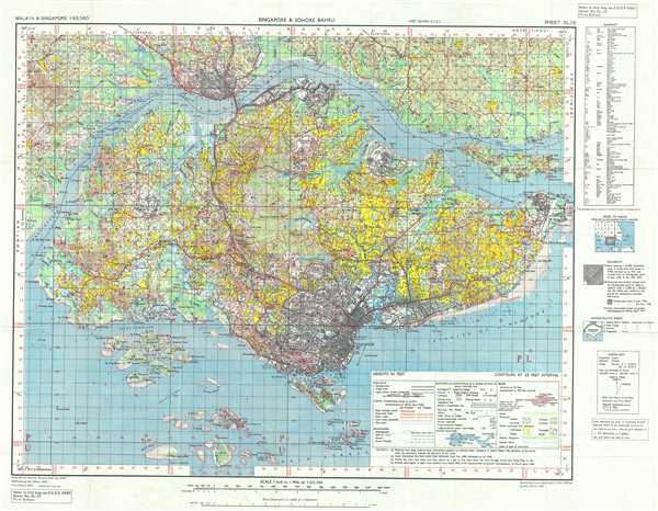
Singapore and Johore Bahru
sold
- Digital Map Information
- Suitable for large format printing
- File Size: 21.61 MB
- File Type: ZIP / TIFF
- ICC color profile embedded
- Delivered instantly via download link
This is a 1953 British War Office map of Singapore and Johor Bahru (Johore Bahru), # 4690. This map centers on the island of Singapore and depicts Johor Bahru and the surrounding areas of the extreme southern tip of the Malaysian peninsula. The border ... (more details)
Gorgeous and rare hand colored German edition of De L'Isle's map of North America.

America das Mitternächtige nach der Zeichnung des Herrn Wilhelm Delisle.
sold
- Digital Map Information
- Suitable for large format printing
- DPI: 300
- File Size: 4.95 MB
- File Type: ZIP / TIFF
- ICC color profile embedded
- Delivered instantly via download link
This is a beautiful hand colored 1745 Johann Justin Gebauers map of North America. This map is a rare German language edition of Guillaume Delisle's map. The map depicts from Baffin Bay and Greenland south through Canada and the United States, through ... (more details)
Stunning early map of the Niagara Isthmus with exceptionally fine engraving.

Plan de la Cataracte de Niagara et le l'Isthme qui separe les Lacs Erié et Ontario.
sold
- Digital Map Information
- Suitable for large format printing
- DPI: 300
- File Size: 3.5 MB
- File Type: ZIP / TIFF
- ICC color profile embedded
- Delivered instantly via download link
A wonderful 1801 map of the Niagara Falls and the Niagara isthmus between Lake Erie and Lake Ontario. Oriented to the west, this map covers the Niagara River from Lake Erie to Lake Ontario. It identifies Fort Erie, Fort Niagara, Grand Isle, and of ... (more details)
Charming Japanese pictorial map of the world with illustrations of cannibalism.
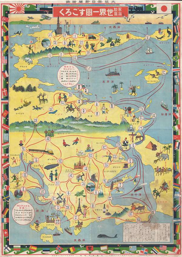
家庭教育世界一周すごろく / Home Education Round-the-World Sugoroku./ Katei kyōiku sekai isshū sugoroku.
sold
- Digital Map Information
- Suitable for large format printing
- File Size: 37.45 MB
- File Type: ZIP / TIFF
- ICC color profile embedded
- Delivered instantly via download link
This is an exceptionally charming Taisho 15 or 1926 Japanese pictorial world map and round-the-world sugoroku game. Although somewhat distorted and not drawn to scale, this is both a game board and a map of the world. Oriented with east at the ... (more details)
Rare and historically important map of Ecuador and the Spanish-French Geodesic Mission.
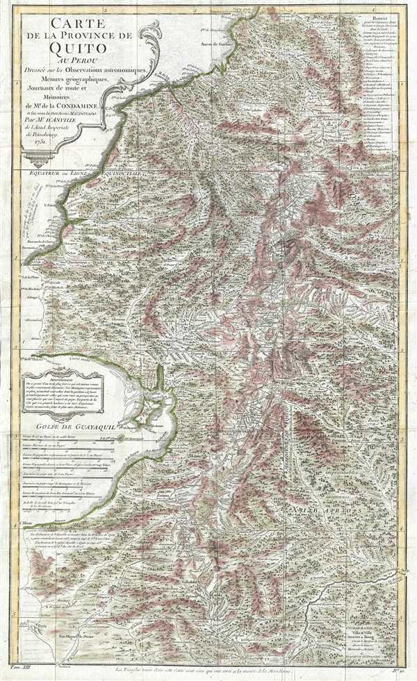
Carte de la Province de Quito au Perou. Dressée sur les observations astronomiques, mesure géographiques, journaux de route et mémoires de Mr. de Condamine et sur ceux de Don Pedro Maldonado.
sold
- Digital Map Information
- Suitable for large format printing
- DPI: 300
- File Size: 12.49 MB
- File Type: ZIP / TIFF
- ICC color profile embedded
- Delivered instantly via download link
This is a 1751 Charles Marie de la Condamine and Jean-Baptiste Bourguinon d'Anville map of Ecuador and Peru. This map details, with incredible precision, the area which the Spanish called the Province of Quito, which covers parts of modern day ... (more details)
Rare and historically significant map of the Swedish and Dutch Arctic Expeditions of 1878.
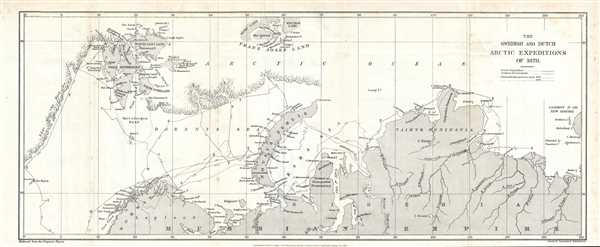
The Swedish and Dutch Arctic Expeditions of 1878.
sold
- Digital Map Information
- Suitable for large format printing
- File Size: 4.39 MB
- File Type: ZIP / TIFF
- ICC color profile embedded
- Delivered instantly via download link
This is a rare 1879 Sir Clements Robert's map of the Arctic. This map depicts the northern coast of Russia (Russian Empire), Lapland and Norway the Arctic Ocean, and the edge of the ice sheet. Novaya Zemlya (Novaya Zemlia), the Kara Sea, and ... (more details)
One of the first accurate maps of the Hindu Kush Mountains in Afghanistan.
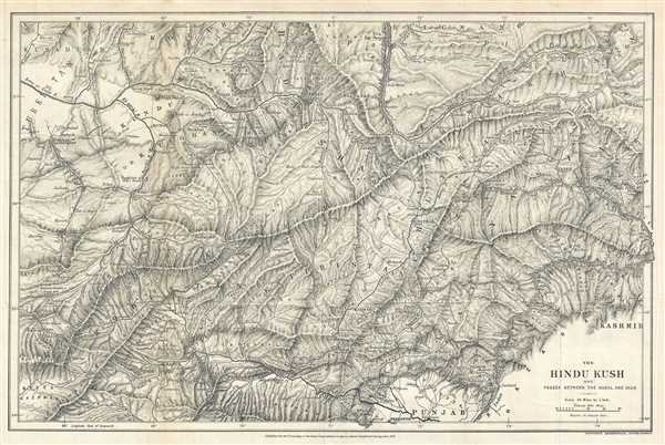
The Hindu Kush and Passes Between the Kabul and Oxus.
sold
- Digital Map Information
- Suitable for large format printing
- File Size: 9.24 MB
- File Type: ZIP / TIFF
- ICC color profile embedded
- Delivered instantly via download link
This is a rare 1879 Sir Clements Robert Stanford map of Afghanistan and Pakistan. The map present parts of both Afghanistan and Pakistan, but is centered around the Hindu Kush Mountains and their watershed. The map depicts myriad rivers in ... (more details)
One of the earliest accurate mappings of the Afghanistan's Sulimani Mountains.

The Sulimani Mountains on the Afghan Frontier of British India. Based on Major Wilson's map, collated with other authorities.
sold
- Digital Map Information
- Suitable for large format printing
- File Size: 12.7 MB
- File Type: ZIP / TIFF
- ICC color profile embedded
- Delivered instantly via download link
This is a rare 1879 Sir Clements Robert's map of the Sulimani Mountains in Afghanistan. This map depicts the Afghanistan-Pakistan border, which at the time was British India, from Peshawar (Peshawur) and Kabul in the north to south to ... (more details)
Incredible hand colored map of Hispaniola before Christopher Columbus illustrating indigenous Zemi artifacts.
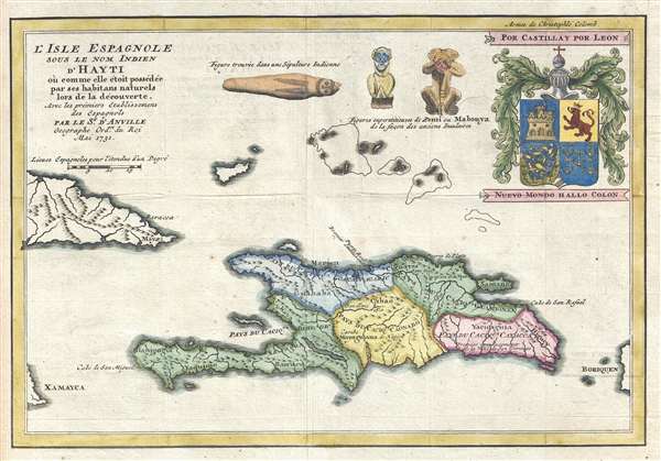
L'Isle Espagnole Sous le Nom Indien d'Hayti où comme elle étoit possédée par ses habitans naturels lor de la découverte, Avec les prémiers Etablissements des Espagnols.
sold
- Digital Map Information
- Suitable for large format printing
- DPI: 300
- File Size: 2.56 MB
- File Type: ZIP / TIFF
- ICC color profile embedded
- Delivered instantly via download link
This is a beautiful hand colored 1731 Jean-Baptiste Bourguinon d'Anville map of Haiti. This map depicts the island of Hispaniola as it may have been before Christopher Columbus made is trans-Atlantic voyage. Hispaniola is divided into ... (more details)
Beautiful view of Lake Winnipesaukee, New Hampshire

Lake Winnipesaukee New Hampshire
sold
- Digital Map Information
- Suitable for large format printing
- File Size: 18.03 MB
- File Type: ZIP / TIFF
- ICC color profile embedded
- Delivered instantly via download link
This is a beautiful 1909 bird's eye view style pocket map of Lake Winnipesaukee, New Hampshire by the Geo. H. Walker and Company, Boston. One of the more obscure and rare maps by George Walker, it covers the popular summertime ... (more details)
Ivan Chisholm Pictorial map illustrating the history of Boston.
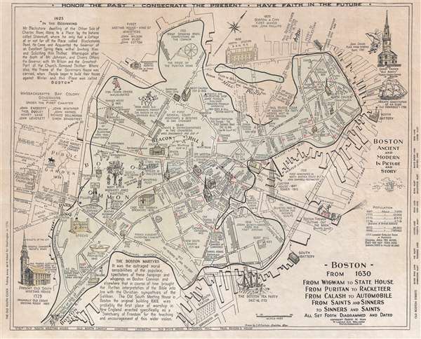
Boston from 1630 From Wigwam to State house From puritan to Racketeer From Calash to Automobile From Saints and Sinners to Sinners and Saints All Set Forth Diagramed and Dated.
sold
- Digital Map Information
- Suitable for large format printing
- File Size: 9.78 MB
- File Type: ZIP / TIFF
- ICC color profile embedded
- Delivered instantly via download link
A delightful c. 1960 broadside historical pictorial map of Boston. Drawn by Ivan A. Chisholm, of Braintree Massachusetts, and published by Robert M. Winn, this pictorial map attempts to illustrate the history of Boston on a ... (more details)
Road map of Korea created for the Korean War.
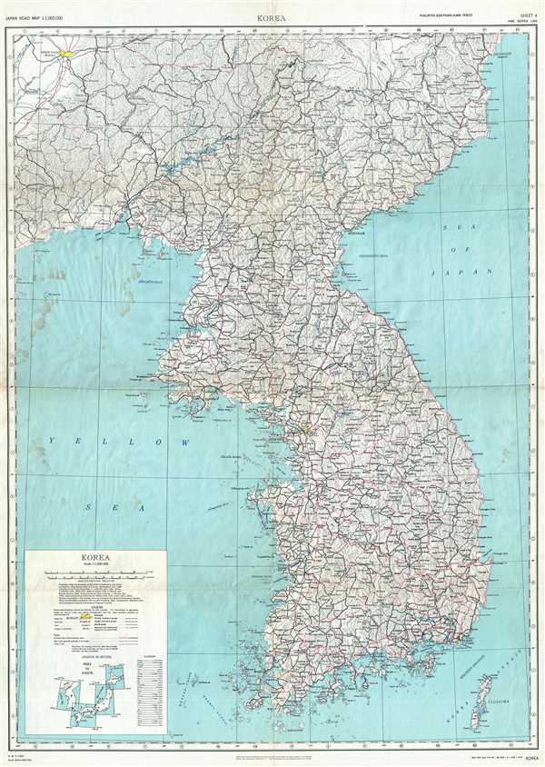
Korea. AMS Series L302 Sheet 4.
sold
- Digital Map Information
- Suitable for large format printing
- File Size: 27.01 MB
- File Type: ZIP / TIFF
- ICC color profile embedded
- Delivered instantly via download link
This is a 1951 Korean War (1950 – 1953) U.S. Army Map Service road map of Korea. This map depicts the entire Korean peninsula, including both North (DPRK) and South Korea (ROK), from Pusan to the Chinese border, and ... (more details)
Rare map illustrating Japanese concerns over Russian and American expansionism.

[Russia, China, Japan, Korea, Alaska]
sold
- Digital Map Information
- Suitable for large format printing
- File Size: 50.29 MB
- File Type: ZIP / TIFF
- ICC color profile embedded
- Delivered instantly via download link
This is a highly unusual 1867 or Keiō 3 Japanese lithograph map of Asia and Alaska. The map covers from the Caspian Sea and Nova Zembla to Alaska as far as Prince of Wales Island and Sitka. It embraces most of the ... (more details)
Scarce final issue of the important Holland-Jefferys Map New York, New Jersey, and the Hudson Valley on the brink of the American Revolutionary War. The best obtainable Revolutionary War Era map of this region.
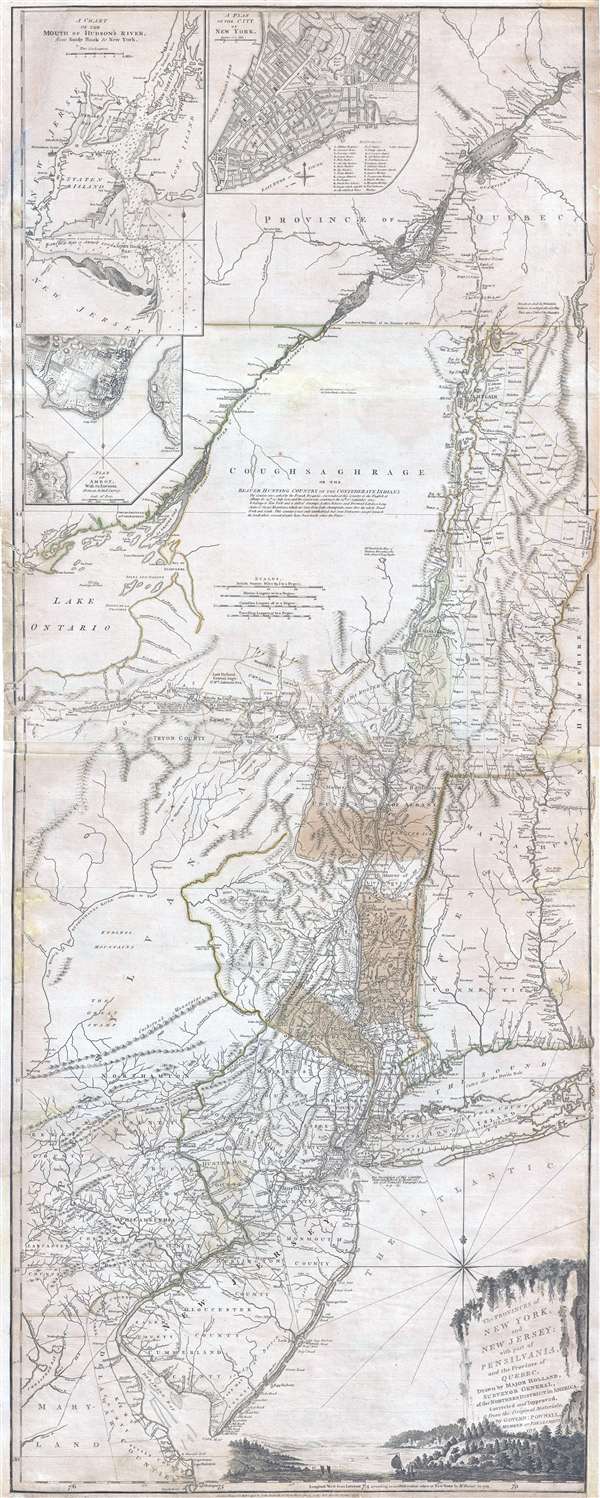
The Provinces of NEW YORK, and NEW JERSEY; with part of PENSILVANIA, and the Governments of TROIS RIVIERES, and MONTREAL: drawn by Major Holland, Surveyor General, of the Norther District in America. / A Chorographical Map of the Country between Albany, Oswego, Fort Frontenac, and Les Trois Rivieres; Exhibiting all the Grants made by the French Governors on Lake Champlain; & between that Lake & Montreal.
sold
- Digital Map Information
- Suitable for large format printing
- DPI: 300
- File Size: 26.6 MB
- File Type: ZIP / TIFF
- ICC color profile embedded
- Delivered instantly via download link
One of the most important, influential, and comprehensive American Revolutionary War Era map of New York, New Jersey, Vermont, and the Hudson Valley corridor, this is an final 1776 state of Major Samuel Holland and ... (more details)