
Map of Alaska from the year it was ceded by Russia to the United States.

North Western America, Showing the Territory Ceded by Russia to the United States.
sold
- Digital Map Information
- Suitable for large format printing
- File Size: 6.32 MB
- File Type: ZIP / TIFF
- ICC color profile embedded
- Delivered instantly via download link
This is a beautiful hand colored 1867 map of Alaska by the American map publisher S. A. Mitchell Jr. It covers the territory ceded by Russia to the United States (modern day Alaska) and neighboring regions. Color coded according to county and territory. Shows ... (more details)
Beautiful map of Florida with inset of Mobile, Alabama.
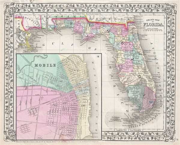
County Map of Florida.
sold
- Digital Map Information
- Suitable for large format printing
- File Size: 5.97 MB
- File Type: ZIP / TIFF
- ICC color profile embedded
- Delivered instantly via download link
This hand colored antique map of Florida is a lithographic engraving dating to 1867 by the important American map publisher Samuel Augustus Mitchell, the younger. Map features a large inset of Mobile Alabama, indicating streets and important buildings. ... (more details)
A desirable map depicting the states of Arizona and New Mexico.

Arizona and New Mexico.
sold
- Digital Map Information
- Suitable for large format printing
- File Size: 6.57 MB
- File Type: ZIP / TIFF
- ICC color profile embedded
- Delivered instantly via download link
A beautiful example of S. A. Mitchell Jr.'s 1867 map of Arizona and New Mexico. Superb detail regarding American Indian Tribes, mining areas, and emigrant trails. Denotes both political and geographical details. One of the most attractive American ... (more details)
Mitchell's plan of the city of Chicago, Illinois.
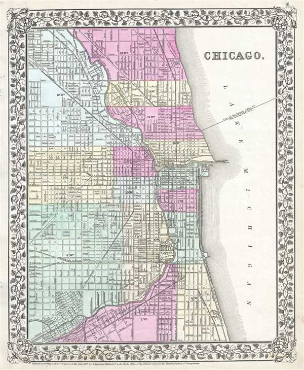
Chicago.
sold
- Digital Map Information
- Suitable for large format printing
- File Size: 6.54 MB
- File Type: ZIP / TIFF
- ICC color profile embedded
- Delivered instantly via download link
This hand colored map or plan of the city of Chicago dates to 1869 and was issued by the important American map publisher Samuel Augustus Mitchell, the younger. It covers from thirty first street northward to Fullerton Avenue. The map covers the ... (more details)
Beautiful topographical map of northern Cape Cod and Provincetown.
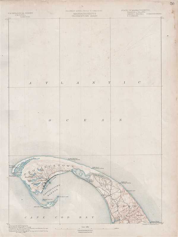
Massachusetts Provincetown Sheet.
sold
- Digital Map Information
- Suitable for large format printing
- File Size: 1.52 MB
- File Type: ZIP / TIFF
- ICC color profile embedded
- Delivered instantly via download link
One of the most sought after topographical maps produced by the U.S. Geological Survey. The 1890 edition of the U.S.G.S. Survey Map of Provincetown covers the northern tip of Cape Cod and extends from Gull Pamet River and Smalls Hill north along ... (more details)
An iconic surrealist embodiment of the golden age of air travel by Lucian Boucher.

Air France.
sold
- Digital Map Information
- Suitable for large format printing
- File Size: 27.49 MB
- File Type: ZIP / TIFF
- ICC color profile embedded
- Delivered instantly via download link
One of Lucien Boucher's more iconic surrealistic map images, this is a scarce large format edition of his 1947 pictorial map of the world showing the routes of Air France. Boucher started producing maps for Air France as early as 1933. ... (more details)
Stunning map of several important Canadian cities during the French and Indian War.
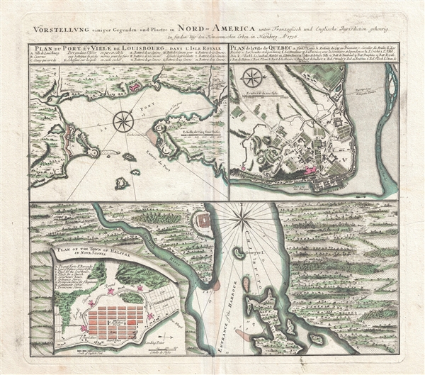
Vorstellung einiger Gegenden und Plaetze in Nord-America unter Franzoesisch und Englische Jurisdiction gehoerig.
sold
- Digital Map Information
- Suitable for large format printing
- DPI: 300
- File Size: 15.08 MB
- File Type: ZIP / TIFF
- ICC color profile embedded
- Delivered instantly via download link
An attractive 1756 Homann Heirs map of the Canadian cities of Halifax (Nova Scotia), Louisbourg (Nova Scotia) and Quebec City (Quebec) at the outset of the French and Indian War (1756 – 1763). Essentially four maps on one sheet. ... (more details)
Beautiful nautical Chart of Florida's Key West.

Preliminary Coast Chart No. 71 Florida Reefs From Newfound Harbor Key to Boca Grande Key.
sold
- Digital Map Information
- Suitable for large format printing
- File Size: 2.94 MB
- File Type: ZIP / TIFF
- ICC color profile embedded
- Delivered instantly via download link
This is a very attractive example of the rare 1859 U.S. Coast Survey Map the western Florida Keys. Centered on Key West, this map covers from Ramrod Key and Newfound Harbor Key in the east to Boca Grande Key in the west. All of the ... (more details)
One of the first modern trianguation surveys of the Texas coastline.

Sketch I Showing the Progress of the Survey in Section No. IX form 1848 to 1861.
sold
- Digital Map Information
- Suitable for large format printing
- File Size: 3.7 MB
- File Type: ZIP / TIFF
- ICC color profile embedded
- Delivered instantly via download link
An attractive example of the 1861 U.S. Coast survey progress chart of the Texas Gulf Coast from Corpus Christi to Galveston. The map covers the Texas Coast line from Laguna Madre eastwards past Matagorda Bay to Galveston Bay. It ... (more details)
Early manuscript map of Bali and Lombok, Indonesia.
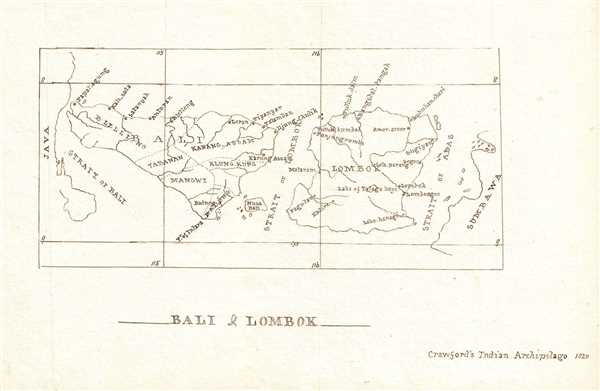
Bali and Lombok.
sold
- Digital Map Information
- Suitable for large format printing
- DPI: 300
- File Size: 0.74 MB
- File Type: ZIP / TIFF
- ICC color profile embedded
- Delivered instantly via download link
This is a beautiful c.1835 manuscript map of Bali and Lombok Islands of Indonesia. According to the note in the lower right quadrant, this map is most likely based on ‘Crawford’s Indian Archipelago, 1820’. The map is ... (more details)
Manuscript map of the Cocos or Keeling Islands of Australia, later studied by Charles Darwin.
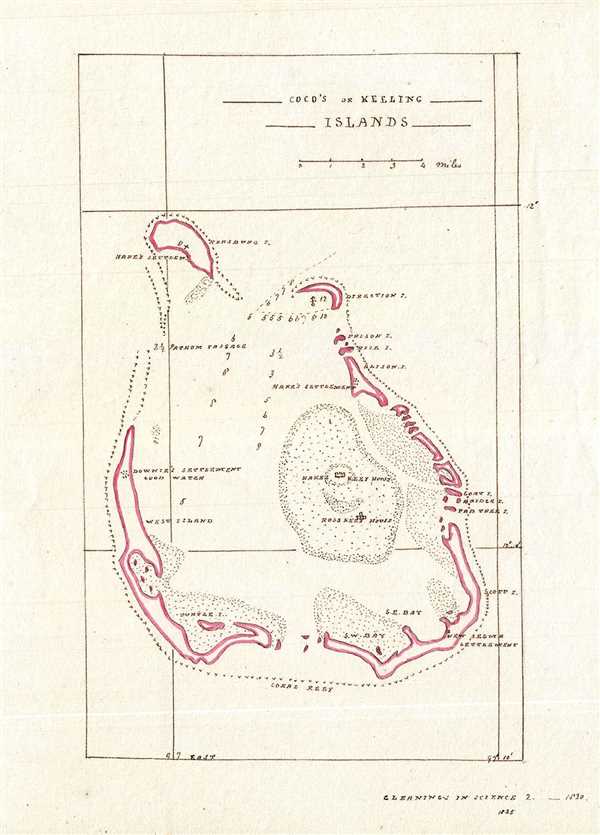
Coco's or Keeling Islands.
sold
- Digital Map Information
- Suitable for large format printing
- DPI: 300
- File Size: 1.17 MB
- File Type: ZIP / TIFF
- ICC color profile embedded
- Delivered instantly via download link
This is an exceptionally detailed 1835 manuscript nautical map of the Cocos or Keeling Islands of Australia located in the Indian Ocean. The map covers the South Keeling Islands, an atoll of 24 inlets which form an ... (more details)
Beautiful manuscript map based on the travels of A.F. Gardiner.

[Zoolu Country].
sold
- Digital Map Information
- Suitable for large format printing
- DPI: 300
- File Size: 1.03 MB
- File Type: ZIP / TIFF
- ICC color profile embedded
- Delivered instantly via download link
This is a lovely c.1840 manuscript map of Zululand and vicinity, South Africa. It covers the region from the Tugela River north to Umzoloni or Unkunginglove. According to the text in the lower right quadrant, this ... (more details)
Beautiful manuscript map of the Chamisso Wilderness based on Beechey's voyage.
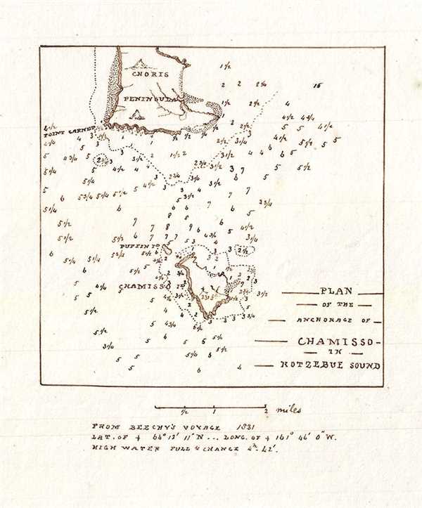
Plan of the Anchorage of Chamisso in Kotzebue Sound.
sold
- Digital Map Information
- Suitable for large format printing
- DPI: 300
- File Size: 0.46 MB
- File Type: ZIP / TIFF
- ICC color profile embedded
- Delivered instantly via download link
This is a beautiful 1835 manuscript map depicting the anchorage of Chamisso Island and Kotzebue Sound in the Northwest Arctic region of Alaska. The map is centered on Chamisso Island and includes the southern part ... (more details)
Manuscript nautical chart of the volcanic Columbretes Islands of Spain.
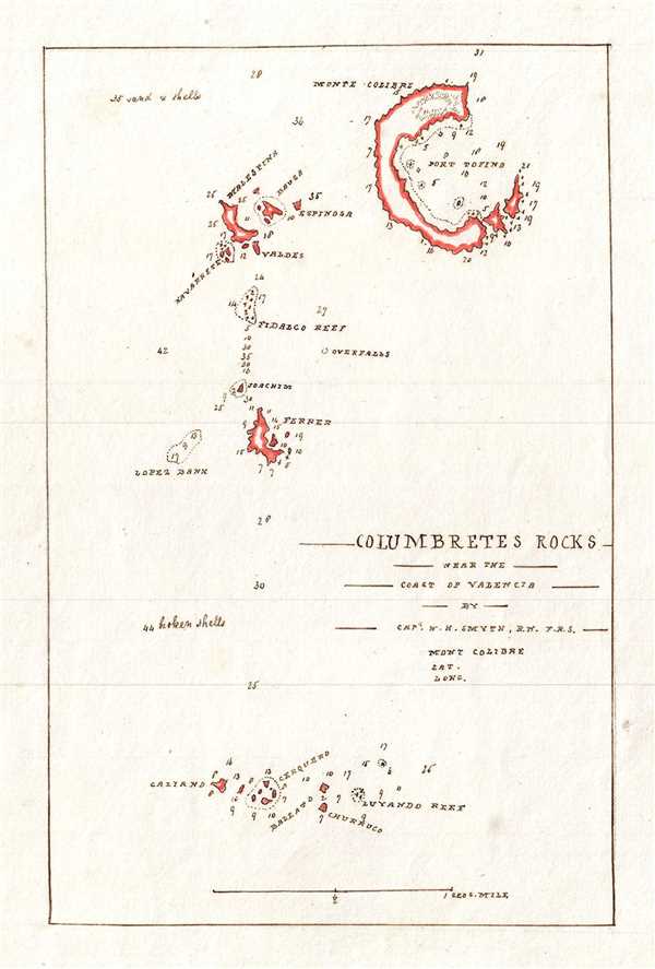
Columbretes Rocks near the Coast of Valencia.
sold
- Digital Map Information
- Suitable for large format printing
- DPI: 300
- File Size: 0.68 MB
- File Type: ZIP / TIFF
- ICC color profile embedded
- Delivered instantly via download link
This is a nice c.1835 manuscript nautical map of the Columbretes Islands located near the coast of Valencia, Spain. The map covers the entire group from the small southernmost islands of Galiano, Cerquero, ... (more details)
Manuscript map of the eastern portion of the Hoshangabad District in Madhya Pradesh, India.
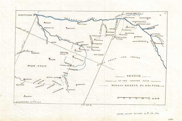
Sketch of the Country from Tendoo Kherie to Baitool.
$250.00
Acquire
- Digital Map Information
- Suitable for large format printing
- DPI: 300
- File Size: 0.98 MB
- File Type: ZIP / TIFF
- ICC color profile embedded
- Delivered instantly via download link
This is a beautiful 1835 manuscript map of the eastern portion of the Hoshangabad District in modern day Madhya Pradesh, India. The map covers from Tendukheda and the Narmada River south as to Baitool ... (more details)
Manuscript map of the western portion of the Hoshangabad District in India.
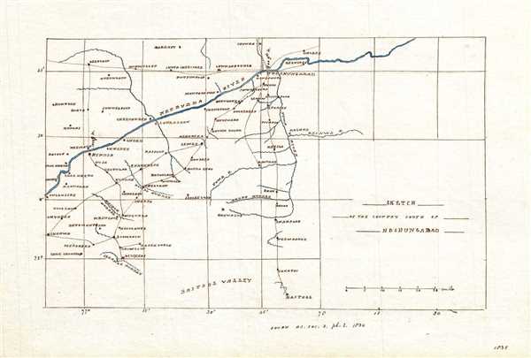
Sketch of the Country South of Hoshungabad.
$250.00
Acquire
- Digital Map Information
- Suitable for large format printing
- DPI: 300
- File Size: 0.97 MB
- File Type: ZIP / TIFF
- ICC color profile embedded
- Delivered instantly via download link
This is a beautiful 1835 manuscript map of the western portion of the Hoshangabad District in modern day Madhya Pradesh, India. The map covers from the Narmada River south as to Baitool (Betul) and ... (more details)
19th century manuscript map of Hispaniola or Santo Domingo in the West Indies.
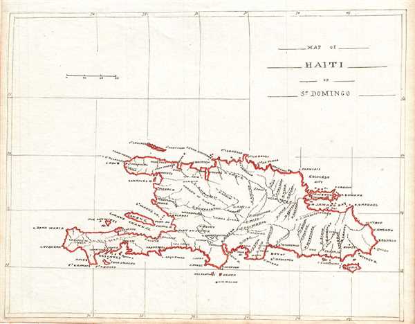
Map of Haiti or St. Domingo.
sold
- Digital Map Information
- Suitable for large format printing
- DPI: 300
- File Size: 1.26 MB
- File Type: ZIP / TIFF
- ICC color profile embedded
- Delivered instantly via download link
This is a beautiful c.1835 manuscript map of the island of Santo Domingo (St. Domingo) or Hispaniola. It covers the entire island with striking outline color. Identifies cities, towns, rivers and ... (more details)
The only published version of the Revolutionary War British manuscript headquarters map of New York City. Staggeringly huge and extremely rare!
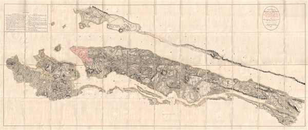
B. F. . Stevens's Facsimile of the Unpublished British Head Quarters Colored Manuscript Map of New York & Environs (1782) Reproduced from the Original Drawing in the War Office, London.
sold
- Digital Map Information
- Suitable for large format printing
- Full resolution TIFF file
- ICC color profile embedded
- Delivered instantly via download link
Quite a remarkable discovery of exceptional size, beauty, and rarity. This gigantic Revolutionary War Era map of New York City is the only published facsimile the the great manuscript map of New ... (more details)
Important map issued at the outset of the French and Indian War.

America Septentrionalis a domino d'Anville in Galiis edita nunc in Anglia coloniis in interiorem Virginiam deductis nec non fluvii Ohio cursu aucta notisq geographicis et historicis illustrata.
sold
- Digital Map Information
- Suitable for large format printing
- DPI: 300
- File Size: 14.65 MB
- File Type: ZIP / TIFF
- ICC color profile embedded
- Delivered instantly via download link
A fine example of the 1756 first edition of the Homann Heirs map of the English Colonies in North America near the outset of the French and Indian War. The map covers much of the eastern part of ... (more details)
The iconic Bufflao Map.
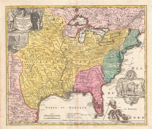
Amplissimae Regionis Mississipi seu Provinciae Ludovicianae a R.P. Ludovico Hennepin Francisc Miss in America Septentrionali Anno 1687. Detectae, Nunc Gallorum Coloniis et Actionum Negotiis Toto Orbe Celeberrimae.
sold
- Digital Map Information
- Suitable for large format printing
- DPI: 300
- File Size: 17.79 MB
- File Type: ZIP / TIFF
- ICC color profile embedded
- Delivered instantly via download link
An iconic c. 1720 map of the Mississippi River Valley by Johann Baptiste Homan. Commonly called the 'Buffalo Map' for its distinctive decorative elements depicting a stylized buffalo, this map ... (more details)