
Igniting the Congo Crisis.

Etat du Katanga. Le pays du bonheur. Inchi yetu. Notre pays.
sold
- Digital Map Information
- Suitable for large format printing
- DPI: 600
- File Size: 61.2
- File Type: ZIP / TIFF
- # of Files: 1
- ICC color profile embedded
- Delivered instantly via download link
This is a c. 1960 Louis Dressen map of the State of Katanga, a secessionist region of the Congo, published in Elisabethville, Katanga's capital. Katanga's secession ignited the Congo Crisis and ultimately led to the dictatorship of Mobutu Sese Seko. (more details)
Definitive mapping of Basque dialects.
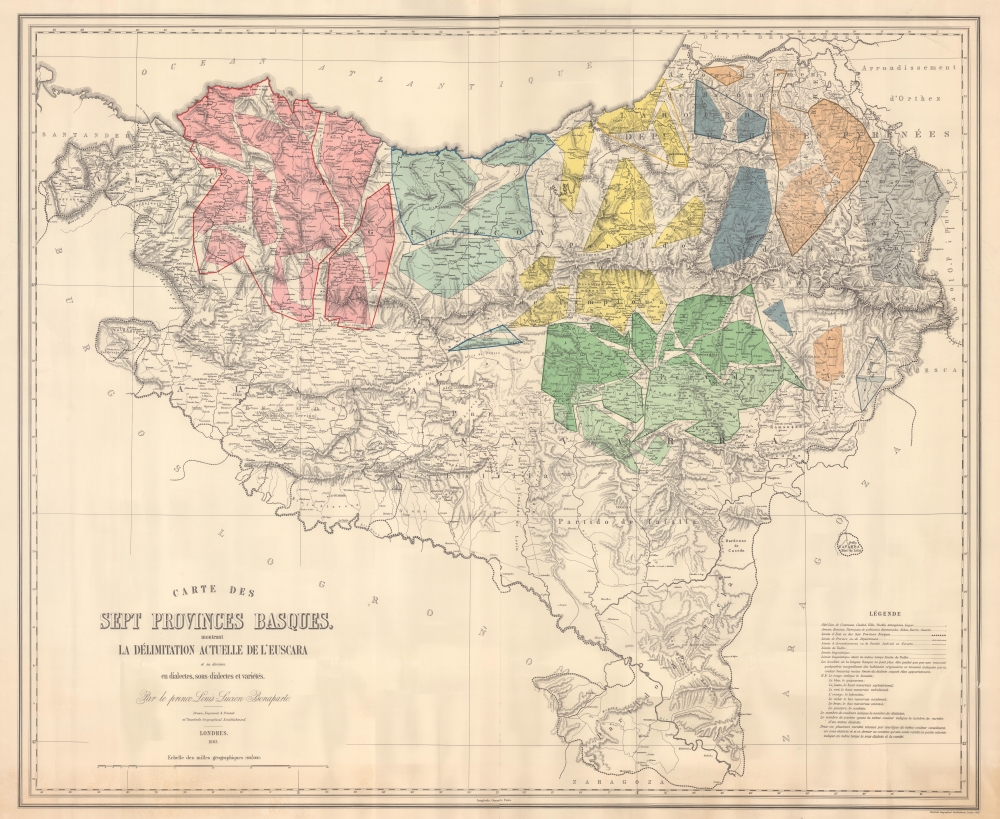
Carte des Sept Provinces Basques, montrant La Délimitation Actuelle de L'Euscara et sa division en dialectes, sous-dialects et variétés.
sold
- Digital Map Information
- Suitable for large format printing
- File Size: 81.28 MB
- File Type: ZIP / TIFF
- ICC color profile embedded
- Delivered instantly via download link
This is an impressive large-scale 1863 linguistic map of the Basque country in Spain and France showing the dialects, varieties, and sub-varieties of the Basque language, Euskara. The map illustrates the philological of Louis Lucien Bonaparte, whose classifications of Euskara remains definitive. (more details)
New take on the West Indies.
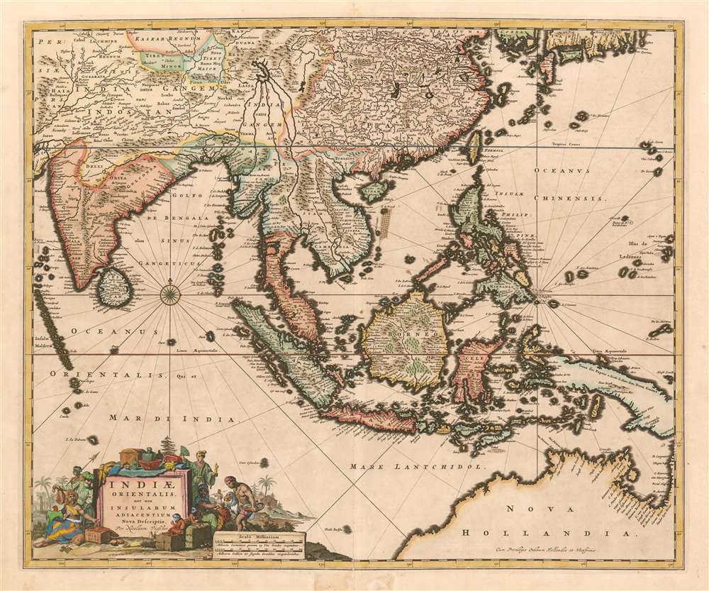
Indiae Orientalis, nec non Insularum Adiacenum Nova Descriptio per Nicolaum Visscher.
sold
- Digital Map Information
- Suitable for large format printing
- Full resolution TIFF file
- ICC color profile embedded
- Delivered instantly via download link
This is Nicolas Visscher's c. 1657 map of the East Indies, one of the defining Dutch maps of the primary source of Dutch wealth for the second half of the 17th century. The map shows India and the Indian Ocean, the East Indies, the north coast of Australia showing the Gulf of Carpentaria, and New Guinea. China is shown, as are the southern coasts of Korea and Japan. (more details)
Comprehensive proposal for justice for Native peoples.

Lilawaste Lake Country refuge-to-be.
$1,200.00
Acquire
- Digital Map Information
- Suitable for large format printing
- File Size: 29.92 MB
- File Type: ZIP / TIFF
- ICC color profile embedded
- Delivered instantly via download link
An engrossing and poignant map that merits hours of close study, this is a highly detailed and acerbic proposal for a 'Lilawaste Lake Country Refuge' drawn by the pseudonymous Iktomi. It appeared in the 1937 book America Needs Indians!, by the same author, a creative and combative work that sharply criticizes White society's destruction of indigenous cultures and proposes measures for maintaining and even reviving the latter. (more details)
Unique WWII Axis Route Map.

Marcha de la División Español,a de Voluntarios hacia el frente del Este. Grafenwöhe, 21. Agosto - Nowgorod, 9. Octubre 1941.
sold
- Digital Map Information
- Suitable for large format printing
- File Size: 3.19 MB
- File Type: ZIP / TIFF
- ICC color profile embedded
- Delivered instantly via download link
This is a unique 1942 World War II Axis-made unit route map illustrating the war experience of the Spanish Volunteer Division (Spanish Blue Division). The Blue Division was a group of staunchly anti-Bolsehevic Spanish volunteers who joined the German Wehrmacht on the Eastern Front against Communist Russia. It is one of VERY few examples of a WWII unit route map made by Axis forces. (more details)
Hardship and Training at Valley Forge.

Topographic View of Valley Forge During the Encampment of Washington's Army in the Winter of 1777 - 78.
sold
- Digital Map Information
- Suitable for large format printing
- File Size: 53.94 MB
- File Type: ZIP / TIFF
- ICC color profile embedded
- Delivered instantly via download link
This is a c. 1877 George S. Harris map of Valley Forge, Pennsylvania, and the Continental Army encampment during the American Revolutionary War. Buildings are illustrated in profile, including General George Washington's headquarters, the headquarters of other officers, the arsenal, and huts housing soldiers. Soldiers are illustrating drilling with Baron von Steuben's newly introduced tactics. Redoubts (fortifications) underscore the very real threat of enemy attack. (more details)
Navigating the Bay.

San Francisco Entrance California.
sold
- Digital Map Information
- Suitable for large format printing
- File Size: 91.18 MB
- File Type: ZIP / TIFF
- ICC color profile embedded
- Delivered instantly via download link
This is a 1903 U.S. Coast and Geodetic Survey nautical chart or map of San Francisco Bay, California. (more details)
Romanic steam travel on the Danube.
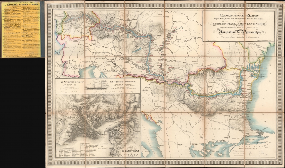
Carte du cours du Danube depuis Ulm jusqu'à son embouchure dans la Mer noire Guide de Voyage a Constantinople sur le Danube avec indication de tous les points de la Navigation des Pyroscaphes sur cette route.
sold
- Digital Map Information
- Suitable for large format printing
- Full resolution TIFF file
- ICC color profile embedded
- Delivered instantly via download link
A beautiful 1864 Artaria map harkening to the romantic early days of steam navigation on the Danube. (more details)
First edition of Camy's humorous pictorial map of Alaska.

A Good-Natured Map of Alaska, showing the services offered by 'the Alaska Line' and suggesting some of the most interesting features of the Territory.
sold
- Digital Map Information
- Suitable for large format printing
- File Size: 42.46 MB
- File Type: ZIP / TIFF
- ICC color profile embedded
- Delivered instantly via download link
A delightful 1934 first edition pictorial map of Alaska drawn by Edward Camy to promote 'The Alaska Line. (more details)
Japan's 'Good War'

大東亞戰局要圖 獨立國ビルマ / [Map of the War Situation in Greater East Asia Independent Burma].
sold
- Digital Map Information
- Suitable for large format printing
- Full resolution TIFF file
- ICC color profile embedded
- Delivered instantly via download link
A colorful 1943 pictorial manga propaganda map of Burma, published by the Tōyō bunka kyōkai (Oriental Cultural Association) as a supplement to its publication Gahō Yakushin no Nihon. Typical of Japanese wartime propaganda, it presents Burma as an idyllic land of pagodas and peaceful villagers, and it moreover celebrates the establishment of an 'independent' Japanese puppet government several months earlier. (more details)
The only America map of the Mercator Atlas.
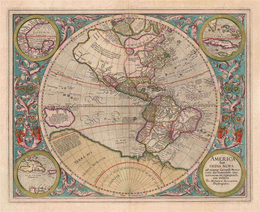
America, siue, India Nova. Ad magnae Gerardi Mercatoris aui vniversalis imitationem in compendium redacta.
sold
- Digital Map Information
- Suitable for large format printing
- DPI: 600
- File Size: 51.54 MB
- File Type: ZIP / TIFF
- ICC color profile embedded
- Delivered instantly via download link
This is a beautifully colored 1613 Hondius edition of Mercator's America, one of the most visually arresting early maps of the Western Hemisphere. (more details)
A rare, early copperplate map of India, Persia, and Arabia.
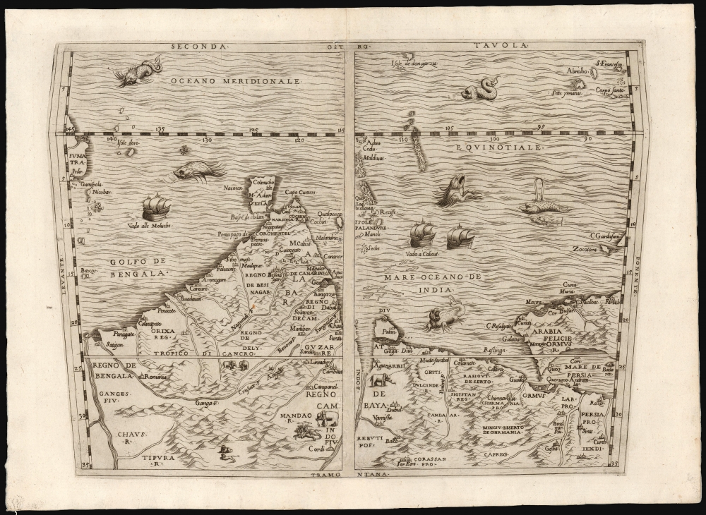
Seconda Tavola.
sold
- Digital Map Information
- Suitable for large format printing
- File Size: 10.98 MB
- File Type: ZIP / TIFF
- ICC color profile embedded
- Delivered instantly via download link
This is a scarce copperplate edition, commonly dated 1563, of the first accurate map of South Asia, including India, Arabia, and the Persian Gulf. It was drawn for Giovanni Battista Ramusio by his friend, the great cartographer Giacomo Gastaldi. The map was first published in Volume I of Ramusio's delle Navigationi et Viaggi in 1554, but this copperplate edition was engraved by Niccolo Nelli to replace the original woodblock after it was lost in a fire. (more details)
Travel the world on Pan Am at the beginning of the Jet Age.

Pan American World Airways Systems.
sold
This massive 3-sheet map of the world is John Philip and Paul John Brown's 1959 illustration of the Pan American Airways System (PanAm). Highlighting Pan American's extensive network at the dawn of the jet age, this piece celebrates the airline's role in making the world a smaller place in the wake of World War II (1939 - 1945). Given its massive size, this poster was likely intended for airports and KLM offices. (more details)
The poison of American cultural imperialism.

The Serpent Deceived the Whole World... / To Heal the Poisonous bite of the World Serpent, it takes the medicine that God gives Muhammad.
sold
A rare persuasive 1966 / 1987 map of the world drawn by Eugene Majied for the Nation of Islam's magazine, Muhammad Speaks and, as here, The Final Call. The map consists of an oval world map around which winds an enormous rattlesnake with the head of Uncle Sam. The message is clear - the United States is poisoning the world with American culture. (more details)
Richly-Decorative, Separately-Issued Map of Asia.
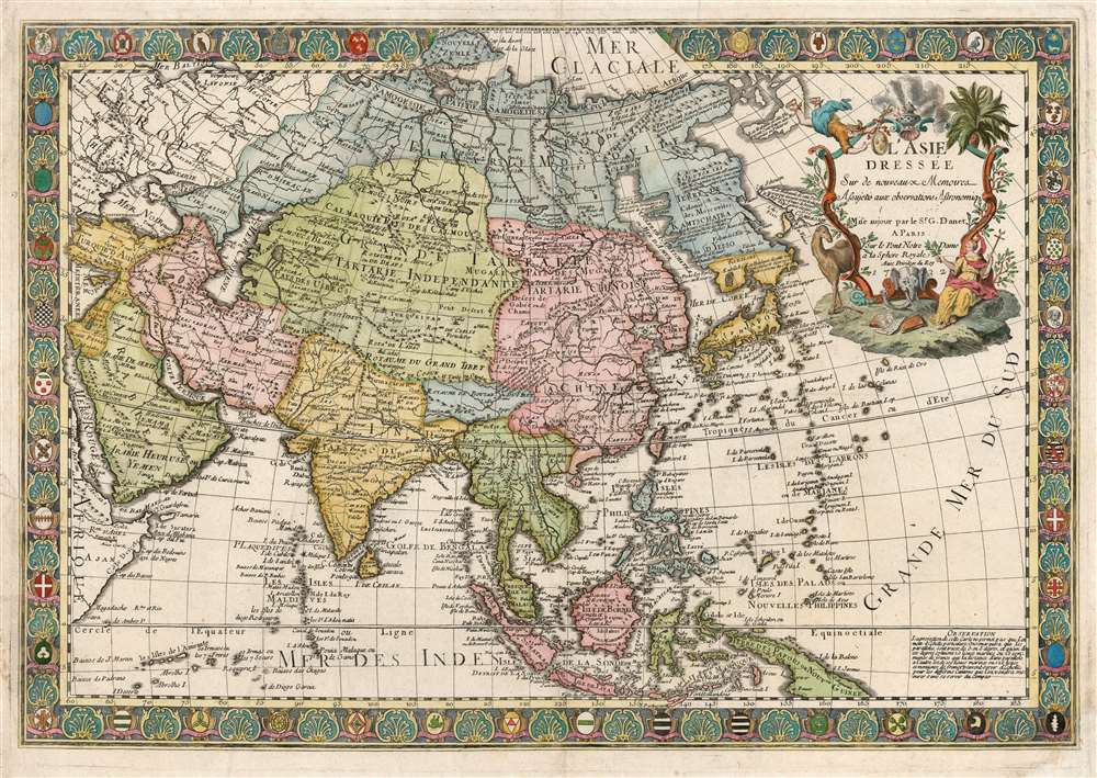
L'Asie Dressée sur de Nouveaux Mémoires Assujettis aux Observations Astronomique.
$2,000.00
Acquire
- Digital Map Information
- Suitable for large format printing
- DPI: 600
- File Size: 95.23 MB
- File Type: ZIP / TIFF
- ICC color profile embedded
- Delivered instantly via download link
This is a separately-issued 1732 Guillaume Danet map of Asia. It is a synthesis of the most advanced cartographic ideas of the age, including from piracies of Strahlenberg's stolen cartography. (more details)
Celebrating French viticulture.
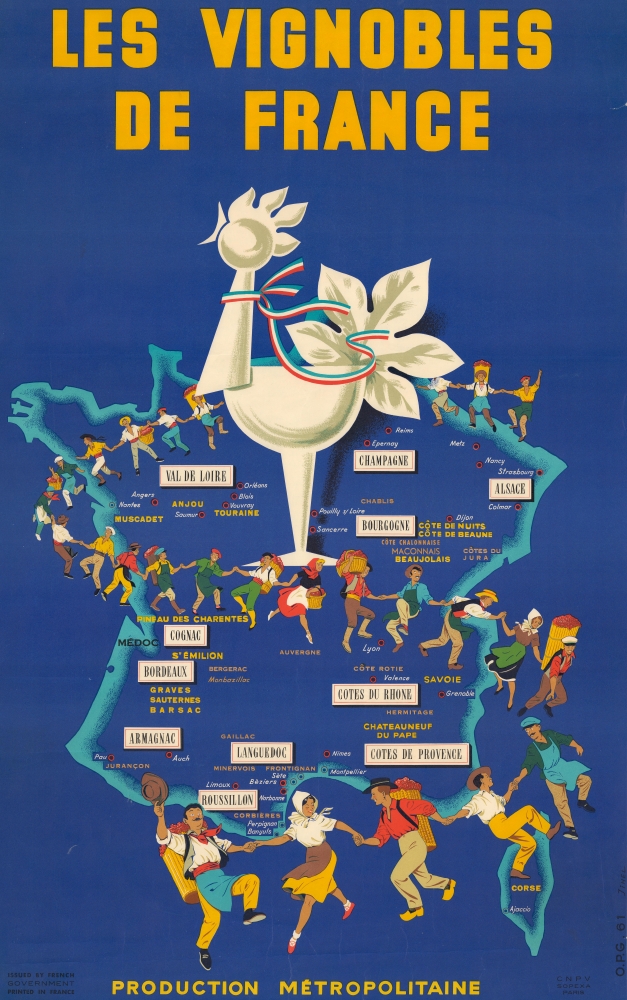
Les Vignobles de France. Production Métropolitaine.
sold
This is a rare 1961 Jihel pictorial map of France's wine regions. (more details)
Last days of the Republic of Texas. Unique configuration!
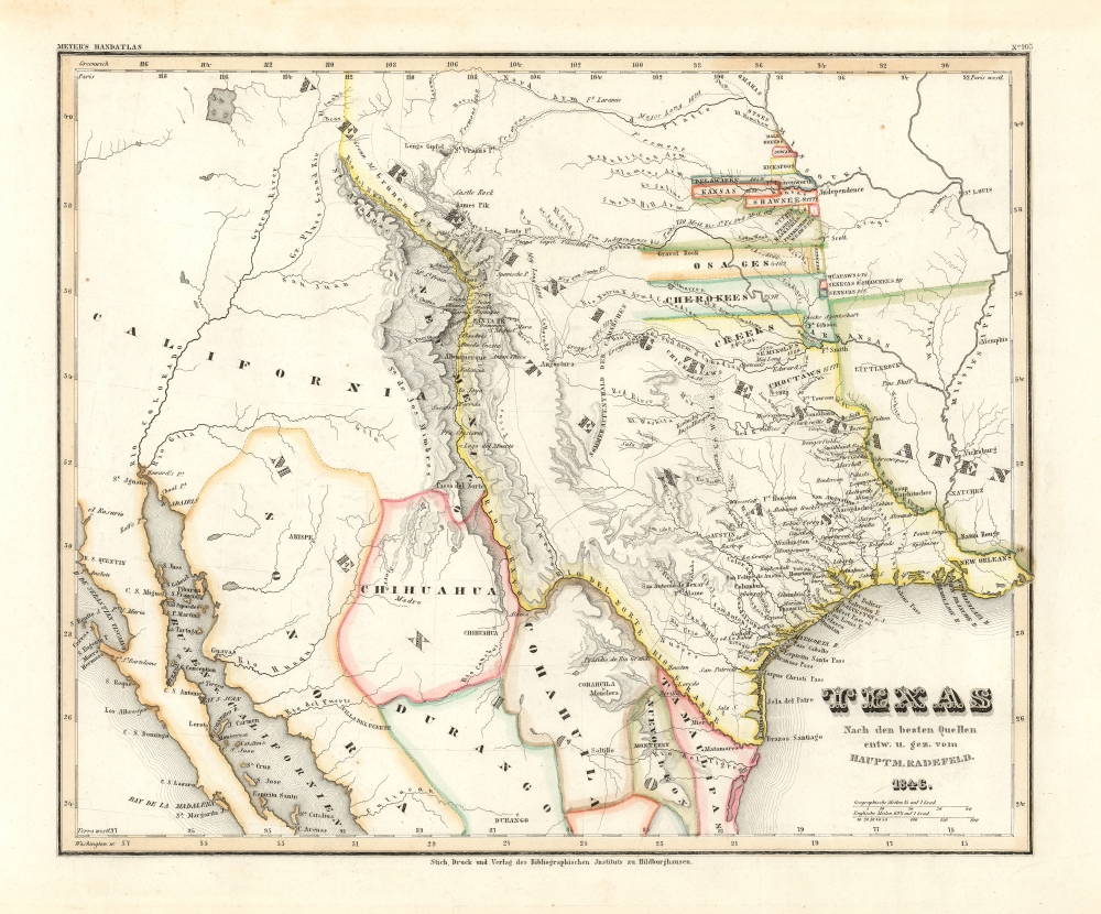
Texas nach den besten Quellen entw. u. gez. vom Hauptm. Radefeld.
sold
- Digital Map Information
- Suitable for large format printing
- File Size: 8.87 MB
- File Type: ZIP / TIFF
- ICC color profile embedded
- Delivered instantly via download link
An important 1846 first edition of Joseph Meyer and Carl Christian Franz Radefeld's map of the Republic of Texas in its final days, just before joining the United States. This map was issued shortly before the outbreak of the Mexican-American War (1846 - 1848) and, as such, constitutes the fullest expression of independent Texas, including a unique configuration incorporating New Orleans. Texas was of great interest to Meyer's primarily German audience, to whom immigration was actively promoted through a number of Texas-booster societies, some of which were legitimate and others which were outright cons. (more details)
The FEC reaches Key West!

Map of the Peninsula of Florida and Adjacent Islands.
sold
- Digital Map Information
- Suitable for large format printing
- Full resolution TIFF file
- ICC color profile embedded
- Delivered instantly via download link
A highly decorative 1914 map of Peninsular Florida issued by the Mathews-Northrup Company for the Henry Morrison Flagler's (1830 - 1913) Florida East Coast Railway. The map is one of just 2 editions to illustrate the Key West Extension. (more details)
Tokyo on the eve of the Great Kanto Earthquake.

(最新) 東京市街地圖 / [(Latest) Tokyo City Map].
sold
- Digital Map Information
- Suitable for large format printing
- Full resolution TIFF file
- ICC color profile embedded
- Delivered instantly via download link
This is a rare 1922 Oobuchi Zenkichi map and guide of Tokyo. It illustrates the density and modernity of Tokyo on the eve of the disastrous Great Kanto Earthquake the following year, which led to large portions of the city being destroyed and rebuilt. (more details)
Socialist Colony in Florida?

Appeal to Reason...
sold
- Digital Map Information
- Suitable for large format printing
- Full resolution TIFF file
- ICC color profile embedded
- Delivered instantly via download link
A curious, unrecorded promotional map and booklet advertising a socialist colony in Volusia County, Florida, published c. 1909 by Eugene C. Howe of the left-wing Midwestern newspaper Appeal to Reason. It is a product of the early 20th-century Florida Land Boom, which successfully promoted newly accessible and irrigated lands to thousands of New Englanders and Midwesterners. The present project had the interesting twist of being a socialist colony. (more details)