
Attractive 18th century map of the Iberian Peninsula.
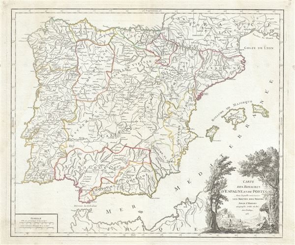
Royaumes d'Espagne et de Portugal.
sold
- Digital Map Information
- Suitable for large format printing
- Full resolution TIFF file
- ICC color profile embedded
- Delivered instantly via download link
This is a fine 1750 map of Spain and Portugal by Robert de Vaugondy. It covers the Iberian Peninsula including the islands of Majorca, Minorca and Ibiza and depicts the provinces as they appeared when the map was drawn. The most prominent provinces are New and ... (more details)
Early map of northwest Spain.

Partie Septentrionale de la Couronne de Castille ou se trouvent les Royaumes de Castille Vieille, de Leon, de Gallice, des Asturies, la Biscaye et la Navarre, en partie.
sold
- Digital Map Information
- Suitable for large format printing
- Full resolution TIFF file
- ICC color profile embedded
- Delivered instantly via download link
This is a beautiful 1752 map of northwestern Spain by Robert de Vaugondy. It extends from Coria north to Bayonne in France and from the Atlantic Ocean east to Tudela and depicts the regions of Galicia, Leon, Asturias, Castile and Biscay. The map renders the ... (more details)
Beautiful Vaugondy map of northeast Spain during the medieval period.

Etats de la Couronne d'Aragon, ou se trouvent les Royaumes d'Aragon et de Navarre, la Principaute de Catalogne.
sold
- Digital Map Information
- Suitable for large format printing
- Full resolution TIFF file
- ICC color profile embedded
- Delivered instantly via download link
This is a beautiful 1752 map of northeast Spain by Robert de Vaugondy. It depicts the Kingdom of Aragon, the Kingdom of Navarre and the Principality of Catalonia as they existed during the medieval and early modern period. The map extends south from Pau in ... (more details)
Beautiful view of George Washington's headquarters at the end of the Revolutionary War.

Fraunce's Tavern, Cor of Broad and Pearl Streets.
sold
- Digital Map Information
- Suitable for large format printing
- Full resolution TIFF file
- ICC color profile embedded
- Delivered instantly via download link
This is a beautifully drawn view of Fraunce’s Tavern located on the corner of Broad St. and Pearl St. in Lower Manhattan. The view features Fraunces Tavern, the headquarters for George Washington during the Revolutionary War while negotiating with the ... (more details)
Scarce early nautical chart of New York Harbor.
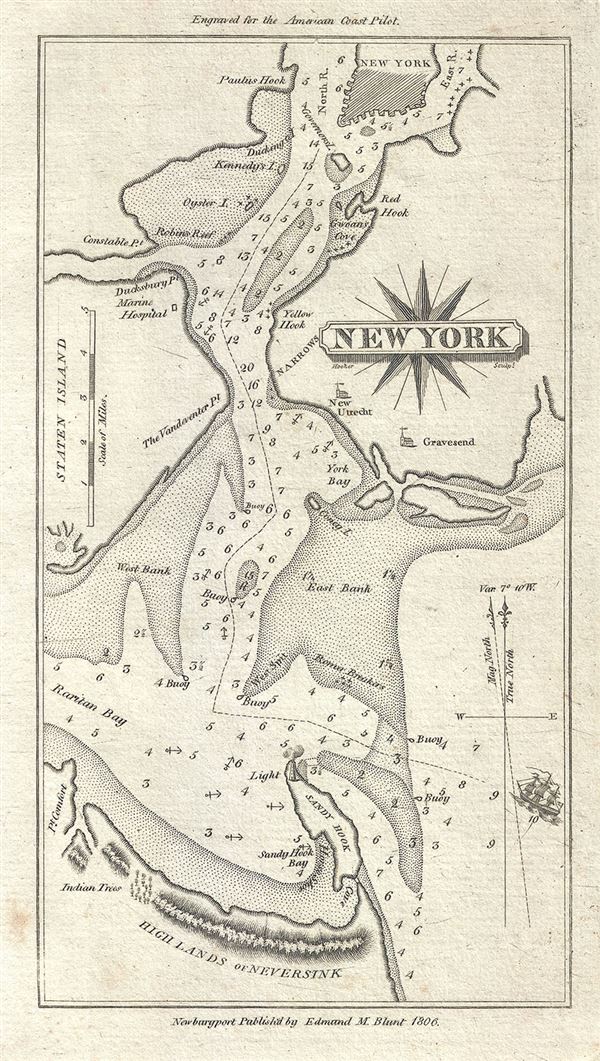
New York.
sold
- Digital Map Information
- Suitable for large format printing
- Full resolution TIFF file
- ICC color profile embedded
- Delivered instantly via download link
This is a scarce 1806 nautical chart or maritime map of New York City by Edmund Blunt. It covers the region including parts of lower Manhattan, Staten Island, Brooklyn and New Jersey. The map identifies several points, islands, bays including Sandy Hook, Red ... (more details)
Beautiful Geological Map of the eastern parts of the Des Moines River.
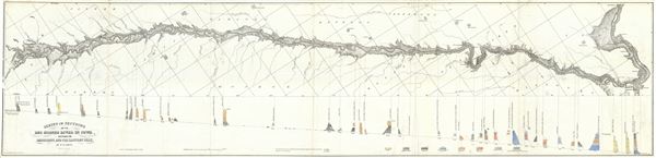
Series of Sections on the Des Moines River in Iowa, between the Mississippi and the Raccoon Fork.
sold
- Digital Map Information
- Suitable for large format printing
- Full resolution TIFF file
- ICC color profile embedded
- Delivered instantly via download link
This is a beautiful 1852 geological map of the Des Moines river in Iowa by D. D. Owen. It covers the flow of the Des Moines River, a tributary of the Mississippi, between the Mississippi and the Raccoon Fork (roughly from Nauvoo in illinois to Des Moines) ... (more details)
Beautiful Geological Map of the western parts of the Des Moines River.
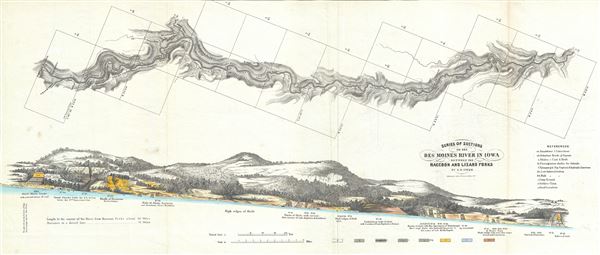
Series of Sections on the Des Moines River in Iowa, between the Raccoon and Lizard Forks.
sold
- Digital Map Information
- Suitable for large format printing
- Full resolution TIFF file
- ICC color profile embedded
- Delivered instantly via download link
This is a beautiful 1852 geological map of the Des Moines river in Iowa by D. D. Owen. It covers the flow of the Des Moines River, a tributary of the Mississippi, between the Raccoon and Lizard Forks (roughly from Des Moines city to Fort Dodge) and notes ... (more details)
Beautiful map of southern Russia and Ukraine.

Imperii Moscovitici pars Australis in lucem edita per Guillielmum de l'Isle, Regis Galliae Geographum.
sold
- Digital Map Information
- Suitable for large format printing
- Full resolution TIFF file
- ICC color profile embedded
- Delivered instantly via download link
This is an attractive 1730 map of southern Russia and Ukraine by the important Augsburg map publisher Georg Matthaus Seutter. It depicts from Novgorod south to Lutik and east as far as Kokchaga. Includes towns, roads rivers, lakes, mountains, forests and ... (more details)
Uncommon map of North America showing California as an Island.
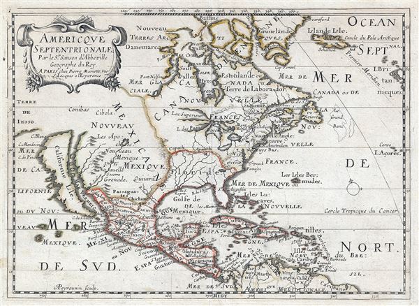
Americque Septentrionale. Par le Sr. Sanson d'Abbeville Geograph du Roy.
sold
- Digital Map Information
- Suitable for large format printing
- DPI: 300
- File Size: 12.05 MB
- File Type: ZIP / TIFF
- ICC color profile embedded
- Delivered instantly via download link
A very attractive 1662 Nicolas Sanson map of North America. Sanson's map covers all of North America from Baffin Bay and Greenland, south to include all of Central America, the West Indies, and parts of the Spanish Main, it similarly extends from ... (more details)
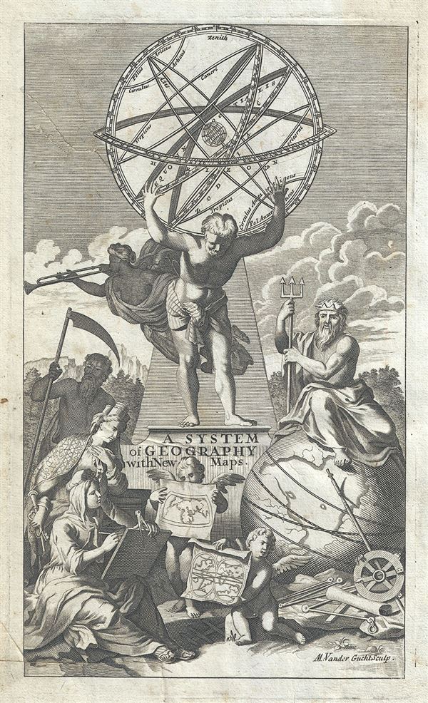
A System of Geography with New Maps.
sold
- Digital Map Information
- Suitable for large format printing
- Full resolution TIFF file
- ICC color profile embedded
- Delivered instantly via download link
This is a beautiful diagram of an Armillary Sphere which appears as the title page to Herman Moll's System of Geography . It depicts Atlas, the titan of astronomy and navigation in Greek mythology, holding the armillary sphere. Neptune, the ... (more details)
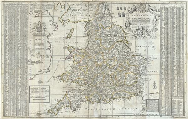
The Southern Part of Great Britain called England and Wales.
sold
- Digital Map Information
- Suitable for large format printing
- Full resolution TIFF file
- ICC color profile embedded
- Delivered instantly via download link
This is a fascinating 1710 Herman Moll map of South Britain, or England and Wales. It depicts the entirety of England and Wales, including the Isle of Man. The map is extremely detailed, noting cities, roads, towns, bishoprics, ... (more details)
Exceptional decorative map of the world revealing older cartographic suppositions. Shows California as an Island.
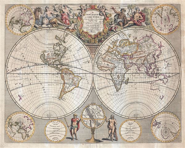
A New Map of the World from the Latest Observations.
sold
- Digital Map Information
- Suitable for large format printing
- Full resolution TIFF file
- ICC color profile embedded
- Delivered instantly via download link
An impressive 1721 double hemisphere map of the World by John Senex. This map covers the entire world in two hemispheres. It appeared during a period of rapid globalization and discovery. Senex here attempts to reveal both the ... (more details)

[Persia].
sold
- Digital Map Information
- Suitable for large format printing
- Full resolution TIFF file
- ICC color profile embedded
- Delivered instantly via download link
This is a rare 1726 map of Persia by Francois Valentijn. It covers from the Gulf of Suez eastward to Ahmedabad (Amadabad) in modern day western India. This map, centered on Persia, includes the Caspian Sea and part of the Arabian ... (more details)

Isole Filippine Ladrones e Moluccos o Isole delle Speziarie comme anco Celebes & c.
sold
- Digital Map Information
- Suitable for large format printing
- DPI: 300
- File Size: 6.83 MB
- File Type: ZIP / TIFF
- ICC color profile embedded
- Delivered instantly via download link
An attractive 1740 map of the southern part of the Philippines or Philippine Islands. Centered on Mindano, the map covers from modern day Vietnam (Cochinchina) to the Ladrones, and from northern Luzon to the island of Timor. It ... (more details)
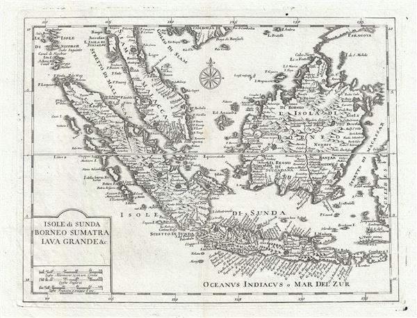
Isole di Sunda Borneo Sumatra Iava Grance & c.
sold
- Digital Map Information
- Suitable for large format printing
- DPI: 300
- File Size: 6.54 MB
- File Type: ZIP / TIFF
- ICC color profile embedded
- Delivered instantly via download link
An attractive 1740 map of the East Indies, including Malay (Malacca), Singapore, Borneo, Sumatra, and Java. Centered on the Strait of Sunda (site of the great Krakatoa Volcano), the map covers from the modern day Thai island of ... (more details)

Isles de Saint Domingue ou Hispaniola, et de la Martinique.
sold
- Digital Map Information
- Suitable for large format printing
- Full resolution TIFF file
- ICC color profile embedded
- Delivered instantly via download link
This is a fine 1750 map of Hispaniola or Santo Domingo (modern day Haiti and the Dominican Republic) by Robert de Vaugondy. It includes the southern tip of Cuba and the Inagua Islands (southern Bahamas). The map is highly ... (more details)
Map of southern Italy with beautifully rendered Mt. Etna.

Partie Meridionale du Royaume de Naples, ou se trouvent la Calabre et l'Isle et Royaume de Sicile.
sold
- Digital Map Information
- Suitable for large format printing
- Full resolution TIFF file
- ICC color profile embedded
- Delivered instantly via download link
This is an attractive 1750 map of southern Italy by Robert de Vaugondy. It covers the southern regions of the territories claimed by the Kingdom of Naples and extends from Agropoli south to include the island of Sicily. ... (more details)
Attractive 18th Century map of the Russian Empire.

Partie Occidentale de l'Empire de Russie, ou se trouve distinguee la Russie Europeenne, Divisee par ses Gouvernemens ou Provinces de Dwinskoy, Oloueckoy, Bielozerskoy, Archangel, Nowogrod, Wolockoy, Ustinskoy, Moscow, Kiowie, Bielogorod, Woroneskoy, et la Petite Tartarie, la Partie Asiatique Contient les Provinces Berezowskoy, Mangajeiskoy, Wiatka, Solkamskoy, Pelymskoy, Utimskoy, Tobolskoy, Surgutskoy, Jenifeiskoy, Narimskoy, Kuzneckoy, Tomskoy, Krasnojarskoy etc. le Royaume de Kasan, le Gouvernement d'Astrachan et les Confins du Royaume des Kalmaks Eleuths. Dressee d'apres les Cartes de l'Atlas Russien.
sold
- Digital Map Information
- Suitable for large format printing
- Full resolution TIFF file
- ICC color profile embedded
- Delivered instantly via download link
This is a beautiful example of Robert de Vaugondy's map of the Russian Empire or Western Russia. The map extends from Poland and the Baltic Sea eastward to Ilimskoy, Siberia and from the Caspian Sea north to Nouvelle ... (more details)
Identifies the apocryphal Lake of Chiamay.

Les Indes Orientales, ou sont distingues les Empires et Royaummes qu'elles contiennent, tirees du Neptune Oriental.
sold
- Digital Map Information
- Suitable for large format printing
- Full resolution TIFF file
- ICC color profile embedded
- Delivered instantly via download link
This is a beautiful 1751 map of India and Southeast Asia by Robert de Vaugondy. It details the Indian subcontinent as well as much of Southeast Asia, including Thailand, Burma (Myanmar), Laos, Cambodia, Vietnam, ... (more details)
Extremely rare, highly influential, and very important foundational map of the North Pacific showing Sea of the West and the apocryphal discoveries of Admiral de Fonte.
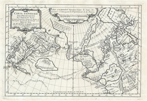
Carte General Des Decouvertes De L'Amiral de Fonte Et autres Navigateurs Espagnols, Anglois, et Russes, pour la recherche du Passage a la Mer du Sud.
sold
- Digital Map Information
- Suitable for large format printing
- DPI: 300
- File Size: 6.51 MB
- File Type: ZIP / TIFF
- ICC color profile embedded
- Delivered instantly via download link
An object of extreme historical importance and rarity, this map was the center of one of the most heated cartographic debates in history. This is an unrecorded state of Joseph-Nicolas de L'Isle's (Delisle) map ... (more details)