
Singapore
Most important chronicle and map of early Singapore.
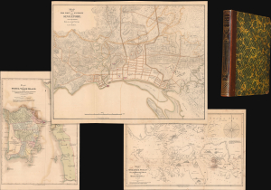
Notices of the Indian Archipelago, and adjacent countries; being a collection of papers relating to Borneo, Celebes, Bali, Java, Sumatra, Nias, the Philippine Islands, Sulu, Siam, Cochin China, Malayan Peninsula, etc.
$32,000.00
Acquire
- Digital Map Information
- Suitable for large format printing
- Full resolution TIFF file
- ICC color profile embedded
- Delivered instantly via download link
A rare example of John Henry Moor's 1837 Notices of the Indian Archipelago, containing within the most important early map of Singapore, as well as otherwise lost reprints of important articles from the Singapore Chronicle, and additional maps of Penang, Singapore Strait, the East Indian Archipelago, Malacca, and Borneo. Moor's work is considered one of the most significant records of early Singapore and one of the first books published in Singapore. (more details)
The French set their eyes on Singapore.
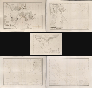
Carte des Atterrages de Singapore. / Carte Particulière des détroits de Singapore, Durian et Rhio. / Carte des Détroits de Singapore, Durian et Rhio et des Parages Environnants. / Carte du Détroit del Malacca Partie Septentrionale. / Carte du Détroit de Malacca Partie Méridionale.
$22,000.00
Acquire
- Digital Map Information
- Suitable for large format printing
- Full resolution TIFF file
- ICC color profile embedded
- Delivered instantly via download link
An exceptional set of five rare 1840s nautical maps/charts detailing Singapore, Malaya, and the Straits of Malacca and Singapore compiled by Urban Dortet de Tessan for the French Dépôt-Général de la Marine. The charts correspond to the Lagrené Mission, a French attempt to establish a colonial presence in East and Southeast Asia that challenged British regional hegemony. (more details)
One of the earliest views of Singapore!
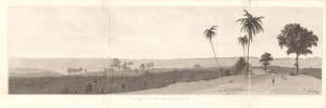
View of Singapore Town and Harbour taken from the Government Hill.
$2,800.00
Acquire
- Digital Map Information
- Suitable for large format printing
- Full resolution TIFF file
- ICC color profile embedded
- Delivered instantly via download link
This is William Daniell's 1830 aquatint panorama of Singapore that appeared in Memoir of the Life and Public Services of Sir Thomas Stamford Raffles. It is considered to be among the earliest views of Singapore. Raffles was the architect of Singapore, and his memoirs were published in 1830, following his death, by John Murray in London. (more details)
First published view of Singapore.
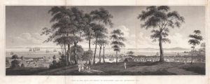
View of the Town and Roads of Singapore from the Government Hill.
$2,200.00
Acquire
- Digital Map Information
- Suitable for large format printing
- DPI: 600
- File Size: 14.72 MB
- File Type: ZIP / TIFF
- ICC color profile embedded
- Delivered instantly via download link
The first printed view of Singapore, issued less than ten years after it was founded by Sir Thomas Stamford Raffles (1781 - 1826). This aquatint view was published in 1828 after a painting by Royal Navy Captain Robert James Elliot. It looks on Singapore from Government Hill, covering the Plain, Singapore River, and Chinatown. Even at this early stage, the view presents a bustling city with numerous buildings and a lively port. We have not been able to trace Elliot's original painting. (more details)
Pre-War Singapore.
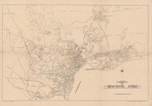
Map of Singapore Town.
$1,350.00
Acquire
- Digital Map Information
- Suitable for large format printing
- File Size: 35.32 MB
- File Type: ZIP / TIFF
- ICC color profile embedded
- Delivered instantly via download link
This uncommon map of Singapore city was issued c. 1930 by Printers Ltd. The map is based on surveys compiled by the Singapore Improvement Trust. Centered on the Downtown Core, the map covers what is today central Singapore from the Labrador Nature Preserve to Marine Parade, extending inland as far as the MacRitchie Reservoir. Streets, districts, rail lines (both proposed and extent), golf courses, and more are noted. The map notes the Civil Aerodrome, or Kallang Airfield, construction on which began in 1931 and finished in 1937. The presence of the Aerodrome here validates our dating, since only the outline of the space is provided, with none of buildings or other structures noted. (more details)
First Edition of Long-Standard British Map of the East Indies.
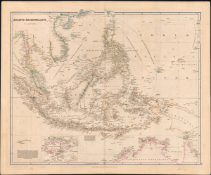
Asiatic Archipelago.
$1,200.00
Acquire
- Digital Map Information
- Suitable for large format printing
- Full resolution TIFF file
- ICC color profile embedded
- Delivered instantly via download link
This is the 1832 first edition of John Arrowsmith's map of Southeast Asia and the East Indies, which would become the standard British map of the region for decades afterward. It is notable for its early inclusion and focus on the 'commercial emporium' of Singapore as the emerging crux of Britain's lucrative China Trade. (more details)
Oh how things have changed.
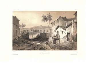
Vue Prise a Sincapour.
$1,000.00
Acquire
- Digital Map Information
- Suitable for large format printing
- Full resolution TIFF file
- ICC color profile embedded
- Delivered instantly via download link
One of the earliest obtainable views of Singapore, this c. 1840 image was drawn by Barthélemy Lauvergne. The 2-color chromolithograph view likely looks east along Singapore River with the old bridge on South Bridge Road at center. Beyond, Battery Point with a hint of fortifications is evident. The low water level and dock extending into empty space underscores that this view was done during the dry season. The Chinese Campong is on the right - note the Chinese characters above the door.
Lauvergne was one of several artists accompanying the 1836 - 1837 Auguste-Nicolas Vaillant (1793 - 1858) circumnavigation. The scientific expedition arrived in Singapore on February 17, 1837 and stayed through February 23rd. It is safe to assume that Lauvergne sketched this view during the expedition's brief stay. (more details)
Lauvergne was one of several artists accompanying the 1836 - 1837 Auguste-Nicolas Vaillant (1793 - 1858) circumnavigation. The scientific expedition arrived in Singapore on February 17, 1837 and stayed through February 23rd. It is safe to assume that Lauvergne sketched this view during the expedition's brief stay. (more details)
The Singapore Strategy.
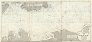
China Sea Singapore Strait Eastern Portion.
$950.00
Acquire
- Digital Map Information
- Suitable for large format printing
- File Size: 33.95 MB
- File Type: ZIP / TIFF
- ICC color profile embedded
- Delivered instantly via download link
This is a first edition 1927 British Admiralty nautical chart or maritime map of the eastern portion of the Singapore Strait. The map was issued during the Interwar Period when British naval hegemony was waning and the 'Singapore Strategy' attempted to turn the island colony into a 'Gibraltar of the East.' (more details)
Malaya and Singapore in the Interwar Period.
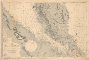
Malacca Strait with part of the East Coast of the Malay Peninsula from the latest British and Foreign Government Surveys.
$750.00
Acquire
- Digital Map Information
- Suitable for large format printing
- Full resolution TIFF file
- ICC color profile embedded
- Delivered instantly via download link
This is a 1929 British Admiralty nautical chart or maritime map of the Malay Peninsula, Singapore, and the Strait of Malacca. It captures the Strait during the Interwar Period (1918 - 1939), when Malaya was the world's largest single source of both rubber and tin, and when the British sought to protect this vitally important waterway from foreign aggression. (more details)
Good Times at the Great World.
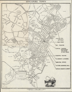
Singapore Town.
$700.00
Acquire
- Digital Map Information
- Suitable for large format printing
- File Size: 7.69 MB
- File Type: ZIP / TIFF
- ICC color profile embedded
- Delivered instantly via download link
An unusual and rare c. 1949 folding map of Singapore produced by Shaw Brothers, a film and entertainment powerhouse, using data from the Survey Department of Malaya. It depicts Singapore during its recovery from World War II (1939 - 1945) and emphasizes the opportunities for entertainment provided by Shaw Brothers establishments. (more details)