
Murray, John
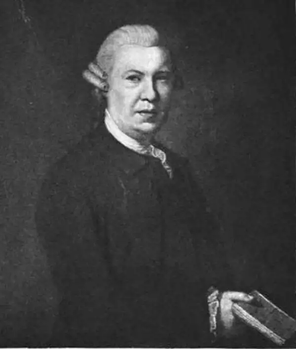
John Murray I (1737 - 1793) founded the British publishing firm John Murray (1768 - present) in London. Born in Edinburgh, Murray served as an officer in the Royal Marines and built a list of authors that included Isaac D’Israeli and published the English Review. Murray the elder also was one of the founding sponsors of the London evening newspaper The Star in 1788. John Murray II (November 27 1778 - June 27, 1843) continued the family publishing business and developed it into one of the most important and influential publishing houses in Britain. The list of authors published by the firm grew to include Jane Austen, Sir Walter Scott, Washington Irving, George Crabbe, and Lord Byron under his tenure. Murray II also moved the business to 50 Albermarle Street in Mayfair, which became famous for Murray’s tradition of ‘four o’clock friends’, which was afternoon tea with his writers. John Murray III (1808 - 1892) continued to grow the business, and the firm published the first English translation of Goethe’s Theory of Colours, David Livingstone’s Missionary Travels and Charles Darwin’s Origin of Species during his tenure. Murray also published Herman Melville’s first two books. The firm began publishing Murray Handbooks in 1836, an ancestor of all modern travel guides. Sir John Murray IV (1851 - 1928) was publisher to Queen Victoria. Three successive Murray’s after Murray IV led the business until it was purchased by Hodder Headline in 2002, which was acquired by the French conglomerate Lagardère Group in 2004. Today, Murray is an imprint of Lagardère under the imprint Hachette UK.
One of the earliest views of Singapore!
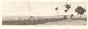
View of Singapore Town and Harbour taken from the Government Hill.
$2,800.00
Acquire
- Digital Map Information
- Suitable for large format printing
- Full resolution TIFF file
- ICC color profile embedded
- Delivered instantly via download link
This is William Daniell's 1830 aquatint panorama of Singapore that appeared in Memoir of the Life and Public Services of Sir Thomas Stamford Raffles. It is considered to be among the earliest views of Singapore. Raffles was the architect of Singapore, and his memoirs were published in 1830, following his death, by John Murray in London. (more details)
Tracking down the lost Franklin Expedition.
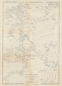
Map of a portion of the Arctic shores of America to accompany Captn. McClintock's narrative.
$600.00
Acquire
- Digital Map Information
- Suitable for large format printing
- File Size: 12.28 MB
- File Type: ZIP / TIFF
- ICC color profile embedded
- Delivered instantly via download link
An intricate map of the waters and islands of Nunavut in northeastern Canada, near Greenland, tracing the lost 'Franklin Expediton'. It was produced by John Arrowsmith in 1859 for Captain Francis McClintock's The Voyage of the 'Fox' in the Arctic Seas: A Narrative of the discovery of the fate of Sir John Franklin and his companions. (more details)
Landmark map of an Amazon tributary.
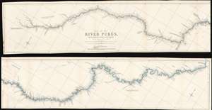
Map of the River Purûs, From Near its Source to its Mouth.
$300.00
Acquire
- Digital Map Information
- Suitable for large format printing
- File Size: 18.98 MB
- File Type: ZIP / TIFF
- ICC color profile embedded
- Delivered instantly via download link
This is landmark 1866 William Chandless map of the Purûs River in Brazil and Peri is he first accurate map of the river's 1,866-mile course. Chandless took measurements throughout his expedition, covering both the ascent and the descent of the river. He identifies tributaries, islands, and Indian villages, and includes a handful of comments concerning the river's depth and width. In the appendix to his article on the expedition, Chandless addresses the creation of the map:
This has been made from bearings and distances taken throughout the whole river, and from observations with sextant and artificial horizon (mercurial). Observations of latitude were taken at 79 points, and time observations for longitude by chronometer at about three-fourths of them. So far as was possible, time observations were repeated at the principal points on the down voyage, so as to be dependent on chronometer for a few days only.Even today the Purûs River basis is considered on of the most remote, biodiverse, and inaccessible parts of the Amazon Rainforest. In 2008, a previously unknown pre-Columbian civilization was discovered in the upper region of the river close to the Bolivian border. After much of the forest in the region was cleared for agricultural use, satellite pictures revealed the remains of large geometric earthworks. (more details)
A 'valuable map' of the Sinai Peninsula - RGS
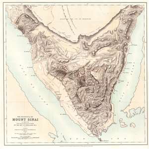
The Peninsula of Mount Sinai. A Sketch from Observations on the Ground by the Rev. F. W. Holland. M.A.
$750.00
Acquire
- Digital Map Information
- Suitable for large format printing
- Full resolution TIFF file
- ICC color profile embedded
- Delivered instantly via download link
This is Frederick Whitmore Holland's 1868 map of the Sinai Peninsula. The peninsula's mountainous terrain is illustrated in detail, with numerous peaks labeled with transliterations of their Arabic names. Holland traces the many wadis (valley, ravine, or channel that is dry except in the rainy season) and provides some commentary on the terrain. Mount Sinai, labeled here as J. Musa (its Arabic name), appears just south of the center of the peninsula. (more details)
First detailed map of the Juruá River, one of the longest tributaries of the Amazon.
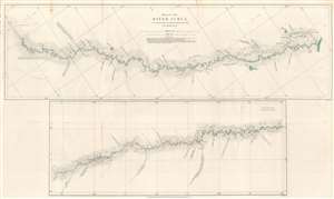
Map of the River Juruá.
$250.00
Acquire
- Digital Map Information
- Suitable for large format printing
- File Size: 13.33 MB
- File Type: ZIP / TIFF
- ICC color profile embedded
- Delivered instantly via download link
This is an 1869 William Chandless map of the Juruá River. The map divides the Juruá into two sections. The upper map illustrates the Juruá from its confluence with the Amazon to a point near Lake Ocoá. The lower map illustrates the upper portion of the river from Lake Ocoá to the point where the expedition reversed course. Small black crosses mark astronomical observations, and the dashed lines indicate the mouth of a lake or tributary. Chandless includes comments on the nature of the tributaries, and also notes the locations of the few tribal villages he encountered. (more details)
Reverend Alexander Williamson's 1860s travels through Manchuria.
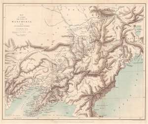
Map to accompany the Notes on Manchuria by the Rev. Alexander Williamson.
$300.00
Acquire
- Digital Map Information
- Suitable for large format printing
- File Size: 8.25 MB
- File Type: ZIP / TIFF
- ICC color profile embedded
- Delivered instantly via download link
This is an 1870 John Murray map of Manchuria, China - a region that within 20 years would become the stage for a global power struggle between Imperial Japan, Qing China, and Tzarist Russia. The map was drawn to accompany a paper written by Reverend Alexander Williamson and published in The Journal of the Royal Geographical Society. Parallel lines trace Williamson's travels through the region. Cities, towns, and villages are labeled throughout, including Mukden (Shenyang). The region's impressive topography leaps off the page, and its extensive river network is well illustrated. Part of the Willow Palisade (labeled here as Barrier of Stakes or Palisade) appears and traverses a southwest-northeast line through the map's center. The Willow Palisade, a system of embankments and ditches planted with willows, was built by the Qing in the late 17th century and separated traditionally Manchu areas from Mongol territory. (more details)
Landmark exploration of a previously unmapped region of Africa.
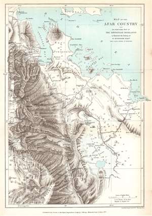
Map of the Afar Country and the Northern Part of the Abyssinian Highlands to illustrate the Journey of W. Munzinger Esqure. Late H.B.M. Consul at Massowa.
$200.00
Acquire
- Digital Map Information
- Suitable for large format printing
- File Size: 5.73 MB
- File Type: ZIP / TIFF
- ICC color profile embedded
- Delivered instantly via download link
This is an 1870 John Murray map of the Afar Country, comprising parts of modern-day Eritrea and Ethiopia. The map was created to accompany a The Journal of the Royal Geographical Society paper by Werner Munzinger. Dashed tracks follow Munzinger's groundbreaking exploration of the little known region. (more details)
'One of the most expensive affairs of honor in history.'
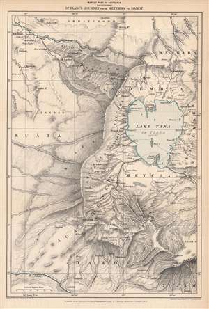
Map of Part of Abyssinia to Illustrate Dr. Blanc's Journey from Metemma to Damot.
$250.00
Acquire
- Digital Map Information
- Suitable for large format printing
- File Size: 7.51 MB
- File Type: ZIP / TIFF
- ICC color profile embedded
- Delivered instantly via download link
This is an 1870 Edward Stanford map of the Amara region of northwestern Abyssinia (Ethiopia) highlighting the route taken by Henry Blanc, one of the British subjects kidnapped by Ethiopian Emperor Tewodros II (r. 1855 - 1868), an act that prompted a punitive expedition by Great Britain in 1867 – 1868. (more details)
The early days of British Aden.
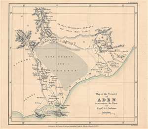
Map of the vicinity of Aden to accompany the paper by Captn. G. J. Stevens.
$350.00
Acquire
- Digital Map Information
- Suitable for large format printing
- File Size: 10.78 MB
- File Type: ZIP / TIFF
- ICC color profile embedded
- Delivered instantly via download link
This is an 1873 map of Aden, Yemen and its surroundings engraved by Edward Weller and published by the firm John Murray for the The Journal of the Royal Geographical Society. The map accompanied an article written by Captain G. J. Stevens of his travels through these lands. (more details)
The beginning of events leading to the Second Anglo-Afghan War.

Map of Eastern Persia to illustrate the Paper by Major General Sir F. J. Goldsmid.
$350.00
Acquire
- Digital Map Information
- Suitable for large format printing
- File Size: 6.04 MB
- File Type: ZIP / TIFF
- ICC color profile embedded
- Delivered instantly via download link
This is an 1873 John Murray map of eastern Persia, or modern-day south-central Iran. A thin red line highlights Sir Frederic John Goldsmid's route through the region from Bandar Abbas on the Strait of Hormuz north to Mash-had. Goldsmid was dispatched to this region in order to enforce a British-negotiated Selstan frontier boundary settlement, a move in the 'Great Game' intended to secure Persia and Afghanistan as buffer provinces between Russia and British India. (more details)
Great Game: Tsar's Acquisition of Transoxiana.
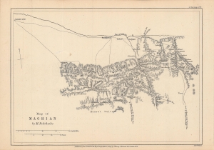
Notes on M. Fedchenko's Map of Maghian.
$250.00
Acquire
- Digital Map Information
- Suitable for large format printing
- File Size: 4.89 MB
- File Type: ZIP / TIFF
- ICC color profile embedded
- Delivered instantly via download link
This is an 1873 map of 'Maghian,' that is, the area that now comprises the westernmost portion of Sughd Province in Tajikistan, along the border with Uzbekistan. Based on a Russian map by Alexei Fedchenko, it was lithographed by Edward Weller and published by John Murray in the Journal of the Royal Geographical Society. (more details)
Pre-Japanese look at indigenous Taiwan.
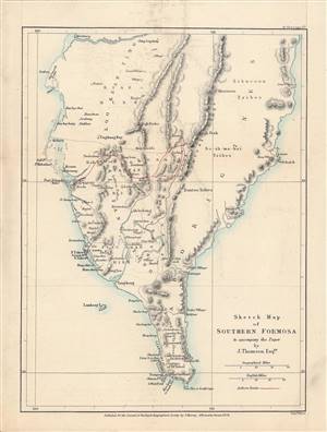
Sketch Map of Southern Formosa.
$650.00
Acquire
- Digital Map Information
- Suitable for large format printing
- File Size: 4.27 MB
- File Type: ZIP / TIFF
- ICC color profile embedded
- Delivered instantly via download link
This is a rare 1873 lithograph of the southern tip of Taiwan, published for the The Journal of the Royal Geographical Society. It encapsulates the geographical knowledge gained during an 1871 trip through southern Taiwan by the geographer and photographer John Thomson and his companion, the missionary James Laidlaw Maxwell. (more details)
'Most Desolate and Uninviting.' -Forrest
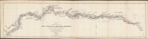
Map showing the route of the West Australian Exploring Expedition through the centre of Australia from Champion Bay on the west coast to the Overland Telegraph Line between Adelaide and Port Darwin.
$850.00
Acquire
- Digital Map Information
- Suitable for large format printing
- File Size: 136.62 MB
- File Type: ZIP / TIFF
- ICC color profile embedded
- Delivered instantly via download link
An 1875 map prepared by John Forrest, head of the Western Australia Exploring Expedition. It traces the progress and discoveries of the first extensive exploration of Western Australia's interior. (more details)
After the conquest of Khiva.
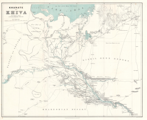
Khanate of Khiva after Russian sources.
$500.00
Acquire
- Digital Map Information
- Suitable for large format printing
- File Size: 24.08 MB
- File Type: ZIP / TIFF
- ICC color profile embedded
- Delivered instantly via download link
This is an 1875 Herbert William Wood map of the Khanate of Khiva in modern-day Uzbekistan - issued shortly after the 1873 Russian conquest of Khiva, a defining moment in the Great Game. (more details)
One of the first western maps of Xinjiang, China, illustrating a Great Game Era British trade mission.
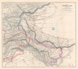
Map of Central Asia to accompany the Paper by Captain H. Trotter R.E., on the Geographical Results of Sir T.D. Forsyth's Mission to Kashgar, 1873 - 74.
$950.00
Acquire
- Digital Map Information
- Suitable for large format printing
- File Size: 24.76 MB
- File Type: ZIP / TIFF
- ICC color profile embedded
- Delivered instantly via download link
This is a 1878 William John Turner and Royal Geographical Society map of Xinjiang, China, that traces explorations of the 1873 - 1874 Forsyth Mission, making this one of the first detailed Western maps of the region. The map is a relic of the Great Game, a series of struggles between Britain and Russia to control Central Asia. (more details)