
Singapore (sold)

A New Chart of the Straits of Malacca and Sincapore Drawn from the Latest Surveys, with Additions and Improvemetns, by J. W. Norie.
sold
- Digital Map Information
- Suitable for large format printing
- DPI: 300
- File Size: 37.68 MB
- File Type: ZIP / TIFF
- ICC color profile embedded
- Delivered instantly via download link
An extremely scarce 1815 map of the Strait of Malacca and Singapore (Sincapore) by John William Norie. This map covers from Aceh in northwestern Sumatra (Acheen) to Singapore Island and Pulu Bintang. This map first appeared in 1803 when it was issued by William ... (more details)
Height of British Colonialism Land co-optation in Malaya.
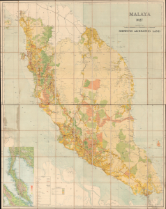
Malaya 1927 Showing Alienated Land.
sold
- Digital Map Information
- Suitable for large format printing
- File Size: 134.17 MB
- File Type: ZIP / TIFF
- ICC color profile embedded
- Delivered instantly via download link
This is a rare and important large format (72 x 56.25 in) 1927 F.M.S. Survey folding wall map of the Malay Peninsula, including Singapore and the Straits Settlements. Among other features, it provides a comprehensive view of land usage (or in this case, 'Alienation' of the lands from Malay populations into British company ownership) across the Malay Peninsula at the height of the colonial era. (more details)
Extremely scarce nautical chart of Singapore and Malacca - the most desirable of Horsburgh's influential nautical charts.

To the Honourable The Court of Directors of the United East India Company This Chart of Malacca Strait Singapore Strait and the Southernmost Promontory of Asia Is Inscribed by Their Faithful and Obedient Servant James Horsburgh.
sold
- Digital Map Information
- Suitable for large format printing
- DPI: 300
- File Size: 31.46 MB
- File Type: ZIP / TIFF
- ICC color profile embedded
- Delivered instantly via download link
An extremely scarce 1844 James Horsburgh nautical chart of southern Malaysia, Singapore, and the straits of Malacca and ... (more details)
Remarkable early French map of Singapore representing the forefront of scientific mapping of the region I the 1840s.
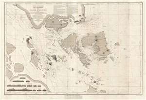
Carte Particulière des Détroits de Singapore, Durian et Rhio.
sold
- Digital Map Information
- Suitable for large format printing
- DPI: 300
- File Size: 22 MB
- File Type: ZIP / TIFF
- ICC color profile embedded
- Delivered instantly via download link
An exceptionally rare nautical chart of Singapore and vicinity issued by Urban Dortet de Tessan, under the patronage of ... (more details)
One of the earliest and most important nautical charts showing Singapore Island.
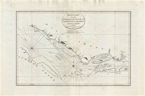
The South Part of the Straits of Malacca inscribed to Captn. G. G. Richardson, by Captn. J. Lindsey.
sold
- Digital Map Information
- Suitable for large format printing
- DPI: 300
- File Size: 27.17 MB
- File Type: ZIP / TIFF
- ICC color profile embedded
- Delivered instantly via download link
An exceptionally scarce and important 1798 nautical map of the Malacca and Singapore Straits by the English maritime ... (more details)
Horsburgh chart of Singapore as the epicenter of British Power in east Asia.
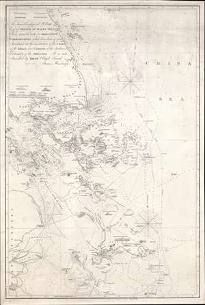
To James Carnegy and R. Scott Esqrs. of Prince of Wales Island As a Tribute due for their valuable Communications which have been of great Assistance in the construction of this chart of the Islands and Channels at the Southwest Extremity of the China Sea. It is not Inscribed by their Obliged Friend James Horsburgh.
sold
- Digital Map Information
- Suitable for large format printing
- DPI: 600
- File Size: 1154.6 MB
- File Type: ZIP / TIFF
- ICC color profile embedded
- Delivered instantly via download link
The rare 1850 final edition of the James Horsburgh nautical map of Singapore and the surrounding waters when it was the epicenter of British power in the East Indies. The chart covers the southern extreme of the Malay Peninsula, including all of Singapore Island and Singapore Strait, as well as adjacent islands and parts of eastern Sumatra. It was Horsburgh's first chart of the dangerous waters surrounding the Strait of Singapore and was the definitive mapping of these seas for nearly 30 years. (more details)
Best early nautical chart of Singapore.
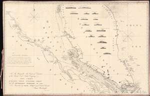
To The Honourable The Court of Directors of the United East India Company This Chart of Malacca Strait Singapore Strait and the Southernmost Promontory of Asia, is Inscribed by their Faithful and Obedient Servant James Horsburgh.
sold
- Digital Map Information
- Suitable for large format printing
- File Size: 27.57 MB
- File Type: ZIP / TIFF
- ICC color profile embedded
- Delivered instantly via download link
This 1857 nautical chart or maritime map of the Strait of Singapore and the southern part of the Malacca Strait is considered to be James Horsburgh's most desirable chart. Made for the British East India Company, this is one of the first charts to accurately map these heavily trafficked but treacherous straits. The chart covers the Malay peninsula roughly from Penang (Prince of Wales Island) to the island of Singapore and from the Sumatran coast to the China Sea. It features sixteen profile views as well as countless depth soundings, especially around the dangerous southern part of the Malacca Strait in the vicinity of Singapore. (more details)
The most detailed complete map of Singapore Island to appear in the 1950s.
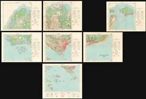
Singapore 1958.
sold
- Digital Map Information
- Suitable for large format printing
- Full resolution TIFF file
- ICC color profile embedded
- Delivered instantly via download link
An extremely important and scarce set of Singapore Maps issued in 1958 under the Surveyor General Malaya. This map set was created during the 1955 - 1958 period of partial internal self-governance and compilated in the year Singapore attained full internal self-governance. The maps cover all of Singapore island as well adjacent islands, and include two supplementary maps, one focusing on Keppel Harbor, and the other extending the coverage eastward to Pulau Tekong. The detail throughout is astounding, with individual buildings, alleyways, roads, and more identified. A key shows the locations of temples (noting religious affiliation), hospitals, schools, government offices, dispensaries, community centers, and fire stations, and other constructions. The map also notes topography, geographical features, the extent of natural and cultivated vegetation, maritime details. (more details)
Extremely scarce early nautical chart of the East Indies and Singapore.
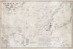
China Sea Sheet 1. To Capt. D. Ross and His Assistants Lieut. P. Maugham, J. Crawford, and J. Houghton, of the Bombay Marine; Who under the auspices of the Honble East India Company, having performed with Arduous Zeal a difficult and dangerous Exploration of the China Sea, so Essential to the safety of Navigation, This Chart Although with an extension of Limits being Chiefly Construction from Their Valuable Surveys, is now Inscribed as a Tribute due to Those Laudable Exertions By their Sincerely Obliged Friend, James Horsburgh.
sold
- Digital Map Information
- Suitable for large format printing
- DPI: 300
- File Size: 41.26 MB
- File Type: ZIP / TIFF
- ICC color profile embedded
- Delivered instantly via download link
An extremely scarce 1842 James Horsburgh nautical chart of parts of the east Indies and Southeast Asia, including ... (more details)
The first major resurvey of the Singapore Straits since the 1840s.
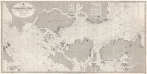
China Sea Singapore Strait.
sold
- Digital Map Information
- Suitable for large format printing
- File Size: 67.1 MB
- File Type: ZIP / TIFF
- ICC color profile embedded
- Delivered instantly via download link
A rare 1870 British Admiralty nautical chart or maritime map of the Singapore Strait. Centered Singapore city ... (more details)
One of the earliest views of Singapore!
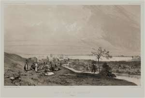
Rade et Ville de Sincapour. (Malaisie).
sold
- Digital Map Information
- Suitable for large format printing
- Full resolution TIFF file
- ICC color profile embedded
- Delivered instantly via download link
One of the earliest obtainable views of Singapore, this is Eugène Cicéri's 1846 view of Singapore drawn from original sketches and maps compiled during Dumont d'Urville's (1790 - 1842) circumnavigation of the globe. The source sketches were created when d'Urville's ships, Astrolabe and Zellee, were at Singapore between June 27 and July 2, 1839. (more details)
Singapore's Chinatown.
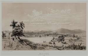
Rade de Sincapour Prise de la maison du Gouverneur. (Malaisie).
sold
- Digital Map Information
- Suitable for large format printing
- Full resolution TIFF file
- ICC color profile embedded
- Delivered instantly via download link
One of the earliest obtainable views of Singapore, this is Eugène Cicéri's 1846 view of Singapore drawn from original sketches and maps compiled during Jules Sébastien César Dumont d'Urville's (1790 - 1842) circumnavigation of the globe. The source sketches were created when d'Urville's ships, Astrolabe and Zélée, were at Singapore between June 27 and July 2, 1839. (more details)
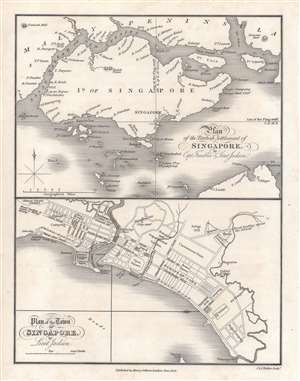
First published plan of Singapore.
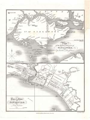
Plan of the Town of Singapore by Lieut. Jackson. / Plan of the British Settlement of Singapore by Capt. Franklin and Lieut. Jackson.
sold
- Digital Map Information
- Suitable for large format printing
- DPI: 600
- File Size: 9.23 MB
- File Type: ZIP / TIFF
- ICC color profile embedded
- Delivered instantly via download link
Known as the Jackson Plan or Raffles Plan, this is the first published map of Singapore. Published in 1828, the map was drawn by Lieutenant Philip Jackson at the request of the founder of modern Singapore, Sir Stamford Raffles (1781 - 1826). It is divided into two sections, a map of the island of Singapore at top, and a close-up plan of the town of Singapore at bottom, oriented towards the west. The city plan presents an idealized version of Singapore following the Raffles vision and, while not fully implemented, was influential in the early development of the colony. (more details)
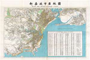
First official Bi-Lingual Map of Singapore issued after Malaysian Independence.
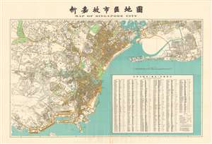
Map of Singapore City. / 新嘉坡市區地圖
sold
- Digital Map Information
- Suitable for large format printing
- File Size: 99.11 MB
- File Type: ZIP / TIFF
- ICC color profile embedded
- Delivered instantly via download link
This is an extremely rare large format 1958 first edition map of Singapore in Chinese and English. Being published just one year after the 1957 Treaty of London recognized the independence of the Federation of Malaysia – which then included Singapore - and in the year that Singapore formally attained internal self-governance. The political transition led to a wave of new bi-lingual publications as English was no longer the only official language. Maps in multiple languages became a necessity both for functional and administrative use. (more details)
First official Bi-Lingual Map of Singapore issued after Malaysian Independence.
Map of Singapore City. / 新嘉坡市區地圖
sold
- Digital Map Information
- Suitable for large format printing
- File Size: 39.44 MB
- File Type: ZIP / TIFF
- ICC color profile embedded
- Delivered instantly via download link
This is an extremely rare large format 1958 first edition map of Singapore in Chinese and English. Being published just one year after the 1957 Treaty of London recognized the independence of the Federation of Malaysia – which then included Singapore - and in the year that Singapore formally attained internal self-governance. The political transition led to a wave of new bi-lingual publications as English was no longer the only official language. Maps in multiple languages became a necessity both for functional and administrative use. (more details)
An extremely scarce nautical chart of the waters around Singapore.

A New Chart Containing the Southwest Part of the China Sea, comprised between The Malaya Peninsula, Straits of Sincapore &c, The Straits of Banca, Gaspar and Billiton, and The Isle of Borneo.
sold
- Digital Map Information
- Suitable for large format printing
- DPI: 300
- File Size: 14.78 MB
- File Type: ZIP / TIFF
- ICC color profile embedded
- Delivered instantly via download link
A scarce 1794 nautical chart or maritime map of the southern tip of the Malay Peninsula, including the island ... (more details)
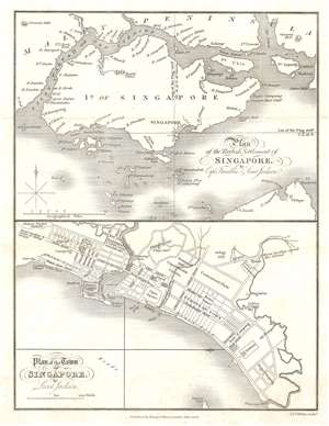
First published plan of Singapore.
Plan of the Town of Singapore by Lieut. Jackson. / Plan of the British Settlement of Singapore by Capt. Franklin and Lieut. Jackson.
sold
- Digital Map Information
- Suitable for large format printing
- Full resolution TIFF file
- ICC color profile embedded
- Delivered instantly via download link
Known as the Jackson Plan or Raffles Plan, this is the first published map of Singapore. Published in 1828, the map was drawn by Lieutenant Philip Jackson at the request of Singapore founder Sir Stamford Raffles (1781 - 1826). It is divided into two sections, a map of the island of Singapore, and a close-up plan of the town of Singapore. The city plan presents an idealized version of Singapore following the Raffles vision and, while not fully implemented, was influential in the early development of the colony. (more details)
The first published map of Singapore!
Plan of the Town of Singapore by Lieut. Jackson. / Plan of the British Settlement of Singapore by Capt. Franklin and Lieut. Jackson.
sold
- Digital Map Information
- Suitable for large format printing
- DPI: 600
- File Size: 3.32 MB
- File Type: ZIP / TIFF
- ICC color profile embedded
- Delivered instantly via download link
Called the Jackson Plan or Raffles Plan, this is the first published map of Singapore. Published in 1828, the map was drawn by Lieutenant Philip Jackson at the request of Singapore founder Sir Stamford Raffles. The map is divided into two sections, a map of the island of Singapore, and a close up of the town of Singapore. The city plan presents an idealized version of Singapore following the Raffles vision and, while not fully implemented, was influential in the early development of the colony. (more details)
First published view of Singapore.
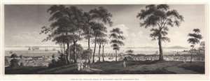
View of the Town and Roads of Singapore from the Government Hill.
sold
- Digital Map Information
- Suitable for large format printing
- Full resolution TIFF file
- ICC color profile embedded
- Delivered instantly via download link
The first printed view of Singapore, issued less than 10 years after it was founded by Sir Thomas Stamford Raffles (1781 - 1826). This aquatint view was published in 1828 after a painting by Royal Navy Captain Robert James Elliot. It looks on Singapore from Government Hill, covering the Plain, Singapore River, and Chinatown. Even at this early stage, presents a bustling city with numerous buildings and a lively port. We have not been able to trance Elliot's original painting. (more details)
Exceptional highly detailed French cart of the Malacca Strait and Singapore.
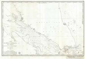
Carte du Détroit de Malacca Partie Méridionale comprenant depuis le Mont Parcelar jusqu'a Singapoure.
sold
- Digital Map Information
- Suitable for large format printing
- Full resolution TIFF file
- ICC color profile embedded
- Delivered instantly via download link
A rare French Dépôt Général de la Marine nautical chart or maritime map of Singapore and the southern ... (more details)
The first view of Singapore!
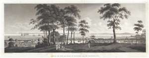
View of the Town and Roads of Singapore from the Government Hill.
sold
- Digital Map Information
- Suitable for large format printing
- DPI: 300
- File Size: 5.67 MB
- File Type: ZIP / TIFF
- ICC color profile embedded
- Delivered instantly via download link
The first printed view of Singapore, issued less than 10 years after it was founded by Sir Thomas ... (more details)
Printed in January 1942 - a month before the Battle of Singapore.
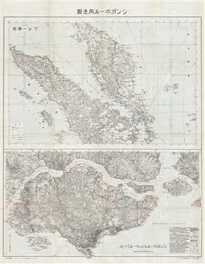
Singapore and Vicinity.
sold
- Digital Map Information
- Suitable for large format printing
- File Size: 28.34 MB
- File Type: ZIP / TIFF
- ICC color profile embedded
- Delivered instantly via download link
This is a 1942 Land Survey Division of the Japanese General Staff map of Malaysia, Sumatra, and ... (more details)
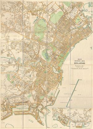
Map of Business Area Singapore.
sold
- Digital Map Information
- Suitable for large format printing
- File Size: 33.88 MB
- File Type: ZIP / TIFF
- ICC color profile embedded
- Delivered instantly via download link
An extremely scarce 1934 F.M.S. (Federated Malay States) Survey map of Singapore's downtown ... (more details)
A Portuguese broadside celebrating the Japanese invasion and capture of Singapore.
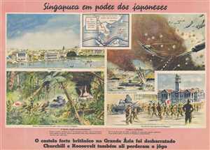
Singapura em poder dos Japoneses.
sold
- Digital Map Information
- Suitable for large format printing
- File Size: 16.34 MB
- File Type: ZIP / TIFF
- ICC color profile embedded
- Delivered instantly via download link
This is a 1942 Section IV of the German Army High Command's Department of Wehrmacht Propaganda Portuguese language pictorial propaganda broadside created celebrating the Japanese invasion and capture of Singapore. Sixty thousand British troops in Singapore surrendered to the Imperial Japanese Army on February 15, 1942, an event Winston Churchill called 'the worst disaster and largest capitulation in British history'. While the vignettes on the front of the broadside do not appear to support the Axis or the Allies, the text on the verso proves otherwise. The text derides British and American imperialism, particularly with regard to Britain's militarization of Singapore and highlights Singapore's fortress-like qualities. The text at the bottom of the page congratulates Japan and states that the British and the United States will soon be annihilated.
A Description of the Broadside
The broadside features four vignettes illustrating different aspects of the Japanese invasion of Singapore. A brightly colored idyllic view of the city of Singapore is situated on the top left, with a vignette of the Japanese advance toward Singapore along the Malay Peninsula below it on the lower left. This vignette features Japanese soldiers trekking through the jungle behind a tank, while a building burns in the background. On the top right, the Japanese attack on the airport in Singapore is illustrated, complete with depictions of the famed Mitsubishi Zero fighter aircraft and several other Japanese planes, all adorned with the Rising Sun. The fourth vignette in the lower right corner presents Japanese troops marching into Singapore in front of the Victoria Theatre and Concert Hall. A map of the region, situated along the top between the view of the city and the vignette of the Japanese aerial attack on the airport, notes the British and American military bases that had been conquered by the Japanese and also states, that with the fall of Singapore, the line in the Pacific between the United States and India, Africa, and Europe, had been severed.
Portuguese Neutrality during World War II
On September 1, 1939, the day Nazi Germany invaded Poland and officially ignited World War II, Portugal declared that the 600-year-old Anglo-Portuguese Alliance remained intact, but since the British were not seeking Portuguese assistance, Portugal would remain neutral in the war. In an aide-mémoire issued on September 5, 1939, the British Government confirmed its understanding of Portugal's statement and supported its neutrality. Even so, Portugal played a critical role in the war, particularly with regard to the refugee crisis suffered by so many during the war, and in saving Europe's Jewish population. Several Portuguese ambassadors and consuls general were responsible for handing out visas to refugees and Europe's Jewish community. The Portuguese Ambassador in Budapest, Carlos Sampaio Garrido, helped an estimated 1,000 Hungarian Jews in 1944 and the Portuguese consul general in Bordeaux helped an undetermined number of refugees by issuing them visas. Around 2,500 refugees were evacuated from Gibraltar in July 1940 ahead of the expected German attack and were welcomed by Portuguese Madeira. (more details)
A Description of the Broadside
The broadside features four vignettes illustrating different aspects of the Japanese invasion of Singapore. A brightly colored idyllic view of the city of Singapore is situated on the top left, with a vignette of the Japanese advance toward Singapore along the Malay Peninsula below it on the lower left. This vignette features Japanese soldiers trekking through the jungle behind a tank, while a building burns in the background. On the top right, the Japanese attack on the airport in Singapore is illustrated, complete with depictions of the famed Mitsubishi Zero fighter aircraft and several other Japanese planes, all adorned with the Rising Sun. The fourth vignette in the lower right corner presents Japanese troops marching into Singapore in front of the Victoria Theatre and Concert Hall. A map of the region, situated along the top between the view of the city and the vignette of the Japanese aerial attack on the airport, notes the British and American military bases that had been conquered by the Japanese and also states, that with the fall of Singapore, the line in the Pacific between the United States and India, Africa, and Europe, had been severed.
Portuguese Neutrality during World War II
On September 1, 1939, the day Nazi Germany invaded Poland and officially ignited World War II, Portugal declared that the 600-year-old Anglo-Portuguese Alliance remained intact, but since the British were not seeking Portuguese assistance, Portugal would remain neutral in the war. In an aide-mémoire issued on September 5, 1939, the British Government confirmed its understanding of Portugal's statement and supported its neutrality. Even so, Portugal played a critical role in the war, particularly with regard to the refugee crisis suffered by so many during the war, and in saving Europe's Jewish population. Several Portuguese ambassadors and consuls general were responsible for handing out visas to refugees and Europe's Jewish community. The Portuguese Ambassador in Budapest, Carlos Sampaio Garrido, helped an estimated 1,000 Hungarian Jews in 1944 and the Portuguese consul general in Bordeaux helped an undetermined number of refugees by issuing them visas. Around 2,500 refugees were evacuated from Gibraltar in July 1940 ahead of the expected German attack and were welcomed by Portuguese Madeira. (more details)
An incredibly detailed city plan of Singapore.
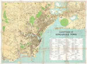
Gazetteer of Singapore Town.
sold
- Digital Map Information
- Suitable for large format printing
- File Size: 26.67 MB
- File Type: ZIP / TIFF
- ICC color profile embedded
- Delivered instantly via download link
This is a 1938 F.M.S. Survey city map or plan of Singapore. The map depicts the city of ... (more details)

East India Archipelago (Western Route to China Chart no. 2)
sold
- Digital Map Information
- Suitable for large format printing
- File Size: 52.8 MB
- File Type: ZIP / TIFF
- ICC color profile embedded
- Delivered instantly via download link
A large and impressive 1872 nautical chart by James Imray covering eastern Malaya (Malaysia), Singapore, and parts of Borneo and Sumatra. (more details)

Strait of Singapore Sheet 2.
sold
- Digital Map Information
- Suitable for large format printing
- File Size: 16.62 MB
- File Type: ZIP / TIFF
- ICC color profile embedded
- Delivered instantly via download link
A scarce 1861 British Admiralty nautical chart or maritime map of the Strait of ... (more details)
Rare French mapping of Singapore.
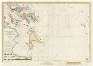
Carte Des Detroits de Singapore, Durian et Rhio et des parages environnants; Dressee d'aprees les cartes d'Horsburgh et celle de l'Amirante Anglaise en 1840 et d'apres la carte Hollandaise du Detroit du Rhio . . . par M. M. Dittlof Tjarssens, Bloijs, Van Treslong, Prins et Van Gogh.
sold
- Digital Map Information
- Suitable for large format printing
- DPI: 300
- File Size: 15.81 MB
- File Type: ZIP / TIFF
- ICC color profile embedded
- Delivered instantly via download link
An exceptionally rare 1852 nautical chart of Singapore and vicinity issued by ... (more details)
An admiralty chart with a detailed city map of Singapore City.
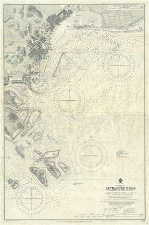
China Sea Singapore Road.
sold
- Digital Map Information
- Suitable for large format printing
- File Size: 24.45 MB
- File Type: ZIP / TIFF
- ICC color profile embedded
- Delivered instantly via download link
This is a 1915 British Admiralty nautical chart or maritime map of the city ... (more details)
An incredible large format chart of the entire Singapore Strait.
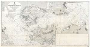
China Sea Singapore Strait.
sold
- Digital Map Information
- Suitable for large format printing
- File Size: 31.02 MB
- File Type: ZIP / TIFF
- ICC color profile embedded
- Delivered instantly via download link
This is a 1927 British Admiralty nautical chart or maritime map of the ... (more details)
Striking Japanese Nautical of Singapore Strait.
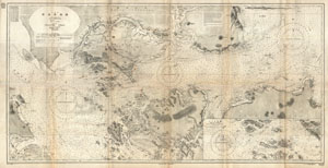
China Sea Singapore Strait.
sold
- Digital Map Information
- Suitable for large format printing
- File Size: 5.63 MB
- File Type: ZIP / TIFF
- ICC color profile embedded
- Delivered instantly via download link
This is a rare and striking large format 1923 Japanese nautical chart ... (more details)
Rare chart of Singapore illustrating early development of the Singapore Strategy.
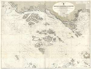
Preliminary Chart China Sea. Western Approaches to Singapore (Attention is called to Notice to Mariners No.1 of each year) From Surveys by Lieut. and Commr. F.A. Reyne R.N. 1912. Lieut. and Commr. R.I. Hancock R.N. 1910, and Leuitenant and Commander H.P. Douglas R.N. 1909. H.M. Surveying Ship 'Waterwitch' 1909-12.
sold
- Digital Map Information
- Suitable for large format printing
- File Size: 41.06 MB
- File Type: ZIP / TIFF
- ICC color profile embedded
- Delivered instantly via download link
A rare 1923 British Admiralty nautical chart illustrating southern ... (more details)