
World War I (sold)
Only Known Surviving Examples of WWI 'balloonatic' Views.
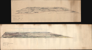
Panoramic View. La Bassee (Canal) to Loos. No 30. Balloon Section. 21:2:1917. / Panoramic View from Q 24a0.0: Lens to Vimy.
sold
- Digital Map Information
- Suitable for large format printing
- Full resolution TIFF file
- ICC color profile embedded
- Delivered instantly via download link
An extraordinary survival, this is a pair of manuscript panoramic views of part of the Western Front in northeastern France during World War I (1914 - 1918). These views were drawn by members of the Royal Naval Air Service and the Royal Flying Corps who rode in baskets beneath hydrogen-filled balloons thousands of feet above the front lines to observe enemy movements and direct artillery fire. Known as kite balloons, these were legitimate military targets, earning the 'balloonatics' had a very high mortality rate. (more details)
Unabashed Japanese ambitions in WWI.
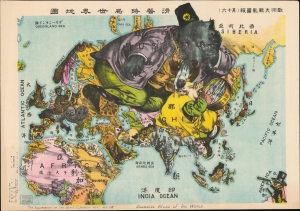
The Illustration of the Graet European War. No. 16. A Humoros Atlas of the World. / 歐洲大戰亂畫報(其十六)滑稽欧亜外交地図.
sold
- Digital Map Information
- Suitable for large format printing
- File Size: 28.45 MB
- File Type: ZIP / TIFF
- ICC color profile embedded
- Delivered instantly via download link
An exceptional September 13, 1914, Japanese serio-comic map of Asia and Europe at the outbreak of World War I. The masterfully drawn chromolithograph map unabashedly illustrates Japanese aspirations to exploit the war in Europe, with underpinning elements of cultural supremacy, imperial ambitions towards China, concern over but contempt for Russia, and grudging respect towards the United States. (more details)
One of the few surviving maps from Meinertzhagan's Nairobi Map Room used for field opperations in the WWI East Africa Campaign.
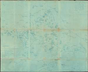
Anglo-German Boundary.
sold
- Digital Map Information
- Suitable for large format printing
- File Size: 28.87 MB
- File Type: ZIP / TIFF
- ICC color profile embedded
- Delivered instantly via download link
One of the most extraordinary military maps we have encountered, this is a September 17, 1914 cyanotype British field map of modern-day Kenya and Tanzania. It is the only surviving example of a definitive field map from the World War I (WWI) East Africa Campaign (1914 - 1918). Likely prepared for the British invasion of German East Africa in November 1914 (which was unsuccessful), the map illustrates the border regions of British and German East Africa (modern Kenya and Tanzania, respectively). Based on a detailed reconnaissance of the Serengeti Plain, the map offers a wealth of information critical to guerilla military movement, not commonly available on published topographical maps. There are extensive manuscript annotations, likely by an officer of the East African Mounted Rifles, marking battles and troop movements. The map is printed in the cyanotype technique, likely at the British Army HQ in Nairobi under the supervision of the brilliant but divisive intelligence operative Lt. Col. Richard Meinertzhagen. (more details)
One-of-a-kind Ottoman Serio-Comic WWI Propaganda Map.
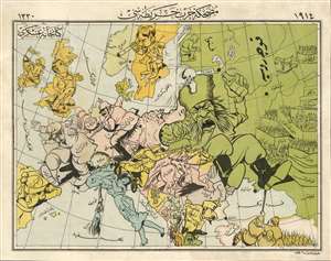
A Háborús Európa Térkép-Karikatúrája. / [A Cartoon War Map of Europe].
sold
- Digital Map Information
- Suitable for large format printing
- File Size: 16.22 MB
- File Type: ZIP / TIFF
- ICC color profile embedded
- Delivered instantly via download link
The only known example of the Ottoman Turkish edition of Varga Imre's important 1914 serio-propaganda map of Europe at the outset of World War I (1814 - 1918), A Háborús Európa Térkép-Karikatúrája. The map is essentially propaganda for the Central Powers wherein Russia appears as an obnoxious drunk and Hungary is illustrated charging fiercely into battle - note, this is the only WWI Era serio-comic map to illustrate Hungary independently. In this Ottoman edition, released in Istanbul by Khaireya and Co. Press, all the text has been translated into Ottoman Turkish. (more details)
Chains of Empire.
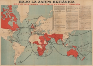
Bajo la Zarpa Británica, Breve historia del militarismo inglés.
sold
- Digital Map Information
- Suitable for large format printing
- File Size: 61.17 MB
- File Type: ZIP / TIFF
- ICC color profile embedded
- Delivered instantly via download link
A fascinating 1918 German-issued Spanish-language World War I broadsheet propaganda map representing the world wrapped in the chains of British militantism and colonialism. Issued by F. Haase, this map was part of the WWI propaganda war waged by both the Allies and Central powers to sway the hearts and minds of neutral nations. (more details)
Chained in the claws of the British Empire.
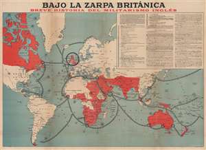
Bajo la zarpa británica, Breve historia del militarismo inglés.
sold
- Digital Map Information
- Suitable for large format printing
- File Size: 211.7 MB
- File Type: ZIP / TIFF
- ICC color profile embedded
- Delivered instantly via download link
A fascinating 1918 German-issued Spanish-language World War I broadsheet propaganda map representing the world wrapped in chains of British militantism and colonialism. Issued by F. Haase, this map was part of the WWI propaganda war waged by both the Allies and Central powers to sway the hearts and minds of neutral nations. (more details)
Japanese propaganda map illustrating WWI and the Russo-Japanese War. The fulfillment of the Meiji Dream!

世界大戰紀念地圖 明治之偉跡 大正之偉業 / Commemorative Map of the World War. The Great Footprint of Meiji, the Great Undertaking of Taisho.
sold
- Digital Map Information
- Suitable for large format printing
- File Size: 65.91 MB
- File Type: ZIP / TIFF
- ICC color profile embedded
- Delivered instantly via download link
A rare, exceptional, and impressively proportioned 1919 Taishō 8 Japanese propaganda map prepared to celebrate Japanese achievements in World War I (Jul 28, 1914 - Nov 11, 1918) and the Russo-Japanese War (Feb 8, 1904 - Sep 5, 1905). During the course of these ... (more details)
WWI Africa Campaign Espionage.
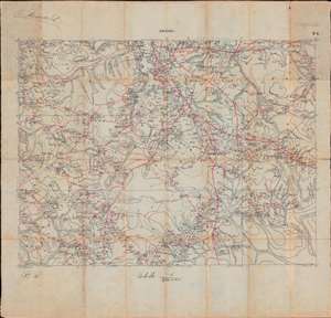
Mwánsa B3 / [Mwanza B3].
sold
- Digital Map Information
- Suitable for large format printing
- Full resolution TIFF file
- ICC color profile embedded
- Delivered instantly via download link
This is a unique manuscript record of reconnaissance and espionage at the height of the World War I East Africa Campaign compiled by Belgian Force Publique intelligence officer G. Massart. This c. 1916 hand-drawn field manuscript details the Mwanza region of northern Tanzania in anticipation of the Tabora Offensive, a major Allied action in the northwestern corner of German East Africa during the East Africa Campaign, World War I (1914 - 1918). The map shows latitude and longitude and offers a wealth never-before-mapped detail regarding topography, roads and paths (red lines), waterways, tribal villages, and geographical features. Before the war, the Mwanza was poorly understood, thus Massart would have been dispatched from the adjacent Belgian Congo to reconnoiter the area - vital for its port access to Lake Victoria - in advance of major action. (more details)
Everyone's favorite map monster.
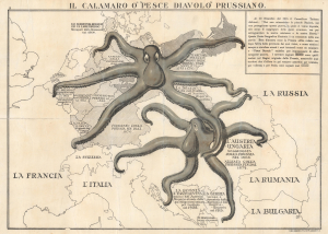
Il Calamaro O' 'Pesce Diavolo' Prussiano.
sold
- Digital Map Information
- Suitable for large format printing
- File Size: 12.01 MB
- File Type: ZIP / TIFF
- ICC color profile embedded
- Delivered instantly via download link
This is a scarce 1916 British propaganda map of Europe with Prussia and Austria-Hungary depicted as voracious octopuses. This Italian-language example was issued to persuade a divided Italian public to ally with the Entente against the Central Powers (Germany and Austria-Hungary). (more details)
'The Dogs of War are loose in Europe!' - Emanuel
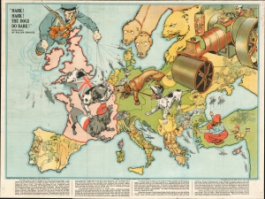
Hark! Hark! The Dogs Do Bark!
sold
- Digital Map Information
- Suitable for large format printing
- File Size: 35.06 MB
- File Type: ZIP / TIFF
- ICC color profile embedded
- Delivered instantly via download link
An iconic 1914 serio-comic satirical map by Johnson, Riddle, and Company issued shortly after the outbreak of World War I (1914 - 1918). The map covers Europe from the Atlantic to the Black Sea and from Scandinavia to Italy. Superimposed on the map are a host of dogs, as well as other animals, and several human figures. Text by the popular Jewish satirist Walter Lewis Emanual appears at the bottom. The lighthearted content captures English optimism early in the war. It was widely assumed that British naval superiority would end the war quickly, some argued in as little as six weeks. (more details)
Wartime German Military Reissue of Seminal French Map of Lebanon.
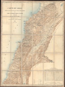
Carte du Liban d'aprés les reconaissances de la Brigade Topographique du Corps Expéditionnaire de Syrie en 1860-1861.
sold
- Digital Map Information
- Suitable for large format printing
- File Size: 54.45 MB
- File Type: ZIP / TIFF
- ICC color profile embedded
- Delivered instantly via download link
This is a 1915 WWI Era German Deputy General Staff issue of a French Dépôt de la Guerre map of Lebanon, then an Ottoman territory. It was issued in anticipation of combat action in the Lebanese Levant, an area then considered unstable due to weak Ottoman rule and ongoing sectarian violence. (more details)
Everyone's favorite WWI cephalopod map monster, the Prussian Octopus!
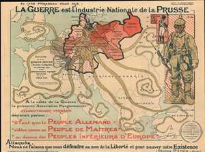
La Guerre est l'industrie Nationale de la Prusse. [War is the Prussian National Industry.]
sold
- Digital Map Information
- Suitable for large format printing
- File Size: 49.33 MB
- File Type: ZIP / TIFF
- ICC color profile embedded
- Delivered instantly via download link
This is a 1917 Maurice Neumont World War I propaganda map of Europe incorporating everyone's favorite cephalopod map monster, the Prussian Octopus, to highlight two centuries of Prussian aggression across Central and Western Europe. It is overprinted with pictorial imagery including the Prussian octopus grasping all of Europe in its clutches and a Prussian soldier. (more details)
German WWI Propaganda criticizing Allied colonialism in the wake of Wilson's Fourteen Points.
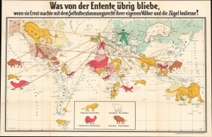
Was von der Entente übrig bliebe wenn sie Ernst machte mit dem Selbstbestimmungsrecht iher eigenen Völker und die Zügel losliesse! [What would remain of the Entente if it took seriously the 'self-determination right' of its own nations and let go of the reins!]
sold
- Digital Map Information
- Suitable for large format printing
- File Size: 36.6 MB
- File Type: ZIP / TIFF
- ICC color profile embedded
- Delivered instantly via download link
This is a fascinating c. 1918 German propaganda pictorial map issued in the wake of World War I (1914 - 1918) criticizing Wilson's Fourteen Points and their call for global 'Self Determination' as hypocritical. The cartographer asks pointedly, 'Why should Germany be morally judged for its colonies, while the Allied (Entente) powers hold the world on colonial leashes?' (more details)
Everyone's favorite WWI cephalopod map monster, the Prussian Octopus!
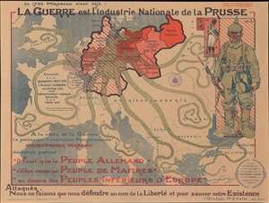
La Guerre est l'industrie Nationale de la Prusse. [War is the Prussian National Industry.]
sold
- Digital Map Information
- Suitable for large format printing
- File Size: 39.45 MB
- File Type: ZIP / TIFF
- ICC color profile embedded
- Delivered instantly via download link
This is a 1917 Maurice Neumont World War I propaganda map of Europe incorporating everyone's favorite cephalopod map monster, the Prussian Octopus, to highlight two centuries of Prussian aggression across Central and Western Europe. The map depicts the region from northeastern Spain to Russia and from England and the North Sea to the Mediterranean Sea and Asia Minor. It is overprinted with pictorial imagery including the Prussian octopus grasping all of Europe in int clutches and a Prussian soldier. (more details)
A Scarce Map from the Opening Days of World War I.
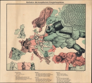
Karikatur des Europäischen Kriegsschauplatzes.
sold
- Digital Map Information
- Suitable for large format printing
- File Size: 10.86 MB
- File Type: ZIP / TIFF
- ICC color profile embedded
- Delivered instantly via download link
A scarce 1914 serio-comic chromolithographic map from the early days of the First World War, printed by Fritz Elsner. Providing a German perspective on the conflict, it harshly denounces the country's enemies, including France, Britain, and Russia. (more details)
Jewish-American immigrant patriotism in WWI.
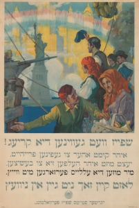
[Food will win the war!] / שפייז וועט געווינען דיא קריעג!
sold
- Digital Map Information
- Suitable for large format printing
- File Size: 64.86 MB
- File Type: ZIP / TIFF
- ICC color profile embedded
- Delivered instantly via download link
A significant 1917 World War I propaganda poster in Yiddish illustrated by Charles Edward Chambers and published by the United States Food Administration. The poster appeals to Jewish immigrants to save food, particularly wheat, for the Allied war effort by suggesting that the European war was a threat to their hard-won freedom. (more details)
'The Dogs of War are loose in Europe!' - Emanuel
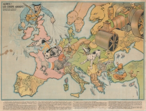
Alerte! les Chiens Aboient! / [Hark! Hark! The Dogs Do Bark!]
sold
- Digital Map Information
- Suitable for large format printing
- File Size: 30.92 MB
- File Type: ZIP / TIFF
- ICC color profile embedded
- Delivered instantly via download link
An uncommon French edition of an iconic 1914 serio-comic satirical map by Johnson, Riddle, and Company issued shortly after the outbreak of World War I (1914 - 1918). (more details)
Japanese interest in the WWI Zimmermann Telegram.
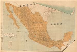
Latest Full Map of the Republic of Mexico 1917 / Saishin mekishiko kyowakoku zenzu. / 最新墨西哥共和國全圖
sold
- Digital Map Information
- Suitable for large format printing
- File Size: 42.78 MB
- File Type: ZIP / TIFF
- ICC color profile embedded
- Delivered instantly via download link
A relic of one of the most extraordinary events in World War I, this is a 1917 Japanese Gen Muraoka (村岡玄 著) map of Mexico issued in response to the infamous Zimmermann Telegram. The Telegram, intercepted by British Intelligence, proposed an alliance between Mexico, Japan, and Germany against the United States in the event that the U.S. entered World War I. While the missive was intercepted and the proposed protocol failed, it generated Japanese interest in Mexico and influenced U.S. participation in WWI against Germany. This is the only known map to demonstrate Japanese interest in the Zimmermann Telegram. (more details)
Contrasting the paradise of Florida with the horrors of WWI trench warfare.
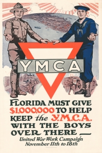
Florida Must Give $1,00,000 to help keep the Y.M.C.A. with the Boys Over There - United War Work Campaign November 11th to 18th.
sold
- Digital Map Information
- Suitable for large format printing
- File Size: 74.91 MB
- File Type: ZIP / TIFF
- ICC color profile embedded
- Delivered instantly via download link
A rare 1918 World War I poster features a pictorial bird's-eye view map of Florida, printed in St. Augustine. The poster was issued as part of a national collaborative fundraising effort to provide social welfare and recreational services to American soldiers and navy men on the European front. This poster embodies earnest initiative, indicative of the era's approach to social responsibility and support for the military. (more details)
Join the Navy!
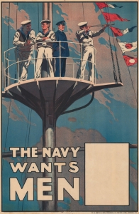
The Navy Wants Men.
sold
- Digital Map Information
- Suitable for large format printing
- File Size: 78.96 MB
- File Type: ZIP / TIFF
- ICC color profile embedded
- Delivered instantly via download link
This is a 1915 British Admiralty World War I recruiting broadside depicting sailors and an officer atop a crow's nest. One sailor looks through a spyglass to the right while the others gaze in various directions. Flags fly in the background. The blank white box in the bottom right corner usually displays information concerning local recruiting offices. (more details)
World War I propaganda broadside featuring Joan of Arc.
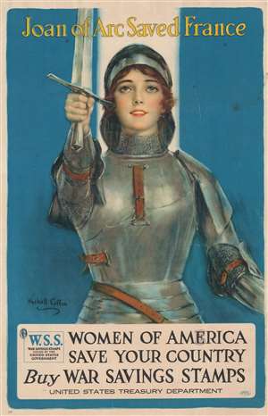
Joan of Arc Saved France. Women of America Save Your Country Buy War Savings Stamps.
sold
- Digital Map Information
- Suitable for large format printing
- File Size: 31.81 MB
- File Type: ZIP / TIFF
- ICC color profile embedded
- Delivered instantly via download link
This is a 1918 Haskell Coffin World War I propaganda broadside depicting Joan of Arc. A portrait of Joan looking toward the future dominates the sheet. Clad in full armor, Joan holds a sword aloft effortlessly, calling on the women to help save America as she had saved France - by buying War Savings Stamps. War Savings Stamps cost ten cents or twenty-five cents each and were mostly bought by women and young children. Raising near $1 billion, the War Savings Stamps program proved successful, although not so much as the Treasury Department hoped. (more details)
Rare World War I Era Satirical Map of Europe drawn from the 'Russian' perspective.
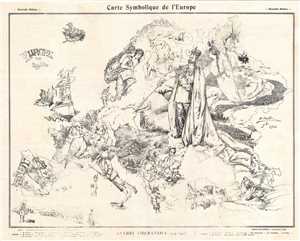
Carte Symbolique de L'Europe. / Europe en 1914.
sold
- Digital Map Information
- Suitable for large format printing
- File Size: 9.74 MB
- File Type: ZIP / TIFF
- ICC color profile embedded
- Delivered instantly via download link
A scarce World War I era satirical map illustrating the political situation in Europe in c. 1914. This map was first issued in Poland where it was drawn by the Warsaw artist Vladislav Levinsky. Warsaw at the time being one of the largest cities in the Russian ... (more details)
Blessings and best wishes to America's soldiers and sailors fighting in Europe.
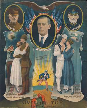
Over the Top with Uncle Sam.
sold
- Digital Map Information
- Suitable for large format printing
- File Size: 28.19 MB
- File Type: ZIP / TIFF
- ICC color profile embedded
- Delivered instantly via download link
This is a 1918 William Haskell World War I (1914 - 1918) pictorial propaganda broadside. A portrait of President Woodrow Wilson (1856 - 1924) with American flags and a bald eagle is the focal point. Portraits of General John J. Pershing (1860 - 1948), and Admiral William Sims (1858 - 1936) flank Wilson's portrait on the left and right, respectively. General Pershing commanded the American Expeditionary Force in Europe, while Admiral Sims commanded U.S. naval forces in Europe. Below the trio, illustrations of an Army soldier and his sweetheart, and a Navy sailor with his sweetheart, adorn the left and right. A poem by an unknown author entitled 'To the Boys in Khaki' sends the sweethearts' (and the country's) blessings and best wishes to the 'Soldier boy Somewhere in France'. A stirring image of an armed Uncle Sam striding 'over the top' (a phrase used to describe a World War I era charge out of a trench along the Western Front) across the Atlantic to Europe, where a German soldier cowers below his cape visually dominates the image. A fleet of American airplanes follows Uncle Sam across the Atlantic, bringing American firepower to bear against the enemy. (more details)
The World War I Western Front in June 1918.
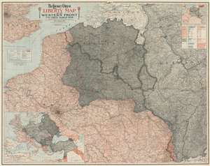
The Literary Digest Liberty Map of the Western Front of the Great World War Showing the Battle Line of Liberty as it Stood June 5, 1918.
sold
- Digital Map Information
- Suitable for large format printing
- Full resolution TIFF file
- ICC color profile embedded
- Delivered instantly via download link
This is a 1918 Matthews-Northrup wall map of northern France, Belgium, Germany, and the surrounding region highlighting the World War I Western Front as of June 5, 1918. A tricolor blue, white, and red line (reminiscent of the French flag) traces the front from the North Sea to Switzerland through parts of western Belgium and northern France. Entente Powers (Britain and France) are shaded pink, while hues of gray fill in members of the 'Teutonic Allies' (Germany) or territory occupied by them (Belgium, Luxembourg, and northeastern France). A blue dashed line marks Germany's farthest advance, while a red dashed line illustrates the advancement of French forces. An accompanying index identifies over 11,000 place names. An inset in the upper right highlights coal and iron regions in occupied territory and Germany and a table just below it quantifies the production. An inset in the lower left corner depicts everywhere fighting was happening around the world. Red lines reinforce these disparate regions: northern France, Russia, Romania, northeastern Italy, Greece, Palestine, and modern-day Iraq. (more details)
Reinforcing German Nationalism late in WWI.
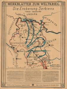
Merkblätter zu Weltkrieg Die Erobergun Serbiens. 7. Oktober - Dezember 1915.
sold
- Digital Map Information
- Suitable for large format printing
- File Size: 16.44 MB
- File Type: ZIP / TIFF
- ICC color profile embedded
- Delivered instantly via download link
This is a 1918 Bodo Zimmermann propaganda broadside map of the Central Powers' Serbia Campaign and victory during World War I (1914 - 1918). The map is part of a rare series of broadsides issued to reinforce German nationalism as the war began to turn against the Central Powers. (more details)
Japan Makes Hay while Europe Burns.
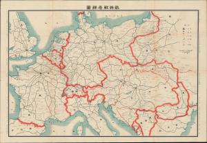
歐洲戰局詳圖 / [Detailed Map of the European War Situation].
sold
- Digital Map Information
- Suitable for large format printing
- DPI: 600
- File Size: 33.77 MB
- File Type: ZIP / TIFF
- ICC color profile embedded
- Delivered instantly via download link
This is a scarce 1914 Japanese-language map of Europe in the opening months of World War I, edited by Hasegawa Seiya for the periodical True Account of the War in Europe. It reflects the significant but often overlooked role that World War I had in catapulting Japan into a global power and setting the stage for World War II. Although little known in the West, Japan was an enthusiastic member of the Entente Alliance during World War I (1914 - 1918), which it leveraged to expand its influence in China and East Asia. (more details)
America to the rescue!
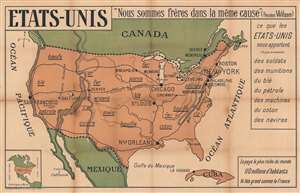
Etats-Unis. 'Nous sommes frères dans la même cause' (Woodrow Wilson).
sold
- Digital Map Information
- Suitable for large format printing
- File Size: 40.93 MB
- File Type: ZIP / TIFF
- ICC color profile embedded
- Delivered instantly via download link
This is a c. 1917 G. Delattre World War I French propaganda map of the United States. The map celebrates American declaration of war just weeks after the event. France and the other Entente powers had been fighting Germany and the Central Powers since August 1914. The French suffered greatly during these nearly three years. Nearly one million were killed and tens of thousands wounded. Large sections of France's industrial northeast were destroyed or occupied by the static trench war. (more details)
Promoting an ostenisbly patriotic song challenging immigrants to do their part and support the U.S. during World War I effort.
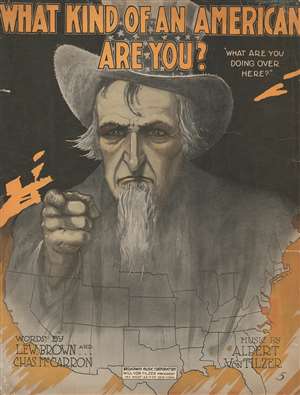
What Kind of an American Are You?
sold
- Digital Map Information
- Suitable for large format printing
- File Size: 16.26 MB
- File Type: ZIP / TIFF
- ICC color profile embedded
- Delivered instantly via download link
This is a 1917 propaganda map of the United States illustrating a cover of sheet music and promoting 'Americanness.' The cover features a map of the entire United States overshadowed by a large portrait of Uncle Sam pointing his index finger at the viewer. The song, written by Lew Brown and Charles McCarron and composed by Albert von Tilzer, is a rousing tune urging Americans to do their part in supporting the effort in World War I. Despite being published during World War I, the song is surprisingly prescient to today's social and political climate. It indirectly calls upon immigrants to be 'more American' and prove their loyalty to the United States. Published in 1917, this song fundamentally upholds the 'us-against-them' mentality that swept over the United States following the declaration of war against Germany - and which seems again on the rise. (more details)
A pictorial map of American World War I cemeteries and monuments published on the eve of World War II.
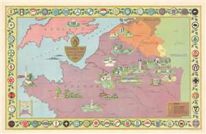
Remembrance Map of American Cemeteries and Battle Monuments in Europe.
sold
- Digital Map Information
- Suitable for large format printing
- File Size: 47.67 MB
- File Type: ZIP / TIFF
- ICC color profile embedded
- Delivered instantly via download link
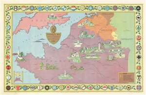
This is a 1939 Cora W. Baker pictorial map of American World War I cemeteries and battlefield monuments in Europe. The map depicts the region from Brittany, France to Germany and from southern England and the Netherlands to Nantes and Besancon, France. American cemeteries and monuments are illustrated in profile throughout France and Belgium, with Brookwood American Cemetery and Memorial in England and the Naval Monument in Gibraltar being the only two sites outside of the two aforementioned countries. Some of the cemeteries include the Somme (Bony) American Cemetery, Suresnes American Cemetery, Meuse-Argonne (Romagne) American Cemetery, and the St. Mihiel (Thiaucourt) American Cemetery in France and the Flanders Field American Cemetery in Belgium. Each of the monuments was erected for a specific purpose. The Naval Monument at Brest, France, for example, commemorates the city's serivce as the principal point of embarkation and debarkation for the American Expeditionary Forces (AEF), while the Tours American Monument commemorates the service of the 650,000 men who served in the Services of Supply (SOS) of the AEF, since Tours was the headquarters of the SOS during the war. Other American monuments in France include the Chateau-Thierry American Monument, the Cantigny American Monument, the Bellicourt American Monument, the Montsec American Monument, and the Montfaucon American Monument. The Audenarde American Monument and the Kemmel American Monument are situated in Belgium. All of these cemeteries and monuments, along with those commemorating the sacrifices of men and women who served in World War II, are operated and maintained by the American Battle Monuments Commission. Cities important to American operations during World War I are also labeled, as are major rivers. The whole is surrounded by a border made up of the shoulder patches of all the American divisions that served in Europe during World War I. (more details)
A pictorial map of American World War I cemeteries and monuments published on the eve of World War II.
Remembrance Map of American Cemeteries and Battle Monuments in Europe.
sold
- Digital Map Information
- Suitable for large format printing
- File Size: 58.61 MB
- File Type: ZIP / TIFF
- ICC color profile embedded
- Delivered instantly via download link
This is a 1939 Cora W. Baker pictorial map of American World War I cemeteries and battlefield monuments in Europe. The map depicts the region from Brittany, France to Germany and from southern England and the Netherlands to Nantes and Besancon, France. American cemeteries and monuments are illustrated in profile throughout France and Belgium, with Brookwood American Cemetery and Memorial in England and the Naval Monument in Gibraltar being the only two sites outside of the two aforementioned countries. Some of the cemeteries include the Somme (Bony) American Cemetery, Suresnes American Cemetery, Meuse-Argonne (Romagne) American Cemetery, and the St. Mihiel (Thiaucourt) American Cemetery in France and the Flanders Field American Cemetery in Belgium. Each of the monuments was erected for a specific reason. The Naval Monument at Brest, France, for example, commemorates that the city served as the principal point of embarkation and debarkation for the American Expeditionary Forces (AEF), while the Tours American Monument commemorates the service of the 650,000 men who served in the Services of Supply (SOS) of the AEF, since Tours was the headquarters of the SOS during the war. Other American monuments in France include the Chateau-Thierry American Monument, the Cantigny American Monument, the Bellicourt American Monument, the Montsec American Monument, and the Montfaucon American Monument. The Audenarde American Monument and the Kemmel American Monument are situated in Belgium. All of these cemeteries and monuments, along with those commemorating the sacrifices of men and women who served in World War II, are operated and maintained by the American Battle Monuments Commission. Cities important to American operations during World War I are also labeled, as are major rivers. The whole is surrounded by a border made up of the shoulder patches of all the American divisions that served in Europe during World War I. (more details)
Canadian WWI military achievement!
War Map Specially Indicating Scenes Where Canadian Troops Distinguished Themselves.
sold
- Digital Map Information
- Suitable for large format printing
- File Size: 58.61 MB
- File Type: ZIP / TIFF
- ICC color profile embedded
- Delivered instantly via download link
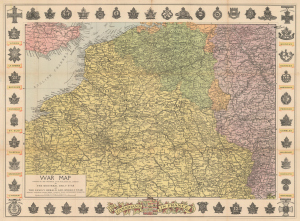
This is a striking c. 1918 Montreal Star commemorative map of the Western Front, celebrating the extraordinary contribution of Canadian forces to the First World War (1914 - 1918). Published for a domestic Canadian audience, it identifies the battlefields where Canadian troops distinguished themselves while surrounding the theater of war with regimental insignia, battle honors, and the highest decorations awarded for military valor. More than a record of Canadian participation in the war, the map reflects a pivotal moment in the formation of Canadian national identity, when the shared sacrifice and battlefield reputation of the Canadian Corps - particularly at Ypres, the Somme, Vimy Ridge, and Passchendaele - helped transform Canada from a British dominion into an increasingly self-conscious nation. (more details)
Highlights the Allied losses after the German Spring Offensive and their gains during the Hundred Days Offensive.
Clason's War Map of the Western Front.
sold
- Digital Map Information
- Suitable for large format printing
- Full resolution TIFF file
- ICC color profile embedded
- Delivered instantly via download link
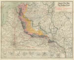
This is a 1918 Clason Map Company map of northern France illustrating the movements of the front line in World War I through early September 1918. Unlike World War II, World War I was fought along mostly static lines of trenches in northern France and Belgium from 1914 through 1918. The map depicts the region from the English Channel and Dieppe to Strasburg (Strassburg) in Alsace, then part of Germany, and from Holland and the North Sea to Colmar. Red overprinting is used to illustrate the battle line at five different times during the four-year slaughter. The furthest line depicts the farthest advance of the German army, when they reached within thirty kilometers of the center of Paris before their advance was stopped by the French at the First Battle of the Marne. This is the battle that includes the fabled taxis of Paris ferrying soldiers to the battlefield. Dashed lines also trace the German offensives of March and June 1918, collectively known as the Spring Offensive. The line of X's marks the Allied campaign that began in August 1918 with the Battle of Amiens. Following the Allied success in the Battle of Amiens, the Germans fell back to the Hindenburg Line, a well-fortified defensive line that was established in 1917 and is illustrated and labeled here. The Hundred Days Offensive, in fact a series of battles that pushed back the Central Powers, eventually led to the end of the war. (more details)