
Faden, William (sold)

William Faden (July 11, 1749 - March 21, 1836) was a Scottish cartographer and map publisher of the late 18th century. Faden was born in London. His father, William MacFaden, was a well-known London printer and publisher of The Literary Magazine. During the Jacobite Rebellion (1745 - 1746), MacFaden changed his family name to Faden, to avoid anti-Scottish sentiment. Faden apprenticed under the engraver James Wigley (1700 - 1782), attaining his freedom in 1771 - in the same year that Thomas Jefferys Sr. died. While Thomas Jefferys Sr. was an important and masterful mapmaker, he was a terrible businessman, and his son, Jefferys Jr., had little interest in building on his father's legacy. MacFaden, perhaps recognizing an opportunity, purchased his son a partnership in the Jefferys firm, which subsequently traded as 'Faden and Jefferys'. Jefferys Jr. also inherited Jefferys Sr.'s title, 'Geographer to the King and to the Prince of Wales'. With little interest in cartography or map publishing, Jefferys Jr. increasingly took a back seat to Faden, and by 1776, he had withdrawn from day-to-day management, although he retained his financial stake. The American Revolutionary War (1775 - 1783) proved to be a boom for the young 'Geographer to the King', who leveraged existing materials and unpublished manuscript maps to which he had access via his official appointment to publish a wealth of important maps, both for official use and the curious public - this period of prosperity laid the financial underpinning for Faden, who by 1783, at the end of the war, acquired full ownership of the firm and removed the Jefferys imprint. In 1801, he engraved and published the first maps for the British Ordnance Survey. By 1822, Faden published over 350 maps, atlases, and military plans. He retired in 1823, selling his plates to James Wyld Sr. Faden died in 1836.
Heart of British Strategy in the Revolutionary War.
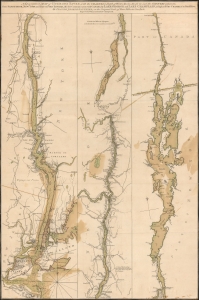
A Topographical Map of Hudsons River, with the channels depth of water, rocks, shoals etc. and the country adjacent, from Sandy-Hook, New York and bay to Fort Edward, also the communication with Canada by Lake George and Lake Champlain, as high as Fort Chambly on Sorel River.
sold
- Digital Map Information
- Suitable for large format printing
- Full resolution TIFF file
- ICC color profile embedded
- Delivered instantly via download link
This is Claude Joseph Sauthier's scarce, magnificent 1776 map of the Hudson River, Lake George, and Lake Champlain: the linchpin of Great Britain's strategy to swiftly achieve victory in the American Revolution. Control of the strategic New York - Montreal corridor would have divided the colonies effectively, allowing Britain to defeat the Revolution piecemeal. (more details)
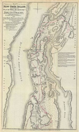
A Topographical Map of the North Part of New-York Island, exhibiting the Plan of Fort Washington, now Fort Knyphausen, With the Rebels Lines to the Southward, which were forced by the Troops under the Command of the Rt. Honble. Earl Percy on the 16th Novr. 1776, and Survey'd immediately after by order of his Lordship. By Claude Joseph Sauthier.
sold
- Digital Map Information
- Suitable for large format printing
- File Size: 7.09 MB
- File Type: ZIP / TIFF
- ICC color profile embedded
- Delivered instantly via download link
This is an uncommon of the northern part of New York City issued 1860 for Valentine's Manual of the Corporation of New York . Originally prepared in 1777 by William Faden to illustrate the struggle for control of New York City during the American Revolutionary ... (more details)
Likely used in the field during the American Revolutionary war.
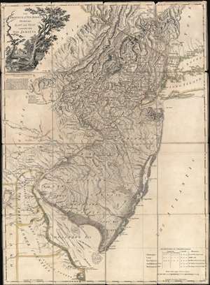
The Province of New Jersey Divided into East and West, commonly called The Jerseys.
sold
- Digital Map Information
- Suitable for large format printing
- Full resolution TIFF file
- ICC color profile embedded
- Delivered instantly via download link
A most fascinating 1777 first-state first-edition map of New Jersey by William Faden and Bernard Ratzer likely used in the field during the American Revolutionary War by the German Hessian supply officer, Friedrich Wilhelm von Wurmb. While focused on New Jersey, coverage extends to include eastern Pennsylvania, Delaware, and New York City. It captures the state's complex topography, noting the Jersey Highlands and the Palisades in the north and the Pine Barrens and coastal marshes in the south. New Jersey is here broken down into 12 counties, as they existed at the time, as well as multiple towns and roads. Note that there are no coastal routes through Monmouth County, requiring travelers instead to travel inland to Crosswicks, then south east to Egg Harbor, before continuing south. There is also an annotation regarding the settlement of Fort Helsingburg, near Salem on the Delaware River, where in 1640, Swedish settlers attempt to establish a colony. (more details)
Strong first-edition strike!
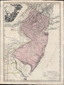
The Province of New Jersey Divided into East and West, commonly called The Jerseys.
sold
- Digital Map Information
- Suitable for large format printing
- Full resolution TIFF file
- ICC color profile embedded
- Delivered instantly via download link
A fine 1777 first-state first-edition map of New Jersey by William Faden and Bernard Ratzer - exhibiting the fine strong strike only evident on first editions. Focused on New Jersey, coverage extends to include eastern Pennsylvania, Delaware, and New York City. It captures the state's complex topography, noting the Jersey Highlands and the Palisades in the north and the Pine Barrens and coastal marshes in the south. New Jersey is here broken down into 12 counties, as they existed at the time, as well as multiple towns and roads. Note that there are no coastal routes through Monmouth County, requiring travelers instead to travel inland to Crosswicks, then south east to Egg Harbor, before continuing south. There is also an annotation regarding the settlement of Fort Helsingburg, near Salem on the Delaware River, where in 1640, Swedish settlers attempt to establish a colony. (more details)
The American Revolutionary Capital Revealed.
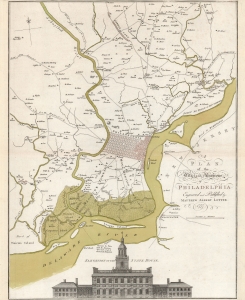
A Plan of the City and Environs of Philadelphia Engraved and Published by Matthew Albert Lotter.
sold
- Digital Map Information
- Suitable for large format printing
- DPI: 600
- File Size: 58.15 MB
- File Type: ZIP / TIFF
- ICC color profile embedded
- Delivered instantly via download link
This is Matthäus Albrecht Lotter's beautiful 1777 edition of the Scull and Heap map of Philadelphia and its environs, an essential Revolutionary War (1775 - 1783) map. The map represents the pinnacle of Philadelphia area cartography when it was the capital of the American Revolution and, as this map went to press, a focus for global attention. Lotter likely published the map to capitalize on German interest in the war. German Hessian mercenaries fought on behalf of the British as early as the August 15, 1776 landing at Staten Island and throughout the remainder of the War. (more details)
Map of the Battle of Saratoga with rare flap.
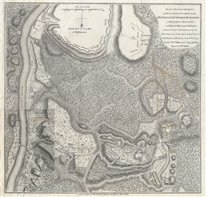
Plan of the Encampment and Position of the Army under His Excelly. Lt. General Burgoyne at Braemus Heights on Hudson's River near Stillwater, on the 20th of Setpr, with the Position of the Detachment & c. in the Action of the 7th, of Octr, & Position of the Army on the 8th, Octr 1777.
sold
- Digital Map Information
- Suitable for large format printing
- DPI: 300
- File Size: 10.99 MB
- File Type: ZIP / TIFF
- ICC color profile embedded
- Delivered instantly via download link
This is a scarce 1780 American Revolutionary War Map illustrating the Battle of Saratoga, a decisive engagement in the favor of the Colonial armies. Oriented to the south, this map covers an region roughly 9 miles south of Saratoga, New York. The map details ... (more details)
Large 18th century map of the Mediterranean region.
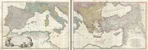
A Map of the Mediterranean Sea with the Adjacent Regions and Seas in Europe, Asia and Africa.
sold
- Digital Map Information
- Suitable for large format printing
- Full resolution TIFF file
- ICC color profile embedded
- Delivered instantly via download link
This is an appealing 1785 map of the Mediterranean region issued by William Faden. A set of two maps, the western sheet covers from Portugal, Spain, Italy, the Maghreb or the Barbary Coast of Africa and includes parts of France and the Balkans. The Spanish ... (more details)
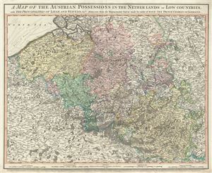
A map of the Austrian possessions in the Netherlands or Low Countries, with the principalities of Liege and Stavelo, etc.
sold
- Digital Map Information
- Suitable for large format printing
- File Size: 23.73 MB
- File Type: ZIP / TIFF
- ICC color profile embedded
- Delivered instantly via download link
This is an attractive 1789 map of Belgium and Luxemburg by William Faden. The map covers present day Belgium and Luxemburg along with adjacent parts of France and Germany. The map extends from Breda, south as far as Montmedy and from Dunkirk east as to ... (more details)
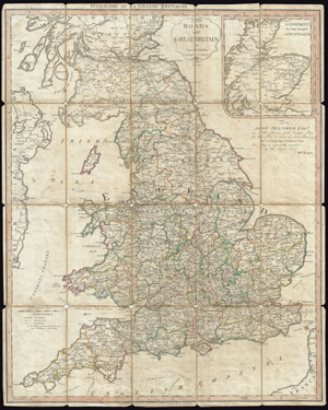
The Roads of Great Britain. Itineraire de la Grande Bretagne.
sold
- Digital Map Information
- Suitable for large format printing
- Full resolution TIFF file
- ICC color profile embedded
- Delivered instantly via download link
A very attractive example of Faden's desirable 'Roads of Great Britain' in its second edition, 1790. Covering from Scotland to Cornwall, this large pocket map was designed with the traveler in mind, showing most of the major and minor roads in England. ... (more details)
Exceedingly rare map illustrating the events of the Second Anglo-Mysore War.
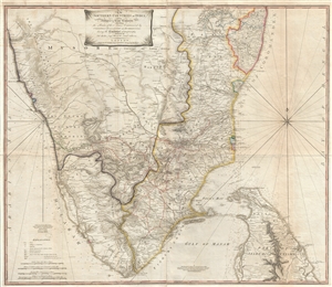
The Southern Countries of India from Madrass to Cape Comorin describing the Routes of the Armies Commanded by Colonels Fullarton and Humberston, during the Campaigns of 1782, 1783, & 1784.
sold
- Digital Map Information
- Suitable for large format printing
- DPI: 300
- File Size: 52.23 MB
- File Type: ZIP / TIFF
- ICC color profile embedded
- Delivered instantly via download link
An extremely rare 1781 map of Southern India by William Faden. The map covers from Mangalore and Madras, south to Cape Comorin (Kanyakumari) and includes the northern half of Sri Lanka or Ceylon. Map with relief is shown by hachures and bathymetric ... (more details)
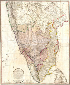
A Map of the Peninsula of India.
sold
- Digital Map Information
- Suitable for large format printing
- DPI: 300
- File Size: 29.68 MB
- File Type: ZIP / TIFF
- ICC color profile embedded
- Delivered instantly via download link
One of the largest and most impressive maps of India to appear in the 18th century. Depicts the subcontinent from Bombay ( Mumbai ) and Aurungabad, south including the northern half of Sri Lanka ( Ceylon ). Printed in 1793 in London by William ... (more details)
The British defend Savannah.
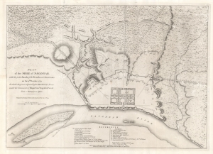
Plan of the Siege of Savannah, with the joint Attack of the French and Americans on the 9th October 1779 in which they were defeated by his Majesty's Forces under the Command of Major Genl. Augustin Prevost from a Survey by an Officer.
sold
- Digital Map Information
- Suitable for large format printing
- DPI: 600
- File Size: 39.85 MB
- File Type: ZIP / TIFF
- ICC color profile embedded
- Delivered instantly via download link
A rare example of the sole contemporaneous map of the Siege of Savannah, published here in 1794 (second edition) for Charles Stedman. The map illustrates one of the bloodiest battles of the American Revolutionary War (1775 - 1783), in which a joint force of French and American soldiers attempted (and failed) to reclaim British-occupied Savannah. (more details)
Scarce nautical chart of the Windward Passage, a popular hunting ground for Caribbean pirates and privateers.
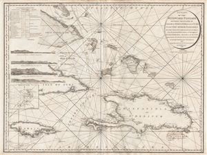
A Chart of the Windward Passage Between the Islands of Jamaica Hispaniola and Cuba with the other Passages to the Northwest of Hispaniola.
sold
- Digital Map Information
- Suitable for large format printing
- DPI: 300
- File Size: 29.95 MB
- File Type: ZIP / TIFF
- ICC color profile embedded
- Delivered instantly via download link
A mesmerizing and extremely scarce 1795 Charles Roberts nautical chart of the Windward Passage, between Cuba and Hispaniola (Santo Domingo), in the Greater Antilles, West Indies. Centered on Great Iguana Island (Le Mornet or Grand Inague) in the ... (more details)
Scarce, Large-Format British Chart of the Caribbean.
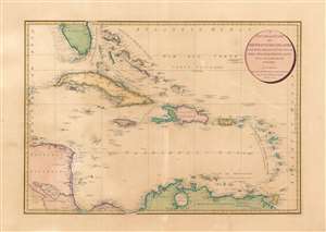
A General Chart of the West India Islands: With the Adjacent Coasts of the Spanish Continent.
sold
- Digital Map Information
- Suitable for large format printing
- Full resolution TIFF file
- ICC color profile embedded
- Delivered instantly via download link
This elegant, large map is William Faden's 1796 map of the West Indies, drawn by the British mapmaker Louis Stanislaw de la Rochette (Delarochette.) Delarochette was the preeminent cartographer working for the prolific map publisher Faden at the end of the 18th century, and this map was among the finest available, and certainly the largest English folio map to focus specifically on the West India Islands during this period. Properly speaking it is a chart, with no detail inland but an abundant and precise treatment of the coastlines. Its scope extends from Rattan or Roatán island off the coast of Honduras in the west, to include Barbados in the east; the map encompasses Trinidad in the south and Tampa Bay in the north. (more details)
Attractive folding pocket map of Ireland.
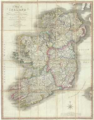
A Map of Ireland divided into Provinces and Counties, showing the Great and Cross Roads with the distances of the Principal Towns from Dublin.
sold
- Digital Map Information
- Suitable for large format printing
- Full resolution TIFF file
- ICC color profile embedded
- Delivered instantly via download link
This is an attractive 1798 map of Ireland by William Faden. It depicts the emerald isle in its entirety, divided into counties and provinces. It covers the four provinces, which remain the same to this day. In the north is Ulster, Connaught in ... (more details)
Iconic wall sized map of India by Faden.

Iconic wall sized map of India chronicling the British military campaign in the subcontinent against Tipu Sultan of Mysore.
sold
- Digital Map Information
- Suitable for large format printing
- DPI: 300
- File Size: 43.81 MB
- File Type: ZIP / TIFF
- ICC color profile embedded
- Delivered instantly via download link
This is Faden's magnificent mapping of the Indian subcontinent, one of the largest and most impressive maps of India to appear in the 18th century. Highly desirable third edition. Presented in two panels, as issued. This chart depicts the ... (more details)
The beginning of the Napoleonic Wars.
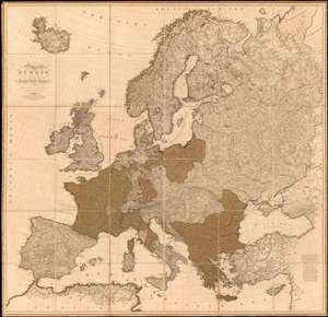
A Map of Europe In which are delineated its Grand Modern Divisions, as well as Partitions into inferior States Governments and C.
sold
- Digital Map Information
- Suitable for large format printing
- Full resolution TIFF file
- ICC color profile embedded
- Delivered instantly via download link
A rare tremendously proportioned 1804 William Faden wall map of Europe issued in the year Napoleon Bonaparte crowed himself Emperor of France - upending generations of dynastic tradition and transforming the continent's political and social landscape. This expansive map covers all of Europe, extending from Iceland to Cyprus and from Spain to the Ural Mountains. Features full old color throughout. (more details)
Possibly the most detailed single map of European Russia to appear in the early 19th century.
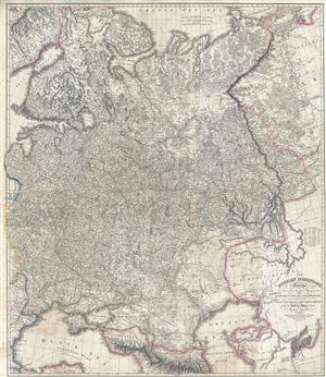
The Russian Dominions in Europe, drawn from the latest Maps, printed by the Academy of Sciences, St. Petersburg; revised and corrected, with the Post Roads & New Governments, from the Russian Atlas of 1806.
sold
- Digital Map Information
- Suitable for large format printing
- DPI: 300
- File Size: 62.38 MB
- File Type: ZIP / TIFF
- ICC color profile embedded
- Delivered instantly via download link
A remarkable large format map first edition 1808 map of Russia by Jaspar Nantiat and William Faden. This exceptional map covers from the Artic Sea to the Black and Caspian Seas and from East Prussia and Moldova to the Aral Sea and Tobolsk. ... (more details)
The best British chart of the West Indies.
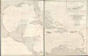
A General Chart of the West Indies and Gulf of Mexico, describing the Gulf and Windward Passages, Coasts of Florida, Louisiana, and Mexico, Bay of Honduras and Musquito Shore; likewise the Coast of the Spanish Main to the Mouths of the Orinoco.
sold
- Digital Map Information
- Suitable for large format printing
- File Size: 158.25 MB
- File Type: ZIP / TIFF
- ICC color profile embedded
- Delivered instantly via download link
An impressive large-format 2-section nautical chart or maritime map illustrating the Gulf of Mexico, the West Indies, Florida, Central America, and the Caribbean Sea, including the Greater and Lesser Antilles. An inset in the upper right details the British Virgin Islands and, although only a small part of the whole map, is one of the better nautical charts of these islands then available (1: 300000). British Honduras (Belize) is also mapped in exceptional detail, reflating continued British interest in the region. Of note is the proposed inter-continental railway being constructed between the Gulf of Honduras and Gulf of Fonseca (Conchagua). There is a wealth of additional practical information for the mariner throughout, as well as notes regarding area where the chart may be inaccurate. Soundings, Lighthouses, and lightships are presented according to standardized nautical conventions. (more details)