
Graham, Andrew B. (sold)

Andrew B. Graham (1845 - September 9, 1909) was an American lithographer active in Washington, D.C. in late 19th and early 20th century. Graham was born in Washington D.C., the son of a lithographer and engraver. After college, he joined the U.S. Coast Survey, where he was a draftsman until 1889. He retired from the Coast Survey to take over management of his father's lithography firm. The firm, Andrew B. Graham Company, was one of several that thrived on lucrative government publication contracts. Graham died of 'brain fever' in his Washington D. C. residence on September 9 of 1909. Some of his work was republished posthumously until about 1917, and his firm was active until at least the early 1920s.
Most sophisticated 19th century map of Molokai.
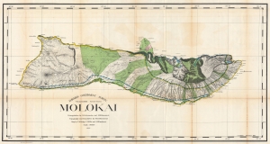
Hawaiian Government Survey. Molokai.
sold
- Digital Map Information
- Suitable for large format printing
- File Size: 154.9 MB
- File Type: ZIP / TIFF
- ICC color profile embedded
- Delivered instantly via download link
This 1897 Christopher Willis map of Molokai is the most sophisticated 19th century mapping of the island. Surveyors from the Hawaiian Government Survey mapped the length and breadth of Molokai and, per Moffat and Fitzpatrick, the map 'represents the final stage in the process of understanding and correctly illustrating the shape of this elongated island between O'ahu and Maui'. (more details)
One of the most detailed maps of Central Luzon issued during the Philippine-American War.
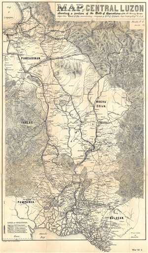
Map of Central Luzon showing a portion of the Field of Operations of the 8th Army Corps.
sold
- Digital Map Information
- Suitable for large format printing
- File Size: 13.46 MB
- File Type: ZIP / TIFF
- ICC color profile embedded
- Delivered instantly via download link
This is an extremely rare map of central Luzon, the Philippines, issued at the height of the Philippine-American War (1899 – 1902) by William L. Sibert of the 8th Army Engineering Corps and the Military Governor in the Philippines, Major General Elwell Stephen Otis. Drawn on a scale of 1 : 240000, this map is one the most detailed cartographic productions to emerge from the Philippine-American War. The map covers central Luzon, specifically the lands including and just north of Manila and Manila Bay to Lingayen Gulf. During the early stages of the Philippine-American War, this area was largely controlled by Philippine forces and was the most active theater. Three different 'lines of operations' are illustrated, marking the advance of three different columns of troops under the command of Major General Henry Ware Lawton, Major General Arthur MacArthur Jr., and Brigadier General Loyd Wheaton. Numerous cities, towns, and villages are labeled throughout along with rivers and lakes. Roads and telegraph lines are also illustrated. Topography is shown by hachure. (more details)
One of the most detailed maps of Central Luzon issued during the Philippine-American War.
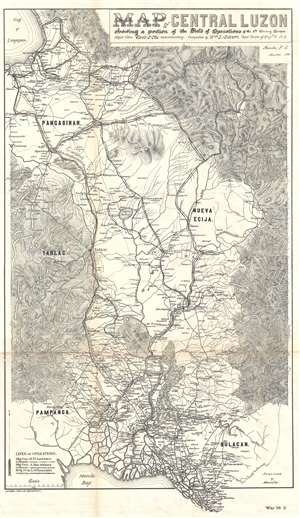
Map of Central Luzon showing a portion of the Field of Operations of the 8th Army Corps.
sold
- Digital Map Information
- Suitable for large format printing
- File Size: 12.63 MB
- File Type: ZIP / TIFF
- ICC color profile embedded
- Delivered instantly via download link
This is an extremely rare map of central Luzon, the Philippines, issued at the height of the Philippine-American War (1899 – 1902) by William L. Sibert of the 8th Army Engineering Corps and the Military Governor in the Philippines, Major General Elwell Stephen Otis. Drawn on a scale of 1 : 240000, this map is one the most detailed cartographic productions to emerge from the Philippine-American War. The map covers central Luzon, specifically the lands including and just north of Manila and Manila Bay to Lingayen Gulf. During the early stages of the Philippine-American War, this area was largely controlled by Philippine forces and was the most active theater. Three different 'lines of operations' are illustrated, marking the advance of three different columns of troops under the command of Major General Henry Ware Lawton, Major General Arthur MacArthur Jr., and Brigadier General Loyd Wheaton. Numerous cities, towns, and villages are labeled throughout along with rivers and lakes. Roads and telegraph lines are also illustrated. Topography is shown by hachure. (more details)
The first major construction of telegraph lines throughout the Philippines - built by the Signal Corps during the Philippine-American War.
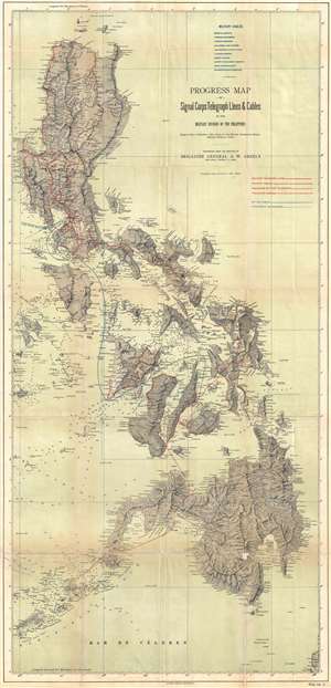
Progress Map of Signal Corps Telegraph Lines and Cables in the Military Division of the Philippines.
sold
- Digital Map Information
- Suitable for large format printing
- File Size: 22.28 MB
- File Type: ZIP / TIFF
- ICC color profile embedded
- Delivered instantly via download link
This is a scarce 1900 map of the Philippines prepared under the direction of General Adolphus Washington Greely. When this map was issued, Greely was the chief of the U.S. Army Signal Corps, in charge of constructing telegraph cables throughout U.S. Territories. ... (more details)
One of the largest most detailed maps of Luzon issued during the Philippine-American War.
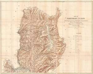
Map of Northern Luzon Showing a portion of the field operations of the 8th Army Corps, Major General Elwell S. Otis Commanding.
sold
- Digital Map Information
- Suitable for large format printing
- File Size: 23.4 MB
- File Type: ZIP / TIFF
- ICC color profile embedded
- Delivered instantly via download link
This is an extremely rare map of Northern Luzon, the Philippines, issued at the height of the Philippine-American War (1899 – 1902) by the Military Governor in the Philippines, Major General Elwell Stephen Otis and the 8th Army Engineering Corps. Drawn on a ... (more details)
Luzon during the Philippine-American War.
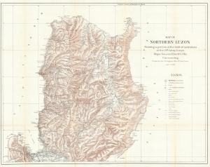
Map of Northern Luzon Showing a portion of the field operations of the 8th Army Corps, Major General Elwell S. Otis Commanding.
sold
- Digital Map Information
- Suitable for large format printing
- File Size: 70.87 MB
- File Type: ZIP / TIFF
- ICC color profile embedded
- Delivered instantly via download link
This is a rare map of Northern Luzon, the Philippines, issued in 1900 at the height of the Philippine-American War (1899 – 1902) by the Military Governor in the Philippines, Major General Elwell Stephen Otis, and the 8th Army Engineering Corps. This map is one of the largest and most detailed cartographic productions to emerge from the Philippine-American War. (more details)
Detailed map of southern Luzon during the Philippine-American War.
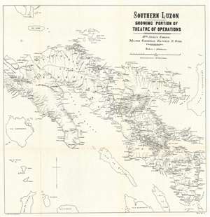
Southern Luzon. Showing Portion of Theatre of Operations. 8th Army Corps, Major General Elwell S. Otis, Commanding.
sold
- Digital Map Information
- Suitable for large format printing
- File Size: 23.92 MB
- File Type: ZIP / TIFF
- ICC color profile embedded
- Delivered instantly via download link
This is an extremely rare map of Southern Luzon, the Philippines, issued at the height of the Philippine-American War (1899 - 1902) by the Military Governor in the Philippines, Major General Elwell Stephen Otis and the 8th Army Engineering Corps. This map is one of the largest and most detailed cartographic productions to emerge from the Philippine-American War. It depicts southern Luzon, from Alabat Island and Camarines Norte to Albay and the San Bernardino Strait. Identifying roadways, towns and cities, political boundaries, telegraph lines, rivers, and more, this map provides the viewer with a comprehensive view of the situation in the region and it appears to have been based upon Spanish sources, as some of the place names are in Spanish. (more details)
One of the most detailed maps of Luzon issued during the Philippine-American War.
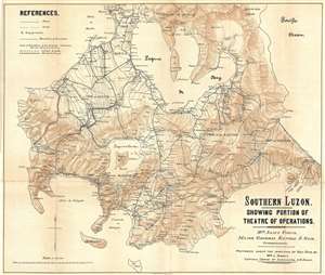
Southern Luzon. Showing Portion of Theater of Operations. 8th Army Corps, Major General Elwell S. Otis, Commanding.
sold
- Digital Map Information
- Suitable for large format printing
- File Size: 15.19 MB
- File Type: ZIP / TIFF
- ICC color profile embedded
- Delivered instantly via download link
This is an extremely rare map of Central Luzon, the Philippines, issued at the height of the Philippine-American War (1899 – 1902) by the Military Governor in the Philippines, Major General Elwell Stephen Otis and the 8th Army Engineering Corps. Drawn on a ... (more details)
Southern Luzon during the Philippine-American War.
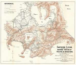
Southern Luzon. Showing Portion of Theater of Operations. 8th Army Corps, Major General Elwell S. Otis, Commanding.
sold
- Digital Map Information
- Suitable for large format printing
- File Size: 35.23 MB
- File Type: ZIP / TIFF
- ICC color profile embedded
- Delivered instantly via download link
This is an extremely scare map of Central Luzon, the Philippines, issued at the height of the Philippine-American War (1899 - 1902) by the Military Governor in the Philippines, Major General Elwell Stephen Otis, and the 8th Army Engineering Corps. It ranks among the most detailed cartographic productions to emerge from the Philippine-American War. Although titled 'Southern Luzon,' this map, in fact, covers Central Luzon, specifically the lands including and just south of Manila, surrounding the Laguna de Bay, as far as the Quezon Isthmus and Isla Verde. During the early stages of the Philippine-American War, this area was primarily controlled by Philippine forces and was the most active theater. The map offers detailed topography via shading throughout and identifies roadways, towns, cities, political boundaries, telegraph lines, and more. (more details)
Detailed map of southern Luzon during the Philippine-American War.
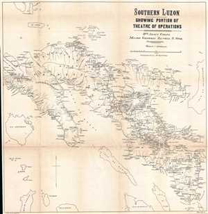
Southern Luzon. Showing Portion of Theatre of Operations. 8th Army Corps, Major General Elwell S. Otis, Commanding.
sold
- Digital Map Information
- Suitable for large format printing
- File Size: 11.78 MB
- File Type: ZIP / TIFF
- ICC color profile embedded
- Delivered instantly via download link
This is an extremely rare map of Southern Luzon, the Philippines, issued at the height of the Philippine-American War (1899 – 1902) by the Military Governor in the Philippines, Major General Elwell Stephen Otis and the 8th Army Engineering Corps. Drawn on ... (more details)
First scientific survey of Maui.
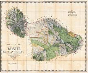
Maui, Hawaiian Islands.
sold
- Digital Map Information
- Suitable for large format printing
- File Size: 310 MB
- File Type: ZIP / TIFF
- ICC color profile embedded
- Delivered instantly via download link
This is the 1903 Frank S. Dodge and John M. Donn map of Maui in the Hawaiian Islands. This map is the first scientific survey of Maui as well as the first map commissioned by U.S. Government after Hawaii's 1898 annexation. (more details)
A visually striking map of the Garden Isle.
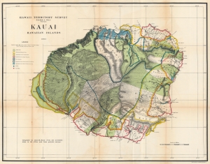
Hawaii Territorial Survey. Kauai Hawaiian Islands.
sold
- Digital Map Information
- Suitable for large format printing
- File Size: 95.27 MB
- File Type: ZIP / TIFF
- ICC color profile embedded
- Delivered instantly via download link
This is a stunning 1903 John M. Donn map of Kauai, created for the Hawaiian Territorial Survey. It is the first comprehensive large-scale modern map of Kauai. (more details)
Evolution of the National Mall.
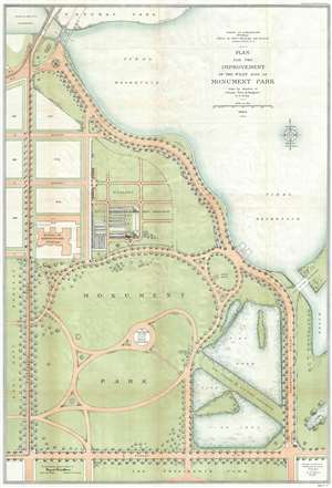
Plan for the Improvement of the West Side of Monument Park.
sold
- Digital Map Information
- Suitable for large format printing
- File Size: 17.94 MB
- File Type: ZIP / TIFF
- ICC color profile embedded
- Delivered instantly via download link
This is a 1902-04 U.S. Army Corps of Engineers map of Monument Park, the National Mall, Washington D.C. This map was issued to address draining issues of drainage - note the large fishponds in the lower right. Centered on the Washington Monument and oriented to the south, with north at the bottom, the map depicts from the President's Park at the bottom to the tidal reservoir, the Maryland Avenue Bridge and Potomac Park at the top, and from Fourteenth Street to Seventeenth Street and the tidal basin on the right. Above Memorial Park and the Washington Monument, B, C, and D Streets are depicted as well as several city blocks. The Bureau of Engraving and Printing is identified, as well as the Nursery of the Office of Public Buildings and Grounds. To the right of Monument Park, two fishponds are illustrated, which, per the map, were part of the U.S. Fish Commission. To the left of Monument Park, across Fourteenth Street, lies the grounds of the Agriculture Department. (more details)
Important map of the Philippines illustrating early proposed railroads.
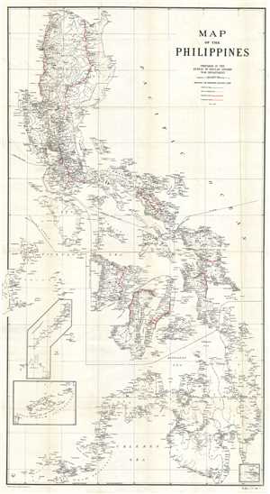
Map of the Philippines.
sold
- Digital Map Information
- Suitable for large format printing
- File Size: 24.8 MB
- File Type: ZIP / TIFF
- ICC color profile embedded
- Delivered instantly via download link
A scarce and impressive large format map of the Philippines issued in 1905 to illustrate proposed rail lines. In 1905 the Second Philippine Commission, under William H. Taft, put forth a request for bids to build a series of modern railway lines between ... (more details)
Important map of the Philippines illustrating early proposed railroads.
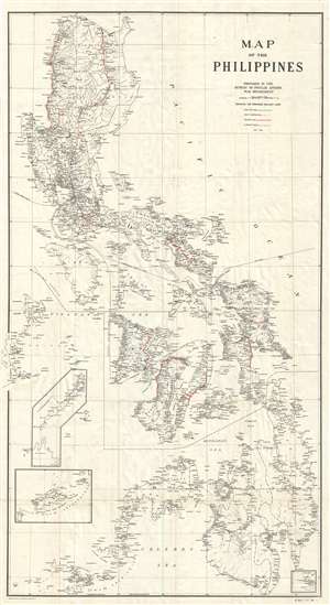
Map of the Philippines.
sold
- Digital Map Information
- Suitable for large format printing
- File Size: 17.85 MB
- File Type: ZIP / TIFF
- ICC color profile embedded
- Delivered instantly via download link
A scarce and impressive large format map of the Philippines issued in 1905 to illustrate proposed rail lines. In 1905 the Second Philippine Commission, under William H. Taft, put forth a request for bids to build a series of modern railway lines between ... (more details)
A comprehensive and detailed map of Oregon at the beginning of the 20th century - marks Crater Lake National Park four years after it was established.
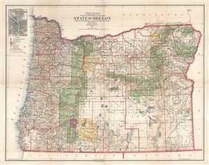
State of Oregon.
sold
- Digital Map Information
- Suitable for large format printing
- File Size: 30.8 MB
- File Type: ZIP / TIFF
- ICC color profile embedded
- Delivered instantly via download link
This is a 1906 Frank Bond and General Land Office map of Oregon. The map depicts the state from the Pacific Ocean to Idaho and from Washington to California. Meticulously detailed, the state's organization is presented at several different levels. At a ... (more details)
First comprehensive modern survey of Oahu.
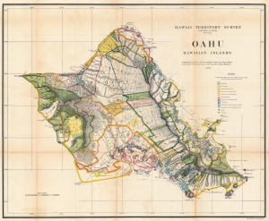
Oahu Hawaiian Islands.
sold
- Digital Map Information
- Suitable for large format printing
- File Size: 107.82 MB
- File Type: ZIP / TIFF
- ICC color profile embedded
- Delivered instantly via download link
This is a 1906 John M. Donn map of Oahu, Hawaiian Islands. It represents the first comprehensive modern mapping of Oahu. (more details)
Explorer's Routes and National Roads.
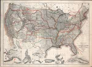
United States Showing Routes of Principal Explorers and Early Roads and Highways.
sold
- Digital Map Information
- Suitable for large format printing
- File Size: 62.87 MB
- File Type: ZIP / TIFF
- ICC color profile embedded
- Delivered instantly via download link
A most fascinating production, this is a fine example of the 1907 first edition of the Berthrong / Bond map of the United States showing exploratory routes and improved roads. The base map is a reduction of the General Land Office map of the United States issued annually from 1899 to illustrate the extending and progress of the Public Surveys. That map has here been overlayed with color-coded routes illustrating the most prominent explorations from the 1500s through the mid-19th century. In addition, it shows important roads then in being built or improved, including the National highway, Braddock Road, the Great Trail. The map was intended to demonstrate the current state of geographical knowledge and underscore the fact that - by 1907, little was left unexplored. (more details)
Beautiful bird's-eye view of Washington, D.C.
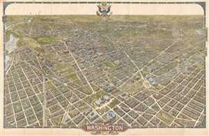
Washington The Beautiful Capital of the Nation.
sold
- Digital Map Information
- Suitable for large format printing
- File Size: 44.05 MB
- File Type: ZIP / TIFF
- ICC color profile embedded
- Delivered instantly via download link
This is an unusual and rare 1921 large-format William Olsen bird's-eye view of Washington, D.C. and environs. Oriented toward the southwest, the view depicts the city from the U.S. Capitol Building south to Virginia and Maryland. Beautifully drawn, ... (more details)