
Kurz and Allison (sold)

Kurz and Allison (1880 - c. 1905) was an American publishing firm known for its chromolithographs. Founded by Louis Kurz (1835 - 1921) and Alexander Allison, the firm was based at 267-269 Wabash Avenue in Chicago. In the partnership, it is known that Kurz, an Austrian immigrant, was the lithographer and it is presumed that Allison provided the financial backing. The firm is most well-known for its series of thirty-six battle scenes from the American Civil War. At the time of their publication, the late 1880s and early 1890s, a general nostalgia was prevalent among Civil War veterans (of which Kurz was one), and evidently the company was trying to capitalize on the sentiment. Kurz and Allison's Civil War prints were not the first such prints to be issued, but they were by far the most popular. In a style reminiscent of Currier and Ives, Kurz and Allison lithographs are not meant to be historical representations, and even, from time to time, included historical inaccuracies. Even so, 'prints depicting the Civil War battles by Kurz and Allison are among the most sought-after collectibles of Civil War enthusiasts.' Their prints are also notable for featuring African-American soldiers, a rarity for the era. After the outbreak of the Spanish-American War, the firm published views from famous battles and continued doing so for the campaigns of the Philippine-American War and the Russo-Japanese War.
Pickett's Charge - High-Water Mark of the Confederacy.
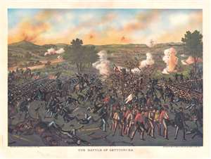
The Battle of Gettysburg.
sold
- Digital Map Information
- Suitable for large format printing
- File Size: 44.7 MB
- File Type: ZIP / TIFF
- ICC color profile embedded
- Delivered instantly via download link
This is a stunning 1884 Kurz and Allison chromolithograph view of the Battle of Gettysburg, specifically Pickett's Charge - an event considered to be the turning point of the American Civil War (1861 - 1865). (more details)
Illustrates the Union victory at Fort Donelson - one of Ulysses S. Grant's first victories in the American Civil War.
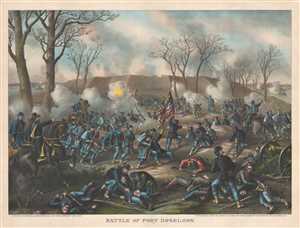
Battle of Fort Donelson.
sold
- Digital Map Information
- Suitable for large format printing
- File Size: 18.72 MB
- File Type: ZIP / TIFF
- ICC color profile embedded
- Delivered instantly via download link
This is an 1887 Kurz and Allison view of the American Civil War Battle of Fort Donelson in Tennessee. The view illustrates the Union Army of the Tennessee commanded by Brigadier General Ulysses S. Grant (depicted on the left astride a horse) assaulting the ... (more details)
Opening the way for Sherman's March.
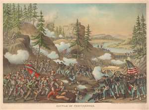
Battle of Chattanooga.
sold
- Digital Map Information
- Suitable for large format printing
- File Size: 41.63 MB
- File Type: ZIP / TIFF
- ICC color profile embedded
- Delivered instantly via download link
This is an 1888 Kurz and Allison view of the American Civil War Battle of Chattanooga. Union forces appear on the right and are illustrated advancing on Confederate positions. Smoke and flames erupt from the barrels of both armies' rifles. Although unlabeled, given the terrain, this view likely depicts either General Sherman's or General Thomas's assault of Missionary Ridge. (more details)
The 'bloodiest' day in American history.
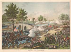
Battle of Antietam.
sold
- Digital Map Information
- Suitable for large format printing
- File Size: 46.91 MB
- File Type: ZIP / TIFF
- ICC color profile embedded
- Delivered instantly via download link
This is an 1888 Kurz and Allison chromolithograph view of the Battle of Antietam, Maryland. The view is hand embellished with guache color. The Battle of Antietam took place on September 17, 1862 and is remembered as the bloodiest day in American history. Antietam was also the last battle in General Robert E. Lee's first invasion of the North. Kurz and Allison's view focuses on the action on 'Burnside's Bridge'. (more details)
First battle between iron clad ships.
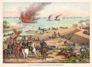
Battle Between the Monitor and Merrimac.
sold
- Digital Map Information
- Suitable for large format printing
- File Size: 49.19 MB
- File Type: ZIP / TIFF
- ICC color profile embedded
- Delivered instantly via download link
This is an 1889 Kurz and Allison chromolithograph view of the Battle of Hampton Roads (March 8 - 9, 1862) - renowned as the first clash of ironclads (more details)
One of the greatest natural disasters in American history.
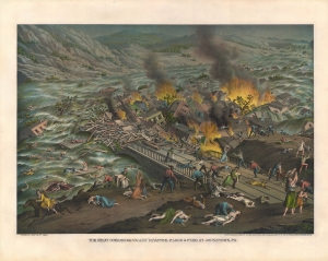
The Great Conemaugh-Valley Disaster, - Flood and Fire at Johnstown, PA.
sold
- Digital Map Information
- Suitable for large format printing
- File Size: 44.1 MB
- File Type: ZIP / TIFF
- ICC color profile embedded
- Delivered instantly via download link
A dramatic c. 1889 chromolithograph view of the disastrous Johnstown flood of May 31, 1889, in Johnstown, Pennsylvania. The view depicts the apex of the flood when debris collected against the Johnstown Railroad Bridge burst into flame. This terrifying image was distributed throughout the United States, becoming the primary artery through which knowledge of the flood and its disastrous consequences were disseminated. (more details)
Focuses on part of the battle fought between the 63rd Ohio and 2nd Texas Infantry Regiments.
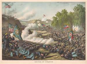
Battle of Corinth.
sold
- Digital Map Information
- Suitable for large format printing
- File Size: 48.88 MB
- File Type: ZIP / TIFF
- ICC color profile embedded
- Delivered instantly via download link
This is an 1891 Kurz and Allison chromolithograph view of the Battle of Corinth (also known as the Second Battle of Corinth) during the American Civil War. The Union Army's 63rd Ohio Infantry Regiment appears on the left side repelling an attack on Battery Robinett by the Confederate Army's 2nd Texas Infantry Regiment from the right side. Soldiers manning both battle lines fire on the other from point blank range and the regimental colors for both units are prominently illustrated. (more details)
The highest overall percentage of casualties of any American Civil War battle.
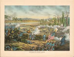
Battle of Stone River. Near Murfreesborough, Tenn.
sold
- Digital Map Information
- Suitable for large format printing
- File Size: 53.11 MB
- File Type: ZIP / TIFF
- ICC color profile embedded
- Delivered instantly via download link
This is an 1891 Kurz and Allison chromolithograph view of the American Civil War Battle of Stones River. Kurz and Allison present a stylized view of the battle, with Union Major General Rosecrans in the foreground on the left. With Union troops on the left and Confederate soldiers are on the right, Kurz and Allison correctly depict the fighting on both sides of the Stones River. The several cannons on the Union side likely allude to the critical role of Union artillery in repulsing two Confederate attacks on January 2. The field is littered with casualties, a reference to the battle's high human cost. (more details)
Columbia - a life-sized chromolithograph.
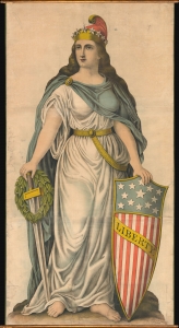
Liberty.
sold
- Digital Map Information
- Suitable for large format printing
- File Size: 188.09 MB
- File Type: ZIP / TIFF
- ICC color profile embedded
- Delivered instantly via download link
A spectacular full-height chromolithograph illustration of Columbia issued c. 1893 by Kurz and Allison, likely for the 1893 Chicago World's Fair or Columbia Exposition. Liberty appears here in full patriotic regalia, with a toga, blue cape, American flag shield, sword, laurel wreath, and Phrygian cap. (more details)
Iconic view of Chicago made for the 1893 Columbian Exposition.
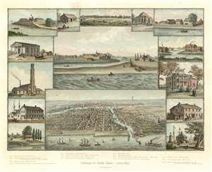
Chicago in Early Days. 1779 - 1857.
sold
- Digital Map Information
- Suitable for large format printing
- Full resolution TIFF file
- ICC color profile embedded
- Delivered instantly via download link
An exceptionally beautiful 1893 Kurz and Allison view of Chicago, Illinois, issued in 1893 to capitalize on the Columbian Exposition or Chicago World's Fair. The image consists of several iconic views of Chicago centered on two contrasting views, Chicago in 1830, three years prior to its founding, appearing at center; and Chicago as a bustling port city, bottom center. The dichotomy presented here underscores the central points of the view - growth, industry, recovery, and prosperity. Surrounding the main view are smaller vignettes illustrating Old Fort Dearborn, the First Settler, Wolf Point, the First Court House, First Rush Medical College, and the Water Works, to name a few. (more details)
Ending 350 years of Spanish occupation colonization of the Philippines.
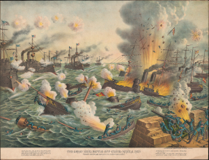
The Great Naval Battle off Cavite (Manila Bay) Fought May 1st 1898 5:30 A.M. till 12:50 P.M. (Noon).
sold
- Digital Map Information
- Suitable for large format printing
- File Size: 115.95 MB
- File Type: ZIP / TIFF
- ICC color profile embedded
- Delivered instantly via download link
This is Kurz and Allison's 1898 chromolithograph view of the 1898 Battle of Manila, part of the Spanish-American War (April 21, 1898 - December 10, 1898). The view illustrates the dramatic sea battle between the Spanish and American navies, considered one of the most decisive naval battles in history, effectively ending 350 years of Spanish colonization in the Philippines. The view depicts the American Asiatic Squadron led by its flagship, the Olympia, bombarding the Spanish Pacific Squadron just off Cavite, on the southern shores of Manila Bay. (more details)
'Remember the Maine, to Hell with Spain.'
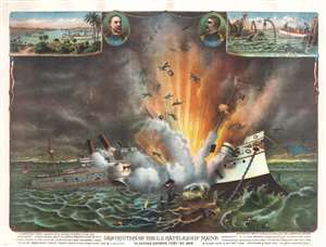
Destruction of the U.S. Battleship Maine in Havana Harbor Feb'Y 15th 1898.
sold
- Digital Map Information
- Suitable for large format printing
- File Size: 57.52 MB
- File Type: ZIP / TIFF
- ICC color profile embedded
- Delivered instantly via download link
The most dramatic illustration of the Destruction of the U.S. Battleship Maine in Havana Harbor - the trigger point of the Spanish American War. This striking full-color chromolithograph view illustrates the horror, magnitude, and suddenness of the battleship's explosion. In the upper left, a vignette of Havana Harbor shows the location of the Maine when she exploded. A second vignette in the upper right illustrates the grizzly work of recovering the bodies. Portraits of Admiral Montgomery Sicard (1836 - 1900), who ordered the Maine to Havana, and the ship's captain, Charles Dwight Sigsbee (1845 - 1923) appear at top center. Text below the main image describes the event. (more details)
Dogged struggle for independence against insurmountable odds.
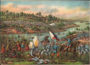
Battle of Paceo, (Manila) Feb'y 4' and 5' 1899. Am. Loss: Kill'd 22, W'd 145, Philip's Over 1000.
sold
- Digital Map Information
- Suitable for large format printing
- File Size: 66.16 MB
- File Type: ZIP / TIFF
- ICC color profile embedded
- Delivered instantly via download link
This is a rare chromolithograph view of the Battle of Pasay, located just outside of Manila, fought in the opening stages of the Philippine-American War (1899 - 1904). The view underscores the dogged and grassroots struggle for Philippine independence against seemingly overwhelming power. (more details)