
Mariette, Pierre (sold)

Pierre Mariette (1569 - 1657) was a French publisher and engraver active in Paris during the first half of the 19th century. Mariette established himself as successful publisher of art prints, but decided to turn his energy to cartography with the purchase of the plates for Melchior Tavernier's maps in 1644. Tavernier had partnered with Sanson before his death and Mariette followed suit. Around 1644- 1648 Mariette partnered with Nicolas Sanson, a then nascent figure in French cartography, to produce folio maps and atlases. The Sanson-Mariette relationship depended upon Sanson to draw and obtain rights for the maps while Mariette engraved them and paid for the expensive printing process. The two then shared rights to the maps into perpetuity. The finished copper plates were split between two such that neither could publish an atlas without the other's assent. The relationship seemed reasonably amicable until Mariette's death in 1657, when disputes arose between Sanson and Mariette's heirs. A court battle finally returned the most of the plates to Sanson's own heirs in 1674. As a consequence, some printings feature the Mariette imprint, others the Sanson imprint, and still others both imprints.
Early map of the British Isles noting Hadrian's Wall.
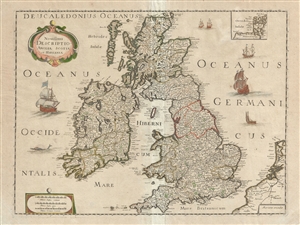
Novissima Descriptio Angliae, Scotiae et Hiberniae.
sold
- Digital Map Information
- Suitable for large format printing
- DPI: 300
- File Size: 13.43 MB
- File Type: ZIP / TIFF
- ICC color profile embedded
- Delivered instantly via download link
This is a beautiful c. 1650 map of the British Isles by Pierre Mariette and Nicolas Sanson. Covers all of England, Scotland, Wales and Ireland. Includes a small inset of the Orkney Islands in the top right quadrant. Beautifully detailed, it notes important cities, ... (more details)
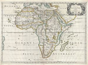
Africa Vetus.
sold
- Digital Map Information
- Suitable for large format printing
- DPI: 300
- File Size: 13.94 MB
- File Type: ZIP / TIFF
- ICC color profile embedded
- Delivered instantly via download link
An uncommon old color first edition example of Nicolas Sanson's map of Africa, prepared an issued separately in 1650. Sanson's map covers Africa in full with adjacent parts of Europe and Arabia represented in part. Sanson, a historian as well as a cartographer, ... (more details)
The Leading Light of French Mapmaking Applies the Ancients to Modern Geography
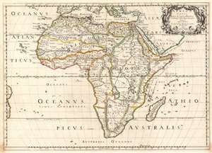
Africa Vetus.
sold
- Digital Map Information
- Suitable for large format printing
- DPI: 600
- File Size: 19.05 MB
- File Type: ZIP / TIFF
- ICC color profile embedded
- Delivered instantly via download link
Nicolas Sanson's 1650 map of Africa, in a very attractive contemporary color example. The map combines modern topography with toponymy drawn from classical geographers. Sanson, a historian as well as a cartographer, intended this map to illustrate Africa as it may have appeared prior to European discovery and exploration. Although the general shape of the continent as well as the surrounding islands and oceans reflect European cartography of the era, Sanson has turned to the Alexandrian cartographer of antiquity, Claudius Ptolemy, to fill in the interior. The southernmost labeled place on the coast is Prassum Promont, a location identified by Ptolemy as the southernmost limit of geographical knowledge. He also follows Ptolemy in his depiction of the White Nile River and its dual lake sources at the base of the Maintains of the Moon. The Ptolemaic mapping of the Nile remained a common feature of Africa maps well into the early 19th century when the explorations of Livingstone and Speake provided new and reliable reconnaissance. The southernmost extreme of Africa he as identified as Anthropophagi Aethiopes (Cannibals). (more details)
The first specific map of Vietnam!
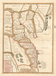
Carte du Royaume d'Annam, comprenant les Royaumes du Tumkin et de la Cocinchine.
sold
- Digital Map Information
- Suitable for large format printing
- DPI: 600
- File Size: 10.55 MB
- File Type: ZIP / TIFF
- ICC color profile embedded
- Delivered instantly via download link
An extraordinary rarity, this is the Alexander de Rhodes and Pierre Mariette 1653 map of Vietnam. This is considered the first specific map of the Kingdom of Annam, or Tonkin, what would later become North Vietnam. Coverage extends from roughly Quảng Ngãi, north to the Chinese border, and west as far as Laos and Cambodia. This map represents a major milestone in the mapping of Vietnam and would prove the underpinning cartography of this region through the mid-19th century. (more details)
Earliest Printed Map to show the Hajj.
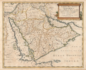
Carte des Trois Arabies Tirée en Parte de l'Arabe de Nubie, en partie de divers autres Autheurs, Par le S. N. Sanson d'Abbeville, Geographe ordinaire du Roy, A Paris.
sold
- Digital Map Information
- Suitable for large format printing
- Full resolution TIFF file
- ICC color profile embedded
- Delivered instantly via download link
This is an attractive example of Nicolas Sanson's scarce 1654 map of the Arabian Peninsula. As indicated in the title, it depicts the three Arabias: Arabie Petree, Arabie Deserte, and Arabia Heureuse; that is, Stony Arabia, Desert Arabia, and 'Happy' Arabia. The map depicts both shores of the Red Sea and the Persian Gulf, and the Indian Ocean island of Zocotora off the horn of Africa. The map includes Mecca and Medina, and the pattern of named settlements describes the Hajj routes: along the Red Sea coast, the overland routes across the peninsula from Basra, and the route to Mecca from Damascus. The Kingdom of Bahrain (Bahraim) appears as well. The largest portion of the Arabian Peninsula is here named Hyaman, ou Arabie Heureuse: 'Yemen, or Happy Arabia.' (more details)
Updating Baffin's Mughal Empire.
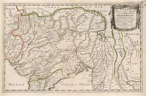
L'Inde deçà et de là Gange, ou est L'Empire do Grand Mogol et Pays Circonvoisins Tirée de Purchas, et de diverses Relations les plus nouvelles.
sold
- Digital Map Information
- Suitable for large format printing
- DPI: 600
- File Size: 44.55 MB
- File Type: ZIP / TIFF
- ICC color profile embedded
- Delivered instantly via download link
This is an attractive example of Nicolas Sanson's 1654 map of the Mughal Empire of Northern India. It is a significant illustration of the early Silk Route trade networks between India and Kabul. The map thus embraces the northern parts of modern India, Pakistan, Afghanistan, Bangladesh, and Burma, as well as parts of Thailand, Laos, and Vietnam. (more details)
A must-have for the early mapping of the American west.
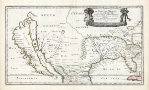
Le Nouveau Mexique, et la Floride: Tirées de diverses Cartes, et Relations. Par N. Sanson d'Abbeville Geogr ordre du Roy. A Paris. Chez Pierre Mariette, Rue S. Jacque a l'Esperance Avec Privilege du Roy, pour vingt Ans. 1656.
sold
- Digital Map Information
- Suitable for large format printing
- DPI: 600
- File Size: 36.2 MB
- File Type: ZIP / TIFF
- ICC color profile embedded
- Delivered instantly via download link
This is a beautiful example of Nicolas Sanson's 1656 map of New Mexico and Florida: the first atlas map to emphasize this geographical focus. It also presented arguably the most influential depiction of California-as-an-island, providing the dominant model of that cartography for the remainder of the seventeenth century, reaching into the eighteenth. (more details)
Sanson’s 1650 map of North America and 1656 map of New Mexico seem to the present writer by far the most interesting and important maps … - C. Wheat
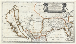
Le Nouveau Mexique, et la Floride: Tirées de diverses Cartes, et Relations. Par N. Sanson d'Abbeville Geogr ordre du Roy. A Paris. Chez Pierre Mariette, Rue S. Iacque a l'Esperance Avec Privilege du Roy, pour vingt Ans. 1656.
sold
- Digital Map Information
- Suitable for large format printing
- DPI: 300
- File Size: 11.08 MB
- File Type: ZIP / TIFF
- ICC color profile embedded
- Delivered instantly via download link
Sanson and Mariette's 1656 first edition map of the central and western part of North America is one of the most important maps ever published pertaining to the American west. This map represents the first time this region has been presented on such a scale and, a ... (more details)
Essential Canadianum: 'The primary map of this period... influenced the cartography of Canada for the next fifty years.' - Kershaw
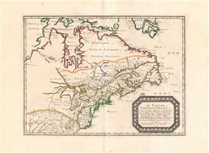
Le Canada, ou Nouvelle France...
sold
- Digital Map Information
- Suitable for large format printing
- DPI: 600
- File Size: 26.16 MB
- File Type: ZIP / TIFF
- ICC color profile embedded
- Delivered instantly via download link
This is Nicolas Sanson's 1656 map of Canada, the Northeast and the Great Lakes, in a superb, untrimmed example. It was among the most influential and important maps of the north part of the Americas to be printed in the 17th century - its depiction of Canada was not superseded until De l'Isle's 1703 Carte du Canada, and it featured the finest depiction of the Great Lakes until the 1687 Coronelli-Nolin. It is among the first printed maps to be informed by the reports of French Jesuit explorers, whose exploration of the Great Lakes region after Champlain's initial explorations was stalled by the 1648 escalation of the Beaver Wars (1603 - 1701) with the Iroquois Confederacy. Following the 1653 pause in the war, Jesuit and French fur traders resumed their push west, gradually revealing the form of the Great Lakes.
The map's treatment of the Arctic waters and Maritime Canada builds on Champlain's basic model, adding place names derived from Dutch and English exploration and preserving Button's explicit northwest passage leading from Button's Bay. (more details)
The map's treatment of the Arctic waters and Maritime Canada builds on Champlain's basic model, adding place names derived from Dutch and English exploration and preserving Button's explicit northwest passage leading from Button's Bay. (more details)
'The primary map of this period... influenced the cartography of Canada for the next fifty years.' - Kershaw

Le Canada, ou Nouvelle France...
sold
- Digital Map Information
- Suitable for large format printing
- Full resolution TIFF file
- ICC color profile embedded
- Delivered instantly via download link
This is Nicolas Sanson's 1656 map of Canada, the Northeast, and the Great Lakes, in an attractive, untrimmed example. It ranks among the most influential and important maps of the north part of the Americas to be printed in the 17th century - its depiction of Canada was not superseded until De l'Isle's 1703 Carte du Canada, and it features the finest depiction of the Great Lakes until the 1687 Coronelli-Nolin. It is among the first printed maps to be informed by the reports of French Jesuit explorers, whose exploration of the Great Lakes region after Champlain's initial explorations was stalled by the 1648 escalation of the Beaver Wars (1603 - 1701) with the Iroquois Confederacy. Following the 1653 pause in the war, Jesuit and French fur traders resumed their push west, gradually revealing the form of the Great Lakes. (more details)
Rare Mapping of Islands of the North Atlantic.
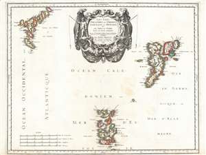
Les Isles Orcadney, ou Orkney; Schetland, ou Hetland; et de Fero, ou Farre, tirées de divers memoires.
sold
- Digital Map Information
- Suitable for large format printing
- DPI: 600
- File Size: 30.27 MB
- File Type: ZIP / TIFF
- ICC color profile embedded
- Delivered instantly via download link
This is a scarce, beautifully engraved 1655 map of the Orkney, Shetland and Faroe Islands, produced by Nicolas Sanson, the preeminent French mapmaker of the 17th century. While the detail of the Orkneys and the Shetlands derives from contemporaneous Dutch sources, Sanson's map is the first to focus on the Faroe Islands, and place them in reasonably accurate context with the other two archipelagos. (more details)
Magnificently Detailed Madagascar.
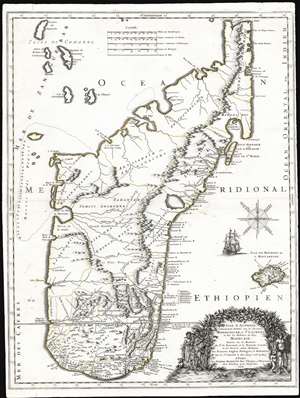
Isle d'Auphine, Communement Nommée par les Europeens Madagascar, et St. Laurens, et par les Habitans du Pays Madecase: Dressée Sur les Memoires du Sr. de Flacourt, et de François Cauche; et Sur Diverses autres Relations des François, Anglois, Portugais et Hollandois. Par le Sr. Sanson le Fils Geogr.' ordre. du Roy. A Paris. Chez Pierre Mariette Rue St. Jacques a l'Esperance Avec Privilege pour Vingt Ans. 1667.
sold
- Digital Map Information
- Suitable for large format printing
- Full resolution TIFF file
- ICC color profile embedded
- Delivered instantly via download link
This is the first edition of Nicolas Sanson's 1667 new map of Madagascar. This map represents the most significant advancement of Madagascar cartography since the map of Étienne de Flacourt (1607 - 1660), who from 1648 to 1653 was French East India’s Governor of Madagascar, and who in 1658 published the first natural history of the island,Histoire de la grande isle Madagascar. (more details)
Europe of the Roman Empire.
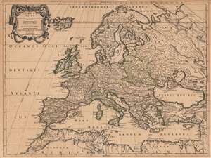
Europa Vetus Nicolai Sanson Christianiss. Galliar. Regis Geographi..
sold
- Digital Map Information
- Suitable for large format printing
- DPI: 600
- File Size: 65.45 MB
- File Type: ZIP / TIFF
- ICC color profile embedded
- Delivered instantly via download link
This is Nicolas Sanson's 1668 map of Europe, in a very attractive contemporary color example. The map combines modern topography with toponymy drawn from classical geographers. Sanson, a historian as well as a cartographer, intended this map to illustrate Europe as it was understood in the days of Imperial Rome. Thus the topography of the map reflects seventeenth-century cartography, while the political divisions and place names are drawn from the cartographers of antiquity: Claudius Ptolemy, Pomponius Mela, and Solinus, among others. The northern limits of the Roman Empire, along the Danube River and the Rhine, are marked with a dotted line and emphasized with outline color. (more details)
France's Winnings from the Treaty of Westphalia.
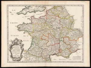
Le Royaume De France et ses Acquisitions vers les Pays Bas, L'Allemagne, L'Italie, et L'Espagne. Avec les Pays Circomvoisins etc. Nouvellement Revue, et Corrigee Par le Sr. Sanson d'Abbeville Geogr. Ordre. de sa Majesté A Paris.
sold
- Digital Map Information
- Suitable for large format printing
- DPI: 600
- File Size: 51.85 MB
- File Type: ZIP / TIFF
- ICC color profile embedded
- Delivered instantly via download link
This is a beautiful, original-color example of Nicolas Sanson's 1678 folio map of the Kingdom of France. Sanson was the preeminent French geographer of the 17th century, and his austere, elegant aesthetic set the standard for French mapmakers into the next century - easily distinguishing the works of French mapmakers from the florid work produced at the same time in the Netherlands. (more details)