
Wells, Edward (sold)

Edward Wells (1667 - 1727) was an English mathematician, geographer, and classical scholar based at Christ Church College, Oxford. Wells trained for the ministry but quickly found himself unsuited to religious life and instead applied for an academic position at Oxford, where he authored numerous well respected works on a wide range of mathematical and scientific topics. He tutored Prince William, the sickly son of Queen Anne, who was likely about 11 at the time this map was prepared. Wells dedicated nearly all of the maps in his atlas, A New Sett of Maps both of Ancient and Present Geography, to the young prince - quite possibly posthumously, as William died in July of 1700 shortly prior to the publication of the atlas. Nonetheless, Wells' geography proved popular and was published in number editions well into the 1730s.
How poorly Europeans understood South America at the beginning of the 18th century!
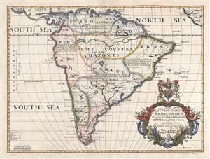
A New Map of South America, Shewing its General Divisions, Chief Cities and Towns; Rivers, Mountains, etc. Dedicated to his Highness William Duke of Gloucester.
sold
- Digital Map Information
- Suitable for large format printing
- DPI: 300
- File Size: 7.04 MB
- File Type: ZIP / TIFF
- ICC color profile embedded
- Delivered instantly via download link
This is a 1700 Edward Wells map of South America. Sparsely illustrated, the scarcity of notations reflects the general lack of knowledge concerning the interior of South America. Annotations in each of the regions provide a date for when Europeans (almost entirely Spaniards, except for the Portuguese in Brazil) conquered different regions and installed their own governments. Two regions, 'The Country of the Amazones' and 'Magelanick Land' are 'little known' to Europeans, meaning that they remained unconquered. Even today, the Amazon Rainforest remains one of the least well-known regions on the planet. The Amazon River cuts its way across the northern portion of the continent. Numerous cities are labeled, including Buenos Aires (Buenos Ayres), Assumption, Cusco, Lima, Quito, and Cartagena. Several cities along the Brazilian coast, such as Pernambuco, San Salvador, Porto Seguro, and Spirito Sancto, are names used in modern Brazil either as city names or as names of region. Two lakes, Lake Parima and the Laguna de Xarayes, are both illustrated here, though only Lake Parima is labeled. Both lakes, which hold equal parts reality and fantasy in their mapping, are central to the European conception of South America and play a critical role in the mapping of the continent. (more details)
Beautiful 18th century map of Spain and Portugal.
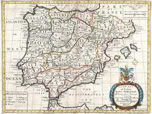
A New Map of Spain and Portugal. Showing their Principal Divisions, Chief Cities, Townes, Ports, Rivers, Mountains, etc.
sold
- Digital Map Information
- Suitable for large format printing
- DPI: 300
- File Size: 7.7 MB
- File Type: ZIP / TIFF
- ICC color profile embedded
- Delivered instantly via download link
This is a 1700 Edward Wells map of Spain and Portugal. The map depicts the Iberian Peninsula, where both Spain and Portugal and located, from the Bay of Biscay on the top to Morocco on the bottom and from the Atlantic Ocean on the left to the Mediterranean Sea on ... (more details)
Asia of the 18th century.
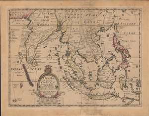
A New Map of the East Indies, Taken from Mr. de Fer's Map of Asia, Shewing their Chief Divisions, Cities, Towns, Ports, Rivers, Mountains etc.
sold
- Digital Map Information
- Suitable for large format printing
- DPI: 600
- File Size: 46.58 MB
- File Type: ZIP / TIFF
- ICC color profile embedded
- Delivered instantly via download link
This is an attractive and scarce c. 1701 map of India, Southeast Asia, and the East Indies by Edward Wells. Based on the cartography on Nicolas de Fer, it is a good representation of Europeans' perception of the geography of South and Southeast Asia at the time. (more details)
A speculative early 18th century perspective on Africa.
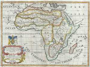
A New Map of Africk Shewing its Present General Divisions Chief Cities or Towns, Rivers, Mountains etc.
sold
- Digital Map Information
- Suitable for large format printing
- Full resolution TIFF file
- ICC color profile embedded
- Delivered instantly via download link
This is a beautiful 1712 map of Africa by Edward Wells of Oxford. It covers the continent of Africa from an early 18th century perspective. The overall composition stresses the fact that, while the coasts of Africa had been well mapped since the late 17th ... (more details)
A beautiful map of the southern parts of Greece during antiquity.
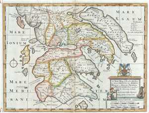
A New Map of the So. and Mid. Parts of Antient Greece viz. Epirus, Hellas, or Graecia Propria, and Peloponnesus, together with the Adjoyning Islands.
sold
- Digital Map Information
- Suitable for large format printing
- Full resolution TIFF file
- ICC color profile embedded
- Delivered instantly via download link
This is an attractive 1712 map of Ancient Greece by Edward Wells of Oxford. It covers southern Ancient Greece including the Peloponnesus, Cythera, Euboea and several other Greek Islands. Identifies various important cites from antiquity including the ... (more details)
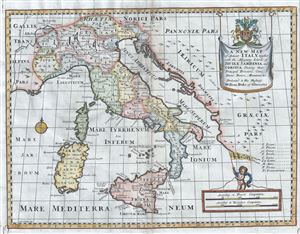
A New Map of Antient Italy, together with the Adjoyning Islands of Sicily, Sardinia, and Corsica, Shewing their Principal Divisions, Cities, Towns, Rivers, Mountains etc.
sold
- Digital Map Information
- Suitable for large format printing
- Full resolution TIFF file
- ICC color profile embedded
- Delivered instantly via download link
This is an uncommon 1712 map of ancient Italy inclusive of the adjoining islands of Sardinia, Corsica and Sicily by Edward Wells of Oxford. It covers all of Italy in the days of the Roman Empire from Cisalpine Gaul to Sicily, noting towns, cities, ... (more details)
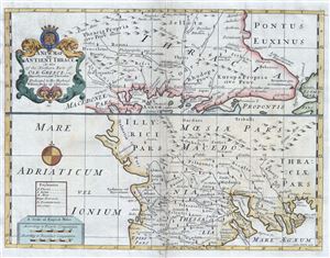
A New Map of Antient Thrace: As also of the Northern Parts of Old Greece, viz. Macedonia, and Thessalia.
sold
- Digital Map Information
- Suitable for large format printing
- Full resolution TIFF file
- ICC color profile embedded
- Delivered instantly via download link
This is a beautiful 1712 map of ancient Thrace or Northern Greece and Bulgaria. Essentially divided into two panels, the top panel depicts from north eastern Greece, with parts of Macedonia and Thrace, to Bulgaria and the Black Sea. The lower map ... (more details)
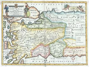
A New Map of the Western Parts of Asia Minor Largely Taken: Shewing their Antient Divisions, Countries or People, Chiefe Cities, Towns, Rivers, Mountains etc.
sold
- Digital Map Information
- Suitable for large format printing
- Full resolution TIFF file
- ICC color profile embedded
- Delivered instantly via download link
This is a beautiful 1712 map of the western part of Asia Minor or Turkey by Edward Wells of Oxford. It covers the western part of Turkey from the Aegean Sea east as far as central Turkey, noting several towns, cities, rivers, mountains, ancient ... (more details)
A decorative map of Israel, Palestine and the Middle East.
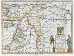
A New Map of the Eastern Parts of Asia Minor Largely taken: As Also of Syria, Armenia, Mesopotamia and c. Showing their Antient Divisions, Countries or People, Chiefe Cities, Towns, Rivers, Mountains, and c. Dedicated to His Highness William Duke of Gloucester.
sold
- Digital Map Information
- Suitable for large format printing
- DPI: 300
- File Size: 9.67 MB
- File Type: ZIP / TIFF
- ICC color profile embedded
- Delivered instantly via download link
This is an unusual 1712 map of the Middle East in antiquity by Edward Wells of Oxford. Covers from the Black Sea to the Persian Gulf and from Cyprus to the Caspian Sea. Includes the modern day countries of Cyprus, Turkey, Syria, Lebanon, Israel, ... (more details)
The Fertile Crescent Mapped.
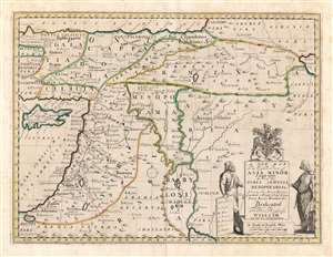
A New Map of the Eastern Parts of Asia Minor Largely taken: As Also of Syria, Armenia, Mesopotamia and c. Shewing their Antient Divisions, Countries or People, Chiefe Cities, Towns, Rivers, Mountains etc. Dedicated to His Highness William Duke of Gloucester.
sold
- Digital Map Information
- Suitable for large format printing
- DPI: 600
- File Size: 46.39 MB
- File Type: ZIP / TIFF
- ICC color profile embedded
- Delivered instantly via download link
This is an elegant 1700 Edward Wells map of the eastern Mediterranean and ancient Mesopotamia. Coverage extends from Cyprus and Asia Minor, eastwards as far as the Caspian and Persian Gulf. The central focus is the watershed of the Tigris and Euphrates, thus embracing ancient Mesopotamia and Babylonia. The kingdoms of Assyria, Armenia, Palestine and Syria are prominent. A decorative title cartouche appears in the lower right, surmounted by the arms of the dedicatee - Prince William, Duke of Gloucester and the son of Queen Anne, who, when this map was being prepared, was a student of Wells. The sickly William never lived to see his tutor's work completed. (more details)
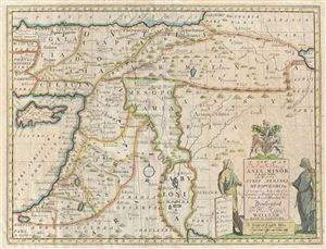
A New Map of the Eastern Parts of Asia Minor Largely taken: As Also of Syria, Armenia, Mesopotamia and c. Showing their Antient Divisions, Countries or People, Chiefe Cities, Towns, Rivers, Mountains, and c. Dedicated to His Highness William Duke of Gloucester.
sold
- Digital Map Information
- Suitable for large format printing
- Full resolution TIFF file
- ICC color profile embedded
- Delivered instantly via download link
An unusual 1712 map of the Middle East in antiquity by Edward Wells of Oxford. Covers from the Black Sea to the Persian Gulf and from Cyprus to the Caspian Sea. Includes the modern day countries of Cyprus, Turkey, Syria, Lebanon, Israel, ... (more details)
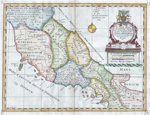
A New Map of Latium, Etruria, and as much of Antient Italy, as lay Between Gallia Cisalpina and Graecia Magna, Shewing their Principal Divisions, Cities, Towns, Rivers Mountains etc.
sold
- Digital Map Information
- Suitable for large format printing
- Full resolution TIFF file
- ICC color profile embedded
- Delivered instantly via download link
This is a scarce 1712 map of central Italy in antiquity by Edward Wells of Oxford. It covers the region during the days of the Roman Empire from Gallia Cisalpine to Graecia Magna, noting towns, cities, rivers, mountains, islands and other ... (more details)
Speculative early map of Central Asia and Siberia.
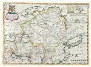
A new map of Great Tartary, and China : with the adjoyning Parts of Asia.
sold
- Digital Map Information
- Suitable for large format printing
- DPI: 300
- File Size: 10.57 MB
- File Type: ZIP / TIFF
- ICC color profile embedded
- Delivered instantly via download link
This is a decorative 1712 map of Tartary by Edward Wells of Oxford. It covers from the Black Sea and Turkey east as far as Japan. It extends north to Nova Zembla and south to the Ganges Delta. When Wells drew this map, this part of the ... (more details)
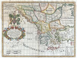
A New Map of Turky in Europe And Parts adjoyning Shewing their Principal Divisions and chiefe Cities, Towns, Rivers, Mountains etc. Dedicated to his Highness William Duke of Glocester.
sold
- Digital Map Information
- Suitable for large format printing
- Full resolution TIFF file
- ICC color profile embedded
- Delivered instantly via download link
This is an attractive 1712 map of Greece, the Balkans, Macedonia and Turkey in Europe by Edward Wells of Oxford. Centered on modern day Greece, it covers from Transylvania and Hungary to Crete and the Mediterranean and from Venice ... (more details)
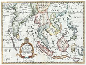
A New Map of the East Indies, Taken from Mr. de Fer's Map of Asia, Shewing their Chief Divisions, Cities, Towns, Ports, Rivers, Mountains etc.
sold
- Digital Map Information
- Suitable for large format printing
- Full resolution TIFF file
- ICC color profile embedded
- Delivered instantly via download link
This is an attractive and scarce 1712 map of India and the East Indies by Edward Wells of Oxford. Centered on Malaysia, this beautiful map covers all of Southeast Asia from Persia to the Timor Island, inclusive of the modern day ... (more details)
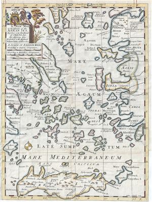
A New Map of the Islands of the Aegaean Sea, Together with The Island of Crete And the Adjoining Isles.
sold
- Digital Map Information
- Suitable for large format printing
- Full resolution TIFF file
- ICC color profile embedded
- Delivered instantly via download link
This is a beautiful 1712 map of the Islands of the Aegean Sea by Edward Wells of Oxford. The map covers the Greek Isles or the Islands of the Aegean Sea from Myrina south to include Crete and from Cythera east as far as Rhodes. ... (more details)
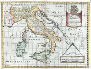
A New Map of Italy, together with the Adjoyning Islands of Sicily, Sardinia, and Corsica, Shewing their Principal Divisions, Cities, Towns, Rivers, Mountains etc.
sold
- Digital Map Information
- Suitable for large format printing
- Full resolution TIFF file
- ICC color profile embedded
- Delivered instantly via download link
This is an uncommon 1712 map of Italy inclusive of the adjoining islands of Sardinia, Corsica and Sicily by Edward Wells of Oxford. It extends north as far as Lake Geneva and Germany and from France to the Gulf of Venice and the ... (more details)
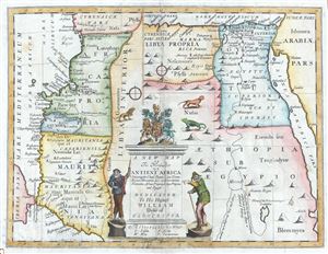
A New Map of The North Part of Antient Africa Shewing the Chiefe People, Cities, Towns, Rivers, Mountains, etc. in Mauritania, Numidia, Africa Propia, Libya Propia, and Egypt.
sold
- Digital Map Information
- Suitable for large format printing
- Full resolution TIFF file
- ICC color profile embedded
- Delivered instantly via download link
This is an uncommon and beautiful 1712 map of the northern part of Africa in ancient times by Edward Wells of Oxford. This interesting map depicts the northern coastlines of Africa with an unusual orientation, with the eastern ... (more details)
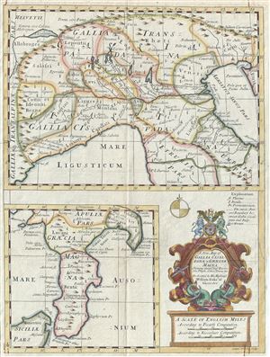
A New Map of Gallia Cisalpina and Graecia Magna Shewing their Chief Divisions, Peoples, Cities, Towns etc.
sold
- Digital Map Information
- Suitable for large format printing
- Full resolution TIFF file
- ICC color profile embedded
- Delivered instantly via download link
This is a charming 1712 map of the northern Italy and southern Italy in antiquity by Edward Wells of Oxford. Essentially two maps on a single sheet, the top map depicts the northern part of Italy from Lake Geneva (Lake ... (more details)
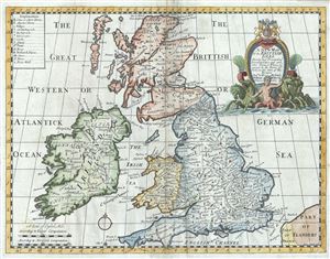
A New Map of the Brittish Isles Shewing their Present Genl. Divisions, Cities and such other Towns, or Places, as answer to the Towns of note, in the time of the Romans.
sold
- Digital Map Information
- Suitable for large format printing
- Full resolution TIFF file
- ICC color profile embedded
- Delivered instantly via download link
This is a beautiful 1712 map of the British Isles by Edward Wells of Oxford. It covers all of England, Wales, Scotland and Ireland. Highly detailed, it notes the present (1712) general division, cities, towns and ... (more details)
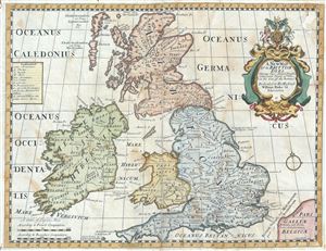
A New Map of the Brittish Isles, Shewing their Antient People, Cities, and Towns of Note, in the time of the Romans.
sold
- Digital Map Information
- Suitable for large format printing
- Full resolution TIFF file
- ICC color profile embedded
- Delivered instantly via download link
This is a beautiful 1712 map of the British Isles during the ancient Roman times by Edward Wells of Oxford. It covers all of modern day England, Wales, Scotland and Ireland. The map is highly detailed and notes ... (more details)
Built to commemorate the American victory at the Battle of Bennington during the American Revolutionary War.
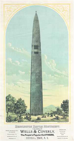
Bennington Battle Monument.
sold
- Digital Map Information
- Suitable for large format printing
- File Size: 5.89 MB
- File Type: ZIP / TIFF
- ICC color profile embedded
- Delivered instantly via download link
This is an 1891 Wells and Coverly view of the Bennington Battle Monument in Bennington, Vermont, a monument built to commemorate the Battle of Bennington during the American Revolutionary War. The view depicts ... (more details)