
Blunt, Edmund March (sold)

Edmund March Blunt (June 20, 1770 - 1862) was an American navigator, bookseller, chartmaker, and cartographer based in Newburyport, Massachusetts. Blunt was born in Portsmouth, New Hampshire in 1770. In 1796, along with the nominal assistance of prominent navigator Captain Lawrence Furlong, Blunt published The American Coast Pilot, one of the most important published works on American navigation. Although much of the work was plagiarized from British publications, the Coast Pilot was an immediate popular success. In response to the popularity of his work, Blunt published 21 subsequent editions, each with important updates and revisions. The first edition to contain map plates was printed in 1804. Following a fire that destroyed his offices at The Sign of the Bible in 1811, Blunt moved his business to New York and opened a new shop, The Sign of the Quadrant. His sons Edmund Jr. (1799 - 1866) and George William (1802 - 1878), joined the firm in 1824 and eventually took over the family business, renaming the firm 'E. and G. W. Blunt'. They both produced their own nautical books, charts, and instruments, as well as republished their father’s work. In 1830, Edmund accepted a position under Ferdinand Hassler at the United States Office of the Coast Survey. Much of Blunt's original work eventually found its way into U.S. Coast Survey Publications. George closed the firm in 1872 and sold the plates and chart copyrights to the U.S. Coast Survey and the U.S. Navy Hydrographic Office. Due to the quality and detail of Blunt's work, revised editions of his most important charts were republished well into the 1880s.
Scarce early nautical chart of New York Harbor.
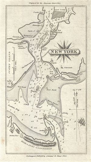
New York.
sold
- Digital Map Information
- Suitable for large format printing
- Full resolution TIFF file
- ICC color profile embedded
- Delivered instantly via download link
This is a scarce 1806 nautical chart or maritime map of New York City by Edmund Blunt. It covers the region including parts of lower Manhattan, Staten Island, Brooklyn and New Jersey. The map identifies several points, islands, bays including Sandy Hook, Red Hook, ... (more details)
A cursed lineage!
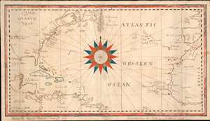
Chart of the Atlantic Ocean.
sold
- Digital Map Information
- Suitable for large format printing
- DPI: 600
- File Size: 12.51 MB
- File Type: ZIP / TIFF
- ICC color profile embedded
- Delivered instantly via download link
An exceptional and finely executed manuscript school-boy map illustrating the North Atlantic, here called the 'Western Ocean.' A striking compass rose dominates the center of the map. It was executed on March 4, 1822 by Charles Haskell (see below), when he must have been about 14. Despite being young, the map, which is based on Blunt's c. 1820 Chart of the Atlantic Ocean, is finely executed, covering from Louisiana to Gibraltar, incorporating most of the eastern United States, part of South America, and west Africa. As one would suspect of a scion of New England fishermen, the many cod fishing banks off the coast, and the Grand Banks, are illustrated with impressive meticulousness. Curiously, the map includes the Saint Peter and Saint Paul Archipelago, at bottom center, a remote atoll in the Atlantic - rarely visited save by occasional whalers. Haskell also notes prevailing wind and currents. (more details)
The Eddy Map.' One of the most important early maps of New York City ever printed.
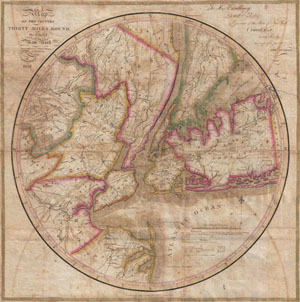
Map of the country Thirty Miles Round the City of New York.
sold
- Digital Map Information
- Suitable for large format printing
- DPI: 300
- File Size: 15.89 MB
- File Type: ZIP / TIFF
- ICC color profile embedded
- Delivered instantly via download link
Known as 'The Eddy Map,' this is an extremely rare and important circular map of New York City and vicinity, dated 1823. Covers the New York City area in roughly a thirty mile radius of Manhattan, extending north to Tarrytown, south to Monmouth, west to Somerset, ... (more details)
Beautiful early maritime map of Cape Poge on Martha's Vineyard.
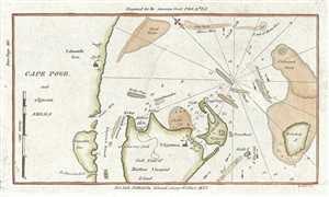
Cape Poge and adjacent Shoals.
sold
- Digital Map Information
- Suitable for large format printing
- DPI: 300
- File Size: 0.83 MB
- File Type: ZIP / TIFF
- ICC color profile embedded
- Delivered instantly via download link
This is a scarce and beautiful 1833 nautical chart or maritime map of Cape Poge, Martha's Vineyard, Massachusetts. It covers the region including parts of Cape Cod, Martha's Vineyard Island, Chappaquidick Island and Muskeget Island. The towns of Falmouth and ... (more details)
Beautifully detailed maritime map of the Delaware Bay.
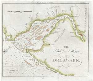
The Bay and River of Delaware.
sold
- Digital Map Information
- Suitable for large format printing
- DPI: 300
- File Size: 2.18 MB
- File Type: ZIP / TIFF
- ICC color profile embedded
- Delivered instantly via download link
This is an attractive 1833 nautical chart or maritime map of the Delaware Bay by Edmund Blunt. It covers part of New Jersey, Delaware and Pennsylvania, noting important towns along the bay, including Philadelphia. Oriented with north to the right, covers ... (more details)
Early map of Sapello Island and Doboy Sound in Georgia.
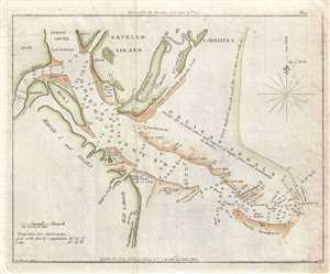
[Doboy Sound. Sapello Island].
sold
- Digital Map Information
- Suitable for large format printing
- DPI: 300
- File Size: 1.8 MB
- File Type: ZIP / TIFF
- ICC color profile embedded
- Delivered instantly via download link
This is a beautiful 1833 nautical chart or maritime map of the entrance to Doboy Sound, Georgia by Edmund Blunt. It covers the part of Sapelo Island, Marsh Island, Cabarita Island and Pelican Shoals and notes the north and south breakers. Numerous depth ... (more details)
Scarce French nautical chart of the East Coast from New York to Florida.
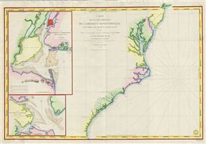
Carte de la Cote Orientale de l'Amerique Septentrionale Partie Comprise Entre New York et la Riviere Saint Jean.
sold
- Digital Map Information
- Suitable for large format printing
- DPI: 300
- File Size: 29.4 MB
- File Type: ZIP / TIFF
- ICC color profile embedded
- Delivered instantly via download link
This is a highly scarce 1834 map of the eastern coast of the United States. The map covers the entire coastline from New York City to the St. John River in Florida, inclusive of the Chesapeake Bay, the Outer Banks, and the Carolina, Virginia, and ... (more details)
The French-American cotton trade.
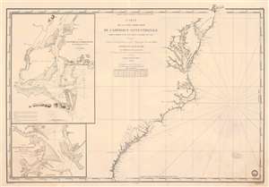
Carte de la Côte Orientale de l'Amérique Septentrionale Partie Comprise Entre New York et la Rivière Saint Jean.
sold
- Digital Map Information
- Suitable for large format printing
- Full resolution TIFF file
- ICC color profile embedded
- Delivered instantly via download link
This is an 1834 French Dépôt-général de la Marine nautical chart or maritime map of the east coast of the United States. The map appeared at the height of the U.S.-French textile trade, which it was likely published to support. Southern ports in Virginia, Carolina, and Georgia provided the bulk of cotton for the French textile industry - a fact that would become a major point of contention during the Civil War (1861 - 1865), leading to the Cotton Famine (1863 - 1863). Depicting from New York City south to the mouth of the St. Johns River in Florida, coastal detail abounds. Depth soundings are indicated along the entire coastline, along with inlets, capes, banks, and coastal islands. The Delaware River is charted to Philadelphia. The Chesapeake Bay is detailed as far as Charlestown and Elkstown. The Potomac River (labeled here as Potomack) is illustrated to Washington, D.C., and the Rappahannock River (labeled here as Rappanahock) runs to Fredericksburg. Both Richmond and Petersburg are labeled along the James River, as is Norfolk. Albemarle and Pamlico Sounds are detailed in North Carolina, and Cape Hatteras, Cape Lookout, and Cape Fear are labeled. Both Charleston and Savannah are identified. (more details)
Detailed coast survey map which predates the U.S. Coast Survey.
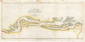
Savannah River From its Mouth to the City of Savannah.
sold
- Digital Map Information
- Suitable for large format printing
- DPI: 300
- File Size: 2.14 MB
- File Type: ZIP / TIFF
- ICC color profile embedded
- Delivered instantly via download link
This is an 1837 Edmund Blunt map or chart of the Savannah River. The map depicts the Savannah River from Savannah to its mouth near Tybee Island. Predating the U.S. Coast Survey, the detail present here is astonishing. Several islands in the river ... (more details)
Rare chart of the Gulf.
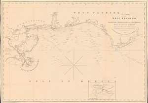
The Coasts of West Florida, Alabama, Mississippi and Louisiana; From the surveys of Gauld improved by those of the U.S. Government and the latest Astronomical Observations.
sold
- Digital Map Information
- Suitable for large format printing
- Full resolution TIFF file
- ICC color profile embedded
- Delivered instantly via download link
A rare Edmund March Blunt 1840 nautical map of West Florida, embracing the Gulf Coast from the mouths of the Mississippi to the Saint Marks River. The survey is based upon the groundbreaking work of Scottish hydrographer George Gould following the French and Indian War (1754 - 1763). Despite being nearly seventy years old by the time this chart was published, it remained the definitive mapping of the Gulf Coast until after the American Civil War (1861 - 1865). (more details)
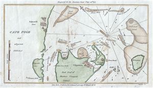
This is a scarce and beautiful 1842 nautical chart or maritime map of Cape Poge, Martha's Vineyard, Massachusetts. It covers the region including parts of Cape Cod, Martha's Vineyard Island, Chappaquidick Island and Muskeget Island. The towns of ... (more details)
Scarce nautical chart of the Gulf Coast.
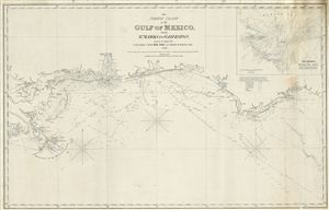
The North Coast of th Gulf of Mexico from St. Marks to Galveston.
sold
- Digital Map Information
- Suitable for large format printing
- DPI: 300
- File Size: 15.24 MB
- File Type: ZIP / TIFF
- ICC color profile embedded
- Delivered instantly via download link
An extremely scarce 1865 nautical chart or maritime map of the Gulf Coast by e and G. W. Blunt. This map, though titled ‘From St. Marks to Galveston' in fact only follows the coast from St. Marks to the Delta of the Mississippi River – ... (more details)
Unusually oriented and enormous nautical chart detailing a voyage through the Bahamas to the Dry Tortugas.
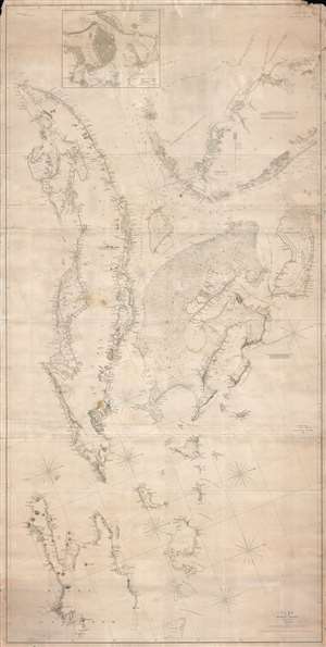
Southern Coast, U. States. Sheet VIII. / Cuba and the Windward Passages. / Southern Coast.. U. States. Sheet VII.
sold
- Digital Map Information
- Suitable for large format printing
- DPI: 300
- File Size: 72.09 MB
- File Type: ZIP / TIFF
- ICC color profile embedded
- Delivered instantly via download link
An enormous and expansive 1844 - 1857 nautical chart or maritime map of Southern Florida, the Bahamas, and Cuba. Curiously oriented to the northeast, this sprawling map covers from central Florida in the vicinity of Tampa Bay, to western ... (more details)
Rare chart of Florida.
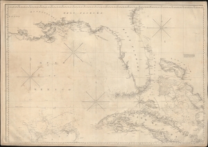
['Chart of the Gulf of Mexico, West Indies, and Spanish Main]. [Northwest Section].
sold
- Digital Map Information
- Suitable for large format printing
- DPI: 600
- File Size: 85.97 MB
- File Type: ZIP / TIFF
- ICC color profile embedded
- Delivered instantly via download link
An intriguing c. 1845 nautical map of Florida and part of the Gulf Coast by Edmund March Blunt. Following loosely on Spanish charts, this map represents the state-of-the-art Florida and Gulf Coast cartography going into the American Civil War (1861 - 1865). (more details)
Supplying the Confederacy through the Blockade.
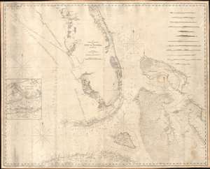
The Bahama Banks and Gulf of Florida, by Edmund Blunt.
sold
- Digital Map Information
- Suitable for large format printing
- Full resolution TIFF file
- ICC color profile embedded
- Delivered instantly via download link
A scarce, detailed, and highly attractive 1847 blueback-style nautical chart or maritime map of Florida and the Bahamas by Edmond Blunt and his sons E. and G. W. Blunt featuring notes and annotations suggestive of use by a Confederate blockade runner. The map offer unique insight into the supply line and trade routes of the Confederacy during the American Civil War. The chart covers Florida from 29°37' N, or, roughly speaking, from the latitude of Lake George south past the Florida Keys (then called the Florida Reef), as far as Cuba and from the longitude of Cape St. George eastwards to include the Bahama Islands. It offers limited inland detail but a fine mapping of coastal regions and countless depth soundings, especially around Tampa Bay, the Florida Keys, and throughout the Bahama Banks - a notoriously dangerous area for ships even with such a fine chart as this. Twelve shore profiles decorate the upper right quadrant. (more details)
Scarce early American nautical chart of Florida with an inset of Key West.
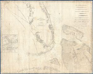
The Bahama Banks and the Gulf of Florida.
sold
- Digital Map Information
- Suitable for large format printing
- DPI: 300
- File Size: 65.76 MB
- File Type: ZIP / TIFF
- ICC color profile embedded
- Delivered instantly via download link
A scarce, detailed, and highly attractive 1848 nautical chart or maritime map of Florida and the Bahamas by e. and G. W. Blunt. The chart covers Florida from 29°37' N, or, roughly speaking, from the latitue of Lake George south past the ... (more details)
New cartography in the wake of the Seminole Wars.

The Bahama Banks and the Gulf of Florida.
sold
- Digital Map Information
- Suitable for large format printing
- File Size: 63.88 MB
- File Type: ZIP / TIFF
- ICC color profile embedded
- Delivered instantly via download link
This is a scarce, detailed, and elegant 1848 nautical chart or maritime map of Florida and the Bahamas by E. and G. W. Blunt. Blunt's chart, which first appeared in his 10-sheet 1827 maritime atlas, represented the height of nautical mapping in and around the Florida peninsula prior to the U.S. Coast Survey in the 1850s. (more details)
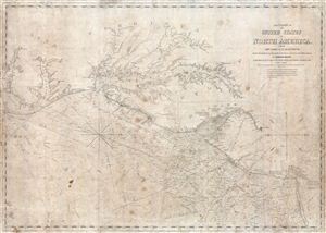
The Coast of the United States of North America, from New York to St. Augustine drawn and regulated according to the best Surveys and Astronomical Observations by Enmund Blunt.
sold
- Digital Map Information
- Suitable for large format printing
- Full resolution TIFF file
- ICC color profile embedded
- Delivered instantly via download link
An interesting 1851 Edmund Blunt maritime chart or nautical map of the coast of the United States between New York City and the Pamlico Sound. Centered on the Chesapeake Bay, which is rendered in full, this map offers a fine pre-U.S. ... (more details)
Massive blueblack Nautical Chart of the southeastern United States coastline.

[Chesapeake Bay to Cuba]
sold
- Digital Map Information
- Suitable for large format printing
- File Size: 80.38 MB
- File Type: ZIP / TIFF
- ICC color profile embedded
- Delivered instantly via download link
A massive four panel 1861 Edmund Blunt blueback nautical chart or maritime map covering the southeastern coast of the United States from the entrance to the Chesapeake Bay to Florida and Cuba, including Virginia, North Carolina, South Carolina, and Georgia coasts. This highly detailed chart is a fine example of Blunt's work offering limited inland detail but a wealth of nautical information including countless depth soundings, light houses, shore lines, river soundings, shipping lanes, and other practical information for the mariner. Although mostly focused on the southeastern United States, the leftmost map or southern sheet, extends to cover Cuba and offers an excellent inset of Havana. (more details)
Privately published chart for Blockade Runners?
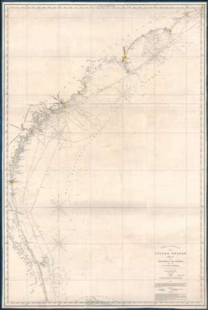
The Coast of the United States Sheet No. 2 from Cape Lookout to Cape Carnaveral from the U.S. Coast Survey.
sold
- Digital Map Information
- Suitable for large format printing
- File Size: 44.94 MB
- File Type: ZIP / TIFF
- ICC color profile embedded
- Delivered instantly via download link
This is a rare 1865 Civil War Era Edmund and George William Blunt 'blockade runner' nautical map of the southeastern coast of the United States extending roughly from Cape Hatteras, North Carolina, to Cape Canaveral (written Carnaveral here), Florida. Benefiting from the work of the U.S. Coast Survey, the chart boasts impressive coastal detail, illustrating innumerable coastal islands, inlets, points, and other important navigational hazards. Depth soundings appear along the coast. Railroads are illustrated operating out of Savannah and Charleston, emphasizing their economic importance to the Confederate States of America. (more details)