
Van der Aa, Pieter (sold)

Pieter van der Aa (1659 - 1733) was a Dutch publisher of maps and atlases active in the late 17th and early 18th centuries. Van der Aa was born in Leyden in 1659. At nine he was apprenticed to a local bookseller and, by 21, had established his own publishing, printing, and auctioneering house. In 1692 Van der Aa was appointed to be one of the High Commissioners of the Booksellers Guild. During his long and impressive career Van der Aa produced thousands of maps, including a vast 28 volume atlas containing no less than 3,000 maps. Few of Van der Aa's maps were original productions, most being copied from the work of earlier cartographers. Nonetheless, when one of Van der Aa's rare original pieces does appear, his style, with unusual projections, elegant engraving, and precise detail, is instantly recognizable and highly desirable. He also pioneered the cartographic idea of separating border artwork from the map plate itself such that every map in a collection could have a similar elaborate border without actually having to re-engrave the complex plates. This technique was used to great effect by later 18th century publishers like Brion de la Tour. Following Van der Aa's death in 1733, his much admired Nouvel Atlas was reissued by the Dutch firm of Covens & Mortier. Today Van der Aa's work is admired for its fine delicate engraving and unusual projections and is considered highly desirable among collectors.
A delightful mix between a view and a city plan - what a great map!
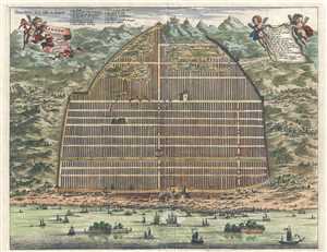
Kanton. In Platte Grondt. / Plate forme de la Ville de Kanton.
sold
- Digital Map Information
- Suitable for large format printing
- DPI: 300
- File Size: 6.31 MB
- File Type: ZIP / TIFF
- ICC color profile embedded
- Delivered instantly via download link
This is a hand colored c. 1670 Pieter van der Aa map or plan of Guangzhou, formerly romanized as Canton, China. Depicted as a hybrid between a view and a plan, the Zhujiang River traverses the bottom of the map, and the amount of traffic and presumed commerce ... (more details)
Incredible view of Guangzhou only a few years after the Qing conquest.
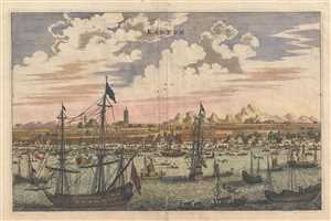
Kanton.
sold
- Digital Map Information
- Suitable for large format printing
- DPI: 300
- File Size: 3.58 MB
- File Type: ZIP / TIFF
- ICC color profile embedded
- Delivered instantly via download link
This is a hand colored c. 1670 Pieter van der Aa map or view of Guangzhou, formerly romanized as Canton, China. Seen from the harbor on the Zhujiang River, Guangzhou's position as a major trading port is emphasized by the amount of traffic on the river. ... (more details)
One of the earliest obtainable European views of China.
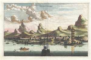
Xaocheu ou Sucheu.
sold
- Digital Map Information
- Suitable for large format printing
- DPI: 300
- File Size: 3.61 MB
- File Type: ZIP / TIFF
- ICC color profile embedded
- Delivered instantly via download link
This is a hand colored c. 1670 Pieter van der Aa map or view of Suzhou, China. The map depicts Suzhou viewed from the Yangtze River. The city walls are easily distinguished, along with a tower on the banks of the river. Mountains rise behind the city. ... (more details)
A view of post-Qing conquest Tianjin.

Tiencienwey.
sold
- Digital Map Information
- Suitable for large format printing
- DPI: 300
- File Size: 3.77 MB
- File Type: ZIP / TIFF
- ICC color profile embedded
- Delivered instantly via download link
This is a 1670 Pieter van der Aa map or view of Tianjin, formerly romanized as Tientsin or Tiencienwey, China. The main focal point is the river, which dominates the center of the piece. Traditional Chinese Junks, an ancient kind of Chinese sailing ... (more details)
Scarce 1707 American 'captivity narrative' with accompanying map and other illustrations.
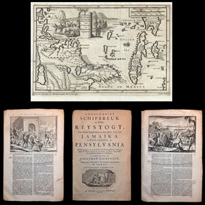
Jonathan Dickensons Ramspoedige Reystogt van Jamaika na Pensylvia nagespoord.
sold
- Digital Map Information
- Suitable for large format printing
- DPI: 300
- File Size: 3.58 MB
- File Type: ZIP / TIFF
- ICC color profile embedded
- Delivered instantly via download link
An exceptionally unusual and very rare 1707 folio 51 page captivity narrative and accompanying 1706 map of the east coast of America prepared by the Dutch cartographer Pieter van der Aa. The map was prepared to illustrate the accompanying ... (more details)
Scarce 1706 Map from American 'captivity narrative'.
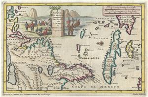
Jonathan Dickensons Ramspoedige Reystogt van Jamaika na Pensylvania nagespoord.
sold
- Digital Map Information
- Suitable for large format printing
- Full resolution TIFF file
- ICC color profile embedded
- Delivered instantly via download link
An exceptionally unusual and very rare 1706 map of the east coast of America prepared by the Dutch cartographer Pieter van der Aa. The map was prepared to illustrate the Dutch edition of journals describing the voyage, shipwreck, capture ... (more details)
Superb map relating to a seminal 'Captivity Tract.'
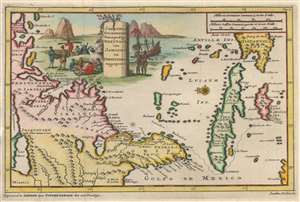
Jonathan Dickensons Ramspoedige Reystogt van Jamaika na Pensylvania nagespoord.
sold
- Digital Map Information
- Suitable for large format printing
- DPI: 600
- File Size: 2.94 MB
- File Type: ZIP / TIFF
- ICC color profile embedded
- Delivered instantly via download link
An exceptionally unusual and very rare 1707 map of the east coast of America prepared by the Dutch cartographer Pieter van der Aa. The map was prepared to illustrate the Dutch edition of journals describing the voyage, shipwreck, capture by Indians, and subsequent travels of Quaker merchant Jonathan Dickinson (1663 - 1722) and his family. Oriented to the east, Dickinson's map covers the eastern part of North America from roughly Lake Erie and New York south to Jamaica, including Virginia, Florida, the Carolinas, and Cuba. A dotted line indicates the path of Dickinson's travels from Port Royal, Jamaica, to Philadelphia, Pennsylvania. (more details)
Superb map relating to a seminal 'Captivity Tract.'
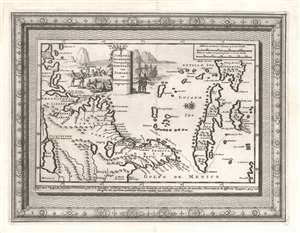
Jonathan Dickensons Ramspoedige Reystogt van Jamaika na Pensylvania nagespoord.
sold
- Digital Map Information
- Suitable for large format printing
- DPI: 600
- File Size: 7.35 MB
- File Type: ZIP / TIFF
- ICC color profile embedded
- Delivered instantly via download link
An exceptionally unusual and very rare separate-issue deluxe edition 1707 map of the east coast of America prepared by the Dutch cartographer Pieter van der Aa featuring unique elaborate border work. The map was prepared to illustrate the Dutch edition of journals describing the voyage, shipwreck, capture by Indians, and subsequent travels of Quaker merchant Jonathan Dickinson (1663 - 1722) and his family. Oriented to the east, Dickinson's map covers the eastern part of North America from roughly Lake Erie and New York south to Jamaica, including Virginia, Florida, the Carolinas, and Cuba. A dotted line indicates the path of Dickinson's travels from Port Royal, Jamaica, to Philadelphia, Pennsylvania. (more details)
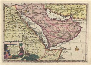
De Roode Zee met de Kusten van Arabien; en het Naauw tussen Aden en Zeila tot aan Bassora.
sold
- Digital Map Information
- Suitable for large format printing
- Full resolution TIFF file
- ICC color profile embedded
- Delivered instantly via download link
This is a very attractive 1707 map of Arabia and Egypt by the Dutch cartographer Pieter Van der Aa. Pieter's (or Pierre) map covers from the Nile delta east as far as the Gulf of Oman and south to include much of modern day Somalia. The ... (more details)
A lovely early decorative map of the American southeast.
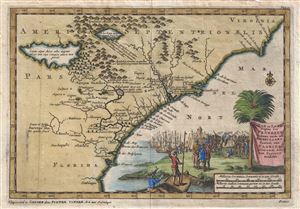
Zee en Land Togten der Franszen Gedaan na, en in't Americaans Gewest van Flordia, aller-eerst door Ioh. Pontius ontdekt.
sold
- Digital Map Information
- Suitable for large format printing
- DPI: 300
- File Size: 2.32 MB
- File Type: ZIP / TIFF
- ICC color profile embedded
- Delivered instantly via download link
A fine first state first edition example of Pieter Van der Aa's 1706 map of the southeast coast of North America. Covering roughly from Cape Romaine (C. de s. Romano) south to St. Augustine (C. Francois), Van der Aa's map includes parts ... (more details)
Captain John Smith's name, applied to contemporary Dutch cartography.
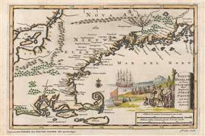
Nieuw Engeland in Twee Scheeptogten door Kapitein Johan Smith inde Iaren 1614 en 1615 Bestevend.
sold
- Digital Map Information
- Suitable for large format printing
- Full resolution TIFF file
- ICC color profile embedded
- Delivered instantly via download link
This is an attractive example of Pieter Van der Aa's 1707 map of New England, issued to illustrate the discoveries Captain John Smith in his 1614 and 1615 voyages. The map covers from the coast of Rhode Island to Penobscot Bay in Maine, showing Cape Cod, Elizabeth Island, and Nantucket. (more details)
Very rare early view of Moscow.
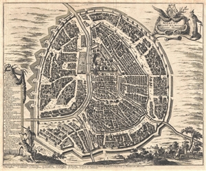
Moscou Capitale de la Moscovie Suivant Olearius.
sold
- Digital Map Information
- Suitable for large format printing
- Full resolution TIFF file
- ICC color profile embedded
- Delivered instantly via download link
A scarce and finely engraved 1719 view and map of Moscow, Russia by Pieter van der Aa. Oriented to the west, this remarkable view illustrates all of Moscow as it appeared at the end of the 17th century. It gives the impression of a ... (more details)
Very rare early view of Moscow.
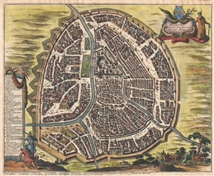
Moscou Capitale de la Moscovie Suivant Olearius.
sold
- Digital Map Information
- Suitable for large format printing
- DPI: 300
- File Size: 6.38 MB
- File Type: ZIP / TIFF
- ICC color profile embedded
- Delivered instantly via download link
A scarce and finely engraved 1719 view and map of Moscow, Russia by Pieter van der Aa. Oriented to the west, this remarkable view illustrates all of Moscow as it appeared at the end of the 17th century. It gives the impression of a ... (more details)
Incredibly detailed map of the Middle East - labels Jerusalem!
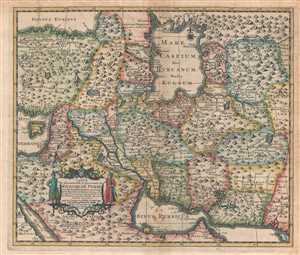
Carte la plus nouvelle et plus-exacte du Royaume de Perse, avec ses Côtes, Villes Maritimes, tous les Pays qui en dependent, et ses Lieux circonvoisins.
sold
- Digital Map Information
- Suitable for large format printing
- DPI: 300
- File Size: 5.34 MB
- File Type: ZIP / TIFF
- ICC color profile embedded
- Delivered instantly via download link
This is a hand colored 1719 Pieter van der Aa map of the Middle East and Iran. The map depicts from the Black Sea and the Caspian Sea to the Persian Gulf and the Red Sea and from the Mediterranean Sea and Turkey to Central Asia. ... (more details)
Scarce edition of an Early Malta.
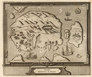
Insulae Melita et Gozo.
sold
- Digital Map Information
- Suitable for large format printing
- Full resolution TIFF file
- ICC color profile embedded
- Delivered instantly via download link
This attractive and scarce map of the Maltese Archipelago, published by Pieter van der Aa in 1725, is a copperplate rendition of Jean Quintin's 1536 map of the islands. Quintin's work was the first printed map of Malta, accompanying his account of his 1530 visit; van der Aa's map accompanied his new edition of Quintin. (more details)
Rare Singapore Map! Only 100 examples ever printed.
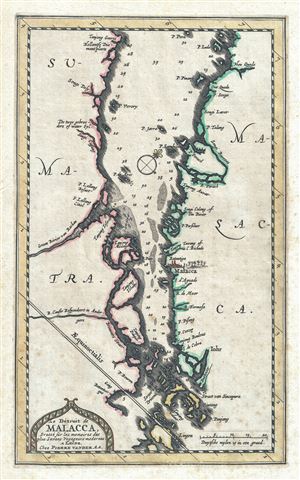
Le Detroit de Malacca dresse sur les memoires des plus savans voyageurs modernes.
sold
- Digital Map Information
- Suitable for large format printing
- DPI: 300
- File Size: 3.14 MB
- File Type: ZIP / TIFF
- ICC color profile embedded
- Delivered instantly via download link
An exceptional and scarce 1727 Pieter van der Aa map of the Strait of Malacca and Singapore including parts of adjacent Sumatra and the Malaya Peninsula (Malaysia). Taking full advantage of the small paper size, this map is ... (more details)
Rare Singapore Map! Only 100 known to have been printed.
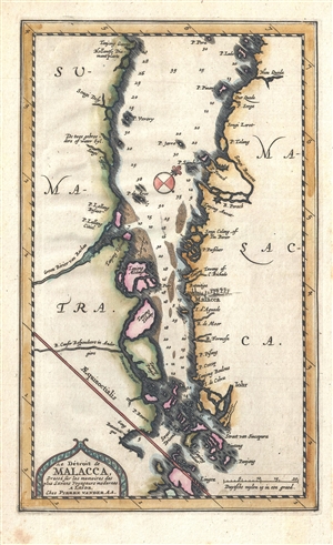
Le Detroit de Malacca dresse sur les memoires des plus savans voyageurs modernes.
sold
- Digital Map Information
- Suitable for large format printing
- DPI: 300
- File Size: 1.82 MB
- File Type: ZIP / TIFF
- ICC color profile embedded
- Delivered instantly via download link
An exceptional and scarce 1727 Pieter van der Aa map of the Strait of Malacca and Singapore including parts of adjacent Sumatra and the Malaya Peninsula (Malaysia). Taking full advantage of the small paper size, this map is ... (more details)
Rare Singapore Map! Only 100 examples ever printed.
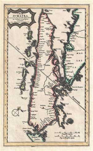
L'Ile de Sumatra suivant les plus nouvelles observations des meilleurs geographes.
sold
- Digital Map Information
- Suitable for large format printing
- Full resolution TIFF file
- ICC color profile embedded
- Delivered instantly via download link
An exceptional and scarce 1727 Pieter van der Aa map of Sumatra, the Strait of Malacca, Singapore, and the southern part of the Malaya Peninsula. Taking full advantage of the small paper size, this map is oriented to the ... (more details)
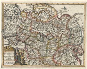
La Grande Tartarie Suivant les Nouvelles Observations de Messrs. De l'Academie Royale des Sciences, etc.
sold
- Digital Map Information
- Suitable for large format printing
- Full resolution TIFF file
- ICC color profile embedded
- Delivered instantly via download link
A very attractive 1729 map of Asia and Tartary by the Dutch cartographer Pieter van der Aa. Pieter's (or Pierre) map covers from the Black Sea to Korea and from Nova Zembla south as far as Lhasa and Lahor. Although Van ... (more details)
Rare example of this lovely map with an elaborate decorative border. Identifies the phantom island of Borodon or St. Brendan.
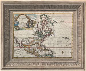
L'Amerique Septentrionale Suivant les Nouvelles Observations de Messrs. De L'Academie Royal des Sciences, etx.
sold
- Digital Map Information
- Suitable for large format printing
- Full resolution TIFF file
- ICC color profile embedded
- Delivered instantly via download link
A fine 1729 map of North America by Pieter Van der Aa with an elaborate frame style border. Centered on the Great Lakes, this map covers all of North America from the Baffin Bay to the Spanish Map and from California to ... (more details)
One of earliest obtainable maps to focus specifically on Taiwan or Formosa.
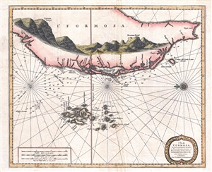
L'Île de Formosa, ou sont exactement marquez les bancs de sables, rochers et brasses d'eau, le tout fait sur les nouvelles observations des plus habiles pilotes.
sold
- Digital Map Information
- Suitable for large format printing
- Full resolution TIFF file
- ICC color profile embedded
- Delivered instantly via download link
One of the few obtainable truly antique maps to focus specifically on Taiwan or Formosa, this is Pieter Van der Aa's 1729 nautical chart L'Île de Formosa . Oriented to the East, the map covers the southwestern ... (more details)
Dramatic view of Moscow in the early 18th century.
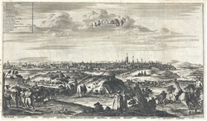
La Ville de Moscou, Capitale de la Moscovie.
sold
- Digital Map Information
- Suitable for large format printing
- DPI: 300
- File Size: 10.29 MB
- File Type: ZIP / TIFF
- ICC color profile embedded
- Delivered instantly via download link
This is a beautiful 1729 view of Moscow by Pieter Van der Aa. It depicts the capital of the Tsardom of Russia, Moscow, as it appeared in the early 18th century. Features the countryside in the foreground with ... (more details)
Dramatic view of Moscow in the early 18th century.
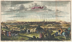
La Ville de Moscou, Capitale de la Moscovie.
sold
- Digital Map Information
- Suitable for large format printing
- DPI: 300
- File Size: 7.25 MB
- File Type: ZIP / TIFF
- ICC color profile embedded
- Delivered instantly via download link
This is a beautiful 1729 view of Moscow by Pieter Van der Aa. It depicts the capital of the Tsardom of Russia, Moscow, as it appeared in the early 18th century. Features the countryside in the foreground with ... (more details)