
Weyss, John E. (sold)

John E. Weyss (1820 - June 24, 1903) was an Austrian-American illustrator, cartographer, and engineer. Born in Vienna, Weyss immigrated to the United States in 1848 and settled in New York. He served as a member of the U.S. Government's Mexican Boundary Survey (1849 - 1855), led by Major William Hemsley Emory, because of his training as an illustrator. In the capacity of a civilian artist working for the army, Weyss contributed several illustrations for Emory's report, which was published in 1857-59. Weyss is also credited on eleven of the report's maps. At the outbreak of the American Civil War, Weyss held a position as a civil engineer for the state of Kentucky. Weyss received a commission as a major from the Governor of Kentucky and, due to his professional experience, was assigned to the staff of Captain Nathaniel Michler, the chief topographical officer in the Army of the Ohio. In this role he did survey work for maps of the vicinity of Shiloh and Corinth, both sites of major Civil War battles. Weyss then joined Captain Michler when he moved to the staff of General Rosecrans in late 1862, for whom they made a series of maps of the Battle of Stones River. Weyss and Michler were then transferred to the Army of the Potomac in May, 1863. One of Weyss's first assignments for the Army of the Potomac was a map of the vicinity of Harper's Ferry, Virginia, for which he produced a highly detailed map of the very complex topography of the region. Soon, Weyss was made responsible for the day-to-day detailed mapping during the siege at Petersburg. After the war, Weyss served as the principal surveyor under the direction of Michler during the creation of the atlas Military maps illustrating the operations of the armies of the Potomac and James, May 4th 1864 to April 9th 1865, that was published in 1869. Weyss served the U.S. Army Corps of Engineers for another twenty years, until he retired sometime in the 1880s. Weyss died on June 4, 1903, in Washington, D.C.
Probably the first detailed map of Harper's Ferry, West Virginia, since West Virginia had only officially been a state since June 1863.
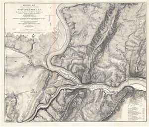
Military Map showing the topographical features of the country adjacent to Harper's Ferry VA. Including Maryland, Loudoun, and Bolivar Heights, and portions of South and Short Mountains, with the positions of the Defensive Works also the Junction of the Potomac and Shenandoah Rivers, and their Passage through the Blue Ridge.
sold
- Digital Map Information
- Suitable for large format printing
- File Size: 32.06 MB
- File Type: ZIP / TIFF
- ICC color profile embedded
- Delivered instantly via download link
This is an extraordinary separate issue 1863 John E. Weyss map of Harper's Ferry, West Virginia, created during the American Civil War. One of the best maps of the region created at the time, particularly from a topographic point of view, the vicinity of Harper's ... (more details)
Part of General Grant's Overland Campaign, the Battle of Totopotomoy Creek immediately preceeded the Battle of Cold Harbor.
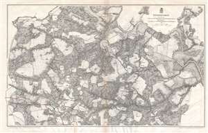
Totopotomoy.
sold
- Digital Map Information
- Suitable for large format printing
- File Size: 27.36 MB
- File Type: ZIP / TIFF
- ICC color profile embedded
- Delivered instantly via download link
This is an 1867 John Weyss and Nathaniel Michler map of the battlefield of Totopotomoy Creek, Virginia. The map depicts the region from the Virginia Central Railroad and Atlee's Station to Mechanicsville and from the Pamunkey River to Washington Academy. Numerous homesteads, farmsteads, churches, and mills are identified, along with Hanover Town, Hawe's Store, and Atlee's Station, which are prominently labeled. Numerous roads traverse the region and the Virginia Central Railroad cuts through the map along the left border. The Pamunkey River snakes its way through the region in the upper left corner. Confederate lines and entrenchments are illustrated in red, while Union troops are noted in blue. (more details)
The first published map of the area around Appomattox Court House - where the U.S. Civil War ended.
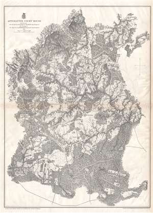
Appomattox Court House.
sold
- Digital Map Information
- Suitable for large format printing
- File Size: 21.1 MB
- File Type: ZIP / TIFF
- ICC color profile embedded
- Delivered instantly via download link
This is an 1867 John Weyss and Nathaniel Michler map of Appomattox Court House, Virginia, where the American Civil War came to a close. The map depicts the region from Appomattox Station on the South Side Railroad to the Jenkins homestead and from the homestead of L. Marshall to Evergreen Station. Beautifully engraved, the area surrounding Appomattox Court House is illustrated in detail, with numerous homesteads noted throughout. Roads traverse the area, along with the South Side Railroad, and rivers and streams are noted. Forests and hills are also included. Troop locations and movements, however, are not depicted. (more details)
Siege of Petersburg including the Battle of Five Forks, forcing the retreat of the Army of Northern Virginia.
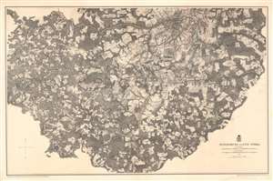
Petersburg and Five Forks.
sold
- Digital Map Information
- Suitable for large format printing
- File Size: 64.72 MB
- File Type: ZIP / TIFF
- ICC color profile embedded
- Delivered instantly via download link
This is an 1867 John Weyss and Nathaniel Michler map of Petersburg and Five Forks, Virginia illustrating the Siege of Petersburg during the American Civil War (1862 - 1865). The map depicts the region from Five Forks to Prince George Court House and from the river road north of the Appomattox River to Malone's Bridge on Rowanty Creek. (more details)
Depicts in detail the battlefield of the Battle of Antietam - the bloodiest day in U.S. history.
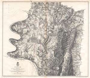
Antietam.
sold
- Digital Map Information
- Suitable for large format printing
- File Size: 19.2 MB
- File Type: ZIP / TIFF
- ICC color profile embedded
- Delivered instantly via download link
This is an 1867 John Weyss and Nathaniel Michler map of the battlefield of Antietam in Maryland. The map depicts the region from the Potomac River to Rohrersville and from Bakersville to just south of the Antietam Iron Works situated at the confluence of Antietam Creek and the Potomac River. (more details)
A detailed map of Harper's Ferry, a key strategic locations during the American Civil War.
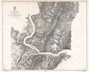
Harper's Ferry.
sold
- Digital Map Information
- Suitable for large format printing
- File Size: 21.51 MB
- File Type: ZIP / TIFF
- ICC color profile embedded
- Delivered instantly via download link
This is an 1867 John Weyss and Nathaniel Michler map of the vicinity of Harper's Ferry, West Virginia. The map depicts the region from just west of the tollgate on the Charlestown Pike to the South Mountains and from the Mullendar farm to Waldro's School House. Harper's Ferry, located at the confluence of the Shenandoah River and the Potomac River, is situated to the left of center. Numerous farmsteads are illustrated and labeled throughout the region, along with mills, schoolhouses, and the town of Bolivar. (more details)
The last major battle fought between the Confederate Army of Northern Virginia and the Union Army of the Potomac.
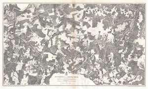
Jetersville and Sailors Creek.
sold
- Digital Map Information
- Suitable for large format printing
- File Size: 31.39 MB
- File Type: ZIP / TIFF
- ICC color profile embedded
- Delivered instantly via download link
This is an 1867 John Weyss and Nathaniel Michler map of the battlefield of Sailor's Creek, Virginia. The map depicts the region from Morton's Ford on the Appomattox River to Flat Creek and from Captain Miller's homestead to the Harper farmstead. Highly detailed, numerous homesteads, mills, farms, and churches are noted throughout, along with the communities of Jetersville and Dentonsville. The Appomattox River traverses the upper left corner, while the Richmond and Danville Railroad cuts through the bottom right corner. The Richmond and Danville is the railroad used by Confederate President Jefferson Davis and his cabinet when they evacuated Richmond on April 2, 1865. (more details)
The battle where Confederate General 'Stonewall' Jackson was killed by friendly fire.
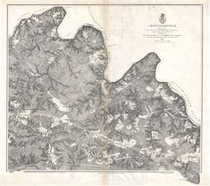
Chancellorville.
sold
- Digital Map Information
- Suitable for large format printing
- File Size: 20.33 MB
- File Type: ZIP / TIFF
- ICC color profile embedded
- Delivered instantly via download link
This is a rare 1867 John Weyss and Nathaniel Michler map of the battlefield of Chancellorsville in Spotsylvania County, Virginia. The map depicts the region from James Taylor's homestead on the Orange Turnpike to the Rappahannock River and from Foster's Ford on the Rapidan River to an unfinished railroad that runs roughly parallel to the Orange Turnpike and Haxel Run. Fortifications are illustrated throughout, although they remain unlabeled, so the viewer is unable to know whether the fortifications are Confederate or Union lines without some prior knowledge. These lines are, most likely, Union Major General Joseph Hooker's defensive lines. Apart from the lack of military notations, the map presents a highly detailed depiction of the region, including numerous homesteads that are identified by the owner's last name, forests, fields, streams, and rivers. The Orange Turnpike nearly divides the region in two, while an unfinished railroad line traverses the map near the bottom border. Chancellorsville itself is situated along the Orange Turnpike in the bottom left quadrant. (more details)
Remembered as one of the most lopsided battles of the war, Union forces suffered over three times the number of casualties as the Confederates during the Battle of Fredericksburg.
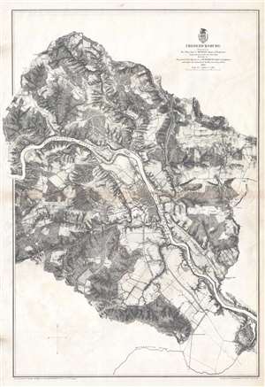
Fredericksburg.
sold
- Digital Map Information
- Suitable for large format printing
- File Size: 21.97 MB
- File Type: ZIP / TIFF
- ICC color profile embedded
- Delivered instantly via download link
This is an 1867 John Weyss and Nathaniel Michler map of the battlefield of Fredericksburg, Virginia. The map depicts the region from the Banks farmstead to the Fitzhugh farmstead and from the Jewett farmstead to the Massaponax River. Highly detailed, numerous homesteads, mills, farms, and churches are noted in the vicinity of the town of Fredericksburg. Fredericksburg itself is situated along the Rappahannock River and the town's street grid is illustrated. The Richmond, Fredericksburg, and Potomac Railroad traverses the map from north to south and crosses the Rappahannock at Fredericksburg. A canal to the northwest of Fredericksburg allows for an easier transit of the section of the Rappahannock around Beck's Island. The Old Richmond Stage Road, Orange Court House Turnpike, and Telegraph Road are illustrated as well. Although the actions of the battle are not explicitly traced, Confederate positions are illustrated in red, while a handful of Union forces are noted in blue. (more details)
One of the most lopsided battles of the Civil War.
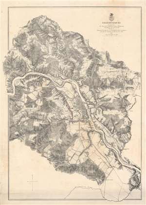
Fredericksburg.
sold
- Digital Map Information
- Suitable for large format printing
- File Size: 59.15 MB
- File Type: ZIP / TIFF
- ICC color profile embedded
- Delivered instantly via download link
This is an 1867 John Weyss and Nathaniel Michler map of the battlefield of Fredericksburg, Virginia. The map depicts the region from the Banks farmstead to the Fitzhugh farmstead and from the Jewett farmstead to the Massaponax River. Highly detailed, numerous homesteads, mills, farms, and churches are noted in the vicinity. Fredericksburg itself is situated along the Rappahannock River and the town's street grid is apparent. The Richmond, Fredericksburg, and Potomac Railroad traverses the map from north to south and crosses the Rappahannock at Fredericksburg. A canal to the northwest of Fredericksburg allows for an easier transit of the Rappahannock around Beck's Island. The Old Richmond Stage Road, Orange Court House Turnpike, and Telegraph Road are illustrated as well. Although the battle is not explicitly traced, Confederate positions are illustrated in red, while a handful of Union forces are noted in blue. (more details)
A battle during Lee's retreat from Richmond concerning two key bridges across the Appomattox River.
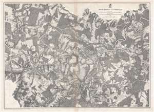
High Bridge and Farmville.
sold
- Digital Map Information
- Suitable for large format printing
- File Size: 28.36 MB
- File Type: ZIP / TIFF
- ICC color profile embedded
- Delivered instantly via download link
This is an 1867 John Weyss and Nathaniel Michler map of the battlefield of High Bridge, Virginia. The map depicts the region from the farmstead of A. Adams to the Parkinson homestead and from the home of H. Burt to Rice's Depot. Numerous homesteads, farmsteads, churches, and mills are identified, along with Farmville and Jamestown (both of which are situated along the Appomattox River), and Rice's Depot. Numerous roads, including the Agola Road, traverse the region and the South Side Railroad crosses most of the map from Rice's Depot near the bottom border to Farmville and then continues on to the left. (more details)
The second major engagement of General Grant's 1864 Overland Campaign.
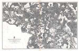
Spottsylvania Court House.
sold
- Digital Map Information
- Suitable for large format printing
- File Size: 24.75 MB
- File Type: ZIP / TIFF
- ICC color profile embedded
- Delivered instantly via download link
This is an 1867 John Weyss and Nathaniel Michler map of the battlefield of Spotsylvania Court House in Virginia, the second battle in General Ulysses S. Grant's 1864 Overland Campaign in Virginia. The map depicts the region from Shady Grove Church to the Abbot homestead and from Piney Branch Church to the Crutchfield farm. (more details)
A major Union campaign led by General Benjamin Butler undertaken (at the same time as Grant's Overland Campaign) that ended in stalemate.
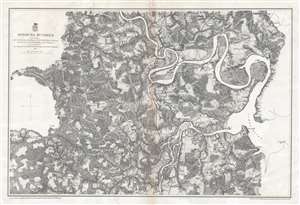
Bermuda Hundred.
sold
- Digital Map Information
- Suitable for large format printing
- File Size: 23.62 MB
- File Type: ZIP / TIFF
- ICC color profile embedded
- Delivered instantly via download link
This is an 1867 John Weyss and Nathaniel Michler map of the Bermuda Hundred Campaign during the American Civil War. The map depicts the region from the Dunnson farm to the Jordan's Point Lighthouse on the James River and from Chaffin's Bluff and Drury's (Drewry's) Bluff to the J. Mason farm. (more details)
A detailed look at the Siege of Petersburg including the Battle of Five Forks, a key victory in forcing the surrender of the Army of Northern Virginia by Robert E. Lee.
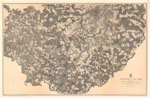
Petersburg and Five Forks.
sold
- Digital Map Information
- Suitable for large format printing
- File Size: 75.14 MB
- File Type: ZIP / TIFF
- ICC color profile embedded
- Delivered instantly via download link
This is an 1867 John Weyss and Nathaniel Michler map of Petersburg and Five Forks, Virginia illustrating the Siege of Petersburg during the American Civil War (1862 - 1865). The map depicts the region from Five Forks to Prince George Court House and from the river road north of the Appomattox River to Malone's Bridge on Rowanty Creek. (more details)
Illustrates in detail Richmond, the capital of the Confederacy, and its environs, along with Confederate and Union fortifications.
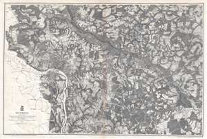
Richmond.
sold
- Digital Map Information
- Suitable for large format printing
- File Size: 27.02 MB
- File Type: ZIP / TIFF
- ICC color profile embedded
- Delivered instantly via download link
This is an 1867 John Weyss and Nathaniel Michler map of Richmond, Virginia, the Capital of the Confederacy, and its environs. The map depicts the region from the Western Plank Road to Hopewell Church and from Yellow Tavern to Willis Methodist Church. Highly detailed, both Confederate and Union fortifications are illustrated, with Confederate lines colored red and Union lines colored blue. The street grid of Richmond and Manchester are illustrated, and farms, mills, churches, and other landmarks are identified throughout. Several railroads, including the Richmond and Fredericksburg, the Richmond and Petersburg, and the Virginia Central are illustrated and labeled, as are the Mechanicsville Turnpike, the Williamsburg Turnpike, and the Brook Turnpike. Cold Harbor, Virginia, the site of the Battle of Cold Harbor, is located only ten miles northeast of Richmond, situating it, and the battle lines, in the upper right quadrant. (more details)
A detailed look at the Siege of Petersburg including the Battle of Five Forks, a key victory in forcing the surrender of the Army of Northern Virginia by Robert E. Lee.
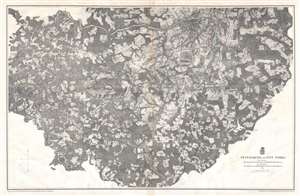
Petersburg and Five Forks.
sold
- Digital Map Information
- Suitable for large format printing
- File Size: 29.42 MB
- File Type: ZIP / TIFF
- ICC color profile embedded
- Delivered instantly via download link
This is an 1867 John Weyss and Nathaniel Michler map of Petersburg and Five Forks, Virginia. The map depicts the region from Five Forks to Prince George Court House and from the river road north of the Appomattox River to Malone's Bridge on Rowanty Creek. (more details)
The last victory for General Robert E. Lee and the Army of Northern Virginia during the American Civil War.
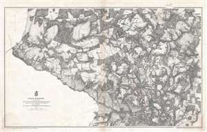
Cold Harbor.
sold
- Digital Map Information
- Suitable for large format printing
- File Size: 24.18 MB
- File Type: ZIP / TIFF
- ICC color profile embedded
- Delivered instantly via download link
This is an 1867 John Weyss and Nathaniel Michler map of the battlefield of Cold Harbor, Virginia. The map depicts the region from the Virginia Central Railroad to Emanuel Church and Black Creek Church and from the Linney Farm to the Taylor farm. The last battle of Union Lieutenant General Ulysses S. Grant's Overland Campaign, the Battle of Cold Harbor proved to be a lopsided victory for General Robert E. Lee and the Confederacy, but it would prove to be his last. Grant had achieved the goal of the Overland Campaign and had forced Lee into defending Richmond, the capital of the Confederacy, and Petersburg behind a network of trenches and other fortifications. Soon after the Battle of Cold Harbor began the Richmond-Petersburg Campaign, more popularly known as the Siege of Petersburg, a nine-month-long episode of trench warfare and small battles, that culminated in the capture of Petersburg and the evacuation of Richmond by the Confederate government. (more details)
The third action in General Grant's 1864 Overland Campaign against General Robert E. Lee.
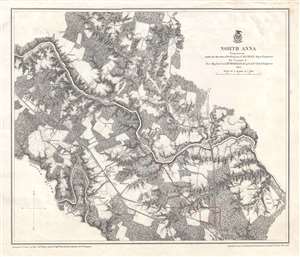
North Anna.
sold
- Digital Map Information
- Suitable for large format printing
- File Size: 11.88 MB
- File Type: ZIP / TIFF
- ICC color profile embedded
- Delivered instantly via download link
This is an 1867 John Weyss and Nathaniel Michler map of the battlefield of North Anna in Virginia, the third battle in General Ulysses S. Grant's 1864 Overland Campaign in Virginia. The map depicts the region from Noel's Station and the Little River to a race course near Major Dowlett's homestead and from Mt. Carmel Church to Hanover Junction. (more details)
The first battle of General Ulysses S. Grant's 1864 Overland Campaign against General Robert E. Lee's Army of Northern Virginia.
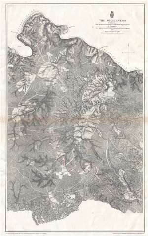
The Wilderness.
sold
- Digital Map Information
- Suitable for large format printing
- File Size: 22.36 MB
- File Type: ZIP / TIFF
- ICC color profile embedded
- Delivered instantly via download link
This is an 1867 John Weyss and Nathaniel Michler map of the battlefield of the Wilderness in Virginia. The map depicts the region from Brook's Ford on the Rapidan River to the Carpenter homestead and from Rapidan River to Miss Billion's homestead. The first battle in General Ulysses S. Grant's Overland Campaign against Robert E. Lee's Army of Northern Virginia, the Battle of the Wilderness ended in a strategic stalemate. Nonetheless, Grant was undeterred and did something no other Union commander had up to that point in the war: he continued on the offensive instead of retreating. By continuing his push deeper into Virginia, even though the Army of the Potomac had suffered catastrophic casualties, Grant won the admiration and support of his soldiers, as they were convinced that the commander of the Army of the Potomac would finally lead them to victory. (more details)
The first battle of General Ulysses S. Grant's 1864 Overland Campaign against General Robert E. Lee's Army of Northern Virginia.
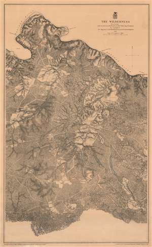
The Wilderness.
sold
- Digital Map Information
- Suitable for large format printing
- File Size: 55.14 MB
- File Type: ZIP / TIFF
- ICC color profile embedded
- Delivered instantly via download link
This is an 1867 John Weyss and Nathaniel Michler map of the battlefield of the Wilderness in Virginia. The map depicts the region from Brook's Ford on the Rapidan River to the Carpenter homestead and from Rapidan River to Miss Billion's homestead. The first battle in General Ulysses S. Grant's Overland Campaign against Robert E. Lee's Army of Northern Virginia, the Battle of the Wilderness ended in a strategic stalemate. Nonetheless, Grant was undeterred and did something no other Union commander had up to that point in the war: he continued on the offensive instead of retreating. By continuing his push deeper into Virginia, even though the Army of the Potomac had suffered catastrophic casualties, Grant won the admiration and support of his soldiers, as they were convinced that the commander of the Army of the Potomac would finally lead them to victory. (more details)
Highlights the areas in which major battles were fought between 1862 and 1865 - including Gettysburg, Antietam, and the Siege of Petersburg.
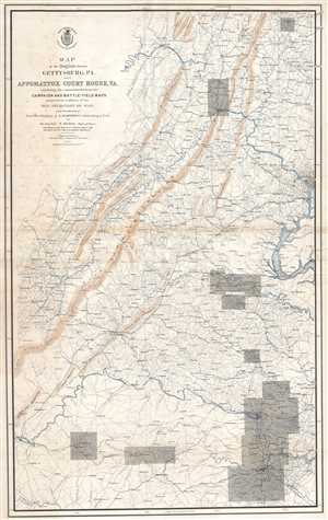
Map of the Region between Gettysburg, PA. and Appomattox Court House, VA. Exhibiting the connection between the Campaign and Battle-Field Maps.
sold
- Digital Map Information
- Suitable for large format printing
- File Size: 27.36 MB
- File Type: ZIP / TIFF
- ICC color profile embedded
- Delivered instantly via download link
This is an 1869 separate-issue Nathaniel Michler map of the eastern United States stretching from Pennsylvania to Virginia marking the locations of major battles during the American Civil War. The map depicts the region from Lynchburg, Virginia to Washington, ... (more details)