
Touring Israel after the Six-Day War.

ישראל / סע וטייל ברחבי ישראל [Israel / Travel and Tour throughout Israel].
sold
A scarce 1970 folding road map of Israel by Mordechai Gabrieli, with prominent advertising for the Delkol (דלקול), a leading purveyor of oil and automotive products. It was produced in the tense period following the Six-Day War, when Israeli troops occupied the Golan Heights, West Bank (including East Jerusalem), and Sinai Peninsula. (more details)
Navigate the waters off the Irish capital.
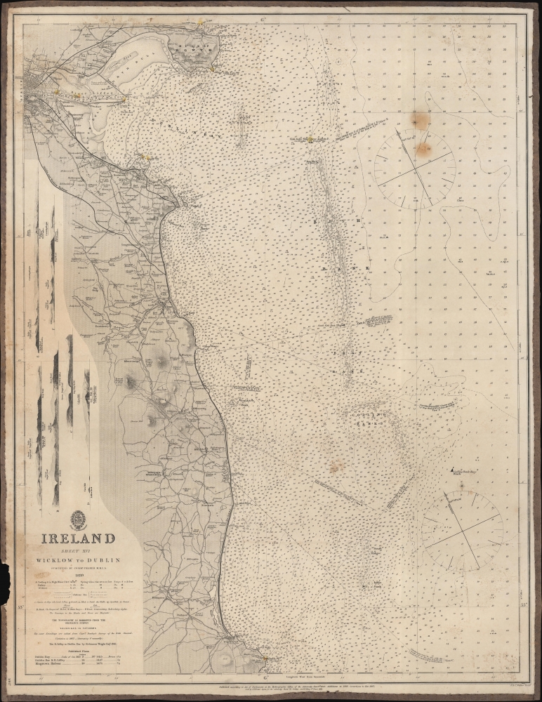
Ireland. Sheet XVI. Wicklow to Dublin.
sold
- Digital Map Information
- Suitable for large format printing
- File Size: 23.14 MB
- File Type: ZIP / TIFF
- ICC color profile embedded
- Delivered instantly via download link
This is an 1862 British Admiralty nautical chart or map of the coast of Ireland from just north of Dublin to Wicklow. (more details)
Significant pre-Revoutionary War map of Manhattan.
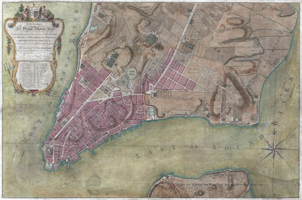
To His Excellency Sr. Henry Moore, Bart. Captain General and Governour in Chief in and over the Province of New York and the Territories depending thereon in America Chancellor and Vice admiral of the same, This Plan of the City of New York, is most HUmbly INscribed, by His Excellency's Most Obedient Servant, Bernd. Ratzen.
sold
- Digital Map Information
- Suitable for large format printing
- DPI: 300
- File Size: 28.36 MB
- File Type: ZIP / TIFF
- ICC color profile embedded
- Delivered instantly via download link
Known as the 'Ratzen Plan,' this is one of the most important, beautiful, and iconic colonial era maps of New York City, offered here in its rare first state. It is the among the most important pre-Revolutionary War maps of Manhattan. (more details)
Classic Dutch Cartes-à-Figures Map of Asia.
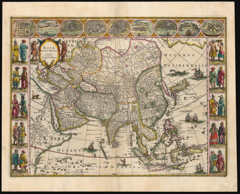
Asia noviter delineata. Auctore Guiljelmo Blaeuw.
sold
- Digital Map Information
- Suitable for large format printing
- Full resolution TIFF file
- ICC color profile embedded
- Delivered instantly via download link
This is a lovely, original-color example of Willem Blaeu's atlas map of Asia. It is one of the most desirable maps of the Dutch Golden Age of mapmaking. It represents a sharp improvement on the maps of Ortelius, Mercator and Hondius, reflecting the strides that the Dutch had made in understanding the geography of the East beginning at the end of the 16th century. The southern coast shows the benefit of the Dutch East India Company's forays to the Spice Islands; the north and east parts of Asia would remain obscure until the latter part of the century. (more details)
New York under the Iroquois.
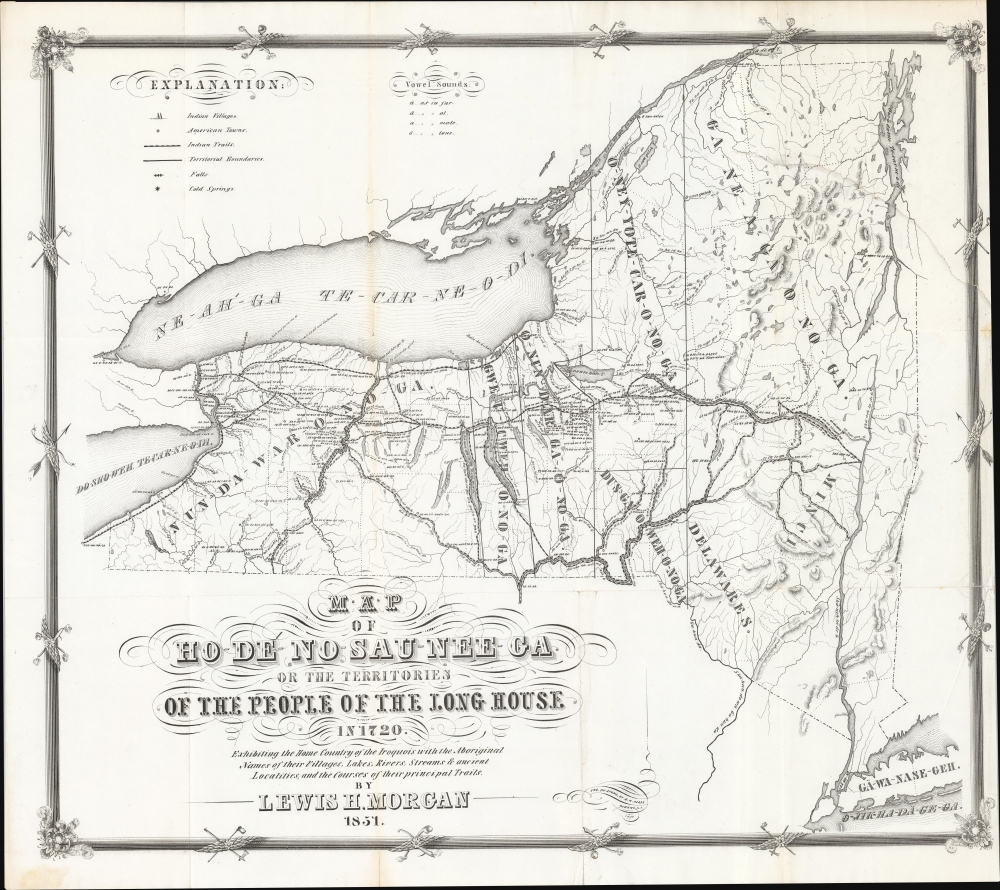
Map of Ho-De'-No-Sau-Nee-Ga or the Territories of the People of the Long House in 1720. Exhibiting the Home Country of the Iroquois with the Aboriginal Names of their Villages, Lakes, River, Streams and Ancient Localities, and the courses of their principal Trails.
sold
- Digital Map Information
- Suitable for large format printing
- DPI: 600
- File Size: 462.83 MB
- File Type: ZIP / TIFF
- ICC color profile embedded
- Delivered instantly via download link
This is the rare 1851 first edition of 'Father of American Anthropology' Lewis Henry Morgan and Seneca Sachem Ely S. Parker's map of New York as it existed under the Iroquois League c. 1720. This novel work is one of the few maps published in the 19th century to directly detail American Indian lands, routes of travel, and language. It is considered the first scientific representation of an American Indian Tribe on a map. (more details)
Relieving the siege of Khartoum.
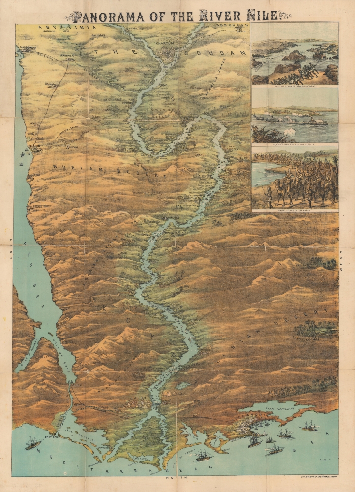
Panorama of the River Nile.
sold
- Digital Map Information
- Suitable for large format printing
- File Size: 122.82 MB
- File Type: ZIP / TIFF
- ICC color profile embedded
- Delivered instantly via download link
An impressive, large-scale chromolithograph bird's-eye view of the Nile River from 1884, published by G. W. Bacon, documenting the Gordon Relief Expedition, an ultimately failed effort to rescue British forces besieged at Khartoum. The expedition captured the attention of the British public in the closing months of 1884 and early 1885 and its failure served as one of the most humbling defeats in the history of the British Empire. (more details)
One of the greatest natural disasters in American history.

The Great Conemaugh-Valley Disaster, - Flood and Fire at Johnstown, PA.
sold
- Digital Map Information
- Suitable for large format printing
- File Size: 44.1 MB
- File Type: ZIP / TIFF
- ICC color profile embedded
- Delivered instantly via download link
A dramatic c. 1889 chromolithograph view of the disastrous Johnstown flood of May 31, 1889, in Johnstown, Pennsylvania. The view depicts the apex of the flood when debris collected against the Johnstown Railroad Bridge burst into flame. This terrifying image was distributed throughout the United States, becoming the primary artery through which knowledge of the flood and its disastrous consequences were disseminated. (more details)
An Ostrich, Elephant, and Alligator walk into the Northwest Passage...
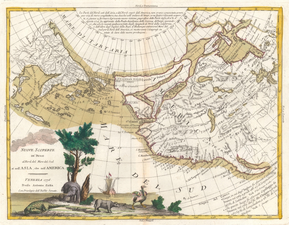
Nuove Scoperte De'Russi al Nord del Mare del Sud si nell'Asia, che nell'America.
sold
- Digital Map Information
- Suitable for large format printing
- DPI: 600
- File Size: 23.82 MB
- File Type: ZIP / TIFF
- ICC color profile embedded
- Delivered instantly via download link
A stunning example of Antonio Zatta's 1776 map of the northwestern parts of America and the northeastern parts of Asia. This map is one of the most sought after and decorative 18th century pre-Cook maps of the Pacific Northwest. (more details)
Taurus from the most important 17th century celestial atlas.

[Taurus].
sold
- Digital Map Information
- Suitable for large format printing
- Full resolution TIFF file
- ICC color profile embedded
- Delivered instantly via download link
This is a beautiful example of Johann Bayer's celestial chart of the zodiacal constellation Taurus, in a finely colored example with gilt highlighting. It was engraved for Bayer's seminal 1603 celestial atlas, Uranometria: omnium asterismorum content schemata, nova methodo delineata, aereis laminis expressa. As the forerunner of all later celestial atlases, the importance and relevance of this work is emphasized by its continued publication throughout the mid-seventeenth-century. (more details)
Oldest building on Princeton's campus.

View of Nassau Hall, Princeton, N. J.
sold
- Digital Map Information
- Suitable for large format printing
- File Size: 27.05 MB
- File Type: ZIP / TIFF
- ICC color profile embedded
- Delivered instantly via download link
This is a c. 1860 F. Childs chromolithograph view of Nassau Hall at Princeton University in Princeton, New Jersey. Nassau Hall appears at center, in the full glory of its 1855 post-fire renovations. (more details)
Native American Historical map by Wounded Sparrow.

A Map-History of American Indian Tribes. This Second Edition is Dedicated to His Memory by His Friend Wounded Swallow.
sold
This is a 1986 Wounded Sparrow / Van Arsdale map of American Indian tribes throughout the United States. It comprises a visual history of American Indians to about 1900. (more details)
A WWII Era map you can, and should, write on.
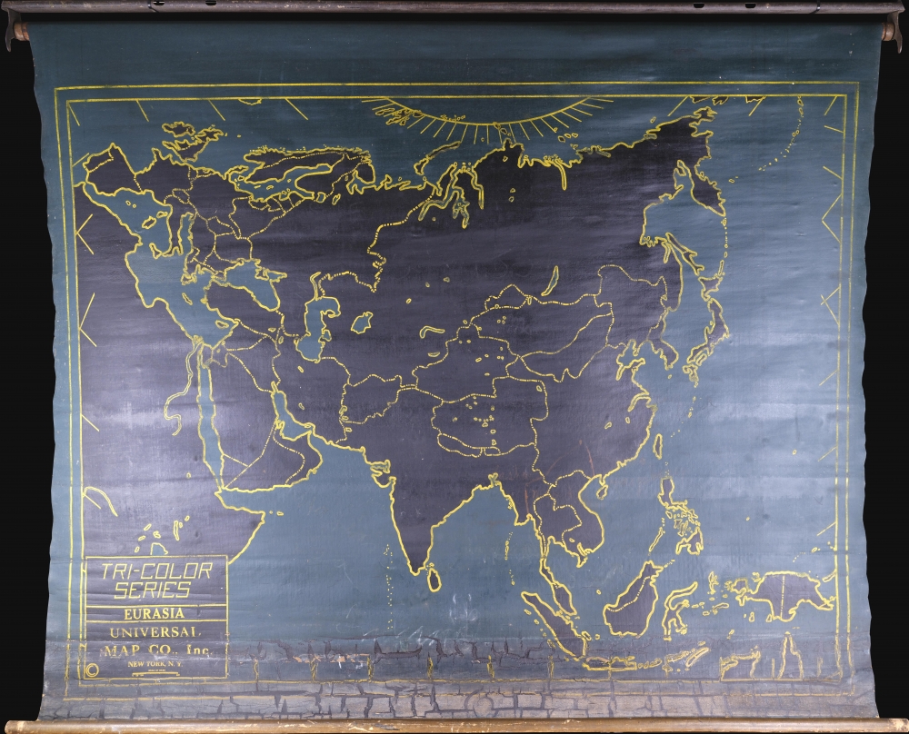
Tri-Color Series. Eurasia.
$950.00
Acquire
- Digital Map Information
- Suitable for large format printing
- Full resolution TIFF file
- ICC color profile embedded
- Delivered instantly via download link
This is a c. 1939 chalkboard map of Asia and Europe. It is a didactic tool designed for schoolroom use - students and teachers could write on the map with chalk then easily wipe it clean. (more details)
Published shortly after the Adirondack Park was created.

Map of the Adirondack Wilderness.
sold
- Digital Map Information
- Suitable for large format printing
- Full resolution TIFF file
- ICC color profile embedded
- Delivered instantly via download link
This is a 1900 Seneca Ray Stoddard map of the Adirondacks, New York, highlighting the Adirondack State Park. This is one of the earliest obtainable commercial maps of the Adirondack Wilderness, published not long after the park's founding, at the height of the Naturalist Movement and the Adirondack Gilded Age. Stoddard's maps are much admired for expressing not only the geography, but also the character of the Adirondacks. (more details)
Pirate Haven to Tourist Heaven.
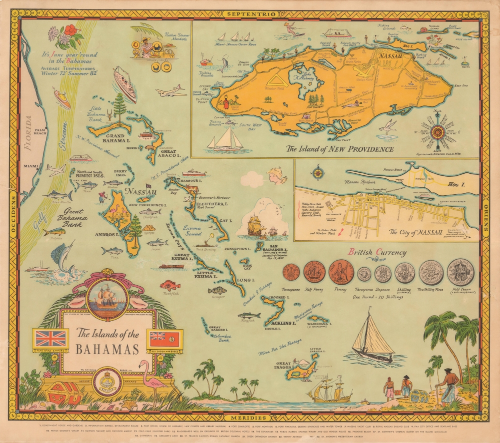
The Islands of the Bahamas.
sold
- Digital Map Information
- Suitable for large format printing
- File Size: 56.73 MB
- File Type: ZIP / TIFF
- ICC color profile embedded
- Delivered instantly via download link
A splendid and vibrant 1951 pictorial map of the Bahamas by George Annand. It highlights elements of the islands' history, economy, and leisure activities, with the likely intention of attracting tourists. (more details)
Macao, Unoccupied but under the Gun.

一万分一澳門市街素圖 / [Basic Street Map of Macao, on a scale of 1:10000].
sold
- Digital Map Information
- Suitable for large format printing
- File Size: 23.28 MB
- File Type: ZIP / TIFF
- ICC color profile embedded
- Delivered instantly via download link
A scarce bilingual (Japanese and Portuguese) 1943 World War II-era city map of Macao produced by the Imperial Japanese Army's General Staff Office. During the war, the city played an important role as a haven for refugees as well as a conduit for weapons and money for the Chinese resistance. It was unique among foreign territories in China for never being occupied by Japan, though Japan did install military 'advisors' who effectively established a protectorate over the territory. (more details)
Basis for the Growth of Tampa Bay.
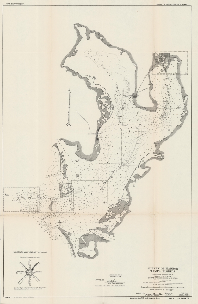
Survey of Harbor Tampa, Florida Index Sheet 1.
sold
- Digital Map Information
- Suitable for large format printing
- File Size: 42.18 MB
- File Type: ZIP / TIFF
- ICC color profile embedded
- Delivered instantly via download link
A 1915 nautical map of Tampa Bay produced by the U.S. Army Corps of Engineers for a Congressional report. The Corps had undertaken multiple projects in this region in the preceding years which allowed Tampa to ship its economic products (phosphate and cigars, primarily) to distant ports, a major factor in the city's growth. (more details)
Channeling Water and Wealth to Tampa.
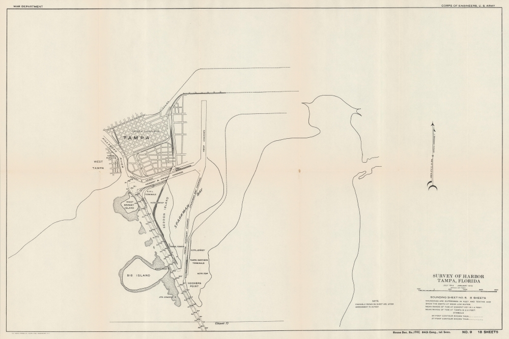
Survey of Harbor Tampa, Florida Sounding Sheet No. 8.
sold
- Digital Map Information
- Suitable for large format printing
- File Size: 31.75 MB
- File Type: ZIP / TIFF
- ICC color profile embedded
- Delivered instantly via download link
A 1915 nautical chart and map of Tampa, Florida, produced by the U.S. Army Corps of Engineers. It demonstrates the dredging and widening of waterways leading to the city, which were essential to the growth of its economy, especially the shipping of phosphate and cigars which were locally produced. (more details)
Get Your Kicks (and Chicken In The Basket) On Route 66.

Legend to Best-Stops.
sold
- Digital Map Information
- Suitable for large format printing
- File Size: 30.48 MB
- File Type: ZIP / TIFF
- ICC color profile embedded
- Delivered instantly via download link
A scarce cartifact, and our next discovery in the series of BestOPS Mapkins: a 1952 map of northern Arizona, printed in two colors on a diner napkin. This 'Mapkin' represents a pictorial icon of the pre-interstate Arizona road trip, focusing specifically on the region along the fabled Route 66 from Gallup, New Mexico to Barstow California. The region covered runs from Phoenix, Arizona in the south, up to the Grand Canyon in the north. (more details)
Romancing the Keys.

Conch Map of the Florida Keys Reefs and Wrecks.
sold
This is a signed example of Jojo Carey's marvelous 1990 pictorial map of the Florida Keys - highlighting reefs, wrecks, and shoals. (more details)
The Ottomans Try to Keep It Together.
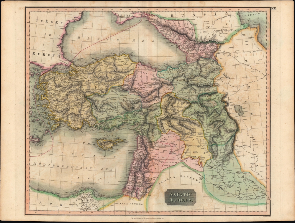
Asiatic Turkey.
sold
- Digital Map Information
- Suitable for large format printing
- Full resolution TIFF file
- ICC color profile embedded
- Delivered instantly via download link
A fine example of John Thomson's vibrant hand-colored 1814 map of 'Asiatic Turkey,' that is, the Asian portion of the Ottoman Empire, published in his New General Atlas in 1815. (more details)