

Veteris Orbis Climata ex Strabo
sold
- Digital Map Information
- Suitable for large format printing
- DPI: 300
- File Size: 3.3 MB
- File Type: ZIP / TIFF
- ICC color profile embedded
- Delivered instantly via download link
A rare and beautifully engraved map of the old world divided into seven climatic zones according to the Ancient Greek geographer Strabo. Depicts Europe, Asia, and northern Africa. Surrounded by seven wind heads. At the northern polar caps is a wonderful ... (more details)
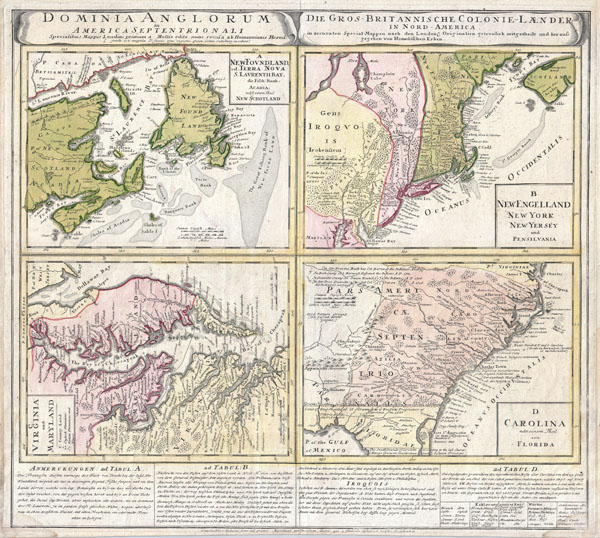
Dominia Anglorum in America Septentrionali. Specialibus Mappis Londini Primum a Mollio Edita, Nunc Recusa ab Homannianis Hered.
sold
- Digital Map Information
- Suitable for large format printing
- DPI: 300
- File Size: 14.69 MB
- File Type: ZIP / TIFF
- ICC color profile embedded
- Delivered instantly via download link
A spectacular example of the Homan Heirs 1737 map of the British Territories in North America. Divided into four separate maps derived from the work of Herman Moll. Covers much of the eastern coast of North America including Nova Scotia & Newfoundland, ... (more details)

Recentissima Asiae Delineatio : Qua Imperia, eius Regna, et Status, Unacum novissimis Russorum detectionibus circa Mare Caspium et Terram Yedso alias dict. per illor. Expedit. et Excursiones, factis sistuntur.
sold
- Digital Map Information
- Suitable for large format printing
- DPI: 300
- File Size: 20.93 MB
- File Type: ZIP / TIFF
- ICC color profile embedded
- Delivered instantly via download link
A rare and attractive 18th century map of Asia by German map publisher Johann Christoph Homann. Covers the entire continent of Asia as well as parts of Europe and northeastern Africa. This is essentially a revised and updated version of J. B. ... (more details)
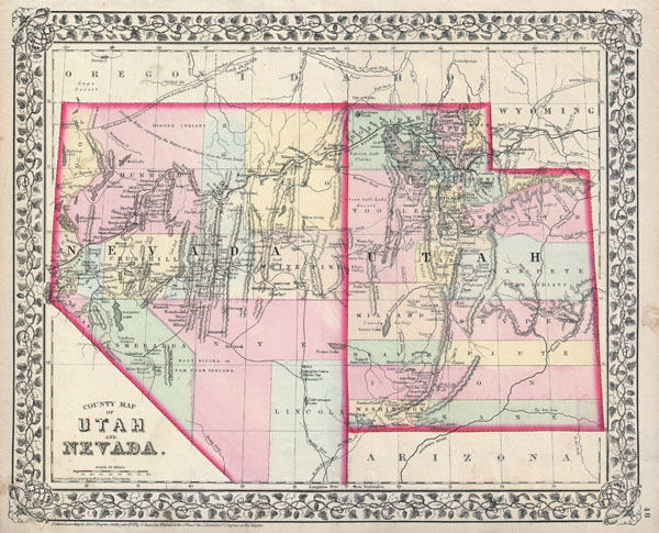
County Map of Utah and Nevada.
sold
- Digital Map Information
- Suitable for large format printing
- File Size: 5.16 MB
- File Type: ZIP / TIFF
- ICC color profile embedded
- Delivered instantly via download link
A beautiful example of S. A. Mitchell Jr.'s 1872 map of Utah and Nevada. Super detail regarding American Indian Tribes, mining areas, and emigrant trails. Denotes both political and geographical details. One of the most attractive American ... (more details)
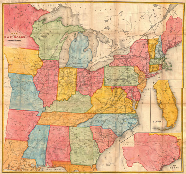
Map of the Railroads in the United States in Operation and Progress to accompany a report from the Treasury Department by Israel D. Andrews.
sold
- Digital Map Information
- Suitable for large format printing
- DPI: 300
- File Size: 7.99 MB
- File Type: ZIP / TIFF
- ICC color profile embedded
- Delivered instantly via download link
A rare and attractive wall sized railroad map of the United States issued in 1852 for Israel de Wolf Andrew's report for the Treasury Department. Depicts from the Great Lakes south to the Gulf of Mexico, and from the states of Iowa, ... (more details)
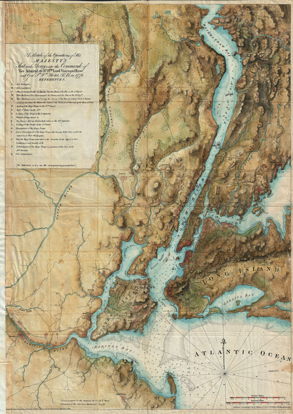
A sketch of the operations of His Majesty's fleet and army : under the command of Vice Admiral the Rt. Hble. Lord Viscount Howe and Genl. Sr. Wm. Howe, K.B., in 1776.
sold
- Digital Map Information
- Suitable for large format printing
- File Size: 22.02 MB
- File Type: ZIP / TIFF
- ICC color profile embedded
- Delivered instantly via download link
A rare and stunning reissue of the Des Barres famous 1777 Map of New York City and Harbor prepared for the 1864 issue of Valentine's Manual of New York. Covers from Sandy Hook northward as far as Haverstraw and the Croton River. ... (more details)
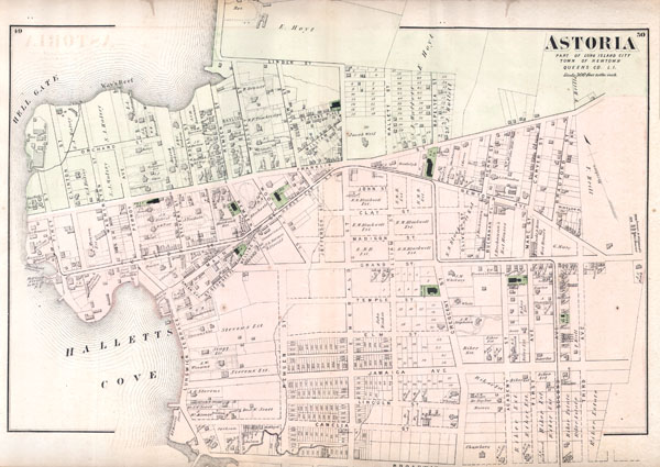
Astoria, Part of Long Island City, Town of Newtown, Queens, Co. L.I.
sold
- Digital Map Information
- Suitable for large format printing
- File Size: 2.37 MB
- File Type: ZIP / TIFF
- ICC color profile embedded
- Delivered instantly via download link
A scarce example of Fredrick W. Beers' map of the southern part of Astoria, Queens, New York. Published in 1873, this magnificent map covers from Hells Gate and Halletts Cove eastward as far as Third Ave and the 'Lorrenz and ... (more details)
The rarest and earliest state of a seminal map.
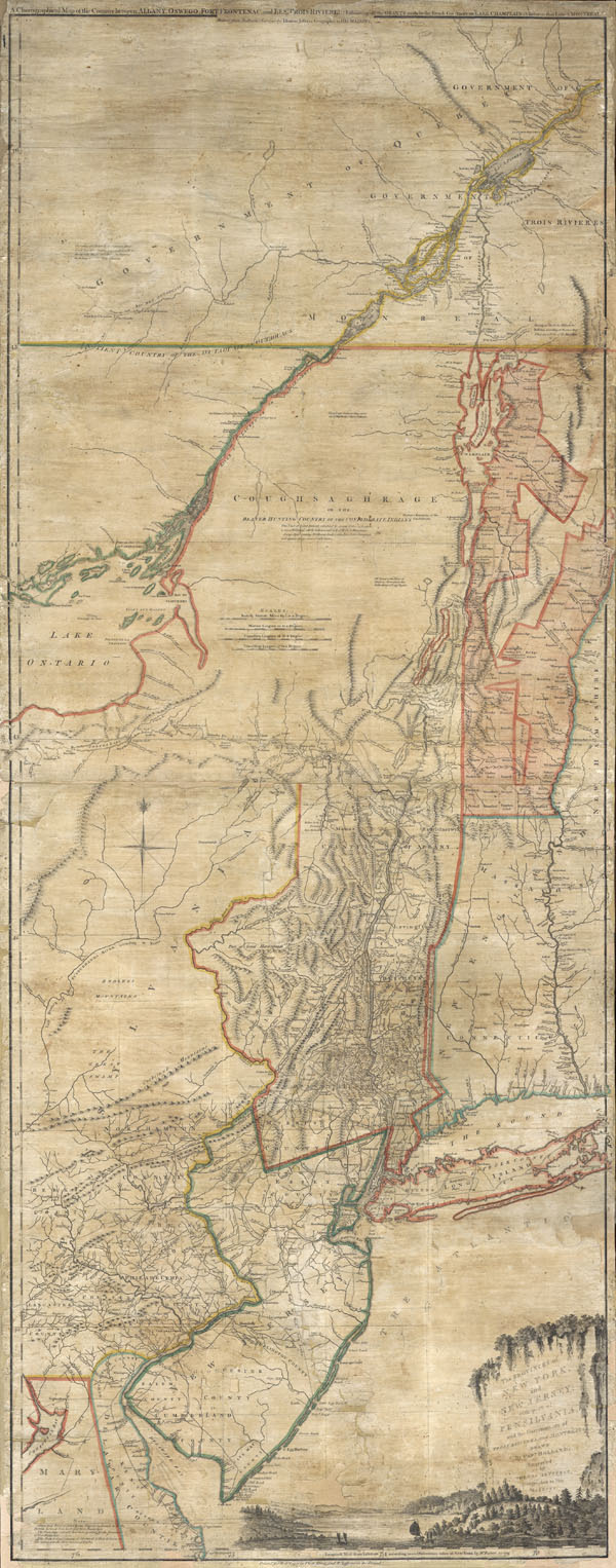
The Provinces of NEW YORK and NEW JERSEY with part of PENSILVANIA, and the Governments of TROIS RIVIERES, and MONTREAL: drawn by Capt. Holland. / A Chorographical Map of the Country between Albany, Oswego, Fort Frontenac, and Les Trois Rivieres; Exhibing all the Grands made by the French Governors on Lake Champlain; & between that Lake & Montreal.
sold
- Digital Map Information
- Suitable for large format printing
- Full resolution TIFF file
- ICC color profile embedded
- Delivered instantly via download link
A first issue first edition example of a seminal map. This is a rare and unusual version of the 1768 first edition of Holland and Jefferys seminal map of New York and New Jersey. Depicts the important trade corridor ... (more details)
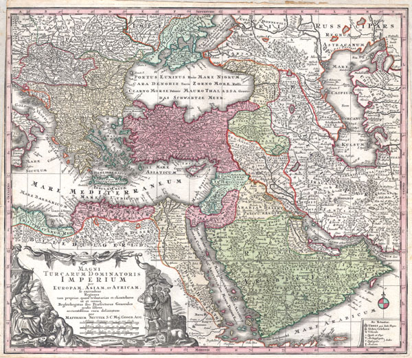
MAGNI TURCARUM DOMINATORIS IMPERIUM per EUROPAM, ASIAM ET AFRICAM, se extendens Regiones tam proprias, quan tributarias et clientelares ut et omnes Beglerbegatus sive Praefecturas Generales oculis sistens accuratissima cura delineatum per MATTHAEUM SEUTTER, S.C. Maj. Geogr. Aug.
sold
- Digital Map Information
- Suitable for large format printing
- DPI: 300
- File Size: 11.5 MB
- File Type: ZIP / TIFF
- ICC color profile embedded
- Delivered instantly via download link
A spectacular c. 1730 map of the Ottoman Empire, including Greece, Turkey, Persia, Egypt and Arabia, by the important Augsburg map publisher Gerog Matthaus Seutter. Depicts from Italy eastward to the Caspian Sea, ... (more details)

Russia.
sold
- Digital Map Information
- Suitable for large format printing
- File Size: 8.85 MB
- File Type: ZIP / TIFF
- ICC color profile embedded
- Delivered instantly via download link
This rare hand colored map of Russia is a copper plate engraving dating to 1856. Produced by the important mid 19th century American map publisher J. H. Colton. Covers the European portion of Russia from the ... (more details)
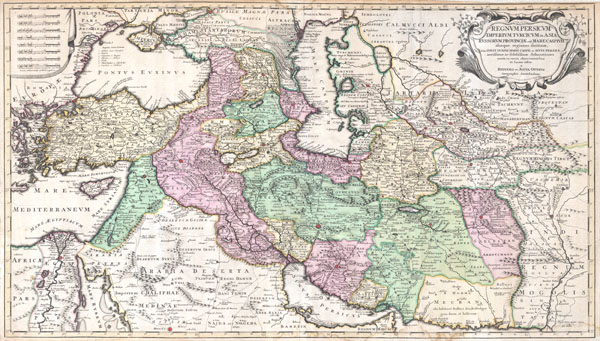
Regnum Persicum Imperium Turcicum in Asia Russorum Provinciae and Mare Caspium.
sold
- Digital Map Information
- Suitable for large format printing
- DPI: 300
- File Size: 15.73 MB
- File Type: ZIP / TIFF
- ICC color profile embedded
- Delivered instantly via download link
A scarce and altogether spectacular c. 1730 map of southwestern Asia, specifically focusing on Persia, by Reiner and Joshua Ottens. Covers from Egypt and Greece eastward to include Turkey, the northern part of ... (more details)
A rare variant on an important early Dutch map of the world.
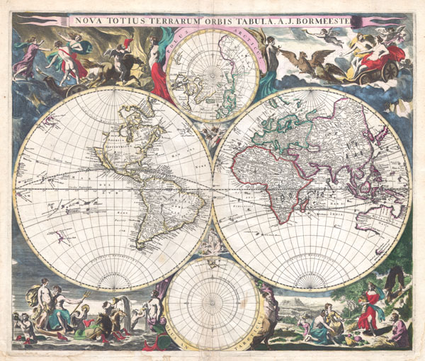
Nova Totius Terrarum Orbis Tabula. A. J. Bormeester.
sold
- Digital Map Information
- Suitable for large format printing
- DPI: 300
- File Size: 9.85 MB
- File Type: ZIP / TIFF
- ICC color profile embedded
- Delivered instantly via download link
An extremely scarce 1684 double hemisphere world by Dutch map publisher Joachim Bormeester. Depicts the world on hemisphere projection with polar projections to the top and bottom of the main map. Surrounded ... (more details)

Carte des Parties Nord et Est de l'Asie qui Comprend les Cotes de la Russie Asiatique le Kamschatka, le Iesso, et les Isles du Japon.
sold
- Digital Map Information
- Suitable for large format printing
- DPI: 300
- File Size: 3.16 MB
- File Type: ZIP / TIFF
- ICC color profile embedded
- Delivered instantly via download link
A map of the Northeast Passage, the northeast coasts of Asia, and the American Northwest. The Northeast Passage, much like American's Northwest Passage, was a long sought after sea route through the Arctic ... (more details)
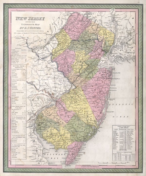
New Jersey reduced from T. Gordon's Map by H. S. Tanner, Published by S. Augustus Mitchell.
sold
- Digital Map Information
- Suitable for large format printing
- DPI: 300
- File Size: 4.17 MB
- File Type: ZIP / TIFF
- ICC color profile embedded
- Delivered instantly via download link
A fine example of Mitchell's c. 1846 map New Jersey. A highly unusual state of this map. In 1846 Mitchell published two editions of the New Universal Atlas , one edition with the Cary and Hart imprint ... (more details)

Map of the United States, and Territories, together with Canada & c.
sold
- Digital Map Information
- Suitable for large format printing
- File Size: 6.71 MB
- File Type: ZIP / TIFF
- ICC color profile embedded
- Delivered instantly via download link
A fine example of Mitchell's 1867 map of the United States. Depicts the entirety of the continental United States along with parts of Canada and Mexico. Shows the country in considerable detail with ... (more details)
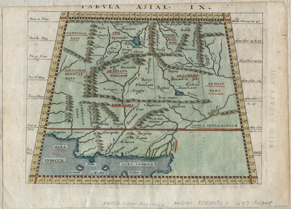
Tabula Asiae IX.
sold
- Digital Map Information
- Suitable for large format printing
- Full resolution TIFF file
- ICC color profile embedded
- Delivered instantly via download link
A scarce and unusual 1597 Ptolemaic map of what constitutes modern day Iran, Pakistan and Afghanistan. Presented on a trapezoidal projection with bold mountain ranges dividing the region. This map ... (more details)
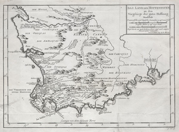
Das Land der Hottentoten an dem Vorgebrige der guten Hoffnung.
sold
- Digital Map Information
- Suitable for large format printing
- Full resolution TIFF file
- ICC color profile embedded
- Delivered instantly via download link
A very scarce example of Bellin's 1747 map of southern Africa and the Cape of Good Hope. Covers from the Bay of St. Helena to Mussel Bay. Dutch settlements appear along the coast line with African ... (more details)
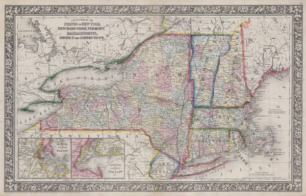
County Map Of The States Of New York, New Hampshire, Vermont. Massachusetts, Rhode Id. And Connecticut.
sold
- Digital Map Information
- Suitable for large format printing
- File Size: 6.76 MB
- File Type: ZIP / TIFF
- ICC color profile embedded
- Delivered instantly via download link
A fine example of Mitchell's 1864 map of New York, Connecticut, Rhode Island, Massachusetts, Vermont and New Hampshire. Depicts the region in considerable detail with notations regarding political ... (more details)
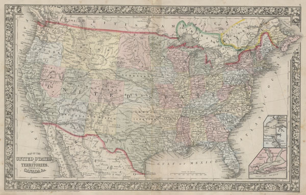
Map of the United States, and Territories, together with Canada & c.
sold
- Digital Map Information
- Suitable for large format printing
- File Size: 6.45 MB
- File Type: ZIP / TIFF
- ICC color profile embedded
- Delivered instantly via download link
A fine example of Mitchell's 1864 map of the United States. Depicts the entirety of the continental United States along with parts of Canada and Mexico. Depicts the country in considerable detail ... (more details)

Map of the World on the Mercator Projection, Exhibiting the American Continent at its Centre.
sold
- Digital Map Information
- Suitable for large format printing
- File Size: 6.14 MB
- File Type: ZIP / TIFF
- ICC color profile embedded
- Delivered instantly via download link
A fine example of Mitchell's 1864 map of the World on Mercator Projection. The American continent is presented at the center of the map. Shows the routes of important explorers including Cook, ... (more details)