
Maritime businesses along Florida's Atlantic and Gulf coasts.
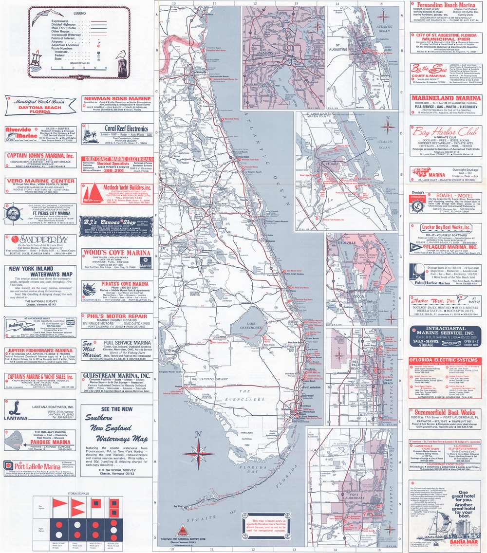
Florida Waterways Map 1979.
sold
This is a 1978 National Survey map of Florida, created as an advertisement for Florida's marinas and other coastal 'facilities'. Eastern Florida appears on the recto and western Florida is printed on the verso. Advertisements promoting marinas, ship electronics sellers, a canvas shop, and a yacht builder, along with several other businesses, occupy approximately half the recto. Red dots bearing corresponding numbers mark businesses. Highways and interstates, along with the Florida Turnpike, are illustrated inland, while cities and towns are labeled throughout. Major cities and tourist destinations, such as Walt Disney World, are labeled in bold. Inset maps detailing Jacksonville, St. Augustine, Stuart, Titusville and the John F. Kennedy Space Center, West Palm Beach, and Fort Lauderdale are situated in the Atlantic to the right of Florida. (more details)
Esso's extremely popular 'upside-down' map created for 'snowbirds'.
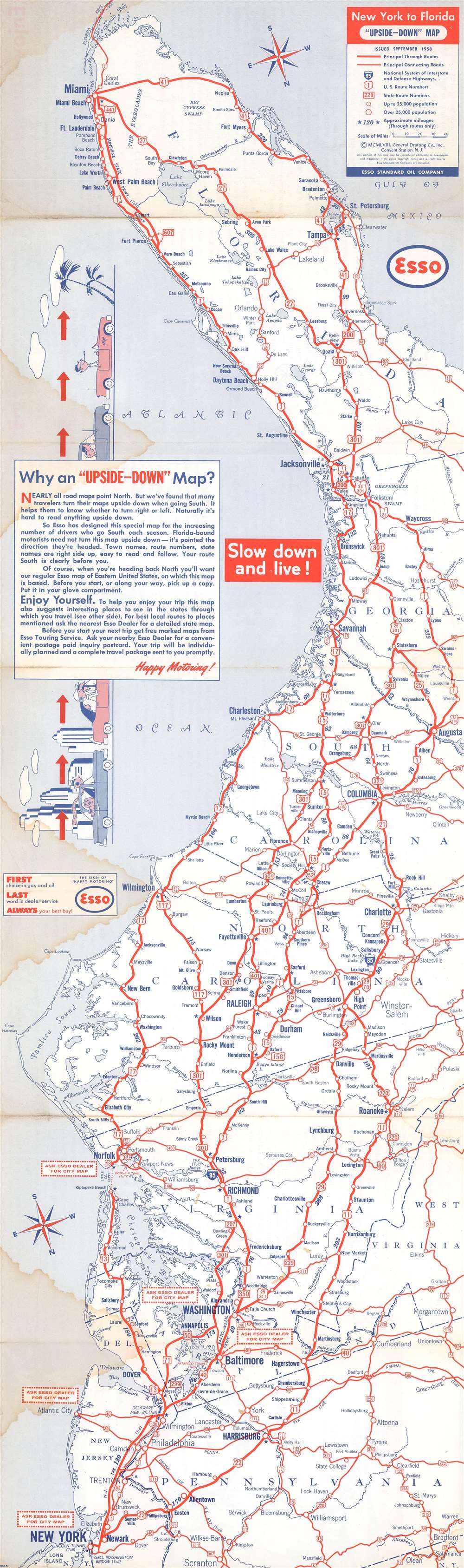
New York to Florida 'Upside-Down' Map.
sold
A map with an unusual concept, this 1958 General Drafting Corporation road map of the east coast of the United States is printed upside-down! Created for 'snowbirds' fleeing New York City for the winter, General Drafting discovered that travelers would turn maps upside-down when traveling south, so it was decided that a map should be created accordingly. Here, the southernmost point, the Florida Keys, appear at the top of the map and New York City at the bottom. As jarring as this may seem at first glance, the idea offers a great deal of practical utility. All text is printed correctly (not upside-down like the map's geography), making it fully functional. Major metropolises, such as New York, Washington, D.C., Baltimore, Richmond, Raleigh, Columbia, Jacksonville, and Miami, are highlighted by large bold block letters, while smaller cities and towns throughout the depicted region are labeled by using progressively smaller, less bolded font. All the highways (both federal and state) are marked by red lines and labeled, making the map, as previously stated, easy to use. (more details)
The second earliest view of Minneapolis.
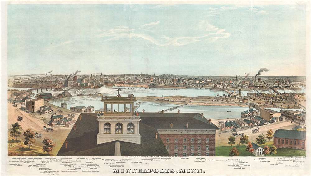
Minneapolis, Minn.
sold
- Digital Map Information
- Suitable for large format printing
- File Size: 29.99 MB
- File Type: ZIP / TIFF
- ICC color profile embedded
- Delivered instantly via download link
A stunning 1874 chromolithograph view of Minneapolis by George H. Ellsbury and Vernon Green. This image is the second earliest specific printed view of Minneapolis, following only the Hageboeck view of 1872. The view looks westwards over the Mississippi River towards Minneapolis. The large building in the foreground sporting an angelic wind vane is the observation tower of the Winslow House Hotel, which in the year this view was issued became the founding structure of Macalester College. The original span of Hennepin Avenue Bridge, the first permanent bridge over the Mississippi River, can be seen crossing the river from Nicollet Island. Eighty-five additional structures are noted beneath the view, including churches, mills, factories, municipal buildings, and hotels. (more details)
World War I propaganda broadside featuring Joan of Arc.

Joan of Arc Saved France. Women of America Save Your Country Buy War Savings Stamps.
sold
- Digital Map Information
- Suitable for large format printing
- File Size: 31.81 MB
- File Type: ZIP / TIFF
- ICC color profile embedded
- Delivered instantly via download link
This is a 1918 Haskell Coffin World War I propaganda broadside depicting Joan of Arc. A portrait of Joan looking toward the future dominates the sheet. Clad in full armor, Joan holds a sword aloft effortlessly, calling on the women to help save America as she had saved France - by buying War Savings Stamps. War Savings Stamps cost ten cents or twenty-five cents each and were mostly bought by women and young children. Raising near $1 billion, the War Savings Stamps program proved successful, although not so much as the Treasury Department hoped. (more details)
Sherman's March to the Sea.
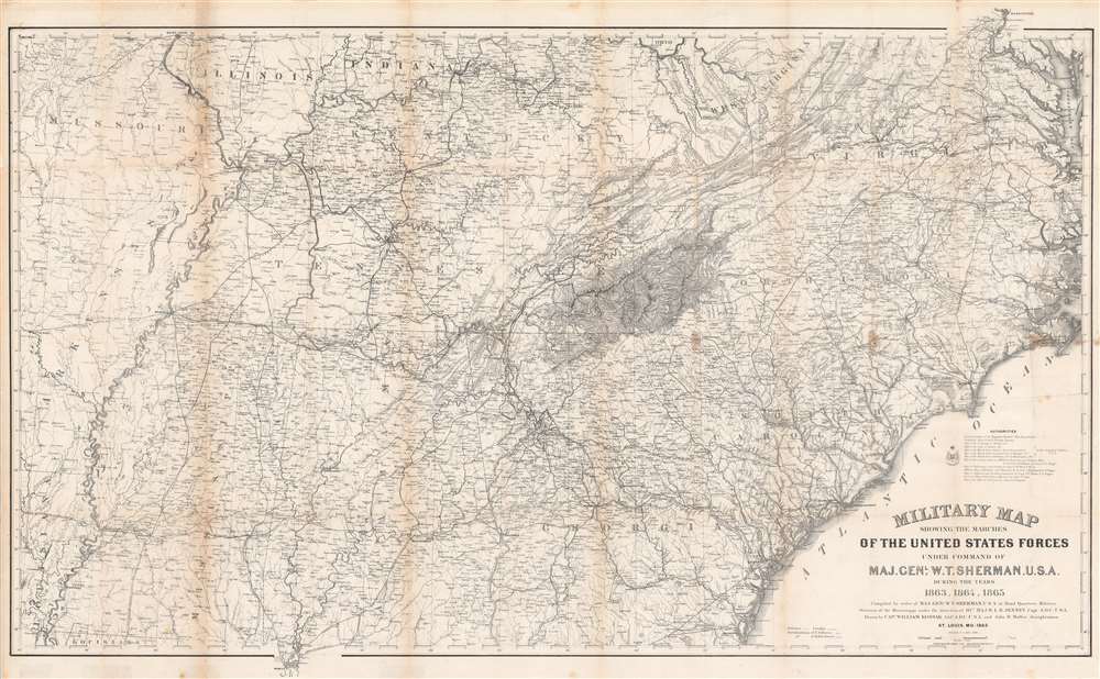
Military Map Showing the Marches of the United States Forces Under Command of Maj. Gen. W. T. Sherman. U.S.A. During the Years 1863, 1864, 1865.
sold
- Digital Map Information
- Suitable for large format printing
- File Size: 83.33 MB
- File Type: ZIP / TIFF
- ICC color profile embedded
- Delivered instantly via download link
This is an 1865 William Kossak map of the southeastern United States tracing the movements of Union Army forces under the command of Major General William Tecumseh Sherman in 1863, 1864, and 1865. Coverage extends from Missouri, Arkansas, and Louisiana to North Carolina and the Atlantic Ocean, and from Missouri, Illinois, Indiana, Kentucky, Ohio, and Virginia to Mobile Bay. Throughout Kossak, and John B. Muller, a draughtsman, achieve astounding detail. The routes followed by General Sherman's units, which include the 4th, 14th, 15th, 16th, 17th, and 20th Army Corps are illustrated. Sherman's movement on Atlanta (a massive operation during which he orchestrated the movements of three separate armies) and Sherman's pursuit of Confederate General John Bell Hood both appear as well. The movements of General J. H. Wilson's Cavalry Corps and those of General G. Stoneman's Cavalry Corps are also depicted, along with Union and Rebel fortifications. (more details)
Outlines and labels the calderas of the Hawaiian volcanoes!
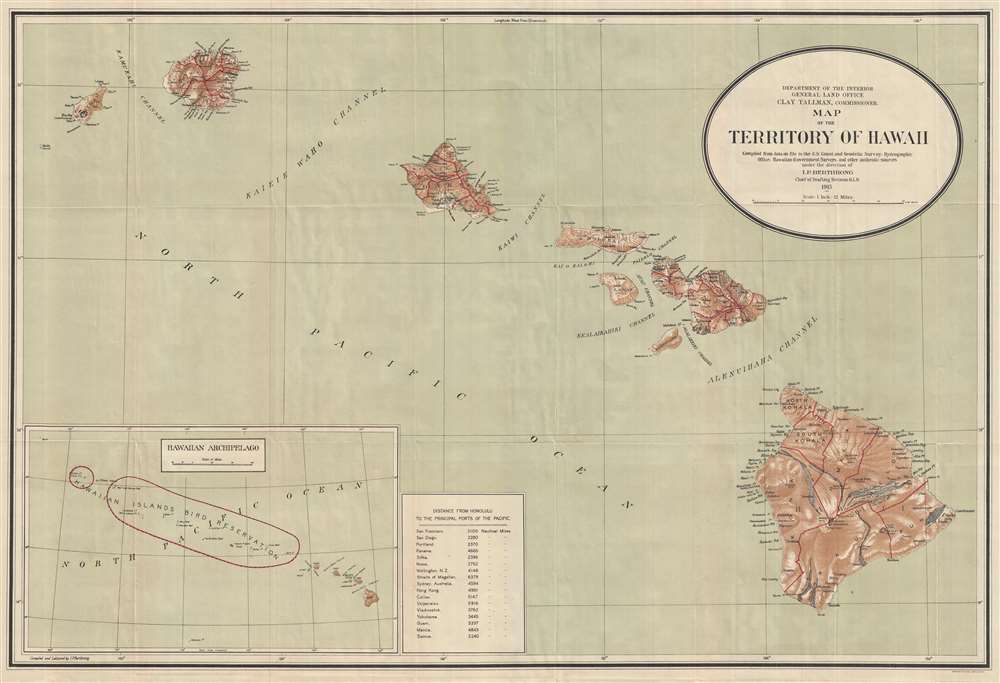
Map of the Territory of Hawaii.
sold
- Digital Map Information
- Suitable for large format printing
- File Size: 8.95 MB
- File Type: ZIP / TIFF
- ICC color profile embedded
- Delivered instantly via download link
This is a 1915 I. P. Berthrong map of Hawaii. The map depicts eight of the Hawaiian Islands: Hawaii, Maui, Kahoolawe, Lanai, Molokai, Oahu, Kauai, and Nihau. Hawaii, Maui, Oahu, and Kauai are divided into regions. On the island of Hawaii, both Kilauea and Mauna Loa are labeled, as well as the Crater of Moku'āweoweo, the summit caldera of Mauna Loa. Several lava flows are illustrated. Rivers and towns are depicted on all the islands, as well as bays and harbors along their coasts. An inset map of the Hawaiian Archipelago is situated at the bottom left. This inset labels the Hawaiian Islands Bird Reservation, which includes all the smaller islands in the archipelago except for Midway Island. A table with distances to the 'principal ports of the Pacific' is placed next to the inset, and includes distances to San Francisco, San Diego, Nome, Wellington, Sydney, Hong Kong, Yokohama, and Manila, among others. (more details)
Published by a Bay Area television station.

kntv…the way to san jose.
sold
This is a 1974 Warren Lamm pictorial bird's-eye view map of the San Francisco Bay Area promoting the KNTV television station of San Jose, California. The view depicts from Sausalito to Salinas and from Hollister to the Pacific. Wonderfully illustrated, San Francisco, Oakland, and San Jose are among the highlighted cities. Palo Alto, San Mateo, Berkeley, Capitola, Santa Cruz, Monterey, and Salinas are also labeled, as are numerous others. Every city is illustrated by its most famous landmarks: San Francisco by streetcars, Berkeley by the University of California, Palo Alto by Stanford University, and, of course, San Jose by a gigantic KNTV sign. The Golden Gate Bridge and the Oakland Bay Bridge, regional landmarks and engineering marvels, are also illustrated. Orange hills in the background round out the piece's fantastic aesthetic. (more details)
Striking view of an iconic symbol of France.

Arc de Triomphe de l'Étoile. Côté de Paris.
sold
- Digital Map Information
- Suitable for large format printing
- Full resolution TIFF file
- ICC color profile embedded
- Delivered instantly via download link
This is a c. 1845 Jules Arnout view of the Arc de Triomphe in Paris, France. Illustrating Arc facing the Champs-Élysées slightly from the left, one can almost discern the left side of the Arc, along with part of the interior. La Départ de 1792 and Le Triomphe de 1810 are the two sculptural groups on the Arc's pillars seen here, along with the three of the six reliefs engraved on this side. (more details)
One of the first views of the Madeleine after it was consecrated as a church in 1845.

Église de la Madeleine.
sold
- Digital Map Information
- Suitable for large format printing
- Full resolution TIFF file
- ICC color profile embedded
- Delivered instantly via download link
This is a c. 1845 Jean-Baptiste Arnout view of the église de la Madeleine in Paris, France. A beautiful piece, the Madeleine, situated on the Place de la Madeleine in Paris's 8th arrondissement, is illustrated from a slightly off-center perspective, allowing for a lovely illustration of Corinthian columns along the side. Parisians in carriages, on horseback, and on foot traverse the Place de la Madeleine and numerous individuals climb the steps into the church. The history of the Madeleine is one that encapsulates the many political changes in France during the late 18th and early 19th centuries. (more details)
Pictorial map of Moosehead Lake.

Moosehead Lake in Maine. Gateway to the Largest of Maine's Unspoiled Areas.
sold
This is a 1953 Luther S. Phillips pictorial map of Moosehead Lake, Maine. Moosehead Lake dominates, with coves, bays, and the larger islands illustrated and labeled. Depth soundings (in feet) are indicated throughout. Towns around the lake, including Rockwood and Greenville, are identified by banners. Two scrolls, one along the left border and the other along the bottom border, numerically identify locations within Rockwood and Greenville, all of which are also marked on the map. Camps, inns, and other locations are identified along the banks of Moosehead Lake as well as in other parts of the region. Pictorial vignettes highlight outdoor activities popular in the region, such as fishing and canoeing, as well as the area's wildlife, including deer and black bear. A moose head adorns the compass rose situated near the right border. Illustrations of the leaves of some trees native to the region create a charming pictorial border, with illustrations of fish, geese, and moose appearing as well. (more details)
A classic view of Boston, Boston Harbor, and Cape Cod.

Bird's Eye View of Boston Harbor and South Shore to Provincetown Showing Steamboat Routes.
sold
- Digital Map Information
- Suitable for large format printing
- Full resolution TIFF file
- ICC color profile embedded
- Delivered instantly via download link
A remarkable chromolithograph map and view of Boston Harbor from Boston to Provincetown - issued for sale on steamships and passenger terminals on the Boston-Provincetown line. The view includes all of Cape Cod Bay, Quincy Bay, and Dorchester Bay, with the communities of Boston, East Boston, South Boston, Dorchester, Quincy, Hough's Neck, Mingham, Nantucket, Duxbury, Plymouth, Cohasset, Scituate, and Provincetown noted. Also notes many of the islands in Boston Harbor including Moon Island, Spectacle Island, Thomson's Island, Long Island, Governor's Island, and many others. Ferry and steamboat routes are noted. Smoke rises from Boston's many manufactories. Today such might be construed as symbol of pollution and urban defilement, but when this view was printed, busy smokestacks were symbols of commercial prosperity and industrial optimism. (more details)
The most important map of the Philippines, in the reduced 'B' variant. Engraved by a Philippine and printed in the Manila.
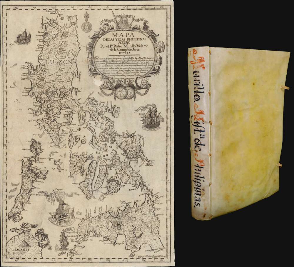
Mapa de Las Yslas Philipinas Hecho Por el Pe. Pedro Murillo Velarde de Compa. de Jesus.
sold
The first edition of Pedro Murillo Velarde's seminal 1749 history of the Philippines, complete with the desirable 1744 Bagay reduction of the 1734 Murillo-Bagay wall map of the Philippines. As a whole, the work is considered one of the most important productions in the history of Philippine printing and a unique Spanish-Philippine collaboration. The map is of particular significance, being the second major map of the Philippines published in the Philippines, engraved by the same hand that engraved the 1734 wall map, but with updates and revisions reflecting 10 years of discovery and development. (more details)
America's first spa resort and National Park.
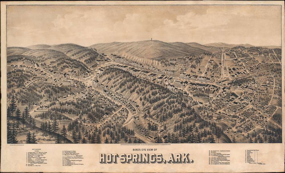
Hot Springs, Ark.
sold
- Digital Map Information
- Suitable for large format printing
- File Size: 31.72 MB
- File Type: ZIP / TIFF
- ICC color profile embedded
- Delivered instantly via download link
An exceptionally rare 1888 two-color chromolithograph bird's-eye view map of Hot Springs, Arkansas - arguably American's first national park and spa city. The view looks east on Hot Springs, possibly from a high point on nearby Sugarloaf Mountain - now part of Hot Springs National Park. Central Avenue, with its bath houses and grand hotels, cuts laterally across the page. Eleven bath houses are noted and keyed alphabetically in the lower right - curiously, they are lettered A-M, but 'I' and 'J' have been omitted. In addition, some 33 other locations, ranging from hotels to stationers and jewelers, are noted and keyed numerically. In the background, the wooden observation tower built in 1877 on top of Hot Springs Mountain by local mill owner Enoch Woolman is identifiable - this was replaced by the current metal tower in 1906. (more details)
Propaganda for Spotswood's settlement of Germans in Virginia.

Virginia Marylandia et Carolina in America Septentrionali Britannorum industria excultae…
sold
- Digital Map Information
- Suitable for large format printing
- Full resolution TIFF file
- ICC color profile embedded
- Delivered instantly via download link
A very handsome example of Johann Baptist Homann's c. 1715 map of Virginia, Carolina, Maryland, and New Jersey; considered one of the most important and decorative maps of this region to appear in the 18th century. Homann drew this map to advocate for Virginia Lieutenant-Governor Alexander Spotswood's 1714 - 1717 plan to settle the little-known interior of Virginia with German immigrants. Shown here is the first mapping of 'Germantown Teutsche Statt' (Germanna) on the Rapidan River, a fork of the Rappahanock River, Fort Christanna (Christ Anna Fort) on the Makharing River, and 'Miester Krugs Plantasie' on the James River. Omission of Spotswood's connection to this map have long led it to being misunderstood or outright dismissed by scholars. Coverage extends from New York City and Long Island south along the Atlantic Cost as far as modern-day Georgia, and as far west as Lake Erie. (more details)
Bustling but bucolic capital city.

City of Concord. N.H. From the High Bluff about 80 Rods North East of Free Bridge, by Henry P. Moore, Concord.
sold
- Digital Map Information
- Suitable for large format printing
- File Size: 28 MB
- File Type: ZIP / TIFF
- ICC color profile embedded
- Delivered instantly via download link
This is a rare 1855 Henry P. Moore / John H. Bufford bird's-eye view of Concord, New Hampshire. The view looks on Concord from a high point to the east, across the Merrimack River. The former covered bridge, what is now Loudon Road, crosses the Merrimack to intersect with the train station. Several churches and the old city hall are evident in the mid-ground, while in the background, the rolling foothills of the White Mountains are just discernible. Several smokestacks and large mills hint at economic prosperity despite the idyllic setting. (more details)
Continuing effort to Discover, or failing that to Suggest, a Northwest Passage.

Nouvelle carte des parties, où l'on a cherche le passage de nord-ouest dans les années 1746 et 1747.
sold
- Digital Map Information
- Suitable for large format printing
- Full resolution TIFF file
- ICC color profile embedded
- Delivered instantly via download link
This is the rare, French edition of Henry Ellis' A New Chart of the Parts where a Northwest Passage was Sought in the Years 1746 and 1747. This map was included in the French translation of Ellis' A Voyage to Hudson's - Bay, which chronicled his journey - largely on behalf of Arthur Dobbs - to northern and Maritime Canada in order to discover the Northwest Passage, which Dobbs believed had been kept hidden by the machinations of the Hudson's Bay Company. (more details)
Stanford and the University of California Berkeley.

Within the Golden Gate.
sold
- Digital Map Information
- Suitable for large format printing
- Full resolution TIFF file
- ICC color profile embedded
- Delivered instantly via download link
This is a c. 1945 Ray Sullivan pictorial view or map of the San Francisco Bay Area, California. Overlooking the Bay Area from a fictional point above the Pacific Ocean, the view illustrates the region from north of Sonoma County south to Gilroy and east as far as Antioch. Sullivan uses color to identify four different 'economic' zones: recreational (pink), industrial (orange), agricultural (green), and residential (gray). Ranches, farms, hunting areas, and the Calistoga Hot Springs appear in the inland agricultural areas. The recreational zone is confined to the coast and the Russian River valley. Historic missions, vineyards, and the Muir Woods are identified within this region. The industrial areas appear along the shores of San Francisco Bay, Suisun Bay, and Grizzly Bay, and shipyards, oil refineries, and the Pan American Airbase appear here. The residential zones are in San Francisco, Palo Alto, Santa Clara, and Oakland. The region's most celebrated institutions, including the University of California Berkeley, Stanford University, and Mills College, are all identified. (more details)
First lithograph map of Guzarat and the region around Mumbai, India.
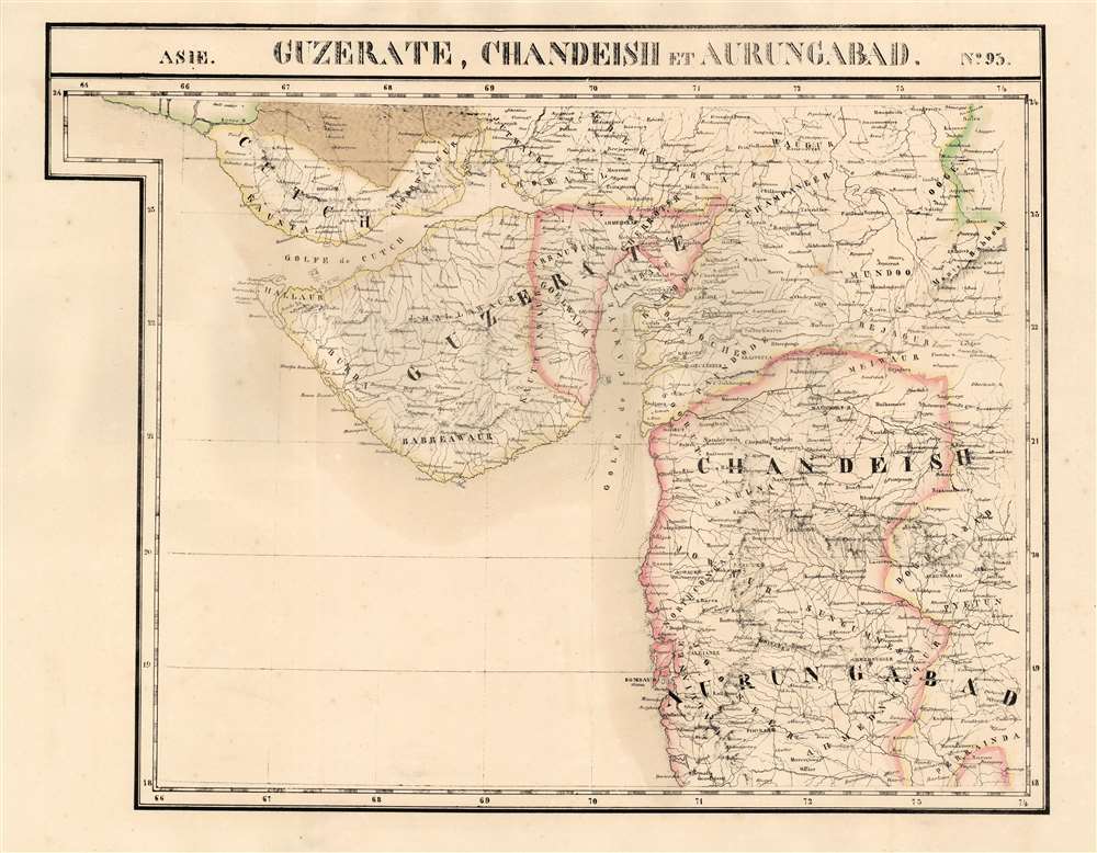
Guzerate, Chandeish et Aurungabad. Asie no. 93.
sold
- Digital Map Information
- Suitable for large format printing
- Full resolution TIFF file
- ICC color profile embedded
- Delivered instantly via download link
This is the 1827 Vandermaelen map of the Indian province of Gujarat, and the coastal part of what is now Maharashtra. It is the first large-scale atlas map to focus on the area, and the first to be executed in lithography. It includes the cities of Mumbai (Bombay on the map,) Surat (Soorut,) and Bhuj (Bhooj.) In the north, it shows part of the Great Rann of Kutch (the massive salt marsh in the Thar Desert) and extends as far south as Mhasala (Mheysala). The eastern reaches of the map include the cities of Ahmednagar, Aurangabad, and Indore in Madhya Pradesh. Topography is pictorial, illustrating the mountains and wetlands with hachures. Vandermaelen appears to have drawn heavily, but not universally, from the maps of Aaron Arrowsmith to inform his work here. (more details)
Stanley Turner's first World War II 'Dated Events' map.
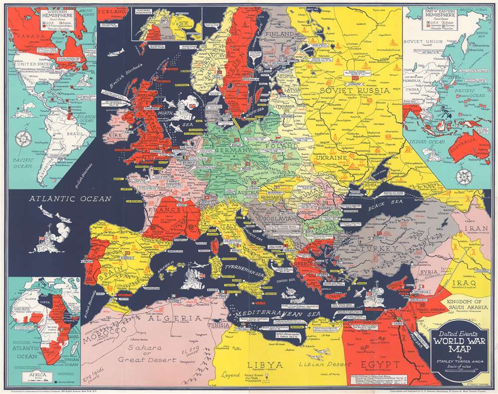
Dated Events World War Map.
sold
- Digital Map Information
- Suitable for large format printing
- File Size: 23.82 MB
- File Type: ZIP / TIFF
- ICC color profile embedded
- Delivered instantly via download link
This is a 1941 Stanley Francis Turner map of Europe during World War II (1939 - 1945), likely Turner's first 'Dated Events' map. This map was issued in late May or early June, based on the events noted. Text boxes mark events, including combat actions and declarations of war, beginning with the 1938 Anschluss. Icons illustrate areas rich in resources, including steel, wheat, coal, and iron - valuable to the war effort on both sides. France is divided into the Occupied Zone and the Unoccupied Zone. (more details)
New York's world famous theaters, including Lincoln Center and the Metropolitan Opera.
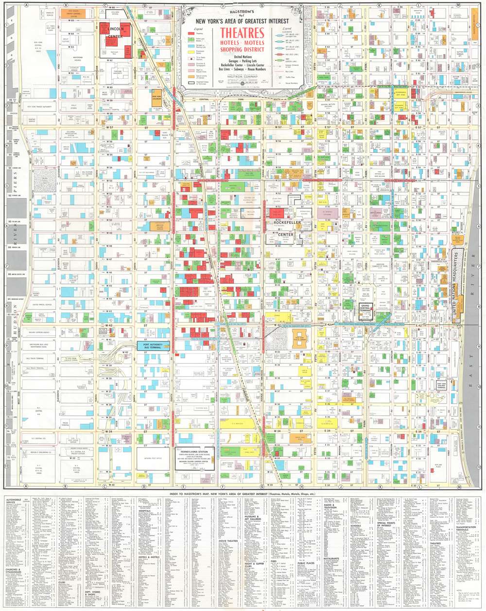
Hagstrom's Map of New York Area of Greatest Interest: Theatres, Hotels, Motels, Shopping District
sold
This is a c. 1966 Hagstrom map of Midtown Manhattan highlighting the Theatre District and its many theatres. The map depicts the city from the West Side Highway and the Hudson River Piers to the East River and from West 66th Street, Central Park, and East 66th Street to 30th Street. Although myriad buildings are illustrated, not all the city blocks are filled. Theatres, hotels and motels, garages or parking lots, prominent stores, tv or radio stations, churches and synagogues, night or supper clubs, and special points of interest are shaded using various colors to allow for easy differentiation and identification. (more details)