
The height of Greenwich Village as a Bohemian Mecca.
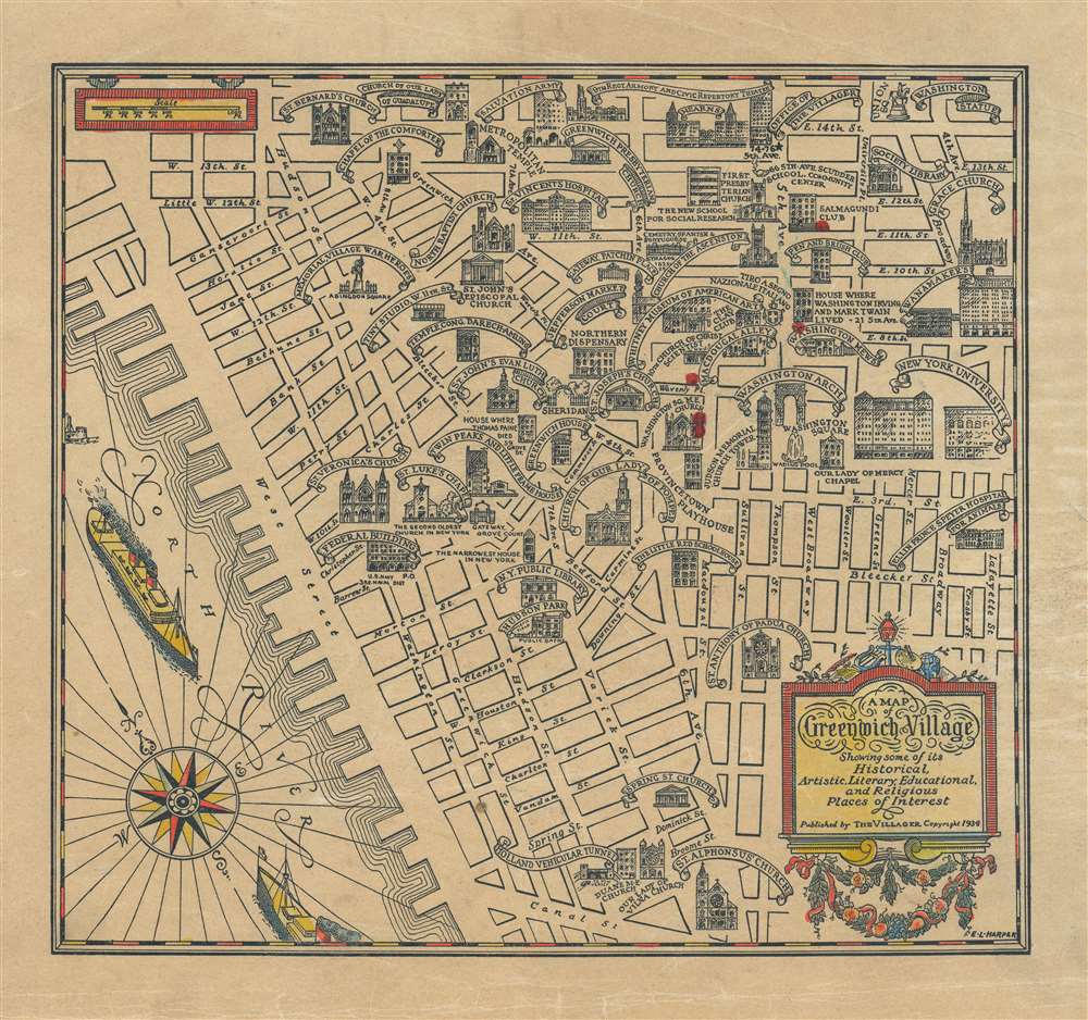
A Map of Greenwich Village Showing some of its Historical, Artistic, Literary, Educational, and Religious Places of Interest.
sold
- Digital Map Information
- Suitable for large format printing
- File Size: 10.48 MB
- File Type: ZIP / TIFF
- ICC color profile embedded
- Delivered instantly via download link
This is a 1934 E. L. Harper pictorial map of Greenwich Village. The map depicts this New York City neighborhood from the North (Hudson) River to Lafayette Street and from East 14th Street to Canal Street. Highly detailed, each of the streets in the neighborhood is labeled, along with numerous locations illustrated in profile. Nearly two dozen different places of worship are depicted, including Grace Church, the Church of Our Lady of Pompeii, and St. Bernard's Church. New York University and the Washington Mews are also illustrated and labeled, along with Washington Square and the Washington Arch. The original Whitney Museum of American Art is included, as well as the New York Public Library and the entrance to the 'Holland Vehicular Tunnel'. (more details)
First edition chart of Boston Harbor.
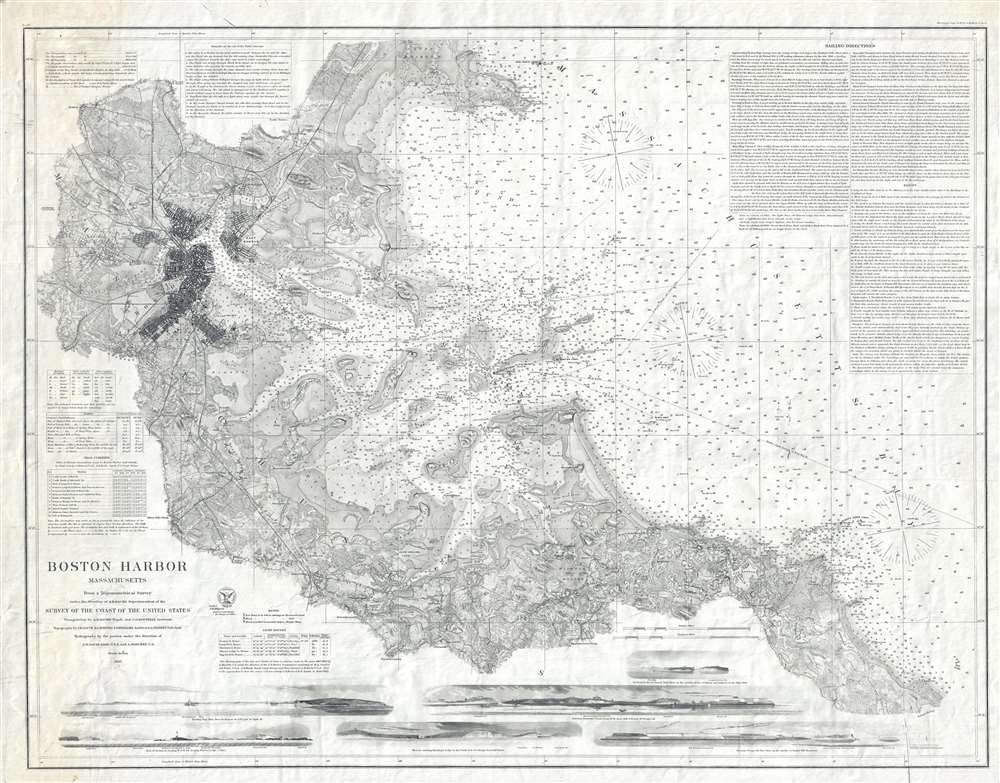
Boston Harbor Massachusetts.
sold
- Digital Map Information
- Suitable for large format printing
- File Size: 24.24 MB
- File Type: ZIP / TIFF
- ICC color profile embedded
- Delivered instantly via download link
A fine separate issue first edition of the 1867 United States Coast Survey nautical chart or maritime map of Boston Harbor. Depicting Boston Harbor from Medford and Cambridge Observatory to Massachusetts Bay and from Lynn Harbor to Weymouth Landing, this beautiful map represents the 'end of an era' for the United States Coast Survey. (more details)
The 'Treasure Scene' in the Florida Keys.

Treasure Sites of the Lower Keys. / Treasure Sites of the Upper Keys.
sold
A set fascinating maps illustrating the sites of discovered and suspected pirate treasure in and around the Florida Keys. The maps were drawn and published by the well-known and controversial Florida treasure Hunter L. Frank Hudson. Collectively the maps illustrate some 65 sites covering from Key Largo to Key West. Sites are numerically keyed explanations around the maps. In addition, there is a key to 'Pirate Tre Markings'. While the scholarship is dubious and unsupported, these maps provide a fascinating look at the Keys 'Treasure Scene'. (more details)
A rare promotional map of Marathon, Florida.

Realtyrama Map of Marathon in the fabulous Florida Keys...
sold
This is a 1959 Robert J. Philpott and Realtyrama map of Marathon, Florida. Depicting from Knight Key Channel to Fat Deer Key, motels, beaches, the Sombrero Golf Course, Marathon Airport, and of course Realtyrama are all identified. Depth soundings (given in feet) surround the keys and provide potential fishermen and pleasure cruisers with some idea of what they face. Printed photographs of a 'tropical home' and a modern airliner decorate the map, along with illustrations of people snorkeling and big game fishing. Indexes of points of interest, streets, accommodations, restaurants, and services are included in the bottom half of the sheet, along with printed photographs of people fishing, boating, and generally enjoying Florida's weather. Advertisements for local businesses fill the verso. (more details)
Reviving enthusiasm for French food and culture after World War II.
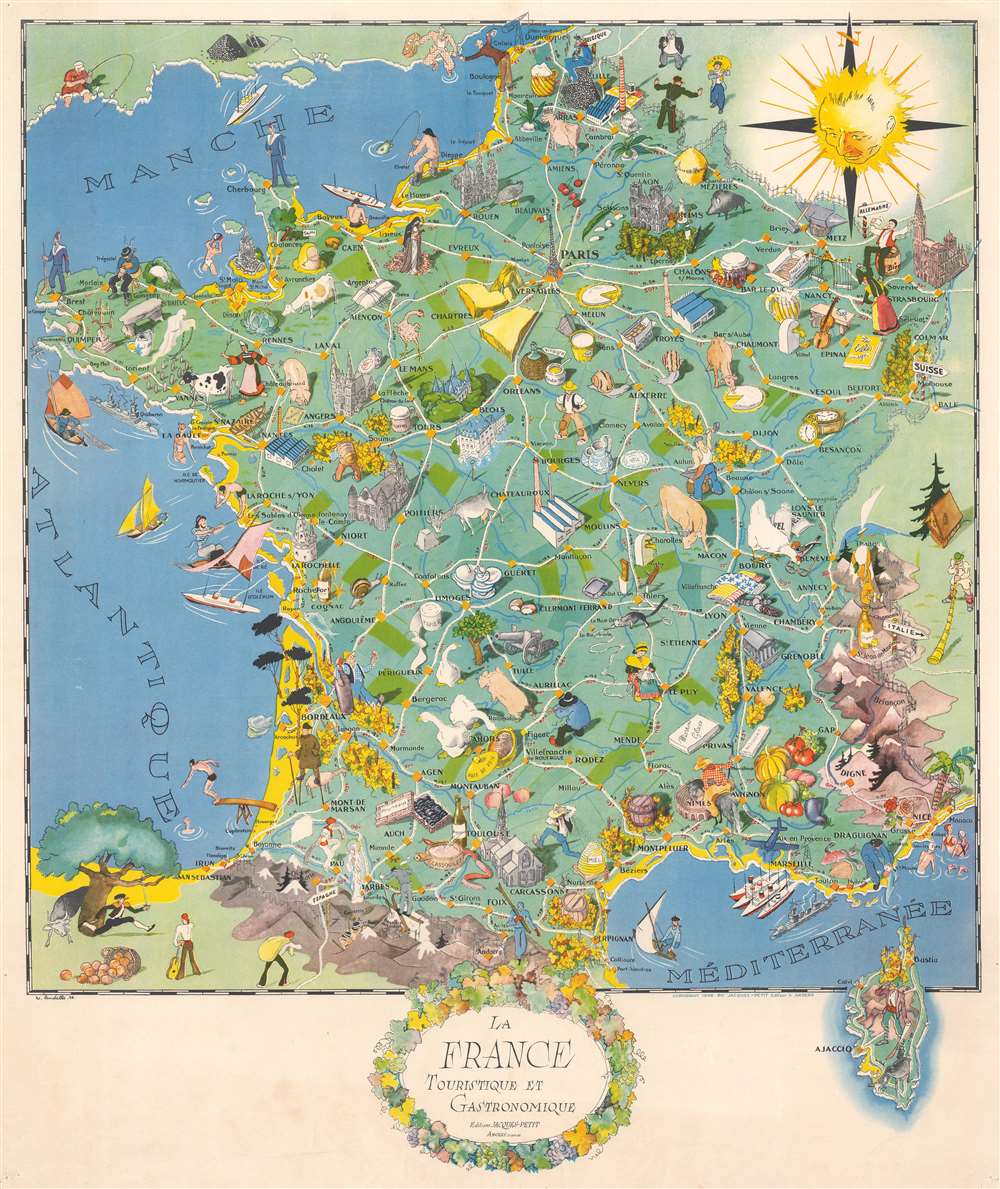
La France Touristique et Gastronomique.
sold
- Digital Map Information
- Suitable for large format printing
- File Size: 35.14 MB
- File Type: ZIP / TIFF
- ICC color profile embedded
- Delivered instantly via download link
This is a 1948 Willy Landelle pictorial map of France celebrating the country's gastronomic and touristic wonders. The map follows shortly after World War II (1939 - 1945), a period where France, devastated by the war, was eager to rebuild is touristic and economic infrastructure. Pictorial vignettes promote French cuisine, cheese, wine, cognac, and other agricultural products. Illustrated tourist sites include the Eiffel Tower in Paris, cathedrals in Strasbourg, Angers, Poitiers, and Rouen, and the Roman arena in Nimes. The world-famous Chenonceau Chateau appears just below the city of Blois and to the right of Tours, marking the celebrated Loire River Valley and its estates. Skiers are illustrated in the Pyrenees, while beach bathers frolic in the French Riviera. (more details)
Exceptional French comparative mountains and rivers chart after Bulla.
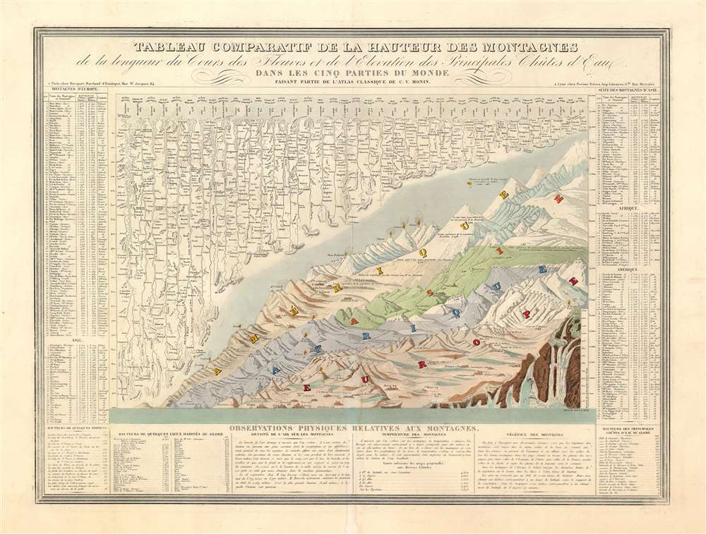
Tableau Comparatif de la Hauteur des Montagnes de la Longueur de Cours des Fleuves.
sold
- Digital Map Information
- Suitable for large format printing
- Full resolution TIFF file
- ICC color profile embedded
- Delivered instantly via download link
This is Charles V. Monin's 1838 comparative mountains and rivers chart. This extraordinary chart is considered the highest expression of the mountains and rivers convention as developed in the 19th century. It is a vast, detailed, comprehensive, and beautifully rendered tableau. Although roughly based upon Bulla's 1826 Tableau Comparatif, Monin added numerous topographical and geological notations, updated the older chart with regard to new information, redrew the waterfalls section, and incorporated textual data to either side of the chart proper. Even the ballooning feat of Gay-Lussac who attained an altitude of 7000 meters in 1808 is noted. (more details)
Highlights the Oregon Trail!
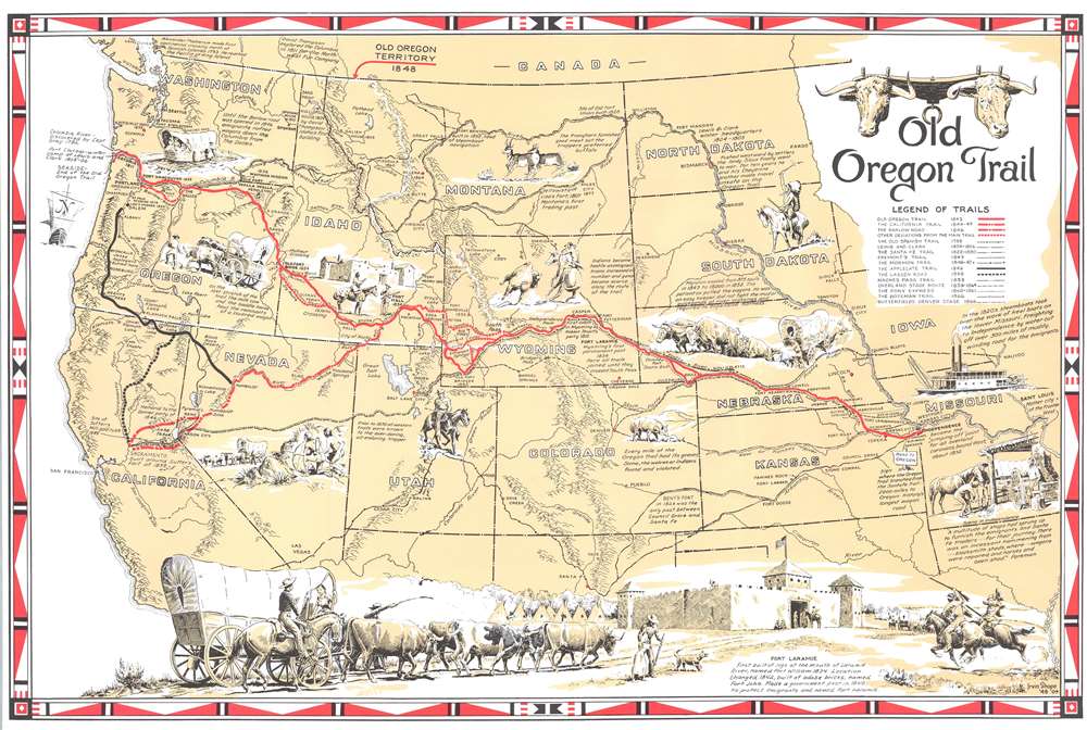
Old Oregon Trail.
sold
- Digital Map Information
- Suitable for large format printing
- File Size: 17.24 MB
- File Type: ZIP / TIFF
- ICC color profile embedded
- Delivered instantly via download link
This is a 1948 Irvin Shope pictorial map of the western United States highlighting the Oregon Trail and its offshoots. A thick red line highlights the Oregon Trail, and offshoots, such as the California Trail, are emphasized with dashed lines. Important waypoints are labeled, including Chimney Rock in Nebraska and South Pass in Wyoming. Other highlighted trails include the Santa Fe Trail, the Overland Stage Route, Lewis and Clark's route to the Pacific, and the celebrated Pony Express Route. Pictorial vignettes illustrate different aspects of the journey west. Covered wagons pulled by teams of oxen, Native Americans hunting bison and stalking settlers, and even a wagon floating across a river decorate the map. A stunning illustration of Fort Laramie and a covered wagon occupy the bottom portion of the map and truly encapsulate the popular stereotype of life in the Old West. Short captions offer historical facts about westward expansion. These note the importance of frontier forts, such as Bent's Fort and significant moments in westward exploration. (more details)
Incorporates beautiful illustrations a plants from all over the world.

World of Flowers.
sold
This is a 1972 John Bartholomew and Barbara Everard pictorial map of the world and its flowers. A topographic world map on Goode's projection occupies the center. While few place names are provided, major bodies of water, landmasses, and islands are named. 161 beautiful illustrations of flora surround the central map. The plants are broken up into eleven geographic groups, which are, proceeding clockwise from the upper left: North America, Arctic, Europe, Mediterranean, Tropical and Central Africa, South Africa, Himalaya and China, Antarctic, Southeast Asia, Australasia, and Central and South America. Each plant is numerically identified and corresponds with indexes situated in the lower left and right corners. (more details)
All the fun in Tampa!

Points of Interest in and around Tampa, Florida Hillsborough County.
sold
- Digital Map Information
- Suitable for large format printing
- File Size: 14.67 MB
- File Type: ZIP / TIFF
- ICC color profile embedded
- Delivered instantly via download link
A very attractive c. 1948 pictorial map of Tampa, Florida, issued by the Tampa Bay Tourist Bureau. On a field of yellow, this map outlines Tampa's streets. Cartoonish vignettes throughout highlight Tampa area attractions. (more details)
Attempt to turn the U.S.S. Saratoga into a Museum Ship.

Welcome Home U.S.S. Saratoga.
sold
A scarce 1994 pictorial map of Jacksonville, Florida. This map was issued to celebrate the return of the U.S.S. Saratoga, a CV-60 class aircraft carrier to Mayport Naval Base in Jacksonville. The view looks loosely east on Jacksonville from a fictional highpoint to the west. The Intercostal waterway and Jacksonville beaches are evident at the top of the map. The St. John's River flows on the left, cutting through the city. The map is rife with brightly colored advertisements representing prominent local business - the sponsors of the map. The Saratoga herself is situated at center, with her complement of crew. (more details)
Aerospace research for the everyman.
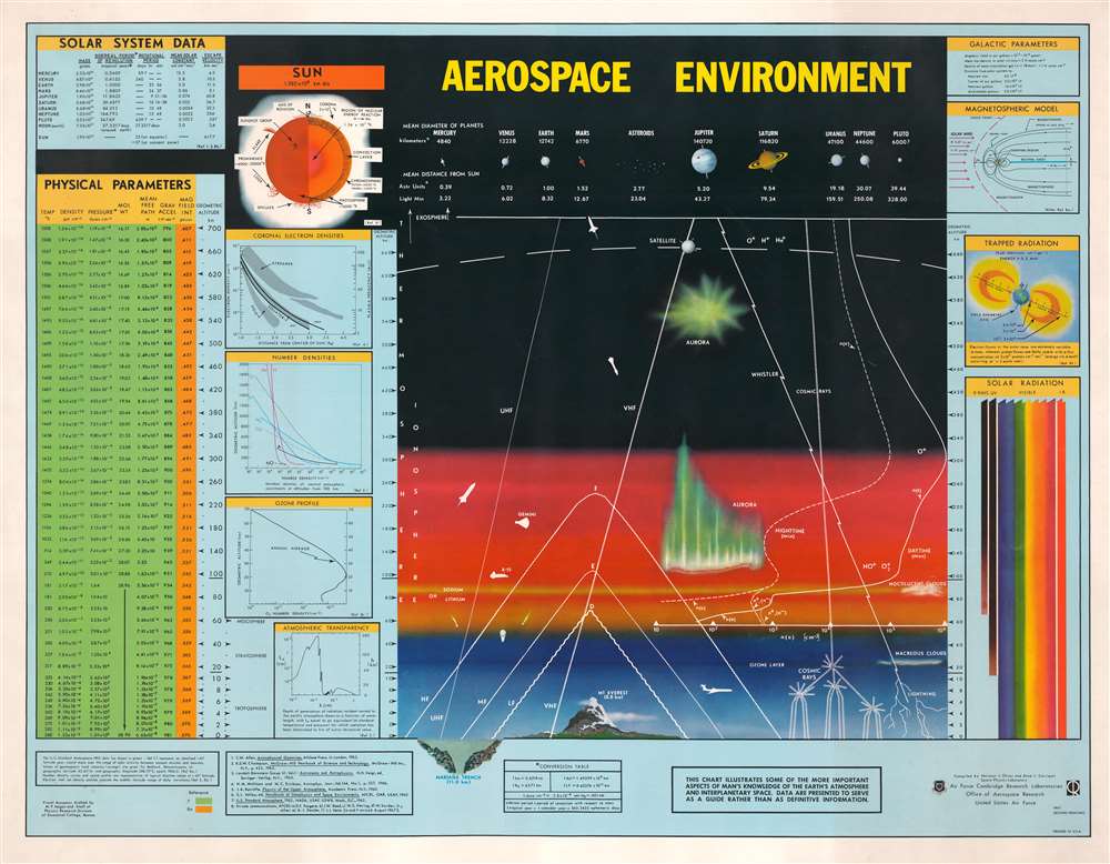
Aerospace Environment.
sold
This is a 1967 Air Force Cambridge Research Laboratories map of the atmosphere and the Solar System. Compiled by Norman J. Oliver and Anne L. Carrigan, the map presents a cross-section of the Earth's atmosphere, identifying the thermosphere and ionosphere. Atmospheric phenomena, such as lightning, auroras, clouds, and the ozone layer are illustrated. As a means of providing scale, both the Mariana Trench (the deepest place in the ocean) and Mount Everest (the tallest mountain on Earth) appear along the bottom to illustrate the immensity of the atmosphere. A jet liner appears to the right of Mount Everest, and the X-15 and Gemini capsule is evident in the ionosphere. Rockets, missiles, and satellites also are illustrated and highlight the innovation of the Space Age. A chart illustrating the diameter of the planets and their average distance from the Sun is situated above a cross-section of the atmosphere. Information about solar radiation, the ozone profile, atmospheric transparency, and other areas of study are included to the left and right of the central cross-section. (more details)
The Erie Canal in Herkimer County.
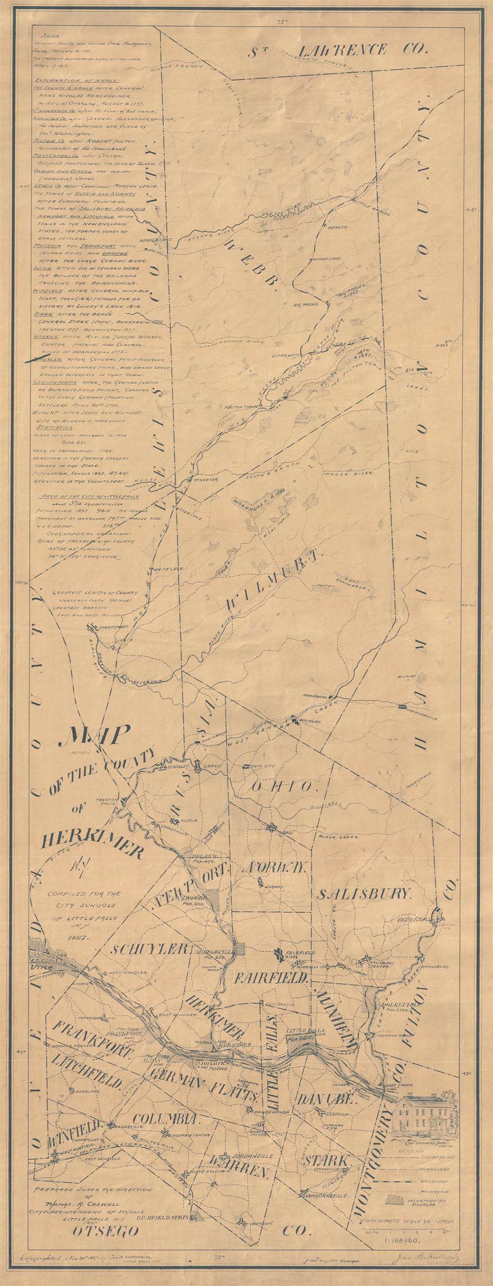
Map of the County of Herkimer N.Y. Compiled for the city schools of Little Falls N.Y. 1897.
sold
- Digital Map Information
- Suitable for large format printing
- File Size: 8.64 MB
- File Type: ZIP / TIFF
- ICC color profile embedded
- Delivered instantly via download link
This 1897 diazo print map of Herkimer County, New York presents the county with surveyor's precision. The map shows the entire county and labels the bordering counties: Otsego County in the south, Oneida County and Lewis County to the west, St. Lawrence County to the north, and Montgomery County, Fulton County, and Hamilton County to the east. (more details)
Exploration through New Mexico.
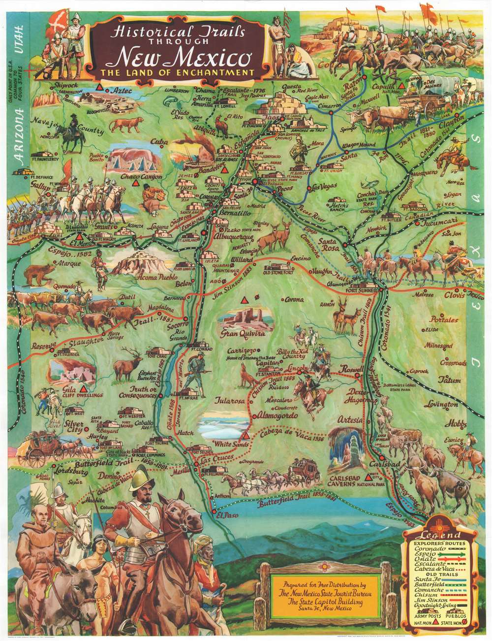
Historical Trails Through New Mexico The Land of Enchantment.
sold
A wonderful example of Wilfred Stedman's beautifully illustrated 1956 map of the historical trails through New Mexico. Historic routes and trails are identified, including the Butterfield Trail, the Santa Fe Trail, and the Goodnight Loving Trail, as well as the exploratory routes taken by Cabeza de Vaca, Coronado, Onate, Escalante, and Espejo. Steadman's map also identifies various army forts, pueblos, and national and state monuments. Fantastically illustrated throughout, carriages, cowboys, soldiers, explorers, forts, and wildlife are among the imagery populating the map. An illustration of Coronado himself is situated in the lower left corner. The verso contains information about the various trails and Coronado. The map details the Four Corners, the only point in the United States common to four states, where the boundaries of Utah, New Mexico, Arizona, and Colorado meet. (more details)
Identifies the Manneken Pis!

Plan Monumental de Bruxelles.
sold
- Digital Map Information
- Suitable for large format printing
- File Size: 29.75 MB
- File Type: ZIP / TIFF
- ICC color profile embedded
- Delivered instantly via download link
This is a c. 1920 Marco Marcovici pictorial map of Brussels (Bruxelles), Belgium. Museums, churches, war memorials, and other monuments are illustrated in profile. The celebrated Mannekin Pis appears on the left side below the Grand Place and to the right of the Église Bon-Secours. Other illustrated sites include the infamous Colonial Museum (Musée Coloniale), the botanical garden, and numerous city parks. Red lines trace city tram lines and red circles mark each lines terminuses. A numerical index identifying 112 locations throughout Brussels appears along the left and right sides and corresponds with those locations on the central map. (more details)
Maine's Capital County.
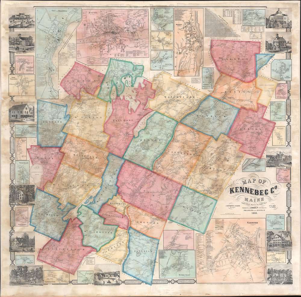
Map of Kennebec County, Maine.
sold
- Digital Map Information
- Suitable for large format printing
- File Size: 182.93 MB
- File Type: ZIP / TIFF
- ICC color profile embedded
- Delivered instantly via download link
A striking 1856 Jacob Chace Jr. wall map of Kennebec County, Maine, home to Augusta, the state capital. Chase was Maine's pre-eminent map publisher in the mid to late 19th century. Cities, towns, and villages throughout are named, including Augusta, situated just below center. The map's exceptional detail extends to individual homesteads (identified by the owner's name). The county's many lakes, ponds, and rivers are also illustrated and labeled. Inset maps provide further detail of important cities, towns, and villages, including Augusta, Hallowell, Waterville, Gardiner, and Winthrop Village. Views of the state capital building in Augusta, the courthouse in Augusta, a daguerrian gallery in Waterville, Litchfield Academy, and several private residences decorate the border. A table of distances and small tables providing agricultural, religious, and population data are included alongside text boxes bearing the names of local businesses. (more details)
French text edition of the first detailed map of Africa.
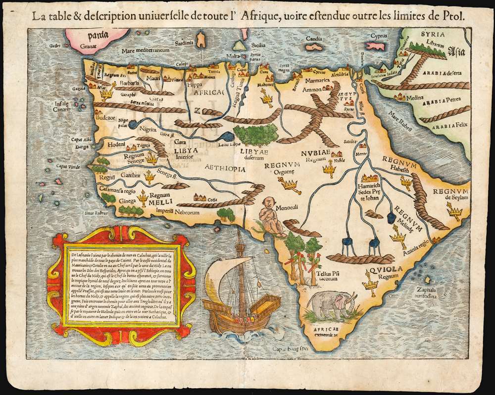
La table et description universelle de toute l'Afrique, voire estendue outre les limites de Ptol.
sold
- Digital Map Information
- Suitable for large format printing
- Full resolution TIFF file
- ICC color profile embedded
- Delivered instantly via download link
This is the 1568 French-text edition of Sebastian Münster's map of Africa, the earliest detailed map of the continent available to the collector. This attractive and evocative map was broadly influential: for more than thirty years during the age of discovery, this map would be the predominant representation of Africa available to the European reader. No more influential image of the continent would appear until the production of Ortelius' atlas, in 1570. (more details)
The San Francisco Hippie Scene, Man.

California.
sold
Rare 1968 pictorial map of California, screen-printed on linen. This large and exceptionally groovy cartoon map depicts hippie-era California with sharp wit and a scenester's savvy. San Francisco and Los Angeles are disproportionately large, as are the mountains along California's eastern border. The sequoias of the north and palm trees of the south evoke the climatological variation of the state. Political variations are also alluded to: while San Francisco sports banners reading 'LOVE' and 'HAIGHT ASHBURY LOVES YOU,' Sacramento's capitol building is decorated with a traffic sign reading 'FAR RIGHT ONLY' while a billboard reads 'PAVE VIET-NAM.' Fishing and hiking scenes dominate the north, homey farms grace the middle of the state, while Southern California is dominated by burger joints, traffic-jammed highways, and smog alerts. The coastline is marked with naval bases and lots of beaches: Redondo, Manhattan, Topanga, and 'San Gregorio Nudist Beach: No Peeking.' (more details)
East Coast from Montauk to St, Augustine.
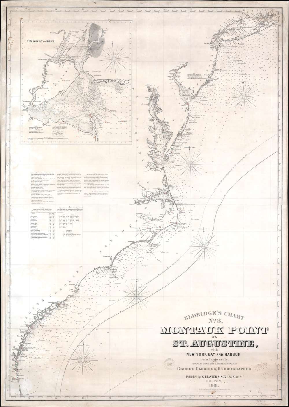
Eldridge's Chart No. 8. Montauk Point to St. Augustine, with New York Bay and Harbor on a Large Scale.
sold
- Digital Map Information
- Suitable for large format printing
- File Size: 51.85 MB
- File Type: ZIP / TIFF
- ICC color profile embedded
- Delivered instantly via download link
This is an 1881 George W. Eldridge blueback nautical chart or maritime map of the east coast of the United States covering from Long Island Sound to St. Augustine, Florida. The chart provides a nautical overview of the eastern seaboard, with countless depth soundings and coastal navigation lights marked in manuscript orange. The Chesapeake Bay especially offers stunning detail - reflecting nearly 50 years of constant meticulous hydrographic work. Coastal islands along New Jersey, Maryland, and the Carolinas, are illustrated in detail as well. The Gulf Stream curves its way to the northeast through the Atlantic. An inset in the upper left corner details New York Bay and Harbor. Depth soundings are indicated throughout the bay and harbor and up the Hudson and East Rivers. New York, Brooklyn, Fort Hamilton, New Utrecht, Gravesend, Jersey City, Hoboken, and Newark are all labeled. (more details)
Spanish issue nautical chart of Florida and the Bahamas.

Carta Esférica del Gran Banco de Bahama parte de la Isla de Cuba y Costa de la Florida.
sold
- Digital Map Information
- Suitable for large format printing
- File Size: 33.52 MB
- File Type: ZIP / TIFF
- ICC color profile embedded
- Delivered instantly via download link
A scarce, large, and highly detailed 1858 nautical chart or maritime map of the Bahamas by the Spanish Direccion de Hidrografia. Within 3 years, this and similar maps would become a hot commodity for enterprising smugglers and blockade-runners supplying the Confederacy from bases in the Bahamas and Matazas, Cuba. Centered on Andros Island, the largest of the Bahama archipelagic state, the map depicts from Grand Bahama to Cuba and from Florida to Exuma. Cartographically and hydrographically, it is a compilation of Spanish and English surveys artfully combined. The Florida coast is illustrated in meticulous detail from, roughly, modern day Vero Beach to Matecumbe Key. Fort Jupiter, Boca Raton, the Miami River, Fort Lauderdale, and Fort Dallas are all noted. The Bahama Bank itself is dense with thousands of soundings - underscoring just how dangerous navigating these low-lying waters could be. The Cuba coast, is also illustrated with exceptional detail, as one would expect from a Spanish chart. (more details)
Earliest example of the largest early 18th century English map of Poland.
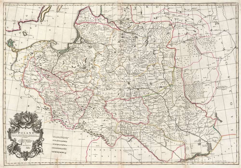
Poland: corrected from the observations communicated to the Royal Society at London and the Royal Academy at Paris.
sold
- Digital Map Information
- Suitable for large format printing
- Full resolution TIFF file
- ICC color profile embedded
- Delivered instantly via download link
This is a lovely, original old color example of John Senex' important map of Poland, one of the largest English maps of the Polish-Lithuanian Commonwealth. The map reaches from the Baltic, Silesia and Hungary in the west to Biela, Molenskow and Severia in the east. It is superbly engraved and richly detailed, with mountains and forests rendered pictorially. The cartouche, with its dedication to Sir James Hallett, has a particularly martial character. Surmounted with weapons, it is flanked by figures representing Mars and Winged Victory, perhaps alluding to the many wars suffered by the Commonwealth. It is unclear what connection Sir James Hallett (1690 - 1734, who may have been a Goldsmith, might have had with the subject matter. (more details)