
Issued in the wake of the April 1927 anti-Communist Shanghai Massacre.
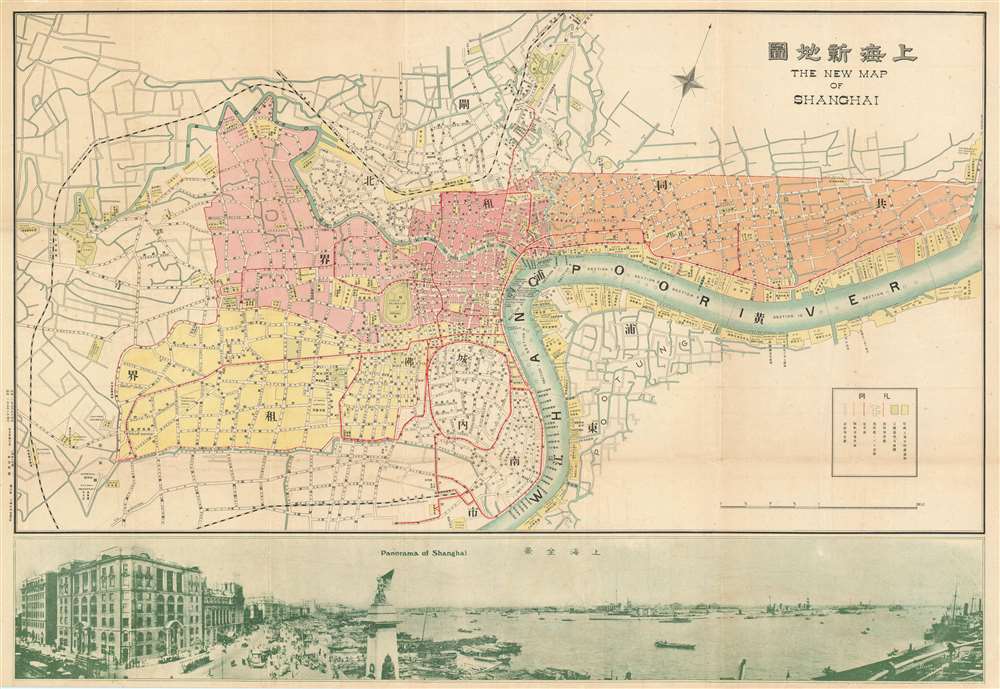
New Map of Shangahi. / 上海新地圖
sold
- Digital Map Information
- Suitable for large format printing
- File Size: 38.8 MB
- File Type: ZIP / TIFF
- ICC color profile embedded
- Delivered instantly via download link
An extremely rare bi-lingual Chinese/English map of Shanghai, China, here in its first edition, issued by the Shanghai-Japanese cartographer Sugie Fusazō (杉江房造) in May of 1927, or Showa 2. This map was produced in the wake of the pro-Nationalist anti-Communist Shanghai Massacre of April 1927, considered the beginning of the Chinese Civil War (國共內戰; 1927 - 1945). This is also the first of Sugie Fusazō's maps to include a panorama of the city (more specifically the Bund), a convention that would be followed in some later editions of the map. The map focuses on the extraterritorial Foreign Concessions huddled around the confluence of the Hunagpu River (Whangpoo) and Soochow Creek (Suzhou). The Japanese area is highlighted in orange, the British in red, the American in Pink, and the large separate French Concession in Yellow. The map extends westward along the Extraterritorial Roads, also administered by the Concessions, as far as the Jessfield Road (Zhongshan) Toyoda Factory, precursor of the modern conglomerate Toyota. (more details)
State-of-the-Art Cartography of the 'Akademiya Nauk', published (instead) by the Berlin Royal Academy of Science
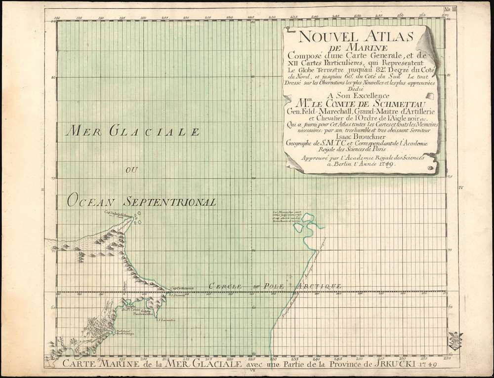
Carte Marine de la Mer Glaciale avec une Partie de la Province de Jrkucki 1749.
sold
- Digital Map Information
- Suitable for large format printing
- Full resolution TIFF file
- ICC color profile embedded
- Delivered instantly via download link
This is a rare 1749 map of the Bering Strait by Issak Bruckner (Issac Brouckner on the map). It is a remarkable and important artifact of 18th century cartography, illustrating the vectors by which secret cartographic data passed from the Russian Academy to the west, specifically to the Royal Academy of Sciences in Berlin under the auspices of Field Marshall Count Samuel von Schmettau, (to whom the map was dedicated). The map is one of twelve sheets executed by the Swiss instrument maker and geographer Bruckner, whose decade as Master of Instruments and globemaker for the Russian Academy of Sciences granted him astonishing access to the latest, secret Russian Naval maps of the northeast Russian coastline. Count von Schmettau opened the Royal Academy's archives to Bruckner, who would synthesize that information along with his own to produce the Nouvel Atlas de Marine, a meticulous twelve-sheet map of the world which Philips would hail as the first Prussian marine atlas. (Phillips, Atlases, 4146). (more details)
Japanese oil prospecting in the East Indies during World War II.
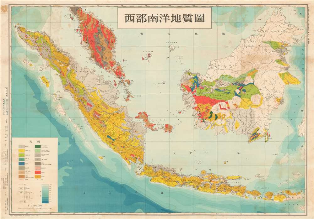
西部南洋地質圖 / Western Ocean Geological Map. / Seibu nan'yō chishitsuzu.
sold
- Digital Map Information
- Suitable for large format printing
- File Size: 49.75 MB
- File Type: ZIP / TIFF
- ICC color profile embedded
- Delivered instantly via download link
An exceptional discovery, this is Ōmura Ichizō's World War II era geological survey of Malay and the East Indies. The survey was completed and published one year after the Japanese conquest of the region in order to assess drilling and mining viability. With a multi-front war in progress, the Japanese needed to acquire as many raw material resources as possible and the geological exploitation of this region was essential to their ambitions. The map depicts from the Malaya Peninsula to southern Java and from Aceh (northwester Sumatra) to North Borneo. Singapore, at the southern tip of Malaya, takes center stage. (more details)
An aviation chart used for low-level flying over Hong Kong.

Low Flying Charts. Hong Kong. GSGS 5061.
sold
This is a 1973 British Ministry of Defense aviation chart of Hong Kong, piece of aviation history that sheds some light on British-Chinese relations during the 1970s. Thick dashed blue lines mark the outer limits of where military aircraft could fly and an inner flying boundary, likely the limit of civilian air traffic. The solid blue lines encircling Hong Kong indicate the Aerodrome Traffic Zone, a zone from ground level up to 2,000 feet meant to protect air traffic preparing to land at Kai Tak airport, which served both military and civilian aircraft. Topography, an ever-important aspect of flying, is indicated by contour lines and shading. Mountain peaks are labeled, and their elevations provided. Many of these are circled in manuscript, which is perhaps an indication that this chart was used by a pilot. Many locations are labeled either in Romanized Chinese or in Romanized Chinese and English. Content important to pilots is included along the right and bottom borders, with a faded stamp declaring that this map was for official use only and that if anyone felt it necessary to give a copy to a non-U.K. official, they had to get it cleared by Survey Branch first. (more details)
Rare illustration of some of the first steamship routes between Japan and China.

海蒸汽飛腳船箱館兵庫長崎支那國上海渡海乘筋之圖亞國四番社中東京万屋正兵衡藏版.
sold
- Digital Map Information
- Suitable for large format printing
- File Size: 9.2 MB
- File Type: ZIP / TIFF
- ICC color profile embedded
- Delivered instantly via download link
An unusual c. 1890 Meiji Era Japanese map illustrating a steamship voyage between the port of Muroran on Hokkaido, to Tokyo, Yokohama, Osaka, Nagasaki, and ultimately Shanghai. The map is oriented to the northeast and covers from the Japanese Kuril Islands to Hong Kong (which is labeled), Taiwan, and the northern tip of Luzon, Philippines. While the map is undated, the primitive mapping of Formosa/Taiwan suggests that it must predate the 1895 Japanese invasion of Taiwan and postdate the development of commercial steamship routes between Japan and Shanghai in the mid 1860s and the adoption of lithographic printing in Japan, c. 1880. We have therefore tentatively dated it to 1890. (more details)
The Great Patriotic War (WWII on the Eastern Front) from the beginning of Operation Barbarossa until the end of the war.
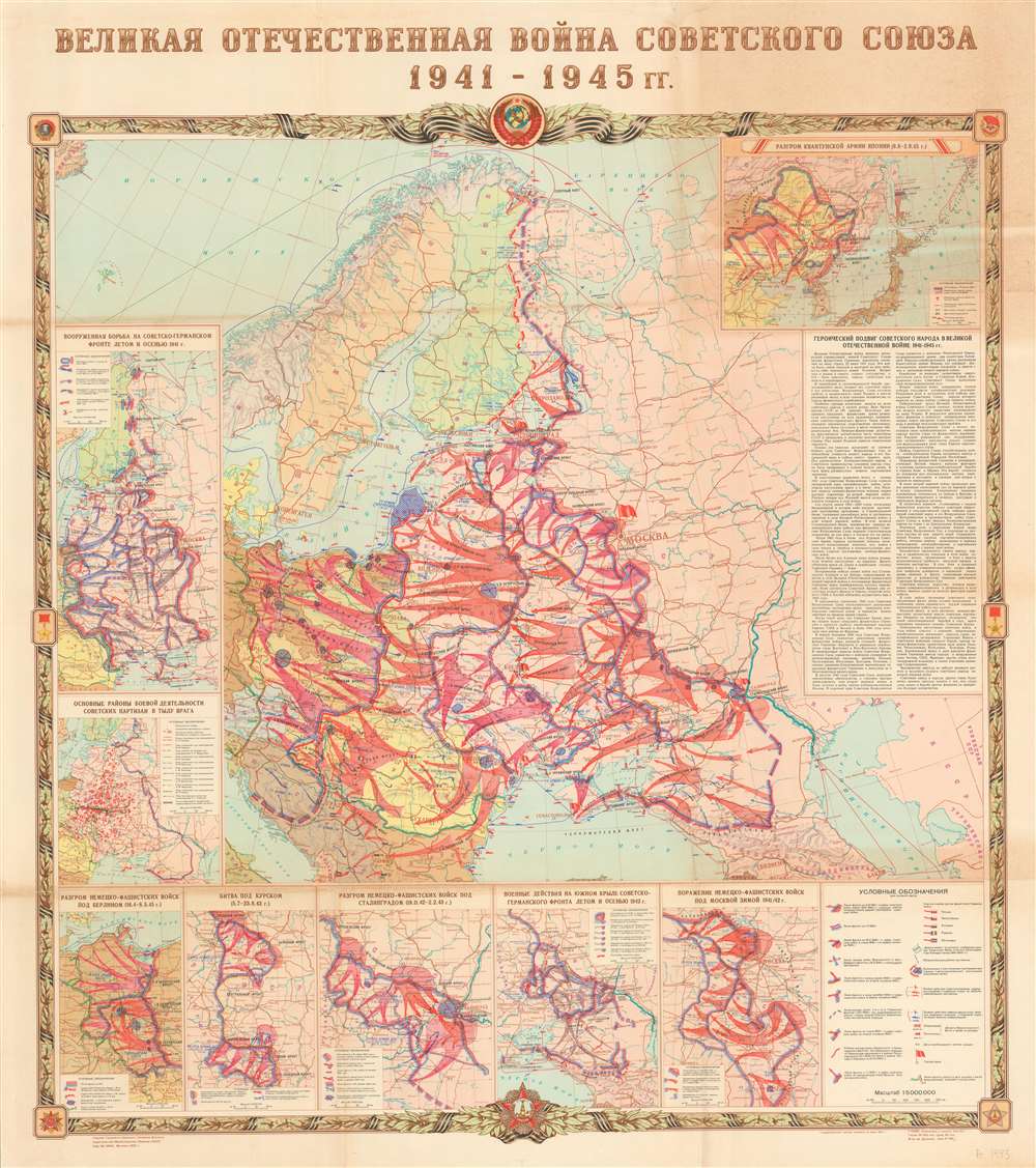
ВЕЛИКАЯ ОТЕЧЕСТВЕННАЯ ВОЙНА СОВЕТСКОГО СОЮЗА 1941 1945 rr. / Great Patriotic War of the Soviet Union 1941 - 1945.
sold
This is a 1970 Soviet Ministry of Defense wall map of Russian and Eastern Europe illustrating Soviet engagements during World War II, known in the Soviet Union as the Great Patriotic War. This beautifully produced map was probably intended for educational purposes and, with its dramatic coloring and golden border, doubtless a propagandish glorification of Soviet military prowess. (more details)
Striking map of Key West created from aerial photography.
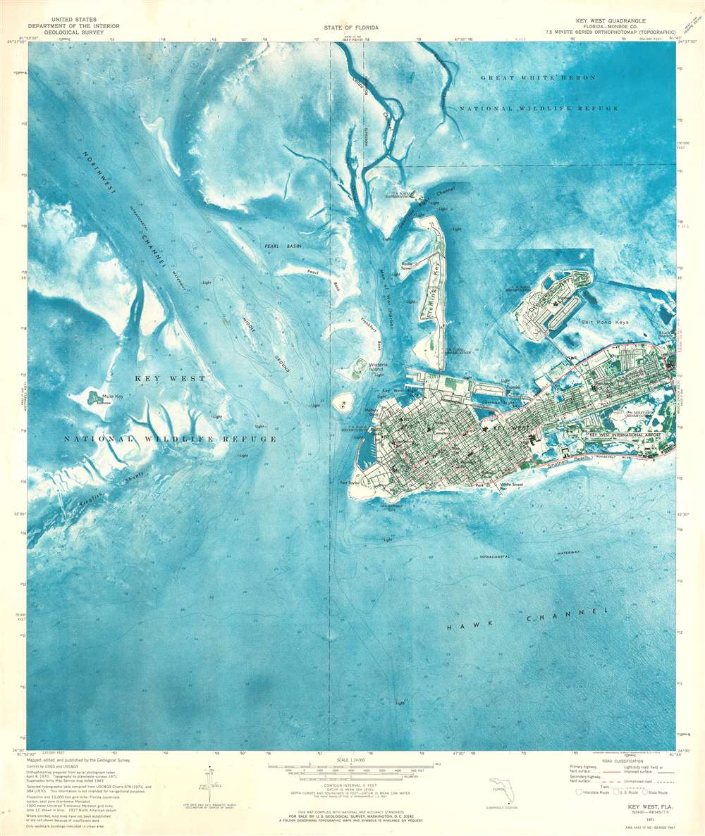
Key West Quadrangle.
sold
This is a 1971 U.S. Geological Survey topographic orthophotomap map of Key West, Florida. It depicts the region from Key West National Wildlife Refuge to Stock Island and from Great White Heron National Wildlife Refuge to the Intracoastal Waterway and Hawk Channel. Benefiting from the use of aerial photography, Key West appears in detail, with roads illustrated in black and highways, designated here as having four lanes, highlighted in red. Per the map, 'only landmark buildings are indicated in urban area', which includes the Key West International Airport, the courthouse, several post offices, and numerous U.S. military reservations. Coastal navigation lights are also noted and are abundant. Small nuances of its coastline are evident along with those on Dredger Key, Fleming Key, and Wisteria Island. Off Key West, the topography of the ocean floor is depicted in striking blue detail. Channels are labeled, as are shoals and the intracoastal waterway. (more details)
Escape Prohibition - the train to Cuba!

Happy Days Are Here Again ... Florida East Coast Railway.
sold
- Digital Map Information
- Suitable for large format printing
- File Size: 9.25 MB
- File Type: ZIP / TIFF
- ICC color profile embedded
- Delivered instantly via download link
An extremely charming c. 1932 pictorial map of Florida, accompanied by its original mailer, issued for the Florida East Coast Railway. The map focuses on eastern Florida as served by Flagler's railway system. Vignette illustrations show fishing, racing beach life, boating, models in Miami, and natural wonders. The keys are sized disproportionately, underscoring the Keys Extension to the Florida East Coast Railway. Of note, on the southern edge of the map, Cuba and Havana appear. Here Cubans waiters await a boat full of eager American's flocking to the 'Paris of the Caribbean' on the P and O Steamship Line to enjoy festive Cuban cocktails. Although this map is undated, the Cuban bartender and eagerly thirsty Americans underscore that this map was issued during Prohibition (1920 - 1933). The title, 'Happy Days are Here Again,' at least for those on their way to Cuba, affirms this idea. (more details)
The locations of POW camps in Germany holding Americans.

Location of German Camps and Hospitals Where American Prisoners of War and Civilian Internees Are Held. based on information received to December 31, 1944.
sold
- Digital Map Information
- Suitable for large format printing
- File Size: 17.94 MB
- File Type: ZIP / TIFF
- ICC color profile embedded
- Delivered instantly via download link
This is a 1945 American National Red Cross map of German prison camps holding American prisoners of war (POWs) and civilian internees. Centered on eastern Germany, camps are labeled in striking red. Various symbols are used to mark camps for prisoners of war, airmen, officers, civilian internees, hospitals, and Marlag and Milag, where Navy and Merchant Marine personnel were imprisoned. Indexes along the left and right sides of the map list the names of each camp, the nearest town, and in in what square of the map grid they are located. These are divided into the same five categories, allowing viewers to quickly find the specific category in which they are interested. (more details)
The 15th convention of the Young People's Society of Christian Endeavor.

Official Map of Washington. Fifteenth International Christian Endeavor Convention. July 8 - 13, 1896.
sold
- Digital Map Information
- Suitable for large format printing
- File Size: 20.82 MB
- File Type: ZIP / TIFF
- ICC color profile embedded
- Delivered instantly via download link
This is an 1896 Young People's Society of Christian Endeavor city plan or map of Washington, D.C. Published for the Fifteenth International Christian Endeavor Convention, over 260 locations in Washington, D.C. and Anacostia are numerically identified and correspond to a detailed index situated along the map's right border. The meeting places for the convention, three of which were 10,000 person tents erected by Christian Endeavor, appear at the top of the index and are followed by churches (divided by denomination), hotels, public buildings (which include museums and government buildings), foreign legations, educational institutions, monuments, and parks. Large black lettering highlights the National Mall and the White Lot, which is known as The Ellipse today. The three large tents, called Williston, Endeavor, and Washington, are marked by large red dots. Major railways and transfer stations are illustrated in red and differentiated by a coding schema. This key is situated just below the title in the upper right. (more details)
Fox Hunting in Eastern Massachusetts!

Hunting Country of the Norfolk Hunt Club.
sold
- Digital Map Information
- Suitable for large format printing
- File Size: 19.71 MB
- File Type: ZIP / TIFF
- ICC color profile embedded
- Delivered instantly via download link
This is a 1922 Henry Goodman Vaughan map of Middlesex County, Massachusetts created for the Norfolk Hunt Club, a Massachusetts fox hunting and horseback riding organization. The map depicts the region from Hopkinton to Norwood and from Sudbury to Franklin. Red overprinting labels the Norfolk Hunt Club, along with their kennels. Numerous clubs, railroad stations, farms, and other locations are also labeled, and sadly the details of many of them have been lost to history. On the base map, the region's road and railroad network are detailed, as are its lakes, ponds, and rivers. An inset map of eastern Cape Cod is situated in the lower left corner. (more details)
Full of charm, this pictorial map of San Diego County highlights activities in the area- like visiting the zoo!
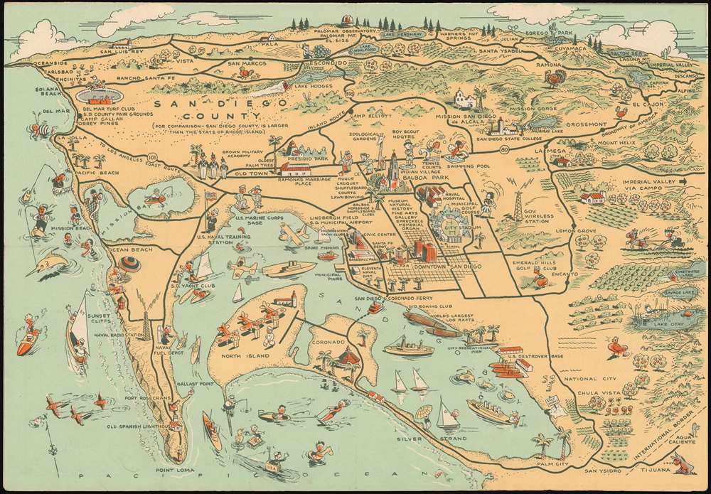
Map of San Diego California City and County.
sold
- Digital Map Information
- Suitable for large format printing
- File Size: 7.94 MB
- File Type: ZIP / TIFF
- ICC color profile embedded
- Delivered instantly via download link
This humorous pictorial map of San Diego was prepared for Lowell E. Jones in 1935. The map covers San Diego County, from Oceanside to Descanso and from Palomar Observatory to Palm City and Point Loma. It features numerous pictorial vignettes illustrating the ... (more details)
A Bicentennial issue of Edward Rowe Snow charming pictorial.
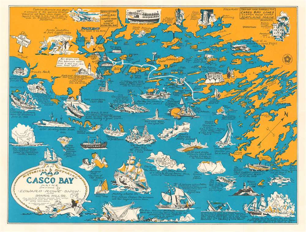
An Historical and Pictorial Map of Casco Bay Maine.
sold
This is a charming 1976 Edward Rowe Snow and Draper Hill, Jr. pictorial and historical map of Casco Bay, Maine. It depicts Casco Bay, an inlet of the Gulf of Maine on the southern coast of Maine, from Prouts Neck (Scarborough Beach State Park) east as far as the southern portion of Georgetown Island, including the city of Portland. Towns and villages are labeled throughout, as are the numerous small islands sprinkled within the bay. (more details)
A richly detailed Map of Ontario and the Great Lakes.
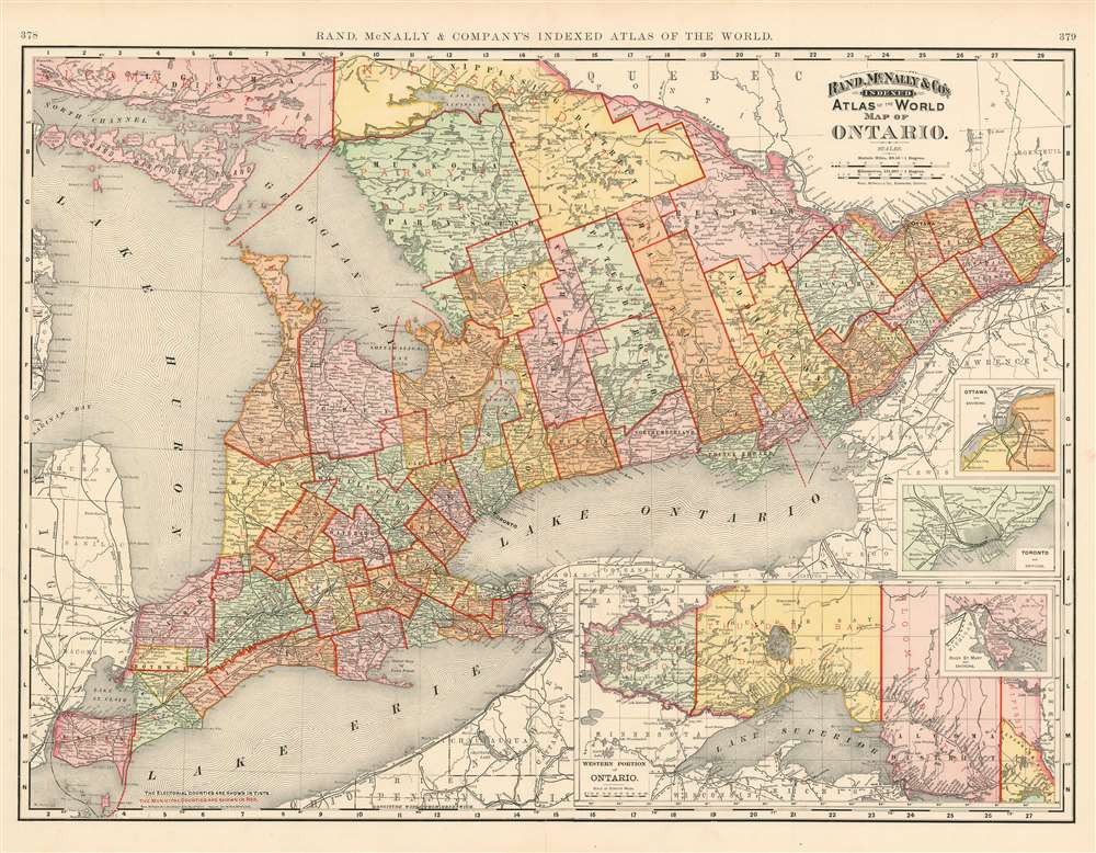
Map of Ontario.
sold
- Digital Map Information
- Suitable for large format printing
- File Size: 39.19 MB
- File Type: ZIP / TIFF
- ICC color profile embedded
- Delivered instantly via download link
This is a beautiful example of Rand McNally and Company's 1892 map of Ontario, Canada. Centered on Lake Ontario, the map covers Upper or West Canada from Essex to Prescott. Four inset maps in the lower right quadrant detail the western portion of Ontario, River St. Mary, Toronto and Ottawa. Both the electoral counties and the municipal counties are identified and labeled in black and red respectively. All five of the Great Lakes are illustrated. Although the region suffered economically during the recession of 1893, Ontario continued to flourish in mineral exploitation and industry. Color coded according to political boundaries, the map notes several towns, cities, rivers and various other topographical details with relief shown by hachure. (more details)
The First Map to show New York Harbor; the First Map to name Canada.

La Nuova Francia.
sold
- Digital Map Information
- Suitable for large format printing
- DPI: 600
- File Size: 14.84 MB
- File Type: ZIP / TIFF
- ICC color profile embedded
- Delivered instantly via download link
This is the seminal 1565 Giovanni Battista Ramusio map of the Northeast and Canada, 'The first printed map devoted to the New England region'(Osher) and the first map to apply a specific name to Canada. The map depicts the northeastern coast of North America from New York to the coast of Labrador, inclusive of New England and maritime Canada. In particular, it is the first map to reveal Giovanni da Verrazano's 1524 voyage to America and to depict his discoveries in what would become New York and New England. It is also among the most visually engaging early maps, being richly decorated with depictions of indigenous peoples, Europeans, flora and fauna, sailing ships, sea monsters, and demons. (more details)
The Russian Empire at its height of expansion just before the Napoleonic Invasion.
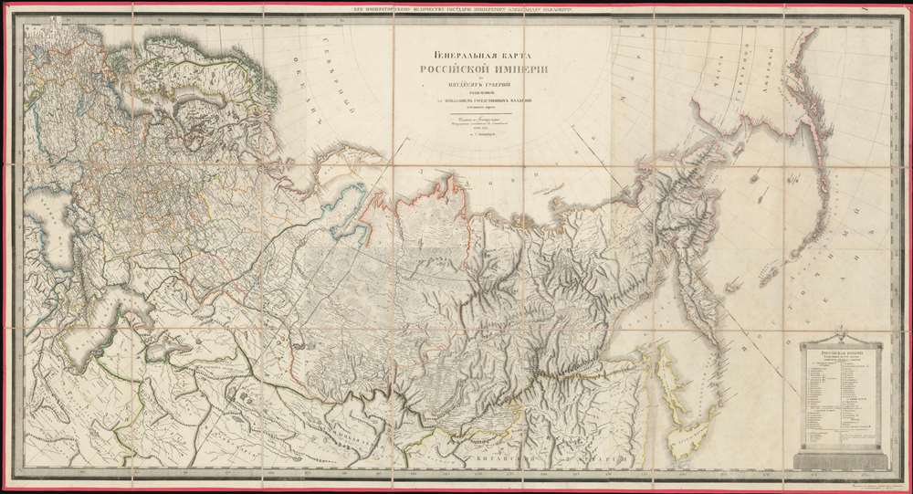
ГЕНЕРАЛЬНАЯ КАРТА РОССIЙСКОЙ ИМПЕРIИ HA ПЯТДЕСЯТЪ ГУБЕРНIЙ РАЗДЂЛЕННОЙ, съ ПОКАЗАНIЕМЪ СОСЕДСТВЕННЫХЪ ВЛАДЂНІЙ и большихъ дорогъ. / A General Map of the Russian Empire Divided into the Fifty Provinces, Showing Neighboring Domains and Highways.
sold
- Digital Map Information
- Suitable for large format printing
- DPI: 600
- File Size: 112.48 MB
- File Type: ZIP / TIFF
- ICC color profile embedded
- Delivered instantly via download link
An exceptionally rare 1809 large-format map of the Russian Empire by Alexsandr Dmitrievich Savinkov. This is the largest and most important map published during Savinkov's tenure at the Saint Petersburg Imperial Map Depot. Presented on a conic equidistant projection, Savinkov's map covers the Russian Empire in all of its expansiveness, from Finland, annexed into Russia in the year this map was made, to Russian Alaska, and from the Arctic to Mongolia. It is dedicated to Savinkov's patron, Tsar Alexander I or Alexander Pavlovich (1777 - 1825), who ruled from 1801 to 1825. The whole exhibits Savinkov's distinctive and exceptional fine engraving style. (more details)
Provenance to the first Governor of Hong Kong.
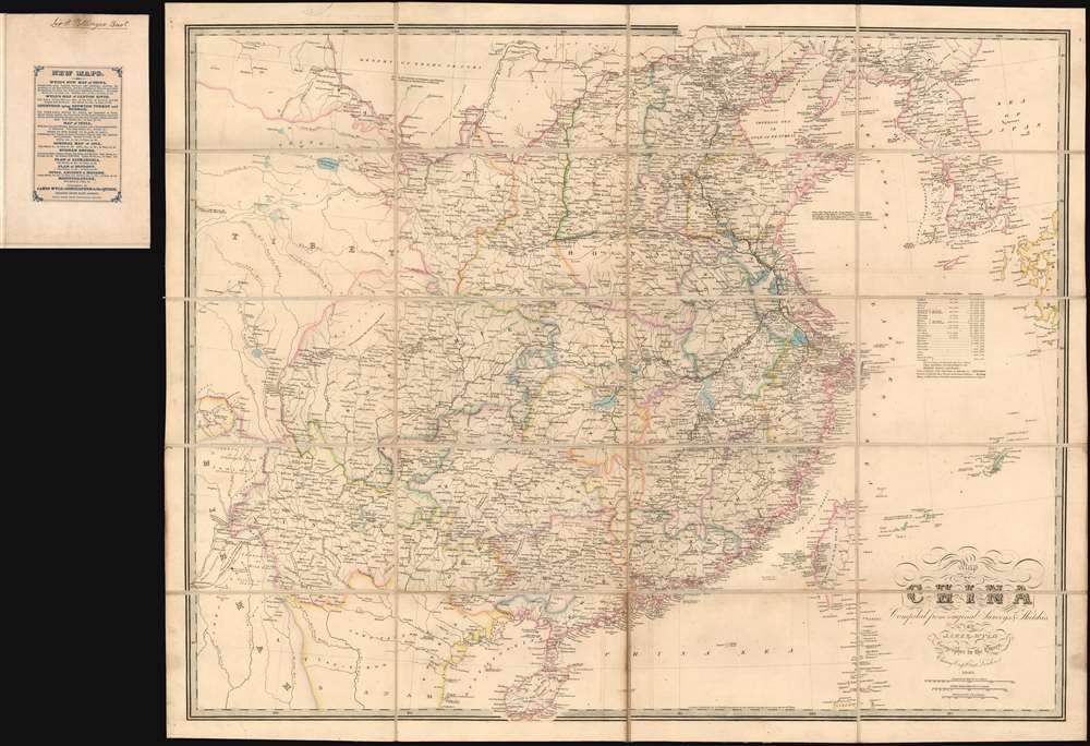
Map of China Compiled from original Surveys and Sketches.
sold
- Digital Map Information
- Suitable for large format printing
- DPI: 600
- File Size: 39.19 MB
- File Type: ZIP / TIFF
- ICC color profile embedded
- Delivered instantly via download link
A beautiful example of the scarce 1840 first edition of James Wyld's First Opium War Era map of China, with provenance to Sir Henry Pottinger, the first governor of Hong Kong, identified here as 'Heong Kong'. The map covers all of China, extending from the Tibet border to western Japan and from Manchuria to Hainan. Korea, rendered in full, is wildly malformed. Taiwan, appearing near the cartouche, is misshaped and only the western coast features any detail. There are notes in industry, transportation networks, the great wall, population, trade resources, and more. (more details)
NavWarMap No. 3 of the Battle of the Atlantic and the Air War in Europe on one side and NavWarMap No. 4 of the Pacific War in the North Pacific on the other.
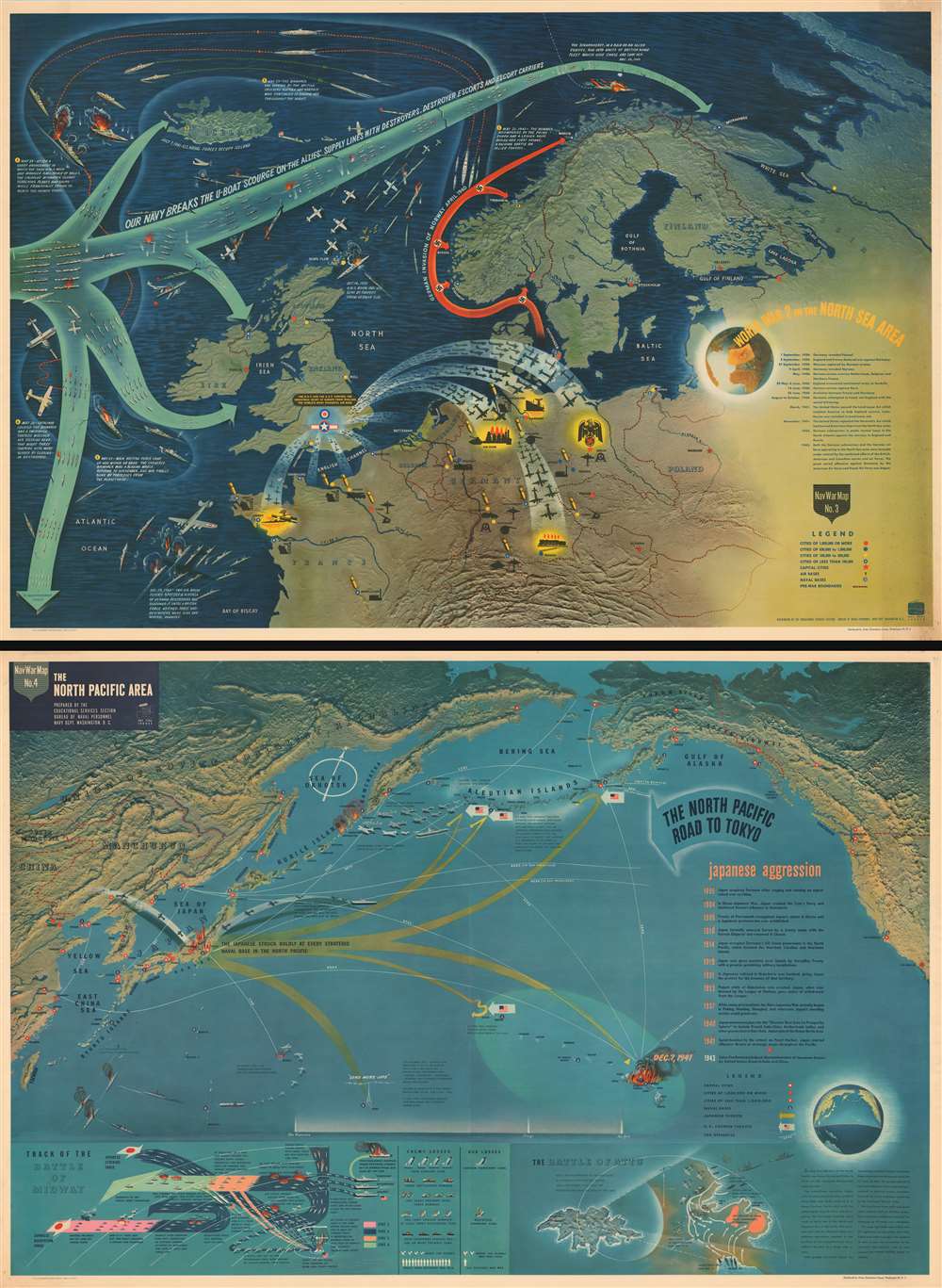
NavWarMap No. 3 World War 2 in the North Sea Area. / NavWarMap No. 4 The North Pacific Area.
sold
- Digital Map Information
- Suitable for large format printing
- File Size: 371.08 MB
- File Type: ZIP / TIFF
- ICC color profile embedded
- Delivered instantly via download link
This is a 1944 double-sided Navy Education Services pictorial map of northwestern Europe and the North Atlantic on one side and a map of the northern Pacific Ocean on the other. The European map depicts the region from the Atlantic Ocean to Russia and from the Arctic Ocean to central France and Switzerland, while the Pacific map illustrates the Pacific basin from the Chinese coast to the Pacific coast of the United States and from the Bering Sea to Hawaii and Taiwan. (more details)
One of the great pictorial maps of Florida.
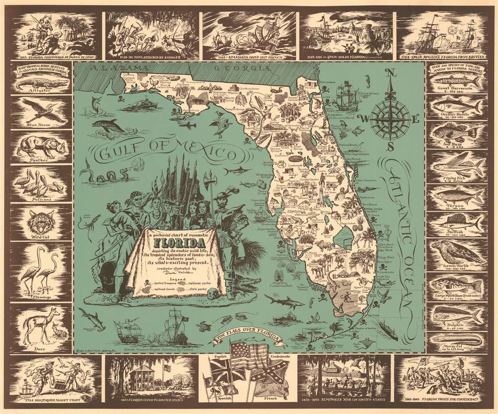
A Pictorial Chart of Romantic Florida depicting its exotic wild life; its tropical splendors of lands and sea; its historic past; its vital and exciting present.
sold
- Digital Map Information
- Suitable for large format printing
- File Size: 23.74 MB
- File Type: ZIP / TIFF
- ICC color profile embedded
- Delivered instantly via download link
One of the best 20th century pictorial maps of Florida. This map, drawn 1951 by David D. C. Mink, embraces Florida's romantic history as well as its flora, fauna, and folklore. The map itself is full of pictorial vignette detail, with illustrations highlighting the animals, produce, and people of Florida. Along the coasts, there are references to explorers, marine life, beach fun, and, supposed pirate history (highlighted by the iconic skull and crossbones). The dramatic cartouche, appearing in the Gulf of Mexico, features pirates, Seminole Indians, adventurers, priests, and Ponce de Leone himself, along with treasure chests and alligators. Surrounding the map there is an elaborate pictorial border, with dated referenced at the top and bottom. To the left and right are terrestrial and aquatic animal life, respectively. (more details)
Provides a visually enthralling overview of the beginning of World War II in Southeast Asia.
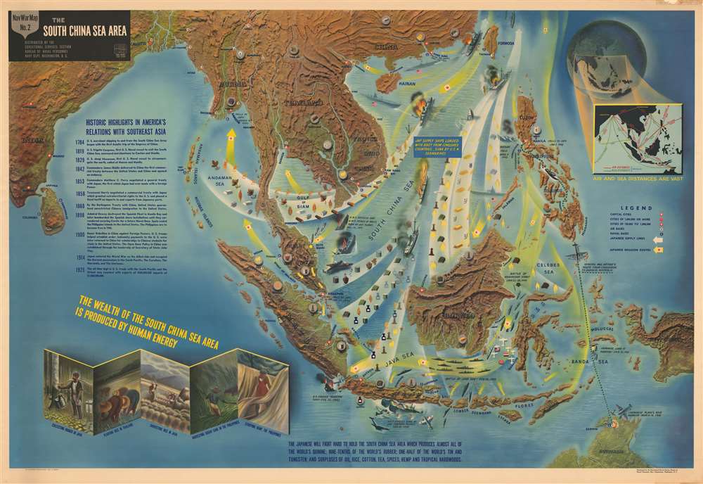
NavWarMap No. 2 The South China Sea Area.
sold
- Digital Map Information
- Suitable for large format printing
- File Size: 201.08 MB
- File Type: ZIP / TIFF
- ICC color profile embedded
- Delivered instantly via download link
This is a 1944 Navy Education Services pictorial map of Southeast Asia. Depicting the region from India to the Pacific Ocean and from China to Java, New Guinea and northern Australia, this NavWarMap provides a visually enthralling overview of the beginning of World War II in Southeast Asia. (more details)