
Divides Africa into three racial zones: Arab Africa, Black Africa, and White-ruled Africa.
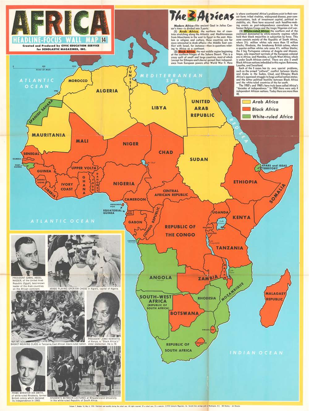
Africa. Headline-Focus Wall Map 14. The 3 Africas.
sold
- Digital Map Information
- Suitable for large format printing
- File Size: 66.47 MB
- File Type: ZIP / TIFF
- ICC color profile embedded
- Delivered instantly via download link
This 1970 Civic Education Service map of Africa divides the continent into three parts: 'modern Africa' is made up of 'Arab Africa', 'Black Africa', and 'White-ruled Africa'. The countries that create each of these regions are shaded either yellow ('Arab Africa'), orange ('Black Africa'), or green ('White-ruled Africa'), and each region is described very succinctly in a text box situated in the upper right corner. (more details)
A charming cartoonish pictorial map of East Texas.

East Texas journeys.
sold
- Digital Map Information
- Suitable for large format printing
- File Size: 36.79 MB
- File Type: ZIP / TIFF
- ICC color profile embedded
- Delivered instantly via download link
This is a 1964 Bill Dyer pictorial map of East Texas. Dyer charmingly combines many aspects of life in East Texas. Here East Texas is shaded pink and a cowboy situated in the lower left is illustrated lassoing East Texas to allow viewers a better idea of exactly which part of the massive state this is. The state's obsession with football is highlighted by illustrations of both the Dallas Cowboys and Houston Oilers. There are also multiple depiction of hunting and fishing and oil derricks. Cities and towns are labeled throughout, including Dallas, Austin, Houston, and Galveston. Houston, while home to the Oilers, is also indicated by an eager NASA astronaut. The natural wonders of East Texas, and the outdoor lifestyle enjoyed by many, are highlighted through vignettes of fishing, riding, golfing, surfing, and sunbathing on its many beaches and lakes. 'Big Tex', an annual landmark of the Texas State Fair, appears near Dallas. A calendar of events in the area is included along the right, in the hope that this will pique someone's interest and encourage a visit. (more details)
A map of Southeast Asia during the Vietnam War that was created for schoolchildren and clearly separates the communist countries from the capitalist countries in the region.

Southeast Asia - A Small War Grows Up. Headline-Focus Wall Map 4.
sold
- Digital Map Information
- Suitable for large format printing
- File Size: 53.76 MB
- File Type: ZIP / TIFF
- ICC color profile embedded
- Delivered instantly via download link
This is a 1965 Civil Education Service pictorial map of Southeast Asia. The map depicts the region from Burma and Thailand to the South China Sea and from China to the Gulf of Siam and the Ca Mau Peninsula. A product of the Cold War and the Vietnam War, the ideological fight between communism and capitalism is immediately apparent, with communist countries shaded red and capitalist countries shaded an almost neon green – ‘the color of money’, ironically. China and North Vietnam are colored red, while Laos is half red and half green, a vivid illustration of the fight between the Pathet Lao forces and the anti-communist government backed forces in that country. Thailand, Burma, and South Vietnam are all green, while Cambodia is a dull red, indicating its pro-communist stance but its officially neutral stance. Icons along the South Vietnamese coast indicate the locations of American naval, helicopter, and air bases situated throughout the country, as well as troop concentrations. Text boxes provide some context, highlighting for example the headquarters of the 1st Cavalry Airmobile Division and locations of important battles between communist and American forces. Other vignettes highlight the now famous Ho Chi Minh Trail, the North Vietnamese supply route from North Vietnam, through Laos, into South Vietnam, areas of guerrilla activity, and the U.S. Seventh Fleet stationed over the Vietnamese Coast. Short biographies of important leaders, including Ho Chi Minh, Nguyen Cao Ky, a South Vietnamese air force general who seized power in June 1965, Prince Sihanouk of Cambodia, and Prince Souvanna Phouma of Laos are included as well, and are accompanied by portraits. A text box in the lower left corner provides context and information concerning America’s escalating role in the region and an assessment of the current state of affairs there. (more details)
The first official map of Guatemala! A cornoerstone piece for Central American 'Decolonization'!
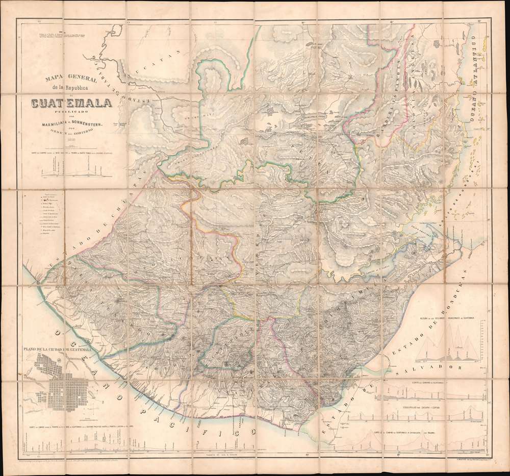
Mapa General de la Republic de Guatemala.
sold
- Digital Map Information
- Suitable for large format printing
- File Size: 79.73 MB
- File Type: ZIP / TIFF
- ICC color profile embedded
- Delivered instantly via download link
A seminal production, this 1959 map by Maximilian von Sonnenstern and August van de Gehüchte is the first official map of Guatemala and a key document associated with Guatemalan independence. The map was commissioned by first president of Guatemala, Rafael Carrera Turcios (1814 - 1865), and is the first broadly accurate meticulously detailed map of that country. The enduring legacy of this map includes its role in establishing and legitimizing Guatemala, as well as its significant evidentiary rule in subsequent Guatemalan boundary disputes and negotiations. In addition, this is the first to accurately map Guatemala's many important Mayan ruins. (more details)
A real estate map of Wheaton, Illinois featuring a profile illustration of Wheaton College.

Prout and Burnham's Official Map of Wheaton, Dupage County Illinois.
sold
- Digital Map Information
- Suitable for large format printing
- File Size: 46.91 MB
- File Type: ZIP / TIFF
- ICC color profile embedded
- Delivered instantly via download link
Created as a promotional piece to entice city dwellers to move to Wheaton, this rare 1892 Charles A. Prout and Graham Burnham city plan or map of Wheaton, Illinois, is divided into lots, with numerous different 'additions' identified. Depicting the city from Carleton Avenue (modern-day N. Carlton Street) to President Street and from Prairie Avenue to the Chicago and Batavia Road (modern-day Roosevelt Road), streets throughout town are illustrated and labeled. Profile sketches of Wheaton College, the Court House, the schoolhouse, and both train depots are included, as are small pictorial icons marking the sites of the city's churches. The Chicago and Northwestern Railway arcs across town, splitting the town in half. Profile illustrations of Adam's Memorial Library and Central Block are situated around the map. (more details)
The earliest obtainable example of the first map to introduce four fictional islands in Lake Superior. Islands later used to draw the post-Revolutionary War US-Canada border.
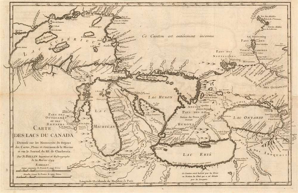
Carte des Lacs du Canada Dresse sur les Manuscrits du Depost des Carts, Plans et Journaux de la Marine et sur le Journal de RP. De Charlevoix.
sold
- Digital Map Information
- Suitable for large format printing
- Full resolution TIFF file
- ICC color profile embedded
- Delivered instantly via download link
This is the 1744 Bellin/ Charlevoix map of the Great Lakes, the most accurate map of the Great Lakes to date and the best to be produced since the De l'Isle map of 1718. It is also the earliest obtainable map, preceded only by a 1742 proof noted by Kershaw, to depict the four fictive islands in Lake Superior (Philippeux, Pontchartrain, Maurepas, and St. Anne) - islands that nonetheless significantly influenced the structuring of post-Revolutionary War borders between British Canada and the fledgling United States. It is also notable for being among the earliest maps to identify Detroit and the Port of Chicago. Bellin's map covers all five Great Lakes and their adjacent drainage systems in considerable detail, noting known fortifications, American Indian villages, missions, and some speculative topography (particularly in Michigan). (more details)
A striking and hilarious map of San Diego by the celebrated cartographic artist Jo Mora.

This limned Carte protraying with most exacting fidelity the History, Romance, and Humor of the glorious City of San Diego by the Pacific…
sold
- Digital Map Information
- Suitable for large format printing
- File Size: 59.84 MB
- File Type: ZIP / TIFF
- ICC color profile embedded
- Delivered instantly via download link
This is a 1928 Jo Mora pictorial map of San Diego, California. With San Diego at its center, the map depicts the California coast from La Jolla to Tijuana. Described by Mora as a 'whimsical map and history of a city in California', comical vignettes abound. Mora, as is his style, effortlessly blends the humor with a celebration of the city and The Marston Company, a department store in San Diego whose founder commissioned the map to commemorate the store's Golden Anniversary. Sites around the area, including several army forts, the Naval Air Station, Balboa Park, the zoo, the San Diego De Alcala Mission, and the Point Loma Lighthouse are illustrated. Mission Beach, Pacific Beach, and La Jolla are all labeled, as well as Soledad Mountain, La Mesa Reservoir, Sweetwater Reservoir, and Mt. Helix. Some of the more comic vignettes include a salesman trying to sell land in a subdivision to a young couple, one of which is holding a bag marked 'Iowa', a man running from a swarm of bees, and a drunk using the sign marking Mexico to hold himself up.
Four insets in the lower right corner highlight buildings around San Diego, while others are illustrated in the lower left corner, along with hilarious portraits of seven different 'savage and ferocious beasts of the forest and mountain to be seen at Balboa Park'. A cartouche in the upper right corner is dedicated to celebrating The Marston Company and features full-length portraits of women modeling the evolution of ladies' fashion. Views of all four Marston Company stores are included as well. The whole is surrounded by a border made up of vignettes commemorating San Diego's history from the discovery of San Diego Bay by Juan Rodriguez Cabrillo, to whom this map is dedicated, to the founding of Spanish missions, to the battles of the Mexican-American War which led to the founding of modern-day San Diego. The arrival of the railroads and the Navy are highlighted as well. (more details)
Four insets in the lower right corner highlight buildings around San Diego, while others are illustrated in the lower left corner, along with hilarious portraits of seven different 'savage and ferocious beasts of the forest and mountain to be seen at Balboa Park'. A cartouche in the upper right corner is dedicated to celebrating The Marston Company and features full-length portraits of women modeling the evolution of ladies' fashion. Views of all four Marston Company stores are included as well. The whole is surrounded by a border made up of vignettes commemorating San Diego's history from the discovery of San Diego Bay by Juan Rodriguez Cabrillo, to whom this map is dedicated, to the founding of Spanish missions, to the battles of the Mexican-American War which led to the founding of modern-day San Diego. The arrival of the railroads and the Navy are highlighted as well. (more details)
The Holiest site in Islam.

Kâ'be-i Muazzama nin Haritasi ve Hac ile Umrenin Menâsiki.
sold
- Digital Map Information
- Suitable for large format printing
- File Size: 18.64 MB
- File Type: ZIP / TIFF
- ICC color profile embedded
- Delivered instantly via download link
This is a c. 1930 Turkish map of the holiest site in Islam, al-Masjid al- Ḥarām, the Great Mosque of Mecca, Saudi Arabia. As is common for maps of Mecca, this plan of the Great Mosque is oriented to the East-Northeast. The map is meticulously drawn with Kaaba at the center and over one hundred locations throughout numerically identified and corresponded to an index. A table providing important distances - useful for the pilgrim - is included in the lower right. The map records a number of historic Islamic monuments, dating to the time of Mohammed, that have since sadly been destroyed to make way for extensive reconstruction, expansion, and renovation. (more details)
A rare city map of Montgomery, Alabama at the turn of the 20th century.
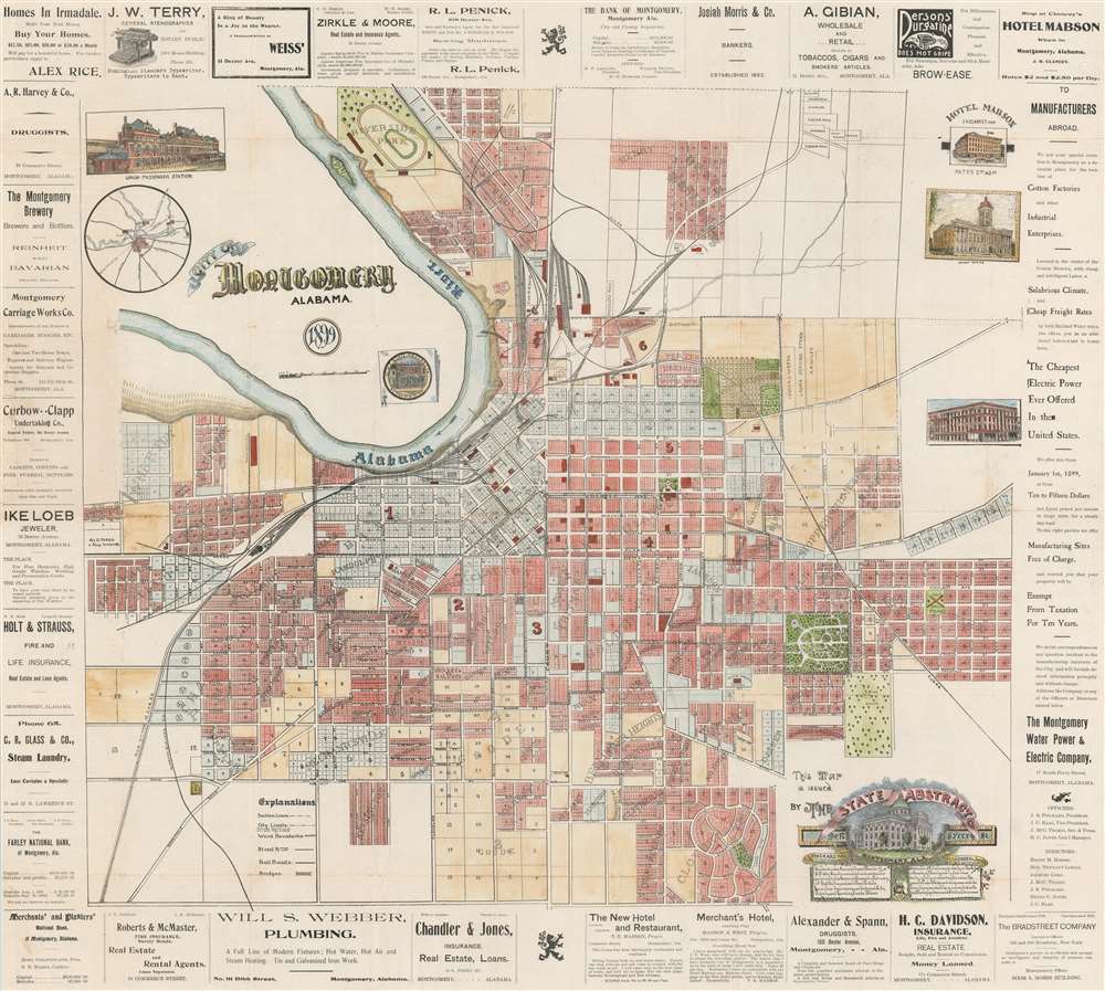
City of Montgomery Alabama.
sold
- Digital Map Information
- Suitable for large format printing
- File Size: 55.62 MB
- File Type: ZIP / TIFF
- ICC color profile embedded
- Delivered instantly via download link
This is a rare 1899 State Abstract Company city plan or map of Montgomery, Alabama. A highly detailed real estate map, individual lots throughout the city are illustrated and labeled, although some areas appear to have not yet fully divided lotted. Streets are identified, as are city wards, cemeteries, and parks. Mills, a distillery, a gun club, the stock yards, and the brick yard are also noted. Numerous railroad lines, including the Georgia and Alabama Railroad, the Alabama Midland Railroad, and the Mobile and Montgomery Division of the Louisville and Nashville Railroad. Views of the Court House, the Hotel Mabson, and Union Station are situated around the central map, as is a small inset map of the vicinity of Montgomery. The whole is surrounded by advertisements for local companies, such as the Montgomery Brewery, the Montgomery Carriage Works Company, a local undertaker, a jeweler, hotels, banks, and druggists. (more details)
Very Rare, Evocative Map of a Bucolic Corner of New York City
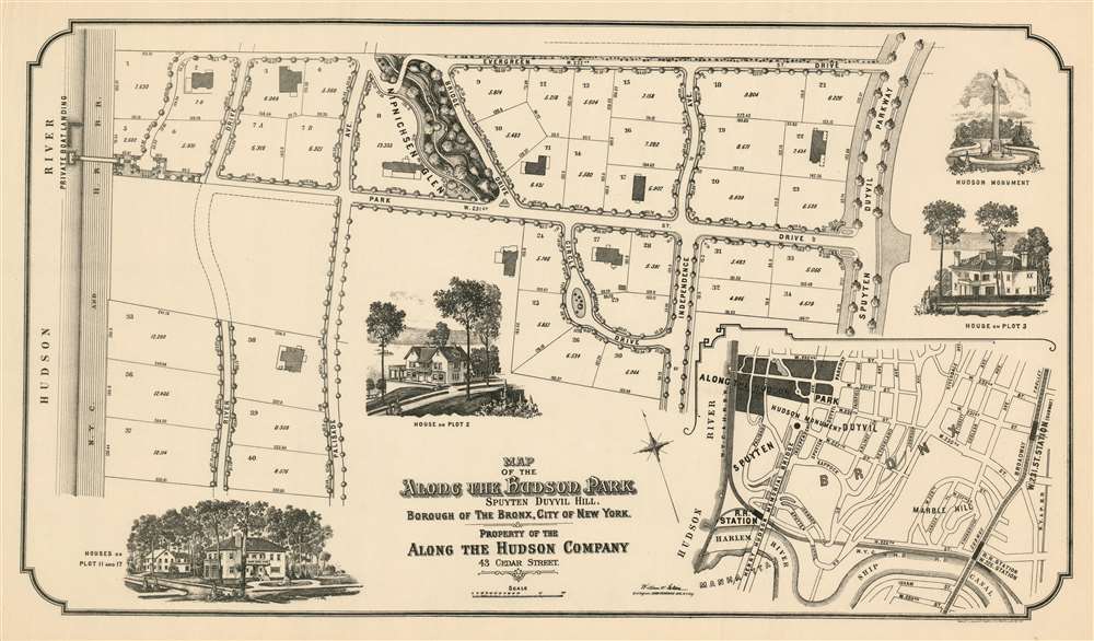
Map of the Along the Hudson Park Spuyten Duyvil Hill, Borough of the Bronx, City of New York. Property of the Along The Hudson Company.
sold
- Digital Map Information
- Suitable for large format printing
- File Size: 29.21 MB
- File Type: ZIP / TIFF
- ICC color profile embedded
- Delivered instantly via download link
This is a separately issued 1909 broadsheet map of the northern part of New York City's Spuyten Duyvil neighborhood, promoted here as 'Along the Hudson Park.' The development extends from about W. 227th up to W. 232nd, and from the Spuyten Duyvil Parkway (now the Henry Hudson) to the Hudson River. This neighborhood had long been - and largely remains - an enclave of residences that were picturesque and oddly remote despite being situated within the city limits. At the beginning of the 20th century urban life steadily encroached on these pockets of pastoral living. As early as 1901, local citizens led by attorney John Jay McKelvey began protesting the overflow into their neighborhoods of tuberculosis patients wandering off from nearby Seton Hospital. Thereafer, McKelvey litigated and legislated against what what he referred to as The City Ugly (in a mordant reference to the 'City Beautiful' movement.) The 'Along the Hudson Company' was one such effort: the company bough properly protectively - often backed by other owners - selling it to those thought to be congenial neighbors, and limiting strictly the use of those lots in the terms of sale. If at least 15,000 square feet, the lot could have a stable, but otherwise construction on these lots were restricted to single-family homes. The neighborhood was advertised in Country Life magazine in 1910:
If you are a person of character and responsibility, with tastes which center about your home and family, and if you have felt the narrowness of City life, then we will gladly show you Something Different. Along-the-Hudson Park on Spuyten Duyvil Hill. A Bit of the Adirondacks Set Within the City Gates and Permanently Restricted. It costs from $20,000 to $40,000 to be a dweller in Along-the-Hudson-Park, but is work it.(more details)
Issued during the election of 1940 wherein Roosevelt won an unprecedented 3rd term.

The Odyssey of F.D.R.
sold
- Digital Map Information
- Suitable for large format printing
- File Size: 23.25 MB
- File Type: ZIP / TIFF
- ICC color profile embedded
- Delivered instantly via download link
This 1939 Constantin Alajálov allegorical pictorial map chronicles the Presidency of Franklin Delano Roosevelt not as 'a history, but a free-wheeling trip through the headlines of the last seven years.' It must be noted that all these headlines fall largely on the negative side, probably because Henry Luce, the publisher of Fortune Magazine, was a harsh critic of Roosevelt, even stating after F.D.R.'s death that it was his 'duty to go on hating him'. (more details)
First state first edition of an iconic map of Quebec City.
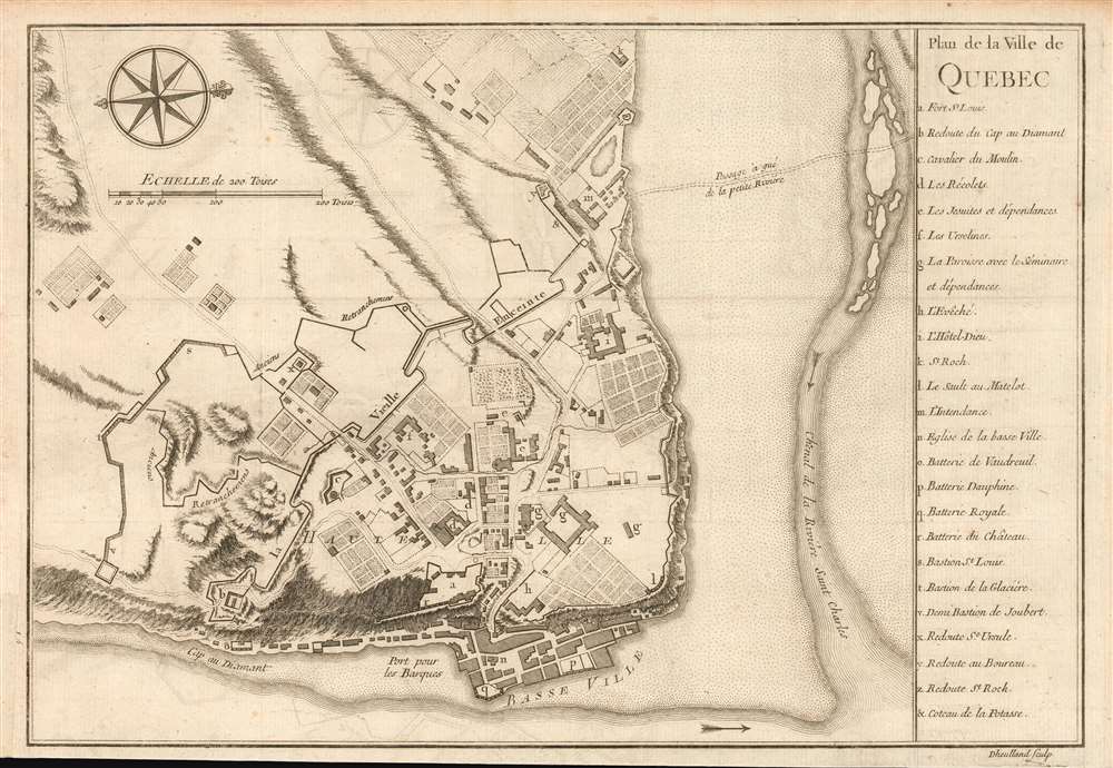
Plan de la Ville de Quebec.
sold
- Digital Map Information
- Suitable for large format printing
- DPI: 600
- File Size: 5.83 MB
- File Type: ZIP / TIFF
- ICC color profile embedded
- Delivered instantly via download link
A scarce 1744 first state first edition of Bellin's important map of Quebec City, Canada. Oriented to the west, Bellin's map covers the fortified center of Quebec City at the conjunction of the St. Laurence River and the St. Charles estuary. The map illustrates various fortifications as well as some 24 individual buildings including churches, schools, batteries and government buildings. Some of the surrounding farmland is also illustrated. On the east side of the city the port and is identified.
When Bellin drew this map Quebec City was a major center for the French Colony of Quebec with its strategic location dominating trade on the vital St. Lawrence artery. After the French and Indian War control of Quebec fell to the British. British rule proved both beneficial and magnanimous to the predominantly French population. (more details)
When Bellin drew this map Quebec City was a major center for the French Colony of Quebec with its strategic location dominating trade on the vital St. Lawrence artery. After the French and Indian War control of Quebec fell to the British. British rule proved both beneficial and magnanimous to the predominantly French population. (more details)
Elegant Map of the Atlantic, Showing Charlevoix' Voyage to and from North America.
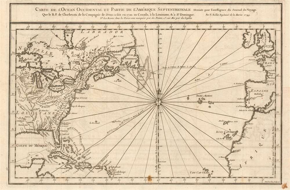
Carte De L'Ocean Occidental et Partie De L'Amerique Septentrionale Dressee pour l'intelligence du Journal du V oyage.
sold
- Digital Map Information
- Suitable for large format printing
- DPI: 600
- File Size: 8.7 MB
- File Type: ZIP / TIFF
- ICC color profile embedded
- Delivered instantly via download link
This is a 1744 Bellin map of the colonized regions of North America and the Caribbean Islands shown in relation to the coasts of Europe and Africa. It appeared in Pierre Francois Xavier de Charlevoix's 1744 Histoire et description generale de la Nouvelle France, one of the most comprehensive works on North America predating the French and Indian War. Charlevoix was a Jesuit missionary and traveler commissioned by the French Crown and the Duke of Orleans to explore French holdings in the Americas, particularly with a view towards finding a profitable route to the Pacific. Many hoped this in the network of rivers and lakes to the west of the Great Lakes, as suggested by earlier explorers and mapmakers such as Lahontan and De l'Isle. (more details)
Visually spectacular map of the Solar System.

Rand McNally Map of Outer Space.
sold
- Digital Map Information
- Suitable for large format printing
- File Size: 101.19 MB
- File Type: ZIP / TIFF
- ICC color profile embedded
- Delivered instantly via download link
This is a 1958 Rand McNally map of the Solar System. The map focuses on the Solar system and illustrates all eight planets (at that point there were nine). Moons orbit Earth, Mars, Jupiter, Saturn, Uranus, and Neptune, each of which is situated in its own orbit around the Sun. The distance in miles between the orbits is provided, as is the distance traveled in each orbit, the length of time spent in one orbit (given in Earth years), and the amount of time it takes for each planet to complete one revolution. Both Ceres and Eros are illustrated in the Asteroid Belt between Mars and Jupiter, and a note states that between 1,500 and 50,000 asteroids are known to exist within the belt. Other celestial formations are noted as well, including Antares, Magellanic clouds, the Crab Nebula, and the Andromeda Galaxy. Text boxes and inset views create a frame around the center map, and provide information concerning interplanetary and intergalactic distances, the relative size of the planes in the Solar System, an artist's rendering of Eros and Ceres, a chart of interplanetary weights, and artist renderings of a volcanic eruption on Mercury, canals on Mars, the Rings of Saturn, methane storms on Venus, the Jupiter's Great Red Spot, and Earth as seen from the Moon. (more details)
An Attracive Map of Quebec in the Vicinity of the Saguenay River

Carte Du Cours de la Riviere Saguenay appellee par les Sauvages Pitchitaouichetz
sold
- Digital Map Information
- Suitable for large format printing
- DPI: 600
- File Size: 5.15 MB
- File Type: ZIP / TIFF
- ICC color profile embedded
- Delivered instantly via download link
This is a 1744 Bellin map of the region of Quebec surrounding the course of the Saguenay River, reaching just short of Lake Saint-Jean. It shows the settlement of Chicoutimi (Chekoutimi on the map) in the location of present-day Saguenay. A track, running southwest, leads to Lac St. Charles near Quebec City.
This map appeared in Pierre Francois Xavier de Charlevoix's 1744 Histoire et description generale de la Nouvelle France, one of the most comprehensive works on North America predating the French and Indian War. Charlevoix was a Jesuit missionary and traveler commissioned by the French Crown and the Duke of Orleans to explore French holdings in the Americas, particularly with a view towards finding a profitable route to the Pacific. Many hoped this in the network of rivers and lakes to the west of the Great Lakes, as suggested by earlier explorers and mapmakers such as Lahontan and De l'Isle. (more details)
This map appeared in Pierre Francois Xavier de Charlevoix's 1744 Histoire et description generale de la Nouvelle France, one of the most comprehensive works on North America predating the French and Indian War. Charlevoix was a Jesuit missionary and traveler commissioned by the French Crown and the Duke of Orleans to explore French holdings in the Americas, particularly with a view towards finding a profitable route to the Pacific. Many hoped this in the network of rivers and lakes to the west of the Great Lakes, as suggested by earlier explorers and mapmakers such as Lahontan and De l'Isle. (more details)
Richly Detailed Brazilian Manuscript from the War of the Triple Alliance
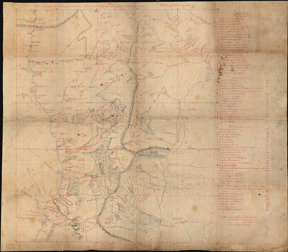
Esboco do Theatro das Operacoes das Cordilheiras do e do Norte do Paraguay organisado pela Commisao d'Engenheiros. V. do Rosario Febereiro de 1870
sold
- Digital Map Information
- Suitable for large format printing
- File Size: 50.08 MB
- File Type: ZIP / TIFF
- ICC color profile embedded
- Delivered instantly via download link
This is a one-off manuscript map of the border region between Paraguay and Brazil, a mountainous region northeast of Asunción, Paraguay, and the main theatre of war during the Paraguayan War (also known in Paraguay as The Great War) between 1864 and 1870. The ... (more details)
A rare geological map of Guatemala.
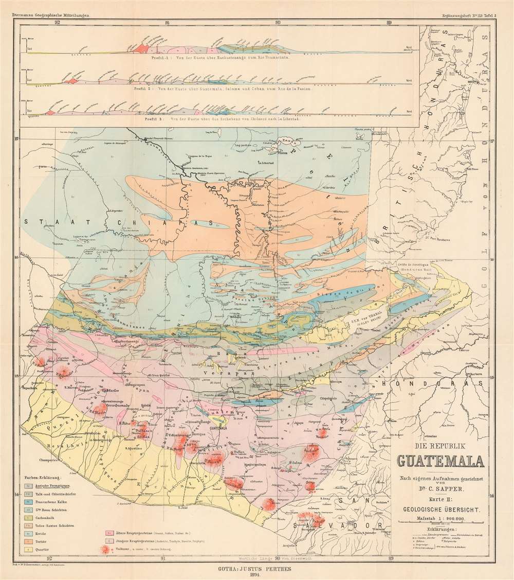
Die Republik Guatemala Nach eigene Aufnahmen gezeiehnet von Dr. C. Sapper. Karte II: Geologische Übersicht.
sold
- Digital Map Information
- Suitable for large format printing
- File Size: 20.11 MB
- File Type: ZIP / TIFF
- ICC color profile embedded
- Delivered instantly via download link
This is an 1894 Bruno Hassenstein geological map of Guatemala. Eleven different colors represent eleven different geological formations, including Azoic formations, formations of talc and chlorite slate, tertiary formations, quaternary formations, and older and younger igneous rock formations. A key situated in the lower left corner identifies which color corresponds with which formation, and small upper-case letters are used on the map to explicitly identify the color used in different sections of the map. Even small areas of each color are labeled, allowing for easy identification of the formations. Three profiles are situated along the top border and present this information from a much different perspective, allowing the viewer a better understanding of how rock formations create layers in the Earth's crust. The first profile illustrates an area 'from the coast via Huehuetenango to the Rio Usumacinta', while the second details a region 'from the coast via Guatemala, Salama and Coban to the Rio de la Pasion', and the third depicts an area from the coast over the Chilasco Plateau to La Libertad'. (more details)
Highlights to vast array of vegetation present in the Mato Grosso, an incredibly biologically diverse part of the Brazilian rainforest.
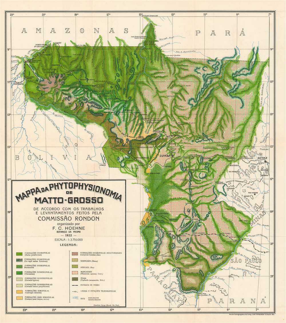
Mapa da Phytophysionomia de Matto-Grosso de Accordo com os Trabalhos e Levantamentos Feitos Pela Commissão Rondon. (Map of the Mato Grosso Phytophysiognomy According to the Works and Surveys Made by the Rondon Commission.)
sold
- Digital Map Information
- Suitable for large format printing
- File Size: 31.56 MB
- File Type: ZIP / TIFF
- ICC color profile embedded
- Delivered instantly via download link
This is a 1922 Frederico Carlos Hoehne map of the Mato Grosso region of Brazil highlighting regional differences in vegetation. The Mato Grosso is one of the most remote and little understood regions of Brazil. It is the location where the famous explorer, Percy Fawcett believed he would discover El Dorado, or as he called it, Z, and where he ultimately vanished. Maps of the Mato Grosso are exceedingly scarce due to the remoteness of the region and density of the rain forest. On this map, Hoehne differentiates between thirteen different 'phytophysiognomies', which are labeled here as 'formations', some of which include 'typical savannahs', 'parquiform low savannahs', and 'high wet meadows', and uses different patterns and colors to identify each one. Phytophysiognomy refers to the specific character and attributes of a given type of plant based on its appearance. Many of the settlements identified here are actually telegraph stations, with the exception of Cuyaba (Cuiabá), the regional capital, Diamantino, Corumba, and others. The telegraph lines are illustrated by thin black lines between the telegraph stations, which are marked by white circles. The whole network illustrated here was put in place by 'The Rondon Commission', a military operation led by Cândido Rondon, a Brazilian military officer and explorer. The Madeira-Mamoré Railroad, situated in the upper left, and the North Western of Brazil Railway, situated in the bottom right quadrant and ending at Porto Esperança, are both illustrated. Perhaps the most intriguing notation present in the key, situated in the lower left corner, is the differentiation between explored rivers and unexplored rivers. (more details)
Extremely Rare Map Showing the Extent of the 1906 San Francisco Fire
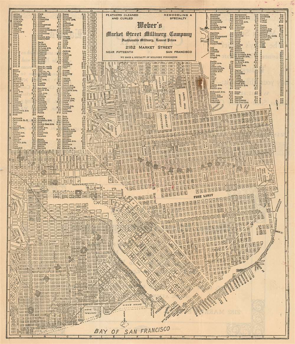
(verso) Revised City Map of San Francisco, Cal.
sold
- Digital Map Information
- Suitable for large format printing
- File Size: 14.01 MB
- File Type: ZIP / TIFF
- ICC color profile embedded
- Delivered instantly via download link
This rare c. 1907 map of San Francisco, advertising a San Francisco Millinery company, excerpts the similarly rare Washington Dodge 1902 Index Map of the City and County of San Francisco. It reproduces identically the portion of the Dodge map comprised of Potrero, the Business District, The Western Addition, and the Mission. Dodge's map, a government publication produced as part of his work as city assessor, was probably the best detailed map of the city produced prior to the 1906 fire. This present map, probably produced in 1907, repurposes the northeast corner of the Dodge map: it has been re-oriented to the west, a new set of coordinate bars and an index of street names has been added and - most significantly - the outer limit of the area destroyed by the fire of 1906 has been masked off and labeled. By thus highlighting the destruction of the late fire, the map is able to reassue its audience that 'Weber's Market Street Millinery Company' can still be found, outside the burned area by a few short blocks. The verso the map touts Weber's wares ('Weber's Market Street Millinery Company Will always have on hand the very Latest Styles in Ladies Millinery, Trimmed Hats, Ready to Wear Hats, Shapes, Frames, Etc., Etc.') but the outside fold trumpets an optimistic outlook for a city staggered by earthquake and fire: 'Revised City Map o San Francisco, Cal. -- Our Prediction Population, in 1912 ONE MILLION.' (more details)
Iconic and hilarious pictorial map of the United States as imagined by a New Yorker in the 1930s.
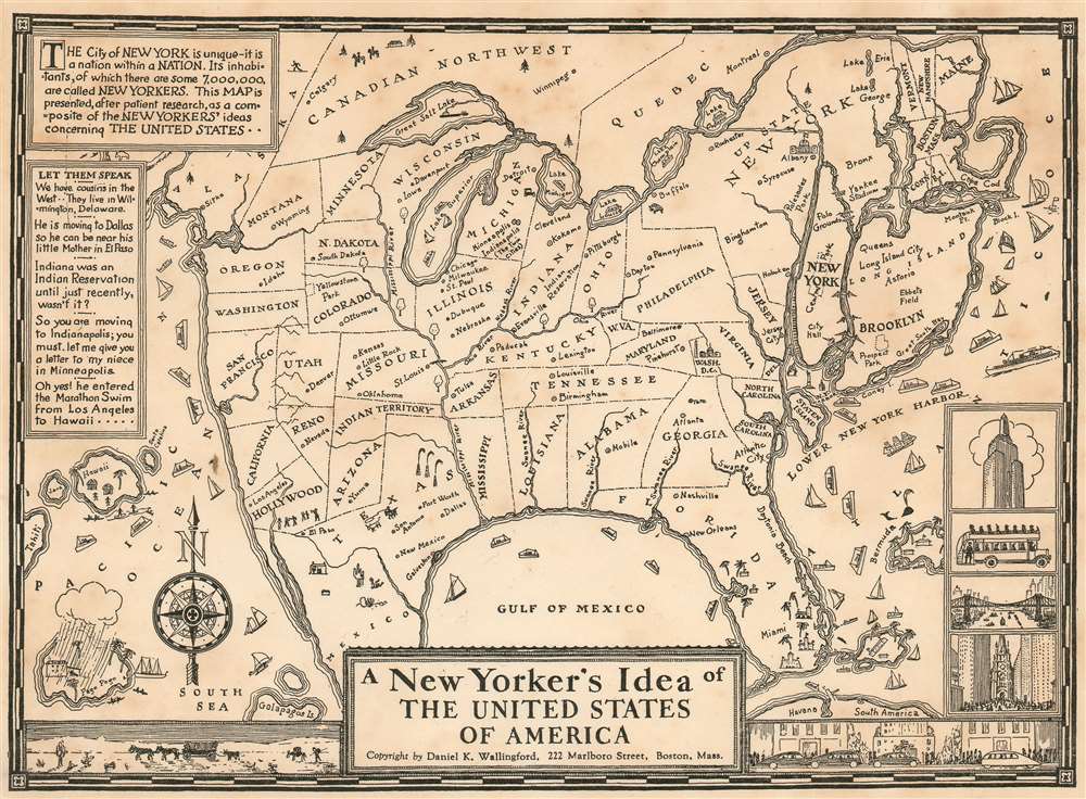
A New Yorker's Idea of The United States of America
sold
- Digital Map Information
- Suitable for large format printing
- File Size: 5.42 MB
- File Type: ZIP / TIFF
- ICC color profile embedded
- Delivered instantly via download link
This scarce and whimsical 1937 map depicts the United States, as seen by a 'typical' New Yorker - as envisaged by the Bostonian author, Daniel K. Wallingford. The map presents a highly distorted view of the country (and a similarly distorted view of the New Yorker), wherein New York State, and in particular Manhattan and Long Island are ludicrously out of proportion in relation to the rest of the country.
The map is a charming combination of humor and satire, depicting the provincialism of a New Yorker, to whom the rest of the country is unimportant. Names of places are either inaccurate or random, showing a New Yorker's supposed ignorance and disinterest in the rest of the country. The American southeast sports a massive Florida and four rivers, all named 'Swanee River'. Hollywood and San Francisco take up two-thirds of California and are shown as separate states. Minneapolis and Indianapolis are shown as 'twin cities' in Michigan, with Chicago, Milwaukee, St. Paul, Dubuque and Nebraska as cities in Illinois. Nevada is a city in Reno, and New Mexico is a city in Texas. The Great Salt Lake replaces Lake Superior, while Lake Michigan takes the name of Lake Superior. Lake Champlain is bigger than Lake Michigan, while Lake Erie is depicted as tiny lake in northern New York.
The map also includes beautiful illustrations of ships, whales, and islands; notable features of several states are also shown pictorially (e.g. the oil wells of Texas.) The lower right quadrant of the map includes four views of New York, including the Empire State building and the Fifth Avenue Coach. Another charming illustration along the lower border depicts a view of the desert and wagons on the left and a city and cars on the right. The upper left quadrant includes amusing text, attributed to actual New Yorkers: 'We have cousins in he west... they live in Wilmington, Delaware.' 'He is moving o Dallas so he can be near his mother in El Paso.' 'Indiana was an Indian Reservation until just recently, wasn't it?'. (more details)
The map is a charming combination of humor and satire, depicting the provincialism of a New Yorker, to whom the rest of the country is unimportant. Names of places are either inaccurate or random, showing a New Yorker's supposed ignorance and disinterest in the rest of the country. The American southeast sports a massive Florida and four rivers, all named 'Swanee River'. Hollywood and San Francisco take up two-thirds of California and are shown as separate states. Minneapolis and Indianapolis are shown as 'twin cities' in Michigan, with Chicago, Milwaukee, St. Paul, Dubuque and Nebraska as cities in Illinois. Nevada is a city in Reno, and New Mexico is a city in Texas. The Great Salt Lake replaces Lake Superior, while Lake Michigan takes the name of Lake Superior. Lake Champlain is bigger than Lake Michigan, while Lake Erie is depicted as tiny lake in northern New York.
The map also includes beautiful illustrations of ships, whales, and islands; notable features of several states are also shown pictorially (e.g. the oil wells of Texas.) The lower right quadrant of the map includes four views of New York, including the Empire State building and the Fifth Avenue Coach. Another charming illustration along the lower border depicts a view of the desert and wagons on the left and a city and cars on the right. The upper left quadrant includes amusing text, attributed to actual New Yorkers: 'We have cousins in he west... they live in Wilmington, Delaware.' 'He is moving o Dallas so he can be near his mother in El Paso.' 'Indiana was an Indian Reservation until just recently, wasn't it?'. (more details)