
The earliest obtainable map of Wellington, capital of New Zealand. Shows Maori land grants.
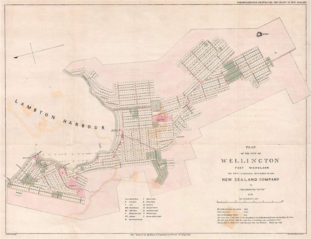
Plan of the City of Wellington Port Nicholson the First and Principal Settlement of the New Zealand Company.
sold
- Digital Map Information
- Suitable for large format printing
- DPI: 300
- File Size: 9.17 MB
- File Type: ZIP / TIFF
- ICC color profile embedded
- Delivered instantly via download link
This rare 1841 map of Wellington is one of the earliest obtainable plans of the modern-day capital of New Zealand. The map was surveyed on behalf of the New Zealand Land Company in 1840 by the first Surveyor-General of New Zealand, Felton Mathew. Mathew laid out the new city's road and grid system in precise detail. The street grid shown here is still reflected in the modern city. This map was issued in 1842 for the House of Commons, probably in conjunction with the Spain Commission, and based upon Mathew's 1840 manuscript survey. (more details)
Map of Manila belonging to a commander of the anti-guerilla 'Ilocano Scouts!'
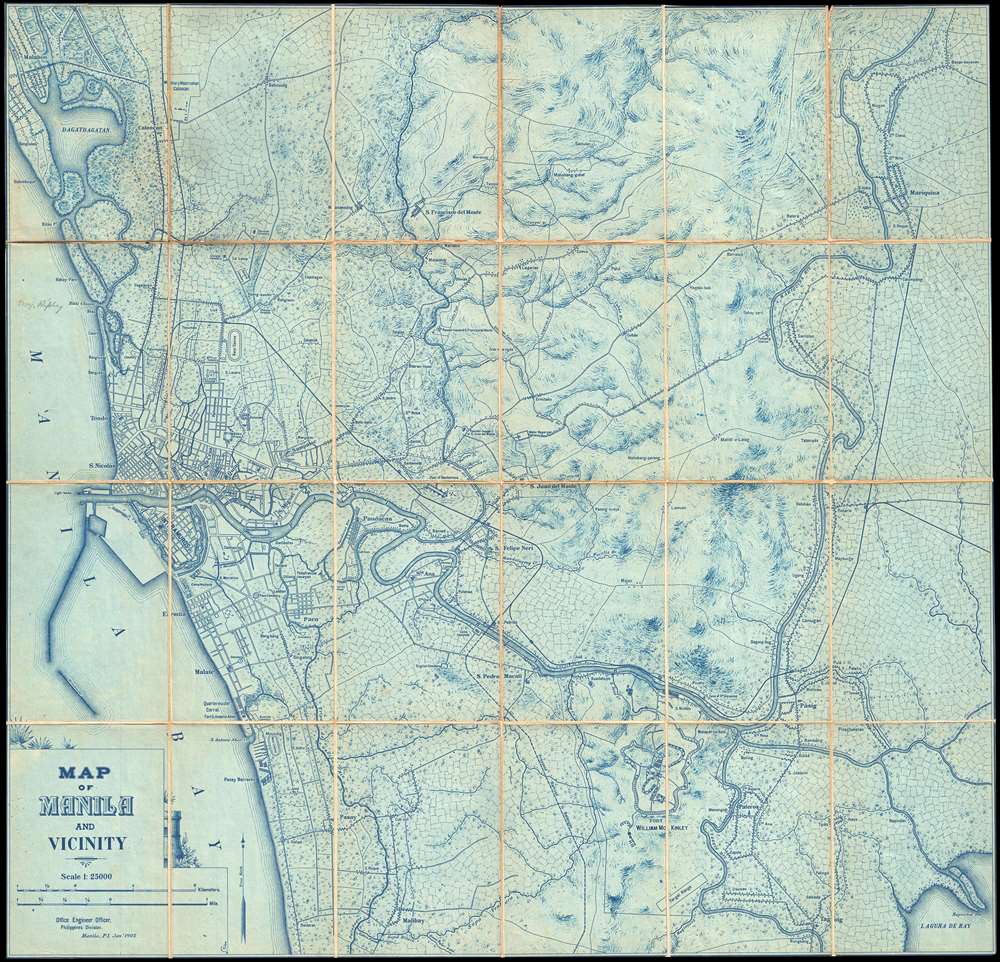
Map of Manila and Vicinity.
sold
- Digital Map Information
- Suitable for large format printing
- File Size: 23.57 MB
- File Type: ZIP / TIFF
- ICC color profile embedded
- Delivered instantly via download link
An unrecorded 1905 cyanotype U. S. Army Engineers map of Manila and vicinity, the Philippines. The map illustrates the Manila region shortly after the Philippine-American War (1899 - 1902), when the United States assumed control of the Philippines after over 300 years of Spanish rule. The United States was eager to develop its new colony with modernized infrastructure, including new railroads, communications systems, and an electrical grid. (more details)
Fine example of Chinese Qing regional cartography.

長樂縣全圖 / Complete Map of Changle County.
sold
- Digital Map Information
- Suitable for large format printing
- DPI: 300
- File Size: 48.61 MB
- File Type: ZIP / TIFF
- ICC color profile embedded
- Delivered instantly via download link
A finely executed c. 1800 late Qing Dynasty Chinese manuscript map of Wuhua County in eastern Guangdong Province, China. The map, which uses the Qing name of the region, Changle County, was composed by an anonymous Chinese cartographer, probably a regional ... (more details)
A folk art pictorial map of the White Mountains created for the burgeoning tourism industry in the region.
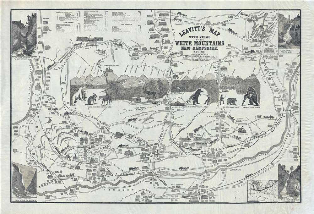
Leavitt's Map with Views of the White Mountains, New Hampshire.
sold
- Digital Map Information
- Suitable for large format printing
- File Size: 16.14 MB
- File Type: ZIP / TIFF
- ICC color profile embedded
- Delivered instantly via download link
Complete with frightening bears, this is Franklin and Victor Leavitt's idiosyncratic 1888 pictorial map of New Hampshire's White Mountains. The folksy map depicts the region from the Androscoggin River to the Connecticut River and from Lake Winnipesaukee to Concord, Vermont. Drawn in Leavitt's own quirky style, the charm of this map is immediately apparent. Created with a tourist in mind, individual hotels and great estates are illustrated in profile throughout the map. Local history abounds, some of which is actual, some of which is pure legend, many of which involve the daring exploits of locals hunting. A view of the White Mountains is situated in the center, with the illustrated peaks labeled and their elevations given (though rounded to the nearest 100 feet). Roads and railroads crisscross the region, nearly all of which are labeled, and illustrations of horse-drawn carriages adorn the roads and while trains run along their tracks. Views of four different waterfalls are situated in each of the corners and an inset map of the rail routes from Boston is included on the lower right. (more details)
Highlights Guatemala's Mayan ruins, including Tikal, Uaxactun, and Piedras Negras.

Pictorial Map of the Republic of Guatemala.
sold
- Digital Map Information
- Suitable for large format printing
- File Size: 25.18 MB
- File Type: ZIP / TIFF
- ICC color profile embedded
- Delivered instantly via download link
This is a c. 1950 Delfino Sánchez Latour pictorial map of Guatemala. The map depicts the region from Mexico to the Atlantic Ocean and Honduras and from Mexico and Belize to the Pacific Ocean and El Salvador. Beautifully illustrated, Latour highlights Guatemala's past and present by including numerous vingettes of Mayan ruins, such as Tikal, Piedras Negras, and Uaxactun (Uaxactum) in the Petén department, alongside images of Guatemalans going about their daily lives: Loggers harvest Guatemala's forests, miners extract gold and silver from its mountains, and farmers harvest their crops and carry them to market. Cities and towns throughout the country are labeled, including Guatemala City, Quezaltenango, and Aguacatan, and some buildings within the cities are illustrated in profile. Lakes and rivers are also illustrated and labeled, as are several volcanoes. A panorama is situated along the bottom border, highlighting the traditional costumes and Guatemalan culture, while also promoting modern fashion and transportation. (more details)
Working nautical chart with annotations around Bermuda.
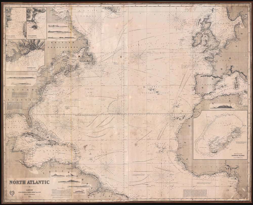
North Atlantic.
sold
- Digital Map Information
- Suitable for large format printing
- File Size: 553.47 MB
- File Type: ZIP / TIFF
- ICC color profile embedded
- Delivered instantly via download link
This is an uncommon 1871 James Imray and Son blueback nautical chart or maritime map of the North Atlantic. The map covers from the Equator and the mouth of the Amazon river to the southern shores of Greenland, and from the Gulf of Mexico to the Baltic Sea and Sardinia. The chart contains a wealth of nautical information regarding trade winds, oceanic depths, currents, and more. There are detailed inset maps of Bermuda, Fayal Channel (Faial-Pico Channel), Azores), Horta and Pim Bays (Azores), and Funchal Bay (Madeira). Some pencil marks and erasures suggest early maritime use in the vicinity of Bermuda. (more details)
An attractive pictorial map of Paris highlighting the city's many iconic buildings, including the Eiffel Tower, the Louvre, and the Arc de Triomphe.
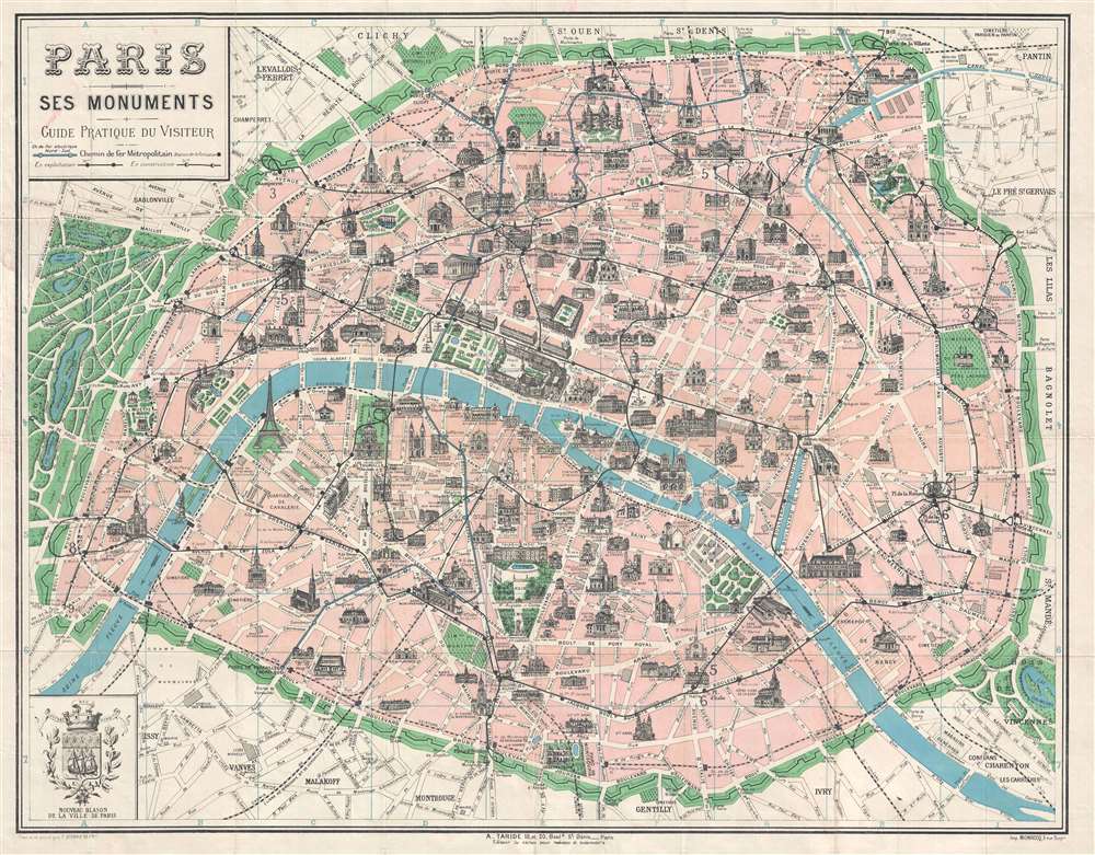
Paris Ses Monuments.
sold
- Digital Map Information
- Suitable for large format printing
- File Size: 12.92 MB
- File Type: ZIP / TIFF
- ICC color profile embedded
- Delivered instantly via download link
This is an attractive c. 1925 pictorial tourist pocket map of Paris, France by F. Borremans. The map depicts the city of Paris from Bois de Boulogne to Bagnolet and the Bois de Vincennes and from Porte de la Villette to the Park Montsouris. Parisian ... (more details)
One of the world's most iconic city plans, it renders Rome in mond-blowing detail.
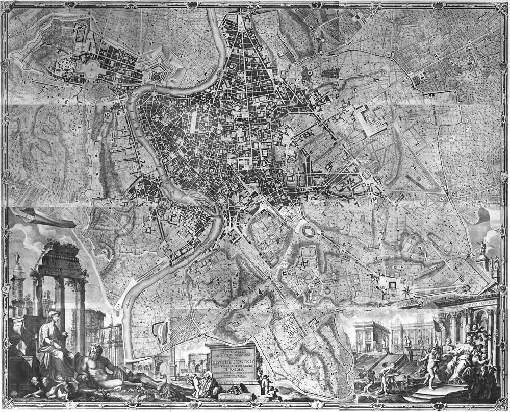
Alla Santita' Di Nostro Signore Papa Benedetto XIV La Nuova Topografia Di Roma Ossequiosamente Offerisce E Dedica L'Umilissimo Servo Giambattista Nolli Comasco.
sold
This is a 1748 Giambattista Nolli city map or plan of Rome, which ranks as one of the best city plans ever produced. The map depicts the city in astonishing detail from the Villa Pamphili to the Tempio di Venere e Cupido and from the Vatican to the Porta San Sebastiano. Commissions by Pope Benedict XIV in an attempt to better understand the formal demarcations between Rome fourteen Rioni (traditional districts dated to the 12th century), Nolli's plan is impressive not only for its scale and accuracy, but because it is an ichnographic plan. (more details)
A striking pictorial map of Lower Manhattan featuring illustrations of the Woolworth Building, Singer Tower, and the Statue of Liberty.
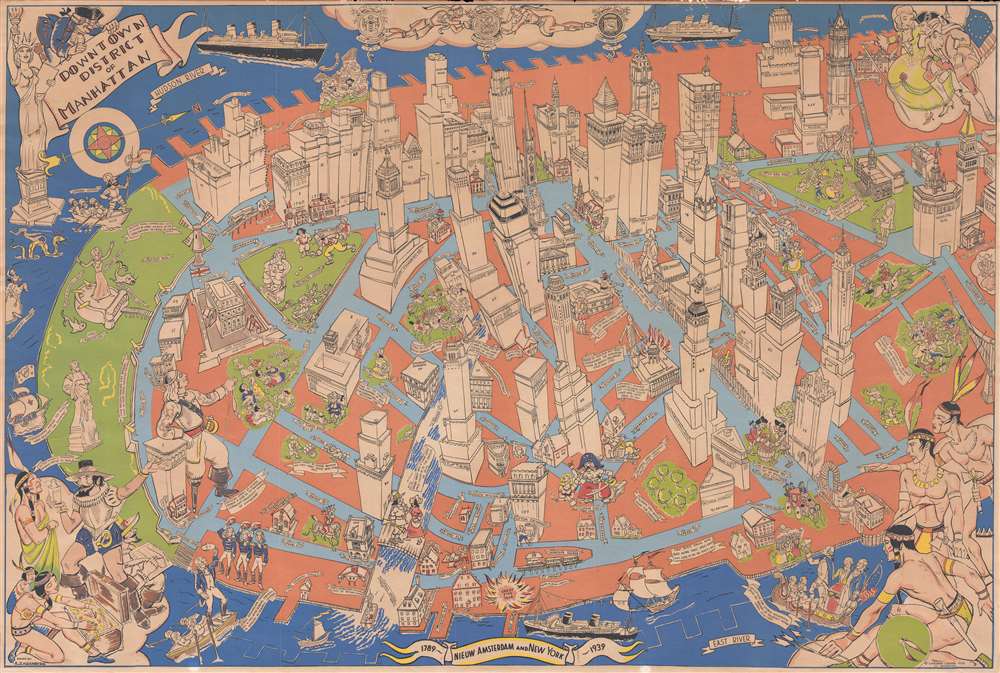
Downtown District of Manhattan.
sold
- Digital Map Information
- Suitable for large format printing
- File Size: 19.65 MB
- File Type: ZIP / TIFF
- ICC color profile embedded
- Delivered instantly via download link
This is a 1938 Arthur Zaidenberg pictorial map of Lower Manhattan in New York City. The map depicts a portion of the borough of Manhattan from Battery Park north to the intersection of Chambers Street and Broadway and from the Hudson River to the East River. Strikingly illustrated, buildings throughout 'downtown Manhattan', as Zaidenberg refers to the area, are drawn in profile. Most of the buildings are labeled, including the Singer Tower, the U.S. Customs House, Fraunces Tavern, City Hall, and the Woolworth building. Each building also bears its street address, allowing visitors to easily find the landmark building they want to see. Several buildings also reference when they were constructed, such as the Presbyterian Church on Wall Street (1719) and Castle Clinton in Battery Park (1807). Famous figures in New York's history are also included, such as Hudson and Verrazzano, two important early explorers who 'discovered' parts of the region. Statues of other historical figures are scattered throughout, including Washington Irving, George Washington, Nathan Hale, and Benjamin Franklin.
Vignettes of historical events also dot the map, such as the Battle of Golden Hill, George Washington leaving after bidding farewell to his generals in 1783, and Washington arriving for his inauguration as president in 1789. A vignette also adorns each corner: the title cartouche is situated in the upper left corner next to a striking illustration of the Statue of Liberty, two citizens from the era of the Revolution are included in the upper right corner, while a trio of Native Americans is illustrated in the lower right corner, and finally Peter Minuit is shown buying 'Manna-Hatin' on the lower left. (more details)
Vignettes of historical events also dot the map, such as the Battle of Golden Hill, George Washington leaving after bidding farewell to his generals in 1783, and Washington arriving for his inauguration as president in 1789. A vignette also adorns each corner: the title cartouche is situated in the upper left corner next to a striking illustration of the Statue of Liberty, two citizens from the era of the Revolution are included in the upper right corner, while a trio of Native Americans is illustrated in the lower right corner, and finally Peter Minuit is shown buying 'Manna-Hatin' on the lower left. (more details)
The first printed map of Asia.

Tabula orientalis regionis, Asiae scilicet extremas complectens terras et regna.
sold
- Digital Map Information
- Suitable for large format printing
- DPI: 300
- File Size: 5 MB
- File Type: ZIP / TIFF
- ICC color profile embedded
- Delivered instantly via download link
This is a c. 1550 Sebastian Munster map of Asia, the first specific printed map of Asia and the earliest obtainable map of the continent. The map depicts the Asian continent from the Caspian Sea and the Persian Gulf to the Pacific Ocean and from the ... (more details)
One of the most detailed maps of Central Luzon issued during the Philippine-American War.

Map of Central Luzon showing a portion of the Field of Operations of the 8th Army Corps.
sold
- Digital Map Information
- Suitable for large format printing
- File Size: 12.63 MB
- File Type: ZIP / TIFF
- ICC color profile embedded
- Delivered instantly via download link
This is an extremely rare map of central Luzon, the Philippines, issued at the height of the Philippine-American War (1899 – 1902) by William L. Sibert of the 8th Army Engineering Corps and the Military Governor in the Philippines, Major General Elwell Stephen Otis. Drawn on a scale of 1 : 240000, this map is one the most detailed cartographic productions to emerge from the Philippine-American War. The map covers central Luzon, specifically the lands including and just north of Manila and Manila Bay to Lingayen Gulf. During the early stages of the Philippine-American War, this area was largely controlled by Philippine forces and was the most active theater. Three different 'lines of operations' are illustrated, marking the advance of three different columns of troops under the command of Major General Henry Ware Lawton, Major General Arthur MacArthur Jr., and Brigadier General Loyd Wheaton. Numerous cities, towns, and villages are labeled throughout along with rivers and lakes. Roads and telegraph lines are also illustrated. Topography is shown by hachure. (more details)
An incredibly rare map of Panay issued during the Philippine-American War.
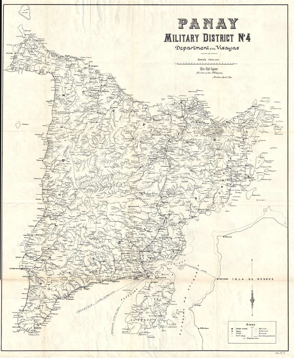
Panay. Military District No. 4. Department of the Visayas.
sold
- Digital Map Information
- Suitable for large format printing
- File Size: 18.08 MB
- File Type: ZIP / TIFF
- ICC color profile embedded
- Delivered instantly via download link
This is a rare 1900 map of Panay, the Vasayas, the Philippines, issued at the height of the Philippine-American War (1899 – 1902) by the Office of the Chief Engineer in the Philippines. The campaign in the Vasayas began four days after the ... (more details)
Depicts in detail the battlefield of the Battle of Antietam - the bloodiest day in U.S. history.
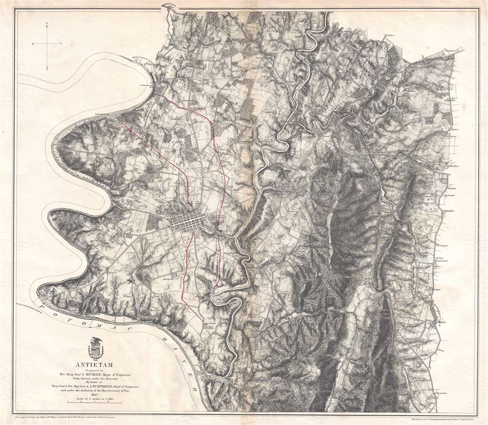
Antietam.
sold
- Digital Map Information
- Suitable for large format printing
- File Size: 19.2 MB
- File Type: ZIP / TIFF
- ICC color profile embedded
- Delivered instantly via download link
This is an 1867 John Weyss and Nathaniel Michler map of the battlefield of Antietam in Maryland. The map depicts the region from the Potomac River to Rohrersville and from Bakersville to just south of the Antietam Iron Works situated at the confluence of Antietam Creek and the Potomac River. (more details)
The battle where Confederate General 'Stonewall' Jackson was killed by friendly fire.
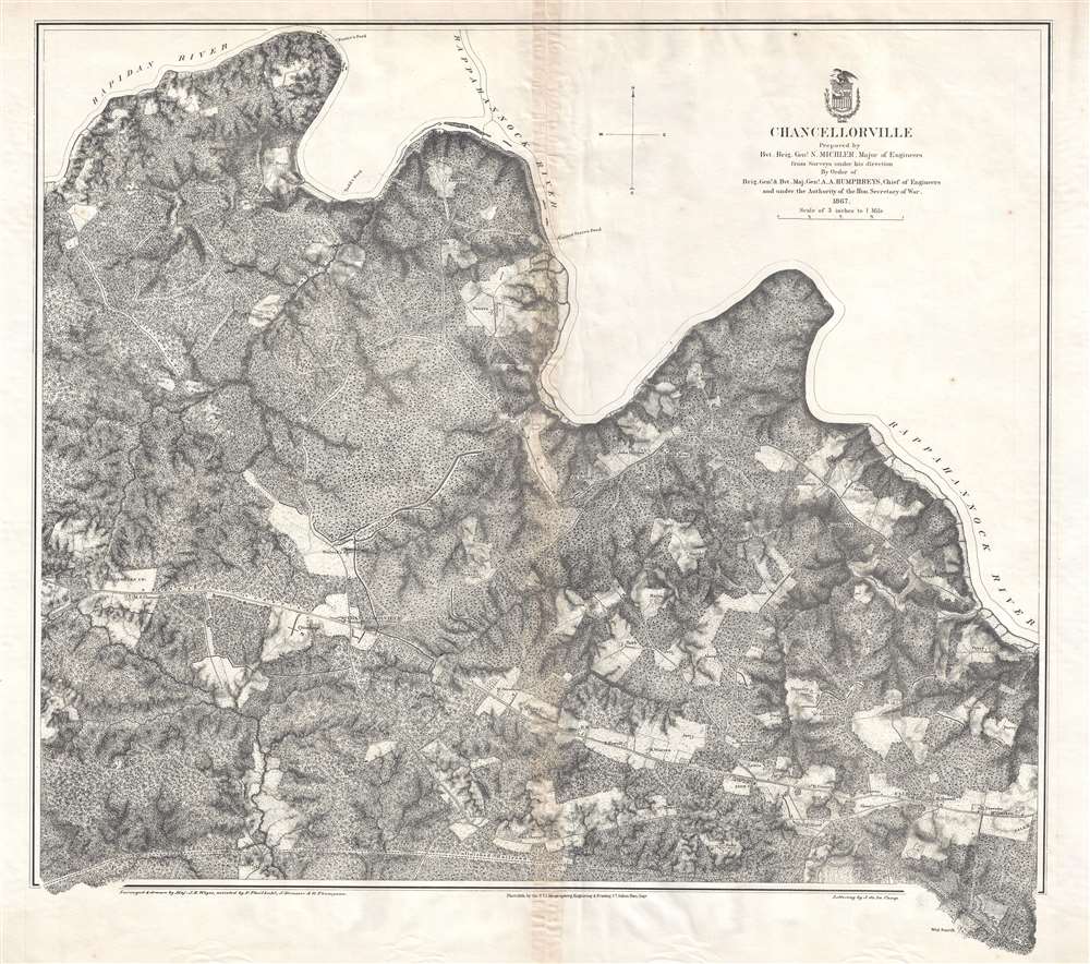
Chancellorville.
sold
- Digital Map Information
- Suitable for large format printing
- File Size: 20.33 MB
- File Type: ZIP / TIFF
- ICC color profile embedded
- Delivered instantly via download link
This is a rare 1867 John Weyss and Nathaniel Michler map of the battlefield of Chancellorsville in Spotsylvania County, Virginia. The map depicts the region from James Taylor's homestead on the Orange Turnpike to the Rappahannock River and from Foster's Ford on the Rapidan River to an unfinished railroad that runs roughly parallel to the Orange Turnpike and Haxel Run. Fortifications are illustrated throughout, although they remain unlabeled, so the viewer is unable to know whether the fortifications are Confederate or Union lines without some prior knowledge. These lines are, most likely, Union Major General Joseph Hooker's defensive lines. Apart from the lack of military notations, the map presents a highly detailed depiction of the region, including numerous homesteads that are identified by the owner's last name, forests, fields, streams, and rivers. The Orange Turnpike nearly divides the region in two, while an unfinished railroad line traverses the map near the bottom border. Chancellorsville itself is situated along the Orange Turnpike in the bottom left quadrant. (more details)
Broadside map of the Mexican Revolution issued to assure Travelers Insurance customers that their assets in Mexico were protected.

Compliments of The Travelers Insurance Company, Hartford, Conn.
sold
- Digital Map Information
- Suitable for large format printing
- File Size: 9.23 MB
- File Type: ZIP / TIFF
- ICC color profile embedded
- Delivered instantly via download link
This is a 1913 Travelers Insurance Company and Rand McNally map of Mexico during the Mexican Revolution (1910 – 1920). The map, intended for American customers of Travelers, was meant to assure investors that their insured assets in Revolutionary Mexico were protected. Coverage extends from the Pacific Ocean to the Atlantic Ocean and from the southern United States to Guatemala, Honduras, and the Gulf of Tehuantepec. Created for the Travelers Insurance Company, the situation in Mexico is presented by using red overprinting identifying which factions controlled various parts of Mexico. Areas controlled by Venustiano Carranza, Jose 'Poncho' Villa, and Emiliano Zapata, all important figures in the Mexican revolution, are labeled, as are all the garrisons of Mexican federal troops. U.S. forts along the U.S.-Mexico border are also highlighted using the red overprinting, reinforcing the notion that the United States was protected against the chaos to its south. As this is a Rand McNally map, myriad cities, towns, and villages are labeled and the principle cities are underscored in red. An inset map of Mexico City and its environs is situated in the lower left corner. (more details)
Promotes tourism in the eastern Sierra Nevadas near Yosemite National Park particularly among sportsmen.
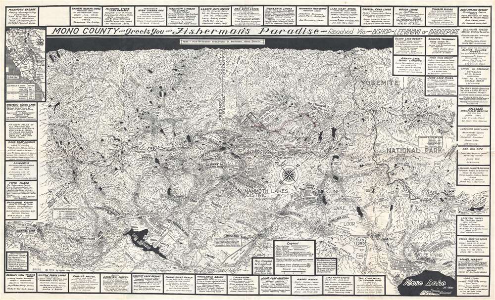
Mono County - Greets You - Fisherman's Paradise - Reached Via - Bishop - Lee Vining or Bridgeport.
sold
- Digital Map Information
- Suitable for large format printing
- File Size: 16.32 MB
- File Type: ZIP / TIFF
- ICC color profile embedded
- Delivered instantly via download link
This is a 1954 Emmett Hayden map of the Mammoth Lakes district of southern Mono County, California, situated in the eastern Sierra Nevada Mountains near Yosemite National Park. The map depicts the region from Paradise Camp located on U.S. ... (more details)
One of the maps in the Greater Co-Prosperity Sphere series and one of the most cartographically beautiful 20th century maps of New Zealand.
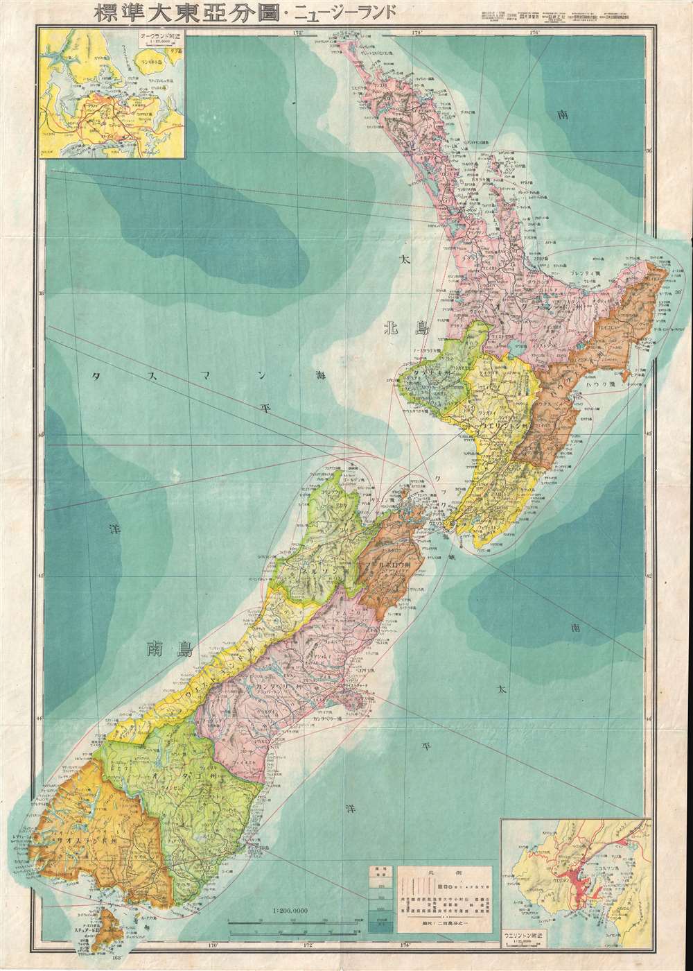
New Zealand.
sold
- Digital Map Information
- Suitable for large format printing
- File Size: 12.03 MB
- File Type: ZIP / TIFF
- ICC color profile embedded
- Delivered instantly via download link
This is a stunning large format Japanese map of New Zealand dating to World War II, one of the maps in the Greater East Asia Co-Prosperity Sphere set. It is one of the most beautiful cartographic depictions of New Zealand to appear in the ... (more details)
Includes vignettes many classic fairy tales, including Little Red Riding Hood, Cinderella, and Snow White.
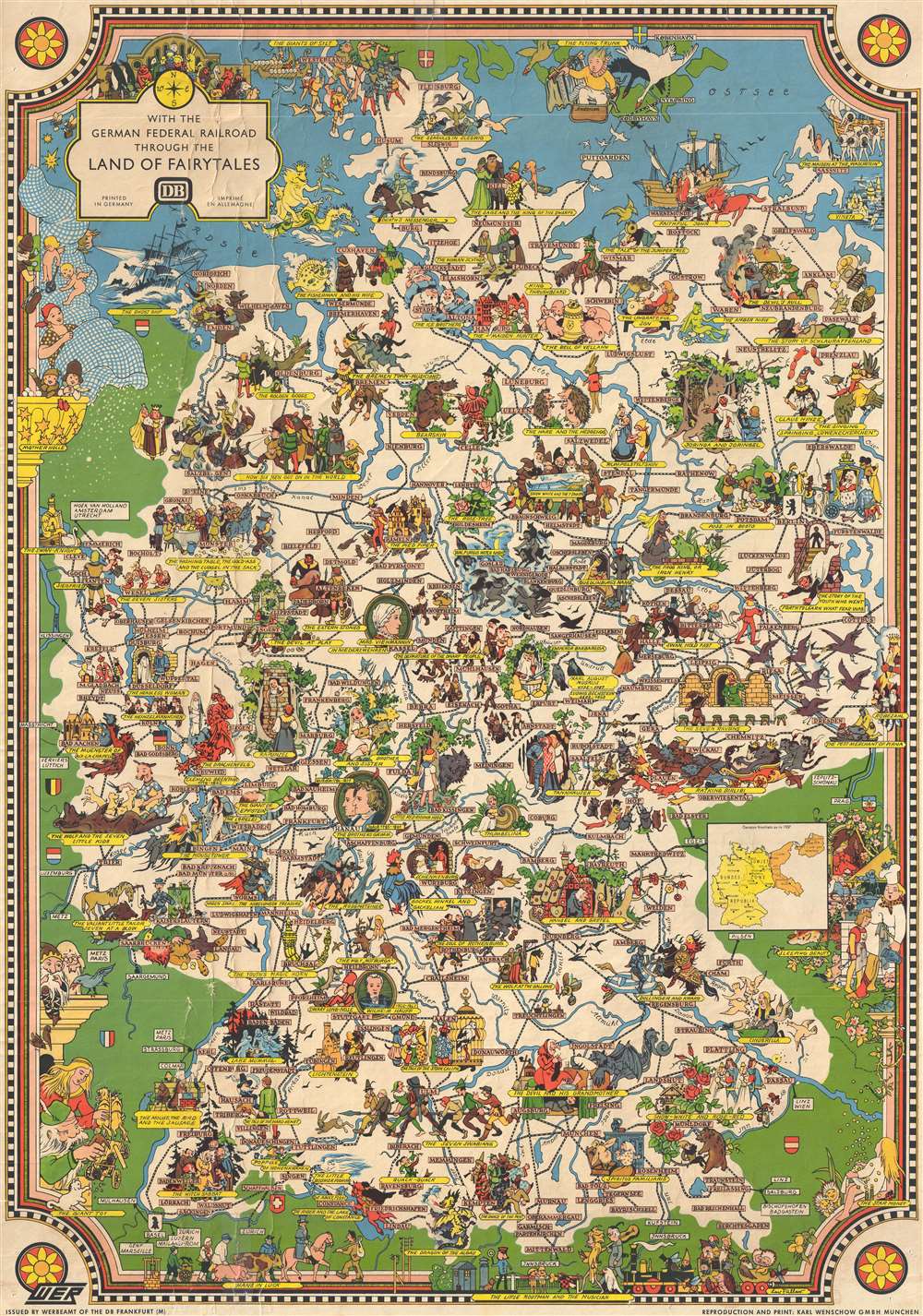
With the German Federal Railroad Through the Land of Fairytales.
sold
- Digital Map Information
- Suitable for large format printing
- File Size: 16.71 MB
- File Type: ZIP / TIFF
- ICC color profile embedded
- Delivered instantly via download link
This is a c. 1960 reprint of a 1937 Leo Faller pictorial map of Germany illustrating many of its fairy tales. Celebrated for its fairy tales, the map depicts Germany from the Netherlands, Belgium, and France to Berlin and the Czech ... (more details)
Includes an inset pictorial map of central Odessa.

Odessa. ОДЕССА.
sold
This is a 1980 V.T. Skobin city map or plan of Odessa, Ukraine. The map depicts the region city from Chernomorets restaurant (Summer Restaurant No. 1) to the Suvorovs'kyi District and from Ilyichevsky district to the Black Sea. ... (more details)
One of the earliest cartographic depictions of Wine Making in California!

Geographical Map of the State of California Compiled from Actual Surveys.
sold
- Digital Map Information
- Suitable for large format printing
- File Size: 21.27 MB
- File Type: ZIP / TIFF
- ICC color profile embedded
- Delivered instantly via download link
A stunning separately issued 1893 decorative map of California issued to promote the Crocker family business interests in the development and settlement of California. It features an early cartographic representation of wine making in California. While the mapmaker, Henry Smith Crocker was on the surface a printer, his business interests were inextricably linked to those of this brother, Central Pacific railroad magnate Charles Crocker (1822 - 1888). H. S. Crocker used his publishing and printing empire to propagandize the Central Pacific as well as the general virtues of California as a place to resettle - this map being one such example, probably issued as a booster publication for the California exhibit at the Chicago Columbian Exposition of 1893. (more details)