
An enigmatic map and the first specific map of the Pacific Northwest and proto-Alaska.
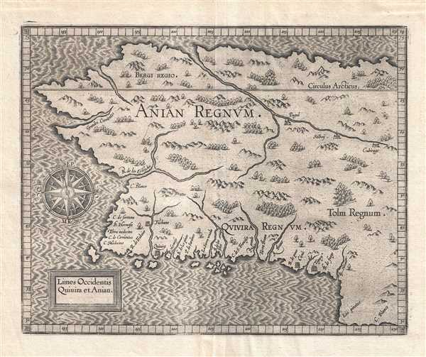
Limes Occidentis Quiuira et Anian. / Anian Regnum.
sold
- Digital Map Information
- Suitable for large format printing
- Full resolution TIFF file
- ICC color profile embedded
- Delivered instantly via download link
A beautiful example of the 1607 edition of Cornelis avn Wytfliet's Anian Regnum . One of Wytfliet's more enigmatic productions, this map speculatively illustrates must of the west coast of the United States, Canada, and Alaska. Although significantly larger ... (more details)
Very rare map of Northern Vietnam showing the South China Sea, Hainan, and extending north roughly as far as modern Day Hong Kong.

Daniel Taverniers Land-Charte des Königreichs Tunqvin.
sold
- Digital Map Information
- Suitable for large format printing
- DPI: 300
- File Size: 1.72 MB
- File Type: ZIP / TIFF
- ICC color profile embedded
- Delivered instantly via download link
A rare, important, and highly desirable 1684 map of modern day Vietnam and the South China Sea by the French Huguenot merchant adventurer, Daniel Tavernier. The map covers the coast of Vietnam from southern China to the Mekong Delta. It includes parts of ... (more details)
Illustrates the many renovations undertaken during President Theodore Roosevelt's first term.
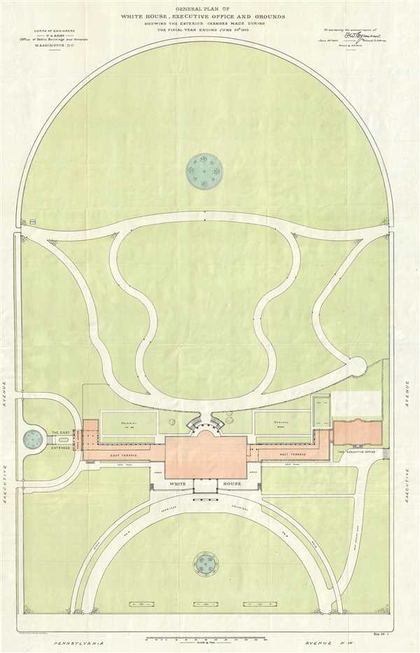
General Plan of the White House, Executive Office and Grounds Showing the Exterior Changes Made During the Fiscal Year Ending June 30th, 1903.
sold
- Digital Map Information
- Suitable for large format printing
- File Size: 8.14 MB
- File Type: ZIP / TIFF
- ICC color profile embedded
- Delivered instantly via download link
This is a 1903 F. D. Owen map or plan of the White House and renovations undertaken by request of President Theodore Roosevelt, including the newly-constructed Executive Office (which would become the West Wing) and East Wing, Roosevelt's entrance for ... (more details)
Beautifully colored and highly detailed map of Mexico and the West Indies.

Kaart van de Onderkoningschappen van Mexico en Nieuw Granada in de Spaansche West-Indien.
sold
- Digital Map Information
- Suitable for large format printing
- DPI: 300
- File Size: 6.66 MB
- File Type: ZIP / TIFF
- ICC color profile embedded
- Delivered instantly via download link
This is a 1765 Isaak Tirion map of Central America and the West Indies. The map depicts the region from the southern United States to northern South America and from the Pacific Ocean to the Atlantic Ocean. Each of the Caribbean islands is illustrated ... (more details)
Iconic humorous map satirizing the stereotypical insular Bostonian.
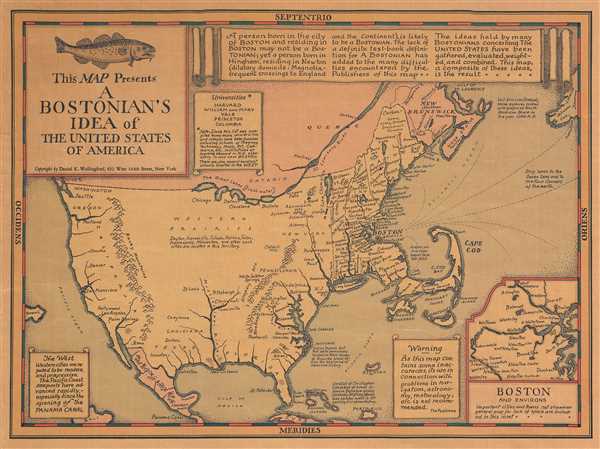
This Map Presents A Bostonian's Idea of the United States of America.
sold
- Digital Map Information
- Suitable for large format printing
- File Size: 4.11 MB
- File Type: ZIP / TIFF
- ICC color profile embedded
- Delivered instantly via download link
This is a 1936 Daniel Wallingford map of the United States as viewed by the stereotypical Bostonian. Poking fun at the caricaturized idea of a Bostonian, the map depicts the country varying detail, with a high degree of accuracy and numerous cities ... (more details)
A beautifully illustrated map of New York City - and it identifies all of the branches of The National City Bank of New York.

Historical Map of New York City.
sold
- Digital Map Information
- Suitable for large format printing
- File Size: 11.29 MB
- File Type: ZIP / TIFF
- ICC color profile embedded
- Delivered instantly via download link
This is a 1932 National City Bank of New York map of New York City. The map depicts four of the five boroughs: Manhattan, Brooklyn, Queens, and the Bronx, with part of Staten Island depicted in an inset situated in the lower right corner. Numerous ... (more details)
Includes an inset map of Salvador, now the capital of the state of Bahia in Brazil.
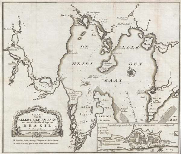
Kaart van de Aller-Heiligen Baay waar aan de Hoofdstad legt van Brazil.
sold
- Digital Map Information
- Suitable for large format printing
- DPI: 300
- File Size: 5.04 MB
- File Type: ZIP / TIFF
- ICC color profile embedded
- Delivered instantly via download link
This is a 1767 Isaak Tirion map of Salvador and the Baia de Todos os Santos (All Saints' Bay) in the state of Bahia in Brazil. The map depicts the region, including the entirety of the bay, from the south, with Salvador and the entrance to the bay ... (more details)
Entertaining pictorial map - Perfect for dog lovers.

A Dog's Idea of the Ideal Country Estate.
sold
- Digital Map Information
- Suitable for large format printing
- File Size: 1.72 MB
- File Type: ZIP / TIFF
- ICC color profile embedded
- Delivered instantly via download link
This is a 1931 John Held, Jr. 'imaginative' pictorial map of a dog’s idea of the ideal country estate. The map depicts numerous locales, activities, and items that any dog would include in its ideal country home. Activities include chasing a ... (more details)
A reduced version of David William Smith's iconic map of Upper Canada / Ontario - created by Franz Pluth.
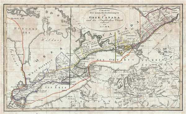
Charte Der neuen Niederlassungen in Ober Canada nach der Smythchen Charte reducirt von I.C.M.R.
sold
- Digital Map Information
- Suitable for large format printing
- DPI: 300
- File Size: 2.54 MB
- File Type: ZIP / TIFF
- ICC color profile embedded
- Delivered instantly via download link
This is an 1820 Franz Pluth and David William Smith map of the province of Upper Canada, or modern-day Ontario, Canada. The map depicts the region from Lake Huron and Detroit to the border between Ontario and Quebec and from Lake Huron and the ... (more details)
Illustrates five different spheres used in cartography.

Sphère de Ptolomée.
sold
- Digital Map Information
- Suitable for large format printing
- DPI: 300
- File Size: 5.38 MB
- File Type: ZIP / TIFF
- ICC color profile embedded
- Delivered instantly via download link
This is Rigobert Bonne's 1775 curious decorative chart of the Spheres. The chart features five different spheres used in mapmaking and calculating map projections. From top left, Sphère de Ptolomée (Ptolemaic Sphere), Sphère Droite (Right ... (more details)
Depicts Spanish, Dutch, English, and French trade routes in the Caribbean - perfect for piracy.
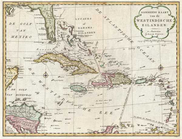
Algemeene Kaart van de Westindische Eilanden.
sold
- Digital Map Information
- Suitable for large format printing
- DPI: 300
- File Size: 6.12 MB
- File Type: ZIP / TIFF
- ICC color profile embedded
- Delivered instantly via download link
This is a 1769 Isaak Tirion map of the West Indies. The map depicts the region from the Yucatan Peninsula and Honduras and Nicaragua to the Lesser Antilles and from Florida to the extreme northern portion of South America. Perhaps the most ... (more details)
References the Jewish community in Suriname - one of the largest and earliest in the Western Hemisphere.
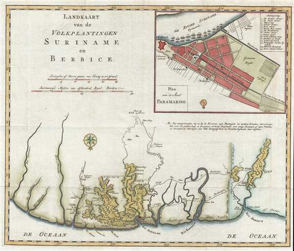
Landkaart van de Volkplantingen Suriname en Berbice.
sold
- Digital Map Information
- Suitable for large format printing
- DPI: 300
- File Size: 5.21 MB
- File Type: ZIP / TIFF
- ICC color profile embedded
- Delivered instantly via download link
This is a 1767 Isaak Tirion map of the Dutch colonies of Suriname and Berbice and labels both the 'Portuguese' and 'German' synagogues in Paramaribo, known respectively as Zedek ve Shalom and Neveh Shalom. The map depicts the region along ... (more details)
French map issued in the fourth year of the French and Indian War.

Carte de la Caroline et Georgie.
sold
- Digital Map Information
- Suitable for large format printing
- DPI: 300
- File Size: 2.51 MB
- File Type: ZIP / TIFF
- ICC color profile embedded
- Delivered instantly via download link
This is French cartographer Jacques-Nicholas Bellin’s 1757 map of the Carolinas and Georgia. It depicts modern day North Carolina, South Carolina, and Georgia, along with parts of Virginia and eastern Tennessee, extending from just ... (more details)
Indicates the numerous castles and smaller forts constructed to protect Cartagena from attack.
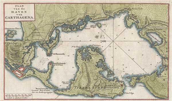
Plan van de Haven van Carthagena.
sold
- Digital Map Information
- Suitable for large format printing
- DPI: 300
- File Size: 2.95 MB
- File Type: ZIP / TIFF
- ICC color profile embedded
- Delivered instantly via download link
This is a 1765 Isaak Tirion map of Cartagena Harbor, Colombia. Oriented toward the east, the map depicts the region from Cartagena to Polonia and from the northern shore of Cartagena Bay to the Isla de Tierra Bomba. Numerous locations ... (more details)
Illustrates the many defenses of San Juan.
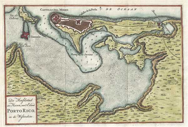
De Hoofdstad en Haven, van't Eiland Porto Rico, in de Westindien.
sold
- Digital Map Information
- Suitable for large format printing
- DPI: 300
- File Size: 2.11 MB
- File Type: ZIP / TIFF
- ICC color profile embedded
- Delivered instantly via download link
This is a 1765 Isaak Tirion map of San Juan Bay and San Juan, Puerto Rico. The map depicts the entire bay and the settlement of San Juan. Several locations are labeled throughout the map, including the San Felipe del Morro Fortress, ... (more details)
Highly detailed map of South America - depicts the apocryphal Lake Xarayes.
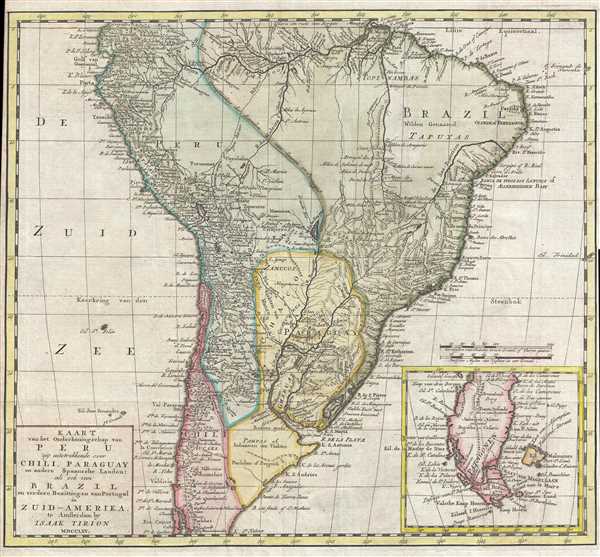
Kaart van het Onderkoningschap van Peru zig uitstrekkende over Chili, Paraguay en andere Spaansche Landen : als ook van Brazil en verdere Bezittingen van Portugal in Zuid-Amerika.
sold
- Digital Map Information
- Suitable for large format printing
- DPI: 300
- File Size: 7.36 MB
- File Type: ZIP / TIFF
- ICC color profile embedded
- Delivered instantly via download link
This is a 1765 Isaak Tirion map of South America. The map depicts the continent from the Equator to Tierra del Fuego and from the Pacific Ocean to the Atlantic Ocean. Divided into several regions, a certain amount of political and ... (more details)
Attractive map of Lima - the capital of the Viceroyalty of Peru.
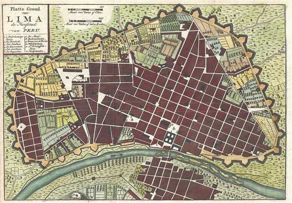
Platte Grond van Lima de Hoofstad van Peru.
sold
- Digital Map Information
- Suitable for large format printing
- DPI: 300
- File Size: 2.34 MB
- File Type: ZIP / TIFF
- ICC color profile embedded
- Delivered instantly via download link
This is a c. 1767 Isaak Tirion map of Lima, Peru. The map depicts the old city center situated along the Rímac River. Encircled by walls and other fortifications, Lima, as stated in the map's title, was the capital of the ... (more details)
Labels Porto-Bello and Panama City.
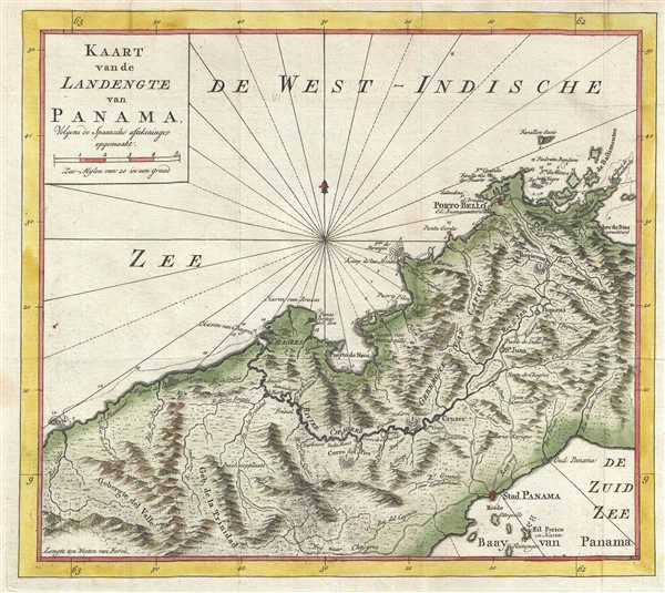
Kaart van de Landengte van Panama. Colgens de Spaansche aftekeninge opgemaakt.
sold
- Digital Map Information
- Suitable for large format printing
- DPI: 300
- File Size: 4.04 MB
- File Type: ZIP / TIFF
- ICC color profile embedded
- Delivered instantly via download link
This is a 1765 Isaak Tirion map of the isthmus of Panama. The map depicts the region from the west, from the Caribbean Sea to the Pacific Ocean. Highly detailed, the map illustrates rivers, streams, bays, roads, and ... (more details)
Includes the legendary Lofoten Maelstrom.

Les Couronnes du Nord Comprenant les Royaumes de Suede Danemarck et Norwege divisés par Provinces et Gouvernemens.
sold
- Digital Map Information
- Suitable for large format printing
- DPI: 300
- File Size: 7.85 MB
- File Type: ZIP / TIFF
- ICC color profile embedded
- Delivered instantly via download link
This is a beautiful example of Jean Janvier's 1762 decorative map of Scandinavia. The map depicts the region from Iceland and England eastward as far as Moscow, north to the Arctic Sea, and south as far as Denmark ... (more details)
Mitchell's distinctive map of New Jersey.

Map of New Jersey Compiled From the latest authorities.
sold
- Digital Map Information
- Suitable for large format printing
- DPI: 300
- File Size: 5.77 MB
- File Type: ZIP / TIFF
- ICC color profile embedded
- Delivered instantly via download link
This is an 1854 S. A. Mitchell map of New Jersey. Extending vertically northward from Delaware Bay and Cape May, it depicts railroads, canals, rivers, State Parks, and bays to reach Pennsylvania on its left and ... (more details)