
'Isle of Dreams - Pleasure Center.'
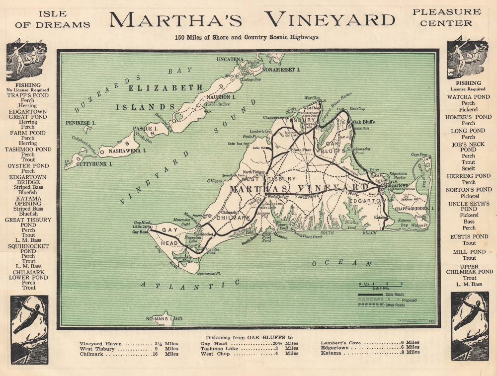
Road Map of Martha's Vineyard Island, Massachusetts.
sold
- Digital Map Information
- Suitable for large format printing
- Full resolution TIFF file
- ICC color profile embedded
- Delivered instantly via download link
This is a c. 1930 George F. Cram road map of Martha's Vineyard, Massachusetts. (more details)
Polar ice on Mars.
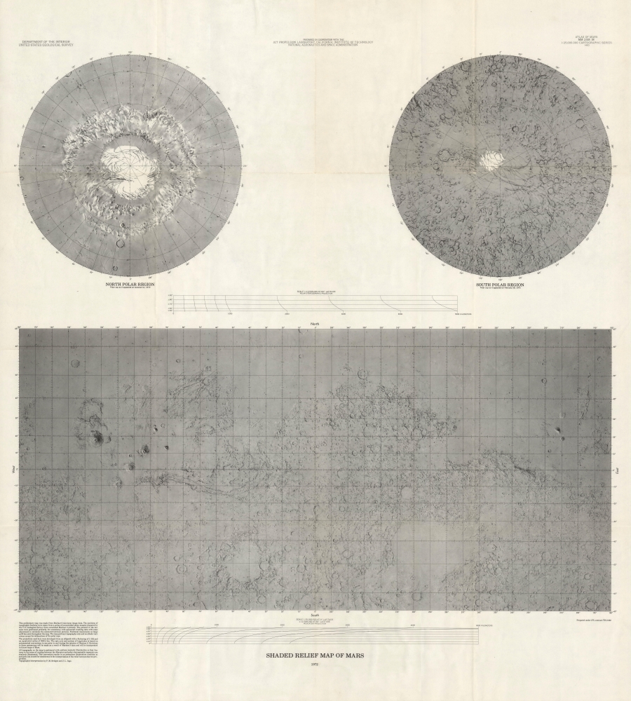
Shaded Relief Map of Mars.
sold
This is a striking 1972 terrestrial relief map of Mars issued from photogeological data collected by the Mariner 9 Mission. The map is a groundbreaking achievement of planetary mapping, completed through a collaborative effort from the Jet Propulsion Laboratory, the California Institute of Technology, and NASA. (more details)
Printing sampler w/ map of Florida.

[Arnold Printing Co. Letterhead Sampler.]
sold
- Digital Map Information
- Suitable for large format printing
- Full resolution TIFF file
- ICC color profile embedded
- Delivered instantly via download link
This is a rare c. 1927 Arnold Printing Company letterhead sampler that features a map of peninsular Florida created as letterhead for the Braswell Realty Company. (more details)
Visit and Live in Florida.
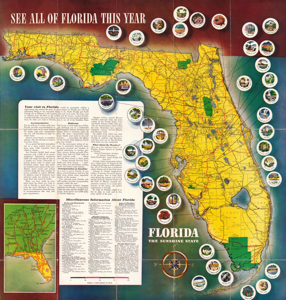
Come to Florida The Sunshine State.
sold
- Digital Map Information
- Suitable for large format printing
- Full resolution TIFF file
- ICC color profile embedded
- Delivered instantly via download link
This is a c. 1948 pictorial map of Florida promoting the state's many enticements. Published during Florida's post-World War II (1939 - 1945) population boom, it also promotes emigration, noting that the population increased 29.2% between 1930 and 1940. (more details)
Ephemeral record of the Massachusetts Interurban Trolley System.

AeroView Map Showing Territory Covered by the Lines of the Bay State Street Railway Co. and Their Connections.
sold
- Digital Map Information
- Suitable for large format printing
- Full resolution TIFF file
- ICC color profile embedded
- Delivered instantly via download link
This is a 1912 Rand Avery view and map of eastern Massachusetts illustrating the Bay State Street Railway Company's interurban trolley network. This is an ephemeral piece, the Bay State Street Railway Company existed for only 6 years before it went bankrupt and bought out. It is thus a rare record of the delcine of the New England interurban trolley. (more details)
Charting a contested fishery.
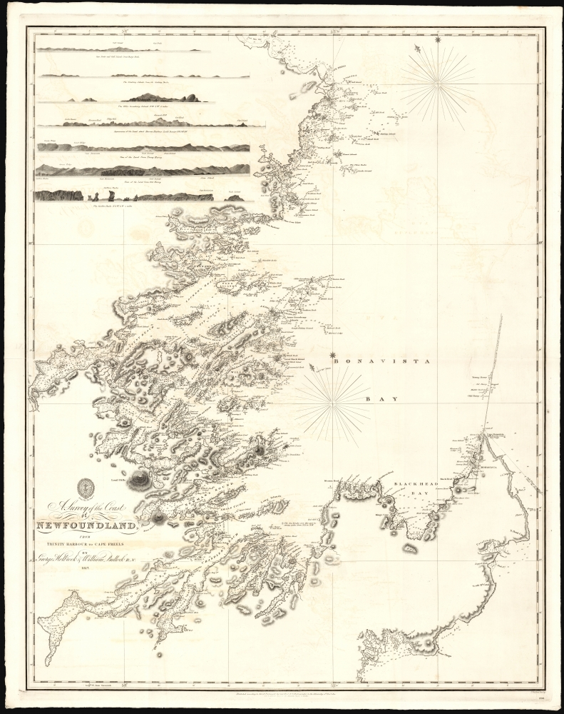
A Survey of the Coast of Newfoundland from Trinity Harbour to Cape Freels.
sold
- Digital Map Information
- Suitable for large format printing
- File Size: 33.84 MB
- File Type: ZIP / TIFF
- ICC color profile embedded
- Delivered instantly via download link
This is a large and rare 1822 British Admiralty Hydrographic Office nautical map of the east coast of Newfoundland, from Trinity Harbor to Deadman's Bay. It follows in the wake of the 1818 Rush-Bagot Agreement, which redefined shipping and fishing rights between America and Great Britain off the coast of Newfoundland and in the Grand Banks in the wake of the war of 1812. (more details)
Definitive Great Lakes Map of the 18th Century.

Partie Occidentale de la Nouvelle France ou du Canada.
sold
- Digital Map Information
- Suitable for large format printing
- File Size: 24.47 MB
- File Type: ZIP / TIFF
- ICC color profile embedded
- Delivered instantly via download link
An influential map of the Great Lakes, drawn in 1755 by Jacques Nicholas Bellin and reengraved by Homann Heirs for the 1755 Atlas Homannianus Mathematic-Historice Delineatus. It depicts the five Great Lakes, as well as the adjacent Indian lands and the English colonies of Pennsylvania, New Jersey, and New York. Due to the reach of the Homann Heirs firm, this is one of the most iconic early maps of the Great Lakes. (more details)
One the eve of the American Revolution.

North America from the French of Mr. D'Anville improved with The English Surveys made since the Peace.
sold
- Digital Map Information
- Suitable for large format printing
- File Size: 26.39 MB
- File Type: ZIP / TIFF
- ICC color profile embedded
- Delivered instantly via download link
This is the 1775 Sayer and Bennett edition of Thomas Jefferys' map of the British Colonies in America, published on the eve of the American Revolutionary War (1775 - 1783). When this map was issued in June 1775, the Battles of Lexington and Concord had already occurred, and a formal Declaration of War from the Continental Congress was imminent. (more details)
Magnificent chart with masterful engraving.
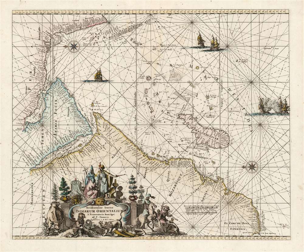
Occidentalior Tractus Indiarum Orientalium à Promontorio Bonae Spei ad C. Comorin.
$825.00
Acquire
- Digital Map Information
- Suitable for large format printing
- DPI: 600
- File Size: 24.08 MB
- File Type: ZIP / TIFF
- ICC color profile embedded
- Delivered instantly via download link
This is Frederic De Wit's map of Africa, Arabia, and part of India, in a handsome example of its scarce 1745 edition printed by Renier and Joshua Ottens. The map represents a key passage in the East India trade routes across the Indian Ocean. It is, moreover, a fine example of the highpoint of Dutch engraving - the work of master engraver Romeyn De Hooghe. (more details)
Earliest map of South Carolina published in the United States.
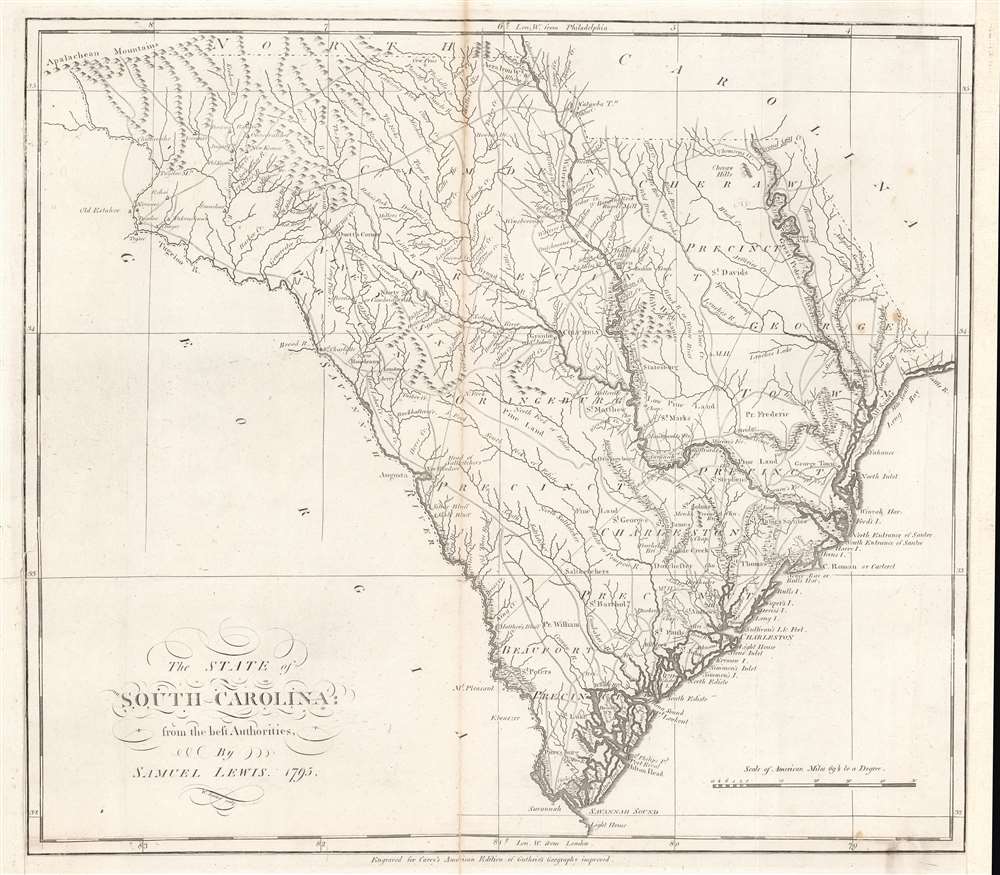
The state of South Carolina : from the best authorities.
sold
- Digital Map Information
- Suitable for large format printing
- DPI: 600
- File Size: 32.86 MB
- File Type: ZIP / TIFF
- ICC color profile embedded
- Delivered instantly via download link
This is a first state example of Samuel Lewis' 1795 map of South Carolina for Carey's General Atlas, the first atlas published in the American Republic. It illustrates the state's mountains, rivers, coastline, settlements, and infrastructure as they appeared soon after American Independence. (more details)
Last Days of the Belgian Congo.

Plan des communes de Leopoldville et environs.
sold
- Digital Map Information
- Suitable for large format printing
- Full resolution TIFF file
- ICC color profile embedded
- Delivered instantly via download link
An impressive 1959 large-format folding map of Léopoldville, now Kinshasa, produced by the Institut Géographique du Congo. It presents the city in the last days of Belgian rule, as anti-colonial tensions were building, resulting in the country's independence the following year. (more details)
Speculative rivers based on American Indian maps.
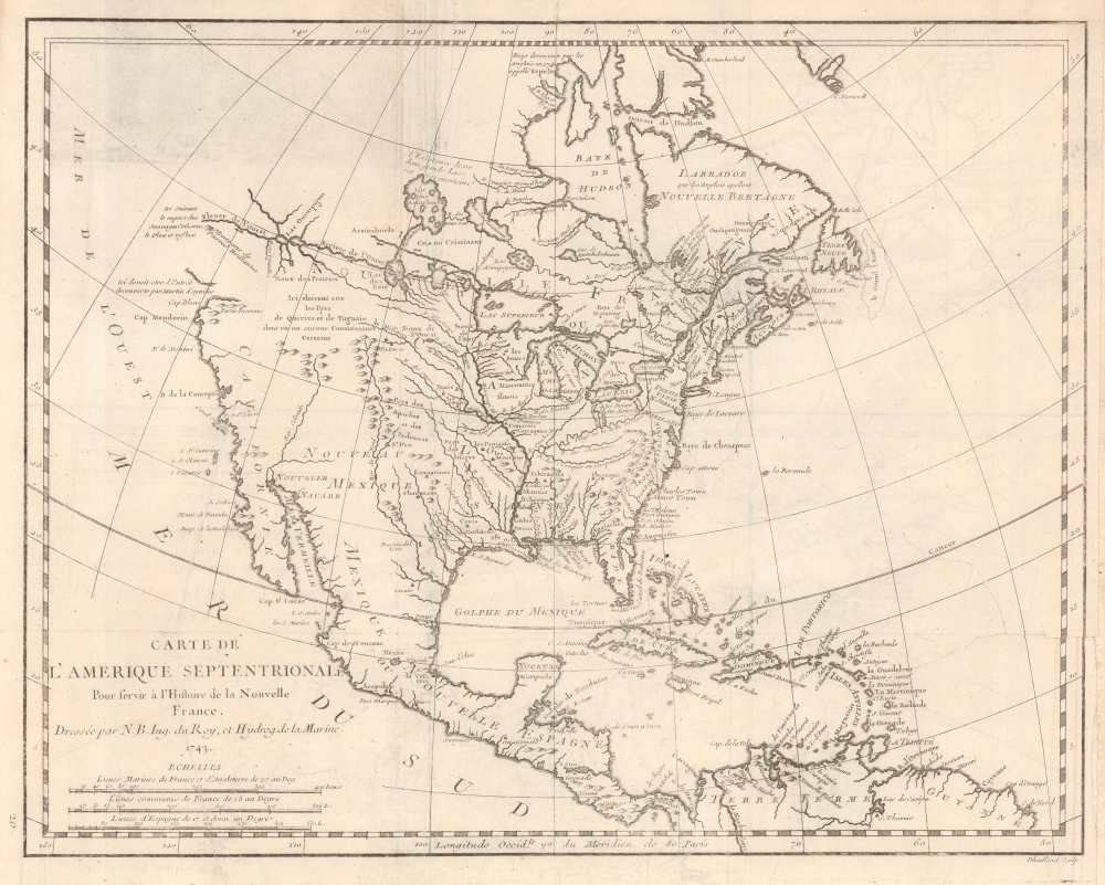
Carte de L'Amerique Septentrionale Pour servir a L'Histoire de la Nouvelle France.
sold
- Digital Map Information
- Suitable for large format printing
- File Size: 6.77 MB
- File Type: ZIP / TIFF
- ICC color profile embedded
- Delivered instantly via download link
An important and influential first edition first state 1743 map of North America by the French cartographer Jacques-Nicholas Bellin. The map is a profoundly French production, illustrating that nation's plans and ambitions for America in the decades preceding the French and Indian War (1754 - 1763). It includes speculative river systems and hopeful cities of gold and suggests broad, if ambiguous, territorial claims. (more details)
82nd Airborne Division and the Occupation of Berlin.

'All American' Paraglide Berlin Edition.
sold
- Digital Map Information
- Suitable for large format printing
- Full resolution TIFF file
- ICC color profile embedded
- Delivered instantly via download link
This is a World War II 1945 82nd Airborne Division pictorial map of Europe. The map highlights the 82nd's combat experience, with a focus on Berlin and the Division's role in the post-war occupation. (more details)
Limited Edition Holden Beach.
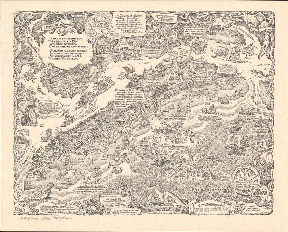
Ye Olde Map of Holden Beach, N.C.
sold
A rare, limited edition signed 1981 Jak Smyrl pictorial map of Holden Beach, North Carolina. (more details)
Charming Pictorial Map of Iraq.
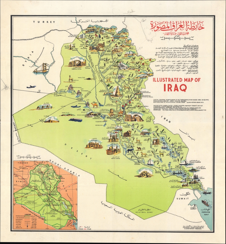
خارطة العراق المصورة / Illustrated Map of Iraq.
sold
A colorful c. 1956 bilingual pictorial map of Iraq prepared by Abdul Karim Rifaat for the Development Board and Ministry of Development. The map appeared during a period of progressive development fueled by oil wealth. However, it also predates, by just two years, the major political and social upheavals leading up to the 1958 Iraqi Military Coup. (more details)
Unique manuscript record of the War of the Quadruple Alliance. Author's own copy.

Guerra De Cerdeña Ysicilia, En Los Años De 1717, 18, 19, Y 1720. Con Reflexiones Militares Del Marquèsde La Mina Conde De Pezuela.
sold
This is an extraordinary 2-volume 1755-57 manuscript account of the War of the Quadruple Alliance, fought over Sicily, drafted by a participant, the II Marques de la Mina, Jaime Miguel de Guzmán Davalos y Spinola. It is Mina's personal copy, emblazoned with his arms, rich with masterfully executed foldout manuscript maps and tables, and features exceptional provenance. At the time of writing, this work was suppressed in Spain, as the loss of the Spanish fleet at the Battle of Cape Passaro was a royal embarrassment, leading to it remaining unpublished for more than 140 years. The War of the Quadruple Alliance here represented, while not well known, had global ramifications, as it significantly diminished the Spanish navy, giving the British largely unopposed free reign on the colonial stage, particularly in the Americas. (more details)
Essential Map for the Carolina Collector.
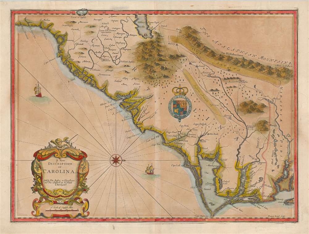
A New Description of Carolina.
sold
- Digital Map Information
- Suitable for large format printing
- Full resolution TIFF file
- ICC color profile embedded
- Delivered instantly via download link
A striking example of the important and scarce map of the Carolina colony engraved by Francis Lamb in 1676, for inclusion in John Speed's atlas. It is one of the earliest early English maps specifically of the colony acquirable by the collector, published just six years after the founding of Charleston. As such, it is a map of seminal importance, and an essential document in the history of the Carolinas specifically, and the British settlements in North America in general. (more details)
Imaginary (but important!) Islands of Lake Superior.

Carte des Lacs du Canada Dresse sur les Manuscrits du Depost des Carts, Plans et Journaux de la Marine et sur le Journal de RP. De Charlevoix.
sold
- Digital Map Information
- Suitable for large format printing
- File Size: 8.57 MB
- File Type: ZIP / TIFF
- ICC color profile embedded
- Delivered instantly via download link
This is the 1744 Bellin / Charlevoix map of the Great Lakes, the most accurate map of the Great Lakes to date and the best produced since the De l'Isle map of 1718. It is also the earliest obtainable map, preceded only by a 1742 proof noted by Kershaw, to depict the four fictive islands in Lake Superior (Philippeux, Pontchartrain, Maurepas, and St. Anne) - islands that nonetheless significantly influenced the structuring of post-Revolutionary War borders between British Canada and the fledgling United States. It is also notable for being among the earliest maps to identify Detroit and the Port of Chicago. Bellin's map covers all five Great Lakes and their adjacent drainage systems in considerable detail, noting known fortifications, American Indian villages, missions, and some speculative topography (particularly in Michigan). (more details)
Inspiration for the animated series 'Disenchantment'. - Matt Groening

The Land of Make Believe.
sold
- Digital Map Information
- Suitable for large format printing
- File Size: 114.65 MB
- File Type: ZIP / TIFF
- ICC color profile embedded
- Delivered instantly via download link
This is a 1930 second edition of the Jaro Hess pictorial map of the Land of Make Believe. It emerged at the height of the Great Depression (1929 - 1933) and offered much needed escapism during those brutal times. The map incorporates some 60 nursery rhymes, fairy tales, and children's stories with creative, entertaining, and attractive illustrations. (more details)
Settling the Borders of British Nigeria.
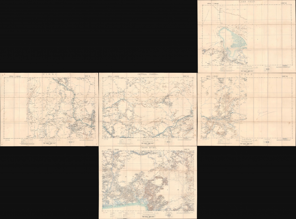
Lake Chad / Nikki / Central Nigeria. / Yola / Cross River.
$1,500.00
Acquire
- Digital Map Information
- Suitable for large format printing
- Full resolution TIFF file
- ICC color profile embedded
- Delivered instantly via download link
A concurrent set of five folding sheets, together forming a map covering central and eastern Nigeria, produced by the Intelligence Division of the British War Office in 1902 (with one map being dated 1905). The maps cover this region as it was roiled by opposition to British encroachments and was being negotiated over between the British and Germans, who controlled the neighboring colony of Kamerun. (more details)