
Rare chart from first published nautical atlas.
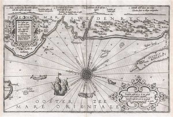
De Custen van een deel van Denemarken en Swederÿck, beginnede va Uuytste tot Calmer Toe…
sold
- Digital Map Information
- Suitable for large format printing
- DPI: 300
- File Size: 9.01 MB
- File Type: ZIP / TIFF
- ICC color profile embedded
- Delivered instantly via download link
This 1586 nautical chart or maritime map of Sweden and Denmark along the North Sea was produced by Lucas Janszoon Waghenaer for his 1586 Spieghel Der Zeevaerdt , a chart book of European coastlines. This nautical chart is oriented to the northeast and covers the ... (more details)
Rare Japanese map of China with inset of Pearl River Delta (Hong Kong).

圖全那支 / Tú quán nà zhī / Whole Map of China.
sold
- Digital Map Information
- Suitable for large format printing
- File Size: 14.73 MB
- File Type: ZIP / TIFF
- ICC color profile embedded
- Delivered instantly via download link
A rare c. 1880 Japanese map of China and Korea by Kishida Ginko. The map covers all of China and Korea, extending westward to Xinjiang and the Taklimakan Desert, south to Hainan and Vietnam, and north as far as northern Sakhalin. Insets detail Hong Kong and the ... (more details)
Scarce map of the Balearic Islands.
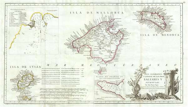
Mapa Geografico, y General de Las Islas Baleares Y Pithuyusas.
sold
- Digital Map Information
- Suitable for large format printing
- DPI: 300
- File Size: 9.9 MB
- File Type: ZIP / TIFF
- ICC color profile embedded
- Delivered instantly via download link
A scarce 1793 of the Balearic Islands of Ibiza, Majorca, and Minorca by the Spanish cartographer Tomás López de Vargas Machuca. The map has an unusual elongated format centered on Majorca (Mallorca). There are insets of the town of Ibiza (Iviza) and Puerto ... (more details)
Illegal Japanese news broadside 'Kawaraban' illustrating the momentous arrival of Commodore Perry in Edo or Tokyo Bay.

海陸御固附 / Kairiku Okatame Tsuke. / Concerning the Defense of Land and Sea.
sold
- Digital Map Information
- Suitable for large format printing
- DPI: 300
- File Size: 14.09 MB
- File Type: ZIP / TIFF
- ICC color profile embedded
- Delivered instantly via download link
A rare c. 1854 Japanese news broadside describing the arrival American Commodore Mathew Perry in Edo Bay. The image depicts Edo or Tokyo Bay with southeast at the top of the map. Perry's ships, of which three including the Mississippi , his paddlewheel ... (more details)
Map used to promote investment in John Law's Compagnie d'Occident (Mississippi Bubble) and the first map to show Le Maire's discoveries.
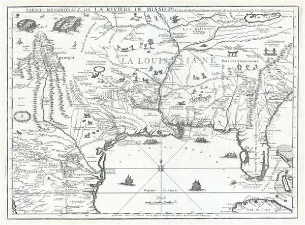
Partie Meridionale De La Riviere De Missisipi, et ses Environs dan L'Amerique Septentrionale.
sold
- Digital Map Information
- Suitable for large format printing
- DPI: 300
- File Size: 15.98 MB
- File Type: ZIP / TIFF
- ICC color profile embedded
- Delivered instantly via download link
A seminal map of the utmost importance and rarity, this is Nicolas de Fer's 1718 map of the Mississippi River Valley drawn to promote the Compagnie d'Occident . Essentially mirroring the coverage of De L'Isle's map of 1703, the map covers from just west ... (more details)
Scarce map of Shanghai with view of the Bund.
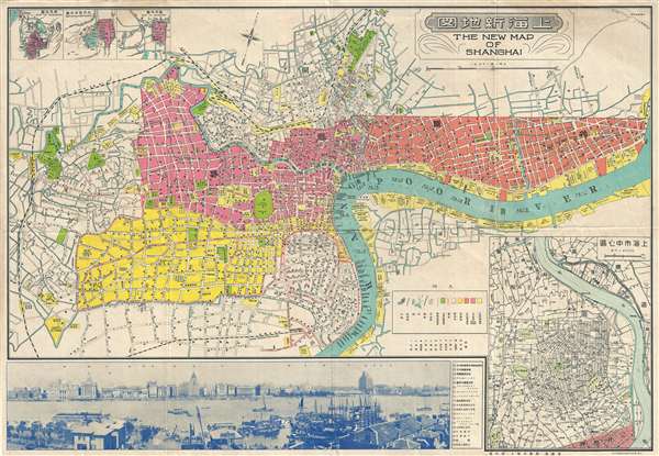
The New Map of Shanghai. /上海最新地圖 / Shànghǎi zuìxīn dìtú.
sold
- Digital Map Information
- Suitable for large format printing
- File Size: 24.78 MB
- File Type: ZIP / TIFF
- ICC color profile embedded
- Delivered instantly via download link
This is a rare and attractive bilingual 1937 map of Shanghai, China. It was made around the start of the Second Sino-Japanese war and World War II. Printed by the Japanese in the 12th year of Hirohito's reign, it depicts central Shanghai including the Chinese Quarter, the French Concession, the English Quarter (along the Bund) etc. Shanghai's cosmopolitan International Settlement is highlighted in Orange (USA), Pink (Great Britain), and Yellow (France). Nineteen important buildings along the Bund are carefully noted and can be referenced via a table to the right of the view. These include the first HSBC Bank, the British Club, the Peace Hotel and the Customs House. There is also a lovely vintage panoramic photo of the Bund along the bottom of the map. Of note, the map includes a large inset in the lower right corner illustrating the development of 'Greater Shanghai'. (more details)
The finest British chart of Hong Kong available during the first Opium War.
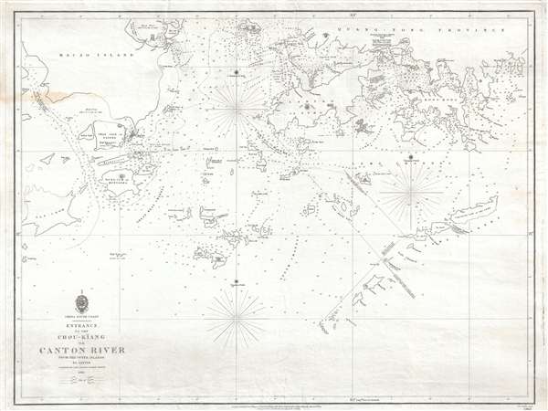
Entrance to the Chou-Kiang or Canton River from the Ouer Islands to Linten.
sold
- Digital Map Information
- Suitable for large format printing
- DPI: 300
- File Size: 6.55 MB
- File Type: ZIP / TIFF
- ICC color profile embedded
- Delivered instantly via download link
A rare and remarkable nautical chart of the utmost significance. This 1840 maritime map of Hong Kong and vicinity is attributed to Captain Daniel Ross, Bombay Marine. During the first Opium War (1839 – 1842), this was the finest and most detailed chart ... (more details)
Only known example of Lucas Schnitzer's view of London before the Great Fire of 1666.

London. / Bildnus de Troffen Statt London in Engeland.
sold
- Digital Map Information
- Suitable for large format printing
- DPI: 300
- File Size: 6.11 MB
- File Type: ZIP / TIFF
- ICC color profile embedded
- Delivered instantly via download link
An exceedingly rare c. 1650 view of London, England, of which there are no other known examples. The view looks north from the south side of the Thames River and extends roughly from modern day Waterloo Bridge to modern day Canary Warf, revealing London ... (more details)
Highly detailed Spanish issue nautical chart of Florida and the Bahamas.
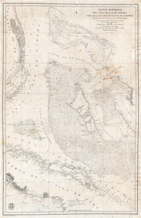
Carta Esférica del Gran Banco de Bahama parte de la Isla de Cuba y Costa de la Florida.
sold
- Digital Map Information
- Suitable for large format printing
- File Size: 20.42 MB
- File Type: ZIP / TIFF
- ICC color profile embedded
- Delivered instantly via download link
A scarce, large, and highly detailed 1858 nautical chart or maritime map of the Bahamas by the Spanish Direccion de Hidrografia . Centered on Andros Island, the largest of the Bahama family, the map covers from Grand Bahama to Cuba and from Florida to ... (more details)
Very attractive and detailed railroad route map of the Eastern United States.
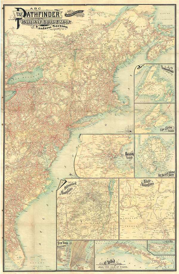
ABC The Pathfinder Railway Guide Map. Eastern Section.
sold
- Digital Map Information
- Suitable for large format printing
- File Size: 40.38 MB
- File Type: ZIP / TIFF
- ICC color profile embedded
- Delivered instantly via download link
A very attractive large format 1901 railroad map of the eastern part of the United States. The map covers the Atlantic Seaboard from Nova Scotia to the Florida Keys and extends west far as Lake Erie and Cedar Key. An array of 9 inset maps fill the ... (more details)
Only know example of George Thompson's 1799 broadside map of the Americas.
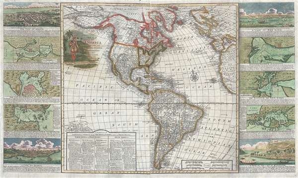
New Map of America divided into its Kingdoms, States, Governments and other Subdivisions, from the latest observations.
sold
- Digital Map Information
- Suitable for large format printing
- DPI: 300
- File Size: 24.5 MB
- File Type: ZIP / TIFF
- ICC color profile embedded
- Delivered instantly via download link
An exceptionally rare separately issued 1799 broadside map of America by the English printer and mapmaker George Thompson. Thompson's map covers the Americas from the Arctic Circle (Arctic Land) to Tierra de Fuego and Cape Horn. It extends ... (more details)
Exceptionally detailed and beautiful wall map of the Burgundy Wine Region, France.

Carte du Duché de Bourgogne, Comtés et Pays adjacents dressée par Ordre de M.M. les Elus Généraux de la Province.
sold
- Digital Map Information
- Suitable for large format printing
- DPI: 300
- File Size: 54.22 MB
- File Type: ZIP / TIFF
- ICC color profile embedded
- Delivered instantly via download link
A stunning 1782 and quite rare wall map of the Duchy of Bourgogne detailing the important Burgundy Wine Region. The map covers from the Champagne region just north of Dijon south as far as Macon and from Nivernais to Rochefort. The map ... (more details)
Remarkable original 1720 view of Lyon, the gastronomic capital of France.

Vue d'une partie de la ville de Lion dessignee dans le maison de Mrs. les Chanoines regulliers de St. Antoine.
sold
- Digital Map Information
- Suitable for large format printing
- File Size: 0.37 MB
- File Type: ZIP / TIFF
- ICC color profile embedded
- Delivered instantly via download link
An extremely rare monumentally proportioned 1720 view of Lyon, foodie capital of France, by François Cleric and François Poilly. The view presents Lyon as seen looking west at the quays from the eastern bank (north is to the right) of ... (more details)
Superb early 19th century map arguing for U.S. annexation of Texas and encouraging westward migration into the newly acquired Louisiana Territory.
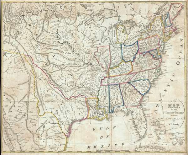
A Map of the United States Including Louisiana.
sold
- Digital Map Information
- Suitable for large format printing
- DPI: 300
- File Size: 13.66 MB
- File Type: ZIP / TIFF
- ICC color profile embedded
- Delivered instantly via download link
A fascinating 1818 map of the United States by William Darby. Intended for use by emigrants migrating westward in the early 19th century, this map covers from the Great Salt Lake (Lake Timpanagos) to the Atlantic seaboard and from Lake ... (more details)
Extremely rare and impressively large 18th century map of Menorca, Spain.
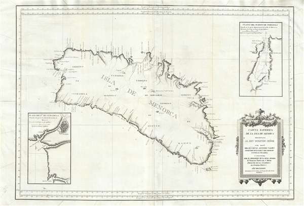
Carta Esférica de las Isla de Menorca; Presentada al Rey Nuestro Señor.
sold
- Digital Map Information
- Suitable for large format printing
- DPI: 300
- File Size: 24.51 MB
- File Type: ZIP / TIFF
- ICC color profile embedded
- Delivered instantly via download link
An extremely rare large scale 1786 Spanish nautical chart detailing the Balearic Island of Menorca (Minorca) by the famed hydrographers Vincente Tofiño de San Miguel and Antonio Valdés y Fernández Bazán. The map covers the island ... (more details)
Gold Field map of Australia drawn for the 1851 Victoria Gold Rush.
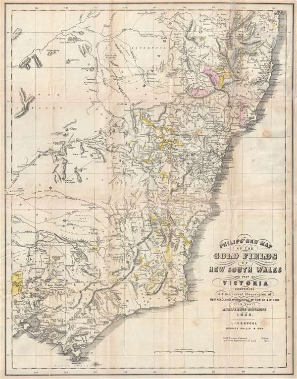
Philip's New Map of the Gold Fields of Australia comprising all the recent discoveries of Rev. W.B. Clarke, Mr. Hargraves, Mr. Hunter and others in the auriferous districts.
sold
- Digital Map Information
- Suitable for large format printing
- DPI: 300
- File Size: 9.34 MB
- File Type: ZIP / TIFF
- ICC color profile embedded
- Delivered instantly via download link
A remarkable 1853 map of the Gold Discoveries in New South Sales, Victoria, Australia. The map, in original color, covers the southeast part of the Australian Continent from Clarence to Pot Phillip and Wilson Promontory. The map ... (more details)
Graphically wonderful Japanese world aviation board game.

世界航空路圖 / Sekai kōkūrozu. / World Aviation Route Map. / 征空すごろく/ Seikū su-goro ku.
sold
- Digital Map Information
- Suitable for large format printing
- File Size: 56.49 MB
- File Type: ZIP / TIFF
- ICC color profile embedded
- Delivered instantly via download link
A rare 1930 Showa 5 Japanese pictorial map of the world and sugoroku game. Centered on Japan, this map covers the entire world with global flights paths are outlined in red. It was issued by the Japanese daily newspaper, Ōsaka ... (more details)
Issued to promote the Murray Hill and Plaza Hotels of New York City.
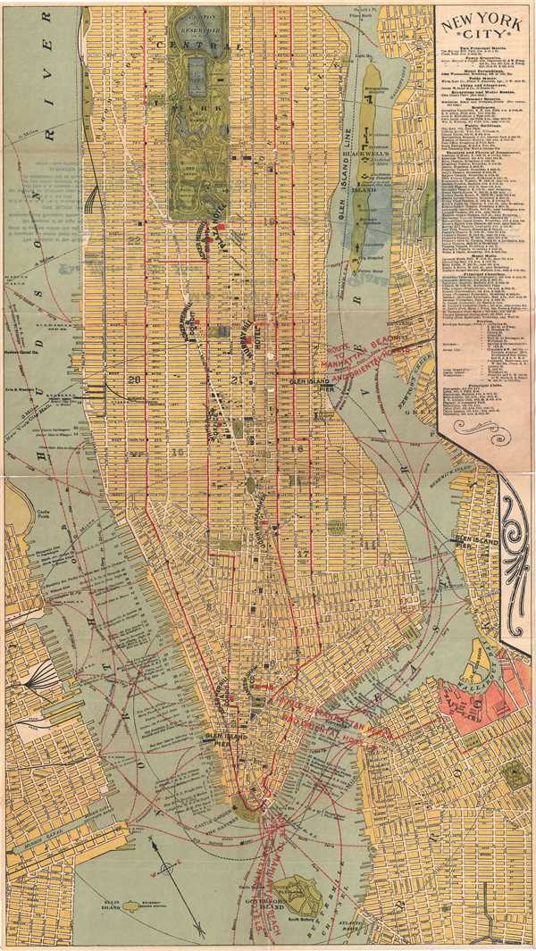
New York City.
sold
- Digital Map Information
- Suitable for large format printing
- File Size: 10.2 MB
- File Type: ZIP / TIFF
- ICC color profile embedded
- Delivered instantly via download link
This is a nice c.1920s map of New York City by F. A. Hammond. The map covers from the Battery and Governor’s Island north to 94th Street in extraordinary detail. Parts of Brooklyn, Queens and New Jersey are also featured. ... (more details)
Includes parts of Austria, Italy and Liechtenstein.

Comte de Tirol, et Eveche de Brixen.
sold
- Digital Map Information
- Suitable for large format printing
- DPI: 300
- File Size: 2.37 MB
- File Type: ZIP / TIFF
- ICC color profile embedded
- Delivered instantly via download link
This is a beautiful 1748 map of the county of Tyrol in modern day Italy and Austria, by Robert de Vaugondy. It covers this historic region from Landeck east to Kuffergasse and south as far as Trento in Italy. It includes ... (more details)
Poland before the partition of the Polish-Lithuanian Commonwealth.

Royaume de Pologne divise en Haute et Basse Pologne, et Subdivise en Palatinats.
sold
- Digital Map Information
- Suitable for large format printing
- DPI: 300
- File Size: 2.15 MB
- File Type: ZIP / TIFF
- ICC color profile embedded
- Delivered instantly via download link
This is a lovely 1749 map of the Kingdom of Poland by Robert de Vaugondy. It depicts the different Palantinates or administrative division of Poland. The map renders the entire region in extraordinary detail offering ... (more details)