

Johnson's Russia.
sold
- Digital Map Information
- Suitable for large format printing
- File Size: 3.37 MB
- File Type: ZIP / TIFF
- ICC color profile embedded
- Delivered instantly via download link
A beautiful example of Johnson and Ward's 1863 map of Russia. Depicts the European portions of Russia from the Arctic Sea south to the Black Sea and Caspian Sea and extends west as far as Warsaw and east as far as Orenburg and Perm. Includes the Ukraine. Russia ... (more details)
The first map to detail Spanish-Mexican land grants in California.
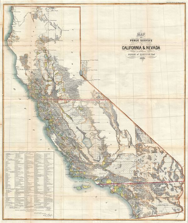
Map of Public Surveys in California and Nevada to accompany Report of Sureyor Genl. 1863.
sold
- Digital Map Information
- Suitable for large format printing
- File Size: 35.86 MB
- File Type: ZIP / TIFF
- ICC color profile embedded
- Delivered instantly via download link
An attractive and uncommon map of California and parts of Nevada issued by the Surveyor General in 1863. The map covers all of California as well as the western parts of Nevada near Lake Tahoe and Carson City. Remarkably, a list of 438 'Private Grants Finally ... (more details)
The quintessential trail map of the American west.
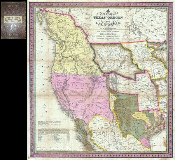
A New Map of Texas Oregon and California with the Regions Adjoining.
sold
- Digital Map Information
- Suitable for large format printing
- Full resolution TIFF file
- ICC color profile embedded
- Delivered instantly via download link
Considered 'the quintessential trail map of the American West' Samuel Augustus Mitchell's 'New Map of Texas Oregon and California' is one of the most important 19th century pocket maps ever issued. In Mitchell's own words This map comprises all that portion of ... (more details)
From an ephemeral period after Cook's voyage but before the offical maps and accounts were released.
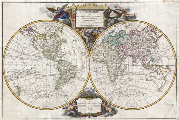
Mappemonde ou Description du Globe Terrestre dresse sur les memories les plus nouveaux et assujettie aux observations astronomiques, avec les Routes, et Decouvertes du Celebre Captaine Cook.
sold
- Digital Map Information
- Suitable for large format printing
- DPI: 300
- File Size: 19.78 MB
- File Type: ZIP / TIFF
- ICC color profile embedded
- Delivered instantly via download link
A remarkable 1783 positivist map of the world by Robert de Vaugondy and Antoine Boudet. The map presents the post-Cook world in two hemispheres surmounted by an elaborate engraved title cartouche. Vaugondy first published this map in 1752. Exploratory and ... (more details)
One of the most beautiful baroque maps of Portugal to appear in the 17th century.
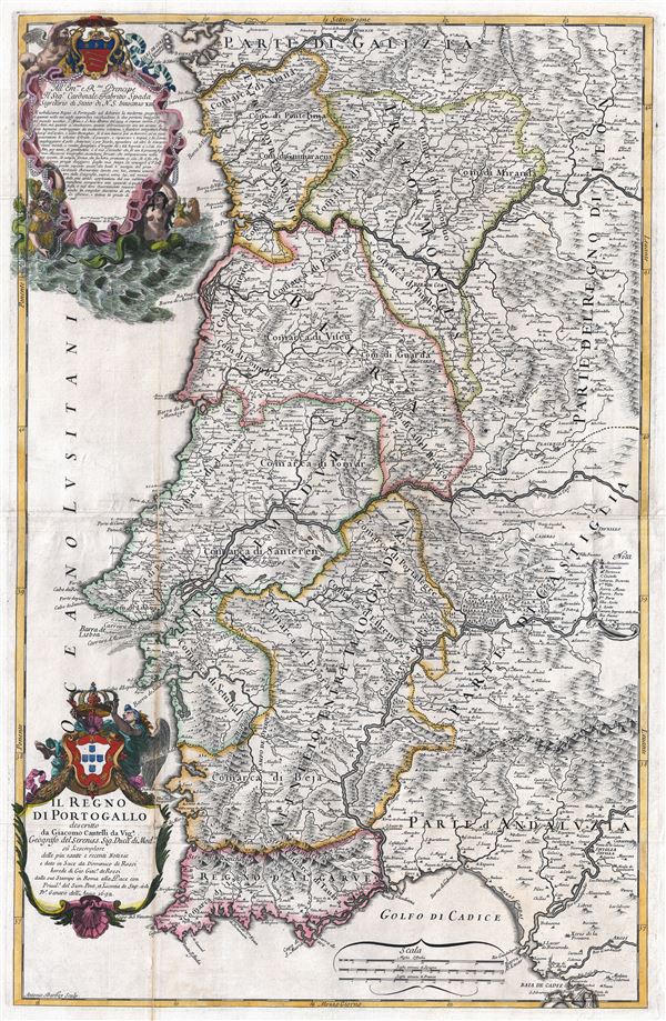
Il Regno di Portogallo.
sold
- Digital Map Information
- Suitable for large format printing
- DPI: 300
- File Size: 28.04 MB
- File Type: ZIP / TIFF
- ICC color profile embedded
- Delivered instantly via download link
An exceptional 1692 map of the Kingdom of Portugal drawn in the Italian baroque style by Giacomo Cantelli da Vignola and Giacomo Giovanni Rossi. This extremely scarce map is without question one of the largest and most beautiful atlas maps of Portugal ever ... (more details)
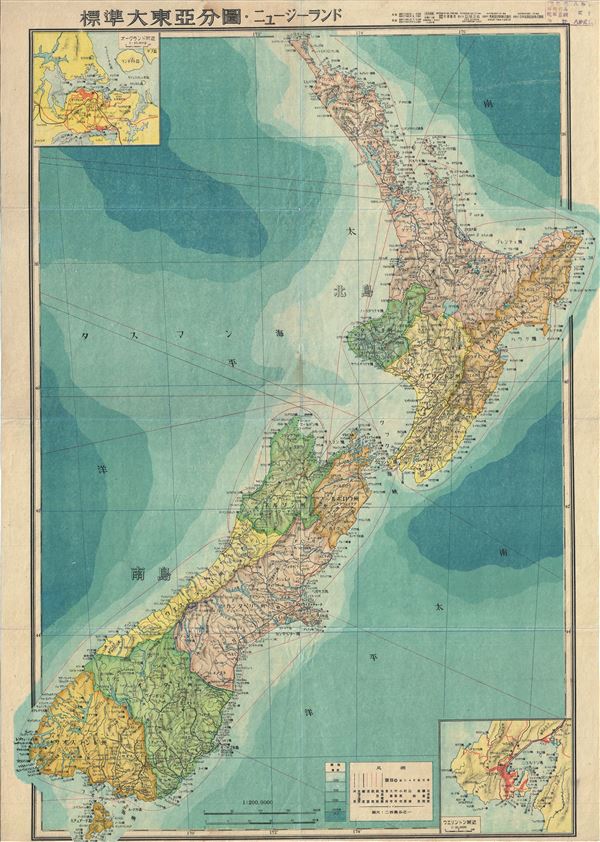
New Zealand.
sold
- Digital Map Information
- Suitable for large format printing
- File Size: 24.36 MB
- File Type: ZIP / TIFF
- ICC color profile embedded
- Delivered instantly via download link
This is a stunning large format Japanese map of New Zealand dating to World War II, and one of the most beautiful cartographic depictions of New Zealand to appear in the 20th century. It covers the entirety of New Zealand, including North Island and South ... (more details)
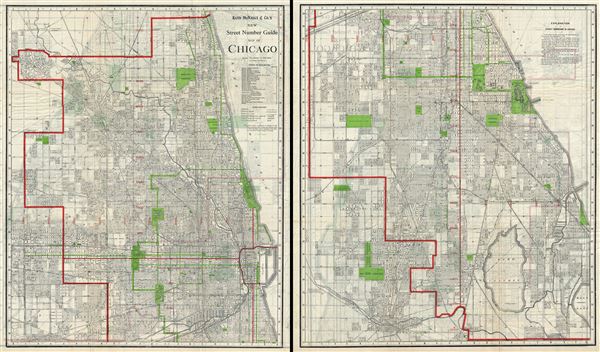
Rand McNally and Co.'s New Street Number Guide Map of Chicago.
sold
- Digital Map Information
- Suitable for large format printing
- File Size: 75.77 MB
- File Type: ZIP / TIFF
- ICC color profile embedded
- Delivered instantly via download link
This is an uncommon 1908 pocket map or city plan of Chicago, Illinois by Rand McNally and Company. The Rand McNally Company issued this enormous pocked map to illustrate their home city in incredible detail. The map is printed on two sides of a single ... (more details)
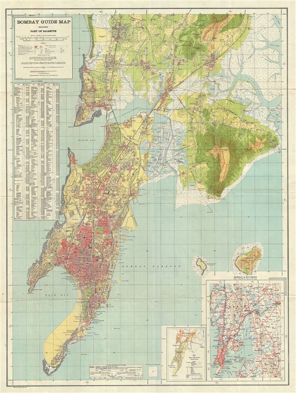
Bombay Guide Map including Part of Salsette.
sold
- Digital Map Information
- Suitable for large format printing
- File Size: 46.62 MB
- File Type: ZIP / TIFF
- ICC color profile embedded
- Delivered instantly via download link
This is a scarce and attractive 1933 map of Bombay (Mumbai), India, issued by the offices of the Survey of India. It covers the island of Bombay in extraordinary detail from Colaba Point to Juhu and Vikhroli, and from Malabar point east as far as ... (more details)
Illustrates the Atlatic Slave trade during the War of Jenkins' Ear.

A New Map or Chart of the Western or Atlantic Ocean, with part of Europe Africa and America: Shewing the Course of the Galleons, Flota, and c. to and from the West Indies.
sold
- Digital Map Information
- Suitable for large format printing
- DPI: 300
- File Size: 9.27 MB
- File Type: ZIP / TIFF
- ICC color profile embedded
- Delivered instantly via download link
A fascinating map of the Atlantic Ocean engraved by Emmanuel Bowen in June, 1740 for issue in the June edition of Gentleman's Magazine. Centered on the Azores, this map covers from Labrador and Newfoundland eastward to including all of England ... (more details)
One of the earliest published thematic maps.
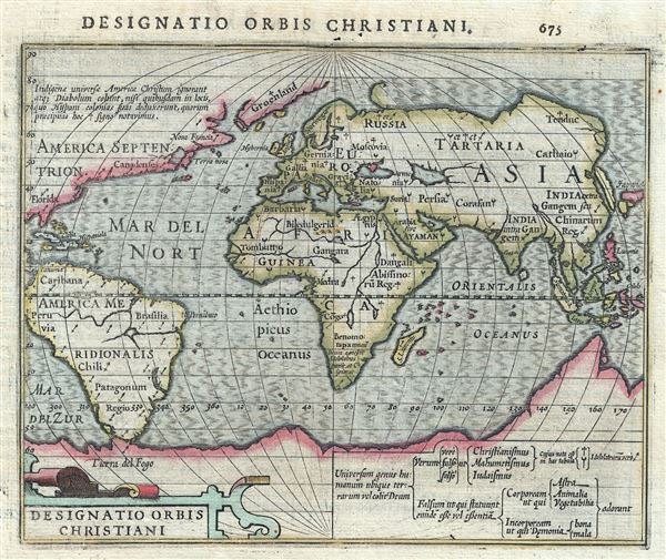
Designatio Orbis Christiani.
sold
- Digital Map Information
- Suitable for large format printing
- DPI: 300
- File Size: 1.98 MB
- File Type: ZIP / TIFF
- ICC color profile embedded
- Delivered instantly via download link
One of the earliest known thematic maps, this is a fine example of the 1607 Mercator- Hondius map of the World showing different religions. The world is presented on a hemispherical projection with Europe and Africa at center. Various ... (more details)

Map of the Central Park Showing the progress of the Work up to January 1st, 1865.
sold
- Digital Map Information
- Suitable for large format printing
- File Size: 9.18 MB
- File Type: ZIP / TIFF
- ICC color profile embedded
- Delivered instantly via download link
An altogether extraordinary hand colored map of New York City's Central Park prepared and printed for inclusion in the Eight Annual Report of the Board of Commissioners of the Central Park . This map first appeared in 1861, with the ... (more details)
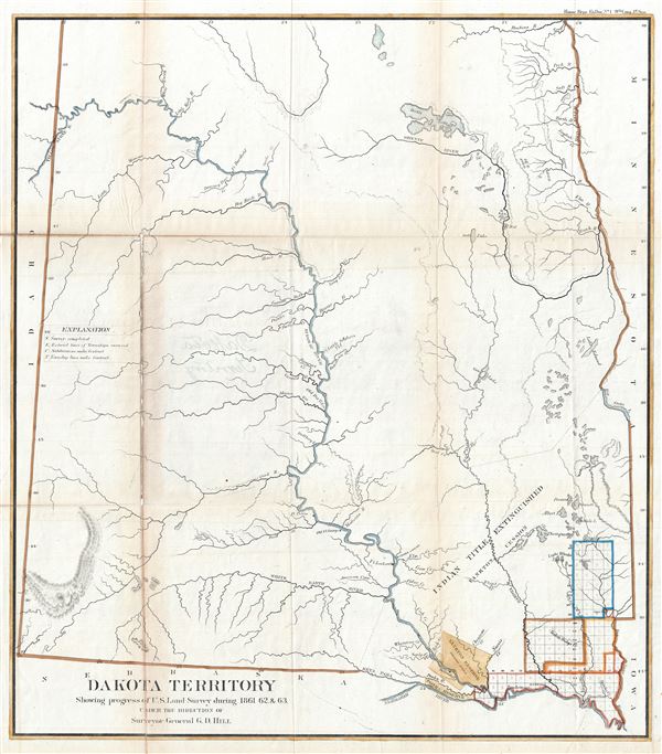
Dakota Territory Showing progress of U.S. Land Survey during 1861, 62 and 63.
sold
- Digital Map Information
- Suitable for large format printing
- File Size: 20.35 MB
- File Type: ZIP / TIFF
- ICC color profile embedded
- Delivered instantly via download link
This is a fine 1863 public survey map of North Dakota and South Dakota (Dakota Territory). It covers the states of North Dakota and South Dakota before they were admitted to the Union. The map was prepared to illustrate the ... (more details)
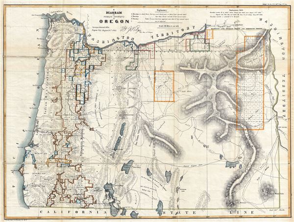
A Diagram of Public Surveys in Oregon.
sold
- Digital Map Information
- Suitable for large format printing
- File Size: 16.79 MB
- File Type: ZIP / TIFF
- ICC color profile embedded
- Delivered instantly via download link
This is a fine 1863 public survey map of Oregon. It covers the region from the Pacific Ocean to Boise and from the Columbia River to the California state boundary. The map was prepared to illustrate the progress of the land ... (more details)
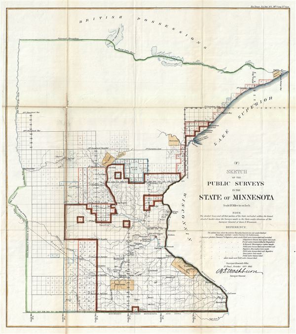
(F) Sketch of the Public Surveys in the State of Minnesota.
sold
- Digital Map Information
- Suitable for large format printing
- File Size: 10.16 MB
- File Type: ZIP / TIFF
- ICC color profile embedded
- Delivered instantly via download link
An attractive 1863 example of the 1863 public survey map of Minnesota by W. D. Washburn, Surveyor General. It covers the state of Minnesota from Brownsville to Rainy Lake. The state of the Land Survey, confined to the ... (more details)

Sketch of Public Surveys in New Mexico to Accompany the Annual Report of the Surveyor General for 1863.
sold
- Digital Map Information
- Suitable for large format printing
- File Size: 8.28 MB
- File Type: ZIP / TIFF
- ICC color profile embedded
- Delivered instantly via download link
This is a beautiful 1863 public survey map of New Mexico. Centered on the Rio Grande, it covers the region entire state of New Mexico from Emory's Spring, north as far as Raton Mountains and from Washington Pass to the ... (more details)
A highly polished map' - Wheat

Map of Public Surveys in Colorado Territory to accompany a report of the Surveyor Gen.
sold
- Digital Map Information
- Suitable for large format printing
- File Size: 11.7 MB
- File Type: ZIP / TIFF
- ICC color profile embedded
- Delivered instantly via download link
This is a beautiful 1863 public survey map of Colorado Territory. It covers the region from the Escalante Mountains to Julesburg and includes survey work, with the progress of the land survey noted via a series of ... (more details)
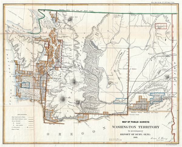
Map of Public Surveys Washington Territory to accompany Report of Surv: Genl: 1863.
sold
- Digital Map Information
- Suitable for large format printing
- File Size: 9.83 MB
- File Type: ZIP / TIFF
- ICC color profile embedded
- Delivered instantly via download link
This is an attractive example of the 1863 public survey map of part of the Washington Territory prepared by Anson G. Henry, Surveyor General of Washington Territory. It covers the region from the Pacific Ocean to ... (more details)

Geographische Beschreibung des Gelobten Landes Canaan, Welches unserem Herrn und Seeligmacher Jesu Christo und seinen Aposteln durchwandert worden.
sold
- Digital Map Information
- Suitable for large format printing
- DPI: 300
- File Size: 10.94 MB
- File Type: ZIP / TIFF
- ICC color profile embedded
- Delivered instantly via download link
This is a beautiful and uncommon c.1700 German variant of the Visscher Family's important map of the Holy Land or Palestine or Israel, or as it is titled (in rough translation) Geographical description of the ... (more details)
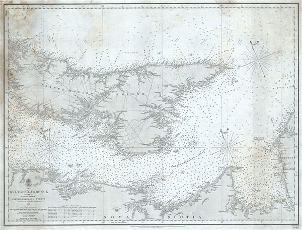
The Gulf of St. Lawrence Sheet IX Eastern part of Northumberland Strait.
sold
- Digital Map Information
- Suitable for large format printing
- File Size: 17.04 MB
- File Type: ZIP / TIFF
- ICC color profile embedded
- Delivered instantly via download link
This is a scarce 1864 British Admiralty Hydrographic Office maritime map or nautical chart of Prince Edward Island and vicinity. Centered on Prince Edward Island, Canada's smallest maritime province, it ... (more details)
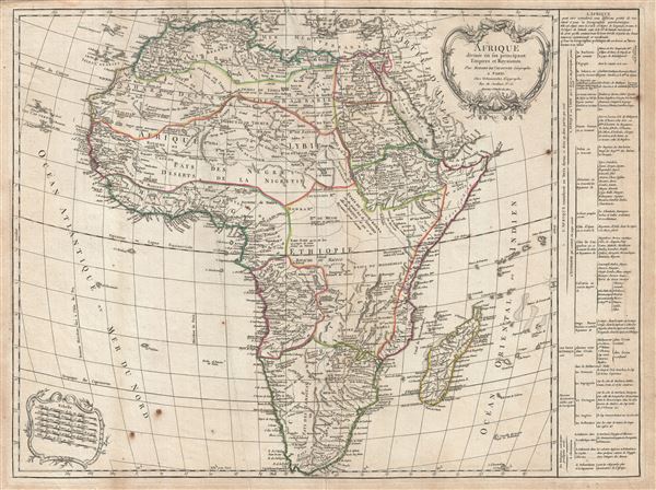
Afrique divisee en les principaux Empire et Royaumes.
sold
- Digital Map Information
- Suitable for large format printing
- DPI: 300
- File Size: 19.91 MB
- File Type: ZIP / TIFF
- ICC color profile embedded
- Delivered instantly via download link
An exceptional 1784 map Africa by Robert de Vaugondy and Charles Delamarche. Following on the work of Nicolas Sanson, Vaugondy's map of Africa covers eth entire continent in considerable detail. The ... (more details)