
Steven J. Pieragastini
A scholar of modern Chinese and world history, drawn to maps of East Asia and beyond the Western tradition.
I come to Geographicus from a background in academia, focused on modern Chinese and world history — which naturally draws me to maps of and from East Asia. I'm also drawn to Russian/Soviet maps, Ottoman maps, and maps from non-Western languages or cartographic traditions.
These maps are exciting because they offer alternative perspectives — not just on historical events, but on geographic knowledge itself, and even on what counts as a "map." They're also generally less cataloged and less familiar to the trade, which means real opportunities to introduce new material for collectors and scholars alike.
Monthly Digest of Steven's Picks

Abu Dhabi on the Cusp of Independence and Modernization.
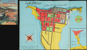
مَدِينَةُ أَبُو ظَبِي الحَدِيثَة [Modern Abu Dhabi City]. / عَامَانِ زَاهِيَان فِي تَارِيخِ إِمَارَةِ أَبُو ظَبِي [Two Glorious Years in the History of the Emirate of Abu Dhabi].
sold
This is a rare 1968 folding map of Abu Dhabi, appearing in the scarce Arabic edition of the Two Glorious Years in the History of the Emirate of Abu Dhabi. The map and book were published in a period of rapid transformation for the emirate, which was preparing for independence and implementing the early phase of a radical modern urban plan. (more details)
Rare Peek into Daily Life in the Emirates during the 1950s.
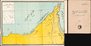
ساحل عمان [Coast of Oman]. / الإمارات السبع على الساحل الأخضر [The Seven Emirates on the Green Coast].
sold
This is a 1957 map of the Trucial States, the future United Arab Emirates, that appeared in the book The Seven Emirates on the Green Coast, written by Ahmad Qasim Al-Burini. Al-Burini's account is one of the most detailed historical accounts of the emirates in this formative period. (more details)
Monumental Coda for the Tokugawa Era.

東海道名所圖會 / [Illustrations of Famous Places on the Tokaido].
sold
- Digital Map Information
- Suitable for large format printing
- Full resolution TIFF file
- ICC color profile embedded
- Delivered instantly via download link
An epic twelve-panel ukiyo-e woodblock print panorama, this work, covering the Tokaido Road between Edo and Kyoto, was produced in 1864 by Utagawa Yoshitora, one of the master woodblock print artists of the era. Published near the end of the Tokugawa Shogunate, it celebrates one of the regime's paramount achievements and the 'famous places' (名所) along it. (more details)
Wargaming for kids.
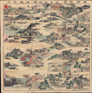
日清戦争軍功双六 / [Sino-Japanese War Military Exploits Sugoroku].
sold
- Digital Map Information
- Suitable for large format printing
- Full resolution TIFF file
- ICC color profile embedded
- Delivered instantly via download link
A fascinating relic of Japanese popular culture during the First Sino-Japanese War, this is an 1894 sugoroku game produced by Fukuda Kumajirō. Illustrating a birds-eye view of the Korean Peninsula and northeastern China, it paints a background of naval and land battle scenes for players to progress across to reach the finish line (agari) at Beijing (Pekin). (more details)
Opening of Treaty Port Nagasaki.

肥前長崎圖 / [Map of Nagasaki in Hizen].
sold
- Digital Map Information
- Suitable for large format printing
- Full resolution TIFF file
- ICC color profile embedded
- Delivered instantly via download link
A colorful c. 1860 ukiyo-e woodblock map of Nagasaki, published by Baikōdō. It displays the port city in the wake of its opening to foreign trade as a treaty port, superseding its earlier role as Japan's outlet to the world via exclusive trade with Chinese and Dutch merchants. (more details)
From imperial capital to modern metropolis.
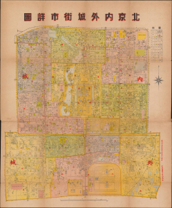
北京内外城街市詳圖 / [Detailed Street Map of the Inner and Outer Cities of Beijing].
sold
- Digital Map Information
- Suitable for large format printing
- Full resolution TIFF file
- ICC color profile embedded
- Delivered instantly via download link
This is a c. 1930 Chinese-language map of Beijing published by the Zhengwen Bookstore. It illustrates the city's transition from imperial capital to modern city, fitted out with streetcars, plumbing, railway stations, and telegraphs. (more details)
The Pacific War begins to turn in the favor of the Allies.
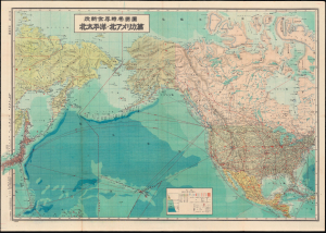
改新世界時局要圖 北太平洋-北アメリカ篇 / [Revised Map of the Global Situation: North Pacific and North America].
sold
- Digital Map Information
- Suitable for large format printing
- Full resolution TIFF file
- ICC color profile embedded
- Delivered instantly via download link
This is a 1943 Serizawa Keigo Japanese map of the northern Pacific Ocean, North America, and the Soviet Far East made during World War II (1939 - 1945). It reflects Japanese interest in the Pacific at the height of the naval and island-based conflict with the United States during World War II. (more details)
Manga satire of PM Yoshida's 5th Cabinet.
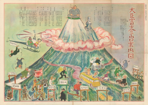
Minister Fuji Mountain Trail Guide Map. / 大臣富士登山口案内図 / Political Boss Faction Water Vein Map. / 政界親分・子分水脈図
sold
A very curious double-sided map / diagram satirizing the Fifth Cabinet of Prime Minister Shigeru Yoshida (1878 - 1967), in power from May 31, 1953, to December 10, 1954. The recto (front) presents a trail map to the summit of Mount Fuji - symbolizing Japan. Yoshida sits atop, smoking a large cigar, while along the way the Christian socialist Tetsu Katayama (1887 - 1978) appears as a monument. At the base of the mountain, Yoshida's cabinet secretaries, each representing an aspect of Japanese governance, work their way to the top via various 'gates' or 'trails.' Some suffer mishaps along the way. The verso (back) offers a similarly intriguing map/diagram of the national political/academic/business/bureaucratic system, represented as a series of interconnected rivers flowing into a sea/nation. (more details)
One of World War II's forgotten fronts.
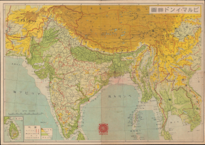
ビルマ - インド詳圖 / [Detailed Map of Burma and India].
sold
- Digital Map Information
- Suitable for large format printing
- Full resolution TIFF file
- ICC color profile embedded
- Delivered instantly via download link
This is a 1942 Asahi Shimbun Japanese map of Burma, India, and surrounding territories, made in the context of the Burma Campaign of World War II (1939 - 1945). When this map was published, Japanese forces were advancing northwards in Burma after having rapidly conquered the capital, Rangoon. It was issued to celebrate the victory and promote the war effort on the home front. (more details)
Battleships and cosmetics.
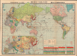
世界現勢國防大地圖 / [Current Map of Global National Defenses].
sold
- Digital Map Information
- Suitable for large format printing
- Full resolution TIFF file
- ICC color profile embedded
- Delivered instantly via download link
This is a rare 1936 world map published in Hinode (日の出), a popular Japanese magazine, showing the comparative military strength of major world powers. The map augurs Japan's coming conflicts with China in 1937 and Western powers in 1941. (more details)
Manchuria just after the establishment of Manchukuo.
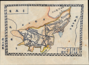
吉林省 / [Jilin Province].
sold
- Digital Map Information
- Suitable for large format printing
- Full resolution TIFF file
- ICC color profile embedded
- Delivered instantly via download link
This is a c. 1932 manuscript map of Jilin Province, Manchuria, China, drawn by Cui Wende. Drawn just after the establishment of the Japanese puppet state of Manchukuo, it highlights critical rail infrastructure, the backbone of Japanese influence in Manchuria even before the establishment of Manchukuo. (more details)