
Washington D.C.
Outbreak of the Civil War.
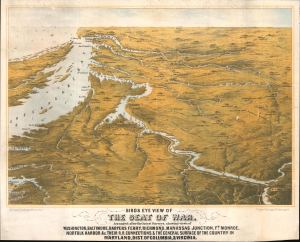
Birds Eye View of The Seat of War. Arranged after the latest Surveys, showing views of Washington, Baltimore, Harpers Ferry, Richmond, Manassas Junction, Ft. Monroe, Norfolk Harbor and c. Their Connections, and The General Surface of the Country in Maryland, Dist. of Columbia, and Virginia.
$3,400.00
Acquire
- Digital Map Information
- Suitable for large format printing
- File Size: 25.3 MB
- File Type: ZIP / TIFF
- ICC color profile embedded
- Delivered instantly via download link
This is a rare 1861 bird's-eye view of the vicinity of Washington, D.C., including Richmond, the mouth of the Chesapeake Bay, and the Potomac River in the early days of the American Civil War (1861 - 1865). The work was compiled by Boston's most talented lithographer, Louis Prang. It is novel in that it is anticipatory, a tool for Prang's audience to understand a conflict that was universally expected, but which had not yet developed. (more details)
Seat of the Civil War around Washington D.C. and the Chesapeake Bay.
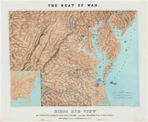
The Sea of War. Birds Eye View of Virginia, Maryland, Delaware and the District of Columbia.
$2,000.00
Acquire
- Digital Map Information
- Suitable for large format printing
- File Size: 56.72 MB
- File Type: ZIP / TIFF
- ICC color profile embedded
- Delivered instantly via download link
A striking 1861 three-color Schedler/Schaus chromolithograph view/map of the Chesapeake Bay region, including Maryland, Virginia, Delaware, and Washington D.C., shortly after the outbreak of the American Civil War (1861 - 1865). (more details)
'A Monthly check for every American...'

A Monthly Check to You for the Rest of your Life Beginning When You Are 65.
$2,000.00
Acquire
- Digital Map Information
- Suitable for large format printing
- File Size: 33.31 MB
- File Type: ZIP / TIFF
- ICC color profile embedded
- Delivered instantly via download link
An iconic piece of American visual history, this is a 1936 Social Security Board broadside promoting the newly created Social Security System. With the U.S. Capitol towering in the background, a hand offers 'your monthly Social Security check' from the United States government: 'A monthly check to you for the rest of your life beginning when you are 65'. The reader is urged to 'get your Social Security Account Number promptly' and that 'applications are being distributed at all work places'. Informative and instructional, the poster includes details regarding eligibility, and how to return an application. Intriguingly, text along the bottom reads, 'Postmasters will display this poster in a conspicuous place in the Post Office lobby, on arrival, but not before November 24, 1936.' While this broadside does show evidence of being displayed in a post office, including pinholes in the upper margin, it is in very good condition. (more details)
America's first great insurance company.
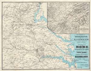
The Approaches from Washington, to Richmond.
$1,250.00
Acquire
- Digital Map Information
- Suitable for large format printing
- File Size: 40.84 MB
- File Type: ZIP / TIFF
- ICC color profile embedded
- Delivered instantly via download link
A scarce 1864 Daniel A. Heald map of the Washington D.C. / Richmond, Virginia area during the American Civil War. The strategically and politically critical corridor between Washington D. C. and Richmond, Virginia was one of the most hotly contested theaters of the American Civil War (1861 - 1865). When this map was issued, in 1864, the war had already turned strongly in favor of the Union. Late 1864 and early 1865 witnessed a succession of battles as Union forces pursued Confederate armies as they retreated toward their capital, Richmond. Battle sites are marked by crossed cavalry swords. The main map relates to the 1862 Peninsular Campaign. While the submap follows military operations in Eastern Tennessee, Northern Alabama, and Georgia - representing the final days of the Confederacy. (more details)
Land of Lincoln.
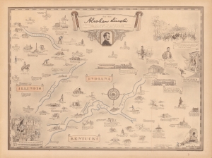
Abraham Lincoln, a pictorial outline of the life of the sixteenth president of the United States.
$500.00
Acquire
- Digital Map Information
- Suitable for large format printing
- File Size: 52.94 MB
- File Type: ZIP / TIFF
- ICC color profile embedded
- Delivered instantly via download link
A curious historical 1934 Karl Smith pictorial map of portions of Kentucky, Illinois, and Indiana, along with Washington, D.C. It traces the momentous life of Abraham Lincoln, from his childhood, to his presidency, through the Civil War, to his final resting place in Springfield, Illinois. (more details)
Striking map of Washington, D.C.
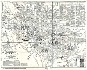
The 'Standard Guide' Ready Reference Map of Washington, to accompany the 'Washington Standard Guide'.
$500.00
Acquire
- Digital Map Information
- Suitable for large format printing
- File Size: 9.28 MB
- File Type: ZIP / TIFF
- ICC color profile embedded
- Delivered instantly via download link
This is a striking 1937 map or plan of Washington, D.C. by the Foster and Reynolds Company of New York. It covers Washington D.C. from the Arlington National Cemetery and Georgetown College eastward as far as 28th Street and the Congressional Cemetery and from the ... (more details)
Chromolithograph view of Washington's tomb at Mount Vernon.
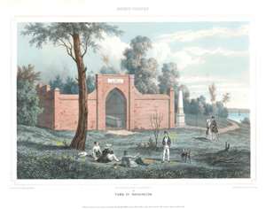
Tomb of Washington.
$375.00
Acquire
- Digital Map Information
- Suitable for large format printing
- Full resolution TIFF file
- ICC color profile embedded
- Delivered instantly via download link
This is an 1848 Augustus Köllner view of George Washington's tomb at Mount Vernon, Virginia. Depicting the New Tomb at Mount Version, the tomb's brick façade dominates the view, and the inscription above the archway is legible and reads 'Within this Enclosure Rest the remains of Genl. George Washington.' Washington's marble casket is seen through the steel gate barring entry to the tomb. A white obelisk (described as a marble shaft by Mount Vernon) appears to the right and was erected in memory of Bushrod Washington, a proprietor of Mount Vernon. Two men and one woman are illustrated lounging under a tree and are seen conversing with another man in the foreground. A couple strolling through the ground are seen further back, and the Potomac River can just be seen along the right side. (more details)
Emerging national capital.
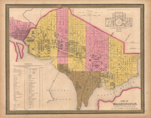
City of Washington.
$350.00
Acquire
- Digital Map Information
- Suitable for large format printing
- File Size: 14.24 MB
- File Type: ZIP / TIFF
- ICC color profile embedded
- Delivered instantly via download link
This is Samuel Augustus Mitchell's 1848 city map of Washington D.C., an emerging city still under construction when this map was published. The plan is a combination of existing urbanization and projections. Nearby Georgetown, also included, was much more developed. (more details)
A work in progress.
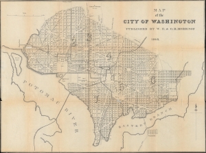
Map of the City of Washington.
$300.00
Acquire
- Digital Map Information
- Suitable for large format printing
- File Size: 15.13 MB
- File Type: ZIP / TIFF
- ICC color profile embedded
- Delivered instantly via download link
A fascinating map of early Reconstruction-era Washington, D.C., produced in 1868 by W.H. and O.H. Morrison for their city guide. It presents the city as the early phases of a major renovation that would completely reshape it were underway. (more details)
War Bond Drive at the Washington Monument.
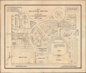
Plan Back the Attack Army Show for 3rd War Loan at the Washington Monument.
$250.00
Acquire
- Digital Map Information
- Suitable for large format printing
- Full resolution TIFF file
- ICC color profile embedded
- Delivered instantly via download link
This is a 1943 map of the grounds of the Washington Monument in Washington, D.C., prepared by the U.S. Army Corps of Engineers. It depicts the exhibits of an army show organized to support the Third War Loan, a successful U.S. government effort to raise funds for the ongoing World War II (1939 - 1945). (more details)
The Grandest Dam of Them All.
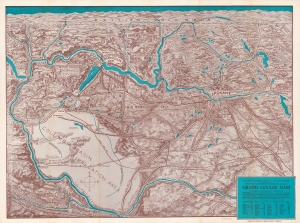
Panoramic perspective of the Spokane Region including the geological and scenic wonderland embracing the Grand Coulee Dam as it will appear when the development is completed.
$250.00
Acquire
- Digital Map Information
- Suitable for large format printing
- Full resolution TIFF file
- ICC color profile embedded
- Delivered instantly via download link
An impressive c. 1935 view of the Spokane region and eastern Washington produced by Inland American Printing for the Spokane Chamber of Commerce. The view is meant to highlight the Grand Coulee Dam, an ambitious project then under construction. (more details)
Urbanizing America.
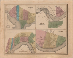
Washington, Louisville and Jeffersonville, New Orleans, Cincinnati.
$200.00
Acquire
- Digital Map Information
- Suitable for large format printing
- DPI: 600
- File Size: 25.34 MB
- File Type: ZIP / TIFF
- ICC color profile embedded
- Delivered instantly via download link
Four lovely city plans printed on one sheet- Washington, D.C., Louisville and Jeffersonville, New Orleans, and Cincinnati - published in 1846 in Thomas Bradford's Universal Illustrated Atlas. (more details)