
Washington D.C. (sold)
A most important Civil War map of Washington D.C.
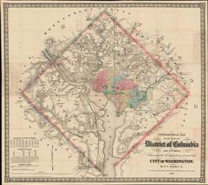
Topographical Map of the Original District of Columbia and Environs: Showing the Fortifications around the City of Washington.
sold
- Digital Map Information
- Suitable for large format printing
- File Size: 51.63 MB
- File Type: ZIP / TIFF
- ICC color profile embedded
- Delivered instantly via download link
Known as 'The Arnold Map', this is the most important Civil War era map of Washington D.C. and vicinity. This map was issued by Edward Greene 'Aloha Vivarttas' Arnold and G. W. Colton in 1862, just after the Second Battle of Bull Run. Centered on the White House, the map illustrates the 'original' ten-mile-square diamond-shaped land allocation set aside for the District of Columbia. As a cartographic piece, Arnold's map exceeded in quality all previous maps of the region, noting roads, canals, turnpikes, railroads, and mills, as well offering a meticulous presentation of topography. Significantly, it illustrates the 51 fortifications, army hospitals, and dozens of small batteries - all critical wartime reconnaissance. (more details)
First official large format plan of Washington D.C.
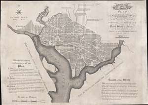
Plan of the City of Washington in the Territory of Columbia, ceded by the States of Virginia and Maryland to the United States of America, and by them established as the Seat of their Government, after the year MDCCC.
sold
- Digital Map Information
- Suitable for large format printing
- Full resolution TIFF file
- ICC color profile embedded
- Delivered instantly via download link
This is Andrew Ellicott's seminal 1792 official large format plan or map of Washington D.C., which would become, 8 years later, the capital of the United States. This is the grandest, most beautiful, and most important official founding plan of Washington D.C. The map illustrates the original urban layout of Washington D.C, then only a small part of the District of Colombia. Centered on the confluence of the Potomac and the Eastern Branch (Anacostia) Rivers, the map covers the Washington D.C. grid as far north as W Street. It also includes the older nearby city of Georgetown. (more details)
The First European Edition of the Seminal Ellicott Plan.
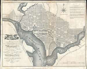
Plan of the City of Washington in the Territory of Columbia ceded by the States of Virginia and Maryland tothe United States of America and by them established as the Seat of their Government after the Year 1800.
sold
- Digital Map Information
- Suitable for large format printing
- DPI: 600
- File Size: 22.36 MB
- File Type: ZIP / TIFF
- ICC color profile embedded
- Delivered instantly via download link
This is the 1795 Russell edition of Andrew Ellicott's seminal plan or map of Washington D.C., published prior to its becoming in 1800 the capital of the United States. The map illustrates the original urban layout of Washington D.C, then only a small part of the District of Columbia. Centered on the confluence of the Potomac and the Eastern Branch (Anacostia) Rivers, the map covers the Washington D.C. grid as far north as W Street. It also includes the older nearby city of Georgetown. (more details)
Stunning large format map of Virginia, Maryland, and Delaware.
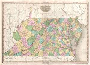
Viginia Maryland Delaware By H.S. Tanner.
sold
- Digital Map Information
- Suitable for large format printing
- DPI: 300
- File Size: 14.78 MB
- File Type: ZIP / TIFF
- ICC color profile embedded
- Delivered instantly via download link
A rare and important map of Virginia (and West Virginia), Maryland and Delaware by H. S. Tanner. This elephant folio map covers these states in full as well as, in less detail, parts of adjacent states. The map shows rivers, topography by hachure, cities, towns ... (more details)
Beautiful bird's-eye view of Washington, D.C.
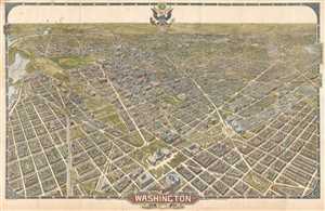
Washington The Beautiful Capital of the Nation.
sold
- Digital Map Information
- Suitable for large format printing
- File Size: 44.05 MB
- File Type: ZIP / TIFF
- ICC color profile embedded
- Delivered instantly via download link
This is an unusual and rare 1921 large-format William Olsen bird's-eye view of Washington, D.C. and environs. Oriented toward the southwest, the view depicts the city from the U.S. Capitol Building south to Virginia and Maryland. Beautifully drawn, individual ... (more details)
Beautiful bird's-eye view of Washington, D.C.
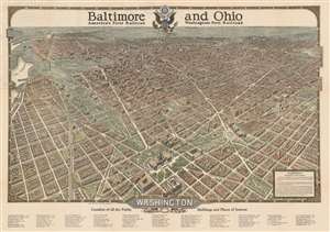
Washington The Beautiful Capital of the Nation.
sold
- Digital Map Information
- Suitable for large format printing
- File Size: 53.67 MB
- File Type: ZIP / TIFF
- ICC color profile embedded
- Delivered instantly via download link
This is 1923 William Olsen bird's-eye view of Washington, D.C. and environs. Oriented toward the southwest, the view depicts the city from the U.S. Capitol Building south to Virginia and Maryland. Beautifully drawn, individual buildings throughout Washington are discernable and numerous locations are labeled. Some of the important government buildings illustrated in three dimensions, include the Library of Congress, the Smithsonian Institution (comprised of the Smithsonian Castle, the Arts and Industries Building, and the National Museum of Natural History), several buildings occupied by the War Department and the Navy Department, and the White House. The Washington Monument and the Lincoln Memorial are both prominently illustrated as well. George Washington University, Georgetown University, and Howard University are also identified. Several different YMCA locations are situated around the city, along with an orphan asylum, hotels, and electric and telephone companies. Foreign legations and embassies are also depicted. Major streets and circles are also labeled, although not all are illustrated, as they are blocked by the buildings. An index of public buildings and other places of interest is situated below the bottom border. (more details)
Illustrates the U.S. Capital, the Washington Monument, and the Lincoln Memorial, among other famous Washington, D.C. sites.
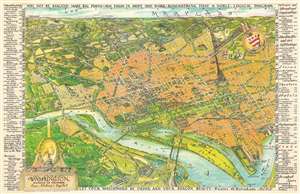
Washington District of Columbia Our Nation's Capital.
sold
- Digital Map Information
- Suitable for large format printing
- File Size: 84.64 MB
- File Type: ZIP / TIFF
- ICC color profile embedded
- Delivered instantly via download link
This is a 1949 Oliver Whitwell Wilson pictorial bird's eye view of Washington, D.C. The map depicts the region from the southeast, looking from Virginia across Washington, D.C. to Maryland. Numerous government buildings monuments and throughout the city are illustrated and labeled, including the Capital Building, the White House, the Supreme Court, the Washington Monument, the Lincoln Memorial, and the Jefferson Memorial. Other landmarks are identified, including the Smithsonian Institution, the National Gallery of Art, the Reflecting Pool, Ford's Theater, and the Library of Congress. Other fixtures around Washington, D.C. are also highlighted, such as George Washington University, Georgetown University, the Naval Observatory, and Union Station. Streets are illustrated, although not all are labeled. Across the river in Virginia, Arlington National Cemetery, complete with the Tomb of the Unknown Soldier, the U.S.S. Maine mast, and Arlington House. The Pentagon, not even ten years old at the time, is also illustrated. Rosslyn is labeled. Outside Washington to the north, several roads are labeled, as are Rock Creek Park, the Army Medical Center, the U.S. Soldier's Home, Catholic University, and, along the horizon, Bethesda, Maryland. George Washington's coat of arms is illustrated in the upper right quadrant at the center of a compass. In the lower right sits a decorative title cartouche featuring an illustration of the Capital, the Washington Monument, and a portrait of George Washington, the first President of the United States. An index of ninety different locations throughout the city is situated along both the left and right borders and includes federal buildings, municipal buildings, scientific and art institutions, stores, theaters, hotels, and restaurants. Each is numerically identified both in the index and on the map, and the index also provides each building's grid location on the map. (more details)
Illustrates the U.S. Capital, the Washington Monument, and the Lincoln Memorial, among other famous Washington, D.C. sites.
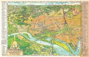
Washington District of Columbia Our Nation's Capital.
sold
- Digital Map Information
- Suitable for large format printing
- File Size: 86.09 MB
- File Type: ZIP / TIFF
- ICC color profile embedded
- Delivered instantly via download link
This is a 1949 Oliver Whitwell Wilson pictorial bird's eye view of Washington, D.C. The map depicts the region from the southeast, looking from Virginia across Washington, D.C. to Maryland. Numerous government buildings monuments and throughout the city are illustrated and labeled, including the Capital Building, the White House, the Supreme Court, the Washington Monument, the Lincoln Memorial, and the Jefferson Memorial. Other landmarks are identified, including the Smithsonian Institution, the National Gallery of Art, the Reflecting Pool, Ford's Theater, and the Library of Congress. Other fixtures around Washington, D.C. are also highlighted, such as George Washington University, Georgetown University, the Naval Observatory, and Union Station. Streets are illustrated, although not all are labeled. Across the river in Virginia, Arlington National Cemetery, complete with the Tomb of the Unknown Soldier, the U.S.S. Maine mast, and Arlington House. The Pentagon, not even ten years old at the time, is also illustrated. Rosslyn is labeled. Outside Washington to the north, several roads are labeled, as are Rock Creek Park, the Army Medical Center, the U.S. Soldier's Home, Catholic University, and, along the horizon, Bethesda, Maryland. George Washington's coat of arms is illustrated in the upper right quadrant at the center of a compass. In the lower right sits a decorative title cartouche featuring an illustration of the Capital, the Washington Monument, and a portrait of George Washington, the first President of the United States. An index of ninety different locations throughout the city is situated along both the left and right borders and includes federal buildings, municipal buildings, scientific and art institutions, stores, theaters, hotels, and restaurants. Each is numerically identified both in the index and on the map, and the index also provides each building's grid location on the map. (more details)
Illustrates the U.S. Capital, the Washington Monument, and the Lincoln Memorial, among other famous Washington, D.C. sites.
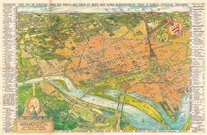
Washington District of Columbia Our Nation's Capital.
sold
- Digital Map Information
- Suitable for large format printing
- File Size: 67.29 MB
- File Type: ZIP / TIFF
- ICC color profile embedded
- Delivered instantly via download link
This is a 1949 Oliver Whitwell Wilson pictorial bird's eye view of Washington, D.C. The map depicts the region from the southeast, looking from Virginia across Washington, D.C. to Maryland. Numerous government buildings monuments and throughout the city are illustrated and labeled, including the Capital Building, the White House, the Supreme Court, the Washington Monument, the Lincoln Memorial, and the Jefferson Memorial. Other landmarks are identified, including the Smithsonian Institution, the National Gallery of Art, the Reflecting Pool, Ford's Theater, and the Library of Congress. Other fixtures around Washington, D.C. are also highlighted, such as George Washington University, Georgetown University, the Naval Observatory, and Union Station. Streets are illustrated, although not all are labeled. Across the river in Virginia, Arlington National Cemetery, complete with the Tomb of the Unknown Soldier, the U.S.S. Maine mast, and Arlington House. The Pentagon, not even ten years old at the time, is also illustrated. Rosslyn is labeled. Outside Washington to the north, several roads are labeled, as are Rock Creek Park, the Army Medical Center, the U.S. Soldier's Home, Catholic University, and, along the horizon, Bethesda, Maryland. George Washington's coat of arms is illustrated in the upper right quadrant at the center of a compass. In the lower right sits a decorative title cartouche featuring an illustration of the Capital, the Washington Monument, and a portrait of George Washington, the first President of the United States. An index of ninety different locations throughout the city is situated along both the left and right borders and includes federal buildings, municipal buildings, scientific and art institutions, stores, theaters, hotels, and restaurants. Each is numerically identified both in the index and on the map, and the index also provides each building's grid location on the map. (more details)
Building a monumental capital.
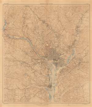
Washington and Vicinity.
sold
- Digital Map Information
- Suitable for large format printing
- File Size: 387.88 MB
- File Type: ZIP / TIFF
- ICC color profile embedded
- Delivered instantly via download link
This is a large and intricately detailed 1917 U.S. Geological Survey map of Washington, D.C., and surrounding areas. It depicts the city in the midst of a rapid expansion in the early 20th century, when it benefitted from an increased focus on public services and the growing writ of the federal government, in part due to World War I. (more details)
Evolution of the National Mall.
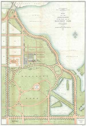
Plan for the Improvement of the West Side of Monument Park.
sold
- Digital Map Information
- Suitable for large format printing
- File Size: 17.94 MB
- File Type: ZIP / TIFF
- ICC color profile embedded
- Delivered instantly via download link
This is a 1902-04 U.S. Army Corps of Engineers map of Monument Park, the National Mall, Washington D.C. This map was issued to address draining issues of drainage - note the large fishponds in the lower right. Centered on the Washington Monument and oriented to the south, with north at the bottom, the map depicts from the President's Park at the bottom to the tidal reservoir, the Maryland Avenue Bridge and Potomac Park at the top, and from Fourteenth Street to Seventeenth Street and the tidal basin on the right. Above Memorial Park and the Washington Monument, B, C, and D Streets are depicted as well as several city blocks. The Bureau of Engraving and Printing is identified, as well as the Nursery of the Office of Public Buildings and Grounds. To the right of Monument Park, two fishponds are illustrated, which, per the map, were part of the U.S. Fish Commission. To the left of Monument Park, across Fourteenth Street, lies the grounds of the Agriculture Department. (more details)
Union hospital during the Civil War.
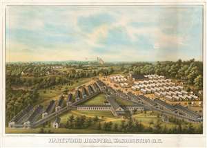
Harewood Hospital, Washington D.C.
sold
- Digital Map Information
- Suitable for large format printing
- File Size: 15.71 MB
- File Type: ZIP / TIFF
- ICC color profile embedded
- Delivered instantly via download link
This is an 1864 bird's eye view of Harewood General Hospital by Charles Magnus. Harewood General Hospital was a pavilion-style hospital operated by the United States during the American Civil War to render care for Union personnel, which was in operation from September 4, 1862, to May 5, 1866. The view shows the V-shaped layout of the Hospital's barracks-like wards, as well as an array of orderly tents extending across fields and into the neighboring woods. (The site of the hospital can be found east of Georgia Avenue NW north of the Glenwood Cemetery and south of the Armed Forces Retirement Home. Washington Hospital Center, the Washington DC VA Medical Center and the Children's National Medical Center can be found there now.) (more details)
One of only four known examples.
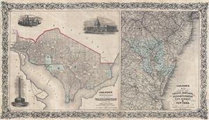
Colton's Georgetown and the city of Washington the Capital of the United States of America. / Colton's Map Showing Part of Virginia, Maryland, Pennsylvania, New Jersey & New York.
sold
- Digital Map Information
- Suitable for large format printing
- File Size: 19.23 MB
- File Type: ZIP / TIFF
- ICC color profile embedded
- Delivered instantly via download link
A highly unusual discovery, this is an independently issued c. 1862 map of Washington D.C. and the Chesapeake Bay area by the American cartographer J. H. Colton. Our research has only been able to identify three known examples of this map, two in the Library ... (more details)
'The March Against Death' anti-Vietnam War Protest.
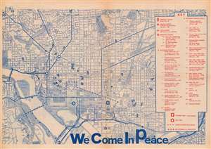
This is a 1969 'National Mobilization Committee to End the War in Vietnam' map of the Washington, D.C. illustrating the massive November 15, 1969 'March Against Death' protest - one of the most significant anti-war protests in the 60s. 'March Against Death' was a 44,000 strong single-file march wherein each participant wore a placard bearing either the name of a soldier killed in Vietnam or a Vietnamese village destroyed. A dashed line marks the route of the March, while other markings indicate assembly areas and rally sites, along with the medical center, the Marshal's Center, and other important locations. (more details)
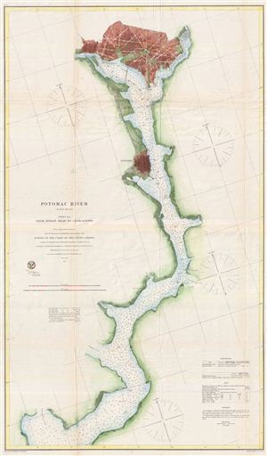
Potomac River (in four sheets) Sheet No. 4.
sold
- Digital Map Information
- Suitable for large format printing
- File Size: 20.82 MB
- File Type: ZIP / TIFF
- ICC color profile embedded
- Delivered instantly via download link
A rare and appealing three section map of Washington D.C., Alexandria, and the Potomac River issued by the U.S. Coast survey in 1864. The map covers the course of the Potomac River from Indian Point to Washington D.C. and includes both Alexandria and ... (more details)
Scarce and beautiful map of Washington D.C. drawn for the inauguration of Benjamin Harrison.
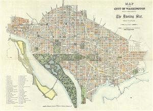
Map of the City of Washington with compliments of The Evening Star. Souvenir of March 4th, 1889.
sold
- Digital Map Information
- Suitable for large format printing
- File Size: 11.49 MB
- File Type: ZIP / TIFF
- ICC color profile embedded
- Delivered instantly via download link
A spectacular and scarce 1889 map of Washington D.C. issued for The Evening Star newspaper. The The Evening Star hired the photo-lithography firm of Bell Brothers to produce this appealing map to commentate the inauguration of Benjamin Harrison as the ... (more details)
Scarce and beautiful map of Washington D.C. drawn for the inauguration of Benjamin Harrison.
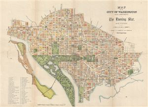
Map of the City of Washington with compliments of The Evening Star. Souvenir of March 4th, 1889.
sold
- Digital Map Information
- Suitable for large format printing
- File Size: 10.62 MB
- File Type: ZIP / TIFF
- ICC color profile embedded
- Delivered instantly via download link
A spectacular and scarce 1889 map of Washington D.C. issued for The Evening Star newspaper. The The Evening Star hired the photo-lithography firm of Bell Brothers to produce this appealing map to commentate the inauguration of Benjamin Harrison as the ... (more details)
The only known example of the Murphy and Olmstead View of the Catholic University of America, Washington D.C.
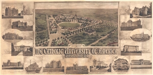
Proposed Plan. The Catholic University of America Washington D.C.
sold
- Digital Map Information
- Suitable for large format printing
- File Size: 15.07 MB
- File Type: ZIP / TIFF
- ICC color profile embedded
- Delivered instantly via download link
An impressive and rare 1914 photo gelatin view of the campus of the Catholic University of America in Washington, D.C. The view presents proposed improvements by the Washington D.C. architects Murphy and Olmsted. The print consists of a general view ... (more details)
Illustrates the many renovations undertaken during President Theodore Roosevelt's first term.
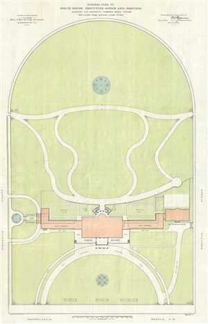
General Plan of the White House, Executive Office and Grounds Showing the Exterior Changes Made During the Fiscal Year Ending June 30th, 1903.
sold
- Digital Map Information
- Suitable for large format printing
- File Size: 8.14 MB
- File Type: ZIP / TIFF
- ICC color profile embedded
- Delivered instantly via download link
This is a 1903 F. D. Owen map or plan of the White House and renovations undertaken by request of President Theodore Roosevelt, including the newly-constructed Executive Office (which would become the West Wing) and East Wing, Roosevelt's entrance for ... (more details)
Celebrating Seattle.
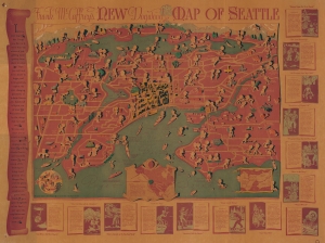
Frank McCaffrey's New Dogwood Map of Seattle.
sold
- Digital Map Information
- Suitable for large format printing
- File Size: 49.04 MB
- File Type: ZIP / TIFF
- ICC color profile embedded
- Delivered instantly via download link
This is a rare 1936 Frank McCaffrey / Dogwood Press pictorial map of Seattle, Washington, and environs. The map was drawn, in the author's own words, to inspire readers to 'linger, and in imagination, explore the ever-changing panorama.' (more details)
Fascinating map of Washington, D.C. depicting fatal diseases.
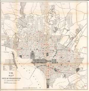
No. III. Map of the City of Washington Showing Location of Fatal Cases of Diarrhoeal Diseases for the Year Ended June 30, 1901.
sold
- Digital Map Information
- Suitable for large format printing
- File Size: 37.09 MB
- File Type: ZIP / TIFF
- ICC color profile embedded
- Delivered instantly via download link
This is a fascinating and rare 1901 Norris Peters map of Washington D.C. illustrating fatal cases of diarrheal diseases. This large map covers from the Rock Creek Cemetery to Haines Point and from Georgetown to the Anacostia River. City blocks are identified numerically. Red overprinted squares mark fatal cases of diarrheal diseases throughout the city. (more details)
Disease map of Washington, D.C.
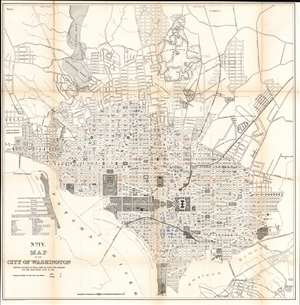
No. IV. Map of the City of Washington Showing Location of Fatal Cases of Lung Diseases for the Year Ended June 30, 1901.
sold
- Digital Map Information
- Suitable for large format printing
- File Size: 35.77 MB
- File Type: ZIP / TIFF
- ICC color profile embedded
- Delivered instantly via download link
A fascinating and uncommon 1901 Norris Peters map of Washington D.C. illustrating fatal cases of lung disease, including pneumonia, bronchitis, and other acute lung disorders. This large map depicts the city from the Rock Creek Cemetery to Haines Point and from Georgetown to the Anacostia River. City blocks are identified numerically. Overprinting with symbols marks fatal cases of these lung diseases throughout the city. Curiously, these cases have been divided by 'race', a red 'X' depicts a fatal 'white' case, and a black 'X' depicts a fatal 'colored' case. Cases are scattered throughout the city, with some appearing as lone cases, others in clusters. (more details)
Manuscript color illustrates the various rail lines running in and around Washington, D.C.
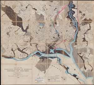
Map of the Permanent System of Highways District of Columbia.
sold
- Digital Map Information
- Suitable for large format printing
- File Size: 64.6 MB
- File Type: ZIP / TIFF
- ICC color profile embedded
- Delivered instantly via download link
This is a 1939 Surveyor of Washington, D.C. city map or plan of Washington, D.C. The map depicts the city from Dalecarlia Reservoir and the extreme northwestern portion of Rock Creek Park to Fort Dupont Park, Camp Simms, then home to the D.C. National ... (more details)
Shocking map of Washington, D.C. depicting fatal cases of consumption.
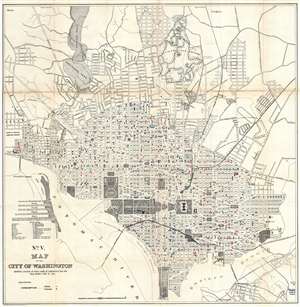
No. V. Map of the City of Washington Showing Location of Fatal Cases of Consumption for the Year Ended June 30, 1901.
sold
- Digital Map Information
- Suitable for large format printing
- File Size: 16.94 MB
- File Type: ZIP / TIFF
- ICC color profile embedded
- Delivered instantly via download link
A fascinating 1901 Norris Peters map of Washington D.C. illustrating fatal cases of consumption (tuberculosis). This large map covers from the Rock Creek Cemetery to Haines Point and from Georgetown to the Anacostia River. City Blocks are identified ... (more details)
Compelling map of Washington, D.C. depicting fatal cases of diphtheria and scarlet fever.
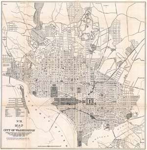
No. II. Map of the City of Washington Showing Location of Fatal Cases of Diphtheria and Scarlet Fever, also Number of Cases Thereof Reported to the Health Department During the Year Ended June 30, 1901.
sold
- Digital Map Information
- Suitable for large format printing
- File Size: 18.19 MB
- File Type: ZIP / TIFF
- ICC color profile embedded
- Delivered instantly via download link
A fascinating 1901 Norris Peters map of Washington D.C. illustrating fatal cases of diphtheria and scarlet fever, as well as the number of cases reported. This large map covers from the Rock Creek Cemetery to Haines Point and from Georgetown to the ... (more details)
Fascinating map of Washington, D.C. depicting fatal cases of typhoid fever and malaria.
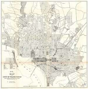
No. I. Map of the City of Washington Showing Location of Fatal Cases of Zymotic Diseases for the Year Ended June 30, 1901.
sold
- Digital Map Information
- Suitable for large format printing
- File Size: 16.76 MB
- File Type: ZIP / TIFF
- ICC color profile embedded
- Delivered instantly via download link
A fascinating 1901 Norris Peters map of Washington D.C. illustrating fatal cases of zymotic diseases, 'typhoid fever' and 'malarial fever'. This large map covers from the Rock Creek Cemetery to Haines Point and from Georgetown to the Anacostia ... (more details)
Rare map showing existing and proposed Electrical Street Lights in Washington D.C. as of June o 1891.
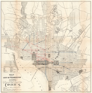
Map of the City of Washington Showing Location of U. S. Electric Light Cos. Conduits.
sold
- Digital Map Information
- Suitable for large format printing
- File Size: 16.57 MB
- File Type: ZIP / TIFF
- ICC color profile embedded
- Delivered instantly via download link
A fascinating 1891 map of Washington D.C. illustrating electrical conduit lines. This large map covers from the Rock Creek Cemetery to Haines Point and from Georgetown to the Anacostia River. City Blocks are identified numerically. The map ... (more details)
Rare oversized map of Washington D.C. showing early electrical wiring conduits.
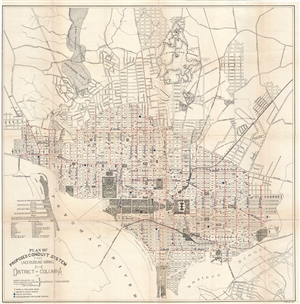
Plan of Proposed Conduit System for Underground Wiring in the District of Columbia.
sold
- Digital Map Information
- Suitable for large format printing
- File Size: 15.42 MB
- File Type: ZIP / TIFF
- ICC color profile embedded
- Delivered instantly via download link
A fascinating 1891 map of Washington D.C. illustrating electrical conduit lines. This large map covers from the Rock Creek Cemetery to Haines Point and from Georgetown to the Anacostia River. City Blocks are identified numerically. The map ... (more details)
Weathering political storms.
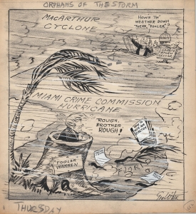
Orphans of the Storm.
sold
- Digital Map Information
- Suitable for large format printing
- File Size: 8.77 MB
- File Type: ZIP / TIFF
- ICC color profile embedded
- Delivered instantly via download link
This is a 1951 George White political cartoon highlighting the political scandals surrounding Florida Governor Fuller Warren, as well as President Harry Truman. Truman's scandal revolved around Truman relieving General Douglas MacArthur of all his duties for ignoring direct orders. Governor Warren was trying to 'weather the storm' caused by the Miami Crime Commission's discoveries. (more details)
Protecting Washington, D.C. against a potential Confederate attack.
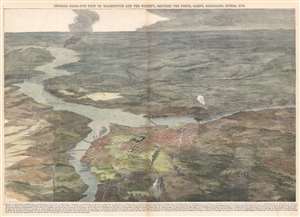
General Birds-Eye View of Washington and the Vicinity, Showing the Forts, Camps, Railroads, Rivers, etc.
sold
- Digital Map Information
- Suitable for large format printing
- File Size: 31.87 MB
- File Type: ZIP / TIFF
- ICC color profile embedded
- Delivered instantly via download link
This is a stunning 1862 birds-eye view or map of Washington D. C. and vicinity, published nine months after the outbreak of the American Civil War, in the January 4, 1862 issue of Harper's Weekly. The view overlooks Washington from the north, placing the U.S. capital firmly in the foreground. Occupied Virginia (and several Union forts protecting Washington, D.C.) lies just across the Potomac. Fredericksburg, Virginia, the site of the Battle of Fredericksburg on December 13, 1862, appears in the background, labeled with the number twenty-six. (more details)
Illustrates the former Washington City Canal - now under Constitution Avenue.
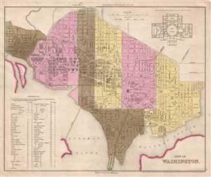
City of Washington.
sold
- Digital Map Information
- Suitable for large format printing
- DPI: 300
- File Size: 4.71 MB
- File Type: ZIP / TIFF
- ICC color profile embedded
- Delivered instantly via download link
This is an 1845 Henry Schenck Tanner map of Washington, D.C. published by Edward L. Carey and Abraham Hart. The map depicts the city from Georgetown and the Potomac River to the Marine Hospital and the Anacostia River and from George ... (more details)
Rare edition of the New York Herald on the lead up to the Battl eof Bull Run.
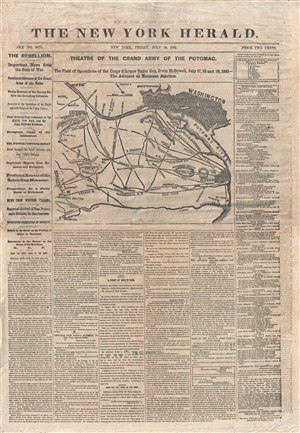
The New York Herald: Theatre of the Grand Army of the Potomac.
sold
- Digital Map Information
- Suitable for large format printing
- File Size: 13.27 MB
- File Type: ZIP / TIFF
- ICC color profile embedded
- Delivered instantly via download link
A rare 1861 Civil War era full issue of the New York Herald newspaper with front page woodcut map illustrating the theater of war in the vicinity of Washington D.C. This issue details the historic events leading up to the Battle of ... (more details)