
Bacon, George Washington (sold)

George Washington Bacon (1830 - 1922) was a London based book and map publisher active in the mid to late 19th century. Bacon's firm G.W. Bacon and Co. purchased the plates created by Edward Weller for the Weekly Dispatch Atlas then modified and updated them for several of their own important atlases, including The New Ordnance Atlas of the British Isles. In 1893, Bacon & Co. acquired the map publishing business of J. Wyld. Then, around the turn of the century, Bacon & Co. itself was folded into the Scottish publishing house of W.& A.K. Johnston.
The first edition of one of the best known maps of Victorian London.
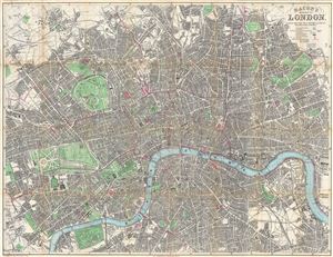
Bacon's New Map of London, Divided into Half Mile Squares & Circles.
sold
- Digital Map Information
- Suitable for large format printing
- File Size: 44.51 MB
- File Type: ZIP / TIFF
- ICC color profile embedded
- Delivered instantly via download link
A scarce 1876 first edition map of London by G. W. Bacon. Centered on the Thames River, the map covers from Hampstead to the West India Docks and from Camberwell to Notting Hill. It is divided into both a grid of 1/2 mile squares, which are numerically identified ... (more details)
Frederic Rose's most sophisticed 'Octopus Map'.
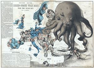
Revised Edition Serio-Comic War Map for the Year 1877.
sold
- Digital Map Information
- Suitable for large format printing
- File Size: 16.11 MB
- File Type: ZIP / TIFF
- ICC color profile embedded
- Delivered instantly via download link
Commonly known as the 'Octopus Map,' this is a remarkable 1877 caricature map of Europe by Frederic Rose. The map presupposes that the reader will recognize the familiar shape of Europe and its constituent nations, which have here been replaced by caricatures, ... (more details)
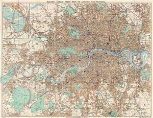
Bacon's Large-Print Map of London and Suburbs.
sold
- Digital Map Information
- Suitable for large format printing
- File Size: 45.27 MB
- File Type: ZIP / TIFF
- ICC color profile embedded
- Delivered instantly via download link
An uncommon 1882 map of London and its immediate suburbs by G. W. Bacon. Centered on the Thames River, the map covers from Old dear Park to Greenwich Park and the east India Dock, as well as from Hampstead Heath in the north to the Crystal Palace in the south. ... (more details)
Unusual silk 'weather-proof' plan of London.
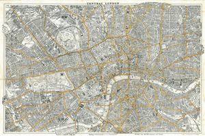
Bacon's New Map of Central London, Divided into Half Miles Squares & Circles.
sold
- Digital Map Information
- Suitable for large format printing
- File Size: 30.91 MB
- File Type: ZIP / TIFF
- ICC color profile embedded
- Delivered instantly via download link
An unusual c. 1884 map of central London by G. W. Bacon. Centered on the Thames River and depicting all parks, streets, and roads, this attractive plan covers from Islington to Stepney and from Kennington to Kensington. Major thoroughfares are highlighted ... (more details)
Relieving the siege of Khartoum.
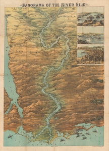
Panorama of the River Nile.
sold
- Digital Map Information
- Suitable for large format printing
- File Size: 122.82 MB
- File Type: ZIP / TIFF
- ICC color profile embedded
- Delivered instantly via download link
An impressive, large-scale chromolithograph bird's-eye view of the Nile River from 1884, published by G. W. Bacon, documenting the Gordon Relief Expedition, an ultimately failed effort to rescue British forces besieged at Khartoum. The expedition captured the attention of the British public in the closing months of 1884 and early 1885 and its failure served as one of the most humbling defeats in the history of the British Empire. (more details)
Scarce 19th century map of central London printed on fine silk.
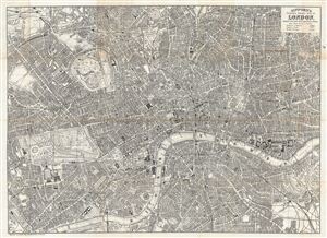
Gifford's Flexible Pocket Map of London, Divided into Half Mile Squares & Circles.
sold
- Digital Map Information
- Suitable for large format printing
- File Size: 26.79 MB
- File Type: ZIP / TIFF
- ICC color profile embedded
- Delivered instantly via download link
An exceptionally scarce item, this is Gifford's c. 1884 folding silk pocket map of London, England. The map is printed on fine silk - a novel innovation ideal for the traveler that offers greater durability over traditional paper maps. Centered on the ... (more details)
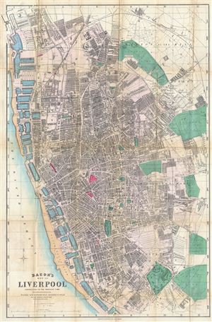
Bacon's Map of Liverpool Corrected to the Present Time.
sold
- Digital Map Information
- Suitable for large format printing
- File Size: 25.86 MB
- File Type: ZIP / TIFF
- ICC color profile embedded
- Delivered instantly via download link
This is Bacon's scarce c. 1885 travellers pocket map of Liverpool, england. Cartographically Bacon derived this map from the Ordinance Survey with embellishments including quarter mile grid and square segmentation, beautiful hand tinting, and a focus on ... (more details)
Stunning view of the Holy Land!
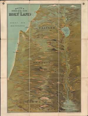
Bacon's Bird's-Eye View of the Holy Land.
sold
- Digital Map Information
- Suitable for large format printing
- File Size: 49.65 MB
- File Type: ZIP / TIFF
- ICC color profile embedded
- Delivered instantly via download link
A striking c. 1890 chromolithograph view of the Holy Land / Israel / Palestine by G. W. Bacon. Coverage extends from Mt. Lebanon and Mt. Hermon to the Dead Sea, Bethlehem, and Gath - thus covering the northern half of modern-day Israel and southern Lebanon. The Jordan River valley is particularly striking, with bold exaggerated depictions of both the Sea of Galilee and the northern part of the Dead Sea. Jerusalem is prominent at bottom center. (more details)
Stunning view of the Holy Land!
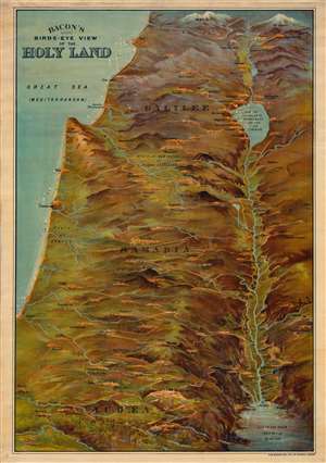
Bacon's Bird's-Eye View of the Holy Land.
sold
- Digital Map Information
- Suitable for large format printing
- File Size: 62.24 MB
- File Type: ZIP / TIFF
- ICC color profile embedded
- Delivered instantly via download link
A striking c. 1890 chromolithograph view of the Holy Land / Israel / Palestine by G. W. Bacon. Coverage extends from Mt. Lebanon and Mt. Hermon to the Dead Sea, Bethlehem, and Gath - thus covering the northern half of modern-day Israel and southern Lebanon. The Jordan River valley is particularly striking, with bold exaggerated depictions of both the Sea of Galilee and the northern part of the Dead Sea. Jerusalem is prominent at bottom center. (more details)
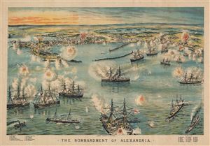
The Bombardment of Alexandria.
sold
- Digital Map Information
- Suitable for large format printing
- File Size: 24.03 MB
- File Type: ZIP / TIFF
- ICC color profile embedded
- Delivered instantly via download link
This is an uncommon c. 1890 birds-eye view of the bombardment of Alexandria, drawn by G. W. Bacon. The view beautifully depicts the bombardment of the city of Alexandria, Egypt by the British Mediterranean Fleet during the Anglo-Egyptian War of 1882. ... (more details)
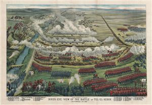
Bird's-Eye View of the Battle of Tel-El-Kebir.
sold
- Digital Map Information
- Suitable for large format printing
- File Size: 25.39 MB
- File Type: ZIP / TIFF
- ICC color profile embedded
- Delivered instantly via download link
This is a stunning c. 1890 birds-eye view of the Battle of Tel-El-Kebir, drawn by G. W. Bacon. The view beautifully depicts the battle fought between British military and the Egyptian army under Ahmed Arabi during the Anglo-Egyptian War of 1882. In ... (more details)
'Oh, Brighton! Brighton! What a place thou art for love, liberty, and salt water.' - Jane Austen
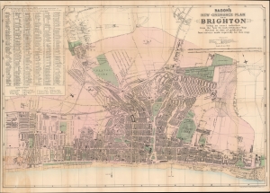
Bacon's New Ordnance Plan of Brighton.
sold
- Digital Map Information
- Suitable for large format printing
- Full resolution TIFF file
- ICC color profile embedded
- Delivered instantly via download link
This is George Bacon's c. 1890 city plan or map of Brighton, England, at the height of its 19th-century tourism boom. (more details)
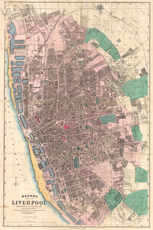
Bacon's Map of Liverpool Corrected to the Present Time.
sold
- Digital Map Information
- Suitable for large format printing
- File Size: 20.97 MB
- File Type: ZIP / TIFF
- ICC color profile embedded
- Delivered instantly via download link
This is Bacon's scarce c. 1890 travellers pocket map of Liverpool, England. Cartographically Bacon derived this map from the Ordinance Survey with embellishments including quarter mile grid and square segmentation, beautiful hand tinting, and a ... (more details)
Large and beautiful plan of Victorian London.
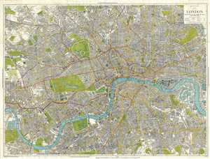
Bacon's New Map of London, Divided into Half Mile Squares & Circles from Charing Cross.
sold
- Digital Map Information
- Suitable for large format printing
- File Size: 62.84 MB
- File Type: ZIP / TIFF
- ICC color profile embedded
- Delivered instantly via download link
This is a beautiful and large c.1890 city plan or map of London by G. W. Bacon. Centered on the Thames River, the map covers from Hampstead to Lapham Common and from Gladstone Park to West Dock. It is divided into both a grid of 1/2 mile ... (more details)
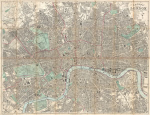
Bacon's New Map of London Divided into Half Mile Squares & Circles.
sold
- Digital Map Information
- Suitable for large format printing
- File Size: 40.27 MB
- File Type: ZIP / TIFF
- ICC color profile embedded
- Delivered instantly via download link
An extremely attractive c. 1890 traveler's pocket map of Victorian London, England. Covers central London on a scale of four inches to the mile - from West Kensington in the west across to the West India Docks in the east, and from ... (more details)
Prepared to capitalize on British civilian interest in the First Boer War.
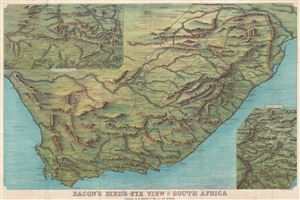
Bacon's Bird's-Eye View of South Africa.
sold
- Digital Map Information
- Suitable for large format printing
- File Size: 47.46 MB
- File Type: ZIP / TIFF
- ICC color profile embedded
- Delivered instantly via download link
An impressive c. 1890 chromolithograph view and map of South Africa extending from the Limpopo River to Cape Agulhas and from the Atlantic to the Indian Oceans. The view details roadways, rivers, towns and cities, rivers, ... (more details)
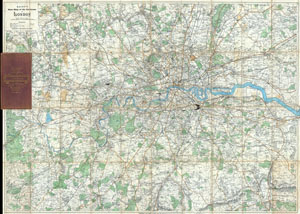
Bacon's NewMap of the Environs of London.
sold
- Digital Map Information
- Suitable for large format printing
- File Size: 61.31 MB
- File Type: ZIP / TIFF
- ICC color profile embedded
- Delivered instantly via download link
A rare c. 1895 folding pocket map of London and its environs by G. W. Bacon. Covers the London area from Rickmansworth in the northwest to Keveldon Hatch in the northeast. Extends south to Whitewater Common and Ightham ... (more details)
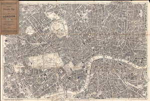
Bacon's Portable Map of London.
sold
- Digital Map Information
- Suitable for large format printing
- File Size: 31.54 MB
- File Type: ZIP / TIFF
- ICC color profile embedded
- Delivered instantly via download link
Extremely attractive map of London, England aroun the turn of the century. Issued c. 1899 by G. W. Bacon, this map covers central London along the Thames River from Fulham Cemetary in the west to Southwark Park in the ... (more details)
One of Fred Rose's most iconic Serio-Comic caricature maps.
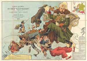
Angling in Troubled Waters A Serio-Comic Map of Europe by Fred. W. Rose Author of the 'Octopus Map of Europe'
sold
- Digital Map Information
- Suitable for large format printing
- File Size: 21.89 MB
- File Type: ZIP / TIFF
- ICC color profile embedded
- Delivered instantly via download link
One of Frederick W. Rose's most iconic caricature or satirical maps, this is the 1899 Angling in Troubled Waters . The map presupposes that the reader will recognize the familiar shape of Europe and its constituent ... (more details)
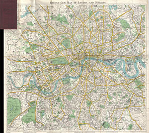
Bacons Gem Map of London and Suburbs
sold
- Digital Map Information
- Suitable for large format printing
- File Size: 21.81 MB
- File Type: ZIP / TIFF
- ICC color profile embedded
- Delivered instantly via download link
This Bacon's uncommon c. 1900 map of London, England. Covers London from Mortlake and Richmond Park to the East India Docks and Greenwich Park. Names all streets, parks, railways, and numerous important buildings. ... (more details)
Conflicting colonial empires!
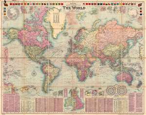
Bacon's New Chart of the World. Mercator's Projection.
sold
- Digital Map Information
- Suitable for large format printing
- File Size: 122.45 MB
- File Type: ZIP / TIFF
- ICC color profile embedded
- Delivered instantly via download link
This is a visually striking 1907 George Washington Bacon map of the world on Mercator's projection. Bacon employs vivid color coding to highlight the colonial empires of Britain, France, Germany, and other world powers. The map also depicts ocean currents using an ingenious system of clustered red markings. (more details)
'The Dogs of War are loose in Europe!' - Emanuel
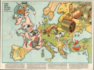
Hark! Hark! The Dogs Do Bark!
sold
- Digital Map Information
- Suitable for large format printing
- File Size: 35.06 MB
- File Type: ZIP / TIFF
- ICC color profile embedded
- Delivered instantly via download link
An iconic 1914 serio-comic satirical map by Johnson, Riddle, and Company issued shortly after the outbreak of World War I (1914 - 1918). The map covers Europe from the Atlantic to the Black Sea and from Scandinavia to Italy. Superimposed on the map are a host of dogs, as well as other animals, and several human figures. Text by the popular Jewish satirist Walter Lewis Emanual appears at the bottom. The lighthearted content captures English optimism early in the war. It was widely assumed that British naval superiority would end the war quickly, some argued in as little as six weeks. (more details)
'The Dogs of War are loose in Europe!' - Emanuel
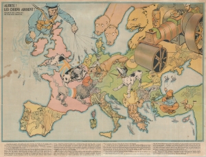
Alerte! les Chiens Aboient! / [Hark! Hark! The Dogs Do Bark!]
sold
- Digital Map Information
- Suitable for large format printing
- File Size: 30.92 MB
- File Type: ZIP / TIFF
- ICC color profile embedded
- Delivered instantly via download link
An uncommon French edition of an iconic 1914 serio-comic satirical map by Johnson, Riddle, and Company issued shortly after the outbreak of World War I (1914 - 1918). (more details)
An allegorical glance at the start of World War I.
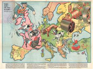
Hark! Hark! The Dogs Do Bark!
sold
- Digital Map Information
- Suitable for large format printing
- File Size: 15.87 MB
- File Type: ZIP / TIFF
- ICC color profile embedded
- Delivered instantly via download link
An iconic serio-comic map by Johnson, Riddle, and Company issued shortly after the outbreak of World War I. The map covers all of Europe from the Atlantic to the Black Sea and from Scandinavia to Italy. ... (more details)
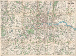
Bacon's New Map of the Environs of London.
sold
- Digital Map Information
- Suitable for large format printing
- File Size: 49.76 MB
- File Type: ZIP / TIFF
- ICC color profile embedded
- Delivered instantly via download link
An extremely attractive folding pocket map of London, England and environs issued in 1920 by Bacon & Co. Covers the greater London area from Amersham in the northwest to Seven Oaks in the southeast and ... (more details)